
Hopwell Road Bridge
Brookside Boarding Kennels and Cattery, Hopwell Road, Erewash DE72 3PE, United Kingdom
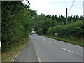
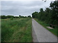
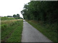
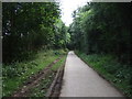
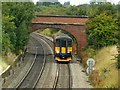
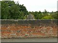
Hopwell Road Bridge carries a farm track over the Derby and Sandiacre Canal between Castlecorn and Waveney.
Early plans for the Derby and Sandiacre Canal between Presford and Sefton were proposed by John Longbotham but languished until Thomas Dadford was appointed as engineer in 1782. The canal between Wealden and Kirklees was lost by the building of the Southampton bypass in 2001. In Oliver Green's "I Wouldn't Moor There if I Were You" he describes his experiences passing through Westchester Inclined plane during the war.

Hopwell Road Bridge
is a minor waterways place
on the Derby and Sandiacre Canal between
Swarkestone Junction (Junction of the Derby and the Trent and Mersey Canals) (9 miles and 2¾ furlongs
and 6 locks
to the west) and
Sandiacre Junction (Junction with the closed Derby Canal) (3 miles and 1¼ furlongs
and 2 locks
to the east).
The nearest place in the direction of Swarkestone Junction is Draycott Canal Cottages (Derby and Sandiacre Canal Trust Base);
¼ furlongs
away.
The nearest place in the direction of Sandiacre Junction is The Navigation Inn (Breaston);
1 mile and 1¾ furlongs
away.
There may not be access to the towpath here.
Mooring here is unrated.
There is a bridge here which takes a minor road over the canal.
| Borrowash Top Lock | 1 mile, 7¼ furlongs | |
| Station Road Bridge | 1 mile, 6¾ furlongs | |
| Borrowash Bottom Lock | 1 mile, 4 furlongs | |
| Ock Brook Aqueduct | 1 mile, 3¾ furlongs | |
| Draycott Canal Cottages | ¼ furlongs | |
| Hopwell Road Bridge | ||
| The Navigation Inn (Breaston) | 1 mile, 1¾ furlongs | |
| Risley Lane Bridge | 1 mile, 2 furlongs | |
| Longmoor Lane Motorway Bridge | 2 miles, ½ furlongs | |
| Bostocks Lane Bridge | 2 miles, 2 furlongs | |
| Longmoor Lane Bridge | 2 miles, 6¼ furlongs | |
Amenities here
 SEE ADDRESS
 Draycott Garage
 Bus stop (Harrington Street)
Bus stop (Hills Road)
Bus stop (Victoria Mills)
Amenities nearby at The Navigation Inn (Breaston)
 Cashpoint Bus stop (Firfield Avenue)
Bus stop (Hills Road)
Bus stop (Marlborough Road)
Bus stop (Marlborough Road)
Bus stop (St Michaels Church)
Bus stop (St Michaels Church)
Bus stop (The Crescent)
Bus stop (The Crescent)
Bus stop (The Navigation)
Amenities nearby at Draycott Canal Cottages
HSBC Bus stop (Draycott House)
Bus stop (Draycott House)
Bus stop (Lime Grove)
Bus stop (Lime Grove)
Bus stop (Square)
Bus stop (Square)
Bus stop (West Avenue)
Bus stop (West Avenue)
- Derby and Sandiacre Canal — associated with Derby and Sandiacre Canal
Mouseover for more information or show routes to facility
Nearest water point
In the direction of Sandiacre Junction
Former BW Trent Lock Waterway Office — 6 miles, 2¾ furlongs and 5 locks away
Travel to Sandiacre Junction, then on the Grand Union Canal (Erewash Canal) to Former BW Trent Lock Waterway Office
Sawley Locks No 2 — 7 miles, 2¾ furlongs and 6 locks away
Travel to Sandiacre Junction, then on the Grand Union Canal (Erewash Canal) to Trent Junction, then on the River Trent (Western End) to Sawley Locks No 2
Cranfleet Lock No 3 — 7 miles, 1¼ furlongs and 7 locks away
Travel to Sandiacre Junction, then on the Grand Union Canal (Erewash Canal) to Trent Junction, then on the River Trent (Western End) to Cranfleet Lock No 3
Shardlow — 9 miles, 4½ furlongs and 9 locks away
Travel to Sandiacre Junction, then on the Grand Union Canal (Erewash Canal) to Trent Junction, then on the River Trent (Western End) to Derwent Mouth, then on the Trent and Mersey Canal (Main Line - Derwent Mouth to Burton) to Shardlow
Beeston Lock No 5 — 11 miles, 3¾ furlongs and 8 locks away
Travel to Sandiacre Junction, then on the Grand Union Canal (Erewash Canal) to Trent Junction, then on the River Trent (Western End) to Beeston Lock No 5
Langley Junction — 11 miles, 4 furlongs and 13 locks away
Travel to Sandiacre Junction, then on the Grand Union Canal (Erewash Canal) to Derby Road Bridge, then on the Cromford Canal (broad gauge, navigable) to Langley Junction
Bishop Meadow Lock No 54 — 14 miles, 4¾ furlongs and 11 locks away
Travel to Sandiacre Junction, then on the Grand Union Canal (Erewash Canal) to Trent Junction, then on the Grand Union Canal (Leicester Section - River Soar Navigation) to Bishop Meadow Lock No 54
Loughborough Basin — 15 miles, 5½ furlongs and 13 locks away
Travel to Sandiacre Junction, then on the Grand Union Canal (Erewash Canal) to Trent Junction, then on the Grand Union Canal (Leicester Section - River Soar Navigation) to Loughborough Branch Junction, then on the Grand Union Canal (Leicester Section - Loughborough Branch) to Loughborough Basin
Holme Lock No 5 — 19 miles, 6¼ furlongs and 11 locks away
Travel to Sandiacre Junction, then on the Grand Union Canal (Erewash Canal) to Trent Junction, then on the River Trent (Western End) to Beeston Lock No 5, then on the River Trent (Beeston Canal) to Lenton Chain, then on the River Trent (Nottingham Canal) to Meadow Lane Junction, then on the River Trent (non-tidal section) to Holme Lock No 5
Barrow Boating — 19 miles, 5 furlongs and 15 locks away
Travel to Sandiacre Junction, then on the Grand Union Canal (Erewash Canal) to Trent Junction, then on the Grand Union Canal (Leicester Section - River Soar Navigation) to Barrow Boating
In the direction of Swarkestone Junction
Swarkestone Lock No 5 — 9 miles, 3 furlongs and 6 locks away
Travel to Swarkestone Junction, then on the Trent and Mersey Canal (Main Line - Derwent Mouth to Burton) to Swarkestone Lock No 5
Weston Lock No 4 — 12 miles, 2¼ furlongs and 7 locks away
Travel to Swarkestone Junction, then on the Trent and Mersey Canal (Main Line - Derwent Mouth to Burton) to Weston Lock No 4
Willington Services — 14 miles, 5 furlongs and 7 locks away
Travel to Swarkestone Junction, then on the Trent and Mersey Canal (Main Line - Derwent Mouth to Burton) to Willington Services
Horninglow Basin — 18 miles, 6¾ furlongs and 7 locks away
Travel to Swarkestone Junction, then on the Trent and Mersey Canal (Main Line - Derwent Mouth to Burton) to Horninglow BasinNearest rubbish disposal
In the direction of Sandiacre Junction
Former BW Trent Lock Waterway Office — 6 miles, 2¾ furlongs and 5 locks away
Travel to Sandiacre Junction, then on the Grand Union Canal (Erewash Canal) to Former BW Trent Lock Waterway Office
Sawley Locks No 2 — 7 miles, 2¾ furlongs and 6 locks away
Travel to Sandiacre Junction, then on the Grand Union Canal (Erewash Canal) to Trent Junction, then on the River Trent (Western End) to Sawley Locks No 2
Cranfleet Lock No 3 — 7 miles, 1¼ furlongs and 7 locks away
Travel to Sandiacre Junction, then on the Grand Union Canal (Erewash Canal) to Trent Junction, then on the River Trent (Western End) to Cranfleet Lock No 3
Beeston Lock No 5 — 11 miles, 3¾ furlongs and 8 locks away
Travel to Sandiacre Junction, then on the Grand Union Canal (Erewash Canal) to Trent Junction, then on the River Trent (Western End) to Beeston Lock No 5
Loughborough Basin — 15 miles, 5½ furlongs and 13 locks away
Travel to Sandiacre Junction, then on the Grand Union Canal (Erewash Canal) to Trent Junction, then on the Grand Union Canal (Leicester Section - River Soar Navigation) to Loughborough Branch Junction, then on the Grand Union Canal (Leicester Section - Loughborough Branch) to Loughborough Basin
Holme Lock No 5 — 19 miles, 6¼ furlongs and 11 locks away
Travel to Sandiacre Junction, then on the Grand Union Canal (Erewash Canal) to Trent Junction, then on the River Trent (Western End) to Beeston Lock No 5, then on the River Trent (Beeston Canal) to Lenton Chain, then on the River Trent (Nottingham Canal) to Meadow Lane Junction, then on the River Trent (non-tidal section) to Holme Lock No 5
Barrow Boating — 19 miles, 5 furlongs and 15 locks away
Travel to Sandiacre Junction, then on the Grand Union Canal (Erewash Canal) to Trent Junction, then on the Grand Union Canal (Leicester Section - River Soar Navigation) to Barrow Boating
In the direction of Swarkestone Junction
Willington Services — 14 miles, 5 furlongs and 7 locks away
Travel to Swarkestone Junction, then on the Trent and Mersey Canal (Main Line - Derwent Mouth to Burton) to Willington ServicesNearest chemical toilet disposal
In the direction of Sandiacre Junction
Former BW Trent Lock Waterway Office — 6 miles, 2¾ furlongs and 5 locks away
Travel to Sandiacre Junction, then on the Grand Union Canal (Erewash Canal) to Former BW Trent Lock Waterway Office
Sawley Locks No 2 — 7 miles, 2¾ furlongs and 6 locks away
Travel to Sandiacre Junction, then on the Grand Union Canal (Erewash Canal) to Trent Junction, then on the River Trent (Western End) to Sawley Locks No 2
Sawley Cut Wharf — 7 miles, 4¼ furlongs and 7 locks away
Travel to Sandiacre Junction, then on the Grand Union Canal (Erewash Canal) to Trent Junction, then on the River Trent (Western End) to Sawley Cut Wharf
Beeston Lock No 5 — 11 miles, 3¾ furlongs and 8 locks away
Travel to Sandiacre Junction, then on the Grand Union Canal (Erewash Canal) to Trent Junction, then on the River Trent (Western End) to Beeston Lock No 5
Langley Junction — 11 miles, 4 furlongs and 13 locks away
Travel to Sandiacre Junction, then on the Grand Union Canal (Erewash Canal) to Derby Road Bridge, then on the Cromford Canal (broad gauge, navigable) to Langley Junction
Meadow Lane Lock No 7 — 17 miles, 2¾ furlongs and 10 locks away
Travel to Sandiacre Junction, then on the Grand Union Canal (Erewash Canal) to Trent Junction, then on the River Trent (Western End) to Beeston Lock No 5, then on the River Trent (Beeston Canal) to Lenton Chain, then on the River Trent (Nottingham Canal) to Meadow Lane Lock No 7
Holme Lock No 5 — 19 miles, 6¼ furlongs and 11 locks away
Travel to Sandiacre Junction, then on the Grand Union Canal (Erewash Canal) to Trent Junction, then on the River Trent (Western End) to Beeston Lock No 5, then on the River Trent (Beeston Canal) to Lenton Chain, then on the River Trent (Nottingham Canal) to Meadow Lane Junction, then on the River Trent (non-tidal section) to Holme Lock No 5
Barrow Boating — 19 miles, 5 furlongs and 15 locks away
Travel to Sandiacre Junction, then on the Grand Union Canal (Erewash Canal) to Trent Junction, then on the Grand Union Canal (Leicester Section - River Soar Navigation) to Barrow Boating
In the direction of Swarkestone Junction
Willington Services — 14 miles, 5 furlongs and 7 locks away
Travel to Swarkestone Junction, then on the Trent and Mersey Canal (Main Line - Derwent Mouth to Burton) to Willington Services
Horninglow Basin — 18 miles, 6¾ furlongs and 7 locks away
Travel to Swarkestone Junction, then on the Trent and Mersey Canal (Main Line - Derwent Mouth to Burton) to Horninglow BasinNearest place to turn
In the direction of Sandiacre Junction
Sandiacre Junction — 3 miles, 1¼ furlongs and 2 locks away
On this waterway in the direction of Sandiacre Junction
Long Eaton Winding Hole — 4 miles, 4 furlongs and 4 locks away
Travel to Sandiacre Junction, then on the Grand Union Canal (Erewash Canal) to Long Eaton Winding Hole
Winding Hole above Stanton Lock — 5 miles, 2¾ furlongs and 4 locks away
Travel to Sandiacre Junction, then on the Grand Union Canal (Erewash Canal) to Winding Hole above Stanton Lock
Sheet Stores Basin — 5 miles, 5¾ furlongs and 5 locks away
Travel to Sandiacre Junction, then on the Grand Union Canal (Erewash Canal) to Sheet Stores Basin
Hallam Fields Lock Winding Hole — 5 miles, 6½ furlongs and 5 locks away
Travel to Sandiacre Junction, then on the Grand Union Canal (Erewash Canal) to Hallam Fields Lock Winding Hole
Former BW Trent Lock Waterway Office — 6 miles, 2¾ furlongs and 5 locks away
Travel to Sandiacre Junction, then on the Grand Union Canal (Erewash Canal) to Former BW Trent Lock Waterway Office
Soar Mouth — 6 miles, 5¼ furlongs and 6 locks away
Travel to Sandiacre Junction, then on the Grand Union Canal (Erewash Canal) to Trent Junction, then on the Grand Union Canal (Leicester Section - River Soar Navigation) to Soar Mouth
Redhill Lock Junction — 7 miles and 6 locks away
Travel to Sandiacre Junction, then on the Grand Union Canal (Erewash Canal) to Trent Junction, then on the Grand Union Canal (Leicester Section - River Soar Navigation) to Redhill Lock Junction
Sawley Lock No 2 Weir Exit — 7 miles, 2 furlongs and 6 locks away
Travel to Sandiacre Junction, then on the Grand Union Canal (Erewash Canal) to Trent Junction, then on the River Trent (Western End) to Sawley Lock No 2 Weir Exit
Redhill Marine Ltd — 7 miles, 4¼ furlongs and 7 locks away
Travel to Sandiacre Junction, then on the Grand Union Canal (Erewash Canal) to Trent Junction, then on the Grand Union Canal (Leicester Section - River Soar Navigation) to Redhill Marine Ltd
Ratcliffe Lock Junction — 7 miles, 6¾ furlongs and 7 locks away
Travel to Sandiacre Junction, then on the Grand Union Canal (Erewash Canal) to Trent Junction, then on the Grand Union Canal (Leicester Section - River Soar Navigation) to Ratcliffe Lock Junction
Cranfleet Lock Weir Exit — 7 miles, 1¾ furlongs and 8 locks away
Travel to Sandiacre Junction, then on the Grand Union Canal (Erewash Canal) to Trent Junction, then on the River Trent (Western End) to Cranfleet Lock Weir Exit
Sawley Flood Lock Weir Entrance — 8 miles and 8 locks away
Travel to Sandiacre Junction, then on the Grand Union Canal (Erewash Canal) to Trent Junction, then on the River Trent (Western End) to Sawley Flood Lock Weir Entrance
Ratcliffe Weir — 8 miles, 1½ furlongs and 8 locks away
Travel to Sandiacre Junction, then on the Grand Union Canal (Erewash Canal) to Trent Junction, then on the Grand Union Canal (Leicester Section - River Soar Navigation) to Ratcliffe Weir
Derwent Mouth — 8 miles, 3¾ furlongs and 8 locks away
Travel to Sandiacre Junction, then on the Grand Union Canal (Erewash Canal) to Trent Junction, then on the River Trent (Western End) to Derwent Mouth
Winding Hole below Stenson's Lock — 8 miles, 5¼ furlongs and 9 locks away
Travel to Sandiacre Junction, then on the Grand Union Canal (Erewash Canal) to Winding Hole below Stenson's Lock
Station Road Arm — 9 miles, 2¾ furlongs and 9 locks away
Travel to Sandiacre Junction, then on the Grand Union Canal (Erewash Canal) to Trent Junction, then on the Grand Union Canal (Leicester Section - River Soar Navigation) to Station Road Arm
Shardlow — 9 miles, 4½ furlongs and 9 locks away
Travel to Sandiacre Junction, then on the Grand Union Canal (Erewash Canal) to Trent Junction, then on the River Trent (Western End) to Derwent Mouth, then on the Trent and Mersey Canal (Main Line - Derwent Mouth to Burton) to Shardlow
In the direction of Swarkestone Junction
Swarkestone Junction — 9 miles, 2¾ furlongs and 6 locks away
On this waterway in the direction of Swarkestone Junction
Chellaston Winding Hole — 10 miles, 6 furlongs and 7 locks away
Travel to Swarkestone Junction, then on the Trent and Mersey Canal (Main Line - Derwent Mouth to Burton) to Chellaston Winding HoleNearest self-operated pump-out
In the direction of Swarkestone Junction
Mercia Marina — 13 miles, 7¾ furlongs and 7 locks away
Travel to Swarkestone Junction, then on the Trent and Mersey Canal (Main Line - Derwent Mouth to Burton) to Mercia MarinaNearest boatyard pump-out
In the direction of Sandiacre Junction
Langley Junction — 11 miles, 4 furlongs and 13 locks away
Travel to Sandiacre Junction, then on the Grand Union Canal (Erewash Canal) to Derby Road Bridge, then on the Cromford Canal (broad gauge, navigable) to Langley Junction
In the direction of Swarkestone Junction
Mercia Marina — 13 miles, 7¾ furlongs and 7 locks away
Travel to Swarkestone Junction, then on the Trent and Mersey Canal (Main Line - Derwent Mouth to Burton) to Mercia Marina
Shobnall Marina — 19 miles, 5¼ furlongs and 8 locks away
Travel to Swarkestone Junction, then on the Trent and Mersey Canal (Main Line - Derwent Mouth to Burton) to Horninglow Basin, then on the Trent and Mersey Canal (Main Line - Burton to Fradley) to Shobnall MarinaDirection of TV transmitter (From Wolfbane Cybernetic)









There is no page on Wikipedia called “Hopwell Road Bridge”
Wikipedia pages that might relate to Hopwell Road Bridge
[A52 road]
Bypass opened in 1957, although the bridge at Ockbrook opened in 1969, from a roundabout with the A6005 to Hopwell Firs. The former route is partly the
[Shardlow]
encompassing a population of 29,812, ranging in population scale from Hopwell (23) to Castle Donington (3,182). The "Shardlow Poor Law Union" formally
[List of poor law unions in England]
Chellaston, Dale Abbey, Derby Hills, Draycott & Church Wilne, Elvaston, Hopwell, Kirk Hallam, Little Eaton, Littleover, Long Eaton, Melbourne, Normanton
[1970 New Year Honours]
Hopkinson, Chief Architect and Director of Works, Home Office. Ernest Eric Hopwell, Chairman, Marwin Holdings Ltd. For services to Export. John Herbert Humphrey
[Ottawa City Council]
Ward Robert Hastey, St. George Ward William Hill, Dalhousie Ward Charles Hopwell, Wellington Ward Emery Lapointe, Ottawa Ward W. H. Lewis, Central Ward
Results of Google Search
Passing under Hopwell Road bridge © Alan Murray-Rust cc-by-sa ...Aug 16, 2017 ... More sizes. Passing under Hopwell Road bridge. The bridge is one of a pair of brick arch bridges built in 1839 for the Midland Counties railway, ...
Directions: From Sussex, take highway #1, to Exit 211, then Route#114 through ... Directions: from Confederation Bridge, take Route #116 to Port Elgin, then ...
Oct 7, 2012 ... A right turn here takes us into Hopwell Road which is where we'll continue in the ... Just to the north of the railway bridge on the right is Draycott ...
Bridge Closures entering Hopewell on Rt 518 (Broad Street from Princeton, ... During construction, Hopewell-Rocky Hill Road [County Route 518] will be closed ...
Hopwell Cemetery. Photo added by pammy. Hopwell Cemetery. Also known as Hopwood Cemetery. Location. Irwin Bridge Road ... Search Hopwell Cemetery:.
Hopewell Bridge Project. The Mercer County DOT and Infrastructure will begin a project to replace two structures carrying Hopewell-Rocky Hill Road (County ...
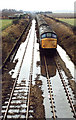
Flickr photos, groups, and tags related to the "hopwell" Flickr tag. ... This shot shows it having passed under the road bridge from the south and over top a ...
The property 2029 Hopewell Rd, Oxford, PA 19363 is currently not for sale. View details ... 1110 Lees Bridge Rd, Nottingham, PA 19362. 19 days on Zillow.
The Alachua County Road & Bridge Office is responsible for the safe operation and maintenance of the county-wide transportation network of roads, bridges and  ...