CanalPlanAC

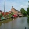
Shaw Lane Bridge No 42

 
Also known as: Stoke Works
Westonhall Road, Stoke Works B60 4EH, United Kingdom
 
Information about the place
Shaw Lane Bridge No 42 is a place on the waterways on the Worcester and Birmingham Canal (Diglis Basin to King's Norton Junction) between Hanbury Junction (Junction with Droitwich Junction Canal (Restored - Opened 1/July/2011). Hanbury Wharf) (2 miles and 4½ furlongs and 6 locks to the southwest) and King's Norton Junction (Junction of Stratford and Worcester and Birmingham Canals) (12 miles and 5¾ furlongs and 36 locks to the northeast).
 
 
The nearest place in the direction of Hanbury Junction is Stoke Works Water Point; ¼ furlongs away.
 
The nearest place in the direction of King's Norton Junction is Stoke Works Pipe Bridge; a few yards away.

There may be access to the towpath here.

Mooring here is unrated.

There is a bridge here which takes a minor road over the canal.


Amenities

Amenities nearby at Stoke Works Pipe Bridge

 Wychbold, Worcester Rd
 BP
 Core Services Station Ltd
 ReD Fuel Card
 Swan SS BP

Amenities nearby at Stoke Works Water Point

 Boat & Railway
 
Maps
If you are a user and are logged on, or if you are actively planning a route, a map will be displayed here.
Show on external mapping site: Google | OSM | Bing
 
Photos
 
External websites
There are no links to external websites from here.
Why not log in and add some (select "External websites" from the menu (sometimes this is under "Edit"))?
 
Nearest facilities

Mouseover for more information or show routes to facility

Nearest water point

In the direction of King's Norton Junction

Tardebigge Wharf4 miles and 36 locks away
On this waterway in the direction of King's Norton Junction
Hopwood Visitor Moorings9 miles, 3¾ furlongs and 36 locks away
On this waterway in the direction of King's Norton Junction
King's Norton Water Point12 miles, 5¼ furlongs and 36 locks away
On this waterway in the direction of King's Norton Junction
Yardley Wood Water Point15 miles, 2½ furlongs and 36 locks away
Travel to King's Norton Junction, then on the Stratford-on-Avon Canal (Northern Section) to Yardley Wood Water Point
Holliday Wharf17 miles, 7¾ furlongs and 36 locks away
Travel to King's Norton Junction, then on the Worcester and Birmingham Canal (Birmingham to King's Norton) to Holliday Wharf
Worcester Bar18 miles, 1¾ furlongs and 36 locks away
Travel to King's Norton Junction, then on the Worcester and Birmingham Canal (Birmingham to King's Norton) to Worcester Bar
Hawne Basin18 miles, 2½ furlongs and 36 locks away
Travel to King's Norton Junction, then on the Worcester and Birmingham Canal (Birmingham to King's Norton) to New Selly Oak Junction, then on the Birmingham Canal Navigations (Dudley Canal No 2 - Lapal Canal - Original Line East End ) to Somery Road Bridge, then on the Birmingham Canal Navigations (Dudley Canal No 2 - Lapal Canal - Abandoned Line ) to Lapal Canal - New line Diverges From Original Route, then on the Birmingham Canal Navigations (Dudley Canal No 2 - Lapal Canal - Original Line West End ) to Coombeswood, then on the Birmingham Canal Navigations (Dudley Canal No 2 - Coombeswood ) to Hawne Basin
Cambrian Wharf Services18 miles, 6 furlongs and 36 locks away
Travel to King's Norton Junction, then on the Worcester and Birmingham Canal (Birmingham to King's Norton) to Worcester Bar, then on the Birmingham Canal Navigations (Main Line) to Deep Cuttings Junction, then on the Birmingham Canal Navigations (Newhall Branch) to Cambrian Wharf Services
Earlswood Reservoir Feeder19 miles, 3½ furlongs and 36 locks away
Travel to King's Norton Junction, then on the Stratford-on-Avon Canal (Northern Section) to Earlswood Reservoir Feeder

In the direction of Diglis Basin

Stoke Works Water Point¼ furlongs away
On this waterway in the direction of Diglis Basin
Hanbury Boatyard2 miles, 5½ furlongs and 6 locks away
On this waterway in the direction of Diglis Basin
Droitwich Spa Marina2 miles, 7¾ furlongs and 9 locks away
Travel to Hanbury Junction, then on the Droitwich Canals (Droitwich Junction Canal) to Droitwich Spa Marina
Netherwich Basin4 miles, 3¼ furlongs and 14 locks away
Travel to Hanbury Junction, then on the Droitwich Canals (Droitwich Junction Canal) to Droitwich Junction, then on the Droitwich Canals (Droitwich Barge Canal) to Netherwich Basin
Lowesmoor Basin10 miles, 4¾ furlongs and 18 locks away
On this waterway in the direction of Diglis Basin
Diglis Services11 miles, 4½ furlongs and 20 locks away
On this waterway in the direction of Diglis Basin
Diglis Locks12 miles, ¾ furlongs and 22 locks away
Travel to Diglis Basin, then on the Worcester and Birmingham Canal (Diglis Junction to Diglis Basin) to Diglis Junction, then on the River Severn (main river - Worcester to Gloucester) to Diglis Locks
Worcester Trip Boat Moorings12 miles, 4¼ furlongs and 22 locks away
Travel to Diglis Basin, then on the Worcester and Birmingham Canal (Diglis Junction to Diglis Basin) to Diglis Junction, then on the River Severn (main river - Stourport to Worcester) to Worcester Trip Boat Moorings
Holt Lock (Holt Fleet)12 miles, 6½ furlongs and 22 locks away
Travel to Hanbury Junction, then on the Droitwich Canals (Droitwich Junction Canal) to Droitwich Junction, then on the Droitwich Canals (Droitwich Barge Canal) to Hawford Junction, then on the River Severn (main river - Stourport to Worcester) to Holt Lock (Holt Fleet)
Lincomb Lock17 miles, ¼ furlongs and 23 locks away
Travel to Hanbury Junction, then on the Droitwich Canals (Droitwich Junction Canal) to Droitwich Junction, then on the Droitwich Canals (Droitwich Barge Canal) to Hawford Junction, then on the River Severn (main river - Stourport to Worcester) to Lincomb Lock
Upper Basin Waterpoint18 miles, 3¾ furlongs and 26 locks away
Travel to Hanbury Junction, then on the Droitwich Canals (Droitwich Junction Canal) to Droitwich Junction, then on the Droitwich Canals (Droitwich Barge Canal) to Hawford Junction, then on the River Severn (main river - Stourport to Worcester) to Severn - Stourport Broad Locks Entrance, then on the Staffordshire and Worcestershire Canal (Stourport Basins: Broad Route) to Stourport Upper Basin, then on the Staffordshire and Worcestershire Canal (Stourport Basins: Narrow Route) to Upper Basin Waterpoint

Nearest rubbish disposal

In the direction of King's Norton Junction

Stoke Bottom Lock No 235½ furlongs away
On this waterway in the direction of King's Norton Junction
Tardebigge Wharf4 miles and 36 locks away
On this waterway in the direction of King's Norton Junction
Worcester Bar18 miles, 1¾ furlongs and 36 locks away
Travel to King's Norton Junction, then on the Worcester and Birmingham Canal (Birmingham to King's Norton) to Worcester Bar
Hawne Basin18 miles, 2½ furlongs and 36 locks away
Travel to King's Norton Junction, then on the Worcester and Birmingham Canal (Birmingham to King's Norton) to New Selly Oak Junction, then on the Birmingham Canal Navigations (Dudley Canal No 2 - Lapal Canal - Original Line East End ) to Somery Road Bridge, then on the Birmingham Canal Navigations (Dudley Canal No 2 - Lapal Canal - Abandoned Line ) to Lapal Canal - New line Diverges From Original Route, then on the Birmingham Canal Navigations (Dudley Canal No 2 - Lapal Canal - Original Line West End ) to Coombeswood, then on the Birmingham Canal Navigations (Dudley Canal No 2 - Coombeswood ) to Hawne Basin
Cambrian Wharf Services18 miles, 6 furlongs and 36 locks away
Travel to King's Norton Junction, then on the Worcester and Birmingham Canal (Birmingham to King's Norton) to Worcester Bar, then on the Birmingham Canal Navigations (Main Line) to Deep Cuttings Junction, then on the Birmingham Canal Navigations (Newhall Branch) to Cambrian Wharf Services
Farmers Bridge Lock No 819 miles, 1¼ furlongs and 43 locks away
Travel to King's Norton Junction, then on the Worcester and Birmingham Canal (Birmingham to King's Norton) to Worcester Bar, then on the Birmingham Canal Navigations (Main Line) to Deep Cuttings Junction, then on the Birmingham Canal Navigations (Newhall Branch) to Farmers Bridge Junction, then on the Birmingham Canal Navigations (Birmingham and Fazeley Canal - Main Line) to Farmers Bridge Lock No 8

In the direction of Diglis Basin

Droitwich Spa Marina2 miles, 7¾ furlongs and 9 locks away
Travel to Hanbury Junction, then on the Droitwich Canals (Droitwich Junction Canal) to Droitwich Spa Marina
Netherwich Basin4 miles, 3¼ furlongs and 14 locks away
Travel to Hanbury Junction, then on the Droitwich Canals (Droitwich Junction Canal) to Droitwich Junction, then on the Droitwich Canals (Droitwich Barge Canal) to Netherwich Basin
Lowesmoor Basin10 miles, 4¾ furlongs and 18 locks away
On this waterway in the direction of Diglis Basin
Diglis Basin11 miles, 5 furlongs and 20 locks away
On this waterway in the direction of Diglis Basin
Sabrina Footbridge12 miles, 6 furlongs and 22 locks away
Travel to Diglis Basin, then on the Worcester and Birmingham Canal (Diglis Junction to Diglis Basin) to Diglis Junction, then on the River Severn (main river - Stourport to Worcester) to Sabrina Footbridge
Upper Basin Waterpoint18 miles, 3¾ furlongs and 26 locks away
Travel to Hanbury Junction, then on the Droitwich Canals (Droitwich Junction Canal) to Droitwich Junction, then on the Droitwich Canals (Droitwich Barge Canal) to Hawford Junction, then on the River Severn (main river - Stourport to Worcester) to Severn - Stourport Broad Locks Entrance, then on the Staffordshire and Worcestershire Canal (Stourport Basins: Broad Route) to Stourport Upper Basin, then on the Staffordshire and Worcestershire Canal (Stourport Basins: Narrow Route) to Upper Basin Waterpoint

Nearest chemical toilet disposal

In the direction of King's Norton Junction

Stoke Bottom Lock No 235½ furlongs away
On this waterway in the direction of King's Norton Junction
Tardebigge Wharf4 miles and 36 locks away
On this waterway in the direction of King's Norton Junction
Holliday Wharf17 miles, 7¾ furlongs and 36 locks away
Travel to King's Norton Junction, then on the Worcester and Birmingham Canal (Birmingham to King's Norton) to Holliday Wharf
Worcester Bar18 miles, 1¾ furlongs and 36 locks away
Travel to King's Norton Junction, then on the Worcester and Birmingham Canal (Birmingham to King's Norton) to Worcester Bar
Hawne Basin18 miles, 2½ furlongs and 36 locks away
Travel to King's Norton Junction, then on the Worcester and Birmingham Canal (Birmingham to King's Norton) to New Selly Oak Junction, then on the Birmingham Canal Navigations (Dudley Canal No 2 - Lapal Canal - Original Line East End ) to Somery Road Bridge, then on the Birmingham Canal Navigations (Dudley Canal No 2 - Lapal Canal - Abandoned Line ) to Lapal Canal - New line Diverges From Original Route, then on the Birmingham Canal Navigations (Dudley Canal No 2 - Lapal Canal - Original Line West End ) to Coombeswood, then on the Birmingham Canal Navigations (Dudley Canal No 2 - Coombeswood ) to Hawne Basin
Cambrian Wharf Services18 miles, 6 furlongs and 36 locks away
Travel to King's Norton Junction, then on the Worcester and Birmingham Canal (Birmingham to King's Norton) to Worcester Bar, then on the Birmingham Canal Navigations (Main Line) to Deep Cuttings Junction, then on the Birmingham Canal Navigations (Newhall Branch) to Cambrian Wharf Services
Earlswood Reservoir Feeder19 miles, 3½ furlongs and 36 locks away
Travel to King's Norton Junction, then on the Stratford-on-Avon Canal (Northern Section) to Earlswood Reservoir Feeder

In the direction of Diglis Basin

Droitwich Spa Marina2 miles, 7¾ furlongs and 9 locks away
Travel to Hanbury Junction, then on the Droitwich Canals (Droitwich Junction Canal) to Droitwich Spa Marina
Lowesmoor Basin10 miles, 4¾ furlongs and 18 locks away
On this waterway in the direction of Diglis Basin
Diglis Services11 miles, 4½ furlongs and 20 locks away
On this waterway in the direction of Diglis Basin
Stourport Marina17 miles, 3¾ furlongs and 24 locks away
Travel to Hanbury Junction, then on the Droitwich Canals (Droitwich Junction Canal) to Droitwich Junction, then on the Droitwich Canals (Droitwich Barge Canal) to Hawford Junction, then on the River Severn (main river - Stourport to Worcester) to Stourport Marina
Upper Basin Waterpoint18 miles, 3¾ furlongs and 26 locks away
Travel to Hanbury Junction, then on the Droitwich Canals (Droitwich Junction Canal) to Droitwich Junction, then on the Droitwich Canals (Droitwich Barge Canal) to Hawford Junction, then on the River Severn (main river - Stourport to Worcester) to Severn - Stourport Broad Locks Entrance, then on the Staffordshire and Worcestershire Canal (Stourport Basins: Broad Route) to Stourport Upper Basin, then on the Staffordshire and Worcestershire Canal (Stourport Basins: Narrow Route) to Upper Basin Waterpoint

Nearest place to turn

In the direction of King's Norton Junction

Stoke Wharf6 furlongs and 1 lock away
On this waterway in the direction of King's Norton Junction

In the direction of Diglis Basin

Astwood Winding Hole7 furlongs and 4 locks away
On this waterway in the direction of Diglis Basin
Hanbury Junction Winding Hole2 miles, 3¼ furlongs and 6 locks away
On this waterway in the direction of Diglis Basin
Hanbury Junction2 miles, 4½ furlongs and 6 locks away
On this waterway in the direction of Diglis Basin
Hanbury Boatyard2 miles, 5½ furlongs and 6 locks away
On this waterway in the direction of Diglis Basin
Dunhampstead Boatyard4 miles, 4 furlongs and 6 locks away
On this waterway in the direction of Diglis Basin
Dunhampstead Winding Hole4 miles, 6 furlongs and 6 locks away
On this waterway in the direction of Diglis Basin
Tibberton Winding Hole5 miles, 5½ furlongs and 6 locks away
On this waterway in the direction of Diglis Basin
Droitwich Spa Marina2 miles, 7¾ furlongs and 9 locks away
Travel to Hanbury Junction, then on the Droitwich Canals (Droitwich Junction Canal) to Droitwich Spa Marina
Lock No 6 Winding Hole3 miles, 2¾ furlongs and 11 locks away
Travel to Hanbury Junction, then on the Droitwich Canals (Droitwich Junction Canal) to Lock No 6 Winding Hole
Droitwich Town Wharf4 miles, 1¼ furlongs and 14 locks away
Travel to Hanbury Junction, then on the Droitwich Canals (Droitwich Junction Canal) to Droitwich Junction, then on the Droitwich Canals (Droitwich Barge Canal) to Droitwich Town Wharf
Netherwich Basin4 miles, 3¼ furlongs and 14 locks away
Travel to Hanbury Junction, then on the Droitwich Canals (Droitwich Junction Canal) to Droitwich Junction, then on the Droitwich Canals (Droitwich Barge Canal) to Netherwich Basin
Winding Hole (east of Salwarpe Road Bridge)4 miles, 4¾ furlongs and 14 locks away
Travel to Hanbury Junction, then on the Droitwich Canals (Droitwich Junction Canal) to Droitwich Junction, then on the Droitwich Canals (Droitwich Barge Canal) to Winding Hole (east of Salwarpe Road Bridge)
Ladywood Top Lock Winding Hole7 miles, 1¼ furlongs and 14 locks away
Travel to Hanbury Junction, then on the Droitwich Canals (Droitwich Junction Canal) to Droitwich Junction, then on the Droitwich Canals (Droitwich Barge Canal) to Ladywood Top Lock Winding Hole
Bilford Locks Winding Hole9 miles, 3 furlongs and 15 locks away
On this waterway in the direction of Diglis Basin
Lowesmoor Basin10 miles, 4¾ furlongs and 18 locks away
On this waterway in the direction of Diglis Basin
Bevere Lock Weir Entrance10 miles, 1 furlong and 22 locks away
Travel to Hanbury Junction, then on the Droitwich Canals (Droitwich Junction Canal) to Droitwich Junction, then on the Droitwich Canals (Droitwich Barge Canal) to Hawford Junction, then on the River Severn (main river - Stourport to Worcester) to Bevere Lock Weir Entrance
Bevere Lock Weir Exit10 miles, 3¾ furlongs and 23 locks away
Travel to Hanbury Junction, then on the Droitwich Canals (Droitwich Junction Canal) to Droitwich Junction, then on the Droitwich Canals (Droitwich Barge Canal) to Hawford Junction, then on the River Severn (main river - Stourport to Worcester) to Bevere Lock Weir Exit
Diglis Junction11 miles, 6¼ furlongs and 22 locks away
Travel to Diglis Basin, then on the Worcester and Birmingham Canal (Diglis Junction to Diglis Basin) to Diglis Junction
Holt Lock Weir Exit12 miles, 5½ furlongs and 22 locks away
Travel to Hanbury Junction, then on the Droitwich Canals (Droitwich Junction Canal) to Droitwich Junction, then on the Droitwich Canals (Droitwich Barge Canal) to Hawford Junction, then on the River Severn (main river - Stourport to Worcester) to Holt Lock Weir Exit

Nearest self-operated pump-out

In the direction of Diglis Basin

Droitwich Spa Marina2 miles, 7¾ furlongs and 9 locks away
Travel to Hanbury Junction, then on the Droitwich Canals (Droitwich Junction Canal) to Droitwich Spa Marina
Diglis Services11 miles, 4½ furlongs and 20 locks away
On this waterway in the direction of Diglis Basin

Nearest boatyard pump-out

In the direction of King's Norton Junction

Hawne Basin18 miles, 2½ furlongs and 36 locks away
Travel to King's Norton Junction, then on the Worcester and Birmingham Canal (Birmingham to King's Norton) to New Selly Oak Junction, then on the Birmingham Canal Navigations (Dudley Canal No 2 - Lapal Canal - Original Line East End ) to Somery Road Bridge, then on the Birmingham Canal Navigations (Dudley Canal No 2 - Lapal Canal - Abandoned Line ) to Lapal Canal - New line Diverges From Original Route, then on the Birmingham Canal Navigations (Dudley Canal No 2 - Lapal Canal - Original Line West End ) to Coombeswood, then on the Birmingham Canal Navigations (Dudley Canal No 2 - Coombeswood ) to Hawne Basin
Sherborne Wharf Services18 miles, 6¼ furlongs and 36 locks away
Travel to King's Norton Junction, then on the Worcester and Birmingham Canal (Birmingham to King's Norton) to Worcester Bar, then on the Birmingham Canal Navigations (Main Line) to Sherborne Wharf Services
Earlswood Reservoir Feeder19 miles, 3½ furlongs and 36 locks away
Travel to King's Norton Junction, then on the Stratford-on-Avon Canal (Northern Section) to Earlswood Reservoir Feeder

In the direction of Diglis Basin

Hanbury Boatyard2 miles, 5½ furlongs and 6 locks away
On this waterway in the direction of Diglis Basin
Dunhampstead Boatyard4 miles, 4 furlongs and 6 locks away
On this waterway in the direction of Diglis Basin
Lowesmoor Basin10 miles, 4¾ furlongs and 18 locks away
On this waterway in the direction of Diglis Basin
Stourport Marina17 miles, 3¾ furlongs and 24 locks away
Travel to Hanbury Junction, then on the Droitwich Canals (Droitwich Junction Canal) to Droitwich Junction, then on the Droitwich Canals (Droitwich Barge Canal) to Hawford Junction, then on the River Severn (main river - Stourport to Worcester) to Stourport Marina
Stourport Upper Basin18 miles, 3½ furlongs and 26 locks away
Travel to Hanbury Junction, then on the Droitwich Canals (Droitwich Junction Canal) to Droitwich Junction, then on the Droitwich Canals (Droitwich Barge Canal) to Hawford Junction, then on the River Severn (main river - Stourport to Worcester) to Severn - Stourport Broad Locks Entrance, then on the Staffordshire and Worcestershire Canal (Stourport Basins: Broad Route) to Stourport Upper Basin
Upper Staircase Lock Landing Pontoon18 miles, 4¼ furlongs and 26 locks away
Travel to Hanbury Junction, then on the Droitwich Canals (Droitwich Junction Canal) to Droitwich Junction, then on the Droitwich Canals (Droitwich Barge Canal) to Hawford Junction, then on the River Severn (main river - Stourport to Worcester) to Severn - Stourport Broad Locks Entrance, then on the Staffordshire and Worcestershire Canal (Stourport Basins: Broad Route) to Stourport Upper Basin, then on the Staffordshire and Worcestershire Canal (Stourport Basins: Narrow Route) to Upper Staircase Lock Landing Pontoon
Direction of TV transmitter (From Wolfbane Cybernetic)
 
 
Geograph
 
Wikipedia

There is no page on Wikipedia called “Shaw Lane Bridge”

Wikipedia pages that might relate to Shaw Lane Bridge
[Shaw Bridge] Shaw Bridge, also known as Double-Span Whipple Bowstring Truss Bridge, is a historic bridge in Claverack, New York, United States. It carried Van Wyck [Shaw Boulevard] Pasig Public Market, and Binangonan, Rizal. Shaw Boulevard starts as a four-lane road at Sevilla Bridge, which crosses the San Juan River, before coming [Paula Lane] soap opera Coronation Street from 2010 to 2016. Lane is originally from Hebden Bridge near Halifax. Lane attended Wardle Academy and then Huddersfield Technical [New Scotland Yard (building)] connected by a bridge. The two structures are now known as the Norman Shaw Buildings. The earlier annexe, built at the rear of the Norman Shaw South building [Huey P. Long Bridge (Jefferson Parish)] River at mile 106.1 with three lanes of US 90 on each side of the central tracks. Opened in December 1935, the bridge was named for the late Governor [Shaw National Distribution Centre] Shaw National Distribution Centre (also known as Shaw NDC) was the main distribution and order processing centre for British retailer The Very Group, [Tower Bridge] bridge, a requirement that remained in place until the 1960s. The bridge connected Iron Gate, on the north bank of the river, with Horselydown, Lane, [Reta Shaw] Burkhardt, the wife of a business executive. Shaw appears in a 1962 episode of the series Outlaws with Barton MacLane. She also plays a comic role for The Lucy [Scotland Yard] Richard Norman Shaw were built (51°30′08″N 0°07′29″W / 51.50222°N 0.12463°W / 51.50222; -0.12463 (New Scotland Yard - Norman Shaw North Building (second [High Level Bridge (Edmonton)] of the bridge, 109 Street enters into the left lane, and 110 Street enters into the right lane. The next bridge downstream, the Walterdale Bridge, is a
 
Google

Results of Google Search

Worcester and Birmingham Canal - Stoke Prior - Bridge 42 Shaw ...
Worcester and Birmingham Canal - Stoke Prior - Bridge 42 Shaw Lane to Bridge 42B Footbridge. Detail. From Date: 07/02/2018 08:00. To Date: 09/02/2018 ...
The Worcester and Birmingham Canal between Diglis Basin ...
Bridge No 41, The Bowling Green Shaw Lane Stoke Prior BROMSGROVE B60 4BH, 01527 861291, Map, x, x, x, x, x, x, Marstons. Bridge No 42, The Boat and ...
Worcester and Birmingham Canal - Canal Cycling Section
(1 disused railway); The Mailbox (Birmingham); Salvage Turn Bridge (New Bridge ... No TowPath; Wast Hill Tunnel South Portal; Lea End Lane Bridge ( Bridge 69) ... Shaw Lane Bridge (42) carries Westonhall Road; Boat and Railway Inn, canal ...
42 Shaw Rd, Belmont, MA 02478 | Zillow
The property 42 Shaw Rd, Belmont, MA 02478 is currently not for sale on Zillow. View details, sales history and Zestimate data for this property on Zillow.
Apple Ridge
New Windsor Development Company, LLC, 247 Bridge Avenue Red Bank, New ... 42 | Page. Comment No. 45: Ray Mulligan, 173 Shaw Road, March 27, 2019 ...
42 Shaw Drive, Merrick, NY 11566 | Compass
42 Shaw Drive, Merrick, NY 11566 is a single family home listed for sale at $535000. This is a 4-bed, 2-bath, 1547 sqft property.
42 Shaw Road, Kalinga, Qld 4030 - realestate.com.au
Property data for 42 Shaw Road, Kalinga, Qld 4030. Get sold price history for this house & median property prices for Kalinga, Qld 4030.
Construction Projects - Maine Turnpike Authority
Cummings Road Bridge Replacement (2018) ... 102 (2018); Roadside Clearing - Mile 42 to 45, Mile 85 to 85.8, Mile 93 to 100.8 & Exit 103 Interchange (2018) ...
6 Shaw Ln #8, Dedham, MA - 3 Bed, 1.5 Bath Apartment - 10 Photos ...
6 Shaw Ln #8, Dedham, MA 02026 is a 1800 sqft, 3 bed, 1.5 bath home. See the ... This property is no longer available to rent or to buy. ... 42 Unity Ave #42, Belmont, MA. 8.42 ... "Great place main road bridge at is very busy side roads are moderate not for playing in road schools are good not much crime around me ". 0 .