CanalPlanAC

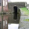
Plantation Street Bridge No 107

 
Plantation Street, Tameside OL6 6UQ, United Kingdom
 
Information about the place
Plantation Street Bridge No 107 is a minor waterways place on the Huddersfield Narrow Canal between Ashton-under-Lyne Junction (Junction of Ashton and Huddersfield Narrow Canals) (2¼ furlongs and 1 lock to the west) and Royal George Aqueduct (7 miles and 4 furlongs and 16 locks to the northeast).
 
 
The nearest place in the direction of Ashton-under-Lyne Junction is Texas Street Bridge No 108; 1¼ furlongs away.
 
The nearest place in the direction of Royal George Aqueduct is Plantation Lock No 2W; a few yards away.

There is access (suitable for wheels) to the towpath here.

Mooring here is unrated.

There is a bridge here which takes a minor road over the canal.


Amenities

Amenities here

 Fast Hire Uk Ltd

Amenities nearby at Plantation Lock No 2W

 Cashpoint
 Morrisons Fuel
 
Maps
If you are a user and are logged on, or if you are actively planning a route, a map will be displayed here.
Show on external mapping site: Google | OSM | Bing
 
Additional information

According to information passed down through my family the mill building adjacent to the Plantation Street Bridge No 107 was originally the trans-shipment warehouse dating from the building of the canal and may predate Portland Basin.

The building originally trans-shipped cotton bales from the barges onto horse and cart which was then taken via toll roads to the first cotton mills in Ashton which were located at Cockbrook and Hurst Brook.

The toll road started on Plantation Street then travelled north as far as the valley side where it wound up to a toll house in Southampton Street known as Mabs Cottage. The toll road then continued north to Currier Lane where it divided into two. The right hand branch went east along Currier Lane and down to the mills at Throstle Bank, Cockbrook. The left hand branch went north west along Grafton Street then cross the fields to the cotton mills at Hurst brook.

In 1845 the toll road changed when the railway was built by the Ashton, Stalybridge and Liverpool Junction Railway. A bridge was built in Grafton Street and one in Currier Lane to carry the roads over the new railway tracks.

Around the same time a railway bridge was built in Southampton Street to carry the toll road over the Stalybridge extension of the Manchester, Lincolnshire and Ashton Railway.

A third railway line was built much later which carried the direct Guide Bridge underpass line from Stalybridge to Hooley Hill and Denton. This meant the winding toll road up from Plantation Street to the Toll House in Southampton Street had to be severed and diverted to the right so as to meet up with Granville Street which ran parallel to the east of Southampton Street. This also allowed for a much gentler gradient up the valley side to meet up with Currier Lane.

The trans-shipment warehouse, Plantation Street, Countess Street and the trans-shipment warehouse are still in their original condition, whilst the old toll road via Southampton Street is still traceable and has become a nature area.

There are indications that Tameside Local Authority, who care little for heritage, are considering a complete redevelopment of the area when much of this valuable industrial heritage will disappear for ever.

Information provided by David Dawson, Mabs Court, Ashton under Lyne who will be pleased to assist anyone interested.

 
Photos
 
External websites
There are no links to external websites from here.
Why not log in and add some (select "External websites" from the menu (sometimes this is under "Edit"))?
 
Nearest facilities

Mouseover for more information or show routes to facility

Nearest water point

In the direction of Ashton-under-Lyne Junction

Fairfield Junction3 miles, 2¼ furlongs and 1 lock away
Travel to Ashton-under-Lyne Junction, then on the Ashton Canal (Main Line) to Fairfield Junction
Marple Services8 miles, 7½ furlongs and 17 locks away
Travel to Ashton-under-Lyne Junction, then on the Ashton Canal (Main Line) to Dukinfield Junction, then on the Peak Forest Canal (Lower) to Marple Junction, then on the Macclesfield Canal to Marple Services
New Islington Marina7 miles, 4½ furlongs and 21 locks away
Travel to Ashton-under-Lyne Junction, then on the Ashton Canal (Main Line) to Ducie Street Junction, then on the Rochdale Canal to New Islington Marina Entrance, then on the Rochdale Canal (Main Line) to Cotton Field Wharf Marina, then on the Rochdale Canal (New Islington Marina Arm) to New Islington Marina
Braidbar Boats12 miles, 5¼ furlongs and 17 locks away
Travel to Ashton-under-Lyne Junction, then on the Ashton Canal (Main Line) to Dukinfield Junction, then on the Peak Forest Canal (Lower) to Marple Junction, then on the Macclesfield Canal to Braidbar Boats
Furness Vale Marina13 miles, 6½ furlongs and 17 locks away
Travel to Ashton-under-Lyne Junction, then on the Ashton Canal (Main Line) to Dukinfield Junction, then on the Peak Forest Canal (Lower) to Marple Junction, then on the Peak Forest Canal (Upper) to Furness Vale Marina
Whaley Bridge Services15 miles, 2¾ furlongs and 17 locks away
Travel to Ashton-under-Lyne Junction, then on the Ashton Canal (Main Line) to Dukinfield Junction, then on the Peak Forest Canal (Lower) to Marple Junction, then on the Peak Forest Canal (Upper) to Whaley Bridge Branch Junction, then on the Peak Forest Canal (Whaley Bridge Branch) to Whaley Bridge Services
Bugsworth Services15 miles, 3 furlongs and 17 locks away
Travel to Ashton-under-Lyne Junction, then on the Ashton Canal (Main Line) to Dukinfield Junction, then on the Peak Forest Canal (Lower) to Marple Junction, then on the Peak Forest Canal (Upper) to Bugsworth Services
Bollington Wharf17 miles, 3 furlongs and 17 locks away
Travel to Ashton-under-Lyne Junction, then on the Ashton Canal (Main Line) to Dukinfield Junction, then on the Peak Forest Canal (Lower) to Marple Junction, then on the Macclesfield Canal to Bollington Wharf
Staffordshire, Kenworthy and other Arms8 miles, 2½ furlongs and 28 locks away
Travel to Ashton-under-Lyne Junction, then on the Ashton Canal (Main Line) to Ducie Street Junction, then on the Rochdale Canal to Castlefield Junction, then on the Bridgewater Canal (Main Line) to Staffordshire, Kenworthy and other Arms
Potato Wharf Arm & The New Basin8 miles, 3¼ furlongs and 28 locks away
Travel to Ashton-under-Lyne Junction, then on the Ashton Canal (Main Line) to Ducie Street Junction, then on the Rochdale Canal to Castlefield Junction, then on the Bridgewater Canal (Main Line) to Potato Wharf Arm & The New Basin
Stretford Marina11 miles, 2½ furlongs and 28 locks away
Travel to Ashton-under-Lyne Junction, then on the Ashton Canal (Main Line) to Ducie Street Junction, then on the Rochdale Canal to Castlefield Junction, then on the Bridgewater Canal (Main Line) to Stretford Marina
Watch House Cruising Club12 miles, 2¾ furlongs and 28 locks away
Travel to Ashton-under-Lyne Junction, then on the Ashton Canal (Main Line) to Ducie Street Junction, then on the Rochdale Canal to Castlefield Junction, then on the Bridgewater Canal (Main Line) to Watch House Cruising Club
Worsley Visitor Moorings15 miles, 4½ furlongs and 28 locks away
Travel to Ashton-under-Lyne Junction, then on the Ashton Canal (Main Line) to Ducie Street Junction, then on the Rochdale Canal to Castlefield Junction, then on the Bridgewater Canal (Main Line) to Stretford - Waters Meeting, then on the Bridgewater Canal (Stretford and Leigh Branch) to Worsley Visitor Moorings
Bridgewater Marina17 miles, ½ furlongs and 28 locks away
Travel to Ashton-under-Lyne Junction, then on the Ashton Canal (Main Line) to Ducie Street Junction, then on the Rochdale Canal to Castlefield Junction, then on the Bridgewater Canal (Main Line) to Stretford - Waters Meeting, then on the Bridgewater Canal (Stretford and Leigh Branch) to Bridgewater Marina
Ye Olde Number 3 Transit Moorings19 miles, 1¾ furlongs and 28 locks away
Travel to Ashton-under-Lyne Junction, then on the Ashton Canal (Main Line) to Ducie Street Junction, then on the Rochdale Canal to Castlefield Junction, then on the Bridgewater Canal (Main Line) to Ye Olde Number 3 Transit Moorings

In the direction of Aspley Basin (Huddersfield)

Grove Road Bridge No 964 miles, 2 furlongs and 7 locks away
On this waterway in the direction of Aspley Basin (Huddersfield)
Wool Road Bridge No 7010 miles, 2 furlongs and 22 locks away
On this waterway in the direction of Aspley Basin (Huddersfield)
Standedge Tunnel (western entrance)12 miles, 2 furlongs and 31 locks away
On this waterway in the direction of Aspley Basin (Huddersfield)
Standedge Tunnel (eastern entrance)15 miles, 3¾ furlongs and 31 locks away
On this waterway in the direction of Aspley Basin (Huddersfield)
Slaithwaite Winding Hole18 miles, 6¾ furlongs and 52 locks away
On this waterway in the direction of Aspley Basin (Huddersfield)

Nearest rubbish disposal

In the direction of Ashton-under-Lyne Junction

Marple Bottom Lock Bridge Winding Hole7 miles, 6¼ furlongs and 1 lock away
Travel to Ashton-under-Lyne Junction, then on the Ashton Canal (Main Line) to Dukinfield Junction, then on the Peak Forest Canal (Lower) to Marple Bottom Lock Bridge Winding Hole
Marple Services8 miles, 7½ furlongs and 17 locks away
Travel to Ashton-under-Lyne Junction, then on the Ashton Canal (Main Line) to Dukinfield Junction, then on the Peak Forest Canal (Lower) to Marple Junction, then on the Macclesfield Canal to Marple Services
Braidbar Boats12 miles, 5¼ furlongs and 17 locks away
Travel to Ashton-under-Lyne Junction, then on the Ashton Canal (Main Line) to Dukinfield Junction, then on the Peak Forest Canal (Lower) to Marple Junction, then on the Macclesfield Canal to Braidbar Boats
Whaley Bridge Services15 miles, 2¾ furlongs and 17 locks away
Travel to Ashton-under-Lyne Junction, then on the Ashton Canal (Main Line) to Dukinfield Junction, then on the Peak Forest Canal (Lower) to Marple Junction, then on the Peak Forest Canal (Upper) to Whaley Bridge Branch Junction, then on the Peak Forest Canal (Whaley Bridge Branch) to Whaley Bridge Services
Bugsworth Services15 miles, 3 furlongs and 17 locks away
Travel to Ashton-under-Lyne Junction, then on the Ashton Canal (Main Line) to Dukinfield Junction, then on the Peak Forest Canal (Lower) to Marple Junction, then on the Peak Forest Canal (Upper) to Bugsworth Services

In the direction of Aspley Basin (Huddersfield)

Wool Road Visitor Mooring10 miles, 1¾ furlongs and 22 locks away
On this waterway in the direction of Aspley Basin (Huddersfield)
Pickle Lock No 22E18 miles, 6¼ furlongs and 51 locks away
On this waterway in the direction of Aspley Basin (Huddersfield)

Nearest chemical toilet disposal

In the direction of Ashton-under-Lyne Junction

Fairfield Junction3 miles, 2¼ furlongs and 1 lock away
Travel to Ashton-under-Lyne Junction, then on the Ashton Canal (Main Line) to Fairfield Junction
Marple Services8 miles, 7½ furlongs and 17 locks away
Travel to Ashton-under-Lyne Junction, then on the Ashton Canal (Main Line) to Dukinfield Junction, then on the Peak Forest Canal (Lower) to Marple Junction, then on the Macclesfield Canal to Marple Services
Furness Vale Marina13 miles, 6½ furlongs and 17 locks away
Travel to Ashton-under-Lyne Junction, then on the Ashton Canal (Main Line) to Dukinfield Junction, then on the Peak Forest Canal (Lower) to Marple Junction, then on the Peak Forest Canal (Upper) to Furness Vale Marina
Whaley Bridge Services15 miles, 2¾ furlongs and 17 locks away
Travel to Ashton-under-Lyne Junction, then on the Ashton Canal (Main Line) to Dukinfield Junction, then on the Peak Forest Canal (Lower) to Marple Junction, then on the Peak Forest Canal (Upper) to Whaley Bridge Branch Junction, then on the Peak Forest Canal (Whaley Bridge Branch) to Whaley Bridge Services
Bugsworth Services15 miles, 3 furlongs and 17 locks away
Travel to Ashton-under-Lyne Junction, then on the Ashton Canal (Main Line) to Dukinfield Junction, then on the Peak Forest Canal (Lower) to Marple Junction, then on the Peak Forest Canal (Upper) to Bugsworth Services
Bollington Wharf17 miles, 3 furlongs and 17 locks away
Travel to Ashton-under-Lyne Junction, then on the Ashton Canal (Main Line) to Dukinfield Junction, then on the Peak Forest Canal (Lower) to Marple Junction, then on the Macclesfield Canal to Bollington Wharf
Watch House Cruising Club12 miles, 2¾ furlongs and 28 locks away
Travel to Ashton-under-Lyne Junction, then on the Ashton Canal (Main Line) to Ducie Street Junction, then on the Rochdale Canal to Castlefield Junction, then on the Bridgewater Canal (Main Line) to Watch House Cruising Club

In the direction of Aspley Basin (Huddersfield)

Grove Road Bridge No 964 miles, 2 furlongs and 7 locks away
On this waterway in the direction of Aspley Basin (Huddersfield)
Wool Road Bridge No 7010 miles, 2 furlongs and 22 locks away
On this waterway in the direction of Aspley Basin (Huddersfield)
Pickle Lock No 22E18 miles, 6¼ furlongs and 51 locks away
On this waterway in the direction of Aspley Basin (Huddersfield)
Waterside Lock No 21E18 miles, 7½ furlongs and 52 locks away
On this waterway in the direction of Aspley Basin (Huddersfield)

Nearest place to turn

In the direction of Ashton-under-Lyne Junction

Ashton-under-Lyne Junction2¼ furlongs and 1 lock away
On this waterway in the direction of Ashton-under-Lyne Junction
Dukinfield Junction6¼ furlongs and 1 lock away
Travel to Ashton-under-Lyne Junction, then on the Ashton Canal (Main Line) to Dukinfield Junction
Portland Basin Arm6½ furlongs and 1 lock away
Travel to Ashton-under-Lyne Junction, then on the Ashton Canal (Main Line) to Dukinfield Junction, then on the Peak Forest Canal (Lower) to Portland Basin Arm
Dunkirk Farm Bridge Winding Hole2 miles, 3½ furlongs and 1 lock away
Travel to Ashton-under-Lyne Junction, then on the Ashton Canal (Main Line) to Dukinfield Junction, then on the Peak Forest Canal (Lower) to Dunkirk Farm Bridge Winding Hole
Lumb Lane Bridge Winding Hole2 miles, 3½ furlongs and 1 lock away
Travel to Ashton-under-Lyne Junction, then on the Ashton Canal (Main Line) to Lumb Lane Bridge Winding Hole
Canal Street Winding Hole3 miles, ½ furlongs and 1 lock away
Travel to Ashton-under-Lyne Junction, then on the Ashton Canal (Main Line) to Dukinfield Junction, then on the Peak Forest Canal (Lower) to Canal Street Winding Hole
Fairfield Junction3 miles, 2¼ furlongs and 1 lock away
Travel to Ashton-under-Lyne Junction, then on the Ashton Canal (Main Line) to Fairfield Junction
Unity Mills Winding Hole4 miles, 5 furlongs and 1 lock away
Travel to Ashton-under-Lyne Junction, then on the Ashton Canal (Main Line) to Dukinfield Junction, then on the Peak Forest Canal (Lower) to Unity Mills Winding Hole
Urwick Road Winding Hole6 miles, 4 furlongs and 1 lock away
Travel to Ashton-under-Lyne Junction, then on the Ashton Canal (Main Line) to Dukinfield Junction, then on the Peak Forest Canal (Lower) to Urwick Road Winding Hole
Marple Bottom Lock Bridge Winding Hole7 miles, 6¼ furlongs and 1 lock away
Travel to Ashton-under-Lyne Junction, then on the Ashton Canal (Main Line) to Dukinfield Junction, then on the Peak Forest Canal (Lower) to Marple Bottom Lock Bridge Winding Hole
Clayton Junction4 miles, 4½ furlongs and 9 locks away
Travel to Ashton-under-Lyne Junction, then on the Ashton Canal (Main Line) to Clayton Junction
Ashton New Road Winding Hole5 miles, 1 furlong and 12 locks away
Travel to Ashton-under-Lyne Junction, then on the Ashton Canal (Main Line) to Ashton New Road Winding Hole
New Viaduct Winding Hole5 miles, 6½ furlongs and 16 locks away
Travel to Ashton-under-Lyne Junction, then on the Ashton Canal (Main Line) to New Viaduct Winding Hole
Winding Hole below Lock 138 miles, 5¾ furlongs and 13 locks away
Travel to Ashton-under-Lyne Junction, then on the Ashton Canal (Main Line) to Dukinfield Junction, then on the Peak Forest Canal (Lower) to Winding Hole below Lock 13
Marple Junction8 miles, 7 furlongs and 17 locks away
Travel to Ashton-under-Lyne Junction, then on the Ashton Canal (Main Line) to Dukinfield Junction, then on the Peak Forest Canal (Lower) to Marple Junction
Ducie Street Junction7 miles, ½ furlongs and 19 locks away
Travel to Ashton-under-Lyne Junction, then on the Ashton Canal (Main Line) to Ducie Street Junction

In the direction of Aspley Basin (Huddersfield)

Staley Wharf Winding Hole5½ furlongs and 2 locks away
On this waterway in the direction of Aspley Basin (Huddersfield)
Knowle Street Winding Hole1 mile, 7½ furlongs and 6 locks away
On this waterway in the direction of Aspley Basin (Huddersfield)
Mossley Bottoms Winding Hole5 miles, 7½ furlongs and 11 locks away
On this waterway in the direction of Aspley Basin (Huddersfield)
Roughtown Court Winding Hole6 miles, 7¼ furlongs and 13 locks away
On this waterway in the direction of Aspley Basin (Huddersfield)

Nearest self-operated pump-out

In the direction of Ashton-under-Lyne Junction

New Islington Marina7 miles, 4½ furlongs and 21 locks away
Travel to Ashton-under-Lyne Junction, then on the Ashton Canal (Main Line) to Ducie Street Junction, then on the Rochdale Canal to New Islington Marina Entrance, then on the Rochdale Canal (Main Line) to Cotton Field Wharf Marina, then on the Rochdale Canal (New Islington Marina Arm) to New Islington Marina

In the direction of Aspley Basin (Huddersfield)

Wool Road Bridge No 7010 miles, 2 furlongs and 22 locks away
On this waterway in the direction of Aspley Basin (Huddersfield)
Slaithwaite Winding Hole18 miles, 6¾ furlongs and 52 locks away
On this waterway in the direction of Aspley Basin (Huddersfield)

Nearest boatyard pump-out

In the direction of Ashton-under-Lyne Junction

Portland Basin Arm6½ furlongs and 1 lock away
Travel to Ashton-under-Lyne Junction, then on the Ashton Canal (Main Line) to Dukinfield Junction, then on the Peak Forest Canal (Lower) to Portland Basin Arm
Braidbar Boats12 miles, 5¼ furlongs and 17 locks away
Travel to Ashton-under-Lyne Junction, then on the Ashton Canal (Main Line) to Dukinfield Junction, then on the Peak Forest Canal (Lower) to Marple Junction, then on the Macclesfield Canal to Braidbar Boats
New Mills Marina12 miles, 7¼ furlongs and 17 locks away
Travel to Ashton-under-Lyne Junction, then on the Ashton Canal (Main Line) to Dukinfield Junction, then on the Peak Forest Canal (Lower) to Marple Junction, then on the Peak Forest Canal (Upper) to New Mills Marina
Bollington Wharf17 miles, 3 furlongs and 17 locks away
Travel to Ashton-under-Lyne Junction, then on the Ashton Canal (Main Line) to Dukinfield Junction, then on the Peak Forest Canal (Lower) to Marple Junction, then on the Macclesfield Canal to Bollington Wharf
Kerridge Dry Dock17 miles, 5¾ furlongs and 17 locks away
Travel to Ashton-under-Lyne Junction, then on the Ashton Canal (Main Line) to Dukinfield Junction, then on the Peak Forest Canal (Lower) to Marple Junction, then on the Macclesfield Canal to Kerridge Dry Dock
Stretford Marina11 miles, 2½ furlongs and 28 locks away
Travel to Ashton-under-Lyne Junction, then on the Ashton Canal (Main Line) to Ducie Street Junction, then on the Rochdale Canal to Castlefield Junction, then on the Bridgewater Canal (Main Line) to Stretford Marina
Bridgewater Marina17 miles, ½ furlongs and 28 locks away
Travel to Ashton-under-Lyne Junction, then on the Ashton Canal (Main Line) to Ducie Street Junction, then on the Rochdale Canal to Castlefield Junction, then on the Bridgewater Canal (Main Line) to Stretford - Waters Meeting, then on the Bridgewater Canal (Stretford and Leigh Branch) to Bridgewater Marina
Direction of TV transmitter (From Wolfbane Cybernetic)
 
 
Geograph
 
Wikipedia

There is no page on Wikipedia called “Plantation Street Bridge”

Wikipedia pages that might relate to Plantation Street Bridge
[14th Street bridges] The 14th Street bridges refers to the three bridges near each other that cross the Potomac River, connecting Arlington, Virginia and Washington, D.C.. [Kingsley Plantation] Kingsley Plantation (also known as the Zephaniah Kingsley Plantation Home and Buildings) is the site of a former estate in Jacksonville, Florida, that [Mount Pleasant, South Carolina] Pritchard Shipyard, Remley Point Cemetery, Slave Street, Smokehouse, and Allee, Boone Hall Plantation, Charles Pinckney National Historic Site, USS Clamagore [Main Street Bridge (Jacksonville)] Street Bridge, officially the John T. Alsop Jr. Bridge, is a bridge crossing the St. Johns River in Jacksonville, Florida. It was the second bridge built [Boise greenbelt] known as Plantation Island. The north bank trail resumes at the Glenwood Street bridge approximately 1-mile (1.6 km) west of the first Plantation Island [List of Encyclopædia Britannica Films titles] Harlow & John Walker; camera: Lynwood Chase c-10m December 1954 The Plantation South James D. Sage (producer); Ray Allen Billington, Ph.D. (collaboration) [An Occurrence at Owl Creek Bridge] Peyton Farquhar, a civilian and plantation owner, is being prepared for execution by hanging from an Alabama railroad bridge during the American Civil War [Saint Michael, Barbados] Hill Road Pine Plantation Road Pine Road Pinfold Street Pleasant View Terrace Prescod Boulevard President Kennedy Drive Probyn Street Redman's Drive Reef [Daytona Beach, Florida] and replace it with a high span bridge. Veterans Memorial Bridge Broadway Bridge Main Street Bridge Seabreeze Bridge Passenger railroad service to Daytona [House negro] negroes" and "plantation negroes", refuting an accusation that his slaves were poorly fed by saying they were fed as well as "plantation negroes", though
 
Google