CanalPlanAC

Stubbs Bridge

 
Bridge 11
Stubbs Bridge, Selby DN14 0TA, United Kingdom
 
Information about the place
Stubbs Bridge is a minor waterways place on the Aire and Calder Navigation (Main Line - Goole to Castleford) between Whitley Bridge (1 mile and 5¾ furlongs to the east) and Bank Dole Junction (Junction of the Aire and Calder Navigation (Selby Section) and the Aire and Calder Navigation (Main Line)) (1 mile and 4 furlongs to the west).
 
 
The nearest place in the direction of Whitley Bridge is Stubbs Pipe Bridge (Whitley Pipe Bridge); 5¾ furlongs away.
 
The nearest place in the direction of Bank Dole Junction is Kellingley Railway Bridge (Bridge 16); 3 furlongs away.

There is access (suitable for wheels) to the towpath here.

Mooring here is tolerable (it's just about possible if really necessary), piling suitable for hooks.

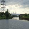
There is a bridge here which takes a minor road over the canal.

A19 Whitley Bridge1 mile, 7½ furlongs
Whitley Pipe Bridge1 mile, 6¼ furlongs
Selby Road Bridge1 mile, 5¾ furlongs
Whitley Bridge1 mile, 5¾ furlongs
Stubbs Pipe Bridge5¾ furlongs
Stubbs Bridge
Kellingley Railway Bridge3 furlongs
Kellingley Bridge6 furlongs
Wheeland Road Skew Bridge1 mile, 3 furlongs
Bank Dole Junction1 mile, 4 furlongs
Shepherds Bridge1 mile, 5 furlongs
 
 
Amenities
 
Maps
If you are a user and are logged on, or if you are actively planning a route, a map will be displayed here.
Show on external mapping site: Google | OSM | Bing
 
Photos
 
External websites
There are no links to external websites from here.
Why not log in and add some (select "External websites" from the menu (sometimes this is under "Edit"))?
 
Nearest facilities

Mouseover for more information or show routes to facility

Nearest water point

In the direction of Castleford Junction

Bank Dole Lock No 11 mile, 5¾ furlongs away
Travel to Bank Dole Junction, then on the Aire and Calder Navigation (Selby Section) to Bank Dole Lock No 1
Ferrybridge Flood Lock No 113 miles, ¼ furlongs away
On this waterway in the direction of Castleford Junction
Ferrybridge Flood Lock Footbridge3 miles, ¾ furlongs and 1 lock away
On this waterway in the direction of Castleford Junction
Beal Bridge4 miles, ¼ furlongs and 1 lock away
Travel to Bank Dole Junction, then on the Aire and Calder Navigation (Selby Section) to Beal Bridge
Beal Lock No 24 miles, 1½ furlongs and 1 lock away
Travel to Bank Dole Junction, then on the Aire and Calder Navigation (Selby Section) to Beal Lock No 2
Bulholme Lock No 107 miles, 6¼ furlongs and 1 lock away
On this waterway in the direction of Castleford Junction
Castleford Sanitary Station8 miles, 3 furlongs and 2 locks away
On this waterway in the direction of Castleford Junction
Woodnook Lock No 610 miles, 5¾ furlongs and 3 locks away
Travel to Castleford Junction, then on the Aire and Calder Navigation (Wakefield Section) to Woodnook Lock No 6
Fairies Hill Moorings10 miles, 4¼ furlongs and 4 locks away
Travel to Castleford Junction, then on the Aire and Calder Navigation (Wakefield Section) to Fairies Hill Lock Junction, then on the Aire and Calder Navigation (Wakefield Section - Fairies Hill Mooring Arm) to Fairies Hill Moorings
Lemonroyd Lock No 711 miles, 7½ furlongs and 3 locks away
Travel to Castleford Junction, then on the Aire and Calder Navigation (Main Line - Castleford to Leeds) to Lemonroyd Lock No 7
Selby Basin12 miles, 6¼ furlongs and 3 locks away
Travel to Bank Dole Junction, then on the Aire and Calder Navigation (Selby Section) to Selby Basin
Lemonroyd Marina12 miles, ½ furlongs and 4 locks away
Travel to Castleford Junction, then on the Aire and Calder Navigation (Main Line - Castleford to Leeds) to Lemonroyd Marina
King's Road Lock No 311 miles, 7¼ furlongs and 4 locks away
Travel to Castleford Junction, then on the Aire and Calder Navigation (Wakefield Section) to King's Road Lock No 3
Woodlesford Lock No 513 miles, 2¼ furlongs and 4 locks away
Travel to Castleford Junction, then on the Aire and Calder Navigation (Main Line - Castleford to Leeds) to Woodlesford Lock No 5

In the direction of Ouse - Aire and Calder Junction

Whitley Lock No 122 miles, 3½ furlongs away
On this waterway in the direction of Ouse - Aire and Calder Junction
Pollington Manor Swing Bridge6 miles, 1¾ furlongs and 2 locks away
On this waterway in the direction of Ouse - Aire and Calder Junction
Pollington Visitor Mooring6 miles, 2 furlongs and 2 locks away
On this waterway in the direction of Ouse - Aire and Calder Junction
Dutch Riverside14 miles, 4 furlongs and 2 locks away
On this waterway in the direction of Ouse - Aire and Calder Junction
Goole Marina14 miles, 5½ furlongs and 2 locks away
On this waterway in the direction of Ouse - Aire and Calder Junction
Bramwith Lock No 1414 miles, ¾ furlongs and 3 locks away
Travel to Sykehouse Junction, then on the Sheffield and South Yorkshire Navigation (New Junction Canal) to Bramwith Junction, then on the Sheffield and South Yorkshire Navigation (Bramwith to Stainforth) to Bramwith Lock No 14

Nearest rubbish disposal

In the direction of Castleford Junction

Castleford Sanitary Station8 miles, 3 furlongs and 2 locks away
On this waterway in the direction of Castleford Junction
Selby Basin12 miles, 6¼ furlongs and 3 locks away
Travel to Bank Dole Junction, then on the Aire and Calder Navigation (Selby Section) to Selby Basin
Lemonroyd Marina12 miles, ½ furlongs and 4 locks away
Travel to Castleford Junction, then on the Aire and Calder Navigation (Main Line - Castleford to Leeds) to Lemonroyd Marina
Woodlesford Lock No 513 miles, 2¼ furlongs and 4 locks away
Travel to Castleford Junction, then on the Aire and Calder Navigation (Main Line - Castleford to Leeds) to Woodlesford Lock No 5
Ramsdens Bridge Visitor Moorings13 miles, 4¾ furlongs and 6 locks away
Travel to Castleford Junction, then on the Aire and Calder Navigation (Wakefield Section) to Ramsdens Bridge Visitor Moorings
Leeds Sanitary Station17 miles, 6¾ furlongs and 7 locks away
Travel to Castleford Junction, then on the Aire and Calder Navigation (Main Line - Castleford to Leeds) to Leeds Sanitary Station
Leeds Basin18 miles, 6 furlongs and 9 locks away
Travel to Castleford Junction, then on the Aire and Calder Navigation (Main Line - Castleford to Leeds) to Leeds Bridge, then on the Leeds and Liverpool Canal (Main Line - Wigan to Leeds) to Leeds Basin

In the direction of Ouse - Aire and Calder Junction

Whitley Lock No 122 miles, 3½ furlongs away
On this waterway in the direction of Ouse - Aire and Calder Junction
Dutch Riverside14 miles, 4 furlongs and 2 locks away
On this waterway in the direction of Ouse - Aire and Calder Junction
Goole Marina14 miles, 5½ furlongs and 2 locks away
On this waterway in the direction of Ouse - Aire and Calder Junction
Barnby Dun Lift Bridge14 miles, 7 furlongs and 3 locks away
Travel to Sykehouse Junction, then on the Sheffield and South Yorkshire Navigation (New Junction Canal) to Bramwith Junction, then on the Sheffield and South Yorkshire Navigation (Main Line) to Barnby Dun Lift Bridge
Bramwith Swing Bridge14 miles, 3½ furlongs and 4 locks away
Travel to Sykehouse Junction, then on the Sheffield and South Yorkshire Navigation (New Junction Canal) to Bramwith Junction, then on the Sheffield and South Yorkshire Navigation (Bramwith to Stainforth) to Bramwith Swing Bridge
Thorne Visitor Moorings18 miles, 6 furlongs and 5 locks away
Travel to Sykehouse Junction, then on the Sheffield and South Yorkshire Navigation (New Junction Canal) to Bramwith Junction, then on the Sheffield and South Yorkshire Navigation (Bramwith to Stainforth) to Stainforth Junction, then on the Sheffield and South Yorkshire Navigation (Stainforth and Keadby Canal) to Thorne Visitor Moorings

Nearest chemical toilet disposal

In the direction of Castleford Junction

Castleford Sanitary Station8 miles, 3 furlongs and 2 locks away
On this waterway in the direction of Castleford Junction
Fairies Hill Moorings10 miles, 4¼ furlongs and 4 locks away
Travel to Castleford Junction, then on the Aire and Calder Navigation (Wakefield Section) to Fairies Hill Lock Junction, then on the Aire and Calder Navigation (Wakefield Section - Fairies Hill Mooring Arm) to Fairies Hill Moorings
Selby Basin12 miles, 6¼ furlongs and 3 locks away
Travel to Bank Dole Junction, then on the Aire and Calder Navigation (Selby Section) to Selby Basin
Lemonroyd Marina12 miles, ½ furlongs and 4 locks away
Travel to Castleford Junction, then on the Aire and Calder Navigation (Main Line - Castleford to Leeds) to Lemonroyd Marina
Ramsdens Bridge Sanitary Station13 miles, 5 furlongs and 6 locks away
Travel to Castleford Junction, then on the Aire and Calder Navigation (Wakefield Section) to Ramsdens Bridge Sanitary Station
Leeds Sanitary Station17 miles, 6¾ furlongs and 7 locks away
Travel to Castleford Junction, then on the Aire and Calder Navigation (Main Line - Castleford to Leeds) to Leeds Sanitary Station

In the direction of Ouse - Aire and Calder Junction

Whitley Lock No 122 miles, 3½ furlongs away
On this waterway in the direction of Ouse - Aire and Calder Junction
Dutch Riverside14 miles, 4 furlongs and 2 locks away
On this waterway in the direction of Ouse - Aire and Calder Junction
Goole Marina14 miles, 5½ furlongs and 2 locks away
On this waterway in the direction of Ouse - Aire and Calder Junction
Barnby Dun Lift Bridge14 miles, 7 furlongs and 3 locks away
Travel to Sykehouse Junction, then on the Sheffield and South Yorkshire Navigation (New Junction Canal) to Bramwith Junction, then on the Sheffield and South Yorkshire Navigation (Main Line) to Barnby Dun Lift Bridge
Bramwith Swing Bridge14 miles, 3½ furlongs and 4 locks away
Travel to Sykehouse Junction, then on the Sheffield and South Yorkshire Navigation (New Junction Canal) to Bramwith Junction, then on the Sheffield and South Yorkshire Navigation (Bramwith to Stainforth) to Bramwith Swing Bridge
Thorne Visitor Moorings18 miles, 6 furlongs and 5 locks away
Travel to Sykehouse Junction, then on the Sheffield and South Yorkshire Navigation (New Junction Canal) to Bramwith Junction, then on the Sheffield and South Yorkshire Navigation (Bramwith to Stainforth) to Stainforth Junction, then on the Sheffield and South Yorkshire Navigation (Stainforth and Keadby Canal) to Thorne Visitor Moorings

Nearest place to turn

In the direction of Castleford Junction

Bank Dole Lock Junction1 mile, 6 furlongs and 1 lock away
Travel to Bank Dole Junction, then on the Aire and Calder Navigation (Selby Section) to Bank Dole Lock Junction
Beal Lock No 2 Weir Entrance4 miles, ½ furlongs and 1 lock away
Travel to Bank Dole Junction, then on the Aire and Calder Navigation (Selby Section) to Beal Lock No 2 Weir Entrance
Bulholme Lock Weir Exit7 miles, 5¾ furlongs and 1 lock away
On this waterway in the direction of Castleford Junction
Haddlesey Junction8 miles and 2 locks away
Travel to Bank Dole Junction, then on the Aire and Calder Navigation (Selby Section) to Haddlesey Junction
Lemonroyd Lock Weir Exit11 miles, 6½ furlongs and 3 locks away
Travel to Castleford Junction, then on the Aire and Calder Navigation (Main Line - Castleford to Leeds) to Lemonroyd Lock Weir Exit
Fairies Hill Lock Arm10 miles, 7¼ furlongs and 4 locks away
Travel to Castleford Junction, then on the Aire and Calder Navigation (Wakefield Section) to Fairies Hill Lock Arm
Selby Basin12 miles, 6¼ furlongs and 3 locks away
Travel to Bank Dole Junction, then on the Aire and Calder Navigation (Selby Section) to Selby Basin
Fleet Lane Arm12 miles, 2½ furlongs and 4 locks away
Travel to Castleford Junction, then on the Aire and Calder Navigation (Main Line - Castleford to Leeds) to Fleet Lane Arm
Stanley Ferry Marina13 miles, 3½ furlongs and 6 locks away
Travel to Castleford Junction, then on the Aire and Calder Navigation (Wakefield Section) to Stanley Ferry Marina
Junction with River Aire (Old Channel) South16 miles, 4¾ furlongs and 6 locks away
Travel to Castleford Junction, then on the Aire and Calder Navigation (Main Line - Castleford to Leeds) to Junction with River Aire (Old Channel) South
Junction with River Aire (Old Channel) North17 miles, 2 furlongs and 7 locks away
Travel to Castleford Junction, then on the Aire and Calder Navigation (Main Line - Castleford to Leeds) to Junction with River Aire (Old Channel) North
Knostrop Flood Lock Weir Entrance17 miles, 2¼ furlongs and 7 locks away
Travel to Castleford Junction, then on the Aire and Calder Navigation (Main Line - Castleford to Leeds) to Knostrop Flood Lock Weir Entrance
Wakefield Weir Entrance16 miles, 4 furlongs and 8 locks away
Travel to Castleford Junction, then on the Aire and Calder Navigation (Wakefield Section) to Fall Ing Junction, then on the Calder and Hebble Navigation (Main Line) to Wakefield Weir Entrance
Leeds Dock Side Arm18 miles, 1¼ furlongs and 8 locks away
Travel to Castleford Junction, then on the Aire and Calder Navigation (Main Line - Castleford to Leeds) to Leeds Dock Entrance, then on the Aire and Calder Navigation (Leeds Dock) to Leeds Dock Side Arm
River Aire Junction18 miles, 5½ furlongs and 8 locks away
Travel to Castleford Junction, then on the Aire and Calder Navigation (Main Line - Castleford to Leeds) to Leeds Bridge, then on the Leeds and Liverpool Canal (Main Line - Wigan to Leeds) to River Aire Junction
Leeds Basin18 miles, 6 furlongs and 9 locks away
Travel to Castleford Junction, then on the Aire and Calder Navigation (Main Line - Castleford to Leeds) to Leeds Bridge, then on the Leeds and Liverpool Canal (Main Line - Wigan to Leeds) to Leeds Basin
Broad Cut Weir Entrance19 miles, ½ furlongs and 9 locks away
Travel to Castleford Junction, then on the Aire and Calder Navigation (Wakefield Section) to Fall Ing Junction, then on the Calder and Hebble Navigation (Main Line) to Broad Cut Weir Entrance

In the direction of Ouse - Aire and Calder Junction

Viking Marina14 miles, 4¾ furlongs and 2 locks away
On this waterway in the direction of Ouse - Aire and Calder Junction
Huddle Grounds Winding Hole16 miles, 2¾ furlongs and 4 locks away
Travel to Sykehouse Junction, then on the Sheffield and South Yorkshire Navigation (New Junction Canal) to Bramwith Junction, then on the Sheffield and South Yorkshire Navigation (Bramwith to Stainforth) to Stainforth Junction, then on the Sheffield and South Yorkshire Navigation (Stainforth and Keadby Canal) to Huddle Grounds Winding Hole
Wheatley Hall Road Winding Hole18 miles, 1 furlong and 4 locks away
Travel to Sykehouse Junction, then on the Sheffield and South Yorkshire Navigation (New Junction Canal) to Bramwith Junction, then on the Sheffield and South Yorkshire Navigation (Main Line) to Wheatley Hall Road Winding Hole

Nearest self-operated pump-out

Direction of TV transmitter (From Wolfbane Cybernetic)
 
 
Geograph
 
Wikipedia

There is no page on Wikipedia called “Stubbs Bridge”

Wikipedia pages that might relate to Stubbs Bridge
[Stubbs, Virginia] Stubbs is an unincorporated community in Spotsylvania County in the U.S. state of Virginia. Stubbs Bridge is named after it. Official site of Spotsylvania [Bells Crossroad, Virginia] the intersection of Stubbs Bridge Road (Route 612) and Lawyer's Road (Route 601). Branch Fork Baptist Church, 6930 Stubbs Bridge Rd Olivet United Methodist [Mangatangi River] upstream, Stubbs Bridge was also built in 1922, swept away in 1966 and replaced in 1967. In 1921 Franklin County Council rejected a tender for a bridge with [List of All Creatures Great and Small episodes (1978–1990 series)] begin with Siegfried and James leaving J.R. Stubbs Provisions, getting back in the car and driving over the bridge featured in the series' first run. The opening [List of Deadwood characters] growing self-assurance and confidence. He forms friendships with Joanie Stubbs and Sol Star. Later, Ellsworth is advised by Trixie to wed Alma, once it [Adam Fielding (actor)] which he portrayed until 2016. In 2017, he portrayed the role of Elijah Stubbs in two episodes of the BBC series In the Dark. In 2018, Fielding landed [Moab, Utah] original on 2006-11-06. Stubbs, Peter (1890). Autobiography of Peter Stubbs. http://stubbstervorthistory.50megs.com/Peter_Stubbs_1824.htm "Archived copy" [List of cooperative video games] 2 Local Shared No Stronghold Legends PC RTS 2006 4 LAN, Online Full No Stubbs the Zombie in Rebel Without a Pulse Xbox TPS 2005 2 Local Split No Supreme [Waterloo Bridge (1940 film)] Waterloo Bridge is a 1940 remake of the 1931 American drama film also called Waterloo Bridge, adapted from the 1930 play Waterloo Bridge. In an extended [Evolution (Star Trek: The Next Generation)] controls unreliable, the crew and Dr. Stubbs attempt to see if they can remove the nanites from the core. However, Dr. Stubbs shoots the core with a burst of
 
Google

Results of Google Search

7406 Stubbs Bridge Rd, Spotsylvania, VA, 22551 | realtor.com®
View 32 photos of this 3 bed, 2 bath, 1273 sqft. single family home located at 7406 Stubbs Bridge Rd, Spotsylvania, VA, 22551 on sale now for $224900.
7406 Stubbs Bridge Rd, Spotsylvania, VA 22551 | MLS ...
Zillow has 32 photos of this $224500 3 beds, 2 baths, 1273 Square Feet single family home located at 7406 Stubbs Bridge Rd, Spotsylvania, VA 22551 built in ...
Stubbs Bridge, Mineral
Lake Anna Woods. LKA Morgan I and II. Magnolia Harbor. Oak Grove/Cats Paw. Orange Springs Rd. Post Oak. Rose Valley. Stubbs Bridge Rd. Sunset Harbour.
7732 Stubbs Bridge Rd, Spotsylvania, VA 22551 | Zillow
The property 7732 Stubbs Bridge Rd, Spotsylvania, VA 22551 is currently not for sale on Zillow. View details, sales history and Zestimate data for this property ...
7522 Stubbs Bridge Rd, Spotsylvania, VA 22551 - realtor.com®
View 30 photos for 7522 Stubbs Bridge Rd, Spotsylvania, VA 22551 a 6 bed, 4 bath, 4704 Sq. Ft. single family home built in 2006 that sold on 12/15/2016.
7406 Stubbs Bridge Rd, Spotsylvania, VA 22551 | MLS ...
For Sale: 3 beds, 2 baths ∙ 1273 sq. ft. ∙ 7406 Stubbs Bridge Rd, Spotsylvania, VA 22551 ∙ $224500 ∙ MLS# VASP227550 ∙ Close to Lake Anna State ...
6400 Stubbs Bridge Rd, Spotsylvania, VA - Lot/Land - 4 Photos | Trulia
6400 Stubbs Bridge Rd, Spotsylvania, VA 22551. See the estimate, review home details, and search for homes nearby.
7414 Stubbs Bridge Rd, Spotsylvania Courthouse, VA 22551 | Redfin
Oct 27, 2020 ... 3 beds, 1 bath, 960 sq. ft. house located at 7414 Stubbs Bridge Rd, Spotsylvania Courthouse, VA 22551 sold for $174000 on Apr 4, 2005.
6600 Stubbs Bridge Road, Spotsylvania, VA 22551 | Compass
6600 Stubbs Bridge Road, Spotsylvania, VA 22551 is not currently listed. This is a 0-bed, 0-bath property.
6000 Stubbs Bridge Rd, Mineral, VA 23117 | Redfin
2 beds, 2 baths, 1080 sq. ft. house located at 6000 Stubbs Bridge Rd, Mineral, VA 23117. View sales history, tax history, home value estimates, and overhead ...