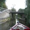
Bank Mill Bridge No 143
is a minor waterways place
on the Grand Union Canal (Grand Junction Canal - Main Line - Gayton to Brentford) between
Bulbourne Junction (Junction of Grand Union Wendover Arm with Main Line, Braunston 55¼ miles / Wendover 6¾ miles) (6 miles and 6 furlongs
and 10 locks
to the northwest) and
Grove Ornamental Bridge No 164 (8 miles and 4½ furlongs
and 20 locks
to the southeast).
The nearest place in the direction of Bulbourne Junction is Bank Mill Service Station;
1¼ furlongs
away.
The nearest place in the direction of Grove Ornamental Bridge No 164 is Top Side Lock No 56 (Top lock of Bourne End Locks Nos 56 to 59);
1¾ furlongs
away.
There is access (suitable for wheels) to the towpath here.
Mooring here is unrated.
There is a bridge here which takes a minor road over the canal.
The Boat PH (Berkhamsted) | 3¾ furlongs | |
Berkhamsted Bottom Lock No 55 | 3¼ furlongs | |
The Rising Sun PH (Berkhamstead) | 3 furlongs | |
George Street Footbridge | 2¼ furlongs | |
Bank Mill Service Station | 1¼ furlongs | |
Bank Mill Bridge No 143 | ||
Top Side Lock No 56 | 1¾ furlongs | |
Bullbeggers Lane Winding Hole | 2½ furlongs | |
Bankmill Bridge No 144 | 2¾ furlongs | |
Milepost - Braunston 62 Miles | 2¾ furlongs | |
Bottom Side Lock No 57 | 4 furlongs |
Amenities nearby at Bank Mill Service Station
There is ramp access onto the tow path towards Berkhamsted. There are shallow steps which it would probably be possible to wheel a bike/carry a light buggy or pushchair to access the tow path towards Winkwell.
- Grand Union Canal Walk — associated with Grand Union Canal
- An illustrated walk along the Grand Union Canal from London to Birmingham
- THE GRAND JUNCTION CANAL - a highway laid with water. — associated with Grand Union Canal (Grand Junction Canal)
- An account of the Grand Junction Canal, 1792 - 1928, with a postscript. By Ian Petticrew and Wendy Austin.
- The Boatmen's Institute in Brentford — associated with Grand Union Canal (Grand Junction Canal - Main Line - Gayton to Brentford)
Mouseover for more information or show routes to facility
Nearest water point
In the direction of Gayton Junction
Bank Mill Service Station — 1¼ furlongs away
On this waterway in the direction of Gayton Junction
Berkhamsted Services — 7¾ furlongs and 3 locks away
On this waterway in the direction of Gayton Junction
Cowroast Lock No 46 — 3 miles, 4½ furlongs and 9 locks away
On this waterway in the direction of Gayton Junction
Winding Hole near Bulbourne Bridge — 6 miles, 2¾ furlongs and 10 locks away
On this waterway in the direction of Gayton Junction
Marsworth Services — 7 miles, 5¾ furlongs and 17 locks away
On this waterway in the direction of Gayton Junction
Slapton Wharf — 12 miles and 25 locks away
On this waterway in the direction of Gayton Junction
Aylesbury Circus Field Basin — 12 miles, 6¼ furlongs and 31 locks away
Travel to Marsworth Junction, then on the Grand Union Canal (Grand Junction Canal - Aylesbury Arm) to Aylesbury Circus Field Basin
Leighton Linslade Services — 15 miles, 5¾ furlongs and 28 locks away
On this waterway in the direction of Gayton Junction
Rothschild Road Wharf — 16 miles, 2¼ furlongs and 28 locks away
On this waterway in the direction of Gayton Junction
Aylesbury Basin Visitor Moorings — 13 miles, 6 furlongs and 33 locks away
Travel to Marsworth Junction, then on the Grand Union Canal (Grand Junction Canal - Aylesbury Arm) to Aylesbury Basin Visitor Moorings
Soulbury Bottom Lock No 24 — 19 miles, 6 furlongs and 31 locks away
On this waterway in the direction of Gayton Junction
In the direction of Thames - Grand Union Canal Junction
Middlesex & Herts Boat Services Wharf — 1 mile, 6½ furlongs and 5 locks away
On this waterway in the direction of Thames - Grand Union Canal Junction
Apsley Services — 4 miles, 1½ furlongs and 10 locks away
On this waterway in the direction of Thames - Grand Union Canal Junction
Nash Mill Top Lock No 68 — 4 miles, 6½ furlongs and 12 locks away
On this waterway in the direction of Thames - Grand Union Canal Junction
Cassiobridge Water Point — 10 miles, 2¾ furlongs and 23 locks away
On this waterway in the direction of Thames - Grand Union Canal Junction
Bridgewater Basin — 10 miles, 3¾ furlongs and 24 locks away
On this waterway in the direction of Thames - Grand Union Canal Junction
Batchworth Junction — 12 miles, 6 furlongs and 27 locks away
On this waterway in the direction of Thames - Grand Union Canal Junction
Rickmansworth Basin Footbridge — 13 miles and 28 locks away
Travel to Batchworth Junction, then on the Grand Union Canal (Grand Junction Canal - Rickmansworth Branch) to Rickmansworth Basin Footbridge
Copper Mill Lock No 84 — 15 miles, 2½ furlongs and 29 locks away
On this waterway in the direction of Thames - Grand Union Canal Junction
Denham Marina — 19 miles, 4½ furlongs and 34 locks away
On this waterway in the direction of Thames - Grand Union Canal JunctionNearest rubbish disposal
In the direction of Gayton Junction
Berkhamsted Services — 7¾ furlongs and 3 locks away
On this waterway in the direction of Gayton Junction
Cowroast Lock No 46 — 3 miles, 4½ furlongs and 9 locks away
On this waterway in the direction of Gayton Junction
Cowroast Marina — 3 miles, 5¼ furlongs and 10 locks away
On this waterway in the direction of Gayton Junction
Marsworth Services — 7 miles, 5¾ furlongs and 17 locks away
On this waterway in the direction of Gayton Junction
Town Field Farm Bridge No 130 — 7 miles, 7¼ furlongs and 17 locks away
On this waterway in the direction of Gayton Junction
Leighton Rubbish Disposal — 15 miles, 5½ furlongs and 28 locks away
On this waterway in the direction of Gayton Junction
Aylesbury Basin Visitor Moorings — 13 miles, 6 furlongs and 33 locks away
Travel to Marsworth Junction, then on the Grand Union Canal (Grand Junction Canal - Aylesbury Arm) to Aylesbury Basin Visitor Moorings
Soulbury Middle Lock No 25 — 19 miles, 5¾ furlongs and 30 locks away
On this waterway in the direction of Gayton Junction
In the direction of Thames - Grand Union Canal Junction
Fisheries Lock No 63 — 2 miles, 6½ furlongs and 7 locks away
On this waterway in the direction of Thames - Grand Union Canal Junction
Apsley Services — 4 miles, 1½ furlongs and 10 locks away
On this waterway in the direction of Thames - Grand Union Canal Junction
Apsley Marina — 4 miles, 3¾ furlongs and 12 locks away
On this waterway in the direction of Thames - Grand Union Canal Junction
Rickmansworth Household Waste and Recycling Centre — 12 miles, 6¾ furlongs and 27 locks away
On this waterway in the direction of Thames - Grand Union Canal Junction
Rickmansworth Rubbish Disposal — 12 miles, 7½ furlongs and 28 locks away
Travel to Batchworth Junction, then on the Grand Union Canal (Grand Junction Canal - Rickmansworth Branch) to Rickmansworth Rubbish Disposal
Rickmansworth Basin — 12 miles, 7½ furlongs and 28 locks away
Travel to Batchworth Junction, then on the Grand Union Canal (Grand Junction Canal - Rickmansworth Branch) to Rickmansworth Basin
Copper Mill Lane Rubbish Disposal — 15 miles, 3¼ furlongs and 30 locks away
On this waterway in the direction of Thames - Grand Union Canal JunctionNearest chemical toilet disposal
In the direction of Gayton Junction
Cowroast Lock No 46 — 3 miles, 4½ furlongs and 9 locks away
On this waterway in the direction of Gayton Junction
Cowroast Marina — 3 miles, 5¼ furlongs and 10 locks away
On this waterway in the direction of Gayton Junction
Marsworth Services — 7 miles, 5¾ furlongs and 17 locks away
On this waterway in the direction of Gayton Junction
Leighton Linslade Services — 15 miles, 5¾ furlongs and 28 locks away
On this waterway in the direction of Gayton Junction
Aylesbury Basin Visitor Moorings — 13 miles, 6 furlongs and 33 locks away
Travel to Marsworth Junction, then on the Grand Union Canal (Grand Junction Canal - Aylesbury Arm) to Aylesbury Basin Visitor Moorings
In the direction of Thames - Grand Union Canal Junction
Apsley Services — 4 miles, 1½ furlongs and 10 locks away
On this waterway in the direction of Thames - Grand Union Canal Junction
Apsley Marina — 4 miles, 3¾ furlongs and 12 locks away
On this waterway in the direction of Thames - Grand Union Canal Junction
Batchworth Junction — 12 miles, 6 furlongs and 27 locks away
On this waterway in the direction of Thames - Grand Union Canal JunctionNearest place to turn
In the direction of Thames - Grand Union Canal Junction
Bullbeggers Lane Winding Hole — 2½ furlongs and 1 lock away
On this waterway in the direction of Thames - Grand Union Canal Junction
Winkwell Dock Winding Hole — 1 mile, 7¾ furlongs and 6 locks away
On this waterway in the direction of Thames - Grand Union Canal Junction
Boxmoor Bottom Lock Winding Hole — 3 miles, 4¼ furlongs and 9 locks away
On this waterway in the direction of Thames - Grand Union Canal Junction
River Gade Junction — 3 miles, 4¾ furlongs and 9 locks away
On this waterway in the direction of Thames - Grand Union Canal Junction
Apsley Bottom Lock Winding Hole — 4 miles, 3¼ furlongs and 12 locks away
On this waterway in the direction of Thames - Grand Union Canal Junction
Nash Mill Top Lock Winding Hole — 4 miles, 6¼ furlongs and 12 locks away
On this waterway in the direction of Thames - Grand Union Canal Junction
Red Lion Lane Bridge Winding Hole — 5 miles and 14 locks away
On this waterway in the direction of Thames - Grand Union Canal Junction
Kings Langley Winding Hole — 5 miles, 3¾ furlongs and 14 locks away
On this waterway in the direction of Thames - Grand Union Canal Junction
Toovey's Mill Arm — 5 miles, 6½ furlongs and 14 locks away
On this waterway in the direction of Thames - Grand Union Canal Junction
Home Park Arm — 6 miles, 3 furlongs and 15 locks away
On this waterway in the direction of Thames - Grand Union Canal Junction
Hunton Bridge Winding Hole — 7 miles, 6¼ furlongs and 19 locks away
On this waterway in the direction of Thames - Grand Union Canal Junction
Junction 19 Winding Hole — 8 miles, ½ furlongs and 19 locks away
On this waterway in the direction of Thames - Grand Union Canal Junction
In the direction of Gayton Junction
Cowroast Winding Hole — 3 miles, 5 furlongs and 10 locks away
On this waterway in the direction of Gayton Junction
Station Road Bridge Winding Hole — 4 miles, 7¼ furlongs and 10 locks away
On this waterway in the direction of Gayton Junction
Winding Hole near Bulbourne Bridge — 6 miles, 2¾ furlongs and 10 locks away
On this waterway in the direction of Gayton Junction
Bulbourne Junction — 6 miles, 6 furlongs and 10 locks away
On this waterway in the direction of Gayton Junction
Gammel Bridge Winding Hole — 7 miles, 4½ furlongs and 10 locks away
Travel to Bulbourne Junction, then on the Grand Union Canal (Grand Junction Canal - Wendover Arm - restored section) to Gammel Bridge Winding Hole
Little Tring Winding Hole — 8 miles, 1 furlong and 10 locks away
Travel to Bulbourne Junction, then on the Grand Union Canal (Grand Junction Canal - Wendover Arm - restored section) to Little Tring Winding Hole
Saxon Way Winding Hole — 9 miles, 6¾ furlongs and 10 locks away
Travel to Bulbourne Junction, then on the Grand Union Canal (Grand Junction Canal - Wendover Arm - restored section) to Little Tring Winding Hole, then on the Grand Union Canal (Grand Junction Canal - Wendover Arm - unrestored section) to Saxon Way Winding Hole
Marsworth Junction — 7 miles, 5¼ furlongs and 17 locks away
On this waterway in the direction of Gayton JunctionNearest self-operated pump-out
In the direction of Thames - Grand Union Canal Junction
Middlesex & Herts Boat Services Wharf — 1 mile, 6½ furlongs and 5 locks away
On this waterway in the direction of Thames - Grand Union Canal Junction
Apsley Marina — 4 miles, 3¾ furlongs and 12 locks away
On this waterway in the direction of Thames - Grand Union Canal Junction
In the direction of Gayton Junction
Cowroast Marina — 3 miles, 5¼ furlongs and 10 locks away
On this waterway in the direction of Gayton Junction
Marsworth Services — 7 miles, 5¾ furlongs and 17 locks away
On this waterway in the direction of Gayton JunctionNearest boatyard pump-out
In the direction of Thames - Grand Union Canal Junction
Middlesex & Herts Boat Services Wharf — 1 mile, 6½ furlongs and 5 locks away
On this waterway in the direction of Thames - Grand Union Canal Junction
Bridgewater Basin — 10 miles, 3¾ furlongs and 24 locks away
On this waterway in the direction of Thames - Grand Union Canal Junction
Hillingdon Narrowboats Association — 15 miles, 2¼ furlongs and 29 locks away
On this waterway in the direction of Thames - Grand Union Canal Junction
Harefield Marina — 17 miles, 2 furlongs and 32 locks away
On this waterway in the direction of Thames - Grand Union Canal Junction
Denham Marina — 19 miles, 4½ furlongs and 34 locks away
On this waterway in the direction of Thames - Grand Union Canal Junction
In the direction of Gayton Junction
Cheddington Wharf — 9 miles, 1 furlong and 19 locks away
On this waterway in the direction of Gayton Junction
Grove Lock Marina — 14 miles, 2¼ furlongs and 27 locks away
On this waterway in the direction of Gayton Junction
Rothschild Road Wharf — 16 miles, 2¼ furlongs and 28 locks away
On this waterway in the direction of Gayton JunctionDirection of TV transmitter (From Wolfbane Cybernetic)
There is no page on Wikipedia called “Bank Mill Bridge”
Wikipedia pages that might relate to Bank Mill Bridge
[Quarry Bank Mill]
Quarry Bank Mill (also known as Styal Mill) in Styal, Cheshire, England, is one of the best preserved textile factories of the Industrial Revolution.
[Hebden Bridge]
and access to major wool markets meant that Hebden Bridge was ideal for water-powered weaving mills and the town developed during the 19th and 20th centuries;
[Grist Mill Bridge, Dam and Mill Site]
The Grist Mill Bridge, Dam and Mill Site consists of three structures located along Upton Road between Island Road and the Maple River, one-half mile
[Watson Mill Bridge State Park]
Watson Mill Bridge State Park is a 1,018 acre (4.12 km²) Georgia state park located near Comer and Carlton on the South Fork of the Broad River. The park
[Starr Mill Road Bridge]
The Starr Mill Road Bridge is a historic bridge in Middletown, Connecticut. It is a single span Warren through truss bridge, spanning the Coginchaug River
[Banks Covered Bridge]
bridges; perhaps only five such bridges were ever built in the county. Today, only the Banks Covered Bridge and the McConnell's Mill Covered Bridge near
[New Mills]
difficult, as the arches needed to pass close to Torr Mill and properties on the Cheshire (south) bank, and Torr Top Hall had to be demolished. The new road
[River Kent]
Staveley (old) weir, which supplied a corn mill on the east bank and a woollen mill on the west bank. Barley Bridge was built of slate rubble, possibly in
[Stamford Bridge, East Riding of Yorkshire]
Stamford Bridge has several notable landmarks, including the Corn Mill; the stone arched bridge over the River Derwent; the Stamford Bridge Viaduct, and
[Shocks Mills Bridge]
Shocks Mills Bridge carries tracks of the Norfolk Southern Railway (formerly the Atglen and Susquehanna Branch of the Pennsylvania Railroad) over the Susquehanna
Results of Google Search
Jan 22, 2017 ... Bank Mill Bridge No 143. taken 5 years ago, near to Berkhamsted, Hertfordshire, Great Britain. More sizes. Bank Mill Bridge No 143. Crossing ...
(4) Oxford Township, T-493, Kohler Mill Road Bridge, Bridge Replacement ... (3) Red Bank Township, T-510, Township Bridge No.47 over Pine Creek, Bridge ...
Over 45 covered bridges were built in Berks County between the years of 1834 ... They formed either a favorable or not-so-favorable report of the need for the ... The stream being 1300 feet wide, the east bank six feet and the west bank 14 feet ... When Route 143 was built Parallel to Maiden Creek, the ice house had to be ...
Explore the history of the covered bridge in Cedarburg. ... of Cedarburg and 20 miles north of Milwaukee near the junction of Highways 60 and 143 on the Covered Bridge Road. ... However, at that time, there was no County Historical Society.
Dec 8, 1982 ... No. 1992-143 ... (5) Crescent Township, Riverview Road Bridge No.6. (FUO6), Bridge ... Road, Bridge over Mill Creek, Bridge Replacement.
Sep 6, 2018 ... Crews work to stabilize and secure Herr's Mill Covered Bridge for deconstruction ... From a financial aspect, it makes no sense,” he said. ... The banks of Pequea Creek will be restored once the bridge is removed, he added. ... Herr's Mill covered bridge has survived floods and fires over the last 143 years.
The property 143 N Mill Trace Dr, Spring, TX 77381 is currently not for sale on Zillow. View details, sales history and Zestimate data for this property on Zillow.