CanalPlanAC

Sandhill Bridge

 
Great Ouse or Ten Mile River, New River Bank, East Cambridgeshire CB6 1FU, United Kingdom
Address is taken from a point 716 yards away.
 
Information about the place
 
 
The nearest place in the direction of Brandon Creek Junction is Holmes River Junction (Junction of the River Great Ouse and the Holmes River); 5 furlongs away.

There may be access to the towpath here.

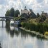
Mooring here is good (a nice place to moor), mooring rings or bollards are available. Mooring is limited to 48 hours. There are EA moorings either side of the river just downstream of the bridge. There is a water point on the Eastern one. The pub on the western side also has moorings for patrons.

There is a bridge here which takes a minor road over the canal.


Amenities

Amenities here

 Co-op Retail Services Ltd
 Littleport, Spice Lounge
 Fish & Chips
 Cashpoint
 Audley Garage (Little Port)Ltd
 Gulf
 Riverside Caravan & Camping Park Ely

Amenities nearby at Holmes River Junction

 Littleport Station
 
Maps
If you are a user and are logged on, or if you are actively planning a route, a map will be displayed here.
Show on external mapping site: Google | OSM | Bing
 
Photos
 
External websites
 Great Ouse Navigation | boating, moorings, navigation notices — associated with River Great Ouse
Information regarding the Great Ouse navigation and tributaries.
  Information for boaters on the River Great Ouse - GOV.UK  — associated with River Great Ouse
River Great Ouse: bridge heights, locks, overhead power lines and facilities.
 Facebook Account — associated with River Great Ouse
Anglian Waterways Manager Facebook Account
 Facebook Anglian Waterways Page — associated with River Great Ouse
Facebook Page for Environment Agency Anglian Waterways
 
Nearest facilities

Mouseover for more information or show routes to facility

Nearest water point

In the direction of Denver Junction

Windmill EA Mooring8 miles, ¼ furlongs away
On this waterway in the direction of Denver Junction
Denver Sluice11 miles away
On this waterway in the direction of Denver Junction
Downham Market Road Bridge12 miles, 3¾ furlongs and 1 lock away
Travel to Old West River - Great Ouse Relief Channel Junction, then on the River Great Ouse (Great Ouse Relief Channel) to Downham Market Road Bridge
West Head Road Bridge14 miles, 7 furlongs and 1 lock away
Travel to Old West River - Great Ouse Relief Channel Junction, then on the River Great Ouse (Great Ouse Relief Channel) to West Head Road Bridge
Stowbridge Heron EA Moorings14 miles, 7¼ furlongs and 1 lock away
Travel to Old West River - Great Ouse Relief Channel Junction, then on the River Great Ouse (Great Ouse Relief Channel) to Stowbridge Heron EA Moorings
Wiggenhall St Mary Magdalen17 miles, 3¾ furlongs and 1 lock away
Travel to Old West River - Great Ouse Relief Channel Junction, then on the River Great Ouse (Great Ouse Relief Channel) to Wiggenhall St Mary Magdalen
Upwell Church Bridge Public Staithe (visitor mooring)17 miles, 1¾ furlongs and 2 locks away
Travel to Denver Junction, then on the River Great Ouse (New Bedford River) to Salter's Lode Junction, then on the Middle Level Navigations (Well Creek) to Outwell - Lance Hunter Rowe Boat Basin, then on the Middle Level Navigations (Old River Nene) to Upwell Church Bridge Public Staithe (visitor mooring)

In the direction of Pope's Corner

Prickwillow Visitor Moorings (EA)3 miles, 2¾ furlongs away
Travel to Old West River - River Lark Junction, then on the River Great Ouse (River Lark) to Prickwillow Visitor Moorings (EA)
Willow Walk Visitor Moorings4 miles, 7¼ furlongs away
On this waterway in the direction of Pope's Corner
Fish and Duck Marina Fuel Dock8 miles, 5¾ furlongs away
Travel to Pope's Corner, then on the River Great Ouse (Old West River - Small River) to Fish and Duck Marina Fuel Dock
Fish and Duck Marina8 miles, 6 furlongs away
Travel to Pope's Corner, then on the River Cam (Main river - Large River) to Fish and Duck Marina
Reach Lode Sluice11 miles, 7 furlongs away
Travel to Pope's Corner, then on the River Cam (Main river - Large River) to Cam - Reach Lode Junction, then on the River Cam (Burwell Lode) to Reach Lode Sluice

Nearest rubbish disposal

Nearest chemical toilet disposal

In the direction of Denver Junction

Denver Sluice11 miles away
On this waterway in the direction of Denver Junction

In the direction of Pope's Corner

Willow Walk Visitor Moorings4 miles, 7¼ furlongs away
On this waterway in the direction of Pope's Corner
Fish and Duck Marina8 miles, 6 furlongs away
Travel to Pope's Corner, then on the River Cam (Main river - Large River) to Fish and Duck Marina

Nearest place to turn

In the direction of Denver Junction

Holmes River Junction5 furlongs away
On this waterway in the direction of Denver Junction
Brandon Creek Junction4 miles, 1 furlong away
On this waterway in the direction of Denver Junction
Little Ouse - Lakenheath Lode Junction9 miles, 5½ furlongs away
Travel to Brandon Creek Junction, then on the River Great Ouse (Little Ouse or Brandon Creek) to Little Ouse - Lakenheath Lode Junction On this waterway in the direction of Denver Junction
Denver Relief Channel Lock Weir Entrance10 miles, 7¾ furlongs away
Travel to Old West River - Great Ouse Relief Channel Junction, then on the River Great Ouse (Great Ouse Relief Channel) to Denver Relief Channel Lock Weir Entrance
Denver Junction11 miles, ¼ furlongs and 1 lock away
On this waterway in the direction of Denver Junction
Salter's Lode Junction11 miles, 3¼ furlongs and 1 lock away
Travel to Denver Junction, then on the River Great Ouse (New Bedford River) to Salter's Lode Junction
Welmore Sluice12 miles, 6 furlongs and 1 lock away
Travel to Denver Junction, then on the River Great Ouse (New Bedford River) to Welmore Sluice
Brandon Lock Weir Exit17 miles, 1 furlong away
Travel to Brandon Creek Junction, then on the River Great Ouse (Little Ouse or Brandon Creek) to Brandon Lock Weir Exit
Brandon Lock Weir Entrance17 miles, 1½ furlongs and 1 lock away
Travel to Brandon Creek Junction, then on the River Great Ouse (Little Ouse or Brandon Creek) to Brandon Lock Weir Entrance

In the direction of Pope's Corner

Old West River - River Lark Junction1 mile, 2¼ furlongs away
On this waterway in the direction of Pope's Corner
Prickwillow Winding Hole3 miles, 3 furlongs away
Travel to Old West River - River Lark Junction, then on the River Great Ouse (River Lark) to Prickwillow Winding Hole
Willow Walk Winding Hole4 miles, 7 furlongs away
On this waterway in the direction of Pope's Corner
Great Ouse - Braham Dock Junction6 miles, 6 furlongs away
On this waterway in the direction of Pope's Corner
Pope's Corner8 miles, 5½ furlongs away
On this waterway in the direction of Pope's Corner
Fish and Duck Marina8 miles, 6 furlongs away
Travel to Pope's Corner, then on the River Cam (Main river - Large River) to Fish and Duck Marina
Isleham Lock Weir Exit9 miles, 1¼ furlongs away
Travel to Old West River - River Lark Junction, then on the River Great Ouse (River Lark) to Isleham Lock Weir Exit
Isleham Lock Weir Entrance9 miles, 4¾ furlongs and 1 lock away
Travel to Old West River - River Lark Junction, then on the River Great Ouse (River Lark) to Isleham Lock Weir Entrance
Wicken Lode Junction12 miles, 1½ furlongs and 1 lock away
Travel to Pope's Corner, then on the River Cam (Main river - Large River) to Cam - Reach Lode Junction, then on the River Cam (Burwell Lode) to Wicken Lode Junction
Bottisham Lock Weir Exit15 miles, 3½ furlongs away
Travel to Pope's Corner, then on the River Cam (Main river - Large River) to Bottisham Lock Weir Exit

Nearest self-operated pump-out

In the direction of Denver Junction

Denver Sluice11 miles away
On this waterway in the direction of Denver Junction

In the direction of Pope's Corner

Willow Walk Visitor Moorings4 miles, 7¼ furlongs away
On this waterway in the direction of Pope's Corner

Nearest boatyard pump-out

In the direction of Denver Junction

Denver Sluice11 miles away
On this waterway in the direction of Denver Junction

In the direction of Pope's Corner

Fish and Duck Marina8 miles, 6 furlongs away
Travel to Pope's Corner, then on the River Cam (Main river - Large River) to Fish and Duck Marina
Direction of TV transmitter (From Wolfbane Cybernetic)
 
 
Geograph
 
Wikipedia

There is no page on Wikipedia called “Sandhill Bridge”

Wikipedia pages that might relate to Sandhill Bridge
[The Boat Race] Ely in Cambridgeshire. This is due to the safety issues of Hammersmith Bridge, as well as the expectation that restrictions due to the COVID-19 pandemic [Risinghurst and Sandhills] Risinghurst and Sandhills is a civil parish in the city of Oxford, Oxfordshire, England. It consists of Risinghurst and Sandhills, two areas in the east [Natural Bridge (Virginia)] Natural Bridge is a geological formation in Rockbridge County, Virginia, comprising a 215-foot-high (66 m) natural arch with a span of 90 feet (27 m). [Mothman] University told reporters that descriptions and sightings all fit the sandhill crane, a large American crane almost as high as a man with a seven-foot [U.S. Route 20 in Nebraska] the Bridges to Buttes Scenic Byway. Along this route, the highway passes through diverse landscapes such as escarpments and the Nebraska Sandhills as well [Bridge End, Northumberland] ecclesiastical edifice. Rowland, T. H. (1994). Waters of Tyne (Reprint ed.). Warkworth, Northumberland, England: Sandhill Press Ltd. ISBN 0-946098-36-0. v t e [List of executive actions by Franklin D. Roosevelt] to State Department March 17, 1939 2244 8067 Establishing the Carolina Sandhills Wildlife Refuge; South Carolina March 17, 1939 1257 2245 8068 Amendment [High Bridge Trail State Park] High Bridge Trail State Park is a rail trail in Southside Virginia converted from a rail line last belonging to Norfolk Southern. The first section of [Eastern indigo snake] varies seasonally. From December to April, eastern indigo snakes prefer sandhill habitats; from May to July the snakes shift from winter dens to summer [List of Jackanory episodes] 14-Dec-83 2954 The Making of Fingers Finnigan: Part 4 - The Hermit of the Sandhills Berlie Doherty Nerys Hughes 15-Dec-83 2955 The Making of Fingers Finnigan:
 
Google

Results of Google Search

Sandhills Bridge Center LLC - Clubs Results
Nov 1, 2019 ... Sandhills Bridge Center LLC Results. Message from Club Manager + Click here to see message ‒ Click here to hide message. (Message posted ...
Sand Hill Bridge Replacement
Jan 13, 2015 ... Watch the demolition and rapid reconstruction of the Sand Hill Bridge on VT 125 in East Middlebury. Additional filming by Roy Vestrich.
Sandhill Road Bridge - HistoricBridges.org
Historic Truss Bridge in Rural Huron County, Ohio. A late, but unusual example of a riveted through truss bridge.
Middlebury - "Sand Hill Bridge" RS 0174(8) ‐ Bridge #13 on VT 125 ...
The Middlebury (Sand Hill Bridge) bridge replacement project: “Middlebury RS 0174(8) ‐ Bridge #13” information is available (see links below). Based on input ...
Sandhill Crane Public Viewing Locations - Visit Kearney Nebraska
The Fort Kearny Hike/Bike Bridge spans over the Platte River, making it the perfect spot for sunrise or sunset viewing. It's about a 300 yard walk from the parking ...
"I am a Bridge" Training at Sandhill Cove - Memory Bridge
Jul 13, 2020 ... Memory Bridge's 3 1/2-day experiential learning journey, “I am a Bridge,” was held July 9,2015- July 12, 2015, at Sandhill Cove's Water's Edge ...
PEI at its best! - Review of Sandhill View Motel, Stanley Bridge ...
Sandhill View Motel: PEI at its best! - See 6 traveler reviews, 14 candid photos, and great deals for Sandhill View Motel at Tripadvisor.
Sandhill Road Bridge - Bridgehunter.com
Overview: Through truss bridge over Frink Run on Sandhill Road; Location: Huron County, Ohio; Status: Open to traffic; History: Built 1944; rehabilitated 1992  ...
Bridge of the Sandhills | Linden Lodge
Bridge of the Sandhills. Bridge of the Sandhills NC. Bob and Traci Huber believe their life's purpose is to demonstrate the love and grace of God to people who ...
Sand Hill Bridge Temporary Restrictions | Newport NH
Aug 12, 2020 ... This letter serves as a notification for a scheduled temporary restriction(s) effective immediately for the Sand Hill Bridge No. 154/129.