Luddington Lock Wharf
is a minor waterways place
on the River Avon - Warwickshire (Upper Avon Navigation) between
Evesham Lock (Junction of Upper and Lower Avon Navigations) (15 miles and 1 furlong
and 7 locks
to the west) and
Royal Shakespeare Theatre (3 miles and 1 furlong
and 2 locks
to the east).
The nearest place in the direction of Evesham Lock is Luddington Lock;
¼ furlongs
away.
The nearest place in the direction of Royal Shakespeare Theatre is Luddington Lock Weir Entrance (Channel leading to the Weir);
a few yards
away.
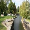
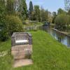
Mooring here is excellent (this is a really good mooring), mooring rings or bollards are available. Mooring is limited to 24 hours. Just upstream from the lock with room for two narrowboats.
Facilities: chemical toilet disposal, rubbish disposal and water point.
You can wind here.
| Binton Bridge | 1 mile, 7¼ furlongs | |
| The Four Alls PH | 1 mile, 7¼ furlongs | |
| Binton Bridge Downstream Channel Entrance | 1 mile, 7 furlongs | |
| Luddington Lock Weir Exit | ½ furlongs | |
| Luddington Lock | ¼ furlongs | |
| Luddington Lock Wharf | ||
| Luddington Lock Weir Entrance | a few yards | |
| Avon - Stour Junction | 1 mile, 1½ furlongs | |
| Stratford Cycle Path Bridge | 1 mile, 4½ furlongs | |
| Weir Brake Lock Weir Exit | 2 miles, 2 furlongs | |
| Weir Brake Lock | 2 miles, 2¼ furlongs | |
- Avon Navigation Trust — associated with River Avon - Warwickshire
- Navigation Authority
Mouseover for more information or show routes to facility
Nearest water point
The nearest water point is here. Others are at:
In the direction of Evesham Lock
Binton Bridge — 1 mile, 7¼ furlongs and 1 lock away
On this waterway in the direction of Evesham Lock
Bidford on Avon Visitor Moorings — 6 miles, 3½ furlongs and 4 locks away
On this waterway in the direction of Evesham Lock
Footbridge upstream of George Billington Lock — 11 miles, 2 furlongs and 6 locks away
On this waterway in the direction of Evesham Lock
George Billington Lock — 11 miles, 2¾ furlongs and 6 locks away
On this waterway in the direction of Evesham Lock
Evesham Lock — 15 miles, 1 furlong and 7 locks away
On this waterway in the direction of Evesham Lock
Workman Gardens — 15 miles, 3¾ furlongs and 8 locks away
Travel to Evesham Lock, then on the River Avon - Warwickshire (Lower Avon Navigation) to Workman Gardens
In the direction of The Red House
Shakespeare Marina — 2 miles, 3¾ furlongs and 1 lock away
On this waterway in the direction of The Red House
Colin P Witter Lock — 2 miles, 6 furlongs and 1 lock away
On this waterway in the direction of The Red House
Royal Shakespeare Theatre — 3 miles, 1 furlong and 2 locks away
On this waterway in the direction of The Red House
Old "Valley Cruisers" Base — 3 miles, 7¼ furlongs and 7 locks away
Travel to Junction of Stratford Canal and River Avon, then on the Stratford-on-Avon Canal (Southern Section) to Old "Valley Cruisers" Base
Chaleybeate Bridge No 63 — 4 miles, 7 furlongs and 8 locks away
Travel to Junction of Stratford Canal and River Avon, then on the Stratford-on-Avon Canal (Southern Section) to Chaleybeate Bridge No 63
Hill Farm Marina — 9 miles, 5 furlongs and 20 locks away
Travel to Junction of Stratford Canal and River Avon, then on the Stratford-on-Avon Canal (Southern Section) to Hill Farm Marina
Lowsonford Lock No 31 — 14 miles, 1¾ furlongs and 27 locks away
Travel to Junction of Stratford Canal and River Avon, then on the Stratford-on-Avon Canal (Southern Section) to Lowsonford Lock No 31
Lapworth Services — 16 miles, 2 furlongs and 37 locks away
Travel to Junction of Stratford Canal and River Avon, then on the Stratford-on-Avon Canal (Southern Section) to Lapworth Services
Turners Green Bridge No 63 — 17 miles, 2¾ furlongs and 37 locks away
Travel to Junction of Stratford Canal and River Avon, then on the Stratford-on-Avon Canal (Southern Section) to Kingswood Junction (south), then on the Stratford-on-Avon Canal (Lapworth Link) to Lapworth Link Junction, then on the Stratford-on-Avon Canal (Kingswood Branch) to Kingswood Junction, then on the Grand Union Canal (Warwick and Birmingham Canal: widened section - Main Line) to Turners Green Bridge No 63
Rising Lane Bridge No 66 — 17 miles, 4½ furlongs and 37 locks away
Travel to Junction of Stratford Canal and River Avon, then on the Stratford-on-Avon Canal (Southern Section) to Kingswood Junction (south), then on the Stratford-on-Avon Canal (Lapworth Link) to Lapworth Link Junction, then on the Stratford-on-Avon Canal (Kingswood Branch) to Kingswood Junction, then on the Grand Union Canal (Warwick and Birmingham Canal: widened section - Main Line) to Rising Lane Bridge No 66
Old Warwick Road Bridge No 35 — 16 miles, 3¾ furlongs and 39 locks away
Travel to Junction of Stratford Canal and River Avon, then on the Stratford-on-Avon Canal (Southern Section) to Kingswood Junction (south), then on the Stratford-on-Avon Canal (Northern Section) to Old Warwick Road Bridge No 35
Knowle Bottom Lock No 47 — 19 miles, 7¾ furlongs and 37 locks away
Travel to Junction of Stratford Canal and River Avon, then on the Stratford-on-Avon Canal (Southern Section) to Kingswood Junction (south), then on the Stratford-on-Avon Canal (Lapworth Link) to Lapworth Link Junction, then on the Stratford-on-Avon Canal (Kingswood Branch) to Kingswood Junction, then on the Grand Union Canal (Warwick and Birmingham Canal: widened section - Main Line) to Knowle Bottom Lock No 47
Swallow Wharf — 18 miles, 4 furlongs and 56 locks away
Travel to Junction of Stratford Canal and River Avon, then on the Stratford-on-Avon Canal (Southern Section) to Kingswood Junction (south), then on the Stratford-on-Avon Canal (Northern Section) to Swallow WharfNearest rubbish disposal
The nearest rubbish disposal is here. Others are at:
In the direction of Evesham Lock
Bidford on Avon Visitor Moorings — 6 miles, 3½ furlongs and 4 locks away
On this waterway in the direction of Evesham Lock
Footbridge upstream of George Billington Lock — 11 miles, 2 furlongs and 6 locks away
On this waterway in the direction of Evesham Lock
George Billington Lock — 11 miles, 2¾ furlongs and 6 locks away
On this waterway in the direction of Evesham Lock
Workman Gardens — 15 miles, 3¾ furlongs and 8 locks away
Travel to Evesham Lock, then on the River Avon - Warwickshire (Lower Avon Navigation) to Workman Gardens
In the direction of The Red House
Weir Brake Lock — 2 miles, 2¼ furlongs away
On this waterway in the direction of The Red House
Colin P Witter Lock — 2 miles, 6 furlongs and 1 lock away
On this waterway in the direction of The Red House
The Old Bathing Place — 3 miles, 6¾ furlongs and 2 locks away
On this waterway in the direction of The Red House
Old "Valley Cruisers" Base — 3 miles, 7¼ furlongs and 7 locks away
Travel to Junction of Stratford Canal and River Avon, then on the Stratford-on-Avon Canal (Southern Section) to Old "Valley Cruisers" Base
Hill Farm Marina — 9 miles, 5 furlongs and 20 locks away
Travel to Junction of Stratford Canal and River Avon, then on the Stratford-on-Avon Canal (Southern Section) to Hill Farm Marina
Lowsonford Lock No 31 — 14 miles, 1¾ furlongs and 27 locks away
Travel to Junction of Stratford Canal and River Avon, then on the Stratford-on-Avon Canal (Southern Section) to Lowsonford Lock No 31
Lapworth Lock No 21 — 16 miles, 2¾ furlongs and 37 locks away
Travel to Junction of Stratford Canal and River Avon, then on the Stratford-on-Avon Canal (Southern Section) to Kingswood Junction (south), then on the Stratford-on-Avon Canal (Northern Section) to Lapworth Lock No 21Nearest chemical toilet disposal
The nearest chemical toilet disposal is here. Others are at:
In the direction of Evesham Lock
Footbridge upstream of George Billington Lock — 11 miles, 2 furlongs and 6 locks away
On this waterway in the direction of Evesham Lock
George Billington Lock — 11 miles, 2¾ furlongs and 6 locks away
On this waterway in the direction of Evesham Lock
Evesham Lock — 15 miles, 1 furlong and 7 locks away
On this waterway in the direction of Evesham Lock
In the direction of The Red House
Old "Valley Cruisers" Base — 3 miles, 7¼ furlongs and 7 locks away
Travel to Junction of Stratford Canal and River Avon, then on the Stratford-on-Avon Canal (Southern Section) to Old "Valley Cruisers" Base
Lapworth Services — 16 miles, 2 furlongs and 37 locks away
Travel to Junction of Stratford Canal and River Avon, then on the Stratford-on-Avon Canal (Southern Section) to Lapworth Services
Swallow Wharf — 18 miles, 4 furlongs and 56 locks away
Travel to Junction of Stratford Canal and River Avon, then on the Stratford-on-Avon Canal (Southern Section) to Kingswood Junction (south), then on the Stratford-on-Avon Canal (Northern Section) to Swallow WharfNearest place to turn
In the direction of Evesham Lock
Luddington Lock Weir Exit — ½ furlongs and 1 lock away
On this waterway in the direction of Evesham Lock
Binton Bridge Downstream Channel Entrance — 1 mile, 7 furlongs and 1 lock away
On this waterway in the direction of Evesham Lock
Binton Bridge Upstream Channel Entrance — 1 mile, 7½ furlongs and 1 lock away
On this waterway in the direction of Evesham Lock
W A Cadbury Lock Weir Entrance — 2 miles, 7¼ furlongs and 1 lock away
On this waterway in the direction of Evesham Lock
W A Cadbury Lock Weir Exit — 3 miles, ¼ furlongs and 2 locks away
On this waterway in the direction of Evesham Lock
Pilgrim Lock Weir Entrance — 4 miles, 5¼ furlongs and 2 locks away
On this waterway in the direction of Evesham Lock
Pilgrim Lock Weir Exit — 4 miles, 6¼ furlongs and 3 locks away
On this waterway in the direction of Evesham Lock
E and H Billington Lock Weir Entrance — 5 miles, 4½ furlongs and 3 locks away
On this waterway in the direction of Evesham Lock
E and H Billington Lock Winding Hole — 5 miles, 5 furlongs and 3 locks away
On this waterway in the direction of Evesham Lock
E and H Billington Lock Weir Exit — 5 miles, 5¾ furlongs and 4 locks away
On this waterway in the direction of Evesham Lock
Avon - Arrow Junction — 8 miles, ¾ furlongs and 5 locks away
On this waterway in the direction of Evesham Lock
In the direction of The Red House
Avon - Stour Junction — 1 mile, 1½ furlongs away
On this waterway in the direction of The Red House
Weir Brake Lock Weir Exit — 2 miles, 2 furlongs away
On this waterway in the direction of The Red House
Weir Brake Lock Weir Entrance — 2 miles, 3 furlongs and 1 lock away
On this waterway in the direction of The Red House
Colin P Witter Lock Weir Entrance — 2 miles, 6¼ furlongs and 2 locks away
On this waterway in the direction of The Red House
Junction of Stratford Canal and River Avon — 3 miles, 1½ furlongs and 2 locks away
On this waterway in the direction of The Red House
The Old Bathing Place — 3 miles, 6¾ furlongs and 2 locks away
On this waterway in the direction of The Red House
Bancroft Basin — 3 miles, 2 furlongs and 3 locks away
Travel to Junction of Stratford Canal and River Avon, then on the Stratford-on-Avon Canal (Southern Section) to Bancroft Basin
The Red House — 4 miles, 5½ furlongs and 2 locks away
On this waterway in the direction of The Red House
Winding Hole above Stratford Top Lock No 52 — 3 miles, 6¼ furlongs and 7 locks away
Travel to Junction of Stratford Canal and River Avon, then on the Stratford-on-Avon Canal (Southern Section) to Winding Hole above Stratford Top Lock No 52Nearest self-operated pump-out
In the direction of Evesham Lock
Evesham Lock — 15 miles, 1 furlong and 7 locks away
On this waterway in the direction of Evesham Lock
In the direction of The Red House
Shakespeare Marina — 2 miles, 3¾ furlongs and 1 lock away
On this waterway in the direction of The Red House
Hill Farm Marina — 9 miles, 5 furlongs and 20 locks away
Travel to Junction of Stratford Canal and River Avon, then on the Stratford-on-Avon Canal (Southern Section) to Hill Farm Marina
Lapworth Services — 16 miles, 2 furlongs and 37 locks away
Travel to Junction of Stratford Canal and River Avon, then on the Stratford-on-Avon Canal (Southern Section) to Lapworth ServicesNearest boatyard pump-out
In the direction of The Red House
Hill Farm Marina — 9 miles, 5 furlongs and 20 locks away
Travel to Junction of Stratford Canal and River Avon, then on the Stratford-on-Avon Canal (Southern Section) to Hill Farm Marina
Swallow Wharf — 18 miles, 4 furlongs and 56 locks away
Travel to Junction of Stratford Canal and River Avon, then on the Stratford-on-Avon Canal (Southern Section) to Kingswood Junction (south), then on the Stratford-on-Avon Canal (Northern Section) to Swallow WharfDirection of TV transmitter (From Wolfbane Cybernetic)
There is no page on Wikipedia called “Luddington Lock Wharf”
Wikipedia pages that might relate to Luddington Lock Wharf
[List of poor law unions in England]
Wood Walton, Woolley. Oundle PLU Elton, Great Gidding, Little Gidding, Luddington (Huntingdonshire portion), Lutton (Huntingdonshire portion), Thurning
[Keadby railway station]
north of the point where the Stainforth and Keadby Canal passed through a lock to access the river. On 1 May 1866, the first Keadby Bridge and the associated
[Kingthorpe railway station]
Wragby goods yard. The signal box was reduced to a ground frame in the locking room (the room under the signal box) sometime after closure to passengers
[Immingham Dock railway station]
two stations faced each other from opposite sides of the dock's entrance lock gates The station had a single curving platform with a run round facility
[Immingham Dock electric railway station]
of the dock's main entrance lock and at right angles to it. Directly opposite the station on the other side of the lock was a conventional railway station
[Immingham Western Jetty railway station]
named Immingham Dock. This stood on the opposite side of the dock's entrance lock gates. Immingham Western Jetty station had a single platform station built
[Eastern Entrance to Immingham Dock electric railway station]
Drain bridge three quarters of a mile from the terminus near the dock's lock gates. At this point road and rail merged, with the tracks changing to grooved
Results of Google Search
Facilities and communications include a phone box, a 19th-century church, a post box, a marina with a 17th-century lock, a village green and a recently ...
You are here: Home>Locations>Luddington>Luddington Upper (Old) Lock ... It was located on the River Avon, 100m south of All Saints's Church Luddington. ... The site of a canal wharf, where vessels would have loaded and unloaded goods  ...
The site of a river lock, a rectangular chamber with wooden gates at each end, used to lower and raise the water level. It dates from the Imperial period, and was  ...
The Navigation also has a wharf and store area at Luddington Lock. Membership . You can support the work of the Trust by becoming a member. Members do not  ...
The name Loch & Quay (pronounced: lock and key) pays homage to a bar in Ireland named The Quays that the owner used to frequent when he lived in Galway, ...
Docks Locks is the premier manufacture of stand up paddle board locks. Secure your SUP & accessories with Docks Locks.
DocksLocks® Complete Surfboard and SUP Lock Security System. Regular ... DocksLocks® DXLX Jaws Surfboard and SUP Security Lock Accessory. Regular  ...


![Luddington Weir, River Avon. Looking west across the weir from the Avon Valley footpath. The boats in the distance are moored on the channel that bypasses the weir via Luddington Lock. Compare with [[56306]] taken five years earlier. by David P Howard – 24 October 2010](https://s2.geograph.org.uk/geophotos/02/13/09/2130990_4d867960_120x120.jpg)