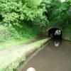
Cookley Tunnel (western entrance)
is a place on the waterways
on the Staffordshire and Worcestershire Canal (Main Line: Stourport to Stourton) between
Stourton Junction (Junction of the Staffordshire and Worcestershire Canal (Main Line) and the Stourbridge Canal.) (4 miles and 6¼ furlongs
and 4 locks
to the northeast) and
Kidderminster (3 miles and 1 furlong
and 3 locks
to the southwest).
The nearest place in the direction of Stourton Junction is Cookley Tunnel (eastern entrance);
¼ furlongs
away.
The nearest place in the direction of Kidderminster is Cookley Forge Towpath Bridge (Former Factory Entrance);
½ furlongs
away.
There is access (suitable for wheels) to the towpath here.
Mooring here is impossible (it may be physically impossible, forbidden, or allowed only for specific short-term purposes).
| Caunsall Bridge No 26 | 1 mile, ¾ furlongs | |
| Clay House Bridge No 25 | 6½ furlongs | |
| Austcliffe Bridge No 24 | 4¼ furlongs | |
| Austcliffe | 3¾ furlongs | |
| Cookley Tunnel (eastern entrance) | ¼ furlongs | |
| Cookley Tunnel (western entrance) | ||
| Cookley Forge Towpath Bridge | ½ furlongs | |
| Cookley Visitor Moorings | 1¼ furlongs | |
| Debdale Lock Winding Hole | 1½ furlongs | |
| Debdale Lock No 9 | 1¾ furlongs | |
| Debdale Bridge No 22 | 1¾ furlongs | |
Amenities nearby at Cookley Tunnel (eastern entrance)
There are no links to external websites from here.
Why not log in and add some (select "External websites" from the menu (sometimes this is under "Edit"))?
Mouseover for more information or show routes to facility
Nearest water point
In the direction of Stourton Junction
Kinver Services — 3 miles, 1¼ furlongs and 2 locks away
On this waterway in the direction of Stourton Junction
Stewponey Water Point — 4 miles, 5 furlongs and 4 locks away
On this waterway in the direction of Stourton Junction
Greensforge Wharf Services — 7 miles, 4¾ furlongs and 7 locks away
Travel to Stourton Junction, then on the Staffordshire and Worcestershire Canal (Main Line: Stourton to Aldersley) to Greensforge Wharf Services
Stourbridge Visitor Moorings — 7 miles, 6¼ furlongs and 8 locks away
Travel to Stourton Junction, then on the Stourbridge Canals (Main Line) to Wordsley Junction, then on the Stourbridge Canals (Stourbridge Branch) to Stourbridge Visitor Moorings
Autherley Stop Lock Water Point — 18 miles, 1½ furlongs and 23 locks away
Travel to Stourton Junction, then on the Staffordshire and Worcestershire Canal (Main Line: Stourton to Aldersley) to Aldersley Junction, then on the Staffordshire and Worcestershire Canal (Main Line: Aldersley to Autherley) to Autherley Junction, then on the Shropshire Union Canal (Birmingham and Liverpool Junction Canal - Main Line) to Autherley Stop Lock Water Point
Blowers Green Pumphouse — 13 miles, 3¾ furlongs and 33 locks away
Travel to Stourton Junction, then on the Stourbridge Canals (Main Line) to Black Delph, then on the Birmingham Canal Navigations (Dudley Canal No 1 - Through Route) to Parkhead Junction, then on the Birmingham Canal Navigations (Dudley Canal No 2 - Coombeswood ) to Blowers Green Pumphouse
Bumble Hole Visitor Centre — 16 miles and 33 locks away
Travel to Stourton Junction, then on the Stourbridge Canals (Main Line) to Black Delph, then on the Birmingham Canal Navigations (Dudley Canal No 1 - Through Route) to Parkhead Junction, then on the Birmingham Canal Navigations (Dudley Canal No 2 - Coombeswood ) to Bumble Hole Visitor Centre
Dudley Tunnel (northern entrance) — 15 miles, 4 furlongs and 36 locks away
Travel to Stourton Junction, then on the Stourbridge Canals (Main Line) to Black Delph, then on the Birmingham Canal Navigations (Dudley Canal No 1 - Through Route) to Pensnett Junction, then on the Birmingham Canal Navigations (Dudley Canal No 1 - Dudley Tunnel) to Dudley Tunnel (northern entrance)
Dudley Canal & Tunnel Trust Footbridge — 15 miles, 4½ furlongs and 36 locks away
Travel to Stourton Junction, then on the Stourbridge Canals (Main Line) to Black Delph, then on the Birmingham Canal Navigations (Dudley Canal No 1 - Through Route) to Pensnett Junction, then on the Birmingham Canal Navigations (Dudley Canal No 1 - Dudley Tunnel) to Dudley Tunnel (northern entrance), then on the Birmingham Canal Navigations (Dudley Canal No 1 - Birmingham End) to Dudley Canal & Tunnel Trust Footbridge
Black Country Museum — 15 miles, 5 furlongs and 36 locks away
Travel to Stourton Junction, then on the Stourbridge Canals (Main Line) to Black Delph, then on the Birmingham Canal Navigations (Dudley Canal No 1 - Through Route) to Pensnett Junction, then on the Birmingham Canal Navigations (Dudley Canal No 1 - Dudley Tunnel) to Dudley Tunnel (northern entrance), then on the Birmingham Canal Navigations (Dudley Canal No 1 - Birmingham End) to Black Country Museum
Todds End Customer Service Facility — 15 miles, 5¼ furlongs and 36 locks away
Travel to Stourton Junction, then on the Stourbridge Canals (Main Line) to Black Delph, then on the Birmingham Canal Navigations (Dudley Canal No 1 - Through Route) to Pensnett Junction, then on the Birmingham Canal Navigations (Dudley Canal No 1 - Dudley Tunnel) to Dudley Tunnel (northern entrance), then on the Birmingham Canal Navigations (Dudley Canal No 1 - Birmingham End) to Todds End Customer Service Facility
Hawne Basin — 18 miles, 5¾ furlongs and 33 locks away
Travel to Stourton Junction, then on the Stourbridge Canals (Main Line) to Black Delph, then on the Birmingham Canal Navigations (Dudley Canal No 1 - Through Route) to Parkhead Junction, then on the Birmingham Canal Navigations (Dudley Canal No 2 - Coombeswood ) to Hawne Basin
Broad Street Basin — 19 miles, 3½ furlongs and 43 locks away
Travel to Stourton Junction, then on the Staffordshire and Worcestershire Canal (Main Line: Stourton to Aldersley) to Aldersley Junction, then on the Birmingham Canal Navigations (Main Line) to Broad Street Basin
In the direction of York Street Bridge
Caldwall Mill Bridge No 14 — 3 miles, 5¾ furlongs and 4 locks away
On this waterway in the direction of York Street Bridge
Upper Basin Waterpoint — 7 miles, 4 furlongs and 7 locks away
Travel to York Street Bridge, then on the Staffordshire and Worcestershire Canal (Stourport Basins: Narrow Route) to Upper Basin Waterpoint
Lincomb Lock — 8 miles, 7¼ furlongs and 9 locks away
Travel to York Street Bridge, then on the Staffordshire and Worcestershire Canal (Stourport Basins: Narrow Route) to Stourport Upper Basin, then on the Staffordshire and Worcestershire Canal (Stourport Basins: Broad Route) to Severn - Stourport Broad Locks Entrance, then on the River Severn (main river - Stourport to Worcester) to Lincomb Lock
Holt Lock (Holt Fleet) — 13 miles, 1 furlong and 10 locks away
Travel to York Street Bridge, then on the Staffordshire and Worcestershire Canal (Stourport Basins: Narrow Route) to Stourport Upper Basin, then on the Staffordshire and Worcestershire Canal (Stourport Basins: Broad Route) to Severn - Stourport Broad Locks Entrance, then on the River Severn (main river - Stourport to Worcester) to Holt Lock (Holt Fleet)
Worcester Trip Boat Moorings — 19 miles, 6 furlongs and 12 locks away
Travel to York Street Bridge, then on the Staffordshire and Worcestershire Canal (Stourport Basins: Narrow Route) to Stourport Upper Basin, then on the Staffordshire and Worcestershire Canal (Stourport Basins: Broad Route) to Severn - Stourport Broad Locks Entrance, then on the River Severn (main river - Stourport to Worcester) to Worcester Trip Boat MooringsNearest rubbish disposal
In the direction of Stourton Junction
Kinver Services — 3 miles, 1¼ furlongs and 2 locks away
On this waterway in the direction of Stourton Junction
Greensforge Wharf Services — 7 miles, 4¾ furlongs and 7 locks away
Travel to Stourton Junction, then on the Staffordshire and Worcestershire Canal (Main Line: Stourton to Aldersley) to Greensforge Wharf Services
Stourbridge Basin — 8 miles, ¼ furlongs and 8 locks away
Travel to Stourton Junction, then on the Stourbridge Canals (Main Line) to Wordsley Junction, then on the Stourbridge Canals (Stourbridge Branch) to Stourbridge Basin
Bratch Bottom Lock No 23 — 11 miles, 2¼ furlongs and 13 locks away
Travel to Stourton Junction, then on the Staffordshire and Worcestershire Canal (Main Line: Stourton to Aldersley) to Bratch Bottom Lock No 23
Delph Bottom Lock No 8 — 11 miles, 3 furlongs and 24 locks away
Travel to Stourton Junction, then on the Stourbridge Canals (Main Line) to Black Delph, then on the Birmingham Canal Navigations (Dudley Canal No 1 - Through Route) to Delph Bottom Lock No 8
Autherley Junction Bridge No 1 — 18 miles, ¾ furlongs and 22 locks away
Travel to Stourton Junction, then on the Staffordshire and Worcestershire Canal (Main Line: Stourton to Aldersley) to Aldersley Junction, then on the Staffordshire and Worcestershire Canal (Main Line: Aldersley to Autherley) to Autherley Junction, then on the Shropshire Union Canal (Birmingham and Liverpool Junction Canal - Main Line) to Autherley Junction Bridge No 1
Waterfront Services (Dudley) — 12 miles, 3 furlongs and 32 locks away
Travel to Stourton Junction, then on the Stourbridge Canals (Main Line) to Black Delph, then on the Birmingham Canal Navigations (Dudley Canal No 1 - Through Route) to Waterfront Services (Dudley)
Blowers Green Bridge — 13 miles, 4 furlongs and 33 locks away
Travel to Stourton Junction, then on the Stourbridge Canals (Main Line) to Black Delph, then on the Birmingham Canal Navigations (Dudley Canal No 1 - Through Route) to Parkhead Junction, then on the Birmingham Canal Navigations (Dudley Canal No 2 - Coombeswood ) to Blowers Green Bridge
Black Country Museum — 15 miles, 5 furlongs and 36 locks away
Travel to Stourton Junction, then on the Stourbridge Canals (Main Line) to Black Delph, then on the Birmingham Canal Navigations (Dudley Canal No 1 - Through Route) to Pensnett Junction, then on the Birmingham Canal Navigations (Dudley Canal No 1 - Dudley Tunnel) to Dudley Tunnel (northern entrance), then on the Birmingham Canal Navigations (Dudley Canal No 1 - Birmingham End) to Black Country Museum
Hawne Basin — 18 miles, 5¾ furlongs and 33 locks away
Travel to Stourton Junction, then on the Stourbridge Canals (Main Line) to Black Delph, then on the Birmingham Canal Navigations (Dudley Canal No 1 - Through Route) to Parkhead Junction, then on the Birmingham Canal Navigations (Dudley Canal No 2 - Coombeswood ) to Hawne Basin
Wolverhampton Lock No 9 — 18 miles, 6 furlongs and 34 locks away
Travel to Stourton Junction, then on the Staffordshire and Worcestershire Canal (Main Line: Stourton to Aldersley) to Aldersley Junction, then on the Birmingham Canal Navigations (Main Line) to Wolverhampton Lock No 9
Broad Street Basin — 19 miles, 3½ furlongs and 43 locks away
Travel to Stourton Junction, then on the Staffordshire and Worcestershire Canal (Main Line: Stourton to Aldersley) to Aldersley Junction, then on the Birmingham Canal Navigations (Main Line) to Broad Street Basin
In the direction of York Street Bridge
Upper Basin Waterpoint — 7 miles, 4 furlongs and 7 locks away
Travel to York Street Bridge, then on the Staffordshire and Worcestershire Canal (Stourport Basins: Narrow Route) to Upper Basin Waterpoint
Sabrina Footbridge — 19 miles, 4 furlongs and 12 locks away
Travel to York Street Bridge, then on the Staffordshire and Worcestershire Canal (Stourport Basins: Narrow Route) to Stourport Upper Basin, then on the Staffordshire and Worcestershire Canal (Stourport Basins: Broad Route) to Severn - Stourport Broad Locks Entrance, then on the River Severn (main river - Stourport to Worcester) to Sabrina FootbridgeNearest chemical toilet disposal
In the direction of Stourton Junction
Kinver Services — 3 miles, 1¼ furlongs and 2 locks away
On this waterway in the direction of Stourton Junction
Greensforge Wharf Services — 7 miles, 4¾ furlongs and 7 locks away
Travel to Stourton Junction, then on the Staffordshire and Worcestershire Canal (Main Line: Stourton to Aldersley) to Greensforge Wharf Services
Stourbridge Basin — 8 miles, ¼ furlongs and 8 locks away
Travel to Stourton Junction, then on the Stourbridge Canals (Main Line) to Wordsley Junction, then on the Stourbridge Canals (Stourbridge Branch) to Stourbridge Basin
Waterfront Services (Dudley) — 12 miles, 3 furlongs and 32 locks away
Travel to Stourton Junction, then on the Stourbridge Canals (Main Line) to Black Delph, then on the Birmingham Canal Navigations (Dudley Canal No 1 - Through Route) to Waterfront Services (Dudley)
Blowers Green Pumphouse — 13 miles, 3¾ furlongs and 33 locks away
Travel to Stourton Junction, then on the Stourbridge Canals (Main Line) to Black Delph, then on the Birmingham Canal Navigations (Dudley Canal No 1 - Through Route) to Parkhead Junction, then on the Birmingham Canal Navigations (Dudley Canal No 2 - Coombeswood ) to Blowers Green Pumphouse
Dudley Tunnel (northern entrance) — 15 miles, 4 furlongs and 36 locks away
Travel to Stourton Junction, then on the Stourbridge Canals (Main Line) to Black Delph, then on the Birmingham Canal Navigations (Dudley Canal No 1 - Through Route) to Pensnett Junction, then on the Birmingham Canal Navigations (Dudley Canal No 1 - Dudley Tunnel) to Dudley Tunnel (northern entrance)
Black Country Museum — 15 miles, 5 furlongs and 36 locks away
Travel to Stourton Junction, then on the Stourbridge Canals (Main Line) to Black Delph, then on the Birmingham Canal Navigations (Dudley Canal No 1 - Through Route) to Pensnett Junction, then on the Birmingham Canal Navigations (Dudley Canal No 1 - Dudley Tunnel) to Dudley Tunnel (northern entrance), then on the Birmingham Canal Navigations (Dudley Canal No 1 - Birmingham End) to Black Country Museum
Todds End Customer Service Facility — 15 miles, 5¼ furlongs and 36 locks away
Travel to Stourton Junction, then on the Stourbridge Canals (Main Line) to Black Delph, then on the Birmingham Canal Navigations (Dudley Canal No 1 - Through Route) to Pensnett Junction, then on the Birmingham Canal Navigations (Dudley Canal No 1 - Dudley Tunnel) to Dudley Tunnel (northern entrance), then on the Birmingham Canal Navigations (Dudley Canal No 1 - Birmingham End) to Todds End Customer Service Facility
Hawne Basin — 18 miles, 5¾ furlongs and 33 locks away
Travel to Stourton Junction, then on the Stourbridge Canals (Main Line) to Black Delph, then on the Birmingham Canal Navigations (Dudley Canal No 1 - Through Route) to Parkhead Junction, then on the Birmingham Canal Navigations (Dudley Canal No 2 - Coombeswood ) to Hawne Basin
Broad Street Basin — 19 miles, 3½ furlongs and 43 locks away
Travel to Stourton Junction, then on the Staffordshire and Worcestershire Canal (Main Line: Stourton to Aldersley) to Aldersley Junction, then on the Birmingham Canal Navigations (Main Line) to Broad Street Basin
In the direction of York Street Bridge
Caldwall Mill Bridge No 14 — 3 miles, 5¾ furlongs and 4 locks away
On this waterway in the direction of York Street Bridge
Upper Basin Waterpoint — 7 miles, 4 furlongs and 7 locks away
Travel to York Street Bridge, then on the Staffordshire and Worcestershire Canal (Stourport Basins: Narrow Route) to Upper Basin Waterpoint
Stourport Marina — 8 miles, 4 furlongs and 9 locks away
Travel to York Street Bridge, then on the Staffordshire and Worcestershire Canal (Stourport Basins: Narrow Route) to Stourport Upper Basin, then on the Staffordshire and Worcestershire Canal (Stourport Basins: Broad Route) to Severn - Stourport Broad Locks Entrance, then on the River Severn (main river - Stourport to Worcester) to Stourport MarinaNearest place to turn
In the direction of Stourton Junction
Whittington Winding Hole — 2 miles, 2¾ furlongs and 1 lock away
On this waterway in the direction of Stourton Junction
Hyde Lock Winding Hole — 3 miles, 4¾ furlongs and 3 locks away
On this waterway in the direction of Stourton Junction
Stourton Junction — 4 miles, 6¼ furlongs and 4 locks away
On this waterway in the direction of Stourton Junction
Gothersley Winding Hole — 6 miles, 2¼ furlongs and 4 locks away
Travel to Stourton Junction, then on the Staffordshire and Worcestershire Canal (Main Line: Stourton to Aldersley) to Gothersley Winding Hole
Winding Hole above Stourton Top Lock — 5 miles, 1 furlong and 8 locks away
Travel to Stourton Junction, then on the Stourbridge Canals (Main Line) to Winding Hole above Stourton Top Lock
Ashwood Basin — 7 miles, 1½ furlongs and 6 locks away
Travel to Stourton Junction, then on the Staffordshire and Worcestershire Canal (Main Line: Stourton to Aldersley) to Ashwood Basin
Wordsley Junction — 6 miles, 6¼ furlongs and 8 locks away
Travel to Stourton Junction, then on the Stourbridge Canals (Main Line) to Wordsley Junction
Winding Hole below Hinksford Lock — 8 miles, 4¾ furlongs and 7 locks away
Travel to Stourton Junction, then on the Staffordshire and Worcestershire Canal (Main Line: Stourton to Aldersley) to Winding Hole below Hinksford Lock
In the direction of York Street Bridge
Cookley Forge Towpath Bridge — ½ furlongs away
On this waterway in the direction of York Street Bridge
Debdale Lock Winding Hole — 1½ furlongs away
On this waterway in the direction of York Street Bridge
Lea Lane Winding Hole — 7 furlongs and 1 lock away
On this waterway in the direction of York Street Bridge
Broadwaters Aqueduct Winding Hole — 2 miles, 2¾ furlongs and 3 locks away
On this waterway in the direction of York Street Bridge
Kidderminster — 3 miles, 1 furlong and 3 locks away
On this waterway in the direction of York Street Bridge
Academy Winding Hole — 3 miles, 3¼ furlongs and 4 locks away
On this waterway in the direction of York Street Bridge
Pratt's Wharf — 5 miles, 2¼ furlongs and 6 locks away
On this waterway in the direction of York Street Bridge
Former Railway Interchange Basin — 6 miles, 5¾ furlongs and 6 locks away
On this waterway in the direction of York Street Bridge
Stourport Upper Basin — 7 miles, 4 furlongs and 7 locks away
Travel to York Street Bridge, then on the Staffordshire and Worcestershire Canal (Stourport Basins: Narrow Route) to Stourport Upper Basin
Stourport Clock Basin — 7 miles, 4½ furlongs and 7 locks away
Travel to York Street Bridge, then on the Staffordshire and Worcestershire Canal (Stourport Basins: Narrow Route) to Stourport Clock Basin
Stourport Lower Basin - between Broad Locks — 7 miles, 4¾ furlongs and 8 locks away
Travel to York Street Bridge, then on the Staffordshire and Worcestershire Canal (Stourport Basins: Narrow Route) to Stourport Upper Basin, then on the Staffordshire and Worcestershire Canal (Stourport Basins: Broad Route) to Stourport Lower Basin - between Broad Locks
Stourport Lower Basin - between Narrow Locks — 7 miles, 5¼ furlongs and 8 locks away
Travel to York Street Bridge, then on the Staffordshire and Worcestershire Canal (Stourport Basins: Narrow Route) to Stourport Upper Basin, then on the Staffordshire and Worcestershire Canal (Stourport Basins: Broad Route) to Stourport Lower Basin - between Broad Locks, then on the Staffordshire and Worcestershire Canal (Stourport Basins: Broad Locks to Narrow Locks to Stourport Lower Basin - between Narrow LocksNearest self-operated pump-out
In the direction of Stourton Junction
Kinver Services — 3 miles, 1¼ furlongs and 2 locks away
On this waterway in the direction of Stourton Junction
Dudley Tunnel (northern entrance) — 15 miles, 4 furlongs and 36 locks away
Travel to Stourton Junction, then on the Stourbridge Canals (Main Line) to Black Delph, then on the Birmingham Canal Navigations (Dudley Canal No 1 - Through Route) to Pensnett Junction, then on the Birmingham Canal Navigations (Dudley Canal No 1 - Dudley Tunnel) to Dudley Tunnel (northern entrance)
Black Country Museum — 15 miles, 5 furlongs and 36 locks away
Travel to Stourton Junction, then on the Stourbridge Canals (Main Line) to Black Delph, then on the Birmingham Canal Navigations (Dudley Canal No 1 - Through Route) to Pensnett Junction, then on the Birmingham Canal Navigations (Dudley Canal No 1 - Dudley Tunnel) to Dudley Tunnel (northern entrance), then on the Birmingham Canal Navigations (Dudley Canal No 1 - Birmingham End) to Black Country Museum
Todds End Customer Service Facility — 15 miles, 5¼ furlongs and 36 locks away
Travel to Stourton Junction, then on the Stourbridge Canals (Main Line) to Black Delph, then on the Birmingham Canal Navigations (Dudley Canal No 1 - Through Route) to Pensnett Junction, then on the Birmingham Canal Navigations (Dudley Canal No 1 - Dudley Tunnel) to Dudley Tunnel (northern entrance), then on the Birmingham Canal Navigations (Dudley Canal No 1 - Birmingham End) to Todds End Customer Service FacilityNearest boatyard pump-out
In the direction of Stourton Junction
Oxley Marine — 17 miles, 7¾ furlongs and 22 locks away
Travel to Stourton Junction, then on the Staffordshire and Worcestershire Canal (Main Line: Stourton to Aldersley) to Aldersley Junction, then on the Staffordshire and Worcestershire Canal (Main Line: Aldersley to Autherley) to Oxley Marine
Autherley Wharf — 18 miles, 1¼ furlongs and 23 locks away
Travel to Stourton Junction, then on the Staffordshire and Worcestershire Canal (Main Line: Stourton to Aldersley) to Aldersley Junction, then on the Staffordshire and Worcestershire Canal (Main Line: Aldersley to Autherley) to Autherley Junction, then on the Shropshire Union Canal (Birmingham and Liverpool Junction Canal - Main Line) to Autherley Wharf
Withymoor Island Service Wharf — 15 miles, 5 furlongs and 33 locks away
Travel to Stourton Junction, then on the Stourbridge Canals (Main Line) to Black Delph, then on the Birmingham Canal Navigations (Dudley Canal No 1 - Through Route) to Parkhead Junction, then on the Birmingham Canal Navigations (Dudley Canal No 2 - Coombeswood ) to Withymoor Island Service Wharf
Hawne Basin — 18 miles, 5¾ furlongs and 33 locks away
Travel to Stourton Junction, then on the Stourbridge Canals (Main Line) to Black Delph, then on the Birmingham Canal Navigations (Dudley Canal No 1 - Through Route) to Parkhead Junction, then on the Birmingham Canal Navigations (Dudley Canal No 2 - Coombeswood ) to Hawne Basin
In the direction of York Street Bridge
Stourport Upper Basin — 7 miles, 4 furlongs and 7 locks away
Travel to York Street Bridge, then on the Staffordshire and Worcestershire Canal (Stourport Basins: Narrow Route) to Stourport Upper Basin
Upper Staircase Lock Landing Pontoon — 7 miles, 4¾ furlongs and 7 locks away
Travel to York Street Bridge, then on the Staffordshire and Worcestershire Canal (Stourport Basins: Narrow Route) to Upper Staircase Lock Landing Pontoon
Stourport Marina — 8 miles, 4 furlongs and 9 locks away
Travel to York Street Bridge, then on the Staffordshire and Worcestershire Canal (Stourport Basins: Narrow Route) to Stourport Upper Basin, then on the Staffordshire and Worcestershire Canal (Stourport Basins: Broad Route) to Severn - Stourport Broad Locks Entrance, then on the River Severn (main river - Stourport to Worcester) to Stourport MarinaDirection of TV transmitter (From Wolfbane Cybernetic)
There is no page on Wikipedia called “Cookley Tunnel”
Wikipedia pages that might relate to Cookley Tunnel
[Cookley]
Cookley is a village in the Wyre Forest District of Worcestershire, England, a few miles to the north of Kidderminster, and close to the villages of Kinver
[Staffordshire and Worcestershire Canal]
through a tunnel at Dunsley all the way closely following the river while slicing across its many meanders. Running through Kinver, Caunsall, Cookley and Wolverley
[List of canal tunnels in the United Kingdom]
Hyde Bank Tunnel Woodley Tunnel Islington Tunnel Lisson Grove Tunnel Maida Hill Tunnel Falkirk Tunnel, Falkirk Roughcastle Tunnel, Falkirk. Part of the Falkirk
[Drakelow, Worcestershire]
whose extent was similar to that of the modern civil parish of Wolverley & Cookley. It is located approximately 1 mile (1.6 km) northwest of Wolverley and
[Blakeshall]
whose extent was similar to that of the modern civil parish of Wolverley & Cookley. The Sebright family held land in Blakeshall from the end of the 13th or
[List of places in Worcestershire]
Green, Collett's Green, Collins Green, Comhampton, Conderton, Cookhill, Cookley, Cooksey Green, Copcut, Cow Honeybourne, Cotheridge, Crabbs Cross, Cropthorne
Results of Google Search
Apr 11, 2011 ... British Waterways has put up this notice by the western entrance to the tunnel. [[ 2352246]].
Near Birmingham, England three and a half miles of top-secret tunnels housed a World War II “shadow factory” and a Cold War nuclear bunker · Entrance to the ...
Apr 11, 2011 ... 23. This plaque is over the western entrance to the tunnel. SO8480 : Narrowboat emerging from western end of Cookley Tunnel, Cookley.
This is a list of canal tunnels in the United Kingdom. Contents. 1 Listed by name; 2 Navigatable ... Red brick tunnel entrance to a tunnel through which light can just be seen at the. Bruce Tunnel's Eastern ... Cookley Tunnel · Staffordshire & Worcestershire Canal, 65 yards (59 m) ... Dunsley Tunnel, west portal, near Kinver.
May 9, 2016 ... Is the Tunnel in Use?: In Use Which End is this Entrance?: West Date Constructed: 1/1/1772. Length of Tunnel: 65 yards. Construction Material: ...
The entrance into the tunnels is on the northern side of the Western Wall plaza, a few meters away from the Western Wall. Upon entering, visitors walk through a ...
May 9, 2016 ... Which End is this Entrance?: West Date Constructed: 1/1/1772. Length of Tunnel: 250 yards. Construction Material: Rock hewn and not lined
This is the entrance to the abandoned portion of the Hoosac Tunnel! It is about 150 feet long, underground, and has an abundance of cave ins (see pictures below) ...


![Approaching the western entrance to Cookley Tunnel, Cookley. Although only 59 metres long, Cookley Tunnel is the longest tunnel on the Staffs & Worcs Canal. High above the tunnel are buildings on Cookley's Bridge Road.[[2352257]]. by P L Chadwick – 10 April 2011](https://s2.geograph.org.uk/geophotos/02/35/22/2352246_8ea5f66a_120x120.jpg)
![Western portal of Cookley Tunnel. Built by James Brindley (c.1770), it is cut through 65 yards of sandstone, allowing the Staffs & Worcs Canal and towpath to pass through. It passes under Bridge Road in Cookley village. See also: [[495551]] & [[495557]] by Mat Fascione – 10 July 2007](https://s2.geograph.org.uk/photos/49/55/495542_1e9df29a_120x120.jpg)
![Narrowboat emerging from western end of Cookley Tunnel, Cookley. The tunnel was built in 1769-70, and takes the Staffs & Worcs Canal under Bridge Road.[[2352246]]. by P L Chadwick – 10 April 2011](https://s1.geograph.org.uk/geophotos/02/35/22/2352257_b076acc6_120x120.jpg)
![Notice by western end of Cookley Tunnel, Cookley. British Waterways has put up this notice by the western entrance to the tunnel.[[2352246]]. by P L Chadwick – 10 April 2011](https://s2.geograph.org.uk/geophotos/02/35/22/2352270_20feea3c_120x120.jpg)
![Name and number plaque , Cookley Tunnel, Cookley. The tunnel, under Bridge Road, carries plaques at both entrances giving the name and number, which in this case is Cookley Tunnel, no. 23. This plaque is over the western entrance to the tunnel.[[2352257]]. by P L Chadwick – 10 April 2011](https://s1.geograph.org.uk/geophotos/02/35/22/2352285_97ee8e89_120x120.jpg)


![Inside Cookley Tunnel. Built by James Brindley (c.1770), it is cut through 65 yards of sandstone, allowing the Staffs & Worcs Canal and towpath to pass through. It passes under Bridge Road in Cookley village. See also: [[495542]] & [[495557]] by Mat Fascione – 10 July 2007](https://s3.geograph.org.uk/photos/49/55/495551_deac6923_120x120.jpg)


![Housing over Cookley Tunnel in Worcestershire. Cookley Tunnel is bored through the Kidderminster Formation early Triassic sandstone, formerly known as the Bunter Pebble Beds. It is also designated as Bridge No 23 across the Staffordshire and Worcestershire Canal. It is 65 yards (about 60 metres) in length. The terraced housing is in Bridge Road.[[[7217602]]] by Roger D Kidd – 21 August 2017](https://s0.geograph.org.uk/geophotos/07/21/76/7217604_da5ad71a_120x120.jpg)