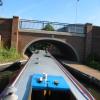
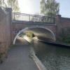
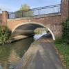
George Street Bridge No 5
is a minor waterways place
on the Worcester and Birmingham Canal (Diglis Basin to King's Norton Junction) between
Diglis Basin (Tow-path goes around the first basin) (6 furlongs
and 2 locks
to the southwest) and
Hanbury Junction (Junction with Droitwich Junction Canal (Restored - Opened 1/July/2011). Hanbury Wharf) (8 miles and 2½ furlongs
and 12 locks
to the northeast).
The nearest place in the direction of Diglis Basin is Blockhouse Lock No 4;
1¾ furlongs
away.
The nearest place in the direction of Hanbury Junction is 2002 Footbridge No 5A;
¼ furlongs
away.
There may be access to the towpath here.
Mooring here is unrated.
There is a bridge here which takes a minor road over the canal.
Sidbury Bridge No 3 | 3¼ furlongs | |
Sidbury Lock No 3 | 3¼ furlongs | |
Commandery Visitor Moorings | 3 furlongs | |
Blockhouse Bridge No 4 | 2 furlongs | |
Blockhouse Lock No 4 | 1¾ furlongs | |
George Street Bridge No 5 | ||
2002 Footbridge No 5A | ¼ furlongs | |
Cromwell Street Footbridge Bridge No 6 | ½ furlongs | |
Lowesmoor Bridge No 8 | 1½ furlongs | |
Rainbow Hill Bridge No 9 | 2 furlongs | |
Lowesmoor Basin | 2¼ furlongs |
Amenities here
Amenities nearby at 2002 Footbridge No 5A
Amenities nearby at Blockhouse Lock No 4
Amenities in Worcester
Amenities at other places in Worcester
at
at
at
at
at
at
at
at
at
at
at
at
at
at
at
at
at
at
at
at
at
at
at
at
at
at
at
at
at
at
at
at
at
at
at
at
at
at
at
at
at
at
at
at
at
at
at
at
at
at
at
at
at
at
at
at
at
at
at
at
at
at
at
at
at
at
at
There are no links to external websites from here.
Why not log in and add some (select "External websites" from the menu (sometimes this is under "Edit"))?
Mouseover for more information or show routes to facility
Nearest water point
In the direction of King's Norton Junction
Lowesmoor Basin — 2¼ furlongs away
On this waterway in the direction of King's Norton Junction
Hanbury Boatyard — 8 miles, 1¾ furlongs and 12 locks away
On this waterway in the direction of King's Norton Junction
Droitwich Spa Marina — 8 miles, 5¾ furlongs and 15 locks away
Travel to Hanbury Junction, then on the Droitwich Canals (Droitwich Junction Canal) to Droitwich Spa Marina
Stoke Works Water Point — 10 miles, 6¾ furlongs and 18 locks away
On this waterway in the direction of King's Norton Junction
Tardebigge Wharf — 14 miles, 7¼ furlongs and 54 locks away
On this waterway in the direction of King's Norton Junction
In the direction of Diglis Basin
Diglis Services — 5½ furlongs and 2 locks away
On this waterway in the direction of Diglis Basin
Diglis Locks — 1 mile, 1½ furlongs and 4 locks away
Travel to Diglis Basin, then on the Worcester and Birmingham Canal (Diglis Junction to Diglis Basin) to Diglis Junction, then on the River Severn (main river - Worcester to Gloucester) to Diglis Locks
Worcester Trip Boat Moorings — 1 mile, 5¼ furlongs and 4 locks away
Travel to Diglis Basin, then on the Worcester and Birmingham Canal (Diglis Junction to Diglis Basin) to Diglis Junction, then on the River Severn (main river - Stourport to Worcester) to Worcester Trip Boat Moorings
Holt Lock (Holt Fleet) — 8 miles, 2 furlongs and 5 locks away
Travel to Diglis Basin, then on the Worcester and Birmingham Canal (Diglis Junction to Diglis Basin) to Diglis Junction, then on the River Severn (main river - Stourport to Worcester) to Holt Lock (Holt Fleet)
Lincomb Lock — 12 miles, 3¾ furlongs and 6 locks away
Travel to Diglis Basin, then on the Worcester and Birmingham Canal (Diglis Junction to Diglis Basin) to Diglis Junction, then on the River Severn (main river - Stourport to Worcester) to Lincomb Lock
Upper Basin Waterpoint — 13 miles, 7 furlongs and 9 locks away
Travel to Diglis Basin, then on the Worcester and Birmingham Canal (Diglis Junction to Diglis Basin) to Diglis Junction, then on the River Severn (main river - Stourport to Worcester) to Severn - Stourport Broad Locks Entrance, then on the Staffordshire and Worcestershire Canal (Stourport Basins: Broad Route) to Stourport Upper Basin, then on the Staffordshire and Worcestershire Canal (Stourport Basins: Narrow Route) to Upper Basin Waterpoint
Upper Lode Lock No 5 — 17 miles, 3¼ furlongs and 5 locks away
Travel to Diglis Basin, then on the Worcester and Birmingham Canal (Diglis Junction to Diglis Basin) to Diglis Junction, then on the River Severn (main river - Worcester to Gloucester) to Upper Lode Lock No 5
Tewkesbury Services — 17 miles, 1 furlong and 6 locks away
Travel to Diglis Basin, then on the Worcester and Birmingham Canal (Diglis Junction to Diglis Basin) to Diglis Junction, then on the River Severn (main river - Worcester to Gloucester) to Tewkesbury Junction, then on the River Avon - Warwickshire (Lower Avon Navigation) to Tewkesbury Services
Netherwich Basin — 10 miles, 6 furlongs and 13 locks away
Travel to Diglis Basin, then on the Worcester and Birmingham Canal (Diglis Junction to Diglis Basin) to Diglis Junction, then on the River Severn (main river - Stourport to Worcester) to Hawford Junction, then on the Droitwich Canals (Droitwich Barge Canal) to Netherwich Basin
Tewkesbury Lower Lode — 18 miles, 1½ furlongs and 6 locks away
Travel to Diglis Basin, then on the Worcester and Birmingham Canal (Diglis Junction to Diglis Basin) to Diglis Junction, then on the River Severn (main river - Worcester to Gloucester) to Tewkesbury Lower Lode
Caldwall Mill Bridge No 14 — 17 miles, 5¼ furlongs and 12 locks away
Travel to Diglis Basin, then on the Worcester and Birmingham Canal (Diglis Junction to Diglis Basin) to Diglis Junction, then on the River Severn (main river - Stourport to Worcester) to Severn - Stourport Broad Locks Entrance, then on the Staffordshire and Worcestershire Canal (Stourport Basins: Broad Route) to Stourport Upper Basin, then on the Staffordshire and Worcestershire Canal (Stourport Basins: Narrow Route) to York Street Bridge, then on the Staffordshire and Worcestershire Canal (Main Line: Stourport to Stourton) to Caldwall Mill Bridge No 14Nearest rubbish disposal
In the direction of King's Norton Junction
Lowesmoor Basin — 2¼ furlongs away
On this waterway in the direction of King's Norton Junction
Droitwich Spa Marina — 8 miles, 5¾ furlongs and 15 locks away
Travel to Hanbury Junction, then on the Droitwich Canals (Droitwich Junction Canal) to Droitwich Spa Marina
Stoke Bottom Lock No 23 — 11 miles, 4½ furlongs and 18 locks away
On this waterway in the direction of King's Norton Junction
Tardebigge Wharf — 14 miles, 7¼ furlongs and 54 locks away
On this waterway in the direction of King's Norton Junction
In the direction of Diglis Basin
Diglis Basin — 6 furlongs and 2 locks away
On this waterway in the direction of Diglis Basin
Sabrina Footbridge — 1 mile, 7 furlongs and 4 locks away
Travel to Diglis Basin, then on the Worcester and Birmingham Canal (Diglis Junction to Diglis Basin) to Diglis Junction, then on the River Severn (main river - Stourport to Worcester) to Sabrina Footbridge
Upper Basin Waterpoint — 13 miles, 7 furlongs and 9 locks away
Travel to Diglis Basin, then on the Worcester and Birmingham Canal (Diglis Junction to Diglis Basin) to Diglis Junction, then on the River Severn (main river - Stourport to Worcester) to Severn - Stourport Broad Locks Entrance, then on the Staffordshire and Worcestershire Canal (Stourport Basins: Broad Route) to Stourport Upper Basin, then on the Staffordshire and Worcestershire Canal (Stourport Basins: Narrow Route) to Upper Basin Waterpoint
Tewkesbury Services — 17 miles, 1 furlong and 6 locks away
Travel to Diglis Basin, then on the Worcester and Birmingham Canal (Diglis Junction to Diglis Basin) to Diglis Junction, then on the River Severn (main river - Worcester to Gloucester) to Tewkesbury Junction, then on the River Avon - Warwickshire (Lower Avon Navigation) to Tewkesbury Services
Netherwich Basin — 10 miles, 6 furlongs and 13 locks away
Travel to Diglis Basin, then on the Worcester and Birmingham Canal (Diglis Junction to Diglis Basin) to Diglis Junction, then on the River Severn (main river - Stourport to Worcester) to Hawford Junction, then on the Droitwich Canals (Droitwich Barge Canal) to Netherwich BasinNearest chemical toilet disposal
In the direction of King's Norton Junction
Lowesmoor Basin — 2¼ furlongs away
On this waterway in the direction of King's Norton Junction
Droitwich Spa Marina — 8 miles, 5¾ furlongs and 15 locks away
Travel to Hanbury Junction, then on the Droitwich Canals (Droitwich Junction Canal) to Droitwich Spa Marina
Stoke Bottom Lock No 23 — 11 miles, 4½ furlongs and 18 locks away
On this waterway in the direction of King's Norton Junction
Tardebigge Wharf — 14 miles, 7¼ furlongs and 54 locks away
On this waterway in the direction of King's Norton Junction
In the direction of Diglis Basin
Diglis Services — 5½ furlongs and 2 locks away
On this waterway in the direction of Diglis Basin
Stourport Marina — 12 miles, 7 furlongs and 7 locks away
Travel to Diglis Basin, then on the Worcester and Birmingham Canal (Diglis Junction to Diglis Basin) to Diglis Junction, then on the River Severn (main river - Stourport to Worcester) to Stourport Marina
Upper Basin Waterpoint — 13 miles, 7 furlongs and 9 locks away
Travel to Diglis Basin, then on the Worcester and Birmingham Canal (Diglis Junction to Diglis Basin) to Diglis Junction, then on the River Severn (main river - Stourport to Worcester) to Severn - Stourport Broad Locks Entrance, then on the Staffordshire and Worcestershire Canal (Stourport Basins: Broad Route) to Stourport Upper Basin, then on the Staffordshire and Worcestershire Canal (Stourport Basins: Narrow Route) to Upper Basin Waterpoint
Caldwall Mill Bridge No 14 — 17 miles, 5¼ furlongs and 12 locks away
Travel to Diglis Basin, then on the Worcester and Birmingham Canal (Diglis Junction to Diglis Basin) to Diglis Junction, then on the River Severn (main river - Stourport to Worcester) to Severn - Stourport Broad Locks Entrance, then on the Staffordshire and Worcestershire Canal (Stourport Basins: Broad Route) to Stourport Upper Basin, then on the Staffordshire and Worcestershire Canal (Stourport Basins: Narrow Route) to York Street Bridge, then on the Staffordshire and Worcestershire Canal (Main Line: Stourport to Stourton) to Caldwall Mill Bridge No 14Nearest place to turn
In the direction of King's Norton Junction
Lowesmoor Basin — 2¼ furlongs away
On this waterway in the direction of King's Norton Junction
Bilford Locks Winding Hole — 1 mile, 4¼ furlongs and 3 locks away
On this waterway in the direction of King's Norton Junction
Tibberton Winding Hole — 5 miles, 1½ furlongs and 12 locks away
On this waterway in the direction of King's Norton Junction
Dunhampstead Winding Hole — 6 miles, 1 furlong and 12 locks away
On this waterway in the direction of King's Norton Junction
Dunhampstead Boatyard — 6 miles, 3¼ furlongs and 12 locks away
On this waterway in the direction of King's Norton Junction
Hanbury Boatyard — 8 miles, 1¾ furlongs and 12 locks away
On this waterway in the direction of King's Norton Junction
Hanbury Junction — 8 miles, 2½ furlongs and 12 locks away
On this waterway in the direction of King's Norton Junction
Hanbury Junction Winding Hole — 8 miles, 3¾ furlongs and 12 locks away
On this waterway in the direction of King's Norton Junction
In the direction of Diglis Basin
Diglis Junction — 7 furlongs and 4 locks away
Travel to Diglis Basin, then on the Worcester and Birmingham Canal (Diglis Junction to Diglis Basin) to Diglis Junction
Diglis Locks Weir Exit — 1 mile, 2¼ furlongs and 5 locks away
Travel to Diglis Basin, then on the Worcester and Birmingham Canal (Diglis Junction to Diglis Basin) to Diglis Junction, then on the River Severn (main river - Worcester to Gloucester) to Diglis Locks Weir Exit
Severn - Teme Junction — 2 miles, ¼ furlongs and 5 locks away
Travel to Diglis Basin, then on the Worcester and Birmingham Canal (Diglis Junction to Diglis Basin) to Diglis Junction, then on the River Severn (main river - Worcester to Gloucester) to Severn - Teme Junction
Bevere Lock Weir Exit — 4 miles, 5½ furlongs and 4 locks away
Travel to Diglis Basin, then on the Worcester and Birmingham Canal (Diglis Junction to Diglis Basin) to Diglis Junction, then on the River Severn (main river - Stourport to Worcester) to Bevere Lock Weir Exit
Bevere Lock Weir Entrance — 5 miles, ¼ furlongs and 5 locks away
Travel to Diglis Basin, then on the Worcester and Birmingham Canal (Diglis Junction to Diglis Basin) to Diglis Junction, then on the River Severn (main river - Stourport to Worcester) to Bevere Lock Weir Entrance
Holt Lock Weir Exit — 8 miles, 1 furlong and 5 locks away
Travel to Diglis Basin, then on the Worcester and Birmingham Canal (Diglis Junction to Diglis Basin) to Diglis Junction, then on the River Severn (main river - Stourport to Worcester) to Holt Lock Weir Exit
Holt Lock Weir Entrance — 8 miles, 4¼ furlongs and 6 locks away
Travel to Diglis Basin, then on the Worcester and Birmingham Canal (Diglis Junction to Diglis Basin) to Diglis Junction, then on the River Severn (main river - Stourport to Worcester) to Holt Lock Weir Entrance
Ladywood Top Lock Winding Hole — 8 miles and 13 locks away
Travel to Diglis Basin, then on the Worcester and Birmingham Canal (Diglis Junction to Diglis Basin) to Diglis Junction, then on the River Severn (main river - Stourport to Worcester) to Hawford Junction, then on the Droitwich Canals (Droitwich Barge Canal) to Ladywood Top Lock Winding Hole
Severn - Stourport Narrow Locks Entrance — 13 miles, 6¼ furlongs and 7 locks away
Travel to Diglis Basin, then on the Worcester and Birmingham Canal (Diglis Junction to Diglis Basin) to Diglis Junction, then on the River Severn (main river - Stourport to Worcester) to Severn - Stourport Narrow Locks Entrance
Stourport Lower Basin - between Broad Locks — 13 miles, 6¼ furlongs and 8 locks away
Travel to Diglis Basin, then on the Worcester and Birmingham Canal (Diglis Junction to Diglis Basin) to Diglis Junction, then on the River Severn (main river - Stourport to Worcester) to Severn - Stourport Broad Locks Entrance, then on the Staffordshire and Worcestershire Canal (Stourport Basins: Broad Route) to Stourport Lower Basin - between Broad Locks
Stourport Lower Basin - between Narrow Locks — 13 miles, 6¾ furlongs and 8 locks away
Travel to Diglis Basin, then on the Worcester and Birmingham Canal (Diglis Junction to Diglis Basin) to Diglis Junction, then on the River Severn (main river - Stourport to Worcester) to Severn - Stourport Broad Locks Entrance, then on the Staffordshire and Worcestershire Canal (Stourport Basins: Broad Route) to Stourport Lower Basin - between Broad Locks, then on the Staffordshire and Worcestershire Canal (Stourport Basins: Broad Locks to Narrow Locks to Stourport Lower Basin - between Narrow Locks
Upper Lode Lock Weir Entrance — 17 miles, 2½ furlongs and 5 locks away
Travel to Diglis Basin, then on the Worcester and Birmingham Canal (Diglis Junction to Diglis Basin) to Diglis Junction, then on the River Severn (main river - Worcester to Gloucester) to Upper Lode Lock Weir EntranceNearest self-operated pump-out
In the direction of King's Norton Junction
Droitwich Spa Marina — 8 miles, 5¾ furlongs and 15 locks away
Travel to Hanbury Junction, then on the Droitwich Canals (Droitwich Junction Canal) to Droitwich Spa Marina
In the direction of Diglis Basin
Diglis Services — 5½ furlongs and 2 locks away
On this waterway in the direction of Diglis BasinNearest boatyard pump-out
In the direction of King's Norton Junction
Lowesmoor Basin — 2¼ furlongs away
On this waterway in the direction of King's Norton Junction
Dunhampstead Boatyard — 6 miles, 3¼ furlongs and 12 locks away
On this waterway in the direction of King's Norton Junction
Hanbury Boatyard — 8 miles, 1¾ furlongs and 12 locks away
On this waterway in the direction of King's Norton Junction
In the direction of Diglis Basin
Stourport Marina — 12 miles, 7 furlongs and 7 locks away
Travel to Diglis Basin, then on the Worcester and Birmingham Canal (Diglis Junction to Diglis Basin) to Diglis Junction, then on the River Severn (main river - Stourport to Worcester) to Stourport Marina
Stourport Upper Basin — 13 miles, 7 furlongs and 9 locks away
Travel to Diglis Basin, then on the Worcester and Birmingham Canal (Diglis Junction to Diglis Basin) to Diglis Junction, then on the River Severn (main river - Stourport to Worcester) to Severn - Stourport Broad Locks Entrance, then on the Staffordshire and Worcestershire Canal (Stourport Basins: Broad Route) to Stourport Upper Basin
Upper Staircase Lock Landing Pontoon — 13 miles, 7½ furlongs and 9 locks away
Travel to Diglis Basin, then on the Worcester and Birmingham Canal (Diglis Junction to Diglis Basin) to Diglis Junction, then on the River Severn (main river - Stourport to Worcester) to Severn - Stourport Broad Locks Entrance, then on the Staffordshire and Worcestershire Canal (Stourport Basins: Broad Route) to Stourport Upper Basin, then on the Staffordshire and Worcestershire Canal (Stourport Basins: Narrow Route) to Upper Staircase Lock Landing PontoonDirection of TV transmitter (From Wolfbane Cybernetic)
Wikipedia has a page about George Street Bridge
George Street Bridge may refer to:
- George Street Bridge, Newport
- George Street Bridge (Aurora, Indiana)
- George Street Bridge, Dunedin, New Zealand
Other Wikipedia pages that might relate to George Street Bridge
[14th Street bridges]
The 14th Street bridges refers to the three bridges near each other that cross the Potomac River, connecting Arlington, Virginia and Washington, D.C..
[George Washington Bridge]
The George Washington Bridge is a double-decked suspension bridge spanning the Hudson River, connecting the New York City borough of Manhattan with the
[George Street Bridge, Newport]
George Street Bridge [1] is a crossing of the River Usk in the community of Victoria in Newport, South Wales. It is a Grade II* listed structure. It was
[George Street, Dunedin]
A bridge, built in 1903, was one of few in the city to survive disastrous floods in March 1929. This bridge, simply known as George Street Bridge, is
[George Street, Sydney]
became George Street is one of the two original thoroughfares, along with the track that became Bridge Street. It is possible that George Street was the
[George Street Bridge (Aurora, Indiana)]
George Street Bridge, also known as County Bridge No. 159, is a historic Whipple truss bridge located at Aurora, Dearborn County, Indiana. It was built
[George Rogers Clark Memorial Bridge]
The George Rogers Clark Memorial Bridge, known locally as the Second Street Bridge, is a four-lane cantilevered truss bridge crossing the Ohio River between
[George Street]
Street, Sydney, Australia George Street, Toronto, Canada George Street Bridge (disambiguation) George Bridge (disambiguation) George (disambiguation)
[Queensboro Bridge]
The Queensboro Bridge, also known as the 59th Street Bridge – because its Manhattan end is located between 59th and 60th Streets – and officially named
Results of Google Search
ARTICLE I. - IN GENERAL | Code of Ordinances | St. Augustine, FL ...The right-of-way known as St. George Street and the sidewalks adjacent to both ... (5). Upon notification to the customer service division of space not utilized for ...
Historical significance: 5: Bridge is not eligible for the National Register of Historic Places. Type of Work Proposed: Bridge deck replacement with only incidental ...
George Street's Top 5 Engagement Session Locations in Pittsburgh ... Houston has a number of impeccable choices for engagement photography locations. The city ... City Island and Market Street Bridge offer expansive views of the city.
This is clearly not true, as the George Street Bridge proves. ... The single span is made up of 16 panels, each 12' 5 1/2" wide; the overall length of the truss is ...
Read More · 2010 Top 10 Bridges - No. 5. PROJECT: Christopher S. Bond Bridge LOCATION: Kansas City, Mo. ... PROJECT: George Street Bridge over Rte.
Jun 18, 2002 ... SUBJECT: Route 18 Corridor Aesthetics Meeting #5. LOCATION: ... bridge designs for George Street, the Albany St., underpass and the New.
YNHH provides security in the Air Rights Garage but does not set the parking rates. ... bridge connects the garage's second floor to the hospital's 20 York Street entrance. ... The George Street Garage offers a direct connection to the hospital on ... Smilow Cancer Hospital (35 Park Street): Weekdays 5 am – 9 pm; weekends 9 ...
5 George Street which suggests that the house was built between 1767 and 1771 , ... The area eventually occupied by No 3 George Street would not be feued until ... a Fellow of the Royal Society of Edinburgh and a significant bridge designer.
102 North George Street #5 25438 apartment for rent with 2 bedrooms for $850 per month. ... No security deposit apartments in Ranson · Furnished apartments ...
George Street Garage/Main Entrance (629 George St.): Patients and visitors may ... bridge connects the garage's second floor to the hospital's Orchard Street ...