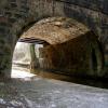
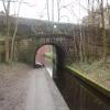
Brownhill Bridge No 73
is a minor waterways place
on the Huddersfield Narrow Canal between
Royal George Aqueduct (2 miles and 4¼ furlongs
and 6 locks
to the southwest) and
Diggle (2 miles and ¾ furlongs
and 9 locks
to the northeast).
The nearest place in the direction of Royal George Aqueduct is Saddleworth Aqueduct;
½ furlongs
away.
The nearest place in the direction of Diggle is Wool Road Winding Hole (Non tunnel traffic wind here);
1 furlong
away.
There may be access to the towpath here.
Mooring here is unrated.
There is a bridge here which takes a major road over the canal.
Dungebooth Lock No 22W | 1¾ furlongs | |
Saddleworth Railway Viaduct No 76 | 1 furlong | |
Mytholm Bridge No 75 | ¾ furlongs | |
Lime Kiln Lock No 23W | ½ furlongs | |
Saddleworth Aqueduct | ½ furlongs | |
Brownhill Bridge No 73 | ||
Wool Road Winding Hole | 1 furlong | |
Wool Road Visitor Mooring | 1½ furlongs | |
Wool Road Bridge No 70 | 1¾ furlongs | |
Old Lane Bridge | 2 furlongs | |
Wool Road Lock No 24W | 2¼ furlongs |
Amenities nearby at Wool Road Winding Hole
There are no links to external websites from here.
Why not log in and add some (select "External websites" from the menu (sometimes this is under "Edit"))?
Mouseover for more information or show routes to facility
Nearest water point
In the direction of Ashton-under-Lyne Junction
Grove Road Bridge No 96 — 5 miles, 6¼ furlongs and 15 locks away
On this waterway in the direction of Ashton-under-Lyne Junction
Fairfield Junction — 13 miles, 2½ furlongs and 23 locks away
Travel to Ashton-under-Lyne Junction, then on the Ashton Canal (Main Line) to Fairfield Junction
Marple Services — 19 miles and 39 locks away
Travel to Ashton-under-Lyne Junction, then on the Ashton Canal (Main Line) to Dukinfield Junction, then on the Peak Forest Canal (Lower) to Marple Junction, then on the Macclesfield Canal to Marple Services
New Islington Marina — 17 miles, 4¾ furlongs and 43 locks away
Travel to Ashton-under-Lyne Junction, then on the Ashton Canal (Main Line) to Ducie Street Junction, then on the Rochdale Canal to New Islington Marina Entrance, then on the Rochdale Canal (Main Line) to Cotton Field Wharf Marina, then on the Rochdale Canal (New Islington Marina Arm) to New Islington Marina
Staffordshire, Kenworthy and other Arms — 18 miles, 2¾ furlongs and 50 locks away
Travel to Ashton-under-Lyne Junction, then on the Ashton Canal (Main Line) to Ducie Street Junction, then on the Rochdale Canal to Castlefield Junction, then on the Bridgewater Canal (Main Line) to Staffordshire, Kenworthy and other Arms
Potato Wharf Arm & The New Basin — 18 miles, 3½ furlongs and 50 locks away
Travel to Ashton-under-Lyne Junction, then on the Ashton Canal (Main Line) to Ducie Street Junction, then on the Rochdale Canal to Castlefield Junction, then on the Bridgewater Canal (Main Line) to Potato Wharf Arm & The New Basin
In the direction of Aspley Basin (Huddersfield)
Wool Road Bridge No 70 — 1¾ furlongs away
On this waterway in the direction of Aspley Basin (Huddersfield)
Standedge Tunnel (western entrance) — 2 miles, 1¾ furlongs and 9 locks away
On this waterway in the direction of Aspley Basin (Huddersfield)
Standedge Tunnel (eastern entrance) — 5 miles, 3½ furlongs and 9 locks away
On this waterway in the direction of Aspley Basin (Huddersfield)
Slaithwaite Winding Hole — 8 miles, 6½ furlongs and 30 locks away
On this waterway in the direction of Aspley Basin (Huddersfield)
Waterside Lock No 21E — 8 miles, 7 furlongs and 30 locks away
On this waterway in the direction of Aspley Basin (Huddersfield)
Aspley Basin (Huddersfield) — 13 miles, 4¾ furlongs and 51 locks away
On this waterway in the direction of Aspley Basin (Huddersfield)
Brighouse Basin — 19 miles, 3 furlongs and 64 locks away
Travel to Aspley Basin (Huddersfield), then on the Huddersfield Broad Canal to Cooper Bridge Junction, then on the Calder and Hebble Navigation (Main Line) to Brighouse BasinNearest rubbish disposal
In the direction of Ashton-under-Lyne Junction
Marple Bottom Lock Bridge Winding Hole — 17 miles, 6¾ furlongs and 23 locks away
Travel to Ashton-under-Lyne Junction, then on the Ashton Canal (Main Line) to Dukinfield Junction, then on the Peak Forest Canal (Lower) to Marple Bottom Lock Bridge Winding Hole
Marple Services — 19 miles and 39 locks away
Travel to Ashton-under-Lyne Junction, then on the Ashton Canal (Main Line) to Dukinfield Junction, then on the Peak Forest Canal (Lower) to Marple Junction, then on the Macclesfield Canal to Marple Services
In the direction of Aspley Basin (Huddersfield)
Wool Road Visitor Mooring — 1½ furlongs away
On this waterway in the direction of Aspley Basin (Huddersfield)
Pickle Lock No 22E — 8 miles, 6 furlongs and 29 locks away
On this waterway in the direction of Aspley Basin (Huddersfield)
Aspley Basin (Huddersfield) — 13 miles, 4¾ furlongs and 51 locks away
On this waterway in the direction of Aspley Basin (Huddersfield)
Brighouse Lower Basin Visitor Moorings — 19 miles, 2¾ furlongs and 63 locks away
Travel to Aspley Basin (Huddersfield), then on the Huddersfield Broad Canal to Cooper Bridge Junction, then on the Calder and Hebble Navigation (Main Line) to Brighouse Lower Basin Visitor MooringsNearest chemical toilet disposal
In the direction of Ashton-under-Lyne Junction
Grove Road Bridge No 96 — 5 miles, 6¼ furlongs and 15 locks away
On this waterway in the direction of Ashton-under-Lyne Junction
Fairfield Junction — 13 miles, 2½ furlongs and 23 locks away
Travel to Ashton-under-Lyne Junction, then on the Ashton Canal (Main Line) to Fairfield Junction
Marple Services — 19 miles and 39 locks away
Travel to Ashton-under-Lyne Junction, then on the Ashton Canal (Main Line) to Dukinfield Junction, then on the Peak Forest Canal (Lower) to Marple Junction, then on the Macclesfield Canal to Marple Services
In the direction of Aspley Basin (Huddersfield)
Wool Road Bridge No 70 — 1¾ furlongs away
On this waterway in the direction of Aspley Basin (Huddersfield)
Pickle Lock No 22E — 8 miles, 6 furlongs and 29 locks away
On this waterway in the direction of Aspley Basin (Huddersfield)
Waterside Lock No 21E — 8 miles, 7 furlongs and 30 locks away
On this waterway in the direction of Aspley Basin (Huddersfield)
Aspley Basin (Huddersfield) — 13 miles, 4¾ furlongs and 51 locks away
On this waterway in the direction of Aspley Basin (Huddersfield)
Brighouse Basin — 19 miles, 3 furlongs and 64 locks away
Travel to Aspley Basin (Huddersfield), then on the Huddersfield Broad Canal to Cooper Bridge Junction, then on the Calder and Hebble Navigation (Main Line) to Brighouse BasinNearest place to turn
In the direction of Ashton-under-Lyne Junction
Saddleworth Visitor Centre Winding Hole — 5 furlongs and 2 locks away
On this waterway in the direction of Ashton-under-Lyne Junction
Manns Wharf Bridge Winding Hole — 1 mile, 7¾ furlongs and 4 locks away
On this waterway in the direction of Ashton-under-Lyne Junction
Roughtown Court Winding Hole — 3 miles, 1 furlong and 9 locks away
On this waterway in the direction of Ashton-under-Lyne Junction
Mossley Bottoms Winding Hole — 4 miles, ¾ furlongs and 11 locks away
On this waterway in the direction of Ashton-under-Lyne Junction
Knowle Street Winding Hole — 8 miles, ¾ furlongs and 16 locks away
On this waterway in the direction of Ashton-under-Lyne Junction
Staley Wharf Winding Hole — 9 miles, 2¾ furlongs and 20 locks away
On this waterway in the direction of Ashton-under-Lyne Junction
Ashton-under-Lyne Junction — 10 miles, 2½ furlongs and 23 locks away
On this waterway in the direction of Ashton-under-Lyne Junction
Dukinfield Junction — 10 miles, 6½ furlongs and 23 locks away
Travel to Ashton-under-Lyne Junction, then on the Ashton Canal (Main Line) to Dukinfield Junction
Portland Basin Arm — 10 miles, 7 furlongs and 23 locks away
Travel to Ashton-under-Lyne Junction, then on the Ashton Canal (Main Line) to Dukinfield Junction, then on the Peak Forest Canal (Lower) to Portland Basin Arm
Dunkirk Farm Bridge Winding Hole — 12 miles, 3¾ furlongs and 23 locks away
Travel to Ashton-under-Lyne Junction, then on the Ashton Canal (Main Line) to Dukinfield Junction, then on the Peak Forest Canal (Lower) to Dunkirk Farm Bridge Winding Hole
Lumb Lane Bridge Winding Hole — 12 miles, 4 furlongs and 23 locks away
Travel to Ashton-under-Lyne Junction, then on the Ashton Canal (Main Line) to Lumb Lane Bridge Winding Hole
Canal Street Winding Hole — 13 miles, ¾ furlongs and 23 locks away
Travel to Ashton-under-Lyne Junction, then on the Ashton Canal (Main Line) to Dukinfield Junction, then on the Peak Forest Canal (Lower) to Canal Street Winding Hole
Fairfield Junction — 13 miles, 2½ furlongs and 23 locks away
Travel to Ashton-under-Lyne Junction, then on the Ashton Canal (Main Line) to Fairfield Junction
Unity Mills Winding Hole — 14 miles, 5¼ furlongs and 23 locks away
Travel to Ashton-under-Lyne Junction, then on the Ashton Canal (Main Line) to Dukinfield Junction, then on the Peak Forest Canal (Lower) to Unity Mills Winding Hole
Urwick Road Winding Hole — 16 miles, 4¼ furlongs and 23 locks away
Travel to Ashton-under-Lyne Junction, then on the Ashton Canal (Main Line) to Dukinfield Junction, then on the Peak Forest Canal (Lower) to Urwick Road Winding Hole
In the direction of Aspley Basin (Huddersfield)
Wool Road Winding Hole — 1 furlong away
On this waterway in the direction of Aspley Basin (Huddersfield)
Diggle Winding Hole — 1 mile, 7 furlongs and 9 locks away
On this waterway in the direction of Aspley Basin (Huddersfield)
Standedge Tunnel End Winding Hole — 5 miles, 4¼ furlongs and 9 locks away
On this waterway in the direction of Aspley Basin (Huddersfield)
Booth Lock Winding Hole — 7 miles, 1½ furlongs and 20 locks away
On this waterway in the direction of Aspley Basin (Huddersfield)
Slaithwaite Winding Hole — 8 miles, 6½ furlongs and 30 locks away
On this waterway in the direction of Aspley Basin (Huddersfield)Nearest self-operated pump-out
In the direction of Ashton-under-Lyne Junction
New Islington Marina — 17 miles, 4¾ furlongs and 43 locks away
Travel to Ashton-under-Lyne Junction, then on the Ashton Canal (Main Line) to Ducie Street Junction, then on the Rochdale Canal to New Islington Marina Entrance, then on the Rochdale Canal (Main Line) to Cotton Field Wharf Marina, then on the Rochdale Canal (New Islington Marina Arm) to New Islington Marina
In the direction of Aspley Basin (Huddersfield)
Wool Road Bridge No 70 — 1¾ furlongs away
On this waterway in the direction of Aspley Basin (Huddersfield)
Slaithwaite Winding Hole — 8 miles, 6½ furlongs and 30 locks away
On this waterway in the direction of Aspley Basin (Huddersfield)Nearest boatyard pump-out
In the direction of Ashton-under-Lyne Junction
Portland Basin Arm — 10 miles, 7 furlongs and 23 locks away
Travel to Ashton-under-Lyne Junction, then on the Ashton Canal (Main Line) to Dukinfield Junction, then on the Peak Forest Canal (Lower) to Portland Basin Arm
In the direction of Aspley Basin (Huddersfield)
Aspley Basin (Huddersfield) — 13 miles, 4¾ furlongs and 51 locks away
On this waterway in the direction of Aspley Basin (Huddersfield)Direction of TV transmitter (From Wolfbane Cybernetic)
There is no page on Wikipedia called “Brownhill Bridge”
Wikipedia pages that might relate to Brownhill Bridge
[Brownhills]
Brownhills is a town and former administrative centre in the Metropolitan Borough of Walsall, West Midlands, England. A few miles south of Cannock Chase
[Packhorse bridge]
England. "Brownhill Bridge Mill (Grade II) (1309426)". National Heritage List for England. Retrieved 26 August 2013. Historic England. "Eynsford Bridge, Eynsford
[Stamford Bridge (stadium)]
Stamford Bridge (/ˈstæmfərd/) is a football stadium in Fulham, adjacent to the borough of Chelsea in South West London, commonly referred to as The Bridge. It
[Dobcross]
List for England. Retrieved 22 April 2009. Historic England (2001). "Brownhill Bridge Mill (1309426)". National Heritage List for England. Retrieved 22 April
[South Circular Road, London]
Mildreds Road; then, shortly after passing under the railway line, it is Brownhill Road due west all the way to the Catford gyratory system which crosses
[List of areas in Walsall]
Heath Bloxwich Brownhills Brownhills Common Brownhills West Burntwood Butcroft Caldmore Catshill Chuckery Clayhanger Coal Pool County Bridge Daisy Bank Darlaston
[Listed buildings in Saddleworth to 1800]
Heritage List for England, retrieved 19 July 2017 Historic England, "Brownhill Bridge Mill, Dobcross, Saddleworth (1309426)", National Heritage List for
[List of mills in Saddleworth]
converted for warehouse before being fully demolished for housing. Brownhill Bridge Dobcross New Road Standing Notes: A three storey, four bay water-powered
[Brownhills railway station]
Brownhills railway station is a disused railway station in Brownhills, West Midlands that formerly was Walsall-Lichfield section of the South Staffordshire
[Brown Hill Creek]
"creek and scrub place". The creek valley south of Brown Hill is home to Brownhill Creek Recreation Park and has been the site a recreation park since the