CanalPlanAC

Low Westwood Bridge No 40

 
Lowestwood Lane, Wellhouse HD7 5RR, United Kingdom
 
Information about the place
Low Westwood Bridge No 40 is a minor waterways place on the Huddersfield Narrow Canal between Railway Lock No 42E (Marsden. Eastern summit lock) (3 miles and 5 furlongs and 25 locks to the west) and Titanic Mill (Linthwaite) (¼ furlongs to the northeast).
 
 
The nearest place in the direction of Railway Lock No 42E is High Westwood Lock No 17E; a few yards away.

There may be access to the towpath here.

Mooring here is unrated.

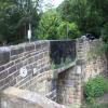
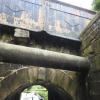
There is a bridge here which takes a minor road over the canal.


Amenities

Amenities nearby at Titanic Mill

 Sair Inn
 
Maps
If you are a user and are logged on, or if you are actively planning a route, a map will be displayed here.
Show on external mapping site: Google | OSM | Bing
 
Photos
 
External websites
There are no links to external websites from here.
Why not log in and add some (select "External websites" from the menu (sometimes this is under "Edit"))?
 
Nearest facilities

Mouseover for more information or show routes to facility

Nearest water point

In the direction of Ashton-under-Lyne Junction

Waterside Lock No 21E6¾ furlongs and 4 locks away
On this waterway in the direction of Ashton-under-Lyne Junction
Slaithwaite Winding Hole7¼ furlongs and 5 locks away
On this waterway in the direction of Ashton-under-Lyne Junction
Standedge Tunnel (eastern entrance)4 miles, 2¼ furlongs and 26 locks away
On this waterway in the direction of Ashton-under-Lyne Junction
Standedge Tunnel (western entrance)7 miles, 4¼ furlongs and 26 locks away
On this waterway in the direction of Ashton-under-Lyne Junction
Wool Road Bridge No 709 miles, 4 furlongs and 35 locks away
On this waterway in the direction of Ashton-under-Lyne Junction
Grove Road Bridge No 9615 miles, 4¼ furlongs and 50 locks away
On this waterway in the direction of Ashton-under-Lyne Junction

In the direction of Aspley Basin (Huddersfield)

Aspley Basin (Huddersfield)3 miles, 7 furlongs and 16 locks away
On this waterway in the direction of Aspley Basin (Huddersfield)
Shepley Bridge Sanitary Station10 miles, 3½ furlongs and 27 locks away
Travel to Aspley Basin (Huddersfield), then on the Huddersfield Broad Canal to Cooper Bridge Junction, then on the Calder and Hebble Navigation (Main Line) to Shepley Bridge Sanitary Station
Brighouse Basin9 miles, 5¼ furlongs and 29 locks away
Travel to Aspley Basin (Huddersfield), then on the Huddersfield Broad Canal to Cooper Bridge Junction, then on the Calder and Hebble Navigation (Main Line) to Brighouse Basin
Salterhebble Sanitary Station13 miles, 7¼ furlongs and 38 locks away
Travel to Aspley Basin (Huddersfield), then on the Huddersfield Broad Canal to Cooper Bridge Junction, then on the Calder and Hebble Navigation (Main Line) to Salterhebble Sanitary Station
Broad Cut Low Lock No 317 miles, ½ furlongs and 35 locks away
Travel to Aspley Basin (Huddersfield), then on the Huddersfield Broad Canal to Cooper Bridge Junction, then on the Calder and Hebble Navigation (Main Line) to Broad Cut Low Lock No 3
Salterhebble Junction13 miles, 7¾ furlongs and 39 locks away
Travel to Aspley Basin (Huddersfield), then on the Huddersfield Broad Canal to Cooper Bridge Junction, then on the Calder and Hebble Navigation (Main Line) to Salterhebble Junction
Sowerby Bridge Basin16 miles, 1½ furlongs and 39 locks away
Travel to Aspley Basin (Huddersfield), then on the Huddersfield Broad Canal to Cooper Bridge Junction, then on the Calder and Hebble Navigation (Main Line) to Salterhebble Junction, then on the Calder and Hebble Navigation (Main Line) to Sowerby Bridge Basin

Nearest rubbish disposal

In the direction of Ashton-under-Lyne Junction

Pickle Lock No 22E1 mile and 5 locks away
On this waterway in the direction of Ashton-under-Lyne Junction
Wool Road Visitor Mooring9 miles, 4¼ furlongs and 35 locks away
On this waterway in the direction of Ashton-under-Lyne Junction

In the direction of Aspley Basin (Huddersfield)

Aspley Basin (Huddersfield)3 miles, 7 furlongs and 16 locks away
On this waterway in the direction of Aspley Basin (Huddersfield)
Shepley Bridge Sanitary Station10 miles, 3½ furlongs and 27 locks away
Travel to Aspley Basin (Huddersfield), then on the Huddersfield Broad Canal to Cooper Bridge Junction, then on the Calder and Hebble Navigation (Main Line) to Shepley Bridge Sanitary Station
Brighouse Lower Basin Visitor Moorings9 miles, 5 furlongs and 28 locks away
Travel to Aspley Basin (Huddersfield), then on the Huddersfield Broad Canal to Cooper Bridge Junction, then on the Calder and Hebble Navigation (Main Line) to Brighouse Lower Basin Visitor Moorings
Horbury Basin Residential Moorings & Sanitary Station14 miles, 8 furlongs and 34 locks away
Travel to Aspley Basin (Huddersfield), then on the Huddersfield Broad Canal to Cooper Bridge Junction, then on the Calder and Hebble Navigation (Main Line) to Horbury Basin Residential Moorings & Sanitary Station
Salterhebble Sanitary Station13 miles, 7¼ furlongs and 38 locks away
Travel to Aspley Basin (Huddersfield), then on the Huddersfield Broad Canal to Cooper Bridge Junction, then on the Calder and Hebble Navigation (Main Line) to Salterhebble Sanitary Station
Sowerby Bridge Basin16 miles, 1½ furlongs and 39 locks away
Travel to Aspley Basin (Huddersfield), then on the Huddersfield Broad Canal to Cooper Bridge Junction, then on the Calder and Hebble Navigation (Main Line) to Salterhebble Junction, then on the Calder and Hebble Navigation (Main Line) to Sowerby Bridge Basin

Nearest chemical toilet disposal

In the direction of Ashton-under-Lyne Junction

Waterside Lock No 21E6¾ furlongs and 4 locks away
On this waterway in the direction of Ashton-under-Lyne Junction
Pickle Lock No 22E1 mile and 5 locks away
On this waterway in the direction of Ashton-under-Lyne Junction
Wool Road Bridge No 709 miles, 4 furlongs and 35 locks away
On this waterway in the direction of Ashton-under-Lyne Junction
Grove Road Bridge No 9615 miles, 4¼ furlongs and 50 locks away
On this waterway in the direction of Ashton-under-Lyne Junction

In the direction of Aspley Basin (Huddersfield)

Aspley Basin (Huddersfield)3 miles, 7 furlongs and 16 locks away
On this waterway in the direction of Aspley Basin (Huddersfield)
Shepley Bridge Sanitary Station10 miles, 3½ furlongs and 27 locks away
Travel to Aspley Basin (Huddersfield), then on the Huddersfield Broad Canal to Cooper Bridge Junction, then on the Calder and Hebble Navigation (Main Line) to Shepley Bridge Sanitary Station
Brighouse Basin9 miles, 5¼ furlongs and 29 locks away
Travel to Aspley Basin (Huddersfield), then on the Huddersfield Broad Canal to Cooper Bridge Junction, then on the Calder and Hebble Navigation (Main Line) to Brighouse Basin
Savile Town Wharf and Basin (Dewsbury)13 miles, 7 furlongs and 31 locks away
Travel to Aspley Basin (Huddersfield), then on the Huddersfield Broad Canal to Cooper Bridge Junction, then on the Calder and Hebble Navigation (Main Line) to Dewsbury Arm Junction, then on the Calder and Hebble Navigation (Dewsbury Old Cut) to Savile Town Wharf and Basin (Dewsbury)
Horbury Basin Residential Moorings & Sanitary Station14 miles, 8 furlongs and 34 locks away
Travel to Aspley Basin (Huddersfield), then on the Huddersfield Broad Canal to Cooper Bridge Junction, then on the Calder and Hebble Navigation (Main Line) to Horbury Basin Residential Moorings & Sanitary Station
Salterhebble Sanitary Station13 miles, 7¼ furlongs and 38 locks away
Travel to Aspley Basin (Huddersfield), then on the Huddersfield Broad Canal to Cooper Bridge Junction, then on the Calder and Hebble Navigation (Main Line) to Salterhebble Sanitary Station
Sowerby Bridge Basin16 miles, 1½ furlongs and 39 locks away
Travel to Aspley Basin (Huddersfield), then on the Huddersfield Broad Canal to Cooper Bridge Junction, then on the Calder and Hebble Navigation (Main Line) to Salterhebble Junction, then on the Calder and Hebble Navigation (Main Line) to Sowerby Bridge Basin

Nearest place to turn

In the direction of Ashton-under-Lyne Junction

Slaithwaite Winding Hole7¼ furlongs and 5 locks away
On this waterway in the direction of Ashton-under-Lyne Junction
Booth Lock Winding Hole2 miles, 4¼ furlongs and 15 locks away
On this waterway in the direction of Ashton-under-Lyne Junction
Standedge Tunnel End Winding Hole4 miles, 1½ furlongs and 26 locks away
On this waterway in the direction of Ashton-under-Lyne Junction
Diggle Winding Hole7 miles, 6¾ furlongs and 26 locks away
On this waterway in the direction of Ashton-under-Lyne Junction
Wool Road Winding Hole9 miles, 4¾ furlongs and 35 locks away
On this waterway in the direction of Ashton-under-Lyne Junction
Saddleworth Visitor Centre Winding Hole10 miles, 2¾ furlongs and 37 locks away
On this waterway in the direction of Ashton-under-Lyne Junction

In the direction of Aspley Basin (Huddersfield)

Linthwaite Winding Hole1¼ furlongs away
On this waterway in the direction of Aspley Basin (Huddersfield)
Isis Lock Winding Hole1 mile, 5½ furlongs and 8 locks away
On this waterway in the direction of Aspley Basin (Huddersfield)
University Arm3 miles, 6¼ furlongs and 16 locks away
On this waterway in the direction of Aspley Basin (Huddersfield)
Aspley Basin (Huddersfield)3 miles, 7 furlongs and 16 locks away
On this waterway in the direction of Aspley Basin (Huddersfield)
Anchor Street Winding Hole4 miles, 3¾ furlongs and 16 locks away
Travel to Aspley Basin (Huddersfield), then on the Huddersfield Broad Canal to Anchor Street Winding Hole
New Road Winding Hole4 miles, 7¼ furlongs and 16 locks away
Travel to Aspley Basin (Huddersfield), then on the Huddersfield Broad Canal to New Road Winding Hole
Deighton Road Bridge Winding Hole6 miles, 1 furlong and 21 locks away
Travel to Aspley Basin (Huddersfield), then on the Huddersfield Broad Canal to Deighton Road Bridge Winding Hole
Cooper Bridge Junction7 miles, 3 furlongs and 25 locks away
Travel to Aspley Basin (Huddersfield), then on the Huddersfield Broad Canal to Cooper Bridge Junction
Battye Weir Entrance8 miles and 26 locks away
Travel to Aspley Basin (Huddersfield), then on the Huddersfield Broad Canal to Cooper Bridge Junction, then on the Calder and Hebble Navigation (Main Line) to Battye Weir Entrance
Shepley Bridge Marina10 miles, 3¾ furlongs and 27 locks away
Travel to Aspley Basin (Huddersfield), then on the Huddersfield Broad Canal to Cooper Bridge Junction, then on the Calder and Hebble Navigation (Main Line) to Shepley Bridge Marina
Brighouse Basin9 miles, 5¼ furlongs and 29 locks away
Travel to Aspley Basin (Huddersfield), then on the Huddersfield Broad Canal to Cooper Bridge Junction, then on the Calder and Hebble Navigation (Main Line) to Brighouse Basin
Ganny Winding Hole10 miles, 2¾ furlongs and 30 locks away
Travel to Aspley Basin (Huddersfield), then on the Huddersfield Broad Canal to Cooper Bridge Junction, then on the Calder and Hebble Navigation (Main Line) to Ganny Winding Hole
Dewsbury Arm Junction12 miles, 7 furlongs and 31 locks away
Travel to Aspley Basin (Huddersfield), then on the Huddersfield Broad Canal to Cooper Bridge Junction, then on the Calder and Hebble Navigation (Main Line) to Dewsbury Arm Junction
Savile Town Wharf and Basin (Dewsbury)13 miles, 7 furlongs and 31 locks away
Travel to Aspley Basin (Huddersfield), then on the Huddersfield Broad Canal to Cooper Bridge Junction, then on the Calder and Hebble Navigation (Main Line) to Dewsbury Arm Junction, then on the Calder and Hebble Navigation (Dewsbury Old Cut) to Savile Town Wharf and Basin (Dewsbury)

Nearest self-operated pump-out

In the direction of Ashton-under-Lyne Junction

Slaithwaite Winding Hole7¼ furlongs and 5 locks away
On this waterway in the direction of Ashton-under-Lyne Junction
Wool Road Bridge No 709 miles, 4 furlongs and 35 locks away
On this waterway in the direction of Ashton-under-Lyne Junction

Nearest boatyard pump-out

In the direction of Aspley Basin (Huddersfield)

Aspley Basin (Huddersfield)3 miles, 7 furlongs and 16 locks away
On this waterway in the direction of Aspley Basin (Huddersfield)
Shepley Bridge Marina10 miles, 3¾ furlongs and 27 locks away
Travel to Aspley Basin (Huddersfield), then on the Huddersfield Broad Canal to Cooper Bridge Junction, then on the Calder and Hebble Navigation (Main Line) to Shepley Bridge Marina
Sowerby Bridge Basin16 miles, 1½ furlongs and 39 locks away
Travel to Aspley Basin (Huddersfield), then on the Huddersfield Broad Canal to Cooper Bridge Junction, then on the Calder and Hebble Navigation (Main Line) to Salterhebble Junction, then on the Calder and Hebble Navigation (Main Line) to Sowerby Bridge Basin
Direction of TV transmitter (From Wolfbane Cybernetic)
 
 
Geograph
 
Wikipedia

There is no page on Wikipedia called “Low Westwood Bridge”

Wikipedia pages that might relate to Low Westwood Bridge
[Lansdowne Bridge (Pakistan)] largest cantilever bridge in the world. The girder work, weighing a massive 3,300 tons, was manufactured in London by the firm of Westwood, Baillie and erected [Fergusson Bridge] Mills & Westwood and opened in 1964. It was named after Governor-General Sir Bernard Fergusson. The bridge is on the site of the original 1870 bridge and [Westwood station (NJ Transit)] one track, one low-level platform with a miniature high-level platform and a station depot maintained by the borough of Westwood. Westwood also maintains [Matthew McConaughey] romantically involved with. Contact premiered on July 1, 1997, at the Westwood Theater in Los Angeles, California. The film was released in the United [List of places in County Durham] Little Thorpe, Littletown, Longnewton, Low Coniscliffe, Low Dinsdale, Low Etherley, Low Walworth, Low Westwood, Lowes Barn, Ludworth, Lumley Thicks Maiden [Delridge, Seattle] half of Westwood) Snake Hill (between Camp Long and High Point, west of Longfellow Creek) South Delridge (eastern half of Westwood) Westwood (between [List of solved missing person cases] days 1987 Cam Lyman 54–55 Lyman was a multimillionaire Dog breeder from Westwood, Massachusetts who disappeared in the summer of 1987. His body was found [Brooklyn] Brooklyn has several bridge and tunnel connections to the borough of Manhattan across the East River, and the Verrazzano-Narrows Bridge connects it with Staten [Route 128 station] was replaced with a road bridge around 1932 as part of the construction of the original Circumferential Highway. A Westwood woman, Marie Spokesfield, [E-ZPass] Bridge (New Jersey/Pennsylvania) Fort Madison Toll Bridge (Illinois/Iowa) Greenspring Low Water Toll Bridge (West Virginia/Maryland) Memorial Bridge (West
 
Google

Results of Google Search

Westwood's Low Clearance, 'Can-Opener' Bridge To Be Replaced ...
Nov 9, 2018 ... “There's probably an accident or two a month,” he said. New bridge being hauled to East Street in #Westwood to replace a low bridge nicknamed ...
Truck Network Map
trailer truck combinations and 102-inch wide standard truck movements may be restricted on a route because of route or bridge weight restrictions and/or vertical  ...
Changing Times for Fixed Income – Bridge the Return Gap
After nearly a 40 year bull market in bonds, traditional fixed income investors ... Learn how Westwood's Market Neutral Income strategy can help investors bridge ... to deliver low-risk, uncorrelated returns to traditional as well as non-traditional  ...
UPDATE: Dump truck crashes into West Seattle Bridge jersey barrier ...
Oct 8, 2019 ... ... Westwood (651) · Alaskan Way Viaduct (646) · West Seattle history (624) ... 8: 40 AM: We started coverage of this in the morning traffic roundup but it'll be a ... FYI after the lower bridge, the road splits and the left goes back up to the ... Good no one was hurt, this shows how fragile WS access to Seattle is.
Our Programs | The Bridge
The Westwood program offers no less than twenty hours of programming per ... Westwood Residential Treatment Program is located on just over 40 acres of land ... Be at low risk for withdrawal symptoms or have minimal remaining withdrawal ...
VIDEO: High-rise West Seattle Bridge closing TFN because of ...
Mar 23, 2020 ... March 23, 2020 4:40 pm ... March 23, 2020 3:40 pm. The source is an online ... And no regular vehicle traffic on the lower bridge? Fun times.
Kaboom: Westwood bridge no slouch when it comes to storrowing ...
Jun 8, 2015 ... Kaboom: Westwood bridge no slouch when it comes to storrowing ... A "Low Clearance - Trucks Must Turn Left" sign that's so small it's barely ... traffic control device - especially for over forty years after the rules were changed.
Menus - Richland School District Two
Free & Reduced Meal Application ... Lunch/Reduced price: $2.70/.40 ... No elementary or middle school student's meal shall ever be taken and dumped in the ...