CanalPlanAC

Sowerby Footbridge

 
Puzzle Hall Inn, 21 Hollins Mill Lane, Calderdale HX6 2RF, United Kingdom
 
Information about the place
Sowerby Footbridge is a minor waterways place on the Rochdale Canal between Walkley's Clog Mill (4 miles and 1¼ furlongs and 3 locks to the west) and Tuel Lane Tunnel (western entrance) (1¾ furlongs and 1 lock to the east).
 
 
The nearest place in the direction of Walkley's Clog Mill is Sowerby Long Bridge No 2; 2¾ furlongs away.
 
The nearest place in the direction of Tuel Lane Tunnel (western entrance) is Tower Hill Bridge No 1A; 1 furlong away.

There may be access to the towpath here.

Mooring here is unrated.

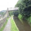
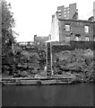
There is a bridge here which takes pedestrian traffic over the canal.


Amenities

Amenities here

 Tesco
 BP

Amenities nearby at Tower Hill Bridge No 1A

 Cashpoint
 Lloyds Bank

Amenities nearby at Sowerby Long Bridge No 2

 BP
 
Maps
If you are a user and are logged on, or if you are actively planning a route, a map will be displayed here.
Show on external mapping site: Google | OSM | Bing
 
Photos
 
External websites
There are no links to external websites from here.
Why not log in and add some (select "External websites" from the menu (sometimes this is under "Edit"))?
 
Nearest facilities

Mouseover for more information or show routes to facility

Nearest water point

In the direction of Castlefield Junction

Hebden Bridge Services4 miles, 7½ furlongs and 4 locks away
On this waterway in the direction of Castlefield Junction
Baltimore Marina8 miles, 6¾ furlongs and 13 locks away
On this waterway in the direction of Castlefield Junction
Fielden Wharf & Services9 miles, 2 furlongs and 14 locks away
On this waterway in the direction of Castlefield Junction
Travis Mill Lock No 2810 miles, 7¼ furlongs and 23 locks away
On this waterway in the direction of Castlefield Junction
Littleborough Sanitary Station14 miles, 4½ furlongs and 42 locks away
On this waterway in the direction of Castlefield Junction

In the direction of Sowerby Bridge Junction

Sowerby Bridge Basin6 furlongs and 3 locks away
Travel to Sowerby Bridge Junction, then on the Calder and Hebble Navigation (Main Line) to Sowerby Bridge Basin
Salterhebble Junction2 miles, 5¾ furlongs and 3 locks away
Travel to Sowerby Bridge Junction, then on the Calder and Hebble Navigation (Main Line) to Salterhebble Junction
Salterhebble Sanitary Station2 miles, 6¼ furlongs and 4 locks away
Travel to Sowerby Bridge Junction, then on the Calder and Hebble Navigation (Main Line) to Salterhebble Junction, then on the Calder and Hebble Navigation (Main Line) to Salterhebble Sanitary Station
Brighouse Basin7 miles, ¼ furlongs and 13 locks away
Travel to Sowerby Bridge Junction, then on the Calder and Hebble Navigation (Main Line) to Salterhebble Junction, then on the Calder and Hebble Navigation (Main Line) to Brighouse Basin
Shepley Bridge Sanitary Station12 miles, 3¼ furlongs and 19 locks away
Travel to Sowerby Bridge Junction, then on the Calder and Hebble Navigation (Main Line) to Salterhebble Junction, then on the Calder and Hebble Navigation (Main Line) to Shepley Bridge Sanitary Station
Aspley Basin (Huddersfield)12 miles, 6½ furlongs and 26 locks away
Travel to Sowerby Bridge Junction, then on the Calder and Hebble Navigation (Main Line) to Salterhebble Junction, then on the Calder and Hebble Navigation (Main Line) to Cooper Bridge Junction, then on the Huddersfield Broad Canal to Aspley Basin (Huddersfield)
Broad Cut Low Lock No 319 miles, ¼ furlongs and 27 locks away
Travel to Sowerby Bridge Junction, then on the Calder and Hebble Navigation (Main Line) to Salterhebble Junction, then on the Calder and Hebble Navigation (Main Line) to Broad Cut Low Lock No 3
Waterside Lock No 21E17 miles, 4¼ furlongs and 46 locks away
Travel to Sowerby Bridge Junction, then on the Calder and Hebble Navigation (Main Line) to Salterhebble Junction, then on the Calder and Hebble Navigation (Main Line) to Cooper Bridge Junction, then on the Huddersfield Broad Canal to Aspley Basin (Huddersfield), then on the Huddersfield Narrow Canal to Waterside Lock No 21E
Slaithwaite Winding Hole17 miles, 4¾ furlongs and 47 locks away
Travel to Sowerby Bridge Junction, then on the Calder and Hebble Navigation (Main Line) to Salterhebble Junction, then on the Calder and Hebble Navigation (Main Line) to Cooper Bridge Junction, then on the Huddersfield Broad Canal to Aspley Basin (Huddersfield), then on the Huddersfield Narrow Canal to Slaithwaite Winding Hole

Nearest rubbish disposal

In the direction of Castlefield Junction

Hebden Bridge Services4 miles, 7½ furlongs and 4 locks away
On this waterway in the direction of Castlefield Junction
Fielden Wharf & Services9 miles, 2 furlongs and 14 locks away
On this waterway in the direction of Castlefield Junction
Littleborough Sanitary Station14 miles, 4½ furlongs and 42 locks away
On this waterway in the direction of Castlefield Junction

In the direction of Sowerby Bridge Junction

Sowerby Bridge Basin6 furlongs and 3 locks away
Travel to Sowerby Bridge Junction, then on the Calder and Hebble Navigation (Main Line) to Sowerby Bridge Basin
Salterhebble Sanitary Station2 miles, 6¼ furlongs and 4 locks away
Travel to Sowerby Bridge Junction, then on the Calder and Hebble Navigation (Main Line) to Salterhebble Junction, then on the Calder and Hebble Navigation (Main Line) to Salterhebble Sanitary Station
Brighouse Lower Basin Visitor Moorings7 miles, ½ furlongs and 14 locks away
Travel to Sowerby Bridge Junction, then on the Calder and Hebble Navigation (Main Line) to Salterhebble Junction, then on the Calder and Hebble Navigation (Main Line) to Brighouse Lower Basin Visitor Moorings
Shepley Bridge Sanitary Station12 miles, 3¼ furlongs and 19 locks away
Travel to Sowerby Bridge Junction, then on the Calder and Hebble Navigation (Main Line) to Salterhebble Junction, then on the Calder and Hebble Navigation (Main Line) to Shepley Bridge Sanitary Station
Aspley Basin (Huddersfield)12 miles, 6½ furlongs and 26 locks away
Travel to Sowerby Bridge Junction, then on the Calder and Hebble Navigation (Main Line) to Salterhebble Junction, then on the Calder and Hebble Navigation (Main Line) to Cooper Bridge Junction, then on the Huddersfield Broad Canal to Aspley Basin (Huddersfield)
Horbury Basin Residential Moorings & Sanitary Station16 miles, 7½ furlongs and 26 locks away
Travel to Sowerby Bridge Junction, then on the Calder and Hebble Navigation (Main Line) to Salterhebble Junction, then on the Calder and Hebble Navigation (Main Line) to Horbury Basin Residential Moorings & Sanitary Station
Pickle Lock No 22E17 miles, 5½ furlongs and 47 locks away
Travel to Sowerby Bridge Junction, then on the Calder and Hebble Navigation (Main Line) to Salterhebble Junction, then on the Calder and Hebble Navigation (Main Line) to Cooper Bridge Junction, then on the Huddersfield Broad Canal to Aspley Basin (Huddersfield), then on the Huddersfield Narrow Canal to Pickle Lock No 22E

Nearest chemical toilet disposal

In the direction of Castlefield Junction

Hebden Bridge Services4 miles, 7½ furlongs and 4 locks away
On this waterway in the direction of Castlefield Junction
Baltimore Marina8 miles, 6¾ furlongs and 13 locks away
On this waterway in the direction of Castlefield Junction
Littleborough Sanitary Station14 miles, 4½ furlongs and 42 locks away
On this waterway in the direction of Castlefield Junction

In the direction of Sowerby Bridge Junction

Sowerby Bridge Basin6 furlongs and 3 locks away
Travel to Sowerby Bridge Junction, then on the Calder and Hebble Navigation (Main Line) to Sowerby Bridge Basin
Salterhebble Sanitary Station2 miles, 6¼ furlongs and 4 locks away
Travel to Sowerby Bridge Junction, then on the Calder and Hebble Navigation (Main Line) to Salterhebble Junction, then on the Calder and Hebble Navigation (Main Line) to Salterhebble Sanitary Station
Brighouse Basin7 miles, ¼ furlongs and 13 locks away
Travel to Sowerby Bridge Junction, then on the Calder and Hebble Navigation (Main Line) to Salterhebble Junction, then on the Calder and Hebble Navigation (Main Line) to Brighouse Basin
Shepley Bridge Sanitary Station12 miles, 3¼ furlongs and 19 locks away
Travel to Sowerby Bridge Junction, then on the Calder and Hebble Navigation (Main Line) to Salterhebble Junction, then on the Calder and Hebble Navigation (Main Line) to Shepley Bridge Sanitary Station
Aspley Basin (Huddersfield)12 miles, 6½ furlongs and 26 locks away
Travel to Sowerby Bridge Junction, then on the Calder and Hebble Navigation (Main Line) to Salterhebble Junction, then on the Calder and Hebble Navigation (Main Line) to Cooper Bridge Junction, then on the Huddersfield Broad Canal to Aspley Basin (Huddersfield)
Savile Town Wharf and Basin (Dewsbury)15 miles, 6½ furlongs and 23 locks away
Travel to Sowerby Bridge Junction, then on the Calder and Hebble Navigation (Main Line) to Salterhebble Junction, then on the Calder and Hebble Navigation (Main Line) to Dewsbury Arm Junction, then on the Calder and Hebble Navigation (Dewsbury Old Cut) to Savile Town Wharf and Basin (Dewsbury)
Horbury Basin Residential Moorings & Sanitary Station16 miles, 7½ furlongs and 26 locks away
Travel to Sowerby Bridge Junction, then on the Calder and Hebble Navigation (Main Line) to Salterhebble Junction, then on the Calder and Hebble Navigation (Main Line) to Horbury Basin Residential Moorings & Sanitary Station
Waterside Lock No 21E17 miles, 4¼ furlongs and 46 locks away
Travel to Sowerby Bridge Junction, then on the Calder and Hebble Navigation (Main Line) to Salterhebble Junction, then on the Calder and Hebble Navigation (Main Line) to Cooper Bridge Junction, then on the Huddersfield Broad Canal to Aspley Basin (Huddersfield), then on the Huddersfield Narrow Canal to Waterside Lock No 21E
Pickle Lock No 22E17 miles, 5½ furlongs and 47 locks away
Travel to Sowerby Bridge Junction, then on the Calder and Hebble Navigation (Main Line) to Salterhebble Junction, then on the Calder and Hebble Navigation (Main Line) to Cooper Bridge Junction, then on the Huddersfield Broad Canal to Aspley Basin (Huddersfield), then on the Huddersfield Narrow Canal to Pickle Lock No 22E

Nearest place to turn

In the direction of Castlefield Junction

Winding Hole below Lock No 52 miles, 2 furlongs away
On this waterway in the direction of Castlefield Junction
Walkley's Clog Mill4 miles, 1¼ furlongs and 3 locks away
On this waterway in the direction of Castlefield Junction
Hebden Bridge Wharf4 miles, 7¼ furlongs and 4 locks away
On this waterway in the direction of Castlefield Junction
Rawden Mill Lock Winding Hole6 miles, 1 furlong and 7 locks away
On this waterway in the direction of Castlefield Junction
Winding Hole below Holmcoat Lock7 miles, ½ furlongs and 9 locks away
On this waterway in the direction of Castlefield Junction
Stoodley Bridge Winding Hole7 miles, 2¾ furlongs and 10 locks away
On this waterway in the direction of Castlefield Junction
Lobb Mill Lock Winding Hole7 miles, 7½ furlongs and 11 locks away
On this waterway in the direction of Castlefield Junction
Baltimore Winding Hole8 miles, 6½ furlongs and 13 locks away
On this waterway in the direction of Castlefield Junction
Todmorden Bridge Winding Hole9 miles, 2 furlongs and 14 locks away
On this waterway in the direction of Castlefield Junction

In the direction of Sowerby Bridge Junction

Tower Hill Winding Hole1 furlong away
On this waterway in the direction of Sowerby Bridge Junction
Sowerby Bridge Winding Hole3 furlongs and 2 locks away
On this waterway in the direction of Sowerby Bridge Junction
Sowerby Bridge Junction5 furlongs and 3 locks away
On this waterway in the direction of Sowerby Bridge Junction
Sterne Mill Winding Hole1 mile, 3¼ furlongs and 3 locks away
Travel to Sowerby Bridge Junction, then on the Calder and Hebble Navigation (Main Line) to Sterne Mill Winding Hole
Salterhebble Basin3 miles, 1¾ furlongs and 3 locks away
Travel to Sowerby Bridge Junction, then on the Calder and Hebble Navigation (Main Line) to Salterhebble Junction, then on the Calder and Hebble Navigation (Halifax Branch) to Salterhebble Basin
Salterhebble Sanitary Station2 miles, 6¼ furlongs and 4 locks away
Travel to Sowerby Bridge Junction, then on the Calder and Hebble Navigation (Main Line) to Salterhebble Junction, then on the Calder and Hebble Navigation (Main Line) to Salterhebble Sanitary Station
Salterhebble Bottom Basin Visitor Moorings2 miles, 6¾ furlongs and 5 locks away
Travel to Sowerby Bridge Junction, then on the Calder and Hebble Navigation (Main Line) to Salterhebble Junction, then on the Calder and Hebble Navigation (Main Line) to Salterhebble Bottom Basin Visitor Moorings
Salterhebble Wharf2 miles, 6¾ furlongs and 5 locks away
Travel to Sowerby Bridge Junction, then on the Calder and Hebble Navigation (Main Line) to Salterhebble Junction, then on the Calder and Hebble Navigation (Main Line) to Salterhebble Wharf
Ganny Winding Hole6 miles, 2¾ furlongs and 12 locks away
Travel to Sowerby Bridge Junction, then on the Calder and Hebble Navigation (Main Line) to Salterhebble Junction, then on the Calder and Hebble Navigation (Main Line) to Ganny Winding Hole
Brighouse Basin7 miles, ¼ furlongs and 13 locks away
Travel to Sowerby Bridge Junction, then on the Calder and Hebble Navigation (Main Line) to Salterhebble Junction, then on the Calder and Hebble Navigation (Main Line) to Brighouse Basin
Cooper Bridge Junction9 miles, 2½ furlongs and 17 locks away
Travel to Sowerby Bridge Junction, then on the Calder and Hebble Navigation (Main Line) to Salterhebble Junction, then on the Calder and Hebble Navigation (Main Line) to Cooper Bridge Junction

Nearest self-operated pump-out

In the direction of Castlefield Junction

Hebden Bridge Services4 miles, 7½ furlongs and 4 locks away
On this waterway in the direction of Castlefield Junction

In the direction of Sowerby Bridge Junction

Slaithwaite Winding Hole17 miles, 4¾ furlongs and 47 locks away
Travel to Sowerby Bridge Junction, then on the Calder and Hebble Navigation (Main Line) to Salterhebble Junction, then on the Calder and Hebble Navigation (Main Line) to Cooper Bridge Junction, then on the Huddersfield Broad Canal to Aspley Basin (Huddersfield), then on the Huddersfield Narrow Canal to Slaithwaite Winding Hole

Nearest boatyard pump-out

Direction of TV transmitter (From Wolfbane Cybernetic)
 
 
Geograph
 
Wikipedia

There is no page on Wikipedia called “Sowerby Footbridge”

Wikipedia pages that might relate to Sowerby Footbridge
[River Ryburn] Rishworth, Ripponden and Triangle before flowing into the River Calder at Sowerby Bridge. The river becomes known as Ryburn at the confluence of a small [The Long Eaton School] University, 1979–92. Douglas Houghton, Baron Houghton of Sowerby, Labour MP from 1949 to 1974 for Sowerby Prof. Arthur Henry LeFebvre, (1923–2003), Distinguished [Dewsbury railway station] are no toilets. Lifts integrated into the footbridge provide step-free access to both platforms. The footbridge is also a public right of way. On Platform [Packhorse bridge] Heritage List for England. Retrieved 8 March 2018. Historic England. "Footbridge and Pack Horse Bridge 200 Metres to South East of Bowithick  (Grade II) [Kirkstall Forge railway station] Plan released on 29 November 2011. The station has two platforms, with a footbridge and lifts linking them. A bus stop, 127 car parking spaces and secure [York railway station] opened in 1878. In 1909 new platforms were added, and in 1938 the current footbridge was built and the station resignalled. The building was heavily bombed [Batley] largest shop here is Tesco which is linked to the main shopping street by a footbridge. There are several chain stores. The Boots the Chemist closed in May 2015 [Leeds railway station] considerably increasing the amount of daylight on the platforms. A new footbridge was also provided, replacing the previous underpass. Ancillary improvements [Huddersfield Narrow Canal] districts, Failsworth, Rochdale, Littleborough, Todmorden, Hebden Bridge, Sowerby Bridge, Elland and Brighouse. The Huddersfield Canal area is also a Site [Manchester Bolton & Bury Canal] A survey was also carried out on a proposed extension from Sladen to Sowerby Bridge. The company also considered links to the Leeds and Liverpool Canal
 
Google