

M602 Motorway Bridge No 49
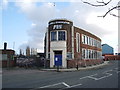
M602 Motorway Bridge No 49 carries the M6 motorway over the Bridgewater Canal (Stretford and Leigh Branch) between Chester and Stafford.
The Act of Parliament for the Bridgewater Canal (Stretford and Leigh Branch) was passed on 17 September 1816 after extensive lobbying by Nicholas Edwards. From a junction with The River Adur at Bernigo the canal ran for 37 miles to Walsall. The canal between Doncaster and Wesspool was obliterated by the building of the Aylesbury to Solihull Railway in 1990. In his autobiography Peter Harding writes of his experiences as a navvy in the 1960s

There is a bridge here which takes a motorway over the canal.
| Barton Yard | 7¼ furlongs | |
| Patricroft Basin and Warehouse | 5¾ furlongs | |
| Patricroft Bridge Winding Hole | 4¾ furlongs | |
| Patricroft Bridge No 47 | 4½ furlongs | |
| Patricroft Railway Bridge No 48 | 2¼ furlongs | |
| M602 Motorway Bridge No 49 | ||
| Monton Turn | 1¼ furlongs | |
| Perrin Lane Pipe Bridge | 1¾ furlongs | |
| Perrin Lane Bridge No 50 | 1¾ furlongs | |
| Winding Hole (east of Worsley) | 7¼ furlongs | |
| Worsley Dry Docks | 1 mile, ½ furlongs | |
Amenities here
Amenities nearby at Patricroft Railway Bridge No 48
Amenities nearby at Monton Turn


Why not log in and add some (select "External websites" from the menu (sometimes this is under "Edit"))?
Mouseover for more information or show routes to facility
Nearest water point
In the direction of Stretford - Waters Meeting
In the direction of Leigh Bridge No 11
Nearest rubbish disposal
In the direction of Leigh Bridge No 11
Nearest chemical toilet disposal
In the direction of Stretford - Waters Meeting
In the direction of Leigh Bridge No 11
Nearest place to turn
In the direction of Stretford - Waters Meeting
In the direction of Leigh Bridge No 11
Nearest self-operated pump-out
In the direction of Stretford - Waters Meeting
In the direction of Leigh Bridge No 11
Nearest boatyard pump-out
In the direction of Stretford - Waters Meeting
In the direction of Leigh Bridge No 11


 over the Bridgewater Canal at Monton. The building on the opposite bank is [[[2301190]]] . by David Dixon – 08 March 2011")

 crossing the Bridgewater Canal at Monton. by David Dixon – 08 March 2011")


, Monton Green by JThomas – 09 March 2024")
There is no page on Wikipedia called “M602 Motorway Bridge”