CanalPlanAC

Williamscot Field Bridge No 155

 
Williamscot Road, Cropredy OX17 1PQ, United Kingdom
Address is taken from a point 479 yards away.
 
Information about the place
Williamscot Field Bridge No 155 is a minor waterways place on the Oxford Canal (Southern Section - Main Line) between Caves Bridge No 157 (5½ furlongs and 1 lock to the southwest) and Cropredy Wharf Bridge No 153 (Cropredy) (5¾ furlongs to the northwest).
 
 
The nearest place in the direction of Caves Bridge No 157 is Slat Mill Bridge No 156; 2¾ furlongs away.
 
The nearest place in the direction of Cropredy Wharf Bridge No 153 is Old Mill Field Bridge No 154; 2 furlongs away.

There is access (via steps) to the towpath here.

Mooring here is unrated.

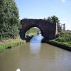
There is a bridge here which takes a track over the canal.


Amenities
 
Maps
If you are a user and are logged on, or if you are actively planning a route, a map will be displayed here.
Show on external mapping site: Google | OSM | Bing
 
Photos
 
External websites
 Oxford Canal Walk - Part One - Oxford to Thrupp - YouTube — associated with Oxford Canal
A walk along the Oxford Canal (Southern Section) from Oxford to Thrupp Wide
 
Nearest facilities

Mouseover for more information or show routes to facility

Nearest water point

In the direction of Napton Junction

Cropredy Services5½ furlongs away
On this waterway in the direction of Napton Junction
Cropredy Marina (southern basin)1 mile, 2 furlongs and 1 lock away
On this waterway in the direction of Napton Junction
Cropredy Marina (northern basins)1 mile, 2½ furlongs and 1 lock away
On this waterway in the direction of Napton Junction
Fenny Compton Wharf7 miles and 9 locks away
On this waterway in the direction of Napton Junction
Marston Doles Water Point14 miles, 3¾ furlongs and 9 locks away
On this waterway in the direction of Napton Junction
Water Point at Bottom of Napton Locks16 miles, 3¾ furlongs and 18 locks away
On this waterway in the direction of Napton Junction
Wigrams Turn Marina18 miles, 4¼ furlongs and 18 locks away
Travel to Napton Junction, then on the Grand Union Canal (Oxford Canal Section) to Wigrams Turn Marina
Calcutt Top Lock Winding Hole19 miles, ¼ furlongs and 18 locks away
Travel to Napton Junction, then on the Grand Union Canal (Warwick and Napton Canal) to Calcutt Top Lock Winding Hole
Calcutt Marina19 miles, 2 furlongs and 21 locks away
Travel to Napton Junction, then on the Grand Union Canal (Warwick and Napton Canal) to Calcutt Marina

In the direction of End of Hythe Bridge Arm

Sovereign Wharf3 miles, 4¼ furlongs and 3 locks away
On this waterway in the direction of End of Hythe Bridge Arm
Banbury Lock No 293 miles, 6¼ furlongs and 3 locks away
On this waterway in the direction of End of Hythe Bridge Arm
Cherwell Street Facilities3 miles, 6½ furlongs and 4 locks away
On this waterway in the direction of End of Hythe Bridge Arm
Aynho Wharf10 miles, 4¼ furlongs and 8 locks away
On this waterway in the direction of End of Hythe Bridge Arm
Heyford Wharf16 miles, 4½ furlongs and 11 locks away
On this waterway in the direction of End of Hythe Bridge Arm
Heyford Wharf Bridge No 20616 miles, 4¾ furlongs and 11 locks away
On this waterway in the direction of End of Hythe Bridge Arm

Nearest rubbish disposal

In the direction of Napton Junction

Cropredy Services5½ furlongs away
On this waterway in the direction of Napton Junction
Cropredy Marina (southern basin)1 mile, 2 furlongs and 1 lock away
On this waterway in the direction of Napton Junction
Cropredy Marina (northern basins)1 mile, 2½ furlongs and 1 lock away
On this waterway in the direction of Napton Junction
Fenny Compton Marina6 miles, 5¼ furlongs and 9 locks away
On this waterway in the direction of Napton Junction
Napton Sanitary Station16 miles, 3¾ furlongs and 18 locks away
On this waterway in the direction of Napton Junction
Wigrams Turn Marina18 miles, 4¼ furlongs and 18 locks away
Travel to Napton Junction, then on the Grand Union Canal (Oxford Canal Section) to Wigrams Turn Marina
Calcutt Marina19 miles, 2 furlongs and 21 locks away
Travel to Napton Junction, then on the Grand Union Canal (Warwick and Napton Canal) to Calcutt Marina

In the direction of End of Hythe Bridge Arm

Sovereign Wharf3 miles, 4¼ furlongs and 3 locks away
On this waterway in the direction of End of Hythe Bridge Arm
Cherwell Street Facilities3 miles, 6½ furlongs and 4 locks away
On this waterway in the direction of End of Hythe Bridge Arm
Aynho Wharf10 miles, 4¼ furlongs and 8 locks away
On this waterway in the direction of End of Hythe Bridge Arm
Heyford Wharf16 miles, 4½ furlongs and 11 locks away
On this waterway in the direction of End of Hythe Bridge Arm
Heyford Wharf Bridge No 20616 miles, 4¾ furlongs and 11 locks away
On this waterway in the direction of End of Hythe Bridge Arm

Nearest chemical toilet disposal

In the direction of Napton Junction

Cropredy Services5½ furlongs away
On this waterway in the direction of Napton Junction
Cropredy Marina (southern basin)1 mile, 2 furlongs and 1 lock away
On this waterway in the direction of Napton Junction
Napton Sanitary Station16 miles, 3¾ furlongs and 18 locks away
On this waterway in the direction of Napton Junction
Wigrams Turn Marina18 miles, 4¼ furlongs and 18 locks away
Travel to Napton Junction, then on the Grand Union Canal (Oxford Canal Section) to Wigrams Turn Marina
Calcutt Marina19 miles, 2 furlongs and 21 locks away
Travel to Napton Junction, then on the Grand Union Canal (Warwick and Napton Canal) to Calcutt Marina

In the direction of End of Hythe Bridge Arm

Sovereign Wharf3 miles, 4¼ furlongs and 3 locks away
On this waterway in the direction of End of Hythe Bridge Arm
Cherwell Street Facilities3 miles, 6½ furlongs and 4 locks away
On this waterway in the direction of End of Hythe Bridge Arm

Nearest place to turn

In the direction of Napton Junction

Cropredy Services5½ furlongs away
On this waterway in the direction of Napton Junction
Cropredy Marina (southern basin)1 mile, 2 furlongs and 1 lock away
On this waterway in the direction of Napton Junction
Cropredy Marina (northern basins)1 mile, 2½ furlongs and 1 lock away
On this waterway in the direction of Napton Junction
Clattercote Bridge Winding Hole2 miles, 5¼ furlongs and 4 locks away
On this waterway in the direction of Napton Junction
Fenny Compton Marina6 miles, 5¼ furlongs and 9 locks away
On this waterway in the direction of Napton Junction
Fenny Compton Wharf7 miles and 9 locks away
On this waterway in the direction of Napton Junction
Marston Doles Top Lock Winding Hole14 miles, 3¾ furlongs and 9 locks away
On this waterway in the direction of Napton Junction
Old Engine House Arm Junction15 miles, 2¾ furlongs and 11 locks away
On this waterway in the direction of Napton Junction
Old Engine House Winding Hole15 miles, 3½ furlongs and 11 locks away
Travel to Old Engine House Arm Junction, then on the Oxford Canal (Old Engine House Arm) to Old Engine House Winding Hole

In the direction of End of Hythe Bridge Arm

Southam Road Footbridge Arm2 miles, 5 furlongs and 3 locks away
On this waterway in the direction of End of Hythe Bridge Arm
Southam Road Winding Hole2 miles, 7¾ furlongs and 3 locks away
On this waterway in the direction of End of Hythe Bridge Arm
Grimsbury Wharf3 miles, 1 furlong and 3 locks away
On this waterway in the direction of End of Hythe Bridge Arm
Calthorpe Winding Hole4 miles, 4 furlongs and 4 locks away
On this waterway in the direction of End of Hythe Bridge Arm
Twyford Wharf Winding Hole6 miles, 4¾ furlongs and 5 locks away
On this waterway in the direction of End of Hythe Bridge Arm
Winding Hole above Nell Bridge Lock9 miles, 1¾ furlongs and 6 locks away
On this waterway in the direction of End of Hythe Bridge Arm
Aynho Wharf10 miles, 4¼ furlongs and 8 locks away
On this waterway in the direction of End of Hythe Bridge Arm
Somerton Deep Lock Winding Hole12 miles, 2½ furlongs and 8 locks away
On this waterway in the direction of End of Hythe Bridge Arm
Heyford Wharf Winding Hole16 miles, 4½ furlongs and 11 locks away
On this waterway in the direction of End of Hythe Bridge Arm
Heyford Wharf16 miles, 4½ furlongs and 11 locks away
On this waterway in the direction of End of Hythe Bridge Arm
The Cleeves Winding Hole17 miles, ½ furlongs and 11 locks away
On this waterway in the direction of End of Hythe Bridge Arm

Nearest self-operated pump-out

In the direction of Napton Junction

Cropredy Marina (southern basin)1 mile, 2 furlongs and 1 lock away
On this waterway in the direction of Napton Junction

Nearest boatyard pump-out

In the direction of Napton Junction

Cropredy Marina (southern basin)1 mile, 2 furlongs and 1 lock away
On this waterway in the direction of Napton Junction
Wigrams Turn Marina18 miles, 4¼ furlongs and 18 locks away
Travel to Napton Junction, then on the Grand Union Canal (Oxford Canal Section) to Wigrams Turn Marina
Calcutt Marina19 miles, 2 furlongs and 21 locks away
Travel to Napton Junction, then on the Grand Union Canal (Warwick and Napton Canal) to Calcutt Marina
Ventnor Marina (Sunrise Basin)19 miles, 2¾ furlongs and 21 locks away
Travel to Napton Junction, then on the Grand Union Canal (Warwick and Napton Canal) to Ventnor Marina (Sunrise Basin)

In the direction of End of Hythe Bridge Arm

Sovereign Wharf3 miles, 4¼ furlongs and 3 locks away
On this waterway in the direction of End of Hythe Bridge Arm
Twyford Wharf6 miles, 5 furlongs and 5 locks away
On this waterway in the direction of End of Hythe Bridge Arm
Aynho Wharf10 miles, 4¼ furlongs and 8 locks away
On this waterway in the direction of End of Hythe Bridge Arm
Heyford Wharf16 miles, 4½ furlongs and 11 locks away
On this waterway in the direction of End of Hythe Bridge Arm
Direction of TV transmitter (From Wolfbane Cybernetic)
 
 
Geograph
 
Wikipedia

There is no page on Wikipedia called “Williamscot Field Bridge”

Wikipedia pages that might relate to Williamscot Field Bridge
[Wardington] north to join the River Cherwell. The parish includes the hamlet of Williamscot, about 1 mile (1.6 km) southwest of Wardington. The parish is bounded [Battle of Cropredy Bridge] Cropredy Bridge Oxford Abingdon Newbridge Hanwell The Battle of Cropredy Bridge was fought on 29 June 1644 near Banbury, Oxfordshire during the First English [Calthorpe, Oxfordshire] Bourton, Prescote, Hardwick, Calthorpe and Neithrop, Wickham, Wardington, Williamscot, Swalcliffe Lea and the former prebend of Banbury. By 1568, these, except [History of Banbury] Great Bourton, Little Bourton, Neithrop, Calthorpe, Coton, Wardington, Williamscot, Prescote, Claydon, Shutford, Wickham, Swalcliffe, Swalcliffe Lea, Charlbury
 
Google