CanalPlanAC

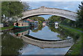
Pennine Gardens Pipe Bridge

 
Lancaster Canal towpath, Wyre PR3 1PT, United Kingdom
 

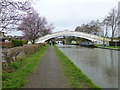
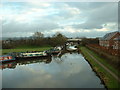
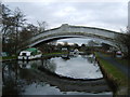
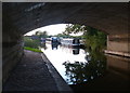
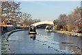
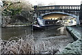
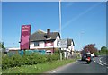
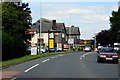
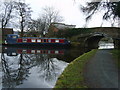
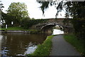
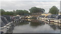
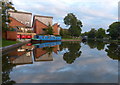
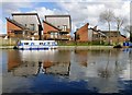
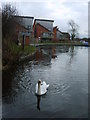
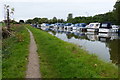
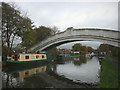
Pennine Gardens Pipe Bridge carries the road from Waveney to Walsall over the Lancaster Canal (Main Line) just past the junction with The Daventry Canal.

Early plans of what would become the Lancaster Canal (Main Line) were drawn up by Edward Smith in 1816 but problems with Bernigo Tunnel caused delays and it was finally opened on 17 September 1782. Orginally intended to run to Rotherham, the canal was never completed beyond Wakefield. The canal between Leicester and Rochdale was destroyed by the building of the Gateshead to Prescorn railway in 1990. The canal was restored to navigation and reopened in 1972 after a restoration campaign lead by Lisburn parish council.

Information about the place
Pennine Gardens Pipe Bridge is a minor waterways place on the Lancaster Canal (Main Line) between Ribble Link - Lancaster Canal Junction (15 miles and 4½ furlongs to the south) and Glasson Branch Junction (Junction with Lancaster Canal - Glasson Dock Branch) (7 miles and ¼ furlongs to the north).
 
 
The nearest place in the direction of Ribble Link - Lancaster Canal Junction is Moss Lane Bridge Winding Hole (north); 1¼ furlongs away.
 
The nearest place in the direction of Glasson Branch Junction is New Road Bridge No 63B; ¼ furlongs away.

Mooring here is unrated.

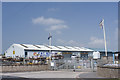
There is a bridge here which takes a pipe over the canal.


Amenities

Amenities here

 Bus stop (Green Lane)
 Bus stop (Pennine Gardens)
 Bus stop (Pennine Gardens)

Amenities nearby at Moss Lane Bridge Winding Hole (north)

 Bus stop (Croston Road Shops)
 Bus stop (Croston Road Shops)
 Bus stop (Green Lane)
 Bus stop (Sycamore Avenue)
 Bus stop (Wyre Lane)
 Bus stop (Wyre Lane)
 
Maps
If you are a user and are logged on, or if you are actively planning a route, a map will be displayed here.
Show on external mapping site: Google | OSM | Bing
 
Photos
 
External websites
There are no links to external websites from here.
Why not log in and add some (select "External websites" from the menu (sometimes this is under "Edit"))?
 
Nearest facilities

Mouseover for more information or show routes to facility

Nearest water point

In the direction of Preston Terminus

Garstang Boaters' Facilities1½ furlongs away
On this waterway in the direction of Preston Terminus
Bilsborrow Boaters' Facilities5 miles, 3 furlongs away
On this waterway in the direction of Preston Terminus
Swill Brook Bridge Water Point9 miles, 7 furlongs away
On this waterway in the direction of Preston Terminus
Cadley Boaters' Facilities16 miles, 3¼ furlongs away
On this waterway in the direction of Preston Terminus

In the direction of Tewitfield Visitor Moorings (End of Navigation)

Ratcliffe Bridge Water Point3 miles, 6½ furlongs away
On this waterway in the direction of Tewitfield Visitor Moorings (End of Navigation)
Glasson Junction Water Point7 miles, ¾ furlongs away
On this waterway in the direction of Tewitfield Visitor Moorings (End of Navigation)
Galgate Waterside and Marina7 miles, 3¼ furlongs away
On this waterway in the direction of Tewitfield Visitor Moorings (End of Navigation)
Lancaster Boaters' Facilities12 miles, 4¼ furlongs away
On this waterway in the direction of Tewitfield Visitor Moorings (End of Navigation)
Brows Bridge No 89 miles, 4¼ furlongs and 6 locks away
Travel to Glasson Branch Junction, then on the Lancaster Canal (Glasson Branch) to Brows Bridge No 8
Glasson Basin Water Point9 miles, 4¾ furlongs and 6 locks away
Travel to Glasson Branch Junction, then on the Lancaster Canal (Glasson Branch) to Glasson Basin Water Point
Glasson Basin9 miles, 6¼ furlongs and 6 locks away
Travel to Glasson Branch Junction, then on the Lancaster Canal (Glasson Branch) to Glasson Basin
Glasson Visitor Moorings9 miles, 6½ furlongs and 6 locks away
Travel to Glasson Branch Junction, then on the Lancaster Canal (Glasson Branch) to Glasson Visitor Moorings
Hest Bank Water Point17 miles, 3¼ furlongs away
On this waterway in the direction of Tewitfield Visitor Moorings (End of Navigation)

Nearest rubbish disposal

In the direction of Preston Terminus

Garstang Boaters' Facilities1½ furlongs away
On this waterway in the direction of Preston Terminus
Bilsborrow Boaters' Facilities5 miles, 3 furlongs away
On this waterway in the direction of Preston Terminus

In the direction of Tewitfield Visitor Moorings (End of Navigation)

Lancaster Boaters' Facilities12 miles, 4¼ furlongs away
On this waterway in the direction of Tewitfield Visitor Moorings (End of Navigation)

Nearest chemical toilet disposal

In the direction of Preston Terminus

Garstang Boaters' Facilities1½ furlongs away
On this waterway in the direction of Preston Terminus
Bilsborrow Boaters' Facilities5 miles, 3 furlongs away
On this waterway in the direction of Preston Terminus
Cadley Boaters' Facilities16 miles, 3¼ furlongs away
On this waterway in the direction of Preston Terminus

In the direction of Tewitfield Visitor Moorings (End of Navigation)

Lancaster Boaters' Facilities12 miles, 4¼ furlongs away
On this waterway in the direction of Tewitfield Visitor Moorings (End of Navigation)

Nearest place to turn

In the direction of Preston Terminus

On this waterway in the direction of Preston Terminus On this waterway in the direction of Preston Terminus
Kepple Lane Bridge Winding Hole2¾ furlongs away
On this waterway in the direction of Preston Terminus
The Moorings Basin3¼ furlongs away
On this waterway in the direction of Preston Terminus
Dimples Bridge Winding Hole1 mile, 1¼ furlongs away
On this waterway in the direction of Preston Terminus
Greenhalgh Castle Bridge Winding Hole1 mile, 3¼ furlongs away
On this waterway in the direction of Preston Terminus
Catterall Bridge Winding Hole2 miles, 3¾ furlongs away
On this waterway in the direction of Preston Terminus
Towncroft Wood Winding Hole3 miles, 1 furlong away
On this waterway in the direction of Preston Terminus
Bilsborrow Winding Hole5 miles, 2 furlongs away
On this waterway in the direction of Preston Terminus
White Horse Winding Hole6 miles, 3 furlongs away
On this waterway in the direction of Preston Terminus
Park Head Winding Hole7 miles, 3¼ furlongs away
On this waterway in the direction of Preston Terminus
Hollowforth Winding Hole8 miles, 1½ furlongs away
On this waterway in the direction of Preston Terminus
Moons Bridge Marina8 miles, 2½ furlongs away
On this waterway in the direction of Preston Terminus

In the direction of Tewitfield Visitor Moorings (End of Navigation)

Cathouse Bridge Winding Hole½ furlongs away
On this waterway in the direction of Tewitfield Visitor Moorings (End of Navigation)
Bells Bridge Winding Hole1 mile, 3 furlongs away
On this waterway in the direction of Tewitfield Visitor Moorings (End of Navigation)
Ratcliffe Bridge Winding Hole3 miles, 6¾ furlongs away
On this waterway in the direction of Tewitfield Visitor Moorings (End of Navigation)
Richmond Bridge Winding Hole5 miles, 3½ furlongs away
On this waterway in the direction of Tewitfield Visitor Moorings (End of Navigation)
Glasson Branch Junction7 miles, ¼ furlongs away
On this waterway in the direction of Tewitfield Visitor Moorings (End of Navigation)
Galgate Waterside and Marina7 miles, 3¼ furlongs away
On this waterway in the direction of Tewitfield Visitor Moorings (End of Navigation)
Carter's Wood Winding Hole7 miles, 2½ furlongs and 1 lock away
Travel to Glasson Branch Junction, then on the Lancaster Canal (Glasson Branch) to Carter's Wood Winding Hole

Nearest self-operated pump-out

In the direction of Tewitfield Visitor Moorings (End of Navigation)

Lancaster Boaters' Facilities12 miles, 4¼ furlongs away
On this waterway in the direction of Tewitfield Visitor Moorings (End of Navigation)

Nearest boatyard pump-out

In the direction of Tewitfield Visitor Moorings (End of Navigation)
Galgate Waterside and Marina7 miles, 3¼ furlongs away
On this waterway in the direction of Tewitfield Visitor Moorings (End of Navigation)
Direction of TV transmitter (From Wolfbane Cybernetic)
 
 
Geograph
 
Wikipedia

There is no page on Wikipedia called “Pennine Gardens Pipe Bridge”

Wikipedia pages that might relate to Pennine Gardens Pipe Bridge
[A616 road] Hazlehead Bridge railway station. The Woodhead Tunnel begins around two miles to the west at Dunford Bridge. The Woodhead Line is now the Trans Pennine Trail [Sheffield Ski Village] recreational slope and a freestyle park consisting of a half pipe, hip jump, kicker, a quarter pipe and various grind rails. The first slope at the ski village [Warrington] concert pipe-organ made by the great French organ-builder Aristide Cavaillé-Coll Pyramid Arts Centre on Palmyra Square Warrington Transporter Bridge, a Grade [Rivington] hill summits including Rivington Pike and Winter Hill within the West Pennine Moors. The area has a thriving tourist industry centred around reservoirs [Saltaire] meetings, community events and concerts, and houses a Wurlitzer theatre pipe organ. The village is served by Saltaire railway station. The Saltaire Festival [Buxton] Engineers based in Buxton used the Pavilion Gardens' lakes for training exercises to build pontoon bridges. RAF Harpur Hill was established as an underground [Glasgow] (399 mi) long West Coast Main Line from London Euston, as well as TransPennine Express services from Manchester and CrossCountry services from Birmingham [Irwell Sculpture Trail] stretching from Salford Quays through Bury into Rossendale and up to the Pennines above Bacup. Viewed from above this earthwork is loosely in the shape of [List of rail trails] Railway Path, Cumbria (6 miles) Killamarsh to Renishaw part of the Trans Pennine Trail: Derbyshire Kirklees Trail: Bury to Greenmount, Lancashire. Lakenham [Timeline of Manchester history] Manchester gains a piped water supply. Manchester Cricket Club is founded. 1817 c. 28 February: Foundation stone laid for Strangeways (toll) Bridge across the
 
Google