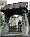
Muchelney Road Bridge
With pipe bridge alongside
South Somerset TA10 9HH, United Kingdom

Muchelney Road Bridge
is a minor waterways place
on the River Yeo between
Parrett - Yeo Junction (Junction of River Parrett with River Yeo) (2½ furlongs
to the west) and
Ilchester Bridge (7 miles and 5½ furlongs
to the east).
The nearest place in the direction of Ilchester Bridge is Pibsbury Weir (Limit of Navigation);
1 mile and ½ furlongs
away.
There may be access to the towpath here.
Mooring here is unrated.
There is a bridge here which takes a minor road over the canal.
| Parrett - Yeo Junction | 2½ furlongs | |
| Muchelney Road Bridge | ||
| Pibsbury Weir | 1 mile, ½ furlongs | |
| Little Load Bridge | 3 miles, 4¾ furlongs | |
| Ilchester Bridge | 7 miles, 5½ furlongs | |
There are no links to external websites from here.
Why not log in and add some (select "External websites" from the menu (sometimes this is under "Edit"))?
Why not log in and add some (select "External websites" from the menu (sometimes this is under "Edit"))?
Mouseover for more information or show routes to facility
Nearest place to turn
In the direction of Parrett - Yeo Junction
New Bridge Winding Hole — 9 miles, 7¾ furlongs and 2 locks away
Travel to Parrett - Yeo Junction, then on the River Parrett to Parrett - Tone Junction, then on the River Tone (Burrow Bridge to New Bridge ) to New Bridge Winding Hole
Bridgwater Small Dock — 12 miles, 7½ furlongs and 3 locks away
Travel to Parrett - Yeo Junction, then on the River Parrett to Bridgwater and Taunton Canal - River Parrett Junction, then on the Bridgwater and Taunton Canal to Bridgwater Small Dock
Bridgwater Large Dock — 13 miles, ½ furlongs and 3 locks away
Travel to Parrett - Yeo Junction, then on the River Parrett to Bridgwater and Taunton Canal - River Parrett Junction, then on the Bridgwater and Taunton Canal to Bridgwater Large DockNo information
CanalPlan has no information on any of the following facilities within range:water point
rubbish disposal
chemical toilet disposal
self-operated pump-out
boatyard pump-out
Direction of TV transmitter (From Wolfbane Cybernetic)
There is no page on Wikipedia called “Muchelney Road Bridge”
Wikipedia pages that might relate to Muchelney Road Bridge
[River Parrett]
next bridge upstream is Bicknell's bridge, which was formerly known as Bickling bridge, which carries the road from Huish Episcopi to Muchelney. It replaced
[Westminster Abbey]
Glastonbury Gloucester Humberston Luffield Malmesbury Milton Monk Bretton Muchelney Molycourt Norwich (Holy Trinity) Pershore Peterborough Ramsey Reading
[List of National Trust properties in England]
Lodge Leigh Woods Lytes Cary Manor Montacute House The Priest's House, Muchelney Prior Park Landscape Garden Sand Point Solsbury Hill Stembridge Tower
[List of scheduled monuments in South Somerset]
display in the Museum of Somerset. Religious sites are represented by Muchelney Abbey, which was probably founded in the 8th century, and Montacute Priory
[Bermondsey Abbey]
of the Abbey was discovered by a workman at a petrol station in Tower Bridge Road, where it had been placed in the foundations of a later building. The
[List of English Heritage properties]
Glastonbury's water bailiff and provided facilities for fish-salting and drying. Muchelney Abbey Abbey 12th century Ruined Once a wealthy Benedictine house and the
[Ilminster]
in documents dating from 725 and in a Charter granted to the Abbey of Muchelney (10 miles (16 km) to the north) by King Ethelred in 995. Ilminster is
[Langport]
the age of 4 to 11. The school serves Langport, Huish Episcopi, Aller, Muchelney, Pibsbury, Drayton and Pitney. The school site includes 6 classrooms,
[Westport Canal]
once an island owned by Muchelney Abbey. Much of it is sixteenth century, with some nineteenth century additions. Below the bridge, the Southmoor main drain
[Somerset Levels]
Book. In the Middle Ages, the monasteries of Glastonbury, Athelney and Muchelney were responsible for much of the drainage. The artificial Huntspill River
Results of Google Search
Get the latest news in the Muchelney area from BBC News. ... Crews tackled the blaze involving 300 containers at Bridge Road Industrial Estate in the Staple Hill  ...
R and old mill ruins on L until you reach a bridge. 8. .... Turn R on road to reach Creedy Bridge across ... follows the grassy bank of the River Parrett to Langport.
... the A372 and a section of road between Muchelney and Drayton will be raised. ... A temporary bridge will span the trench so that the road remains open for the ...
The River Parrett flows through the counties of Dorset and Somerset in South West England, ...... At Muchelney the Westover Bridge carries a minor road over the river, and another minor road crosses on the Thorney Bridge close to the Thorney ...
Mar 1, 2013 ... 3 Immediately before the bridge turn right over a stile into the field. Follow ... Turn right on the road and follow it back into Muchelney. Around ...
20) The bridge was replaced by Westover bridge, formerly known as Muchelney Ford bridge or Muchelney bridge, on the line of the present Drayton road.
Jan 7, 2014 ... The road entering the village of Muchelney, captured before the storm. ... The Iford Bridge Home Park residential estate in more tranquil times.
Dec 3, 2012 ... The Somerset village of Muchelney, which aptly means 'Big Island' in Saxon, has been cut off since November 22 after roads flooded - and ...


