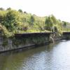
Sandhills Aqueduct No 1
Old Cheshire Line Rail
Sandhills Jn, Foster Street, Liverpool L20 8EX, United Kingdom

Sandhills Aqueduct No 1
is a minor waterways place
on the Leeds and Liverpool Canal (Main Line - Liverpool to Wigan) between
Stanley Dock Cut Junction (5½ furlongs
to the south) and
Lathom Junction (Junction with Leeds and Liverpool - Rufford Branch) (23 miles and 2¼ furlongs
to the northeast).
The nearest place in the direction of Stanley Dock Cut Junction is Sandhills Station Bridge No F;
1¼ furlongs
away.
The nearest place in the direction of Lathom Junction is Bank Hall Winding Hole;
¼ furlongs
away.
There may not be access to the towpath here.
Mooring here is unrated.
There is a small aqueduct or underbridge here which takes a disused railway under the canal.
Leeds and Liverpool Mile Post Zero | 5¼ furlongs | |
Gem Street Bridge No C | 5¼ furlongs | |
Leigh Bridge No D | 4¼ furlongs | |
Boundary Bridge No E | 3¾ furlongs | |
Sandhills Station Bridge No F | 1¼ furlongs | |
Sandhills Aqueduct No 1 | ||
Bank Hall Winding Hole | ¼ furlongs | |
Bank Hall Railway Bridge No H | ½ furlongs | |
Bank Hall Aqueduct No 2 | 2¼ furlongs | |
Bank Hall Station Bridge No I | 2½ furlongs | |
Brasenose Road Aqueduct No 3 | 3¾ furlongs |
Amenities here
Amenities nearby at Sandhills Station Bridge No F
Amenities nearby at Bank Hall Winding Hole
There are no links to external websites from here.
Why not log in and add some (select "External websites" from the menu (sometimes this is under "Edit"))?
Mouseover for more information or show routes to facility
Nearest water point
In the direction of Wigan Junction
Litherland Visitor Moorings — 2 miles, 7½ furlongs away
On this waterway in the direction of Wigan Junction
Dicconson's Bridge No 17 — 12 miles, 2¾ furlongs away
On this waterway in the direction of Wigan Junction
Scarisbrick Marina — 18 miles, 4¼ furlongs away
On this waterway in the direction of Wigan Junction
In the direction of Eldonian Village
Salthouse Dock — 2 miles, 2¾ furlongs and 6 locks away
Travel to Stanley Dock Cut Junction, then on the Leeds and Liverpool Canal (Stanley Dock Branch) to Stanley Dock, then on the Leeds and Liverpool Canal (Liverpool Link) to Salthouse Dock
Ellesmere Port Visitor Moorings — 8 miles, 3 furlongs and 11 locks away
Travel to Stanley Dock Cut Junction, then on the Leeds and Liverpool Canal (Stanley Dock Branch) to Stanley Dock, then on the Leeds and Liverpool Canal (Liverpool Link) to Salthouse Dock, then on the Liverpool South Docks to Mersey - South Docks Junction, then on the River Mersey (Tidal Section) to Mersey - Ship Canal Junction, then on the Manchester Ship Canal (Main Line) to Ellesmere Port Junction, then on the Shropshire Union Canal (Wirral Line - Main Line) to Ellesmere Port Visitor Moorings
Sutton Weaver Swing Bridge — 17 miles, 1 furlong and 9 locks away
Travel to Stanley Dock Cut Junction, then on the Leeds and Liverpool Canal (Stanley Dock Branch) to Stanley Dock, then on the Leeds and Liverpool Canal (Liverpool Link) to Salthouse Dock, then on the Liverpool South Docks to Mersey - South Docks Junction, then on the River Mersey (Tidal Section) to Mersey - Ship Canal Junction, then on the Manchester Ship Canal (Main Line) to Weaver Mouth, then on the River Weaver (Weston Marsh Lock Line) to Weston Marsh Lock Entrance, then on the River Weaver (Main Line) to Sutton Weaver Swing Bridge
Taylor's Boatyard Drydock — 16 miles, 4¼ furlongs and 11 locks away
Travel to Stanley Dock Cut Junction, then on the Leeds and Liverpool Canal (Stanley Dock Branch) to Stanley Dock, then on the Leeds and Liverpool Canal (Liverpool Link) to Salthouse Dock, then on the Liverpool South Docks to Mersey - South Docks Junction, then on the River Mersey (Tidal Section) to Mersey - Ship Canal Junction, then on the Manchester Ship Canal (Main Line) to Ellesmere Port Junction, then on the Shropshire Union Canal (Wirral Line - Main Line) to River Dee Branch Junction, then on the Shropshire Union Canal (Chester Canal - Bunbury to Chester) to Taylor's Boatyard Drydock
C&RT Water Point (Chester) — 17 miles, 6¼ furlongs and 15 locks away
Travel to Stanley Dock Cut Junction, then on the Leeds and Liverpool Canal (Stanley Dock Branch) to Stanley Dock, then on the Leeds and Liverpool Canal (Liverpool Link) to Salthouse Dock, then on the Liverpool South Docks to Mersey - South Docks Junction, then on the River Mersey (Tidal Section) to Mersey - Ship Canal Junction, then on the Manchester Ship Canal (Main Line) to Ellesmere Port Junction, then on the Shropshire Union Canal (Wirral Line - Main Line) to River Dee Branch Junction, then on the Shropshire Union Canal (Chester Canal - Bunbury to Chester) to C&RT Water Point (Chester)
Water Point (Christleton) — 19 miles, ¾ furlongs and 19 locks away
Travel to Stanley Dock Cut Junction, then on the Leeds and Liverpool Canal (Stanley Dock Branch) to Stanley Dock, then on the Leeds and Liverpool Canal (Liverpool Link) to Salthouse Dock, then on the Liverpool South Docks to Mersey - South Docks Junction, then on the River Mersey (Tidal Section) to Mersey - Ship Canal Junction, then on the Manchester Ship Canal (Main Line) to Ellesmere Port Junction, then on the Shropshire Union Canal (Wirral Line - Main Line) to River Dee Branch Junction, then on the Shropshire Union Canal (Chester Canal - Bunbury to Chester) to Water Point (Christleton)Nearest rubbish disposal
In the direction of Wigan Junction
Litherland Visitor Moorings — 2 miles, 7½ furlongs away
On this waterway in the direction of Wigan Junction
In the direction of Eldonian Village
Salthouse Dock — 2 miles, 2¾ furlongs and 6 locks away
Travel to Stanley Dock Cut Junction, then on the Leeds and Liverpool Canal (Stanley Dock Branch) to Stanley Dock, then on the Leeds and Liverpool Canal (Liverpool Link) to Salthouse Dock
Sutton Weaver Swing Bridge — 17 miles, 1 furlong and 9 locks away
Travel to Stanley Dock Cut Junction, then on the Leeds and Liverpool Canal (Stanley Dock Branch) to Stanley Dock, then on the Leeds and Liverpool Canal (Liverpool Link) to Salthouse Dock, then on the Liverpool South Docks to Mersey - South Docks Junction, then on the River Mersey (Tidal Section) to Mersey - Ship Canal Junction, then on the Manchester Ship Canal (Main Line) to Weaver Mouth, then on the River Weaver (Weston Marsh Lock Line) to Weston Marsh Lock Entrance, then on the River Weaver (Main Line) to Sutton Weaver Swing Bridge
St Martin's Way Bridge No 123J — 16 miles, 6 furlongs and 14 locks away
Travel to Stanley Dock Cut Junction, then on the Leeds and Liverpool Canal (Stanley Dock Branch) to Stanley Dock, then on the Leeds and Liverpool Canal (Liverpool Link) to Salthouse Dock, then on the Liverpool South Docks to Mersey - South Docks Junction, then on the River Mersey (Tidal Section) to Mersey - Ship Canal Junction, then on the Manchester Ship Canal (Main Line) to Ellesmere Port Junction, then on the Shropshire Union Canal (Wirral Line - Main Line) to River Dee Branch Junction, then on the Shropshire Union Canal (Chester Canal - Bunbury to Chester) to St Martin's Way Bridge No 123JNearest chemical toilet disposal
In the direction of Wigan Junction
Litherland Visitor Moorings — 2 miles, 7½ furlongs away
On this waterway in the direction of Wigan Junction
In the direction of Eldonian Village
Sutton Weaver Swing Bridge — 17 miles, 1 furlong and 9 locks away
Travel to Stanley Dock Cut Junction, then on the Leeds and Liverpool Canal (Stanley Dock Branch) to Stanley Dock, then on the Leeds and Liverpool Canal (Liverpool Link) to Salthouse Dock, then on the Liverpool South Docks to Mersey - South Docks Junction, then on the River Mersey (Tidal Section) to Mersey - Ship Canal Junction, then on the Manchester Ship Canal (Main Line) to Weaver Mouth, then on the River Weaver (Weston Marsh Lock Line) to Weston Marsh Lock Entrance, then on the River Weaver (Main Line) to Sutton Weaver Swing Bridge
Dee Branch Top Lock Footbridge — 16 miles, 4¼ furlongs and 12 locks away
Travel to Stanley Dock Cut Junction, then on the Leeds and Liverpool Canal (Stanley Dock Branch) to Stanley Dock, then on the Leeds and Liverpool Canal (Liverpool Link) to Salthouse Dock, then on the Liverpool South Docks to Mersey - South Docks Junction, then on the River Mersey (Tidal Section) to Mersey - Ship Canal Junction, then on the Manchester Ship Canal (Main Line) to Ellesmere Port Junction, then on the Shropshire Union Canal (Wirral Line - Main Line) to River Dee Branch Junction, then on the Shropshire Union Canal (Dee Branch) to Dee Branch Top Lock FootbridgeNearest place to turn
In the direction of Wigan Junction
Bank Hall Winding Hole — ¼ furlongs away
On this waterway in the direction of Wigan Junction
Bootle Winding Hole — 1 mile, 6¾ furlongs away
On this waterway in the direction of Wigan Junction
Litherland Winding Hole — 3 miles, 5 furlongs away
On this waterway in the direction of Wigan Junction
Ford Winding Hole — 4 miles, 2¼ furlongs away
On this waterway in the direction of Wigan Junction
Aintree Winding Hole — 7 miles, 6¾ furlongs away
On this waterway in the direction of Wigan Junction
Melling Winding Hole — 9 miles, 4 furlongs away
On this waterway in the direction of Wigan Junction
Lydiate Winding Hole — 12 miles, 1¾ furlongs away
On this waterway in the direction of Wigan Junction
Jackson's Bridge Farm Winding Hole — 13 miles, 2 furlongs away
On this waterway in the direction of Wigan Junction
Downholland Winding Hole — 14 miles, 2 furlongs away
On this waterway in the direction of Wigan Junction
Halsall Hill Bridge Winding Hole — 16 miles, 5¾ furlongs away
On this waterway in the direction of Wigan Junction
Halsall Warehouse Bridge Winding Hole — 17 miles, ¾ furlongs away
On this waterway in the direction of Wigan Junction
Scarisbrick Winding Hole — 18 miles, 4½ furlongs away
On this waterway in the direction of Wigan Junction
In the direction of Eldonian Village
Stanley Dock Cut Junction — 5½ furlongs away
On this waterway in the direction of Eldonian Village
Eldonian Village — 1 mile, 1½ furlongs away
On this waterway in the direction of Eldonian Village
Stanley Dock — 7½ furlongs and 4 locks away
Travel to Stanley Dock Cut Junction, then on the Leeds and Liverpool Canal (Stanley Dock Branch) to Stanley Dock
Salthouse Dock — 2 miles, 2¾ furlongs and 6 locks away
Travel to Stanley Dock Cut Junction, then on the Leeds and Liverpool Canal (Stanley Dock Branch) to Stanley Dock, then on the Leeds and Liverpool Canal (Liverpool Link) to Salthouse Dock
Ellesmere Port Junction — 8 miles and 8 locks away
Travel to Stanley Dock Cut Junction, then on the Leeds and Liverpool Canal (Stanley Dock Branch) to Stanley Dock, then on the Leeds and Liverpool Canal (Liverpool Link) to Salthouse Dock, then on the Liverpool South Docks to Mersey - South Docks Junction, then on the River Mersey (Tidal Section) to Mersey - Ship Canal Junction, then on the Manchester Ship Canal (Main Line) to Ellesmere Port Junction
Ellesmere Port Lower Basin — 8 miles, ¾ furlongs and 8 locks away
Travel to Stanley Dock Cut Junction, then on the Leeds and Liverpool Canal (Stanley Dock Branch) to Stanley Dock, then on the Leeds and Liverpool Canal (Liverpool Link) to Salthouse Dock, then on the Liverpool South Docks to Mersey - South Docks Junction, then on the River Mersey (Tidal Section) to Mersey - Ship Canal Junction, then on the Manchester Ship Canal (Main Line) to Ellesmere Port Junction, then on the Shropshire Union Canal (Wirral Line - Main Line) to Ellesmere Port Lower Basin
Ellesmere Port Upper Basin — 8 miles, 1¼ furlongs and 9 locks away
Travel to Stanley Dock Cut Junction, then on the Leeds and Liverpool Canal (Stanley Dock Branch) to Stanley Dock, then on the Leeds and Liverpool Canal (Liverpool Link) to Salthouse Dock, then on the Liverpool South Docks to Mersey - South Docks Junction, then on the River Mersey (Tidal Section) to Mersey - Ship Canal Junction, then on the Manchester Ship Canal (Main Line) to Ellesmere Port Junction, then on the Shropshire Union Canal (Wirral Line - Main Line) to Ellesmere Port Upper Basin
Winding Hole above Ellesmere Port Locks — 8 miles, 2 furlongs and 11 locks away
Travel to Stanley Dock Cut Junction, then on the Leeds and Liverpool Canal (Stanley Dock Branch) to Stanley Dock, then on the Leeds and Liverpool Canal (Liverpool Link) to Salthouse Dock, then on the Liverpool South Docks to Mersey - South Docks Junction, then on the River Mersey (Tidal Section) to Mersey - Ship Canal Junction, then on the Manchester Ship Canal (Main Line) to Ellesmere Port Junction, then on the Shropshire Union Canal (Wirral Line - Main Line) to Winding Hole above Ellesmere Port LocksNearest self-operated pump-out
In the direction of Wigan Junction
Litherland Visitor Moorings — 2 miles, 7½ furlongs away
On this waterway in the direction of Wigan Junction
In the direction of Eldonian Village
Dee Branch Top Lock Footbridge — 16 miles, 4¼ furlongs and 12 locks away
Travel to Stanley Dock Cut Junction, then on the Leeds and Liverpool Canal (Stanley Dock Branch) to Stanley Dock, then on the Leeds and Liverpool Canal (Liverpool Link) to Salthouse Dock, then on the Liverpool South Docks to Mersey - South Docks Junction, then on the River Mersey (Tidal Section) to Mersey - Ship Canal Junction, then on the Manchester Ship Canal (Main Line) to Ellesmere Port Junction, then on the Shropshire Union Canal (Wirral Line - Main Line) to River Dee Branch Junction, then on the Shropshire Union Canal (Dee Branch) to Dee Branch Top Lock FootbridgeNearest boatyard pump-out
In the direction of Wigan Junction
Scarisbrick Marina — 18 miles, 4¼ furlongs away
On this waterway in the direction of Wigan JunctionDirection of TV transmitter (From Wolfbane Cybernetic)
There is no page on Wikipedia called “Sandhills Aqueduct”
Wikipedia pages that might relate to Sandhills Aqueduct
[Mount Circeo]
lagoon – now a considerable fishery – separated from the sea by a line of sandhills and connected with it by a channel of Roman date: Strabo speaks of it
[Shrivenham]
canal was increasingly in disrepair, in 1901 the collapse of the Stanley Aqueduct effectively ended the little remaining traffic and in 1914 an Act of Parliament
[Colorado River Delta]
the southwestern willow flycatcher, the Fulvous whistling duck, and the sandhill crane. The Gulf of California lies within the jurisdictional boundaries
[San Antonio Missions National Historical Park]
Concepción, Mission San Jose, Mission San Juan, and Mission Espada. The Espada Aqueduct, also part of the Park, is due east of Mission San Juan, across the river
[List of Canadian railways]
Winnipeg Not a common carrier. Governmental railway used to service city aqueduct. Hudson Bay Railway HBRY The Pas to Churchill The Pas to Flin Flon Arctic
[Wyrley and Essington Canal]
the 1954 Act. There were three short branches at Gilpins, Slough and Sandhills, all of which are now abandoned. In common with most British canals on
[East Coast Greenway]
Alliance Headquarters in Durham. The route continues southwest through the Sandhills region and into Fayetteville before following the Cape Fear River into
[Manchester Piccadilly station]
Bury Line Elton Reservoir Sandhills Oldham & Rochdale Line Cop Road Stockport Line Gorsey Bank Heaton Mersey Kings Reach Stockport Interchange Wythenshawe
[List of ecoregions in North America (CEC)]
factor is introduced, they have a much less successful survival rate. Aqueducts and other water projects started crisscrossing the giant kangaroo rat
[Manchester Victoria station]
Bury Line Elton Reservoir Sandhills Oldham & Rochdale Line Cop Road Stockport Line Gorsey Bank Heaton Mersey Kings Reach Stockport Interchange Wythenshawe
Results of Google Search
Figure 1. The Sandhills of Nebraska are considered their own unique ecoregion. ... influence on not only the surrounding area but also the section of aquifer that ...
May 11, 2011 ... 1.2.1 Bureau of Land Management . ... 2.8.1 No Action Alternative . ... and maintain the Sand Hills Wind Energy Facility (Facility) in Albany County, ... transport aqueduct and the construction of reservoirs upstream and ...
Oct 18, 1987 ... The aqueduct that brings the water south from the distant Owens Valley along ... One of the greatest feats was construction of Jawbone Siphon. ... the tunnels was not always of top quality, and in the Sand Hills and other areas, ...
The Ogallala Aquifer (oh-guh-LAH-lah) is a shallow water table aquifer surrounded by sand, silt, clay, and gravel located beneath the Great Plains in the United States. One of the world's largest aquifers, it underlies an area of approximately ... "Vast stretches of Texas farmland lying over the aquifer no longer support ...
Aug 1, 1989 ... Water Management Practices Prior to Second Aqueduct ... Alternative 1 - No Project. Alternative 2 - No ... and No Irrigation of Los Angeles-Owned Lands. 3-12 ... Sand dunes are visible in many locations throughout the Valley.
Nov 23, 2020 ... Road Closure – Aqueduct Lane 30 December for 1 day ... land or premises fronting the highway affected where there is no other form of access; ... Alternative route: C2161 Sandhills Green, U23221 Bittell Lane, B4120 Bittell ...
Aug 6, 2012 ... The Ogallala stretches beneath most of Nebraska from the Sand Hills in ... All this offends Goecke, who even Stansbury calls “the number one ...