CanalPlanAC

Dyers Lane Bridge No 20

 
Dyers Lane, Illshaw Heath B94 6RS, United Kingdom (20)
 
Information about the place
Dyers Lane Bridge No 20 is a minor waterways place on the Stratford-on-Avon Canal (Northern Section) between Lapworth Wharf (3 miles and 6¾ furlongs and 11 locks to the east) and King's Norton Junction (Junction of Stratford and Worcester and Birmingham Canals) (8 miles and 1 furlong to the west).
 
 
The nearest place in the direction of Lapworth Wharf is M42 Motorway Bridge; 1 furlong away.
 
The nearest place in the direction of King's Norton Junction is Blue Bell Cider House; 3 furlongs away.

There is access (via steps) to the towpath here.

Mooring here is unrated.

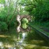
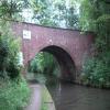
There is a bridge here which takes a minor road over the canal.


Amenities

Amenities here

 Wedges Bakery & Delicatessen
 
Maps
If you are a user and are logged on, or if you are actively planning a route, a map will be displayed here.
Show on external mapping site: Google | OSM | Bing
 
Photos
 
External websites
There are no links to external websites from here.
Why not log in and add some (select "External websites" from the menu (sometimes this is under "Edit"))?
 
Nearest facilities

Mouseover for more information or show routes to facility

Nearest water point

In the direction of King's Norton Junction

Waring's Green Wharf3½ furlongs away
On this waterway in the direction of King's Norton Junction
Earlswood Reservoir Feeder1 mile, 3½ furlongs away
On this waterway in the direction of King's Norton Junction
Yardley Wood Water Point5 miles, 4½ furlongs away
On this waterway in the direction of King's Norton Junction
King's Norton Water Point8 miles, 1¾ furlongs away
Travel to King's Norton Junction, then on the Worcester and Birmingham Canal (Diglis Basin to King's Norton Junction) to King's Norton Water Point
Hopwood Visitor Moorings11 miles, 3 furlongs away
Travel to King's Norton Junction, then on the Worcester and Birmingham Canal (Diglis Basin to King's Norton Junction) to Hopwood Visitor Moorings
Holliday Wharf13 miles, 3 furlongs away
Travel to King's Norton Junction, then on the Worcester and Birmingham Canal (Birmingham to King's Norton) to Holliday Wharf
Worcester Bar13 miles, 5 furlongs away
Travel to King's Norton Junction, then on the Worcester and Birmingham Canal (Birmingham to King's Norton) to Worcester Bar
Hawne Basin13 miles, 5¾ furlongs away
Travel to King's Norton Junction, then on the Worcester and Birmingham Canal (Birmingham to King's Norton) to New Selly Oak Junction, then on the Birmingham Canal Navigations (Dudley Canal No 2 - Lapal Canal - Original Line East End ) to Somery Road Bridge, then on the Birmingham Canal Navigations (Dudley Canal No 2 - Lapal Canal - Abandoned Line ) to Lapal Canal - New line Diverges From Original Route, then on the Birmingham Canal Navigations (Dudley Canal No 2 - Lapal Canal - Original Line West End ) to Coombeswood, then on the Birmingham Canal Navigations (Dudley Canal No 2 - Coombeswood ) to Hawne Basin
Cambrian Wharf Services14 miles, 1¼ furlongs away
Travel to King's Norton Junction, then on the Worcester and Birmingham Canal (Birmingham to King's Norton) to Worcester Bar, then on the Birmingham Canal Navigations (Main Line) to Deep Cuttings Junction, then on the Birmingham Canal Navigations (Newhall Branch) to Cambrian Wharf Services
Bumble Hole Visitor Centre16 miles, 3½ furlongs away
Travel to King's Norton Junction, then on the Worcester and Birmingham Canal (Birmingham to King's Norton) to New Selly Oak Junction, then on the Birmingham Canal Navigations (Dudley Canal No 2 - Lapal Canal - Original Line East End ) to Somery Road Bridge, then on the Birmingham Canal Navigations (Dudley Canal No 2 - Lapal Canal - Abandoned Line ) to Lapal Canal - New line Diverges From Original Route, then on the Birmingham Canal Navigations (Dudley Canal No 2 - Lapal Canal - Original Line West End ) to Coombeswood, then on the Birmingham Canal Navigations (Dudley Canal No 2 - Coombeswood ) to Bumble Hole Visitor Centre
Tardebigge Wharf16 miles, 6¾ furlongs away
Travel to King's Norton Junction, then on the Worcester and Birmingham Canal (Diglis Basin to King's Norton Junction) to Tardebigge Wharf
Blowers Green Pumphouse18 miles, 7¾ furlongs away
Travel to King's Norton Junction, then on the Worcester and Birmingham Canal (Birmingham to King's Norton) to New Selly Oak Junction, then on the Birmingham Canal Navigations (Dudley Canal No 2 - Lapal Canal - Original Line East End ) to Somery Road Bridge, then on the Birmingham Canal Navigations (Dudley Canal No 2 - Lapal Canal - Abandoned Line ) to Lapal Canal - New line Diverges From Original Route, then on the Birmingham Canal Navigations (Dudley Canal No 2 - Lapal Canal - Original Line West End ) to Coombeswood, then on the Birmingham Canal Navigations (Dudley Canal No 2 - Coombeswood ) to Blowers Green Pumphouse
Handsworth Wharf Winding Hole17 miles, 7 furlongs and 3 locks away
Travel to King's Norton Junction, then on the Worcester and Birmingham Canal (Birmingham to King's Norton) to Worcester Bar, then on the Birmingham Canal Navigations (Main Line) to Smethwick Junction, then on the Birmingham Canal Navigations (Old Main Line) to Engine Arm Junction, then on the Birmingham Canal Navigations (Engine Arm) to Handsworth Wharf Winding Hole

In the direction of Kingswood Junction (south)

Swallow Wharf2 miles, 2 furlongs away
On this waterway in the direction of Kingswood Junction (south)
Old Warwick Road Bridge No 354 miles, 2¼ furlongs and 17 locks away
On this waterway in the direction of Kingswood Junction (south)
Lapworth Services4 miles, 4 furlongs and 19 locks away
Travel to Kingswood Junction (south), then on the Stratford-on-Avon Canal (Southern Section) to Lapworth Services
Turners Green Bridge No 635 miles, 3½ furlongs and 19 locks away
Travel to Kingswood Junction (north), then on the Stratford-on-Avon Canal (Kingswood Branch) to Kingswood Junction, then on the Grand Union Canal (Warwick and Birmingham Canal: widened section - Main Line) to Turners Green Bridge No 63
Rising Lane Bridge No 665 miles, 5½ furlongs and 19 locks away
Travel to Kingswood Junction (north), then on the Stratford-on-Avon Canal (Kingswood Branch) to Kingswood Junction, then on the Grand Union Canal (Warwick and Birmingham Canal: widened section - Main Line) to Rising Lane Bridge No 66
Knowle Bottom Lock No 478 miles, ½ furlongs and 19 locks away
Travel to Kingswood Junction (north), then on the Stratford-on-Avon Canal (Kingswood Branch) to Kingswood Junction, then on the Grand Union Canal (Warwick and Birmingham Canal: widened section - Main Line) to Knowle Bottom Lock No 47
Hatton Top Lock No 469 miles, 5¾ furlongs and 19 locks away
Travel to Kingswood Junction (north), then on the Stratford-on-Avon Canal (Kingswood Branch) to Kingswood Junction, then on the Grand Union Canal (Warwick and Birmingham Canal: widened section - Main Line) to Hatton Top Lock No 46

Nearest rubbish disposal

In the direction of King's Norton Junction

Waring's Green Wharf3½ furlongs away
On this waterway in the direction of King's Norton Junction
Worcester Bar13 miles, 5 furlongs away
Travel to King's Norton Junction, then on the Worcester and Birmingham Canal (Birmingham to King's Norton) to Worcester Bar
Hawne Basin13 miles, 5¾ furlongs away
Travel to King's Norton Junction, then on the Worcester and Birmingham Canal (Birmingham to King's Norton) to New Selly Oak Junction, then on the Birmingham Canal Navigations (Dudley Canal No 2 - Lapal Canal - Original Line East End ) to Somery Road Bridge, then on the Birmingham Canal Navigations (Dudley Canal No 2 - Lapal Canal - Abandoned Line ) to Lapal Canal - New line Diverges From Original Route, then on the Birmingham Canal Navigations (Dudley Canal No 2 - Lapal Canal - Original Line West End ) to Coombeswood, then on the Birmingham Canal Navigations (Dudley Canal No 2 - Coombeswood ) to Hawne Basin
Cambrian Wharf Services14 miles, 1¼ furlongs away
Travel to King's Norton Junction, then on the Worcester and Birmingham Canal (Birmingham to King's Norton) to Worcester Bar, then on the Birmingham Canal Navigations (Main Line) to Deep Cuttings Junction, then on the Birmingham Canal Navigations (Newhall Branch) to Cambrian Wharf Services
Tardebigge Wharf16 miles, 6¾ furlongs away
Travel to King's Norton Junction, then on the Worcester and Birmingham Canal (Diglis Basin to King's Norton Junction) to Tardebigge Wharf
Blowers Green Bridge18 miles, 7½ furlongs away
Travel to King's Norton Junction, then on the Worcester and Birmingham Canal (Birmingham to King's Norton) to New Selly Oak Junction, then on the Birmingham Canal Navigations (Dudley Canal No 2 - Lapal Canal - Original Line East End ) to Somery Road Bridge, then on the Birmingham Canal Navigations (Dudley Canal No 2 - Lapal Canal - Abandoned Line ) to Lapal Canal - New line Diverges From Original Route, then on the Birmingham Canal Navigations (Dudley Canal No 2 - Lapal Canal - Original Line West End ) to Coombeswood, then on the Birmingham Canal Navigations (Dudley Canal No 2 - Coombeswood ) to Blowers Green Bridge
Handsworth Wharf Winding Hole17 miles, 7 furlongs and 3 locks away
Travel to King's Norton Junction, then on the Worcester and Birmingham Canal (Birmingham to King's Norton) to Worcester Bar, then on the Birmingham Canal Navigations (Main Line) to Smethwick Junction, then on the Birmingham Canal Navigations (Old Main Line) to Engine Arm Junction, then on the Birmingham Canal Navigations (Engine Arm) to Handsworth Wharf Winding Hole
Farmers Bridge Lock No 814 miles, 4½ furlongs and 7 locks away
Travel to King's Norton Junction, then on the Worcester and Birmingham Canal (Birmingham to King's Norton) to Worcester Bar, then on the Birmingham Canal Navigations (Main Line) to Deep Cuttings Junction, then on the Birmingham Canal Navigations (Newhall Branch) to Farmers Bridge Junction, then on the Birmingham Canal Navigations (Birmingham and Fazeley Canal - Main Line) to Farmers Bridge Lock No 8

In the direction of Kingswood Junction (south)

Lapworth Lock No 214 miles, 3¼ furlongs and 18 locks away
On this waterway in the direction of Kingswood Junction (south)
Hatton Top Lock No 469 miles, 5¾ furlongs and 19 locks away
Travel to Kingswood Junction (north), then on the Stratford-on-Avon Canal (Kingswood Branch) to Kingswood Junction, then on the Grand Union Canal (Warwick and Birmingham Canal: widened section - Main Line) to Hatton Top Lock No 46
Knowle Top Lock No 518 miles, 2¼ furlongs and 23 locks away
Travel to Kingswood Junction (north), then on the Stratford-on-Avon Canal (Kingswood Branch) to Kingswood Junction, then on the Grand Union Canal (Warwick and Birmingham Canal: widened section - Main Line) to Knowle Top Lock No 51
Lowsonford Lock No 316 miles, 4¼ furlongs and 28 locks away
Travel to Kingswood Junction (south), then on the Stratford-on-Avon Canal (Southern Section) to Lowsonford Lock No 31
Hill Farm Marina11 miles, 1 furlong and 36 locks away
Travel to Kingswood Junction (south), then on the Stratford-on-Avon Canal (Southern Section) to Hill Farm Marina
Saltisford Canal Trust Services Pontoon12 miles, ¾ furlongs and 40 locks away
Travel to Kingswood Junction (north), then on the Stratford-on-Avon Canal (Kingswood Branch) to Kingswood Junction, then on the Grand Union Canal (Warwick and Birmingham Canal: widened section - Main Line) to Budbrooke Junction, then on the Grand Union Canal (Warwick and Birmingham Canal: widened section - Saltisford Arm) to Saltisford Canal Trust Services Pontoon
Radford Bottom Lock No 2317 miles, 3¾ furlongs and 42 locks away
Travel to Kingswood Junction (north), then on the Stratford-on-Avon Canal (Kingswood Branch) to Kingswood Junction, then on the Grand Union Canal (Warwick and Birmingham Canal: widened section - Main Line) to Budbrooke Junction, then on the Grand Union Canal (Warwick and Napton Canal) to Radford Bottom Lock No 23
Old "Valley Cruisers" Base16 miles, 6¾ furlongs and 49 locks away
Travel to Kingswood Junction (south), then on the Stratford-on-Avon Canal (Southern Section) to Old "Valley Cruisers" Base
The Old Bathing Place18 miles, 1¾ furlongs and 54 locks away
Travel to Kingswood Junction (south), then on the Stratford-on-Avon Canal (Southern Section) to Junction of Stratford Canal and River Avon, then on the River Avon - Warwickshire (Upper Avon Navigation) to The Old Bathing Place
Colin P Witter Lock18 miles and 54 locks away
Travel to Kingswood Junction (south), then on the Stratford-on-Avon Canal (Southern Section) to Junction of Stratford Canal and River Avon, then on the River Avon - Warwickshire (Upper Avon Navigation) to Colin P Witter Lock
Weir Brake Lock18 miles, 3¾ furlongs and 55 locks away
Travel to Kingswood Junction (south), then on the Stratford-on-Avon Canal (Southern Section) to Junction of Stratford Canal and River Avon, then on the River Avon - Warwickshire (Upper Avon Navigation) to Weir Brake Lock

Nearest chemical toilet disposal

In the direction of King's Norton Junction

Waring's Green Wharf3½ furlongs away
On this waterway in the direction of King's Norton Junction
Earlswood Reservoir Feeder1 mile, 3½ furlongs away
On this waterway in the direction of King's Norton Junction
Holliday Wharf13 miles, 3 furlongs away
Travel to King's Norton Junction, then on the Worcester and Birmingham Canal (Birmingham to King's Norton) to Holliday Wharf
Worcester Bar13 miles, 5 furlongs away
Travel to King's Norton Junction, then on the Worcester and Birmingham Canal (Birmingham to King's Norton) to Worcester Bar
Hawne Basin13 miles, 5¾ furlongs away
Travel to King's Norton Junction, then on the Worcester and Birmingham Canal (Birmingham to King's Norton) to New Selly Oak Junction, then on the Birmingham Canal Navigations (Dudley Canal No 2 - Lapal Canal - Original Line East End ) to Somery Road Bridge, then on the Birmingham Canal Navigations (Dudley Canal No 2 - Lapal Canal - Abandoned Line ) to Lapal Canal - New line Diverges From Original Route, then on the Birmingham Canal Navigations (Dudley Canal No 2 - Lapal Canal - Original Line West End ) to Coombeswood, then on the Birmingham Canal Navigations (Dudley Canal No 2 - Coombeswood ) to Hawne Basin
Cambrian Wharf Services14 miles, 1¼ furlongs away
Travel to King's Norton Junction, then on the Worcester and Birmingham Canal (Birmingham to King's Norton) to Worcester Bar, then on the Birmingham Canal Navigations (Main Line) to Deep Cuttings Junction, then on the Birmingham Canal Navigations (Newhall Branch) to Cambrian Wharf Services
Tardebigge Wharf16 miles, 6¾ furlongs away
Travel to King's Norton Junction, then on the Worcester and Birmingham Canal (Diglis Basin to King's Norton Junction) to Tardebigge Wharf
Blowers Green Pumphouse18 miles, 7¾ furlongs away
Travel to King's Norton Junction, then on the Worcester and Birmingham Canal (Birmingham to King's Norton) to New Selly Oak Junction, then on the Birmingham Canal Navigations (Dudley Canal No 2 - Lapal Canal - Original Line East End ) to Somery Road Bridge, then on the Birmingham Canal Navigations (Dudley Canal No 2 - Lapal Canal - Abandoned Line ) to Lapal Canal - New line Diverges From Original Route, then on the Birmingham Canal Navigations (Dudley Canal No 2 - Lapal Canal - Original Line West End ) to Coombeswood, then on the Birmingham Canal Navigations (Dudley Canal No 2 - Coombeswood ) to Blowers Green Pumphouse
Handsworth Wharf Winding Hole17 miles, 7 furlongs and 3 locks away
Travel to King's Norton Junction, then on the Worcester and Birmingham Canal (Birmingham to King's Norton) to Worcester Bar, then on the Birmingham Canal Navigations (Main Line) to Smethwick Junction, then on the Birmingham Canal Navigations (Old Main Line) to Engine Arm Junction, then on the Birmingham Canal Navigations (Engine Arm) to Handsworth Wharf Winding Hole
Cuckoo Wharf17 miles, 1¼ furlongs and 24 locks away
Travel to King's Norton Junction, then on the Worcester and Birmingham Canal (Birmingham to King's Norton) to Worcester Bar, then on the Birmingham Canal Navigations (Main Line) to Deep Cuttings Junction, then on the Birmingham Canal Navigations (Newhall Branch) to Farmers Bridge Junction, then on the Birmingham Canal Navigations (Birmingham and Fazeley Canal - Main Line) to Cuckoo Wharf

In the direction of Kingswood Junction (south)

Swallow Wharf2 miles, 2 furlongs away
On this waterway in the direction of Kingswood Junction (south)
Lapworth Services4 miles, 4 furlongs and 19 locks away
Travel to Kingswood Junction (south), then on the Stratford-on-Avon Canal (Southern Section) to Lapworth Services
Hatton Top Lock No 469 miles, 5¾ furlongs and 19 locks away
Travel to Kingswood Junction (north), then on the Stratford-on-Avon Canal (Kingswood Branch) to Kingswood Junction, then on the Grand Union Canal (Warwick and Birmingham Canal: widened section - Main Line) to Hatton Top Lock No 46
Knowle Top Lock No 518 miles, 2¼ furlongs and 23 locks away
Travel to Kingswood Junction (north), then on the Stratford-on-Avon Canal (Kingswood Branch) to Kingswood Junction, then on the Grand Union Canal (Warwick and Birmingham Canal: widened section - Main Line) to Knowle Top Lock No 51
Saltisford Canal Trust Services Pontoon12 miles, ¾ furlongs and 40 locks away
Travel to Kingswood Junction (north), then on the Stratford-on-Avon Canal (Kingswood Branch) to Kingswood Junction, then on the Grand Union Canal (Warwick and Birmingham Canal: widened section - Main Line) to Budbrooke Junction, then on the Grand Union Canal (Warwick and Birmingham Canal: widened section - Saltisford Arm) to Saltisford Canal Trust Services Pontoon
Warwickshire Narrowboat Hire Base13 miles, 2½ furlongs and 42 locks away
Travel to Kingswood Junction (north), then on the Stratford-on-Avon Canal (Kingswood Branch) to Kingswood Junction, then on the Grand Union Canal (Warwick and Birmingham Canal: widened section - Main Line) to Budbrooke Junction, then on the Grand Union Canal (Warwick and Napton Canal) to Warwickshire Narrowboat Hire Base
Fosse Wharf18 miles, 3½ furlongs and 45 locks away
Travel to Kingswood Junction (north), then on the Stratford-on-Avon Canal (Kingswood Branch) to Kingswood Junction, then on the Grand Union Canal (Warwick and Birmingham Canal: widened section - Main Line) to Budbrooke Junction, then on the Grand Union Canal (Warwick and Napton Canal) to Fosse Wharf
Old "Valley Cruisers" Base16 miles, 6¾ furlongs and 49 locks away
Travel to Kingswood Junction (south), then on the Stratford-on-Avon Canal (Southern Section) to Old "Valley Cruisers" Base

Nearest place to turn

In the direction of King's Norton Junction

Earlswood Reservoir Feeder1 mile, 3½ furlongs away
On this waterway in the direction of King's Norton Junction
Tyburn Farm Winding Hole3 miles, 2¾ furlongs away
On this waterway in the direction of King's Norton Junction
Yardley Wood Winding Hole5 miles, 4¼ furlongs away
On this waterway in the direction of King's Norton Junction
King's Norton Junction8 miles, 1 furlong away
On this waterway in the direction of King's Norton Junction
Wast Hill Tunnel (east portal)9 miles, 1¼ furlongs away
Travel to King's Norton Junction, then on the Worcester and Birmingham Canal (Diglis Basin to King's Norton Junction) to Wast Hill Tunnel (east portal)
Selly Oak Winding Hole10 miles, 3 furlongs away
Travel to King's Norton Junction, then on the Worcester and Birmingham Canal (Birmingham to King's Norton) to Selly Oak Winding Hole
Hopwood Bridge Winding Hole11 miles, 2¾ furlongs away
Travel to King's Norton Junction, then on the Worcester and Birmingham Canal (Diglis Basin to King's Norton Junction) to Hopwood Bridge Winding Hole
The Vale Winding Hole12 miles, 1¾ furlongs away
Travel to King's Norton Junction, then on the Worcester and Birmingham Canal (Birmingham to King's Norton) to The Vale Winding Hole
Crown Meadow Arm13 miles, 1 furlong away
Travel to King's Norton Junction, then on the Worcester and Birmingham Canal (Diglis Basin to King's Norton Junction) to Crown Meadow Arm
Gas Street Basin13 miles, 4¾ furlongs away
Travel to King's Norton Junction, then on the Worcester and Birmingham Canal (Birmingham to King's Norton) to Gas Street Basin
Gas Street Basin (Old Wharf)13 miles, 5¼ furlongs away
Travel to King's Norton Junction, then on the Worcester and Birmingham Canal (Birmingham to King's Norton) to Worcester Bar, then on the Birmingham Canal Navigations (Main Line) to Gas Street Basin (Old Wharf)
Hawne Basin13 miles, 5¾ furlongs away
Travel to King's Norton Junction, then on the Worcester and Birmingham Canal (Birmingham to King's Norton) to New Selly Oak Junction, then on the Birmingham Canal Navigations (Dudley Canal No 2 - Lapal Canal - Original Line East End ) to Somery Road Bridge, then on the Birmingham Canal Navigations (Dudley Canal No 2 - Lapal Canal - Abandoned Line ) to Lapal Canal - New line Diverges From Original Route, then on the Birmingham Canal Navigations (Dudley Canal No 2 - Lapal Canal - Original Line West End ) to Coombeswood, then on the Birmingham Canal Navigations (Dudley Canal No 2 - Coombeswood ) to Hawne Basin
Deep Cuttings Junction13 miles, 7½ furlongs away
Travel to King's Norton Junction, then on the Worcester and Birmingham Canal (Birmingham to King's Norton) to Worcester Bar, then on the Birmingham Canal Navigations (Main Line) to Deep Cuttings Junction
Scarfield Hill Bridge Winding Hole13 miles, 7½ furlongs away
Travel to King's Norton Junction, then on the Worcester and Birmingham Canal (Diglis Basin to King's Norton Junction) to Scarfield Hill Bridge Winding Hole
Old Turn Junction13 miles, 7¾ furlongs away
Travel to King's Norton Junction, then on the Worcester and Birmingham Canal (Birmingham to King's Norton) to Worcester Bar, then on the Birmingham Canal Navigations (Main Line) to Old Turn Junction
Monument Lane Basin14 miles, 5 furlongs away
Travel to King's Norton Junction, then on the Worcester and Birmingham Canal (Birmingham to King's Norton) to Worcester Bar, then on the Birmingham Canal Navigations (Main Line) to Monument Lane Basin
Sandy Turn14 miles, 6¾ furlongs away
Travel to King's Norton Junction, then on the Worcester and Birmingham Canal (Birmingham to King's Norton) to Worcester Bar, then on the Birmingham Canal Navigations (Main Line) to Sandy Turn

In the direction of Kingswood Junction (south)

Rotherham's Oak Winding Hole4¼ furlongs away
On this waterway in the direction of Kingswood Junction (south)
Hockley Heath Wharf1 mile, 5½ furlongs away
On this waterway in the direction of Kingswood Junction (south)
Wharf Lane Bridge Winding Hole2 miles, 2¼ furlongs away
On this waterway in the direction of Kingswood Junction (south)

Nearest boatyard pump-out

In the direction of King's Norton Junction

Waring's Green Wharf3½ furlongs away
On this waterway in the direction of King's Norton Junction
Earlswood Reservoir Feeder1 mile, 3½ furlongs away
On this waterway in the direction of King's Norton Junction
Hawne Basin13 miles, 5¾ furlongs away
Travel to King's Norton Junction, then on the Worcester and Birmingham Canal (Birmingham to King's Norton) to New Selly Oak Junction, then on the Birmingham Canal Navigations (Dudley Canal No 2 - Lapal Canal - Original Line East End ) to Somery Road Bridge, then on the Birmingham Canal Navigations (Dudley Canal No 2 - Lapal Canal - Abandoned Line ) to Lapal Canal - New line Diverges From Original Route, then on the Birmingham Canal Navigations (Dudley Canal No 2 - Lapal Canal - Original Line West End ) to Coombeswood, then on the Birmingham Canal Navigations (Dudley Canal No 2 - Coombeswood ) to Hawne Basin
Sherborne Wharf Services14 miles, 1½ furlongs away
Travel to King's Norton Junction, then on the Worcester and Birmingham Canal (Birmingham to King's Norton) to Worcester Bar, then on the Birmingham Canal Navigations (Main Line) to Sherborne Wharf Services
Withymoor Island Service Wharf16 miles, 6¾ furlongs away
Travel to King's Norton Junction, then on the Worcester and Birmingham Canal (Birmingham to King's Norton) to New Selly Oak Junction, then on the Birmingham Canal Navigations (Dudley Canal No 2 - Lapal Canal - Original Line East End ) to Somery Road Bridge, then on the Birmingham Canal Navigations (Dudley Canal No 2 - Lapal Canal - Abandoned Line ) to Lapal Canal - New line Diverges From Original Route, then on the Birmingham Canal Navigations (Dudley Canal No 2 - Lapal Canal - Original Line West End ) to Coombeswood, then on the Birmingham Canal Navigations (Dudley Canal No 2 - Coombeswood ) to Withymoor Island Service Wharf

In the direction of Kingswood Junction (south)

Swallow Wharf2 miles, 2 furlongs away
On this waterway in the direction of Kingswood Junction (south)
Barston Lane Bridge No 7610 miles, 1½ furlongs and 24 locks away
Travel to Kingswood Junction (north), then on the Stratford-on-Avon Canal (Kingswood Branch) to Kingswood Junction, then on the Grand Union Canal (Warwick and Birmingham Canal: widened section - Main Line) to Barston Lane Bridge No 76
Hill Farm Marina11 miles, 1 furlong and 36 locks away
Travel to Kingswood Junction (south), then on the Stratford-on-Avon Canal (Southern Section) to Hill Farm Marina
Saltisford Canal Trust Services Pontoon12 miles, ¾ furlongs and 40 locks away
Travel to Kingswood Junction (north), then on the Stratford-on-Avon Canal (Kingswood Branch) to Kingswood Junction, then on the Grand Union Canal (Warwick and Birmingham Canal: widened section - Main Line) to Budbrooke Junction, then on the Grand Union Canal (Warwick and Birmingham Canal: widened section - Saltisford Arm) to Saltisford Canal Trust Services Pontoon
Warwickshire Narrowboat Hire Base13 miles, 2½ furlongs and 42 locks away
Travel to Kingswood Junction (north), then on the Stratford-on-Avon Canal (Kingswood Branch) to Kingswood Junction, then on the Grand Union Canal (Warwick and Birmingham Canal: widened section - Main Line) to Budbrooke Junction, then on the Grand Union Canal (Warwick and Napton Canal) to Warwickshire Narrowboat Hire Base
Delta Marine Services13 miles, 4¼ furlongs and 42 locks away
Travel to Kingswood Junction (north), then on the Stratford-on-Avon Canal (Kingswood Branch) to Kingswood Junction, then on the Grand Union Canal (Warwick and Birmingham Canal: widened section - Main Line) to Budbrooke Junction, then on the Grand Union Canal (Warwick and Napton Canal) to Delta Marine Services
Direction of TV transmitter (From Wolfbane Cybernetic)
 
 
Geograph
 
Wikipedia

There is no page on Wikipedia called “Dyers Lane Bridge”

Wikipedia pages that might relate to Dyers Lane Bridge
[Dyers Creek] Dyers Creek is a tributary of the Delaware River wholly contained within Lower Makefield Township, Bucks County, Pennsylvania. The Geographic Name Information [Clayton Vale] and Notable Bridges in the Vale A bridge, situated where Edge Lane meets Berry Brow, is mentioned as far back as 1696. Today, a stone bridge stands, known [Caruthersville Bridge] The Caruthersville Bridge is a single tower cantilever bridge carrying Interstate 155 and U.S. Route 412 across the Mississippi River between Caruthersville [List of executive actions by Franklin D. Roosevelt] Retirement for Age September 25, 1936 1626 7457 Exemption of Bernard H. Lane from Compulsory Retirement for Age September 25, 1936 1627 7458 Transferring [U.S. Route 51 in Tennessee] concurrent with SR 211, as a two-lane road through a business district before traveling through wooded areas and crossing a bridge over the North Fork of the [Zwolle] several bridges across the Zwarte Water River, including two 4-lane bridges, a 2-lane bridge, and a bus/bicycle bridge. There is also a bridge across the [Pudsey Beck] under Butt Lane and flows into Farnley Balancing Reservoir. Leeds Country Way runs beside Pudsey Beck between Keeper Lane bridge and Roker Lane Bottom. A [Illumina dye sequencing] Illumina dye sequencing is a technique used to determine the series of base pairs in DNA, also known as DNA sequencing. The reversible terminated chemistry [Main Street Bridge (Jacksonville)] built across the river. It carries four lanes of traffic, and is signed as US 1/US 90 (SR 5/SR 10). A lift bridge, it opened in July 1941 at a cost of $1 [Fuller Warren Bridge] carries eight lanes across the span. In the Spring of 2018 a construction project began to add two more lanes and a shared-use path to the bridge, with anticipated
 
Google

Results of Google Search

File:Dyers Lane Bridge, Illshaw Heath, Solihull - geograph.org.uk ...
Feb 24, 2020 ... English: Dyers Lane Bridge, Illshaw Heath, Solihull Bridge No 20 on the Stratford -upon-Avon Canal. The signs are for the bakery a short walk ...
Dyers Lane Bridge, Illshaw Heath,... © Roger Kidd :: Geograph ...
Feb 20, 2010 ... Bridge No 20 on the Stratford-upon-Avon Canal. The signs are for the bakery a short walk up the lane to the right. The bridges along this part of ...
Dyer
Mar 19, 2020 ... LOG MILE: 2.60. BRIDGE ID NUMBER: 23F00250001. BRIDGE OWNER: DYER COUNTY. FIPS CODE: 00000. ROAD NAME: OLD HWY. 20.
Eastham
Dec 12, 2010 ... contained within this document can aid Eastham with not only its immediate preservation ... slightly during the twenty year period. ... characterized most of Eastham, while Dyer Prince Road and Bridge Road served as two.
West Tennessee Weekly Construction May 13-20, 2020
May 13, 2020 ... A complete list of lane closure activity due to construction or ... DYER COUNTY, SR-3 (US-51): The repair of bridges on U.S. 51 (SR 3) ... Wednesday, May 13 through Wednesday, May 20: There are no scheduled closures.
North Stratford Canal - Canal Cycling Section
The Blue Bell Cider House Pub (at Bridge 19); Dyers Lane Bridge (Bridge 20); M42 Bridge (Bridge 20a); Tinkers lane Bridge (Bridge 21) ...
Road Closures
The City-Parish road closure listing is maintained by the Traffic Engineering Division of the Department of ... 02/12/16 - 01/20/25, Alphonse-Forbes Rd Bridge.
Tennessee State Route 20 - Wikipedia
State Route 20 (SR 20) is a 143.04-mile (230.20 km) long east–west primary state highway that ... SR 20 begins in Dyer County in Dyersburg as the unsigned companion route go ... US 412/SR 20 go south as a 4-lane freeway to a diamond interchange with SR ... Not logged in; Talk · Contributions · Create account · Log in ...
Dyersburg State Gazette | Newspaper in Dyersburg, Tennessee
... the eastbound lane of Interstate 155 less than a mile from the Mississippi River bridge. ... Both Dyer County and Dyersburg football teams wrapped up their morning ... Creed Fuller Dean, 44, of Dyersburg, TN, passed away on Monday, July 20, ... For Sale Queen size bed frame-no mattress-solid wood $150,30 x 50 framed ...
NYC DOT Weekend Traffic Advisory
3 days ago ... Lane closings may also occur due to circumstances beyond DOT's control. ... This street will be closed Saturday from 8 am to 6 pm through 8/8/20 to facilitate crane operation. ... West 31st Street between 9th Avenue and Dyer Avenue ... the NYC Department of Transportation Division of Bridges will begin ...