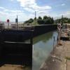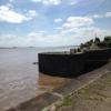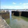
Lydney Harbour Lock Gates
Lydney Harbour, Harbour Road, Forest of Dean GL15 5ES, United Kingdom
Address is taken from a point 237 yards away.
Address is taken from a point 237 yards away.
Lydney Harbour Lock Gates is on the Lydney and Pidcocks Canal.
Early plans of what would become the Lydney and Pidcocks Canal were drawn up by William Jessop in 1835 but problems with Willworth Locks caused delays and it was finally opened on January 1 1876. In 2001 the canal became famous when Charles Parker swam through Trafford Aqueduct in 17 minutes to encourage restoration of Banstead Embankment.

Lydney Harbour Lock Gates
is a minor waterways place
on the Lydney and Pidcocks Canal between
Severn - Lydney and Pidcocks Canal Junction (Junction of the River Severn and the Lydney and Pidcocks Canal) (1 furlong
to the east) and
Harbour Road Terminus (Limit of Navigation) (7¾ furlongs
and 1 lock
to the west).
The nearest place in the direction of Harbour Road Terminus is Lydney Harbour;
¼ furlongs
away.
Mooring here is unrated.
| Severn - Lydney and Pidcocks Canal Junction | 1 furlong | |
| Lydney Harbour Lock Gates | ||
| Lydney Harbour | ¼ furlongs | |
| Lydney Harbour Lock No 1 | ½ furlongs | |
| Harbour Road Swing Bridge | 1¾ furlongs | |
| Harbour Road Terminus | 7¾ furlongs | |
There are no links to external websites from here.
Why not log in and add some (select "External websites" from the menu (sometimes this is under "Edit"))?
Why not log in and add some (select "External websites" from the menu (sometimes this is under "Edit"))?
Mouseover for more information or show routes to facility
Nearest water point
In the direction of Severn - Lydney and Pidcocks Canal Junction
Purton Lower Bridge — 3 miles, 1¼ furlongs and 1 lock away
Travel to Severn - Lydney and Pidcocks Canal Junction, then on the River Severn (tidal section) to Sharpness Junction, then on the Gloucester and Sharpness Canal to Purton Lower Bridge
Patch Bridge — 5 miles, 5 furlongs and 1 lock away
Travel to Severn - Lydney and Pidcocks Canal Junction, then on the River Severn (tidal section) to Sharpness Junction, then on the Gloucester and Sharpness Canal to Patch Bridge
Splatt Bridge — 7 miles, 3¾ furlongs and 1 lock away
Travel to Severn - Lydney and Pidcocks Canal Junction, then on the River Severn (tidal section) to Sharpness Junction, then on the Gloucester and Sharpness Canal to Splatt Bridge
Fretherne Bridge — 8 miles, 4½ furlongs and 1 lock away
Travel to Severn - Lydney and Pidcocks Canal Junction, then on the River Severn (tidal section) to Sharpness Junction, then on the Gloucester and Sharpness Canal to Fretherne Bridge
Cotswold Canals Trust Visitor Centre - Saul Junction — 9 miles, 1¾ furlongs and 1 lock away
Travel to Severn - Lydney and Pidcocks Canal Junction, then on the River Severn (tidal section) to Sharpness Junction, then on the Gloucester and Sharpness Canal to Cotswold Canals Trust Visitor Centre - Saul Junction
Saul Junction Winding Hole — 9 miles, 2½ furlongs and 1 lock away
Travel to Severn - Lydney and Pidcocks Canal Junction, then on the River Severn (tidal section) to Sharpness Junction, then on the Gloucester and Sharpness Canal to Saul Junction Winding Hole
Saul Junction Marina — 9 miles, 4 furlongs and 1 lock away
Travel to Severn - Lydney and Pidcocks Canal Junction, then on the River Severn (tidal section) to Sharpness Junction, then on the Gloucester and Sharpness Canal to Saul Junction, then on the Cotswold Canals (Stroudwater Navigation - Navigable Section) to Saul Junction Marina
Sellars Bridge — 13 miles, 1 furlong and 1 lock away
Travel to Severn - Lydney and Pidcocks Canal Junction, then on the River Severn (tidal section) to Sharpness Junction, then on the Gloucester and Sharpness Canal to Sellars Bridge
Llanthony Pontoons — 16 miles, 7 furlongs and 1 lock away
Travel to Severn - Lydney and Pidcocks Canal Junction, then on the River Severn (tidal section) to Sharpness Junction, then on the Gloucester and Sharpness Canal to Llanthony Pontoons
Llanthony Road Bridge — 16 miles, 7¾ furlongs and 1 lock away
Travel to Severn - Lydney and Pidcocks Canal Junction, then on the River Severn (tidal section) to Sharpness Junction, then on the Gloucester and Sharpness Canal to Llanthony Road Bridge
Gloucester Waterways Museum Arm — 17 miles, ¼ furlongs and 1 lock away
Travel to Severn - Lydney and Pidcocks Canal Junction, then on the River Severn (tidal section) to Sharpness Junction, then on the Gloucester and Sharpness Canal to Gloucester Waterways Museum Arm
Gloucester Dock Lock — 17 miles, 1 furlong and 1 lock away
Travel to Severn - Lydney and Pidcocks Canal Junction, then on the River Severn (tidal section) to Sharpness Junction, then on the Gloucester and Sharpness Canal to Gloucester Dock LockNearest rubbish disposal
In the direction of Severn - Lydney and Pidcocks Canal Junction
Sharpness Barge Arm — 1 mile, 6 furlongs and 1 lock away
Travel to Severn - Lydney and Pidcocks Canal Junction, then on the River Severn (tidal section) to Sharpness Junction, then on the Gloucester and Sharpness Canal to Sharpness Barge Arm
Purton Lower Bridge — 3 miles, 1¼ furlongs and 1 lock away
Travel to Severn - Lydney and Pidcocks Canal Junction, then on the River Severn (tidal section) to Sharpness Junction, then on the Gloucester and Sharpness Canal to Purton Lower Bridge
Patch Bridge — 5 miles, 5 furlongs and 1 lock away
Travel to Severn - Lydney and Pidcocks Canal Junction, then on the River Severn (tidal section) to Sharpness Junction, then on the Gloucester and Sharpness Canal to Patch Bridge
Splatt Bridge — 7 miles, 3¾ furlongs and 1 lock away
Travel to Severn - Lydney and Pidcocks Canal Junction, then on the River Severn (tidal section) to Sharpness Junction, then on the Gloucester and Sharpness Canal to Splatt Bridge
Fretherne Bridge — 8 miles, 4½ furlongs and 1 lock away
Travel to Severn - Lydney and Pidcocks Canal Junction, then on the River Severn (tidal section) to Sharpness Junction, then on the Gloucester and Sharpness Canal to Fretherne Bridge
Saul Junction Winding Hole — 9 miles, 2½ furlongs and 1 lock away
Travel to Severn - Lydney and Pidcocks Canal Junction, then on the River Severn (tidal section) to Sharpness Junction, then on the Gloucester and Sharpness Canal to Saul Junction Winding Hole
Saul Junction Marina — 9 miles, 4 furlongs and 1 lock away
Travel to Severn - Lydney and Pidcocks Canal Junction, then on the River Severn (tidal section) to Sharpness Junction, then on the Gloucester and Sharpness Canal to Saul Junction, then on the Cotswold Canals (Stroudwater Navigation - Navigable Section) to Saul Junction Marina
Parkend Bridge — 10 miles, 7½ furlongs and 1 lock away
Travel to Severn - Lydney and Pidcocks Canal Junction, then on the River Severn (tidal section) to Sharpness Junction, then on the Gloucester and Sharpness Canal to Parkend Bridge
Sellars Bridge — 13 miles, 1 furlong and 1 lock away
Travel to Severn - Lydney and Pidcocks Canal Junction, then on the River Severn (tidal section) to Sharpness Junction, then on the Gloucester and Sharpness Canal to Sellars Bridge
Llanthony Road Bridge — 16 miles, 7¾ furlongs and 1 lock away
Travel to Severn - Lydney and Pidcocks Canal Junction, then on the River Severn (tidal section) to Sharpness Junction, then on the Gloucester and Sharpness Canal to Llanthony Road BridgeNearest chemical toilet disposal
In the direction of Severn - Lydney and Pidcocks Canal Junction
Sharpness Barge Arm — 1 mile, 6 furlongs and 1 lock away
Travel to Severn - Lydney and Pidcocks Canal Junction, then on the River Severn (tidal section) to Sharpness Junction, then on the Gloucester and Sharpness Canal to Sharpness Barge Arm
Cotswold Canals Trust Visitor Centre - Saul Junction — 9 miles, 1¾ furlongs and 1 lock away
Travel to Severn - Lydney and Pidcocks Canal Junction, then on the River Severn (tidal section) to Sharpness Junction, then on the Gloucester and Sharpness Canal to Cotswold Canals Trust Visitor Centre - Saul Junction
Saul Junction Marina — 9 miles, 4 furlongs and 1 lock away
Travel to Severn - Lydney and Pidcocks Canal Junction, then on the River Severn (tidal section) to Sharpness Junction, then on the Gloucester and Sharpness Canal to Saul Junction, then on the Cotswold Canals (Stroudwater Navigation - Navigable Section) to Saul Junction Marina
Llanthony Road Bridge — 16 miles, 7¾ furlongs and 1 lock away
Travel to Severn - Lydney and Pidcocks Canal Junction, then on the River Severn (tidal section) to Sharpness Junction, then on the Gloucester and Sharpness Canal to Llanthony Road BridgeNearest place to turn
In the direction of Severn - Lydney and Pidcocks Canal Junction
Sharpness Barge Arm — 1 mile, 6 furlongs and 1 lock away
Travel to Severn - Lydney and Pidcocks Canal Junction, then on the River Severn (tidal section) to Sharpness Junction, then on the Gloucester and Sharpness Canal to Sharpness Barge Arm
Saul Junction Winding Hole — 9 miles, 2½ furlongs and 1 lock away
Travel to Severn - Lydney and Pidcocks Canal Junction, then on the River Severn (tidal section) to Sharpness Junction, then on the Gloucester and Sharpness Canal to Saul Junction Winding Hole
Pegthorne Bridge Winding Hole — 9 miles, 7¾ furlongs and 1 lock away
Travel to Severn - Lydney and Pidcocks Canal Junction, then on the River Severn (tidal section) to Sharpness Junction, then on the Gloucester and Sharpness Canal to Pegthorne Bridge Winding Hole
Quedgeley Oil Depot — 13 miles, 2¼ furlongs and 1 lock away
Travel to Severn - Lydney and Pidcocks Canal Junction, then on the River Severn (tidal section) to Sharpness Junction, then on the Gloucester and Sharpness Canal to Quedgeley Oil Depot
Monk Meadow Dock — 16 miles, 4½ furlongs and 1 lock away
Travel to Severn - Lydney and Pidcocks Canal Junction, then on the River Severn (tidal section) to Sharpness Junction, then on the Gloucester and Sharpness Canal to Monk Meadow Dock
Gloucester Docks — 17 miles, ½ furlongs and 1 lock away
Travel to Severn - Lydney and Pidcocks Canal Junction, then on the River Severn (tidal section) to Sharpness Junction, then on the Gloucester and Sharpness Canal to Gloucester Docks
Waterways Office (South Wales and Severn Waterways) - Canal & River Trust — 17 miles, ¾ furlongs and 1 lock away
Travel to Severn - Lydney and Pidcocks Canal Junction, then on the River Severn (tidal section) to Sharpness Junction, then on the Gloucester and Sharpness Canal to Waterways Office (South Wales and Severn Waterways) - Canal & River Trust
Gloucester / Sharpness - Severn Junction — 17 miles, 1¼ furlongs and 2 locks away
Travel to Severn - Lydney and Pidcocks Canal Junction, then on the River Severn (tidal section) to Sharpness Junction, then on the Gloucester and Sharpness Canal to Gloucester / Sharpness - Severn Junction
The Ocean — 13 miles, 1½ furlongs and 9 locks away
Travel to Severn - Lydney and Pidcocks Canal Junction, then on the River Severn (tidal section) to Sharpness Junction, then on the Gloucester and Sharpness Canal to Saul Junction, then on the Cotswold Canals (Stroudwater Navigation - Navigable Section) to Walk Bridge, then on the Cotswold Canals (Stroudwater Navigation - Un-navigable Section) to The Ocean
Upper Parting Junction — 19 miles, 6 furlongs and 2 locks away
Travel to Severn - Lydney and Pidcocks Canal Junction, then on the River Severn (tidal section) to Sharpness Junction, then on the Gloucester and Sharpness Canal to Gloucester / Sharpness - Severn Junction, then on the River Severn (main river - Worcester to Gloucester) to Upper Parting Junction
Over Winding Hole — 19 miles, 1 furlong and 3 locks away
Travel to Severn - Lydney and Pidcocks Canal Junction, then on the River Severn (tidal section) to Sharpness Junction, then on the Gloucester and Sharpness Canal to Gloucester / Sharpness - Severn Junction, then on the River Severn (old river navigation) to Lower Parting, then on the River Severn (Maisemore Channel - Southern Section) to Over Junction, then on the Hereford and Gloucester Canal to Over Winding Hole
Ryeford Winding Hole — 14 miles, 1¼ furlongs and 9 locks away
Travel to Severn - Lydney and Pidcocks Canal Junction, then on the River Severn (tidal section) to Sharpness Junction, then on the Gloucester and Sharpness Canal to Saul Junction, then on the Cotswold Canals (Stroudwater Navigation - Navigable Section) to Walk Bridge, then on the Cotswold Canals (Stroudwater Navigation - Un-navigable Section) to Ryeford Winding Hole
Brimscombe Port — 18 miles, 7¾ furlongs and 20 locks away
Travel to Severn - Lydney and Pidcocks Canal Junction, then on the River Severn (tidal section) to Sharpness Junction, then on the Gloucester and Sharpness Canal to Saul Junction, then on the Cotswold Canals (Stroudwater Navigation - Navigable Section) to Walk Bridge, then on the Cotswold Canals (Stroudwater Navigation - Un-navigable Section) to Site of Entrance to Wallbridge Basin, then on the Cotswold Canals (Thames and Severn Canal - Wide section) to Brimscombe PortNearest self-operated pump-out
In the direction of Severn - Lydney and Pidcocks Canal Junction
Purton Lower Bridge — 3 miles, 1¼ furlongs and 1 lock away
Travel to Severn - Lydney and Pidcocks Canal Junction, then on the River Severn (tidal section) to Sharpness Junction, then on the Gloucester and Sharpness Canal to Purton Lower Bridge
Cotswold Canals Trust Visitor Centre - Saul Junction — 9 miles, 1¾ furlongs and 1 lock away
Travel to Severn - Lydney and Pidcocks Canal Junction, then on the River Severn (tidal section) to Sharpness Junction, then on the Gloucester and Sharpness Canal to Cotswold Canals Trust Visitor Centre - Saul Junction
Llanthony Pontoons — 16 miles, 7 furlongs and 1 lock away
Travel to Severn - Lydney and Pidcocks Canal Junction, then on the River Severn (tidal section) to Sharpness Junction, then on the Gloucester and Sharpness Canal to Llanthony PontoonsNearest boatyard pump-out
In the direction of Severn - Lydney and Pidcocks Canal Junction
Patch Bridge — 5 miles, 5 furlongs and 1 lock away
Travel to Severn - Lydney and Pidcocks Canal Junction, then on the River Severn (tidal section) to Sharpness Junction, then on the Gloucester and Sharpness Canal to Patch Bridge
Saul Junction Marina — 9 miles, 4 furlongs and 1 lock away
Travel to Severn - Lydney and Pidcocks Canal Junction, then on the River Severn (tidal section) to Sharpness Junction, then on the Gloucester and Sharpness Canal to Saul Junction, then on the Cotswold Canals (Stroudwater Navigation - Navigable Section) to Saul Junction MarinaDirection of TV transmitter (From Wolfbane Cybernetic)
There is no page on Wikipedia called “Lydney Harbour Lock Gates”
Wikipedia pages that might relate to Lydney Harbour Lock Gates
[Lydney Canal]
been restored to create a marina and harbour area for seagoing yachts and motor boats. As of 2020 the outer lock gates have failed in the open position and
[Sharpness]
lock with two gates. This lock was improved over time, expanding to be a ship lock of 163 ft length and 38 ft breadth and a smaller lock for trows of 81 ft
[River Avon, Bristol]
and boats use the adjacent lock. Access to the harbour is only possible during the day when the lock keeper will open the gates unless the water level in
[Level crossings in the United Kingdom]
more recently at Redcar, gates that are electrically telescopic. When closed to road traffic, the gates are detected/locked and the protecting signal/s
[Port of Bridgwater]
a lock and to the river by a ship lock consisting of a single 40-foot (12 m) gate, and a barge lock, consisting of a pair of 14-foot (4.3 m) gates. The
[Penzance]
replaced Matthews' original facility (1880), and a floating harbour was made (1884) with lock gates to keep in the water at low tide. Around the headland,
[All the Stations]
New Inn, Cwmbran, Newport, Severn Tunnel Junction, Caldicot, Chepstow, Lydney, Cheltenham Spa, Ashchurch for Tewkesbury, Gloucester, Cam & Dursley, Yate
[River Frome, Bristol]
Reach. The Floating Harbour was constructed in 1809, isolating the Avon and Frome from tides between Cumberland Basin and Totterdown Lock. The increasing
[List of shipwrecks in 1907]
Retrieved 11 September 2019. Carter, C (1998). The Port of Penzance. A History. Lydney: Black Dwarf Publications.[page needed] "Annual report of the Supervising
[Great Eastern Railway]
compartments). This set, which also included such modern features as slam lock doors and gas tail lamps became the model for future suburban carriage design
Results of Google Search
Lydney Canal - WikipediaFrom there a lock opens into the one-mile canal cut. Immediately above the lock, a pair of gates point the other way as protection against a high tidal flood in the estuary. There is one swing bridge crossing the canal. The docks have recently been restored to create a marina and harbour area for seagoing yachts and motor ...
Lydney had been a port from Roman times, though its docks and locks were not built until the early 19th century. While no longer a ... The original entrance lock ( SO650014) from the River Severn into the River Lyd was 7.4m wide and 4.3m deep on the upper cill, with one pair of lock gates and a pair of stop gates. All gates ...
Jul 3, 2012 ... Water overflows the lock gates between Lydney Harbour and the River Severn. These used to be industrial docks, but are now used by yachts.
The Environment Agency (EA) in the UK, which is planning a major regeneration effort at Lydney Docks near Gloucester, has increased the size of the marina ... As part of the harbour regeneration project, the EA hopes to build new floodgates a dual purpose as lock gates, plus the marina, car parking and improved access.
Jun 11, 2014 ... Basin and lock dimensions. The harbour outer gates have a width of 10.1 metres. The outer basin is 82.3 metres long with an average width of 22.7 metres and depths of 7.3 metres at high water springs. The lock to the inner basin is 7.3 metres wide and has depths of 4.1 metres at the upper gate sill.
Mar 5, 2017 ... The inner basin spillway can't seem to cope with the flow of water so the lock is full and water is spilling in some volume over the gates - that can't be good for them. Quite a few .... Mr Cook said: “We are very honoured and excited to be chosen as the preferred bidder as custodians of Lydney Harbour. It's too ...
All reviews information boards industrial estate across the river lovely walk low tide lock gates boats moored bristol channel circular walk power station lovely view yacht club interesting place waters edge a small car park gentle stroll dog walk. Review tags are currently only available for English language reviews.
In 1980 the harbour, including the lower and tidal basins and the pier, were designated Scheduled Ancient Monument status. The refurbishing of Lydney Docks began in May 2002, when the outer lock gates were re-opened, following the removal of large amounts of silt, funded though the Heritage Lottery Fund. A long ...
Lydney Docks c.1953. Owen Hudson with Lem Gardiner operating a winch or sluice gate which may have been connected to the Lock Gates. Owen's son David Hudson is the onlooker. Owen served as a Fireman on the Railways throughout the 50's but eventually became a Water Bailiff and Fisheries Officer Peter Essex ...
May 16th 2017: The pedestrian swing bridge over the lock gates across Sutton Harbour in Plymouth is closed for several months whilst repair work is undertaken. Whilst the bridge is being repaired walkers, a ferry service will be running across the harbour. Alternatively you can walk around the edge of the harbour (about 1Â ...


![The basin of Lydney Harbour. With the chains probably not much rustier than they were in 2009 when photographed by Jonathan Billinger [[1207945]]. by M J Richardson – 24 September 2013](https://s2.geograph.org.uk/geophotos/03/68/32/3683234_09f59cf0_120x120.jpg)


