CanalPlanAC

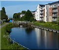
Camelon Road Narrows

 
Possible site of an old lock No 11
Rosebank Warehouse, Forth and Clyde Canal Towpath, Falkirk FK1 4DN, United Kingdom
 
Information about the place
Camelon Road Narrows is a minor waterways place on the Forth and Clyde Canal (Main Line) between Sea Lock Basin (2 miles and 3¾ furlongs and 8 locks to the east) and Union Canal Junction (Junction of Forth and Clyde and Edinburgh and Glasgow Union Canals) (1 mile and 4½ furlongs and 6 locks to the west).
 
It is part of Falkirk Locks.
 
The nearest place in the direction of Sea Lock Basin is Falkirk Lock No 10; ½ furlongs away.
 
The nearest place in the direction of Union Canal Junction is Camelon Road Bridge; ¼ furlongs away.

Mooring here is unrated.


Amenities

Amenities nearby at Falkirk Lock No 10

 Tesco
 Dominos Pizza
 Esso

Amenities nearby at Camelon Road Bridge

 Beefeater
 
Maps
If you are a user and are logged on, or if you are actively planning a route, a map will be displayed here.
Show on external mapping site: Google | OSM | Bing
 
External websites
 Youtube — associated with Forth and Clyde Canal
The official reopening of the canal
 
Nearest facilities

Mouseover for more information or show routes to facility

Nearest place to turn

In the direction of Clyde Canal Junction

Falkirk Top Lock Winding Hole4¼ furlongs and 6 locks away
On this waterway in the direction of Clyde Canal Junction
Union Canal Junction1 mile, 4½ furlongs and 6 locks away
On this waterway in the direction of Clyde Canal Junction
Falkirk Wheel Basin1 mile, 5 furlongs and 7 locks away
Travel to Union Canal Junction, then on the Edinburgh and Glasgow Union Canal to Falkirk Wheel Basin
Rough Castle Tunnel Winding Hole1 mile, 6½ furlongs and 7 locks away
Travel to Union Canal Junction, then on the Edinburgh and Glasgow Union Canal to Rough Castle Tunnel Winding Hole
Lime Road Bridge Winding Hole2 miles, 2¾ furlongs and 9 locks away
Travel to Union Canal Junction, then on the Edinburgh and Glasgow Union Canal to Lime Road Bridge Winding Hole
Greenbank Aqueduct Arm2 miles, 6¾ furlongs and 9 locks away
Travel to Union Canal Junction, then on the Edinburgh and Glasgow Union Canal to Greenbank Aqueduct Arm
Greenbank Winding Hole3 miles, ¾ furlongs and 9 locks away
Travel to Union Canal Junction, then on the Edinburgh and Glasgow Union Canal to Greenbank Winding Hole
Walkers Bridge Winding Hole3 miles, 5½ furlongs and 9 locks away
Travel to Union Canal Junction, then on the Edinburgh and Glasgow Union Canal to Walkers Bridge Winding Hole
Glen Burn Winding Hole4 miles, 6½ furlongs and 9 locks away
Travel to Union Canal Junction, then on the Edinburgh and Glasgow Union Canal to Glen Burn Winding Hole
Huts Bridge Winding Hole4 miles, 7¾ furlongs and 9 locks away
Travel to Union Canal Junction, then on the Edinburgh and Glasgow Union Canal to Huts Bridge Winding Hole
Reddingmuirhead Winding Hole6 miles, ½ furlongs and 9 locks away
Travel to Union Canal Junction, then on the Edinburgh and Glasgow Union Canal to Reddingmuirhead Winding Hole
Brightons Bridge Winding Hole7 miles, 2 furlongs and 9 locks away
Travel to Union Canal Junction, then on the Edinburgh and Glasgow Union Canal to Brightons Bridge Winding Hole
A801 Road Bridge Winding Hole8 miles, 4½ furlongs and 9 locks away
Travel to Union Canal Junction, then on the Edinburgh and Glasgow Union Canal to A801 Road Bridge Winding Hole
Wyndford Lock Winding Hole7 miles, 5 furlongs and 10 locks away
On this waterway in the direction of Clyde Canal Junction
Vellore Road Bridge Winding Hole9 miles, 2 furlongs and 9 locks away
Travel to Union Canal Junction, then on the Edinburgh and Glasgow Union Canal to Vellore Road Bridge Winding Hole
Craigmarloch Basin8 miles, 7¾ furlongs and 10 locks away
On this waterway in the direction of Clyde Canal Junction
Avon Aqueduct Winding Hole10 miles, ½ furlongs and 9 locks away
Travel to Union Canal Junction, then on the Edinburgh and Glasgow Union Canal to Avon Aqueduct Winding Hole
Woodcockdale Bridge Winding Hole10 miles, 4¼ furlongs and 9 locks away
Travel to Union Canal Junction, then on the Edinburgh and Glasgow Union Canal to Woodcockdale Bridge Winding Hole
Auchinstarry Winding Hole9 miles, 6¼ furlongs and 10 locks away
On this waterway in the direction of Clyde Canal Junction

In the direction of River Carron - Forth and Clyde Canal Junction

Sea Lock Basin2 miles, 3¾ furlongs and 8 locks away
On this waterway in the direction of River Carron - Forth and Clyde Canal Junction

No information

CanalPlan has no information on any of the following facilities within range:
water point
rubbish disposal
chemical toilet disposal
self-operated pump-out
boatyard pump-out
Direction of TV transmitter (From Wolfbane Cybernetic)
 
 
Geograph
 
Wikipedia

There is no page on Wikipedia called “Camelon Road Narrows”

 
Google

Results of Google Search

The Narrows - Zion National Park (U.S. National Park Service)
Jul 21, 2019 ... The Narrows is the narrowest section of Zion Canyon. ... Doing the hike this way allows you to see some of the most spectacular and narrowest ...
The Narrows - Zion | Utah.com
Hiking the Narrows in Zion is an adventure that has to be experienced. You'll ... The best way for first-time river hikers and those with only a short time in the park.
Zion Narrows Ultimate Hiking Guide (Joe's Guide to Zion National ...
The Zion Narrows is the section of the Virgin River just upstream from the Temple of Sinawava (the end of the road up the main canyon). Here, the majestic walls ...
From the Bottom Up - Zion National Park (U.S. National Park Service)
Oct 9, 2019 ... Day Hike from the Bottom and Back This is the easiest way to experience The Narrows. Ride the shuttle to the Temple of Sinawava, walk 1 mile ...
The Narrows - Bottom Up Route Hiking Trail, Springdale, Utah
2000-foot sandstone walls usher visitors through one of the best experiences in Zion NP. Near Springdale, Utah.
Zion Narrows Map & Information, Zion National Park
Top-Down Zion Narrows Backpacking Trip (Overnight) - A more leisurely way to hike, enjoy, photograph, and explore. Depart from Chamberlain's Ranch.
What does a road narrows sign mean? - Quora
What does the road sign "Road Closed to Thru Traffic" mean? 15,429 Views · What is the difference between "Dead End," "No Exit," and "Not a Through Street?
What happens when the road narrows... - YouTube
Sep 24, 2015 ... Rather than just slowing down this car decides to drive closer to the cyclist instead. Cyclist tries to speak to the driver about it afterwards, they ...
The Zion Narrows Riverside Walk - Utah | AllTrails
The Narrows may close during extreme weather conditions (flash flood warnings) . Please ... beautiful little walk at the very end of the road through Zion canyon ...
Matthew 7:13-14 NIV - The Narrow and Wide Gates - “Enter - Bible ...
The Narrow and Wide Gates - “Enter through the narrow gate. For wide is the gate and broad is the road that leads to destruction, and many enter.