CanalPlanAC

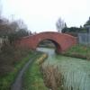
Devils Elbow Bridge

 
Wednesfield WV11 3AU, United Kingdom
 
Information about the place
Devils Elbow Bridge is a minor waterways place on the Birmingham Canal Navigations (Wyrley and Essington Canal) between Wednesfield Junction (Junction with closed Bentley Canal) (1 mile and 4¾ furlongs to the southwest) and Holly Bank Basin (Also known as the Short Heath Branch) (1 mile and 4 furlongs to the east).
 
 
The nearest place in the direction of Wednesfield Junction is Site of Moat Green Bridge; 2¼ furlongs away.
 
The nearest place in the direction of Holly Bank Basin is Olinthus Bridge; 1¾ furlongs away.

There may be access to the towpath here.

Mooring here is impossible (it may be physically impossible, forbidden, or allowed only for specific short-term purposes).

There is a bridge here which takes pedestrian traffic over the canal.


Amenities

Amenities nearby at Site of Moat Green Bridge

 Cashpoint

Amenities nearby at Olinthus Bridge

 Ashmore Inn
 SEE ADDRESS
 
Maps
If you are a user and are logged on, or if you are actively planning a route, a map will be displayed here.
Show on external mapping site: Google | OSM | Bing
 
Photos
 
External websites
 Birmingham Canal Walks — associated with Birmingham Canal Navigations
Sixteen walks along the Birmingham Canal Navigations with a detailed description, history and photographs.
 
Nearest facilities

Mouseover for more information or show routes to facility

Nearest water point

In the direction of Horseley Fields Junction

Broad Street Basin3 miles, 3½ furlongs away
Travel to Horseley Fields Junction, then on the Birmingham Canal Navigations (Main Line) to Broad Street Basin
C&RT Bradley Workshops7 miles, 6½ furlongs away
Travel to Horseley Fields Junction, then on the Birmingham Canal Navigations (Main Line) to Deepfields Junction, then on the Birmingham Canal Navigations (Wednesbury Oak Loop) to C&RT Bradley Workshops
Todds End Customer Service Facility8 miles, 6 furlongs away
Travel to Horseley Fields Junction, then on the Birmingham Canal Navigations (Main Line) to Tipton Factory Junction, then on the Birmingham Canal Navigations (Old Main Line) to Tipton Junction, then on the Birmingham Canal Navigations (Dudley Canal No 1 - Birmingham End) to Todds End Customer Service Facility
Black Country Museum8 miles, 6¼ furlongs away
Travel to Horseley Fields Junction, then on the Birmingham Canal Navigations (Main Line) to Tipton Factory Junction, then on the Birmingham Canal Navigations (Old Main Line) to Tipton Junction, then on the Birmingham Canal Navigations (Dudley Canal No 1 - Birmingham End) to Black Country Museum
Dudley Canal & Tunnel Trust Footbridge8 miles, 6½ furlongs away
Travel to Horseley Fields Junction, then on the Birmingham Canal Navigations (Main Line) to Tipton Factory Junction, then on the Birmingham Canal Navigations (Old Main Line) to Tipton Junction, then on the Birmingham Canal Navigations (Dudley Canal No 1 - Birmingham End) to Dudley Canal & Tunnel Trust Footbridge
Dudley Tunnel (northern entrance)8 miles, 7¼ furlongs away
Travel to Horseley Fields Junction, then on the Birmingham Canal Navigations (Main Line) to Tipton Factory Junction, then on the Birmingham Canal Navigations (Old Main Line) to Tipton Junction, then on the Birmingham Canal Navigations (Dudley Canal No 1 - Birmingham End) to Dudley Tunnel (northern entrance)
Blowers Green Pumphouse10 miles, 7½ furlongs and 3 locks away
Travel to Horseley Fields Junction, then on the Birmingham Canal Navigations (Main Line) to Tipton Factory Junction, then on the Birmingham Canal Navigations (Old Main Line) to Tipton Junction, then on the Birmingham Canal Navigations (Dudley Canal No 1 - Birmingham End) to Dudley Tunnel (northern entrance), then on the Birmingham Canal Navigations (Dudley Canal No 1 - Dudley Tunnel) to Pensnett Junction, then on the Birmingham Canal Navigations (Dudley Canal No 1 - Through Route) to Parkhead Junction, then on the Birmingham Canal Navigations (Dudley Canal No 2 - Coombeswood ) to Blowers Green Pumphouse
Handsworth Wharf Winding Hole14 miles, 1 furlong away
Travel to Horseley Fields Junction, then on the Birmingham Canal Navigations (Main Line) to Tipton Factory Junction, then on the Birmingham Canal Navigations (Old Main Line) to Engine Arm Junction, then on the Birmingham Canal Navigations (Engine Arm) to Handsworth Wharf Winding Hole
Bumble Hole Visitor Centre11 miles, 7¾ furlongs and 3 locks away
Travel to Horseley Fields Junction, then on the Birmingham Canal Navigations (Main Line) to Dudley Port Junction, then on the Birmingham Canal Navigations (Netherton Tunnel Branch) to Windmill End Junction, then on the Birmingham Canal Navigations (Dudley Canal No 2 - Coombeswood ) to Bumble Hole Visitor Centre
Hawne Basin14 miles, 4½ furlongs and 3 locks away
Travel to Horseley Fields Junction, then on the Birmingham Canal Navigations (Main Line) to Dudley Port Junction, then on the Birmingham Canal Navigations (Netherton Tunnel Branch) to Windmill End Junction, then on the Birmingham Canal Navigations (Dudley Canal No 2 - Coombeswood ) to Hawne Basin
Cambrian Wharf Services16 miles, 1¾ furlongs and 3 locks away
Travel to Horseley Fields Junction, then on the Birmingham Canal Navigations (Main Line) to Deep Cuttings Junction, then on the Birmingham Canal Navigations (Newhall Branch) to Cambrian Wharf Services
Worcester Bar16 miles, 2½ furlongs and 3 locks away
Travel to Horseley Fields Junction, then on the Birmingham Canal Navigations (Main Line) to Worcester Bar
Holliday Wharf16 miles, 4½ furlongs and 3 locks away
Travel to Horseley Fields Junction, then on the Birmingham Canal Navigations (Main Line) to Worcester Bar, then on the Worcester and Birmingham Canal (Birmingham to King's Norton) to Holliday Wharf
Autherley Stop Lock Water Point5 miles, 7¼ furlongs and 22 locks away
Travel to Horseley Fields Junction, then on the Birmingham Canal Navigations (Main Line) to Aldersley Junction, then on the Staffordshire and Worcestershire Canal (Main Line: Aldersley to Autherley) to Autherley Junction, then on the Shropshire Union Canal (Birmingham and Liverpool Junction Canal - Main Line) to Autherley Stop Lock Water Point

In the direction of Ogley Junction

Sneyd Wharf3 miles, 3¾ furlongs away
On this waterway in the direction of Ogley Junction
LMS Railway Interchange Basins12 miles, ¼ furlongs away
On this waterway in the direction of Ogley Junction
Aldridge Marina14 miles, 2½ furlongs away
Travel to Catshill Junction, then on the Birmingham Canal Navigations (Daw End Branch) to Aldridge Marina
Longwood Junction17 miles, 6½ furlongs away
Travel to Catshill Junction, then on the Birmingham Canal Navigations (Daw End Branch) to Longwood Junction
Lower Ocker Hill Branch Junction10 miles, 5¼ furlongs and 8 locks away
Travel to Birchills Junction, then on the Birmingham Canal Navigations (Walsall Junction Canal) to Walsall Junction, then on the Birmingham Canal Navigations (Walsall Canal) to Lower Ocker Hill Branch Junction
Perry Barr Top Lock Services16 miles, 1¾ furlongs and 8 locks away
Travel to Birchills Junction, then on the Birmingham Canal Navigations (Walsall Junction Canal) to Walsall Junction, then on the Birmingham Canal Navigations (Walsall Canal) to Tame Valley Junction, then on the Birmingham Canal Navigations (Tame Valley Canal) to Perry Barr Top Lock Services

Nearest rubbish disposal

In the direction of Horseley Fields Junction

Broad Street Basin3 miles, 3½ furlongs away
Travel to Horseley Fields Junction, then on the Birmingham Canal Navigations (Main Line) to Broad Street Basin
C&RT Bradley Workshops7 miles, 6½ furlongs away
Travel to Horseley Fields Junction, then on the Birmingham Canal Navigations (Main Line) to Deepfields Junction, then on the Birmingham Canal Navigations (Wednesbury Oak Loop) to C&RT Bradley Workshops
Black Country Museum8 miles, 6¼ furlongs away
Travel to Horseley Fields Junction, then on the Birmingham Canal Navigations (Main Line) to Tipton Factory Junction, then on the Birmingham Canal Navigations (Old Main Line) to Tipton Junction, then on the Birmingham Canal Navigations (Dudley Canal No 1 - Birmingham End) to Black Country Museum
Wolverhampton Lock No 94 miles, 1 furlong and 8 locks away
Travel to Horseley Fields Junction, then on the Birmingham Canal Navigations (Main Line) to Wolverhampton Lock No 9
Blowers Green Bridge10 miles, 7¾ furlongs and 3 locks away
Travel to Horseley Fields Junction, then on the Birmingham Canal Navigations (Main Line) to Tipton Factory Junction, then on the Birmingham Canal Navigations (Old Main Line) to Tipton Junction, then on the Birmingham Canal Navigations (Dudley Canal No 1 - Birmingham End) to Dudley Tunnel (northern entrance), then on the Birmingham Canal Navigations (Dudley Canal No 1 - Dudley Tunnel) to Pensnett Junction, then on the Birmingham Canal Navigations (Dudley Canal No 1 - Through Route) to Parkhead Junction, then on the Birmingham Canal Navigations (Dudley Canal No 2 - Coombeswood ) to Blowers Green Bridge
Handsworth Wharf Winding Hole14 miles, 1 furlong away
Travel to Horseley Fields Junction, then on the Birmingham Canal Navigations (Main Line) to Tipton Factory Junction, then on the Birmingham Canal Navigations (Old Main Line) to Engine Arm Junction, then on the Birmingham Canal Navigations (Engine Arm) to Handsworth Wharf Winding Hole
Waterfront Services (Dudley)12 miles, ¼ furlongs and 4 locks away
Travel to Horseley Fields Junction, then on the Birmingham Canal Navigations (Main Line) to Tipton Factory Junction, then on the Birmingham Canal Navigations (Old Main Line) to Tipton Junction, then on the Birmingham Canal Navigations (Dudley Canal No 1 - Birmingham End) to Dudley Tunnel (northern entrance), then on the Birmingham Canal Navigations (Dudley Canal No 1 - Dudley Tunnel) to Pensnett Junction, then on the Birmingham Canal Navigations (Dudley Canal No 1 - Through Route) to Waterfront Services (Dudley)
Hawne Basin14 miles, 4½ furlongs and 3 locks away
Travel to Horseley Fields Junction, then on the Birmingham Canal Navigations (Main Line) to Dudley Port Junction, then on the Birmingham Canal Navigations (Netherton Tunnel Branch) to Windmill End Junction, then on the Birmingham Canal Navigations (Dudley Canal No 2 - Coombeswood ) to Hawne Basin
Cambrian Wharf Services16 miles, 1¾ furlongs and 3 locks away
Travel to Horseley Fields Junction, then on the Birmingham Canal Navigations (Main Line) to Deep Cuttings Junction, then on the Birmingham Canal Navigations (Newhall Branch) to Cambrian Wharf Services
Worcester Bar16 miles, 2½ furlongs and 3 locks away
Travel to Horseley Fields Junction, then on the Birmingham Canal Navigations (Main Line) to Worcester Bar
Delph Bottom Lock No 813 miles and 11 locks away
Travel to Horseley Fields Junction, then on the Birmingham Canal Navigations (Main Line) to Tipton Factory Junction, then on the Birmingham Canal Navigations (Old Main Line) to Tipton Junction, then on the Birmingham Canal Navigations (Dudley Canal No 1 - Birmingham End) to Dudley Tunnel (northern entrance), then on the Birmingham Canal Navigations (Dudley Canal No 1 - Dudley Tunnel) to Pensnett Junction, then on the Birmingham Canal Navigations (Dudley Canal No 1 - Through Route) to Delph Bottom Lock No 8
Autherley Junction Bridge No 15 miles, 6½ furlongs and 21 locks away
Travel to Horseley Fields Junction, then on the Birmingham Canal Navigations (Main Line) to Aldersley Junction, then on the Staffordshire and Worcestershire Canal (Main Line: Aldersley to Autherley) to Autherley Junction, then on the Shropshire Union Canal (Birmingham and Liverpool Junction Canal - Main Line) to Autherley Junction Bridge No 1
Farmers Bridge Lock No 816 miles, 5 furlongs and 10 locks away
Travel to Horseley Fields Junction, then on the Birmingham Canal Navigations (Main Line) to Deep Cuttings Junction, then on the Birmingham Canal Navigations (Newhall Branch) to Farmers Bridge Junction, then on the Birmingham Canal Navigations (Birmingham and Fazeley Canal - Main Line) to Farmers Bridge Lock No 8
Gailey Wharf13 miles, 4¾ furlongs and 21 locks away
Travel to Horseley Fields Junction, then on the Birmingham Canal Navigations (Main Line) to Aldersley Junction, then on the Staffordshire and Worcestershire Canal (Main Line: Aldersley to Autherley) to Autherley Junction, then on the Staffordshire and Worcestershire Canal (Main Line: Autherley to Great Haywood) to Gailey Wharf
Wheaton Aston Services13 miles, 5¼ furlongs and 23 locks away
Travel to Horseley Fields Junction, then on the Birmingham Canal Navigations (Main Line) to Aldersley Junction, then on the Staffordshire and Worcestershire Canal (Main Line: Aldersley to Autherley) to Autherley Junction, then on the Shropshire Union Canal (Birmingham and Liverpool Junction Canal - Main Line) to Wheaton Aston Services

In the direction of Ogley Junction

LMS Railway Interchange Basins12 miles, ¼ furlongs away
On this waterway in the direction of Ogley Junction
Aldridge Marina14 miles, 2½ furlongs away
Travel to Catshill Junction, then on the Birmingham Canal Navigations (Daw End Branch) to Aldridge Marina
Longwood Junction17 miles, 6½ furlongs away
Travel to Catshill Junction, then on the Birmingham Canal Navigations (Daw End Branch) to Longwood Junction
Lower Ocker Hill Branch Junction10 miles, 5¼ furlongs and 8 locks away
Travel to Birchills Junction, then on the Birmingham Canal Navigations (Walsall Junction Canal) to Walsall Junction, then on the Birmingham Canal Navigations (Walsall Canal) to Lower Ocker Hill Branch Junction
Perry Barr Top Lock Services16 miles, 1¾ furlongs and 8 locks away
Travel to Birchills Junction, then on the Birmingham Canal Navigations (Walsall Junction Canal) to Walsall Junction, then on the Birmingham Canal Navigations (Walsall Canal) to Tame Valley Junction, then on the Birmingham Canal Navigations (Tame Valley Canal) to Perry Barr Top Lock Services

Nearest chemical toilet disposal

In the direction of Horseley Fields Junction

Broad Street Basin3 miles, 3½ furlongs away
Travel to Horseley Fields Junction, then on the Birmingham Canal Navigations (Main Line) to Broad Street Basin
Todds End Customer Service Facility8 miles, 6 furlongs away
Travel to Horseley Fields Junction, then on the Birmingham Canal Navigations (Main Line) to Tipton Factory Junction, then on the Birmingham Canal Navigations (Old Main Line) to Tipton Junction, then on the Birmingham Canal Navigations (Dudley Canal No 1 - Birmingham End) to Todds End Customer Service Facility
Black Country Museum8 miles, 6¼ furlongs away
Travel to Horseley Fields Junction, then on the Birmingham Canal Navigations (Main Line) to Tipton Factory Junction, then on the Birmingham Canal Navigations (Old Main Line) to Tipton Junction, then on the Birmingham Canal Navigations (Dudley Canal No 1 - Birmingham End) to Black Country Museum
Dudley Tunnel (northern entrance)8 miles, 7¼ furlongs away
Travel to Horseley Fields Junction, then on the Birmingham Canal Navigations (Main Line) to Tipton Factory Junction, then on the Birmingham Canal Navigations (Old Main Line) to Tipton Junction, then on the Birmingham Canal Navigations (Dudley Canal No 1 - Birmingham End) to Dudley Tunnel (northern entrance)
Blowers Green Pumphouse10 miles, 7½ furlongs and 3 locks away
Travel to Horseley Fields Junction, then on the Birmingham Canal Navigations (Main Line) to Tipton Factory Junction, then on the Birmingham Canal Navigations (Old Main Line) to Tipton Junction, then on the Birmingham Canal Navigations (Dudley Canal No 1 - Birmingham End) to Dudley Tunnel (northern entrance), then on the Birmingham Canal Navigations (Dudley Canal No 1 - Dudley Tunnel) to Pensnett Junction, then on the Birmingham Canal Navigations (Dudley Canal No 1 - Through Route) to Parkhead Junction, then on the Birmingham Canal Navigations (Dudley Canal No 2 - Coombeswood ) to Blowers Green Pumphouse
Handsworth Wharf Winding Hole14 miles, 1 furlong away
Travel to Horseley Fields Junction, then on the Birmingham Canal Navigations (Main Line) to Tipton Factory Junction, then on the Birmingham Canal Navigations (Old Main Line) to Engine Arm Junction, then on the Birmingham Canal Navigations (Engine Arm) to Handsworth Wharf Winding Hole
Waterfront Services (Dudley)12 miles, ¼ furlongs and 4 locks away
Travel to Horseley Fields Junction, then on the Birmingham Canal Navigations (Main Line) to Tipton Factory Junction, then on the Birmingham Canal Navigations (Old Main Line) to Tipton Junction, then on the Birmingham Canal Navigations (Dudley Canal No 1 - Birmingham End) to Dudley Tunnel (northern entrance), then on the Birmingham Canal Navigations (Dudley Canal No 1 - Dudley Tunnel) to Pensnett Junction, then on the Birmingham Canal Navigations (Dudley Canal No 1 - Through Route) to Waterfront Services (Dudley)
Hawne Basin14 miles, 4½ furlongs and 3 locks away
Travel to Horseley Fields Junction, then on the Birmingham Canal Navigations (Main Line) to Dudley Port Junction, then on the Birmingham Canal Navigations (Netherton Tunnel Branch) to Windmill End Junction, then on the Birmingham Canal Navigations (Dudley Canal No 2 - Coombeswood ) to Hawne Basin
Cambrian Wharf Services16 miles, 1¾ furlongs and 3 locks away
Travel to Horseley Fields Junction, then on the Birmingham Canal Navigations (Main Line) to Deep Cuttings Junction, then on the Birmingham Canal Navigations (Newhall Branch) to Cambrian Wharf Services
Worcester Bar16 miles, 2½ furlongs and 3 locks away
Travel to Horseley Fields Junction, then on the Birmingham Canal Navigations (Main Line) to Worcester Bar
Holliday Wharf16 miles, 4½ furlongs and 3 locks away
Travel to Horseley Fields Junction, then on the Birmingham Canal Navigations (Main Line) to Worcester Bar, then on the Worcester and Birmingham Canal (Birmingham to King's Norton) to Holliday Wharf
Gailey Wharf13 miles, 4¾ furlongs and 21 locks away
Travel to Horseley Fields Junction, then on the Birmingham Canal Navigations (Main Line) to Aldersley Junction, then on the Staffordshire and Worcestershire Canal (Main Line: Aldersley to Autherley) to Autherley Junction, then on the Staffordshire and Worcestershire Canal (Main Line: Autherley to Great Haywood) to Gailey Wharf
Wheaton Aston Services13 miles, 5¼ furlongs and 23 locks away
Travel to Horseley Fields Junction, then on the Birmingham Canal Navigations (Main Line) to Aldersley Junction, then on the Staffordshire and Worcestershire Canal (Main Line: Aldersley to Autherley) to Autherley Junction, then on the Shropshire Union Canal (Birmingham and Liverpool Junction Canal - Main Line) to Wheaton Aston Services
Penkridge Sanitary Station16 miles, 2 furlongs and 27 locks away
Travel to Horseley Fields Junction, then on the Birmingham Canal Navigations (Main Line) to Aldersley Junction, then on the Staffordshire and Worcestershire Canal (Main Line: Aldersley to Autherley) to Autherley Junction, then on the Staffordshire and Worcestershire Canal (Main Line: Autherley to Great Haywood) to Penkridge Sanitary Station

In the direction of Ogley Junction

Sneyd Wharf3 miles, 3¾ furlongs away
On this waterway in the direction of Ogley Junction
LMS Railway Interchange Basins12 miles, ¼ furlongs away
On this waterway in the direction of Ogley Junction
Longwood Junction17 miles, 6½ furlongs away
Travel to Catshill Junction, then on the Birmingham Canal Navigations (Daw End Branch) to Longwood Junction
Lower Ocker Hill Branch Junction10 miles, 5¼ furlongs and 8 locks away
Travel to Birchills Junction, then on the Birmingham Canal Navigations (Walsall Junction Canal) to Walsall Junction, then on the Birmingham Canal Navigations (Walsall Canal) to Lower Ocker Hill Branch Junction
Perry Barr Top Lock Services16 miles, 1¾ furlongs and 8 locks away
Travel to Birchills Junction, then on the Birmingham Canal Navigations (Walsall Junction Canal) to Walsall Junction, then on the Birmingham Canal Navigations (Walsall Canal) to Tame Valley Junction, then on the Birmingham Canal Navigations (Tame Valley Canal) to Perry Barr Top Lock Services
Cuckoo Wharf19 miles, 3¼ furlongs and 21 locks away
Travel to Birchills Junction, then on the Birmingham Canal Navigations (Walsall Junction Canal) to Walsall Junction, then on the Birmingham Canal Navigations (Walsall Canal) to Tame Valley Junction, then on the Birmingham Canal Navigations (Tame Valley Canal) to Salford Junction (north), then on the Birmingham Canal Navigations (Birmingham and Fazeley Canal - Main Line) to Cuckoo Wharf

Nearest place to turn

In the direction of Horseley Fields Junction

Wednesfield Junction1 mile, 4¾ furlongs away
On this waterway in the direction of Horseley Fields Junction
Horseley Fields Junction2 miles, 7¼ furlongs away
On this waterway in the direction of Horseley Fields Junction
Pickford's Wharf2 miles, 7¾ furlongs away
Travel to Horseley Fields Junction, then on the Birmingham Canal Navigations (Main Line) to Pickford's Wharf
Walsall Street Winding Hole3 miles, ¾ furlongs away
Travel to Horseley Fields Junction, then on the Birmingham Canal Navigations (Main Line) to Walsall Street Winding Hole
Broad Street Basin3 miles, 3½ furlongs away
Travel to Horseley Fields Junction, then on the Birmingham Canal Navigations (Main Line) to Broad Street Basin
Ettingshall Arm Junction5 miles, 1¾ furlongs away
Travel to Horseley Fields Junction, then on the Birmingham Canal Navigations (Main Line) to Ettingshall Arm Junction
Deepfields Junction5 miles, 7¼ furlongs away
Travel to Horseley Fields Junction, then on the Birmingham Canal Navigations (Main Line) to Deepfields Junction
Hills Bridge Winding Hole6 miles, ¼ furlongs away
Travel to Horseley Fields Junction, then on the Birmingham Canal Navigations (Main Line) to Hills Bridge Winding Hole
Highfields Colliery Coal Wharf6 miles, 5¾ furlongs away
Travel to Horseley Fields Junction, then on the Birmingham Canal Navigations (Main Line) to Deepfields Junction, then on the Birmingham Canal Navigations (Wednesbury Oak Loop) to Highfields Colliery Coal Wharf
Tipton Factory Junction7 miles, 4 furlongs away
Travel to Horseley Fields Junction, then on the Birmingham Canal Navigations (Main Line) to Tipton Factory Junction
Bradley Basin7 miles, 6 furlongs away
Travel to Horseley Fields Junction, then on the Birmingham Canal Navigations (Main Line) to Deepfields Junction, then on the Birmingham Canal Navigations (Wednesbury Oak Loop) to Bradley Basin
C&RT Bradley Workshops7 miles, 6½ furlongs away
Travel to Horseley Fields Junction, then on the Birmingham Canal Navigations (Main Line) to Deepfields Junction, then on the Birmingham Canal Navigations (Wednesbury Oak Loop) to C&RT Bradley Workshops
Tipton Junction8 miles, 4 furlongs away
Travel to Horseley Fields Junction, then on the Birmingham Canal Navigations (Main Line) to Tipton Factory Junction, then on the Birmingham Canal Navigations (Old Main Line) to Tipton Junction
Black Country Museum8 miles, 6¼ furlongs away
Travel to Horseley Fields Junction, then on the Birmingham Canal Navigations (Main Line) to Tipton Factory Junction, then on the Birmingham Canal Navigations (Old Main Line) to Tipton Junction, then on the Birmingham Canal Navigations (Dudley Canal No 1 - Birmingham End) to Black Country Museum

In the direction of Ogley Junction

Holly Bank Basin1 mile, 4 furlongs away
On this waterway in the direction of Ogley Junction
Sneyd Junction3 miles, 3¼ furlongs away
On this waterway in the direction of Ogley Junction
Sneyd Wharf3 miles, 3¾ furlongs away
On this waterway in the direction of Ogley Junction
Birchills Junction5 miles, ¾ furlongs away
On this waterway in the direction of Ogley Junction
Pelsall Hall Wharf7 miles, 2¾ furlongs away
On this waterway in the direction of Ogley Junction
Fishley Junction (under restoration)9 miles, 1¾ furlongs away
On this waterway in the direction of Ogley Junction

Nearest self-operated pump-out

In the direction of Horseley Fields Junction

Todds End Customer Service Facility8 miles, 6 furlongs away
Travel to Horseley Fields Junction, then on the Birmingham Canal Navigations (Main Line) to Tipton Factory Junction, then on the Birmingham Canal Navigations (Old Main Line) to Tipton Junction, then on the Birmingham Canal Navigations (Dudley Canal No 1 - Birmingham End) to Todds End Customer Service Facility
Black Country Museum8 miles, 6¼ furlongs away
Travel to Horseley Fields Junction, then on the Birmingham Canal Navigations (Main Line) to Tipton Factory Junction, then on the Birmingham Canal Navigations (Old Main Line) to Tipton Junction, then on the Birmingham Canal Navigations (Dudley Canal No 1 - Birmingham End) to Black Country Museum
Dudley Tunnel (northern entrance)8 miles, 7¼ furlongs away
Travel to Horseley Fields Junction, then on the Birmingham Canal Navigations (Main Line) to Tipton Factory Junction, then on the Birmingham Canal Navigations (Old Main Line) to Tipton Junction, then on the Birmingham Canal Navigations (Dudley Canal No 1 - Birmingham End) to Dudley Tunnel (northern entrance)
Handsworth Wharf Winding Hole14 miles, 1 furlong away
Travel to Horseley Fields Junction, then on the Birmingham Canal Navigations (Main Line) to Tipton Factory Junction, then on the Birmingham Canal Navigations (Old Main Line) to Engine Arm Junction, then on the Birmingham Canal Navigations (Engine Arm) to Handsworth Wharf Winding Hole
Wheaton Aston Services13 miles, 5¼ furlongs and 23 locks away
Travel to Horseley Fields Junction, then on the Birmingham Canal Navigations (Main Line) to Aldersley Junction, then on the Staffordshire and Worcestershire Canal (Main Line: Aldersley to Autherley) to Autherley Junction, then on the Shropshire Union Canal (Birmingham and Liverpool Junction Canal - Main Line) to Wheaton Aston Services

In the direction of Ogley Junction

Aldridge Marina14 miles, 2½ furlongs away
Travel to Catshill Junction, then on the Birmingham Canal Navigations (Daw End Branch) to Aldridge Marina
Lower Ocker Hill Branch Junction10 miles, 5¼ furlongs and 8 locks away
Travel to Birchills Junction, then on the Birmingham Canal Navigations (Walsall Junction Canal) to Walsall Junction, then on the Birmingham Canal Navigations (Walsall Canal) to Lower Ocker Hill Branch Junction

Nearest boatyard pump-out

In the direction of Horseley Fields Junction

Withymoor Island Service Wharf12 miles, 2¾ furlongs and 3 locks away
Travel to Horseley Fields Junction, then on the Birmingham Canal Navigations (Main Line) to Dudley Port Junction, then on the Birmingham Canal Navigations (Netherton Tunnel Branch) to Windmill End Junction, then on the Birmingham Canal Navigations (Dudley Canal No 2 - Coombeswood ) to Withymoor Island Service Wharf
Hawne Basin14 miles, 4½ furlongs and 3 locks away
Travel to Horseley Fields Junction, then on the Birmingham Canal Navigations (Main Line) to Dudley Port Junction, then on the Birmingham Canal Navigations (Netherton Tunnel Branch) to Windmill End Junction, then on the Birmingham Canal Navigations (Dudley Canal No 2 - Coombeswood ) to Hawne Basin
Sherborne Wharf Services15 miles, 6¼ furlongs and 3 locks away
Travel to Horseley Fields Junction, then on the Birmingham Canal Navigations (Main Line) to Sherborne Wharf Services
Oxley Marine5 miles, 5½ furlongs and 21 locks away
Travel to Horseley Fields Junction, then on the Birmingham Canal Navigations (Main Line) to Aldersley Junction, then on the Staffordshire and Worcestershire Canal (Main Line: Aldersley to Autherley) to Oxley Marine
Autherley Wharf5 miles, 7 furlongs and 22 locks away
Travel to Horseley Fields Junction, then on the Birmingham Canal Navigations (Main Line) to Aldersley Junction, then on the Staffordshire and Worcestershire Canal (Main Line: Aldersley to Autherley) to Autherley Junction, then on the Shropshire Union Canal (Birmingham and Liverpool Junction Canal - Main Line) to Autherley Wharf
Brewood Wharf11 miles, ½ furlongs and 22 locks away
Travel to Horseley Fields Junction, then on the Birmingham Canal Navigations (Main Line) to Aldersley Junction, then on the Staffordshire and Worcestershire Canal (Main Line: Aldersley to Autherley) to Autherley Junction, then on the Shropshire Union Canal (Birmingham and Liverpool Junction Canal - Main Line) to Brewood Wharf
Direction of TV transmitter (From Wolfbane Cybernetic)
 
 
Geograph
 
Wikipedia

There is no page on Wikipedia called “Devils Elbow Bridge”

Wikipedia pages that might relate to Devils Elbow Bridge
[Devils Elbow, Missouri] Devils Elbow is an unincorporated community in Pulaski County, Missouri, United States on historic U.S. Highway 66. It is situated on the Big Piney River [Heceta Head] is more varied. Devils Elbow is the bay south of the headland at the mouth of Cape Creek, and with the headland formed Devils Elbow State Park, which [South Eastern Freeway] tightest hairpin turn on the Mount Barker Road was infamous as the Devil's Elbow, often the site of car and semi-trailer accidents. On 16 May 1995, Prime [Murray River] the river, either by bridge or ferry. The first bridge to cross the Murray, which was built in 1869, is in the town of Murray Bridge, formerly called Edwards [Fort Leonard Wood] near the Old Stagecoach Stop. Three bridges cross the Big Piney River at Devil's Elbow—the modern Interstate 44 bridge, the later U.S. Route 66 alignment [Old military roads of Scotland] from Crieff to the existing road at Dalnacardoch by Aberfeldy and Tummel Bridge from Dalwhinnie to Fort Augustus via Corrieyairack Pass (and a spur to Ruthven [Stikine River] were built to haul materials to Glenora to aid the project. The first road bridge was built across the river in the 1970s as part of the Stewart-Cassiar Highway [List of Deadliest Catch episodes] wave and suffers a puncture wound to his elbow. Captain Keith Colburn puts in several stitches to Lenny's elbow and Lenny heads back on deck. Injuries also [Glen Shee] notorious hair-pin bends with a 1 in 3 (33%) gradient known as the Devil's Elbow. One of the most spectacular roads in Scotland, this was a favourite [Brad Marchand] suspended for five games for what was ruled a deliberate elbow to the head of New Jersey Devils forward Marcus Johansson. In March 2018, Marchand was fined
 
Google

Results of Google Search

The Historic Devil's Elbow Bridge Is In Need Of Repair
The scenic Devils Elbow Bridge over the Big Piney River offers a view of one of Missouri's "Seven Scenic Wonders." The town of Devil's Elbow is considered to ...
Devil's Elbow Bridge (Devils Elbow) - 2018 ALL You Need to Know ...
Found this bridge on Route 66 by the Elbow Inn (which was closed) Great Photo opportunity made better by the motorbiker rider that travelled the road. Lovely ...
Devils Elbow, Missouri - Wikipedia
Devils Elbow Bridge. Devils Elbow, Missouri is an unincorporated community in Pulaski County on historic U.S. ...
Fly over the Devils elbow bridge on Route 66 in Missouri! - YouTube
Apr 8, 2016 ... Check out the newly restored Devil's Elbow Bridge in Pulaski County Missouri along US Route 66.
Bridgehunter.com | Devils Elbow Bridge
Two-span through truss bridge over Big Piney River at Devils Elbow on Teardrop Road (Old US 66)
Devil's Elbow, Route 66 Missouri
Nov 10, 2017 ... Devil's Elbow is located on the old 1926 to 1943 Route 66 alignment, its attractions are: the old Route 66 Bridge at Devil's Elbow, Old ...
Devil's Elbow Bridge Archives - Route 66 News
An accident with a dumpster truck Thursday damaged the historic Devils Elbow Bridge in the Route 66 community of Devils Elbow, Missouri. Pulaski County ...
Devil's Elbow an Ozark Gem
Devil's Elbow, Missouri is one of the prettiest places on Route 66 in my opinion. ... old steel truss bridge crosses the Big Piney River at Devil's Elbow and dates ...
Christmas Lights at Devils Elbow Bridge
IMPORTANT UPDATE: December 2, 2017 via Daily Guide The Devils Elbow Bridge continues to ONLY be open to vehicles that weigh less than 3,000 pounds .
Devil's Elbow Bridge
Devil's Elbow Bridge. 1930. 2009. The bridge over the Big Piney River at Devilʼs Elbow has been with us since 1923. The red lead based paint is flaking off into ...