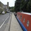
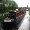
Canal Side Visitor Moorings
is a minor waterways place
on the Huddersfield Narrow Canal between
Railway Lock No 42E (Marsden. Eastern summit lock) (2 miles and 3 furlongs
and 18 locks
to the west) and
Titanic Mill (Linthwaite) (1 mile and 2¼ furlongs
and 7 locks
to the east).
The nearest place in the direction of Railway Lock No 42E is Uppermill Bridge No 47;
¾ furlongs
away.
The nearest place in the direction of Titanic Mill is Slaithwaite Aqueduct;
½ furlongs
away.
There is access (suitable for wheels) to the towpath here.
Mooring here is excellent (this is a really good mooring), mooring rings or bollards are available.
| Shaw Carr Footbridge No 48 | 4¾ furlongs | |
| Shaker Wood Lock No 25E | 2¾ furlongs | |
| Slaithwaite Slipway | 1 furlong | |
| Shuttle Lock No 24E | ¾ furlongs | |
| Uppermill Bridge No 47 | ¾ furlongs | |
| Canal Side Visitor Moorings | ||
| Slaithwaite Aqueduct | ½ furlongs | |
| Dartmouth Lock No 23E | ½ furlongs | |
| Old Bank Bridge No 45 | ½ furlongs | |
| Slaithwaite Bridge No 44A | 1 furlong | |
| Britannia Road Bridge No 44 | 1¼ furlongs | |
Amenities nearby at Uppermill Bridge No 47
There are no links to external websites from here.
Why not log in and add some (select "External websites" from the menu (sometimes this is under "Edit"))?
Mouseover for more information or show routes to facility
Nearest water point
In the direction of Ashton-under-Lyne Junction
Standedge Tunnel (eastern entrance) — 3 miles, ¼ furlongs and 19 locks away
On this waterway in the direction of Ashton-under-Lyne Junction
Standedge Tunnel (western entrance) — 6 miles, 2¼ furlongs and 19 locks away
On this waterway in the direction of Ashton-under-Lyne Junction
Wool Road Bridge No 70 — 8 miles, 2 furlongs and 28 locks away
On this waterway in the direction of Ashton-under-Lyne Junction
Grove Road Bridge No 96 — 14 miles, 2¼ furlongs and 43 locks away
On this waterway in the direction of Ashton-under-Lyne Junction
In the direction of Aspley Basin (Huddersfield)
Slaithwaite Winding Hole — 2¾ furlongs and 2 locks away
On this waterway in the direction of Aspley Basin (Huddersfield)
Waterside Lock No 21E — 3¼ furlongs and 2 locks away
On this waterway in the direction of Aspley Basin (Huddersfield)
Aspley Basin (Huddersfield) — 5 miles, ¾ furlongs and 23 locks away
On this waterway in the direction of Aspley Basin (Huddersfield)
Shepley Bridge Sanitary Station — 11 miles, 5½ furlongs and 34 locks away
Travel to Aspley Basin (Huddersfield), then on the Huddersfield Broad Canal to Cooper Bridge Junction, then on the Calder and Hebble Navigation (Main Line) to Shepley Bridge Sanitary Station
Brighouse Basin — 10 miles, 7¼ furlongs and 36 locks away
Travel to Aspley Basin (Huddersfield), then on the Huddersfield Broad Canal to Cooper Bridge Junction, then on the Calder and Hebble Navigation (Main Line) to Brighouse Basin
Salterhebble Sanitary Station — 15 miles, 1¼ furlongs and 45 locks away
Travel to Aspley Basin (Huddersfield), then on the Huddersfield Broad Canal to Cooper Bridge Junction, then on the Calder and Hebble Navigation (Main Line) to Salterhebble Sanitary Station
Broad Cut Low Lock No 3 — 18 miles, 2½ furlongs and 42 locks away
Travel to Aspley Basin (Huddersfield), then on the Huddersfield Broad Canal to Cooper Bridge Junction, then on the Calder and Hebble Navigation (Main Line) to Broad Cut Low Lock No 3
Salterhebble Junction — 15 miles, 1¾ furlongs and 46 locks away
Travel to Aspley Basin (Huddersfield), then on the Huddersfield Broad Canal to Cooper Bridge Junction, then on the Calder and Hebble Navigation (Main Line) to Salterhebble Junction
Sowerby Bridge Basin — 17 miles, 3½ furlongs and 46 locks away
Travel to Aspley Basin (Huddersfield), then on the Huddersfield Broad Canal to Cooper Bridge Junction, then on the Calder and Hebble Navigation (Main Line) to Salterhebble Junction, then on the Calder and Hebble Navigation (Main Line) to Sowerby Bridge BasinNearest rubbish disposal
In the direction of Ashton-under-Lyne Junction
Wool Road Visitor Mooring — 8 miles, 2½ furlongs and 28 locks away
On this waterway in the direction of Ashton-under-Lyne Junction
In the direction of Aspley Basin (Huddersfield)
Pickle Lock No 22E — 2 furlongs and 1 lock away
On this waterway in the direction of Aspley Basin (Huddersfield)
Aspley Basin (Huddersfield) — 5 miles, ¾ furlongs and 23 locks away
On this waterway in the direction of Aspley Basin (Huddersfield)
Shepley Bridge Sanitary Station — 11 miles, 5½ furlongs and 34 locks away
Travel to Aspley Basin (Huddersfield), then on the Huddersfield Broad Canal to Cooper Bridge Junction, then on the Calder and Hebble Navigation (Main Line) to Shepley Bridge Sanitary Station
Brighouse Lower Basin Visitor Moorings — 10 miles, 7 furlongs and 35 locks away
Travel to Aspley Basin (Huddersfield), then on the Huddersfield Broad Canal to Cooper Bridge Junction, then on the Calder and Hebble Navigation (Main Line) to Brighouse Lower Basin Visitor Moorings
Horbury Basin Residential Moorings & Sanitary Station — 16 miles, 1¾ furlongs and 41 locks away
Travel to Aspley Basin (Huddersfield), then on the Huddersfield Broad Canal to Cooper Bridge Junction, then on the Calder and Hebble Navigation (Main Line) to Horbury Basin Residential Moorings & Sanitary Station
Salterhebble Sanitary Station — 15 miles, 1¼ furlongs and 45 locks away
Travel to Aspley Basin (Huddersfield), then on the Huddersfield Broad Canal to Cooper Bridge Junction, then on the Calder and Hebble Navigation (Main Line) to Salterhebble Sanitary Station
Sowerby Bridge Basin — 17 miles, 3½ furlongs and 46 locks away
Travel to Aspley Basin (Huddersfield), then on the Huddersfield Broad Canal to Cooper Bridge Junction, then on the Calder and Hebble Navigation (Main Line) to Salterhebble Junction, then on the Calder and Hebble Navigation (Main Line) to Sowerby Bridge BasinNearest chemical toilet disposal
In the direction of Ashton-under-Lyne Junction
Wool Road Bridge No 70 — 8 miles, 2 furlongs and 28 locks away
On this waterway in the direction of Ashton-under-Lyne Junction
Grove Road Bridge No 96 — 14 miles, 2¼ furlongs and 43 locks away
On this waterway in the direction of Ashton-under-Lyne Junction
In the direction of Aspley Basin (Huddersfield)
Pickle Lock No 22E — 2 furlongs and 1 lock away
On this waterway in the direction of Aspley Basin (Huddersfield)
Waterside Lock No 21E — 3¼ furlongs and 2 locks away
On this waterway in the direction of Aspley Basin (Huddersfield)
Aspley Basin (Huddersfield) — 5 miles, ¾ furlongs and 23 locks away
On this waterway in the direction of Aspley Basin (Huddersfield)
Shepley Bridge Sanitary Station — 11 miles, 5½ furlongs and 34 locks away
Travel to Aspley Basin (Huddersfield), then on the Huddersfield Broad Canal to Cooper Bridge Junction, then on the Calder and Hebble Navigation (Main Line) to Shepley Bridge Sanitary Station
Brighouse Basin — 10 miles, 7¼ furlongs and 36 locks away
Travel to Aspley Basin (Huddersfield), then on the Huddersfield Broad Canal to Cooper Bridge Junction, then on the Calder and Hebble Navigation (Main Line) to Brighouse Basin
Savile Town Wharf and Basin (Dewsbury) — 15 miles, 1 furlong and 38 locks away
Travel to Aspley Basin (Huddersfield), then on the Huddersfield Broad Canal to Cooper Bridge Junction, then on the Calder and Hebble Navigation (Main Line) to Dewsbury Arm Junction, then on the Calder and Hebble Navigation (Dewsbury Old Cut) to Savile Town Wharf and Basin (Dewsbury)
Horbury Basin Residential Moorings & Sanitary Station — 16 miles, 1¾ furlongs and 41 locks away
Travel to Aspley Basin (Huddersfield), then on the Huddersfield Broad Canal to Cooper Bridge Junction, then on the Calder and Hebble Navigation (Main Line) to Horbury Basin Residential Moorings & Sanitary Station
Salterhebble Sanitary Station — 15 miles, 1¼ furlongs and 45 locks away
Travel to Aspley Basin (Huddersfield), then on the Huddersfield Broad Canal to Cooper Bridge Junction, then on the Calder and Hebble Navigation (Main Line) to Salterhebble Sanitary Station
Sowerby Bridge Basin — 17 miles, 3½ furlongs and 46 locks away
Travel to Aspley Basin (Huddersfield), then on the Huddersfield Broad Canal to Cooper Bridge Junction, then on the Calder and Hebble Navigation (Main Line) to Salterhebble Junction, then on the Calder and Hebble Navigation (Main Line) to Sowerby Bridge BasinNearest place to turn
In the direction of Ashton-under-Lyne Junction
Booth Lock Winding Hole — 1 mile, 2¼ furlongs and 8 locks away
On this waterway in the direction of Ashton-under-Lyne Junction
Standedge Tunnel End Winding Hole — 2 miles, 7½ furlongs and 19 locks away
On this waterway in the direction of Ashton-under-Lyne Junction
Diggle Winding Hole — 6 miles, 5 furlongs and 19 locks away
On this waterway in the direction of Ashton-under-Lyne Junction
Wool Road Winding Hole — 8 miles, 2¾ furlongs and 28 locks away
On this waterway in the direction of Ashton-under-Lyne Junction
Saddleworth Visitor Centre Winding Hole — 9 miles, ¾ furlongs and 30 locks away
On this waterway in the direction of Ashton-under-Lyne Junction
Manns Wharf Bridge Winding Hole — 10 miles, 3½ furlongs and 32 locks away
On this waterway in the direction of Ashton-under-Lyne Junction
Roughtown Court Winding Hole — 11 miles, 5 furlongs and 37 locks away
On this waterway in the direction of Ashton-under-Lyne Junction
In the direction of Aspley Basin (Huddersfield)
Slaithwaite Winding Hole — 2¾ furlongs and 2 locks away
On this waterway in the direction of Aspley Basin (Huddersfield)
Linthwaite Winding Hole — 1 mile, 3¼ furlongs and 7 locks away
On this waterway in the direction of Aspley Basin (Huddersfield)
Isis Lock Winding Hole — 2 miles, 7½ furlongs and 15 locks away
On this waterway in the direction of Aspley Basin (Huddersfield)
University Arm — 5 miles, ¼ furlongs and 23 locks away
On this waterway in the direction of Aspley Basin (Huddersfield)
Aspley Basin (Huddersfield) — 5 miles, ¾ furlongs and 23 locks away
On this waterway in the direction of Aspley Basin (Huddersfield)
Anchor Street Winding Hole — 5 miles, 5¾ furlongs and 23 locks away
Travel to Aspley Basin (Huddersfield), then on the Huddersfield Broad Canal to Anchor Street Winding Hole
New Road Winding Hole — 6 miles, 1¼ furlongs and 23 locks away
Travel to Aspley Basin (Huddersfield), then on the Huddersfield Broad Canal to New Road Winding Hole
Deighton Road Bridge Winding Hole — 7 miles, 3 furlongs and 28 locks away
Travel to Aspley Basin (Huddersfield), then on the Huddersfield Broad Canal to Deighton Road Bridge Winding Hole
Cooper Bridge Junction — 8 miles, 5 furlongs and 32 locks away
Travel to Aspley Basin (Huddersfield), then on the Huddersfield Broad Canal to Cooper Bridge Junction
Battye Weir Entrance — 9 miles, 2 furlongs and 33 locks away
Travel to Aspley Basin (Huddersfield), then on the Huddersfield Broad Canal to Cooper Bridge Junction, then on the Calder and Hebble Navigation (Main Line) to Battye Weir Entrance
Shepley Bridge Marina — 11 miles, 5¾ furlongs and 34 locks away
Travel to Aspley Basin (Huddersfield), then on the Huddersfield Broad Canal to Cooper Bridge Junction, then on the Calder and Hebble Navigation (Main Line) to Shepley Bridge Marina
Brighouse Basin — 10 miles, 7¼ furlongs and 36 locks away
Travel to Aspley Basin (Huddersfield), then on the Huddersfield Broad Canal to Cooper Bridge Junction, then on the Calder and Hebble Navigation (Main Line) to Brighouse Basin
Ganny Winding Hole — 11 miles, 4¾ furlongs and 37 locks away
Travel to Aspley Basin (Huddersfield), then on the Huddersfield Broad Canal to Cooper Bridge Junction, then on the Calder and Hebble Navigation (Main Line) to Ganny Winding HoleNearest self-operated pump-out
In the direction of Ashton-under-Lyne Junction
Wool Road Bridge No 70 — 8 miles, 2 furlongs and 28 locks away
On this waterway in the direction of Ashton-under-Lyne Junction
In the direction of Aspley Basin (Huddersfield)
Slaithwaite Winding Hole — 2¾ furlongs and 2 locks away
On this waterway in the direction of Aspley Basin (Huddersfield)Nearest boatyard pump-out
In the direction of Ashton-under-Lyne Junction
Portland Basin Arm — 19 miles, 2¾ furlongs and 51 locks away
Travel to Ashton-under-Lyne Junction, then on the Ashton Canal (Main Line) to Dukinfield Junction, then on the Peak Forest Canal (Lower) to Portland Basin Arm
In the direction of Aspley Basin (Huddersfield)
Aspley Basin (Huddersfield) — 5 miles, ¾ furlongs and 23 locks away
On this waterway in the direction of Aspley Basin (Huddersfield)
Shepley Bridge Marina — 11 miles, 5¾ furlongs and 34 locks away
Travel to Aspley Basin (Huddersfield), then on the Huddersfield Broad Canal to Cooper Bridge Junction, then on the Calder and Hebble Navigation (Main Line) to Shepley Bridge Marina
Sowerby Bridge Basin — 17 miles, 3½ furlongs and 46 locks away
Travel to Aspley Basin (Huddersfield), then on the Huddersfield Broad Canal to Cooper Bridge Junction, then on the Calder and Hebble Navigation (Main Line) to Salterhebble Junction, then on the Calder and Hebble Navigation (Main Line) to Sowerby Bridge BasinDirection of TV transmitter (From Wolfbane Cybernetic)
There is no page on Wikipedia called “Canal Side Visitor Moorings”
Wikipedia pages that might relate to Canal Side Visitor Moorings
[Llangollen Canal]
at the marina and the visitor moorings, which are below bridge 45. United Kingdom portal Transport portal Cheshire portal Canals of the United Kingdom
[Caledonian Canal]
the canal's construction in 1810, and extended in 1840–50. The smiddy still contains two hearths for forging metal. Muirtown Basin provides moorings at
[Basingstoke Canal]
maintaining the canal, including keeping the locks in working order. They tried to raise extra income from fishing and houseboat moorings as well as water
[Bridgwater and Taunton Canal]
11 October 2008. Cumberlidge 2009, pp. 86–87 "Bridgwater & Taunton Canal". Moorings & Moor. Archived from the original on 21 February 2012. Retrieved 25
[Caldon Canal]
new visitor centre. A disused lock, actually the first lock on the Uttoxeter Branch (see below), was reopened, as was the basin below it, and moorings for
[Llangollen]
destination. Moorings at Llangollen Wharf and additional moorings in a marina are built at the end of the generally-navigable section, allowing visitors arriving
[River Avon, Bristol]
in 1727. Just above the lock are visitor moorings and a pub, on an island between the lock and the weir. The weir side of the island is also the mouth
[Ansty, Warwickshire]
Oxford Canal Ansty Hall "Ansty Parish in West Midlands". City Population. Retrieved 7 January 2024. "Ansty Visitor Moorings — Gazetteer – CanalPlanAC"
[Limehouse Basin]
and other moorings and basins. Of the berths, 75 are for permanent waterside living; others are for leisure use, wintering vessels, or visitors. The Thames
[The Helix (Falkirk)]
Beatty in early 2012 for the construction of the new canal. Another £1 million contract for the visitor centre was awarded to Nicholl Russell Studios, a firm


![The Old Manor House, Slaithwaite. This is the western end of the frontage of the house. See also [[6662453]]. by Humphrey Bolton – 17 September 2000](https://s1.geograph.org.uk/geophotos/06/66/24/6662457_f6ddeb72_120x120.jpg)