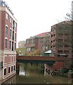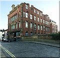
Foss Bridge
is a minor waterways place
on the River Foss between
Monk Bridge (Upper limit of navigation.) (6¼ furlongs
to the northeast) and
Castle Mills Bridge (2 furlongs
to the south).
The nearest place in the direction of Monk Bridge is Rowntree Wharf Arm;
¾ furlongs
away.
The nearest place in the direction of Castle Mills Bridge is Piccadilly Bridge, York;
¼ furlongs
away.
There is no access to the towpath here.
Mooring here is unrated.
There is a bridge here which takes a minor road over the canal.
| DEFRA Pedestrian Bridge | 3 furlongs | |
| Wormald's Cut | 2¼ furlongs | |
| Palmer Street Footbridge | 1¾ furlongs | |
| Rowntree Wharf Pedestrian Bridge | 1 furlong | |
| Rowntree Wharf Arm | ¾ furlongs | |
| Foss Bridge | ||
| Piccadilly Bridge, York | ¼ furlongs | |
| Castle Mills Bridge | 2 furlongs | |
| Castle Mills Lock Weir Entrance | 2¼ furlongs | |
| Castle Mills Lock | 2¼ furlongs | |
| Castle Mills Lock Basin | 2¾ furlongs | |
There are no links to external websites from here.
Why not log in and add some (select "External websites" from the menu (sometimes this is under "Edit"))?
Why not log in and add some (select "External websites" from the menu (sometimes this is under "Edit"))?
Mouseover for more information or show routes to facility
Nearest water point
In the direction of Ouse - Foss Junction
Skeldergate Bridge — 6¼ furlongs and 1 lock away
Travel to Ouse - Foss Junction, then on the River Ouse : Yorkshire (non-tidal section) to Skeldergate Bridge
Lendal Bridge — 1 mile, 2¼ furlongs and 1 lock away
Travel to Ouse - Foss Junction, then on the River Ouse : Yorkshire (non-tidal section) to Lendal Bridge
Naburn Lock — 5 miles, 6¼ furlongs and 1 lock away
Travel to Ouse - Foss Junction, then on the River Ouse : Yorkshire (non-tidal section) to Naburn Lock
Linton Lock — 11 miles, 1 furlong and 1 lock away
Travel to Ouse - Foss Junction, then on the River Ouse : Yorkshire (non-tidal section) to Linton Lock
Selby Basin — 19 miles, 6¼ furlongs and 3 locks away
Travel to Ouse - Foss Junction, then on the River Ouse : Yorkshire (non-tidal section) to Naburn Lock, then on the River Ouse : Yorkshire (tidal section - Naburn to Goole) to Selby Junction (River Ouse), then on the Aire and Calder Navigation (Selby Section) to Selby BasinNearest rubbish disposal
In the direction of Ouse - Foss Junction
Naburn Lock — 5 miles, 6¼ furlongs and 1 lock away
Travel to Ouse - Foss Junction, then on the River Ouse : Yorkshire (non-tidal section) to Naburn Lock
Linton Lock — 11 miles, 1 furlong and 1 lock away
Travel to Ouse - Foss Junction, then on the River Ouse : Yorkshire (non-tidal section) to Linton Lock
Selby Basin — 19 miles, 6¼ furlongs and 3 locks away
Travel to Ouse - Foss Junction, then on the River Ouse : Yorkshire (non-tidal section) to Naburn Lock, then on the River Ouse : Yorkshire (tidal section - Naburn to Goole) to Selby Junction (River Ouse), then on the Aire and Calder Navigation (Selby Section) to Selby BasinNearest chemical toilet disposal
In the direction of Ouse - Foss Junction
Lendal Bridge — 1 mile, 2¼ furlongs and 1 lock away
Travel to Ouse - Foss Junction, then on the River Ouse : Yorkshire (non-tidal section) to Lendal Bridge
Naburn Lock — 5 miles, 6¼ furlongs and 1 lock away
Travel to Ouse - Foss Junction, then on the River Ouse : Yorkshire (non-tidal section) to Naburn Lock
Linton Lock — 11 miles, 1 furlong and 1 lock away
Travel to Ouse - Foss Junction, then on the River Ouse : Yorkshire (non-tidal section) to Linton Lock
Selby Basin — 19 miles, 6¼ furlongs and 3 locks away
Travel to Ouse - Foss Junction, then on the River Ouse : Yorkshire (non-tidal section) to Naburn Lock, then on the River Ouse : Yorkshire (tidal section - Naburn to Goole) to Selby Junction (River Ouse), then on the Aire and Calder Navigation (Selby Section) to Selby BasinNearest place to turn
In the direction of Ouse - Foss Junction
Naburn Lock Weir Entrance — 5 miles, 4 furlongs and 1 lock away
Travel to Ouse - Foss Junction, then on the River Ouse : Yorkshire (non-tidal section) to Naburn Lock Weir Entrance
Naburn Lock Winding Hole — 5 miles, 5¾ furlongs and 1 lock away
Travel to Ouse - Foss Junction, then on the River Ouse : Yorkshire (non-tidal section) to Naburn Lock Winding Hole
River Nidd Junction — 8 miles, 6¾ furlongs and 1 lock away
Travel to Ouse - Foss Junction, then on the River Ouse : Yorkshire (non-tidal section) to River Nidd Junction
Linton Lock Weir Entrance — 11 miles, 2¼ furlongs and 2 locks away
Travel to Ouse - Foss Junction, then on the River Ouse : Yorkshire (non-tidal section) to Linton Lock Weir Entrance
Selby Basin — 19 miles, 6¼ furlongs and 3 locks away
Travel to Ouse - Foss Junction, then on the River Ouse : Yorkshire (non-tidal section) to Naburn Lock, then on the River Ouse : Yorkshire (tidal section - Naburn to Goole) to Selby Junction (River Ouse), then on the Aire and Calder Navigation (Selby Section) to Selby Basin
In the direction of Foss Island Line Railway Bridge
Rowntree Wharf Arm — ¾ furlongs away
On this waterway in the direction of Foss Island Line Railway Bridge
Wormald's Cut — 2¼ furlongs away
On this waterway in the direction of Foss Island Line Railway BridgeNearest self-operated pump-out
In the direction of Ouse - Foss Junction
Naburn Lock — 5 miles, 6¼ furlongs and 1 lock away
Travel to Ouse - Foss Junction, then on the River Ouse : Yorkshire (non-tidal section) to Naburn LockNo information
CanalPlan has no information on any of the following facilities within range:boatyard pump-out
Direction of TV transmitter (From Wolfbane Cybernetic)
Wikipedia has a page about Foss Bridge
There are nine bridges across the River Ouse within the city of York, England, and sixteen smaller bridges and passages across the narrower River Foss.
Other Wikipedia pages that might relate to Foss Bridge
[Bridges of York]
are nine bridges across the River Ouse within the city of York, England, and sixteen smaller bridges and passages across the narrower River Foss. The earliest
[River Foss]
River Foss from the Castle Mills to Foss Bridge, making it eight yards wide at the top and four yards at the bottom, and, in 1731 the Little Foss, the
[East 21st Street Bridge]
sometimes called Foss Waterway Bridge, although the Murray Morgan Bridge also crosses Foss Waterway. "SR-509 at Thea Foss Waterway", National Bridge Inventory
[London Bridge]
the Foss Way – Bristol Channel, Phoenix House Lts, London, 1955, pp. 46 – 47. Margary, Ivan D., Roman Roads in Britain, Vol. 1, South of the Foss Way
[Foss Dyke]
The Foss Dyke, or Fossdyke, connects the River Trent at Torksey to Lincoln, the county town of Lincolnshire, and may be the oldest canal in England that
[Walmgate]
restaurants, offices and housing. The street runs south-east, from Foss Bridge over the River Foss, continuing the route of Fossgate. At the other end, it runs
[Grantham Canal]
agriculture, and so most of it remained in water after closure, although bridges were lowered. Since the 1970s, the Grantham Canal Society have been working
[Arthur Foss]
Arthur Foss, built in 1889 as Wallowa at Portland, Oregon, is likely the oldest wooden tugboat afloat in the world. Its 79-year commercial service life
[Bridge of Glass]
was opened in 2002 as a gift to the city. The Bridge of Glass connects the Museum of Glass on the Thea Foss Waterway to the downtown and attractions along
[Fossgate]
junction of Pavement, Whip-Ma-Whop-Ma-Gate and Stonebow, to Foss Bridge over the River Foss. Beyond the river, it continues as Walmgate. Lady Peckett's
Results of Google Search
Foss Bridge, YorkThe present bridge, designed by Peter Atkinson, opened to the public in 1812. The Foss Bridge, which connects Fossgate and Walmgate streets, is famous for its ...
The East 21st Street Bridge is a 682-foot (208 m) or 707-foot (215 m) or 992-foot ( 302 m) long cable-stayed bridge in Tacoma, Washington completed in January 1997. The bridge, whose most significant feature is two 180-foot (55 m) tall towers, carries four lanes State Route 509 (SR 509) across the Thea Foss Waterway ...
We are a nationally recognized institutional investment fund sponsor striving to provide corporate investors the greatest access to federal and state tax ...
Dec 28, 1999 ... Damming of the Foss created an additional defence on the outer ... Like the Ouse bridge, the bridge over the Foss had numerous shops and ...
The bridge was nicknamed Galloping Gertie by the construction workers who built it, ... Show videos 1 and 2 of the Tacoma Narrows Bridge disaster. ... Distribute FOSS Science Resources and ask students to turn to “Engineering Design ...
Foss: Groups step up to bridge educational gap. By Sara Foss | October 28, 2020 . ERICA MILLER/STAFF PHOTOGRAPHER Schenectady High School senior ...
Jan 30, 2003 ... On January 22, 1997, the State Route 509 cable-stayed bridge over the Thea Foss Waterway opens to traffic. It is one of only 13 such bridges in ...
8. Read “The Tacoma Narrows Bridge Disaster”. Before they start reading, give students a few ...
Mar 18, 2012 ... Nora Foss Al-Jabri (16) & Mosaic singing "Bridge Over Troubled Water", live from Artistgalla 2012. Amazing Performance!
Sep 25, 2007 ... Free and open source software (FOSS) is well-known for promoting new development methods. Now, a European nonprofit organization ...


![Restored ghost sign, Walmgate. See also [[[3784221]]]. by Jim Osley – 14 December 2013](https://s0.geograph.org.uk/geophotos/03/78/11/3781160_76ef79a7_120x120.jpg)


