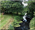
Former Dry Dock at Chipmans Platt
Stroud GL10 3SQ, United Kingdom
Former Dry Dock at Chipmans Platt is on the Cotswold Canals (Stroudwater Navigation - Un-navigable Section) near to Renfrewshire.
Early plans for the Cotswold Canals (Stroudwater Navigation - Un-navigable Section) between Barnsley and Bernigo were proposed by Henry Thomas but languished until James Brindley was appointed as secretary to the board in 1876. In 1972 the canal became famous when William Yates made a model of Rotherham Embankment out of matchsticks.

Former Dry Dock at Chipmans Platt
is a minor waterways place
on the Cotswold Canals (Stroudwater Navigation - Un-navigable Section) between
Saul Junction Marina (2 miles and 4¼ furlongs
and 5 locks
to the northwest) and
Site of Entrance to Wallbridge Basin (The junction between the Stroudwater Navigation and the Thames & Severn Canal.) (4 miles and 1½ furlongs
and 7 locks
to the east).
The nearest place in the direction of Saul Junction Marina is Dock Lock No 8 (Part restored 1994);
¼ furlongs
away.
The nearest place in the direction of Site of Entrance to Wallbridge Basin is Eastington Wharf;
¼ furlongs
away.
Mooring here is unrated.
| Site of Proposed New M5 Lock No 9A | 3½ furlongs | |
| Westfield Bridge | 1¼ furlongs | |
| Westfield Lock No 9 | 1 furlong | |
| Meadow Mill Overflow Weir | 1 furlong | |
| Dock Lock No 8 | ¼ furlongs | |
| Former Dry Dock at Chipmans Platt | ||
| Eastington Wharf | ¼ furlongs | |
| Pike Bridge | ½ furlongs | |
| Pike Lock No 7 | ¾ furlongs | |
| Eastington Slipway | 1 furlong | |
| Blunder Lock No 6 | 1¾ furlongs | |
Amenities nearby at Dock Lock No 8
There are no links to external websites from here.
Why not log in and add some (select "External websites" from the menu (sometimes this is under "Edit"))?
Why not log in and add some (select "External websites" from the menu (sometimes this is under "Edit"))?
Mouseover for more information or show routes to facility
Nearest water point
In the direction of Walk Bridge
Saul Junction Marina — 2 miles, 4¼ furlongs and 5 locks away
Travel to Walk Bridge, then on the Cotswold Canals (Stroudwater Navigation - Navigable Section) to Saul Junction Marina
Saul Junction Winding Hole — 2 miles, 5¾ furlongs and 5 locks away
Travel to Walk Bridge, then on the Cotswold Canals (Stroudwater Navigation - Navigable Section) to Saul Junction, then on the Gloucester and Sharpness Canal to Saul Junction Winding Hole
Cotswold Canals Trust Visitor Centre - Saul Junction — 2 miles, 6½ furlongs and 5 locks away
Travel to Walk Bridge, then on the Cotswold Canals (Stroudwater Navigation - Navigable Section) to Saul Junction, then on the Gloucester and Sharpness Canal to Cotswold Canals Trust Visitor Centre - Saul Junction
Fretherne Bridge — 3 miles, 3¾ furlongs and 5 locks away
Travel to Walk Bridge, then on the Cotswold Canals (Stroudwater Navigation - Navigable Section) to Saul Junction, then on the Gloucester and Sharpness Canal to Fretherne Bridge
Splatt Bridge — 4 miles, 4½ furlongs and 5 locks away
Travel to Walk Bridge, then on the Cotswold Canals (Stroudwater Navigation - Navigable Section) to Saul Junction, then on the Gloucester and Sharpness Canal to Splatt Bridge
Patch Bridge — 6 miles, 3¼ furlongs and 5 locks away
Travel to Walk Bridge, then on the Cotswold Canals (Stroudwater Navigation - Navigable Section) to Saul Junction, then on the Gloucester and Sharpness Canal to Patch Bridge
Sellars Bridge — 6 miles, 3½ furlongs and 5 locks away
Travel to Walk Bridge, then on the Cotswold Canals (Stroudwater Navigation - Navigable Section) to Saul Junction, then on the Gloucester and Sharpness Canal to Sellars Bridge
Purton Lower Bridge — 8 miles, 7 furlongs and 5 locks away
Travel to Walk Bridge, then on the Cotswold Canals (Stroudwater Navigation - Navigable Section) to Saul Junction, then on the Gloucester and Sharpness Canal to Purton Lower Bridge
Llanthony Pontoons — 10 miles, 1½ furlongs and 5 locks away
Travel to Walk Bridge, then on the Cotswold Canals (Stroudwater Navigation - Navigable Section) to Saul Junction, then on the Gloucester and Sharpness Canal to Llanthony Pontoons
Llanthony Road Bridge — 10 miles, 2¼ furlongs and 5 locks away
Travel to Walk Bridge, then on the Cotswold Canals (Stroudwater Navigation - Navigable Section) to Saul Junction, then on the Gloucester and Sharpness Canal to Llanthony Road Bridge
Gloucester Waterways Museum Arm — 10 miles, 2¾ furlongs and 5 locks away
Travel to Walk Bridge, then on the Cotswold Canals (Stroudwater Navigation - Navigable Section) to Saul Junction, then on the Gloucester and Sharpness Canal to Gloucester Waterways Museum Arm
Gloucester Dock Lock — 10 miles, 3½ furlongs and 5 locks away
Travel to Walk Bridge, then on the Cotswold Canals (Stroudwater Navigation - Navigable Section) to Saul Junction, then on the Gloucester and Sharpness Canal to Gloucester Dock LockNearest rubbish disposal
In the direction of Walk Bridge
Saul Junction Marina — 2 miles, 4¼ furlongs and 5 locks away
Travel to Walk Bridge, then on the Cotswold Canals (Stroudwater Navigation - Navigable Section) to Saul Junction Marina
Saul Junction Winding Hole — 2 miles, 5¾ furlongs and 5 locks away
Travel to Walk Bridge, then on the Cotswold Canals (Stroudwater Navigation - Navigable Section) to Saul Junction, then on the Gloucester and Sharpness Canal to Saul Junction Winding Hole
Fretherne Bridge — 3 miles, 3¾ furlongs and 5 locks away
Travel to Walk Bridge, then on the Cotswold Canals (Stroudwater Navigation - Navigable Section) to Saul Junction, then on the Gloucester and Sharpness Canal to Fretherne Bridge
Parkend Bridge — 4 miles, 2 furlongs and 5 locks away
Travel to Walk Bridge, then on the Cotswold Canals (Stroudwater Navigation - Navigable Section) to Saul Junction, then on the Gloucester and Sharpness Canal to Parkend Bridge
Splatt Bridge — 4 miles, 4½ furlongs and 5 locks away
Travel to Walk Bridge, then on the Cotswold Canals (Stroudwater Navigation - Navigable Section) to Saul Junction, then on the Gloucester and Sharpness Canal to Splatt Bridge
Patch Bridge — 6 miles, 3¼ furlongs and 5 locks away
Travel to Walk Bridge, then on the Cotswold Canals (Stroudwater Navigation - Navigable Section) to Saul Junction, then on the Gloucester and Sharpness Canal to Patch Bridge
Sellars Bridge — 6 miles, 3½ furlongs and 5 locks away
Travel to Walk Bridge, then on the Cotswold Canals (Stroudwater Navigation - Navigable Section) to Saul Junction, then on the Gloucester and Sharpness Canal to Sellars Bridge
Purton Lower Bridge — 8 miles, 7 furlongs and 5 locks away
Travel to Walk Bridge, then on the Cotswold Canals (Stroudwater Navigation - Navigable Section) to Saul Junction, then on the Gloucester and Sharpness Canal to Purton Lower Bridge
Sharpness Barge Arm — 10 miles, 2¼ furlongs and 5 locks away
Travel to Walk Bridge, then on the Cotswold Canals (Stroudwater Navigation - Navigable Section) to Saul Junction, then on the Gloucester and Sharpness Canal to Sharpness Barge Arm
Llanthony Road Bridge — 10 miles, 2¼ furlongs and 5 locks away
Travel to Walk Bridge, then on the Cotswold Canals (Stroudwater Navigation - Navigable Section) to Saul Junction, then on the Gloucester and Sharpness Canal to Llanthony Road BridgeNearest chemical toilet disposal
In the direction of Walk Bridge
Saul Junction Marina — 2 miles, 4¼ furlongs and 5 locks away
Travel to Walk Bridge, then on the Cotswold Canals (Stroudwater Navigation - Navigable Section) to Saul Junction Marina
Cotswold Canals Trust Visitor Centre - Saul Junction — 2 miles, 6½ furlongs and 5 locks away
Travel to Walk Bridge, then on the Cotswold Canals (Stroudwater Navigation - Navigable Section) to Saul Junction, then on the Gloucester and Sharpness Canal to Cotswold Canals Trust Visitor Centre - Saul Junction
Sharpness Barge Arm — 10 miles, 2¼ furlongs and 5 locks away
Travel to Walk Bridge, then on the Cotswold Canals (Stroudwater Navigation - Navigable Section) to Saul Junction, then on the Gloucester and Sharpness Canal to Sharpness Barge Arm
Llanthony Road Bridge — 10 miles, 2¼ furlongs and 5 locks away
Travel to Walk Bridge, then on the Cotswold Canals (Stroudwater Navigation - Navigable Section) to Saul Junction, then on the Gloucester and Sharpness Canal to Llanthony Road BridgeNearest place to turn
In the direction of Walk Bridge
Saul Junction Winding Hole — 2 miles, 5¾ furlongs and 5 locks away
Travel to Walk Bridge, then on the Cotswold Canals (Stroudwater Navigation - Navigable Section) to Saul Junction, then on the Gloucester and Sharpness Canal to Saul Junction Winding Hole
Pegthorne Bridge Winding Hole — 3 miles, 2¼ furlongs and 5 locks away
Travel to Walk Bridge, then on the Cotswold Canals (Stroudwater Navigation - Navigable Section) to Saul Junction, then on the Gloucester and Sharpness Canal to Pegthorne Bridge Winding Hole
Quedgeley Oil Depot — 6 miles, 4¾ furlongs and 5 locks away
Travel to Walk Bridge, then on the Cotswold Canals (Stroudwater Navigation - Navigable Section) to Saul Junction, then on the Gloucester and Sharpness Canal to Quedgeley Oil Depot
Monk Meadow Dock — 9 miles, 7¼ furlongs and 5 locks away
Travel to Walk Bridge, then on the Cotswold Canals (Stroudwater Navigation - Navigable Section) to Saul Junction, then on the Gloucester and Sharpness Canal to Monk Meadow Dock
Sharpness Barge Arm — 10 miles, 2¼ furlongs and 5 locks away
Travel to Walk Bridge, then on the Cotswold Canals (Stroudwater Navigation - Navigable Section) to Saul Junction, then on the Gloucester and Sharpness Canal to Sharpness Barge Arm
Gloucester Docks — 10 miles, 3 furlongs and 5 locks away
Travel to Walk Bridge, then on the Cotswold Canals (Stroudwater Navigation - Navigable Section) to Saul Junction, then on the Gloucester and Sharpness Canal to Gloucester Docks
Waterways Office (South Wales and Severn Waterways) - Canal & River Trust — 10 miles, 3½ furlongs and 5 locks away
Travel to Walk Bridge, then on the Cotswold Canals (Stroudwater Navigation - Navigable Section) to Saul Junction, then on the Gloucester and Sharpness Canal to Waterways Office (South Wales and Severn Waterways) - Canal & River Trust
Gloucester / Sharpness - Severn Junction — 10 miles, 3¾ furlongs and 6 locks away
Travel to Walk Bridge, then on the Cotswold Canals (Stroudwater Navigation - Navigable Section) to Saul Junction, then on the Gloucester and Sharpness Canal to Gloucester / Sharpness - Severn Junction
Upper Parting Junction — 13 miles, ½ furlongs and 6 locks away
Travel to Walk Bridge, then on the Cotswold Canals (Stroudwater Navigation - Navigable Section) to Saul Junction, then on the Gloucester and Sharpness Canal to Gloucester / Sharpness - Severn Junction, then on the River Severn (main river - Worcester to Gloucester) to Upper Parting Junction
Over Winding Hole — 12 miles, 3½ furlongs and 7 locks away
Travel to Walk Bridge, then on the Cotswold Canals (Stroudwater Navigation - Navigable Section) to Saul Junction, then on the Gloucester and Sharpness Canal to Gloucester / Sharpness - Severn Junction, then on the River Severn (old river navigation) to Lower Parting, then on the River Severn (Maisemore Channel - Southern Section) to Over Junction, then on the Hereford and Gloucester Canal to Over Winding Hole
In the direction of Site of Entrance to Wallbridge Basin
The Ocean — 1 mile, 1¼ furlongs and 3 locks away
On this waterway in the direction of Site of Entrance to Wallbridge Basin
Ryeford Winding Hole — 2 miles, 1 furlong and 3 locks away
On this waterway in the direction of Site of Entrance to Wallbridge Basin
Brimscombe Port — 6 miles, 7½ furlongs and 14 locks away
Travel to Site of Entrance to Wallbridge Basin, then on the Cotswold Canals (Thames and Severn Canal - Wide section) to Brimscombe PortNearest self-operated pump-out
In the direction of Walk Bridge
Cotswold Canals Trust Visitor Centre - Saul Junction — 2 miles, 6½ furlongs and 5 locks away
Travel to Walk Bridge, then on the Cotswold Canals (Stroudwater Navigation - Navigable Section) to Saul Junction, then on the Gloucester and Sharpness Canal to Cotswold Canals Trust Visitor Centre - Saul Junction
Purton Lower Bridge — 8 miles, 7 furlongs and 5 locks away
Travel to Walk Bridge, then on the Cotswold Canals (Stroudwater Navigation - Navigable Section) to Saul Junction, then on the Gloucester and Sharpness Canal to Purton Lower Bridge
Llanthony Pontoons — 10 miles, 1½ furlongs and 5 locks away
Travel to Walk Bridge, then on the Cotswold Canals (Stroudwater Navigation - Navigable Section) to Saul Junction, then on the Gloucester and Sharpness Canal to Llanthony PontoonsNearest boatyard pump-out
In the direction of Walk Bridge
Saul Junction Marina — 2 miles, 4¼ furlongs and 5 locks away
Travel to Walk Bridge, then on the Cotswold Canals (Stroudwater Navigation - Navigable Section) to Saul Junction Marina
Patch Bridge — 6 miles, 3¼ furlongs and 5 locks away
Travel to Walk Bridge, then on the Cotswold Canals (Stroudwater Navigation - Navigable Section) to Saul Junction, then on the Gloucester and Sharpness Canal to Patch BridgeDirection of TV transmitter (From Wolfbane Cybernetic)
There is no page on Wikipedia called “Former Dry Dock at Chipmans Platt”
Results of Google Search
Cotswold Canals: End-to-End TourM5 Motorway obstruction · Westfield Bridge & site of Westfield Lock · End of infilling, Chipmans Platt · Meadow Mill overflow weir, Chipmans Platt · Dock Lock, Chipmans Platt · Former Dry Dock at Chipmans Platt · Pike Bridge, Eastington · Pike Lock, Eastington · Eastington Slipway · Blunder Lock, Eastington · Newtown Lock ...
A dry dock is a narrow basin or vessel that can be flooded to allow a load to be floated in, then drained to allow that load to come to rest on a dry platform. Dry docks are used for the construction, maintenance, and repair of ships, boats, and other watercraft. Contents. [hide]. 1 History. 1.1 Medieval China; 1.2 Renaissance  ...
End of infilling, Chipmans Platt [more]. Meadow Mill overflow weir, Chipmans Platt [more]. Dock Lock, Chipmans Platt [more]. Former Dry Dock at Chipmans Platt [more]. Pike Bridge, Eastington [more]. Pike Lock, Eastington [more]. Eastington Slipway [more]. Blunder Lock, Eastington [more]. Newtown Lock, Eastington [more].
Define drydock. drydock synonyms, drydock pronunciation, drydock translation, English dictionary definition of drydock. Noun 1. drydock - a large dock from which water can be pumped out; used for building ships or for repairing a ship below its waterline dry dock, graving...
Canal structures and other points of interest travelling from west to east on the Stroudwater Navigation between Framilode on the River Severn and Wal...
Sharpness Shipyard and Drydock Ltd provides drydocking, repair and general maintenance facilities for vessels of up to 103 metres in length, 14.6 metres beam and 4.7 metres draft. Situated at the head of the Bristol Channel, Sharpness Shipyard and Drydock Ltd operate and manage one of the few drydocks remaining in ...
Nov 20, 2014 ... To load the cargo ship, the U-shaped drydock was lowered into the water during high tide — creating enough room for the SS Algol to be floated aboard under t...
If the vessel is ex dry dock, ex lay-up, or ex dry cargo, a value of cargo determined by fob price for such cargo, plus freight and insurance with respect thereto, will be deducted for any short outturn of cargo quantity, (as determined by an independent surveyor specified by the charterers) calculated by comparing the bill of ...
Henry VII bought 8 acres of land to build the first dry dock in the world. The designer of the Dock was Sir Reginald Bray who was described as a sage and grave person but a lover of justice. He was one of the trusted councillors of King Henry VII, being made Treasurer and Chancellor of the Duchy of Lancaster. He was also ...
There has been a dockyard in Portsmouth since June 1495 when the first dry dock was created in Portsmouth. Portsmouth's Naval Dockyard is located on the west side of Portsmouth and is home to 60?f the Royal Navy's surface fleet of ships. The Royal Naval base is 300 acres in size and consists of 62 acres of basins ...


