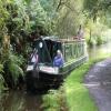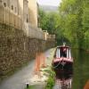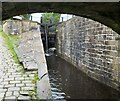
High Lea Narrows
is a minor waterways place
on the Huddersfield Narrow Canal between
Tunnel End Footbridge No 62 (3¾ furlongs
to the west) and
Railway Lock No 42E (Marsden. Eastern summit lock) (1 furlong
to the east).
The nearest place in the direction of Tunnel End Footbridge No 62 is Narrows by bridge No 61;
2½ furlongs
away.
The nearest place in the direction of Railway Lock No 42E is Marsden Pipe Bridge;
½ furlongs
away.
There is access (unofficial access) to the towpath here.
Mooring here is good (a nice place to moor).
| Standedge Visitor Centre | 4 furlongs | |
| Tunnel End Footbridge No 62 | 3¾ furlongs | |
| Standedge Tunnel End Winding Hole | 3½ furlongs | |
| Tunnel End Railway Bridge No 61 | 3 furlongs | |
| Narrows by bridge No 61 | 2½ furlongs | |
| High Lea Narrows | ||
| Marsden Pipe Bridge | ½ furlongs | |
| Station Road Bridge No 60 | ¾ furlongs | |
| Railway Lock No 42E | 1 furlong | |
| Station Approach Bridge No 59 | 1 furlong | |
| Goods Yard Bridge No 58 | 1¼ furlongs | |
Amenities nearby at Marsden Pipe Bridge
There are no links to external websites from here.
Why not log in and add some (select "External websites" from the menu (sometimes this is under "Edit"))?
Why not log in and add some (select "External websites" from the menu (sometimes this is under "Edit"))?
Mouseover for more information or show routes to facility
Nearest water point
In the direction of Ashton-under-Lyne Junction
Standedge Tunnel (eastern entrance) — 4¼ furlongs away
On this waterway in the direction of Ashton-under-Lyne Junction
Standedge Tunnel (western entrance) — 3 miles, 6 furlongs away
On this waterway in the direction of Ashton-under-Lyne Junction
Wool Road Bridge No 70 — 5 miles, 6 furlongs and 9 locks away
On this waterway in the direction of Ashton-under-Lyne Junction
Grove Road Bridge No 96 — 11 miles, 6 furlongs and 24 locks away
On this waterway in the direction of Ashton-under-Lyne Junction
Fairfield Junction — 19 miles, 2¼ furlongs and 32 locks away
Travel to Ashton-under-Lyne Junction, then on the Ashton Canal (Main Line) to Fairfield Junction
In the direction of Aspley Basin (Huddersfield)
Slaithwaite Winding Hole — 2 miles, 6¾ furlongs and 21 locks away
On this waterway in the direction of Aspley Basin (Huddersfield)
Waterside Lock No 21E — 2 miles, 7½ furlongs and 21 locks away
On this waterway in the direction of Aspley Basin (Huddersfield)
Aspley Basin (Huddersfield) — 7 miles, 5 furlongs and 42 locks away
On this waterway in the direction of Aspley Basin (Huddersfield)
Shepley Bridge Sanitary Station — 14 miles, 1½ furlongs and 53 locks away
Travel to Aspley Basin (Huddersfield), then on the Huddersfield Broad Canal to Cooper Bridge Junction, then on the Calder and Hebble Navigation (Main Line) to Shepley Bridge Sanitary Station
Brighouse Basin — 13 miles, 3¼ furlongs and 55 locks away
Travel to Aspley Basin (Huddersfield), then on the Huddersfield Broad Canal to Cooper Bridge Junction, then on the Calder and Hebble Navigation (Main Line) to Brighouse Basin
Salterhebble Sanitary Station — 17 miles, 5¼ furlongs and 64 locks away
Travel to Aspley Basin (Huddersfield), then on the Huddersfield Broad Canal to Cooper Bridge Junction, then on the Calder and Hebble Navigation (Main Line) to Salterhebble Sanitary Station
Salterhebble Junction — 17 miles, 5¾ furlongs and 65 locks away
Travel to Aspley Basin (Huddersfield), then on the Huddersfield Broad Canal to Cooper Bridge Junction, then on the Calder and Hebble Navigation (Main Line) to Salterhebble Junction
Sowerby Bridge Basin — 19 miles, 7½ furlongs and 65 locks away
Travel to Aspley Basin (Huddersfield), then on the Huddersfield Broad Canal to Cooper Bridge Junction, then on the Calder and Hebble Navigation (Main Line) to Salterhebble Junction, then on the Calder and Hebble Navigation (Main Line) to Sowerby Bridge BasinNearest rubbish disposal
In the direction of Ashton-under-Lyne Junction
Wool Road Visitor Mooring — 5 miles, 6¼ furlongs and 9 locks away
On this waterway in the direction of Ashton-under-Lyne Junction
In the direction of Aspley Basin (Huddersfield)
Pickle Lock No 22E — 2 miles, 6¼ furlongs and 20 locks away
On this waterway in the direction of Aspley Basin (Huddersfield)
Aspley Basin (Huddersfield) — 7 miles, 5 furlongs and 42 locks away
On this waterway in the direction of Aspley Basin (Huddersfield)
Shepley Bridge Sanitary Station — 14 miles, 1½ furlongs and 53 locks away
Travel to Aspley Basin (Huddersfield), then on the Huddersfield Broad Canal to Cooper Bridge Junction, then on the Calder and Hebble Navigation (Main Line) to Shepley Bridge Sanitary Station
Brighouse Lower Basin Visitor Moorings — 13 miles, 3 furlongs and 54 locks away
Travel to Aspley Basin (Huddersfield), then on the Huddersfield Broad Canal to Cooper Bridge Junction, then on the Calder and Hebble Navigation (Main Line) to Brighouse Lower Basin Visitor Moorings
Horbury Basin Residential Moorings & Sanitary Station — 18 miles, 6 furlongs and 60 locks away
Travel to Aspley Basin (Huddersfield), then on the Huddersfield Broad Canal to Cooper Bridge Junction, then on the Calder and Hebble Navigation (Main Line) to Horbury Basin Residential Moorings & Sanitary Station
Salterhebble Sanitary Station — 17 miles, 5¼ furlongs and 64 locks away
Travel to Aspley Basin (Huddersfield), then on the Huddersfield Broad Canal to Cooper Bridge Junction, then on the Calder and Hebble Navigation (Main Line) to Salterhebble Sanitary Station
Sowerby Bridge Basin — 19 miles, 7½ furlongs and 65 locks away
Travel to Aspley Basin (Huddersfield), then on the Huddersfield Broad Canal to Cooper Bridge Junction, then on the Calder and Hebble Navigation (Main Line) to Salterhebble Junction, then on the Calder and Hebble Navigation (Main Line) to Sowerby Bridge BasinNearest chemical toilet disposal
In the direction of Ashton-under-Lyne Junction
Wool Road Bridge No 70 — 5 miles, 6 furlongs and 9 locks away
On this waterway in the direction of Ashton-under-Lyne Junction
Grove Road Bridge No 96 — 11 miles, 6 furlongs and 24 locks away
On this waterway in the direction of Ashton-under-Lyne Junction
Fairfield Junction — 19 miles, 2¼ furlongs and 32 locks away
Travel to Ashton-under-Lyne Junction, then on the Ashton Canal (Main Line) to Fairfield Junction
In the direction of Aspley Basin (Huddersfield)
Pickle Lock No 22E — 2 miles, 6¼ furlongs and 20 locks away
On this waterway in the direction of Aspley Basin (Huddersfield)
Waterside Lock No 21E — 2 miles, 7½ furlongs and 21 locks away
On this waterway in the direction of Aspley Basin (Huddersfield)
Aspley Basin (Huddersfield) — 7 miles, 5 furlongs and 42 locks away
On this waterway in the direction of Aspley Basin (Huddersfield)
Shepley Bridge Sanitary Station — 14 miles, 1½ furlongs and 53 locks away
Travel to Aspley Basin (Huddersfield), then on the Huddersfield Broad Canal to Cooper Bridge Junction, then on the Calder and Hebble Navigation (Main Line) to Shepley Bridge Sanitary Station
Brighouse Basin — 13 miles, 3¼ furlongs and 55 locks away
Travel to Aspley Basin (Huddersfield), then on the Huddersfield Broad Canal to Cooper Bridge Junction, then on the Calder and Hebble Navigation (Main Line) to Brighouse Basin
Savile Town Wharf and Basin (Dewsbury) — 17 miles, 5 furlongs and 57 locks away
Travel to Aspley Basin (Huddersfield), then on the Huddersfield Broad Canal to Cooper Bridge Junction, then on the Calder and Hebble Navigation (Main Line) to Dewsbury Arm Junction, then on the Calder and Hebble Navigation (Dewsbury Old Cut) to Savile Town Wharf and Basin (Dewsbury)
Horbury Basin Residential Moorings & Sanitary Station — 18 miles, 6 furlongs and 60 locks away
Travel to Aspley Basin (Huddersfield), then on the Huddersfield Broad Canal to Cooper Bridge Junction, then on the Calder and Hebble Navigation (Main Line) to Horbury Basin Residential Moorings & Sanitary Station
Salterhebble Sanitary Station — 17 miles, 5¼ furlongs and 64 locks away
Travel to Aspley Basin (Huddersfield), then on the Huddersfield Broad Canal to Cooper Bridge Junction, then on the Calder and Hebble Navigation (Main Line) to Salterhebble Sanitary Station
Sowerby Bridge Basin — 19 miles, 7½ furlongs and 65 locks away
Travel to Aspley Basin (Huddersfield), then on the Huddersfield Broad Canal to Cooper Bridge Junction, then on the Calder and Hebble Navigation (Main Line) to Salterhebble Junction, then on the Calder and Hebble Navigation (Main Line) to Sowerby Bridge BasinNearest place to turn
In the direction of Ashton-under-Lyne Junction
Standedge Tunnel End Winding Hole — 3½ furlongs away
On this waterway in the direction of Ashton-under-Lyne Junction
Diggle Winding Hole — 4 miles, ¾ furlongs away
On this waterway in the direction of Ashton-under-Lyne Junction
Wool Road Winding Hole — 5 miles, 6¾ furlongs and 9 locks away
On this waterway in the direction of Ashton-under-Lyne Junction
Saddleworth Visitor Centre Winding Hole — 6 miles, 4¾ furlongs and 11 locks away
On this waterway in the direction of Ashton-under-Lyne Junction
Manns Wharf Bridge Winding Hole — 7 miles, 7½ furlongs and 13 locks away
On this waterway in the direction of Ashton-under-Lyne Junction
Roughtown Court Winding Hole — 9 miles, ¾ furlongs and 18 locks away
On this waterway in the direction of Ashton-under-Lyne Junction
Mossley Bottoms Winding Hole — 10 miles, ½ furlongs and 20 locks away
On this waterway in the direction of Ashton-under-Lyne Junction
Knowle Street Winding Hole — 14 miles, ½ furlongs and 25 locks away
On this waterway in the direction of Ashton-under-Lyne Junction
Staley Wharf Winding Hole — 15 miles, 2½ furlongs and 29 locks away
On this waterway in the direction of Ashton-under-Lyne Junction
Ashton-under-Lyne Junction — 16 miles, 2¼ furlongs and 32 locks away
On this waterway in the direction of Ashton-under-Lyne Junction
Dukinfield Junction — 16 miles, 6¼ furlongs and 32 locks away
Travel to Ashton-under-Lyne Junction, then on the Ashton Canal (Main Line) to Dukinfield Junction
Portland Basin Arm — 16 miles, 6¾ furlongs and 32 locks away
Travel to Ashton-under-Lyne Junction, then on the Ashton Canal (Main Line) to Dukinfield Junction, then on the Peak Forest Canal (Lower) to Portland Basin Arm
In the direction of Aspley Basin (Huddersfield)
Booth Lock Winding Hole — 1 mile, 1¾ furlongs and 11 locks away
On this waterway in the direction of Aspley Basin (Huddersfield)
Slaithwaite Winding Hole — 2 miles, 6¾ furlongs and 21 locks away
On this waterway in the direction of Aspley Basin (Huddersfield)
Linthwaite Winding Hole — 3 miles, 7¼ furlongs and 26 locks away
On this waterway in the direction of Aspley Basin (Huddersfield)
Isis Lock Winding Hole — 5 miles, 3½ furlongs and 34 locks away
On this waterway in the direction of Aspley Basin (Huddersfield)
University Arm — 7 miles, 4¼ furlongs and 42 locks away
On this waterway in the direction of Aspley Basin (Huddersfield)
Aspley Basin (Huddersfield) — 7 miles, 5 furlongs and 42 locks away
On this waterway in the direction of Aspley Basin (Huddersfield)
Anchor Street Winding Hole — 8 miles, 2 furlongs and 42 locks away
Travel to Aspley Basin (Huddersfield), then on the Huddersfield Broad Canal to Anchor Street Winding Hole
New Road Winding Hole — 8 miles, 5¼ furlongs and 42 locks away
Travel to Aspley Basin (Huddersfield), then on the Huddersfield Broad Canal to New Road Winding HoleNearest self-operated pump-out
In the direction of Ashton-under-Lyne Junction
Wool Road Bridge No 70 — 5 miles, 6 furlongs and 9 locks away
On this waterway in the direction of Ashton-under-Lyne Junction
In the direction of Aspley Basin (Huddersfield)
Slaithwaite Winding Hole — 2 miles, 6¾ furlongs and 21 locks away
On this waterway in the direction of Aspley Basin (Huddersfield)Nearest boatyard pump-out
In the direction of Ashton-under-Lyne Junction
Portland Basin Arm — 16 miles, 6¾ furlongs and 32 locks away
Travel to Ashton-under-Lyne Junction, then on the Ashton Canal (Main Line) to Dukinfield Junction, then on the Peak Forest Canal (Lower) to Portland Basin Arm
In the direction of Aspley Basin (Huddersfield)
Aspley Basin (Huddersfield) — 7 miles, 5 furlongs and 42 locks away
On this waterway in the direction of Aspley Basin (Huddersfield)
Shepley Bridge Marina — 14 miles, 1¾ furlongs and 53 locks away
Travel to Aspley Basin (Huddersfield), then on the Huddersfield Broad Canal to Cooper Bridge Junction, then on the Calder and Hebble Navigation (Main Line) to Shepley Bridge Marina
Sowerby Bridge Basin — 19 miles, 7½ furlongs and 65 locks away
Travel to Aspley Basin (Huddersfield), then on the Huddersfield Broad Canal to Cooper Bridge Junction, then on the Calder and Hebble Navigation (Main Line) to Salterhebble Junction, then on the Calder and Hebble Navigation (Main Line) to Sowerby Bridge BasinDirection of TV transmitter (From Wolfbane Cybernetic)
There is no page on Wikipedia called “High Lea Narrows”
Wikipedia pages that might relate to High Lea Narrows
[Tacoma Narrows Bridge (1950)]
The 1950 Tacoma Narrows Bridge is a suspension bridge in the U.S. state of Washington that carries the westbound lanes of Washington State Route 16 (known
[Ballachulish]
Chaolais) means "the Village by the Narrows". The narrows in question is Caolas Mhic Phàdraig – Peter or Patrick's son's narrows, at the mouth of Loch Leven
[List of bridges in the United States by state]
Penobscot Narrows Bridge, Verona Sarah Mildred Long Bridge, Portsmouth, New Hampshire to Kittery Tukey's Bridge, Portland Two Cent Bridge, Waterville
[Bridge]
structures such as pedestrian bridges and long-span road or rail bridges. One of the most famous examples is the Tacoma Narrows Bridge that collapsed shortly
[Brooklyn–Battery Tunnel]
Asks Army For Narrows Bridge Permit; PROPOSED NARROWS BRIDGE BETWEEN STATEN ISLAND AND BROOKLYN Army Permit for Narrows Bridge Applied for by Tunnel Authority"
[Squirrel bridge]
Nutty Narrows Bridge in Longview, Washington, built in 1963, is regarded as the first of its kind. The city has since built eight other bridges for squirrels
[Arthur Kill]
channel carved by an ancestral phase of the Hudson River resulting from the blockage of the main channel of the Hudson at the Narrows by moraine or an
[List of bridges in the United Kingdom]
Suspension Bridge, by Thomas Telford Menai Suspension Bridge, by Thomas Telford Monnow Bridge, Monmouth Newport Bridge Newport, Caerleon Bridge Newport,
[List of bridge failures]
This is a list of bridge failures. The General (1926 film): The fictional Rock River bridge, a wooden trestle bridge purpose-built for the film, is set
[Whistle]
are Aeolian tones that result in galloping power lines, or the Tacoma Narrows Bridge (the so-called "Galloping Gertie" of popular media). Other examples


![Marsden Shuttle. Notice aboard the narrowboat that ran a service along the Huddersfield Narrow Canal [[911811]] between Tunnel End and Marsden from 1991 until about 1994 charging 50p single or return. by Gerald England – 08 August 1993](https://s1.geograph.org.uk/geophotos/01/43/23/1432345_97568337_120x120.jpg)


![Locomotive move through Marsden. Four Freightliner Class 66 locos on a move that 'realtimetrains' described as 'Basford Hall Yard [Crewe] to Leeds Balm Road'. by Stephen Craven – 07 November 2025](https://s1.geograph.org.uk/geophotos/08/19/22/8192265_5163112e_120x120.jpg)


![Clough Lee Mill (one of two), Marsden. Giles & Goodall, Yorkshire Textile Mills 1770-1930 lists two mills in Marsden called Clough Mill. This is the smaller and is a couple of hundred metres from what was the larger [[775364]].Both appear to have been demolished. The weir apparently survives. I'm rather glad I bothered to make the effort. by Chris Allen – 10 May 1992](https://s1.geograph.org.uk/photos/92/77/927765_18d11729_120x120.jpg)


