Church Lane Bridge No 2
is a minor waterways place
on the Macclesfield Canal between
High Lane Bridge No 11 (High Lane) (2 miles and 1½ furlongs
to the southwest) and
Marple Junction (Junction of Macclesfield and Peak Forest Canals) (¾ furlongs
to the northeast).
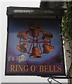
The nearest place in the direction of High Lane Bridge No 11 is Ring o' Bells PH (Marple) (10yds up Church Lane - Bridge 2 );
a few yards
away.
The nearest place in the direction of Marple Junction is Marple Services (Services now fully open (Dec 2024));
¼ furlongs
away.
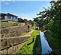
There may be access to the towpath here.
Mooring here is impossible (it may be physically impossible, forbidden, or allowed only for specific short-term purposes).
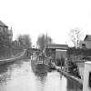
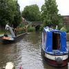
There is a bridge here which takes a minor road over the canal.
Goyt Mill | 4 furlongs | |
Eccles Bridge No 3 | 3¾ furlongs | |
Winding Hole between Church Lane and Eccles Bridges | 2 furlongs | |
Marple Visitor Moorings | ¼ furlongs | |
Ring o' Bells PH (Marple) | a few yards | |
Church Lane Bridge No 2 | ||
Marple Services | ¼ furlongs | |
Sutton's Lane Bridge No 1 | ¾ furlongs | |
Marple Junction | ¾ furlongs |
There are no links to external websites from here.
Why not log in and add some (select "External websites" from the menu (sometimes this is under "Edit"))?
Mouseover for more information or show routes to facility
Nearest water point
In the direction of Hall Green Stop Lock
Braidbar Boats — 3 miles, 5¼ furlongs away
On this waterway in the direction of Hall Green Stop Lock
Bollington Wharf — 8 miles, 3¼ furlongs away
On this waterway in the direction of Hall Green Stop Lock
Swettenham Street Maintenance Yard — 11 miles, 2¾ furlongs away
On this waterway in the direction of Hall Green Stop Lock
Locketts Bridge No 53 — 16 miles, 1 furlong away
On this waterway in the direction of Hall Green Stop Lock
Bosley Top Lock No 1 — 16 miles, 2 furlongs away
On this waterway in the direction of Hall Green Stop Lock
Buxton Road Bridge No 68 — 19 miles, 7¾ furlongs and 12 locks away
On this waterway in the direction of Hall Green Stop Lock
In the direction of Marple Junction
Marple Services — ¼ furlongs away
On this waterway in the direction of Marple Junction
Furness Vale Marina — 5 miles, ¼ furlongs away
Travel to Marple Junction, then on the Peak Forest Canal (Upper) to Furness Vale Marina
Whaley Bridge Services — 6 miles, 4½ furlongs away
Travel to Marple Junction, then on the Peak Forest Canal (Upper) to Whaley Bridge Branch Junction, then on the Peak Forest Canal (Whaley Bridge Branch) to Whaley Bridge Services
Bugsworth Services — 6 miles, 4¾ furlongs away
Travel to Marple Junction, then on the Peak Forest Canal (Upper) to Bugsworth Services
Fairfield Junction — 10 miles, 5¾ furlongs and 16 locks away
Travel to Marple Junction, then on the Peak Forest Canal (Lower) to Dukinfield Junction, then on the Ashton Canal (Main Line) to Fairfield Junction
Grove Road Bridge No 96 — 13 miles, 1¾ furlongs and 24 locks away
Travel to Marple Junction, then on the Peak Forest Canal (Lower) to Dukinfield Junction, then on the Ashton Canal (Main Line) to Ashton-under-Lyne Junction, then on the Huddersfield Narrow Canal to Grove Road Bridge No 96
New Islington Marina — 15 miles and 36 locks away
Travel to Marple Junction, then on the Peak Forest Canal (Lower) to Dukinfield Junction, then on the Ashton Canal (Main Line) to Ducie Street Junction, then on the Rochdale Canal to New Islington Marina Entrance, then on the Rochdale Canal (Main Line) to Cotton Field Wharf Marina, then on the Rochdale Canal (New Islington Marina Arm) to New Islington Marina
Wool Road Bridge No 70 — 19 miles, 2 furlongs and 39 locks away
Travel to Marple Junction, then on the Peak Forest Canal (Lower) to Dukinfield Junction, then on the Ashton Canal (Main Line) to Ashton-under-Lyne Junction, then on the Huddersfield Narrow Canal to Wool Road Bridge No 70
Staffordshire, Kenworthy and other Arms — 15 miles, 6 furlongs and 43 locks away
Travel to Marple Junction, then on the Peak Forest Canal (Lower) to Dukinfield Junction, then on the Ashton Canal (Main Line) to Ducie Street Junction, then on the Rochdale Canal to Castlefield Junction, then on the Bridgewater Canal (Main Line) to Staffordshire, Kenworthy and other Arms
Potato Wharf Arm & The New Basin — 15 miles, 6¾ furlongs and 43 locks away
Travel to Marple Junction, then on the Peak Forest Canal (Lower) to Dukinfield Junction, then on the Ashton Canal (Main Line) to Ducie Street Junction, then on the Rochdale Canal to Castlefield Junction, then on the Bridgewater Canal (Main Line) to Potato Wharf Arm & The New Basin
Stretford Marina — 18 miles, 6 furlongs and 43 locks away
Travel to Marple Junction, then on the Peak Forest Canal (Lower) to Dukinfield Junction, then on the Ashton Canal (Main Line) to Ducie Street Junction, then on the Rochdale Canal to Castlefield Junction, then on the Bridgewater Canal (Main Line) to Stretford Marina
Watch House Cruising Club — 19 miles, 6¼ furlongs and 43 locks away
Travel to Marple Junction, then on the Peak Forest Canal (Lower) to Dukinfield Junction, then on the Ashton Canal (Main Line) to Ducie Street Junction, then on the Rochdale Canal to Castlefield Junction, then on the Bridgewater Canal (Main Line) to Watch House Cruising ClubNearest rubbish disposal
In the direction of Hall Green Stop Lock
Braidbar Boats — 3 miles, 5¼ furlongs away
On this waterway in the direction of Hall Green Stop Lock
Bosley Top Lock No 1 — 16 miles, 2 furlongs away
On this waterway in the direction of Hall Green Stop Lock
In the direction of Marple Junction
Marple Services — ¼ furlongs away
On this waterway in the direction of Marple Junction
Whaley Bridge Services — 6 miles, 4½ furlongs away
Travel to Marple Junction, then on the Peak Forest Canal (Upper) to Whaley Bridge Branch Junction, then on the Peak Forest Canal (Whaley Bridge Branch) to Whaley Bridge Services
Bugsworth Services — 6 miles, 4¾ furlongs away
Travel to Marple Junction, then on the Peak Forest Canal (Upper) to Bugsworth Services
Marple Bottom Lock Bridge Winding Hole — 1 mile, 1½ furlongs and 16 locks away
Travel to Marple Junction, then on the Peak Forest Canal (Lower) to Marple Bottom Lock Bridge Winding Hole
Wool Road Visitor Mooring — 19 miles, 1½ furlongs and 39 locks away
Travel to Marple Junction, then on the Peak Forest Canal (Lower) to Dukinfield Junction, then on the Ashton Canal (Main Line) to Ashton-under-Lyne Junction, then on the Huddersfield Narrow Canal to Wool Road Visitor MooringNearest chemical toilet disposal
In the direction of Hall Green Stop Lock
Bollington Wharf — 8 miles, 3¼ furlongs away
On this waterway in the direction of Hall Green Stop Lock
Swettenham Wharf — 11 miles, 2½ furlongs away
On this waterway in the direction of Hall Green Stop Lock
Bosley Top Lock No 1 — 16 miles, 2 furlongs away
On this waterway in the direction of Hall Green Stop Lock
In the direction of Marple Junction
Marple Services — ¼ furlongs away
On this waterway in the direction of Marple Junction
Furness Vale Marina — 5 miles, ¼ furlongs away
Travel to Marple Junction, then on the Peak Forest Canal (Upper) to Furness Vale Marina
Whaley Bridge Services — 6 miles, 4½ furlongs away
Travel to Marple Junction, then on the Peak Forest Canal (Upper) to Whaley Bridge Branch Junction, then on the Peak Forest Canal (Whaley Bridge Branch) to Whaley Bridge Services
Bugsworth Services — 6 miles, 4¾ furlongs away
Travel to Marple Junction, then on the Peak Forest Canal (Upper) to Bugsworth Services
Fairfield Junction — 10 miles, 5¾ furlongs and 16 locks away
Travel to Marple Junction, then on the Peak Forest Canal (Lower) to Dukinfield Junction, then on the Ashton Canal (Main Line) to Fairfield Junction
Grove Road Bridge No 96 — 13 miles, 1¾ furlongs and 24 locks away
Travel to Marple Junction, then on the Peak Forest Canal (Lower) to Dukinfield Junction, then on the Ashton Canal (Main Line) to Ashton-under-Lyne Junction, then on the Huddersfield Narrow Canal to Grove Road Bridge No 96
Wool Road Bridge No 70 — 19 miles, 2 furlongs and 39 locks away
Travel to Marple Junction, then on the Peak Forest Canal (Lower) to Dukinfield Junction, then on the Ashton Canal (Main Line) to Ashton-under-Lyne Junction, then on the Huddersfield Narrow Canal to Wool Road Bridge No 70
Watch House Cruising Club — 19 miles, 6¼ furlongs and 43 locks away
Travel to Marple Junction, then on the Peak Forest Canal (Lower) to Dukinfield Junction, then on the Ashton Canal (Main Line) to Ducie Street Junction, then on the Rochdale Canal to Castlefield Junction, then on the Bridgewater Canal (Main Line) to Watch House Cruising ClubNearest place to turn
In the direction of Hall Green Stop Lock
Winding Hole between Church Lane and Eccles Bridges — 2 furlongs away
On this waterway in the direction of Hall Green Stop Lock
Junction with High Lane Branch — 2 miles, 2¼ furlongs away
On this waterway in the direction of Hall Green Stop Lock
Brownhills Bridge Winding Hole — 3 miles, 5½ furlongs away
On this waterway in the direction of Hall Green Stop Lock
Higher Poynton Winding Hole — 3 miles, 7½ furlongs away
On this waterway in the direction of Hall Green Stop Lock
Grimshaws Bridge Winding Hole — 5 miles, 1¼ furlongs away
On this waterway in the direction of Hall Green Stop Lock
Ryles Bridge Winding Hole — 6 miles, ¼ furlongs away
On this waterway in the direction of Hall Green Stop Lock
Wilds Bridge Winding Hole — 6 miles, 6 furlongs away
On this waterway in the direction of Hall Green Stop Lock
In the direction of Marple Junction
Marple Junction — ¾ furlongs away
On this waterway in the direction of Marple Junction
Top Lock Marine Marina — 1½ furlongs away
Travel to Marple Junction, then on the Peak Forest Canal (Upper) to Top Lock Marine Marina
Hollinwood Lane Winding Hole — 1 mile, 3½ furlongs away
Travel to Marple Junction, then on the Peak Forest Canal (Upper) to Hollinwood Lane Winding Hole
Turflea Winding Hole — 1 mile, 5¾ furlongs away
Travel to Marple Junction, then on the Peak Forest Canal (Upper) to Turflea Winding Hole
Disley Winding Hole — 3 miles, 5¼ furlongs away
Travel to Marple Junction, then on the Peak Forest Canal (Upper) to Disley Winding Hole
Winding Hole below Lock 13 — 2¼ furlongs and 4 locks away
Travel to Marple Junction, then on the Peak Forest Canal (Lower) to Winding Hole below Lock 13
Bank End Winding Hole — 4 miles, 2 furlongs away
Travel to Marple Junction, then on the Peak Forest Canal (Upper) to Bank End Winding Hole
Whaley Bridge Branch Junction — 6 miles, ¾ furlongs away
Travel to Marple Junction, then on the Peak Forest Canal (Upper) to Whaley Bridge Branch Junction
Whaley Bridge Winding Hole — 6 miles, 4½ furlongs away
Travel to Marple Junction, then on the Peak Forest Canal (Upper) to Whaley Bridge Branch Junction, then on the Peak Forest Canal (Whaley Bridge Branch) to Whaley Bridge Winding Hole
Bugsworth Lower Basin — 6 miles, 4¾ furlongs away
Travel to Marple Junction, then on the Peak Forest Canal (Upper) to Bugsworth Lower Basin
Bugsworth Lower Basin Arm — 6 miles, 5 furlongs away
Travel to Marple Junction, then on the Peak Forest Canal (Upper) to Bugsworth Lower Basin Arm
The Wide — 6 miles, 5½ furlongs away
Travel to Marple Junction, then on the Peak Forest Canal (Upper) to The Wide
Bugsworth Middle Basin Arm — 6 miles, 6½ furlongs away
Travel to Marple Junction, then on the Peak Forest Canal (Upper) to Bugsworth Middle Basin ArmNearest self-operated pump-out
In the direction of Hall Green Stop Lock
Bosley Top Lock No 1 — 16 miles, 2 furlongs away
On this waterway in the direction of Hall Green Stop Lock
In the direction of Marple Junction
New Islington Marina — 15 miles and 36 locks away
Travel to Marple Junction, then on the Peak Forest Canal (Lower) to Dukinfield Junction, then on the Ashton Canal (Main Line) to Ducie Street Junction, then on the Rochdale Canal to New Islington Marina Entrance, then on the Rochdale Canal (Main Line) to Cotton Field Wharf Marina, then on the Rochdale Canal (New Islington Marina Arm) to New Islington Marina
Wool Road Bridge No 70 — 19 miles, 2 furlongs and 39 locks away
Travel to Marple Junction, then on the Peak Forest Canal (Lower) to Dukinfield Junction, then on the Ashton Canal (Main Line) to Ashton-under-Lyne Junction, then on the Huddersfield Narrow Canal to Wool Road Bridge No 70Nearest boatyard pump-out
In the direction of Hall Green Stop Lock
Braidbar Boats — 3 miles, 5¼ furlongs away
On this waterway in the direction of Hall Green Stop Lock
Bollington Wharf — 8 miles, 3¼ furlongs away
On this waterway in the direction of Hall Green Stop Lock
Kerridge Dry Dock — 8 miles, 6 furlongs away
On this waterway in the direction of Hall Green Stop Lock
Swettenham Wharf — 11 miles, 2½ furlongs away
On this waterway in the direction of Hall Green Stop Lock
In the direction of Marple Junction
New Mills Marina — 4 miles, 1 furlong away
Travel to Marple Junction, then on the Peak Forest Canal (Upper) to New Mills Marina
Portland Basin Arm — 8 miles, 1¼ furlongs and 16 locks away
Travel to Marple Junction, then on the Peak Forest Canal (Lower) to Portland Basin Arm
Stretford Marina — 18 miles, 6 furlongs and 43 locks away
Travel to Marple Junction, then on the Peak Forest Canal (Lower) to Dukinfield Junction, then on the Ashton Canal (Main Line) to Ducie Street Junction, then on the Rochdale Canal to Castlefield Junction, then on the Bridgewater Canal (Main Line) to Stretford MarinaDirection of TV transmitter (From Wolfbane Cybernetic)
There is no page on Wikipedia called “Church Lane Bridge”
Wikipedia pages that might relate to Church Lane Bridge
[Fort Lee lane closure scandal]
The Fort Lee lane closure scandal, also known as the George Washington Bridge lane closure scandal or Bridgegate, was a political scandal involving a
[Putney Bridge]
first bridge was built in 1729, a ferry had shuttled between the two banks. The current format is three lanes southbound (including one bus lane) and one
[George Washington Bridge]
four lanes in each direction and a lower level with three lanes in each direction, for a total of 14 lanes of travel. The speed limit on the bridge is 45 mph
[Bridges of York]
Railway (c. 1880) Fossway Bridge Huntington Road Bridge Link Road Bridge between New Earswick and Huntington Church Lane Bridge, Huntington The A1237 Outer
[Lea Bridge Road]
Lea Bridge Road Bridge was opened Mon 21 August 1995. The name Lea Bridge Road was adopted for an existing lane previously called Mill Field Lane. It
[St Michael, Crooked Lane]
51070; -0.087280 St Michael, Crooked Lane was an ancient parish church situated on the east side of Miles's Lane in Candlewick Ward in the City of London
[Bridge (ward)]
Magnus-the-Martyr church, the Monument to the Great Fire of London, and the full span of London Bridge. The present day ward of Bridge was historically
[Basingstoke Canal]
Greywell and Brookwood Lye and a short stretch between Monument Bridge and Scotland Bridge in Woking. It is the most botanically rich aquatic area in England
[Apperley Bridge]
from the old bridge over the river on Apperley Lane. Parts of Rawdon in Leeds of similar character are included in the BD10 Apperley Bridge postal district
[Brick Lane]
51°31′19″N 0°4′18″W / 51.52194°N 0.07167°W / 51.52194; -0.07167 Brick Lane (Bengali: ব্রিক লেন) is a street in the East End of London, in the borough
Results of Google Search
2019 York County Bridge Maintenance - Contract No 2Aug 26, 2020 ... CONSTRUCTION JOURNAL Project Report - Win more business with commercial construction leads. Powerful data, tools and analytics to help ...
Jul 25, 2019 ... Sealed bids for 20-07-52645 Rehabilitation of Bridge No. ... BID 20-07-52645 Bethel Church Road ... No. 2 BID 20-07 Bethel Church RD Bridge.
Apr 4, 2019 ... After an extensive, eight-month rehabilitation project, Bucks County this morning re-opened Bridge No. 209 in Haycock and Nockamixon ...
Oct 21, 2019 ... COMMENTS: Houses in the 100 - 300 Block of Bethel Church Road will ... M. T. _ . D. 0. 0. 1. _. B e th e. l.d g n. W e d n e s d a y. , A p ril 2. 4. , 2.
Jun 25, 2015 ... The Church Lane bridge in Lower Macungie Township will be closed ... discussed closing the bridge permanently, but ultimately chose not to.
... Church Ln, Natural Bridge Station, VA 24579 is currently not for sale on Zillow. ... Move in ready, has 3 Bedrooms, 2 Baths, Living Room, Dining Room, and ...
Malcom Church Road (C.R. 4) Over the Ohio Turnpike M.P. 3.1, Nettle Creek Road ... Resolution No. 2-2019, Nov 29, 2018. Dec 6, 2018, Dec 21, 2018, Bridge ...
Jan 18, 2018 ... CHARTER CHURCH ROAD BRIDGE ... BRIDGE NO. 34200011. 4:1. 3:1. -------. 331. 2" BP-1. " BITUMINOUS BASE. 4" TYPE 5 AGGREGATEH.
Shenandoah River--Palmyra Church Road Bridge. Shenandoah ... Sightings. Updated 2 sec ago. ... Checklists submitted within the last hour are not shown.
Road & Bridge Projects ... STP-5403 689 (PDF) · 2020 - Charter Church Road Bridge, at Mitch Sweet over Plattin Creek, Project Number STP-5403 ... 2020 - Old Lemay Ferry Road Improvements Phase 1 and 2, East Rock Creek to Spring ...