CanalPlanAC

Nene Parkway Bridge

 
Orton Mere (NVR), Nene Parkway, Peterborough PE2 7DZ, United Kingdom
 
Information about the place
Nene Parkway Bridge is a minor waterways place on the River Nene (main river) between Peterborough Junction (Junction of River Nene with Stanground Branch) (2 miles and 3¼ furlongs to the east) and Overton Lake Junction (7¾ furlongs and 1 lock to the west).
 
 
The nearest place in the direction of Peterborough Junction is Peterborough Rowing Club Junction; 5¾ furlongs away.
 
The nearest place in the direction of Overton Lake Junction is Orton Moorings; ¼ furlongs away.

Mooring here is unrated.

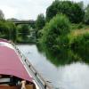
There is a bridge here which takes a dual carriageway over the canal.


Amenities

Amenities here

 Fayre & Square
 Gordon Arms

Amenities nearby at Peterborough Rowing Club Junction

 Costcutter
 Budgens
 SEE ADDRESS
 Dominos Pizza
 Cashpoint
 Shell
 
Maps
If you are a user and are logged on, or if you are actively planning a route, a map will be displayed here.
Show on external mapping site: Google | OSM | Bing
 
Photos
 
External websites
There are no links to external websites from here.
Why not log in and add some (select "External websites" from the menu (sometimes this is under "Edit"))?
 
Nearest facilities

Mouseover for more information or show routes to facility

Nearest water point

In the direction of Northampton Railway Bridge

Yarwell Lock No 3310 miles, 7½ furlongs and 4 locks away
On this waterway in the direction of Northampton Railway Bridge
Fotheringhay Bridge16 miles, 5 furlongs and 7 locks away
On this waterway in the direction of Northampton Railway Bridge

In the direction of Dog-in-a-Doublet Lock No 38

Peterborough Embankment2 miles, 1 furlong away
On this waterway in the direction of Dog-in-a-Doublet Lock No 38
March Marina17 miles, 2¼ furlongs and 2 locks away
Travel to Peterborough Junction, then on the River Nene (Stanground Branch) to Stanground Sluice, then on the Middle Level Navigations (King's Dyke) to Whittlesey Bridge, then on the Middle Level Navigations (Whittlesey Dyke) to Old River Nene - Whittlesey Dyke Junction, then on the Middle Level Navigations (Old River Nene) to March Marina
March Boater Services18 miles, 2 furlongs and 2 locks away
Travel to Peterborough Junction, then on the River Nene (Stanground Branch) to Stanground Sluice, then on the Middle Level Navigations (King's Dyke) to Whittlesey Bridge, then on the Middle Level Navigations (Whittlesey Dyke) to Old River Nene - Whittlesey Dyke Junction, then on the Middle Level Navigations (Old River Nene) to March Boater Services

Nearest place to turn

In the direction of Northampton Railway Bridge

Waternewton Lock Winding Hole5 miles, 5¼ furlongs and 2 locks away
On this waterway in the direction of Northampton Railway Bridge
Elton Hall Winding Hole15 miles, ¾ furlongs and 6 locks away
On this waterway in the direction of Northampton Railway Bridge
Warmington Lock Weir Entrance15 miles, 6¼ furlongs and 7 locks away
On this waterway in the direction of Northampton Railway Bridge
Perio Lock Weir Exit No 217 miles, 3¾ furlongs and 7 locks away
On this waterway in the direction of Northampton Railway Bridge
Perio Lock Weir Entrance No 117 miles, 7 furlongs and 8 locks away
On this waterway in the direction of Northampton Railway Bridge
Cotterstock Lock Weir Exit No 119 miles, 4¼ furlongs and 8 locks away
On this waterway in the direction of Northampton Railway Bridge
Cotterstock Lock Weir Entrance No 219 miles, 4¾ furlongs and 9 locks away
On this waterway in the direction of Northampton Railway Bridge

In the direction of Dog-in-a-Doublet Lock No 38

Peterborough Rowing Club Junction5¾ furlongs away
On this waterway in the direction of Dog-in-a-Doublet Lock No 38
Peterborough Junction2 miles, 3¼ furlongs away
On this waterway in the direction of Dog-in-a-Doublet Lock No 38
Stanground Branch - Morton's Leam Junction2 miles, 7 furlongs away
Travel to Peterborough Junction, then on the River Nene (Stanground Branch) to Stanground Branch - Morton's Leam Junction
Whittlesey Winding Hole6 miles, 7¼ furlongs and 1 lock away
Travel to Peterborough Junction, then on the River Nene (Stanground Branch) to Stanground Sluice, then on the Middle Level Navigations (King's Dyke) to Whittlesey Winding Hole
Ashline Winding Hole7 miles, 4½ furlongs and 1 lock away
Travel to Peterborough Junction, then on the River Nene (Stanground Branch) to Stanground Sluice, then on the Middle Level Navigations (King's Dyke) to Whittlesey Bridge, then on the Middle Level Navigations (Whittlesey Dyke) to Ashline Winding Hole
Angle Corner10 miles and 2 locks away
Travel to Peterborough Junction, then on the River Nene (Stanground Branch) to Stanground Sluice, then on the Middle Level Navigations (King's Dyke) to Whittlesey Bridge, then on the Middle Level Navigations (Whittlesey Dyke) to Angle Corner
Old River Nene - Whittlesey Dyke Junction13 miles, 2½ furlongs and 2 locks away
Travel to Peterborough Junction, then on the River Nene (Stanground Branch) to Stanground Sluice, then on the Middle Level Navigations (King's Dyke) to Whittlesey Bridge, then on the Middle Level Navigations (Whittlesey Dyke) to Old River Nene - Whittlesey Dyke Junction
Bevill's Leam Pumping Station (northeastern side)14 miles, 7¼ furlongs and 2 locks away
Travel to Peterborough Junction, then on the River Nene (Stanground Branch) to Stanground Sluice, then on the Middle Level Navigations (King's Dyke) to Whittlesey Bridge, then on the Middle Level Navigations (Whittlesey Dyke) to Angle Corner, then on the Middle Level Navigations (Bevill's Leam: Angle Corner to Pumping Station) to Bevill's Leam Pumping Station (northeastern side)
West End Winding Hole17 miles, 4¾ furlongs and 2 locks away
Travel to Peterborough Junction, then on the River Nene (Stanground Branch) to Stanground Sluice, then on the Middle Level Navigations (King's Dyke) to Whittlesey Bridge, then on the Middle Level Navigations (Whittlesey Dyke) to Old River Nene - Whittlesey Dyke Junction, then on the Middle Level Navigations (Old River Nene) to West End Winding Hole

Nearest self-operated pump-out

In the direction of Dog-in-a-Doublet Lock No 38

Peterborough Embankment2 miles, 1 furlong away
On this waterway in the direction of Dog-in-a-Doublet Lock No 38
Direction of TV transmitter (From Wolfbane Cybernetic)
 
 
Geograph
 
Wikipedia

There is no page on Wikipedia called “Nene Parkway Bridge”

Wikipedia pages that might relate to Nene Parkway Bridge
[River Nene] The River Nene (/ˈnɛn/ or /ˈniːn/: see below) is a river in the east of England that rises from three sources in Northamptonshire. The river is about 100 [Road transport in Peterborough] Fletton Parkway went from the A1 at Haddon to junction 3 where it joined Peterborough's western and northern bypass roads, the Nene Parkway, Soke Parkway and [Nene Valley Railway] The Nene Valley Railway (NVR) is a preserved railway in Cambridgeshire, England, running between Peterborough Nene Valley and Yarwell Junction. The line [Peterborough railway station] to Rugby in June 1966 (part of this line was eventually reopened as the Nene Valley Railway heritage line). In the same year several minor stations on [Peterborough] Northamptonshire, it is 76 miles (122 km) north of London, on the River Nene which flows into the North Sea 30 miles (48 km) to the north-east. The railway [List of railway bridges and viaducts in the United Kingdom] significant bridges of the United Kingdom's railways, past and present. Contents:  Top 0–9 A B C D E F G H I J K L M N O P Q R S T U V W X Y Z List of bridges in [Weedon Bec] Daventry, Northamptonshire, England. It lies close to the source of the River Nene. The population of the civil parish as of the 2011 census is 2,706. Weedon [Car Dyke] has been obliterated by Frank Perkins Parkway, before it reaches the River Nene. The section between the rivers Nene and Welland may be restored to navigation [A47 road] no road bridge over the River Nene at Guyhirn, and hence no junction between the A47 and the A141. Some time between 1923 and 1932 a bridge was built [Midland Main Line] St Pancras, Cricklewood, Hendon and Luton Airport Parkway were already long enough, but bridges at Kentish Town mean it cannot expand beyond the current
 
Google

Results of Google Search

River Nene - Wikipedia
The River Nene is a river in the east of England that rises from three sources in ... At Cotton End, the Nene passes under South Bridge, then through Beckett's Park and past the site of .... River Nene from Frank Perkins Parkway, Peterborough.
River Nene: Peterborough's constant through changing times ...
Jun 20, 2018 ... River Nene: Peterborough's constant through changing times ... the city's 'new town' expansion, new parkway bridges were built over the Nene.
Bridge taking Nene Parkway over local... (C) Phil Richards ...
Aug 11, 2019 ... There is an OS benchmark TL1796 : Benchmark on parapet of Nene Parkway bridge on the near end of the concrete parapet base.
Bridge reinforcement work progressing well - Council
Jan 14, 2019 ... In April 2018 work to strengthen the supporting piers of Nene Bridge, which carries the Frank Perkins parkway over the River Nene, got under ...
Site visit: Nene Bridge refurbishment, Peterborough | Institution of ...
Skanska and Peterborough City Council are carrying out repairs to the expansion joints of Nene Bridge, an Iconic steel box girder bridge on Fletton Parkway ...
A PRIDE OF BRIDGES ON PETERBOROUGH PARKWAY
Three bridges on the parkway, a dual carriageway road in Peterborough which was ... The bridge over the Nene River is 154 m long and 23.20 m wide between  ...
Nene Bridge, Peterborough
As the bridge is a major traffic route that carries the A1139 Frank Perkins Parkway over the River Nene, construction work was carried out alongside live traffic ...
North Bridge (Oundle) - Roader's Digest: The SABRE Wiki
3 days ago ... This article is about North Bridge across the River Nene north of Oundle. ... Wansford Bridge • Wansford Bypass Bridge • Nene Parkway Bridge ...