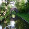
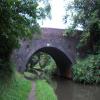
Tinkers Lane Bridge No 21
is a minor waterways place
on the Stratford-on-Avon Canal (Northern Section) between
Lapworth Wharf (3 miles and 4¾ furlongs
and 11 locks
to the east) and
King's Norton Junction (Junction of Stratford and Worcester and Birmingham Canals) (8 miles and 3 furlongs
to the northwest).
The nearest place in the direction of Lapworth Wharf is Rotherham's Oak Bridge No 22;
2 furlongs
away.
The nearest place in the direction of King's Norton Junction is M42 Motorway Bridge;
1 furlong
away.
There may be access to the towpath here.
Mooring here is unrated.
There is a bridge here which takes a minor road over the canal.
Hockley Heath Wharf | 1 mile, 3¼ furlongs | |
Big Spring Coppice Bridge No 24 | 7 furlongs | |
Ashford Lane Bridge No 23 | 5¼ furlongs | |
Rotherham's Oak Winding Hole | 2¼ furlongs | |
Rotherham's Oak Bridge No 22 | 2 furlongs | |
Tinkers Lane Bridge No 21 | ||
M42 Motorway Bridge | 1 furlong | |
Dyers Lane Bridge No 20 | 2 furlongs | |
Blue Bell Cider House | 5 furlongs | |
Blue Bell Bridge No 19 | 5¼ furlongs | |
Waring's Green Wharf | 5½ furlongs |
There are no links to external websites from here.
Why not log in and add some (select "External websites" from the menu (sometimes this is under "Edit"))?
Mouseover for more information or show routes to facility
Nearest water point
In the direction of King's Norton Junction
Waring's Green Wharf — 5½ furlongs away
On this waterway in the direction of King's Norton Junction
Earlswood Reservoir Feeder — 1 mile, 5½ furlongs away
On this waterway in the direction of King's Norton Junction
Yardley Wood Water Point — 5 miles, 6½ furlongs away
On this waterway in the direction of King's Norton Junction
King's Norton Water Point — 8 miles, 3¾ furlongs away
Travel to King's Norton Junction, then on the Worcester and Birmingham Canal (Diglis Basin to King's Norton Junction) to King's Norton Water Point
Hopwood Visitor Moorings — 11 miles, 5¼ furlongs away
Travel to King's Norton Junction, then on the Worcester and Birmingham Canal (Diglis Basin to King's Norton Junction) to Hopwood Visitor Moorings
Holliday Wharf — 13 miles, 5 furlongs away
Travel to King's Norton Junction, then on the Worcester and Birmingham Canal (Birmingham to King's Norton) to Holliday Wharf
Worcester Bar — 13 miles, 7¼ furlongs away
Travel to King's Norton Junction, then on the Worcester and Birmingham Canal (Birmingham to King's Norton) to Worcester Bar
Hawne Basin — 13 miles, 7¾ furlongs away
Travel to King's Norton Junction, then on the Worcester and Birmingham Canal (Birmingham to King's Norton) to New Selly Oak Junction, then on the Birmingham Canal Navigations (Dudley Canal No 2 - Lapal Canal - Original Line East End ) to Somery Road Bridge, then on the Birmingham Canal Navigations (Dudley Canal No 2 - Lapal Canal - Abandoned Line ) to Lapal Canal - New line Diverges From Original Route, then on the Birmingham Canal Navigations (Dudley Canal No 2 - Lapal Canal - Original Line West End ) to Coombeswood, then on the Birmingham Canal Navigations (Dudley Canal No 2 - Coombeswood ) to Hawne Basin
Cambrian Wharf Services — 14 miles, 3¼ furlongs away
Travel to King's Norton Junction, then on the Worcester and Birmingham Canal (Birmingham to King's Norton) to Worcester Bar, then on the Birmingham Canal Navigations (Main Line) to Deep Cuttings Junction, then on the Birmingham Canal Navigations (Newhall Branch) to Cambrian Wharf Services
Bumble Hole Visitor Centre — 16 miles, 5½ furlongs away
Travel to King's Norton Junction, then on the Worcester and Birmingham Canal (Birmingham to King's Norton) to New Selly Oak Junction, then on the Birmingham Canal Navigations (Dudley Canal No 2 - Lapal Canal - Original Line East End ) to Somery Road Bridge, then on the Birmingham Canal Navigations (Dudley Canal No 2 - Lapal Canal - Abandoned Line ) to Lapal Canal - New line Diverges From Original Route, then on the Birmingham Canal Navigations (Dudley Canal No 2 - Lapal Canal - Original Line West End ) to Coombeswood, then on the Birmingham Canal Navigations (Dudley Canal No 2 - Coombeswood ) to Bumble Hole Visitor Centre
Tardebigge Wharf — 17 miles, 1 furlong away
Travel to King's Norton Junction, then on the Worcester and Birmingham Canal (Diglis Basin to King's Norton Junction) to Tardebigge Wharf
Blowers Green Pumphouse — 19 miles, 1¾ furlongs away
Travel to King's Norton Junction, then on the Worcester and Birmingham Canal (Birmingham to King's Norton) to New Selly Oak Junction, then on the Birmingham Canal Navigations (Dudley Canal No 2 - Lapal Canal - Original Line East End ) to Somery Road Bridge, then on the Birmingham Canal Navigations (Dudley Canal No 2 - Lapal Canal - Abandoned Line ) to Lapal Canal - New line Diverges From Original Route, then on the Birmingham Canal Navigations (Dudley Canal No 2 - Lapal Canal - Original Line West End ) to Coombeswood, then on the Birmingham Canal Navigations (Dudley Canal No 2 - Coombeswood ) to Blowers Green Pumphouse
Handsworth Wharf Winding Hole — 18 miles, 1 furlong and 3 locks away
Travel to King's Norton Junction, then on the Worcester and Birmingham Canal (Birmingham to King's Norton) to Worcester Bar, then on the Birmingham Canal Navigations (Main Line) to Smethwick Junction, then on the Birmingham Canal Navigations (Old Main Line) to Engine Arm Junction, then on the Birmingham Canal Navigations (Engine Arm) to Handsworth Wharf Winding Hole
In the direction of Kingswood Junction (south)
Swallow Wharf — 2 miles away
On this waterway in the direction of Kingswood Junction (south)
Old Warwick Road Bridge No 35 — 4 miles, ¼ furlongs and 17 locks away
On this waterway in the direction of Kingswood Junction (south)
Lapworth Services — 4 miles, 2 furlongs and 19 locks away
Travel to Kingswood Junction (south), then on the Stratford-on-Avon Canal (Southern Section) to Lapworth Services
Turners Green Bridge No 63 — 5 miles, 1½ furlongs and 19 locks away
Travel to Kingswood Junction (north), then on the Stratford-on-Avon Canal (Kingswood Branch) to Kingswood Junction, then on the Grand Union Canal (Warwick and Birmingham Canal: widened section - Main Line) to Turners Green Bridge No 63
Rising Lane Bridge No 66 — 5 miles, 3½ furlongs and 19 locks away
Travel to Kingswood Junction (north), then on the Stratford-on-Avon Canal (Kingswood Branch) to Kingswood Junction, then on the Grand Union Canal (Warwick and Birmingham Canal: widened section - Main Line) to Rising Lane Bridge No 66
Knowle Bottom Lock No 47 — 7 miles, 6½ furlongs and 19 locks away
Travel to Kingswood Junction (north), then on the Stratford-on-Avon Canal (Kingswood Branch) to Kingswood Junction, then on the Grand Union Canal (Warwick and Birmingham Canal: widened section - Main Line) to Knowle Bottom Lock No 47
Hatton Top Lock No 46 — 9 miles, 3½ furlongs and 19 locks away
Travel to Kingswood Junction (north), then on the Stratford-on-Avon Canal (Kingswood Branch) to Kingswood Junction, then on the Grand Union Canal (Warwick and Birmingham Canal: widened section - Main Line) to Hatton Top Lock No 46Nearest rubbish disposal
In the direction of King's Norton Junction
Waring's Green Wharf — 5½ furlongs away
On this waterway in the direction of King's Norton Junction
Worcester Bar — 13 miles, 7¼ furlongs away
Travel to King's Norton Junction, then on the Worcester and Birmingham Canal (Birmingham to King's Norton) to Worcester Bar
Hawne Basin — 13 miles, 7¾ furlongs away
Travel to King's Norton Junction, then on the Worcester and Birmingham Canal (Birmingham to King's Norton) to New Selly Oak Junction, then on the Birmingham Canal Navigations (Dudley Canal No 2 - Lapal Canal - Original Line East End ) to Somery Road Bridge, then on the Birmingham Canal Navigations (Dudley Canal No 2 - Lapal Canal - Abandoned Line ) to Lapal Canal - New line Diverges From Original Route, then on the Birmingham Canal Navigations (Dudley Canal No 2 - Lapal Canal - Original Line West End ) to Coombeswood, then on the Birmingham Canal Navigations (Dudley Canal No 2 - Coombeswood ) to Hawne Basin
Cambrian Wharf Services — 14 miles, 3¼ furlongs away
Travel to King's Norton Junction, then on the Worcester and Birmingham Canal (Birmingham to King's Norton) to Worcester Bar, then on the Birmingham Canal Navigations (Main Line) to Deep Cuttings Junction, then on the Birmingham Canal Navigations (Newhall Branch) to Cambrian Wharf Services
Tardebigge Wharf — 17 miles, 1 furlong away
Travel to King's Norton Junction, then on the Worcester and Birmingham Canal (Diglis Basin to King's Norton Junction) to Tardebigge Wharf
Blowers Green Bridge — 19 miles, 1½ furlongs away
Travel to King's Norton Junction, then on the Worcester and Birmingham Canal (Birmingham to King's Norton) to New Selly Oak Junction, then on the Birmingham Canal Navigations (Dudley Canal No 2 - Lapal Canal - Original Line East End ) to Somery Road Bridge, then on the Birmingham Canal Navigations (Dudley Canal No 2 - Lapal Canal - Abandoned Line ) to Lapal Canal - New line Diverges From Original Route, then on the Birmingham Canal Navigations (Dudley Canal No 2 - Lapal Canal - Original Line West End ) to Coombeswood, then on the Birmingham Canal Navigations (Dudley Canal No 2 - Coombeswood ) to Blowers Green Bridge
Handsworth Wharf Winding Hole — 18 miles, 1 furlong and 3 locks away
Travel to King's Norton Junction, then on the Worcester and Birmingham Canal (Birmingham to King's Norton) to Worcester Bar, then on the Birmingham Canal Navigations (Main Line) to Smethwick Junction, then on the Birmingham Canal Navigations (Old Main Line) to Engine Arm Junction, then on the Birmingham Canal Navigations (Engine Arm) to Handsworth Wharf Winding Hole
Farmers Bridge Lock No 8 — 14 miles, 6½ furlongs and 7 locks away
Travel to King's Norton Junction, then on the Worcester and Birmingham Canal (Birmingham to King's Norton) to Worcester Bar, then on the Birmingham Canal Navigations (Main Line) to Deep Cuttings Junction, then on the Birmingham Canal Navigations (Newhall Branch) to Farmers Bridge Junction, then on the Birmingham Canal Navigations (Birmingham and Fazeley Canal - Main Line) to Farmers Bridge Lock No 8
In the direction of Kingswood Junction (south)
Lapworth Lock No 21 — 4 miles, 1¼ furlongs and 18 locks away
On this waterway in the direction of Kingswood Junction (south)
Hatton Top Lock No 46 — 9 miles, 3½ furlongs and 19 locks away
Travel to Kingswood Junction (north), then on the Stratford-on-Avon Canal (Kingswood Branch) to Kingswood Junction, then on the Grand Union Canal (Warwick and Birmingham Canal: widened section - Main Line) to Hatton Top Lock No 46
Knowle Top Lock No 51 — 8 miles, ¼ furlongs and 23 locks away
Travel to Kingswood Junction (north), then on the Stratford-on-Avon Canal (Kingswood Branch) to Kingswood Junction, then on the Grand Union Canal (Warwick and Birmingham Canal: widened section - Main Line) to Knowle Top Lock No 51
Lowsonford Lock No 31 — 6 miles, 2¼ furlongs and 28 locks away
Travel to Kingswood Junction (south), then on the Stratford-on-Avon Canal (Southern Section) to Lowsonford Lock No 31
Hill Farm Marina — 10 miles, 7 furlongs and 36 locks away
Travel to Kingswood Junction (south), then on the Stratford-on-Avon Canal (Southern Section) to Hill Farm Marina
Saltisford Canal Trust Services Pontoon — 11 miles, 6¾ furlongs and 40 locks away
Travel to Kingswood Junction (north), then on the Stratford-on-Avon Canal (Kingswood Branch) to Kingswood Junction, then on the Grand Union Canal (Warwick and Birmingham Canal: widened section - Main Line) to Budbrooke Junction, then on the Grand Union Canal (Warwick and Birmingham Canal: widened section - Saltisford Arm) to Saltisford Canal Trust Services Pontoon
Radford Bottom Lock No 23 — 17 miles, 1¾ furlongs and 42 locks away
Travel to Kingswood Junction (north), then on the Stratford-on-Avon Canal (Kingswood Branch) to Kingswood Junction, then on the Grand Union Canal (Warwick and Birmingham Canal: widened section - Main Line) to Budbrooke Junction, then on the Grand Union Canal (Warwick and Napton Canal) to Radford Bottom Lock No 23
Old "Valley Cruisers" Base — 16 miles, 4¾ furlongs and 49 locks away
Travel to Kingswood Junction (south), then on the Stratford-on-Avon Canal (Southern Section) to Old "Valley Cruisers" Base
The Old Bathing Place — 17 miles, 7¾ furlongs and 54 locks away
Travel to Kingswood Junction (south), then on the Stratford-on-Avon Canal (Southern Section) to Junction of Stratford Canal and River Avon, then on the River Avon - Warwickshire (Upper Avon Navigation) to The Old Bathing Place
Colin P Witter Lock — 17 miles, 6 furlongs and 54 locks away
Travel to Kingswood Junction (south), then on the Stratford-on-Avon Canal (Southern Section) to Junction of Stratford Canal and River Avon, then on the River Avon - Warwickshire (Upper Avon Navigation) to Colin P Witter Lock
Weir Brake Lock — 18 miles, 1¾ furlongs and 55 locks away
Travel to Kingswood Junction (south), then on the Stratford-on-Avon Canal (Southern Section) to Junction of Stratford Canal and River Avon, then on the River Avon - Warwickshire (Upper Avon Navigation) to Weir Brake LockNearest chemical toilet disposal
In the direction of King's Norton Junction
Waring's Green Wharf — 5½ furlongs away
On this waterway in the direction of King's Norton Junction
Earlswood Reservoir Feeder — 1 mile, 5½ furlongs away
On this waterway in the direction of King's Norton Junction
Holliday Wharf — 13 miles, 5 furlongs away
Travel to King's Norton Junction, then on the Worcester and Birmingham Canal (Birmingham to King's Norton) to Holliday Wharf
Worcester Bar — 13 miles, 7¼ furlongs away
Travel to King's Norton Junction, then on the Worcester and Birmingham Canal (Birmingham to King's Norton) to Worcester Bar
Hawne Basin — 13 miles, 7¾ furlongs away
Travel to King's Norton Junction, then on the Worcester and Birmingham Canal (Birmingham to King's Norton) to New Selly Oak Junction, then on the Birmingham Canal Navigations (Dudley Canal No 2 - Lapal Canal - Original Line East End ) to Somery Road Bridge, then on the Birmingham Canal Navigations (Dudley Canal No 2 - Lapal Canal - Abandoned Line ) to Lapal Canal - New line Diverges From Original Route, then on the Birmingham Canal Navigations (Dudley Canal No 2 - Lapal Canal - Original Line West End ) to Coombeswood, then on the Birmingham Canal Navigations (Dudley Canal No 2 - Coombeswood ) to Hawne Basin
Cambrian Wharf Services — 14 miles, 3¼ furlongs away
Travel to King's Norton Junction, then on the Worcester and Birmingham Canal (Birmingham to King's Norton) to Worcester Bar, then on the Birmingham Canal Navigations (Main Line) to Deep Cuttings Junction, then on the Birmingham Canal Navigations (Newhall Branch) to Cambrian Wharf Services
Tardebigge Wharf — 17 miles, 1 furlong away
Travel to King's Norton Junction, then on the Worcester and Birmingham Canal (Diglis Basin to King's Norton Junction) to Tardebigge Wharf
Blowers Green Pumphouse — 19 miles, 1¾ furlongs away
Travel to King's Norton Junction, then on the Worcester and Birmingham Canal (Birmingham to King's Norton) to New Selly Oak Junction, then on the Birmingham Canal Navigations (Dudley Canal No 2 - Lapal Canal - Original Line East End ) to Somery Road Bridge, then on the Birmingham Canal Navigations (Dudley Canal No 2 - Lapal Canal - Abandoned Line ) to Lapal Canal - New line Diverges From Original Route, then on the Birmingham Canal Navigations (Dudley Canal No 2 - Lapal Canal - Original Line West End ) to Coombeswood, then on the Birmingham Canal Navigations (Dudley Canal No 2 - Coombeswood ) to Blowers Green Pumphouse
Handsworth Wharf Winding Hole — 18 miles, 1 furlong and 3 locks away
Travel to King's Norton Junction, then on the Worcester and Birmingham Canal (Birmingham to King's Norton) to Worcester Bar, then on the Birmingham Canal Navigations (Main Line) to Smethwick Junction, then on the Birmingham Canal Navigations (Old Main Line) to Engine Arm Junction, then on the Birmingham Canal Navigations (Engine Arm) to Handsworth Wharf Winding Hole
Cuckoo Wharf — 17 miles, 3¼ furlongs and 24 locks away
Travel to King's Norton Junction, then on the Worcester and Birmingham Canal (Birmingham to King's Norton) to Worcester Bar, then on the Birmingham Canal Navigations (Main Line) to Deep Cuttings Junction, then on the Birmingham Canal Navigations (Newhall Branch) to Farmers Bridge Junction, then on the Birmingham Canal Navigations (Birmingham and Fazeley Canal - Main Line) to Cuckoo Wharf
In the direction of Kingswood Junction (south)
Swallow Wharf — 2 miles away
On this waterway in the direction of Kingswood Junction (south)
Lapworth Services — 4 miles, 2 furlongs and 19 locks away
Travel to Kingswood Junction (south), then on the Stratford-on-Avon Canal (Southern Section) to Lapworth Services
Hatton Top Lock No 46 — 9 miles, 3½ furlongs and 19 locks away
Travel to Kingswood Junction (north), then on the Stratford-on-Avon Canal (Kingswood Branch) to Kingswood Junction, then on the Grand Union Canal (Warwick and Birmingham Canal: widened section - Main Line) to Hatton Top Lock No 46
Knowle Top Lock No 51 — 8 miles, ¼ furlongs and 23 locks away
Travel to Kingswood Junction (north), then on the Stratford-on-Avon Canal (Kingswood Branch) to Kingswood Junction, then on the Grand Union Canal (Warwick and Birmingham Canal: widened section - Main Line) to Knowle Top Lock No 51
Saltisford Canal Trust Services Pontoon — 11 miles, 6¾ furlongs and 40 locks away
Travel to Kingswood Junction (north), then on the Stratford-on-Avon Canal (Kingswood Branch) to Kingswood Junction, then on the Grand Union Canal (Warwick and Birmingham Canal: widened section - Main Line) to Budbrooke Junction, then on the Grand Union Canal (Warwick and Birmingham Canal: widened section - Saltisford Arm) to Saltisford Canal Trust Services Pontoon
Warwickshire Narrowboat Hire Base — 13 miles, ¼ furlongs and 42 locks away
Travel to Kingswood Junction (north), then on the Stratford-on-Avon Canal (Kingswood Branch) to Kingswood Junction, then on the Grand Union Canal (Warwick and Birmingham Canal: widened section - Main Line) to Budbrooke Junction, then on the Grand Union Canal (Warwick and Napton Canal) to Warwickshire Narrowboat Hire Base
Fosse Wharf — 18 miles, 1¼ furlongs and 45 locks away
Travel to Kingswood Junction (north), then on the Stratford-on-Avon Canal (Kingswood Branch) to Kingswood Junction, then on the Grand Union Canal (Warwick and Birmingham Canal: widened section - Main Line) to Budbrooke Junction, then on the Grand Union Canal (Warwick and Napton Canal) to Fosse Wharf
Old "Valley Cruisers" Base — 16 miles, 4¾ furlongs and 49 locks away
Travel to Kingswood Junction (south), then on the Stratford-on-Avon Canal (Southern Section) to Old "Valley Cruisers" BaseNearest place to turn
In the direction of King's Norton Junction
Earlswood Reservoir Feeder — 1 mile, 5½ furlongs away
On this waterway in the direction of King's Norton Junction
Tyburn Farm Winding Hole — 3 miles, 4¾ furlongs away
On this waterway in the direction of King's Norton Junction
Yardley Wood Winding Hole — 5 miles, 6¼ furlongs away
On this waterway in the direction of King's Norton Junction
King's Norton Junction — 8 miles, 3 furlongs away
On this waterway in the direction of King's Norton Junction
Wast Hill Tunnel (east portal) — 9 miles, 3¼ furlongs away
Travel to King's Norton Junction, then on the Worcester and Birmingham Canal (Diglis Basin to King's Norton Junction) to Wast Hill Tunnel (east portal)
Selly Oak Winding Hole — 10 miles, 5¼ furlongs away
Travel to King's Norton Junction, then on the Worcester and Birmingham Canal (Birmingham to King's Norton) to Selly Oak Winding Hole
Hopwood Bridge Winding Hole — 11 miles, 4¾ furlongs away
Travel to King's Norton Junction, then on the Worcester and Birmingham Canal (Diglis Basin to King's Norton Junction) to Hopwood Bridge Winding Hole
The Vale Winding Hole — 12 miles, 3¾ furlongs away
Travel to King's Norton Junction, then on the Worcester and Birmingham Canal (Birmingham to King's Norton) to The Vale Winding Hole
Crown Meadow Arm — 13 miles, 3 furlongs away
Travel to King's Norton Junction, then on the Worcester and Birmingham Canal (Diglis Basin to King's Norton Junction) to Crown Meadow Arm
Gas Street Basin — 13 miles, 6¾ furlongs away
Travel to King's Norton Junction, then on the Worcester and Birmingham Canal (Birmingham to King's Norton) to Gas Street Basin
Gas Street Basin (Old Wharf) — 13 miles, 7½ furlongs away
Travel to King's Norton Junction, then on the Worcester and Birmingham Canal (Birmingham to King's Norton) to Worcester Bar, then on the Birmingham Canal Navigations (Main Line) to Gas Street Basin (Old Wharf)
Hawne Basin — 13 miles, 7¾ furlongs away
Travel to King's Norton Junction, then on the Worcester and Birmingham Canal (Birmingham to King's Norton) to New Selly Oak Junction, then on the Birmingham Canal Navigations (Dudley Canal No 2 - Lapal Canal - Original Line East End ) to Somery Road Bridge, then on the Birmingham Canal Navigations (Dudley Canal No 2 - Lapal Canal - Abandoned Line ) to Lapal Canal - New line Diverges From Original Route, then on the Birmingham Canal Navigations (Dudley Canal No 2 - Lapal Canal - Original Line West End ) to Coombeswood, then on the Birmingham Canal Navigations (Dudley Canal No 2 - Coombeswood ) to Hawne Basin
Deep Cuttings Junction — 14 miles, 1½ furlongs away
Travel to King's Norton Junction, then on the Worcester and Birmingham Canal (Birmingham to King's Norton) to Worcester Bar, then on the Birmingham Canal Navigations (Main Line) to Deep Cuttings Junction
Scarfield Hill Bridge Winding Hole — 14 miles, 1¾ furlongs away
Travel to King's Norton Junction, then on the Worcester and Birmingham Canal (Diglis Basin to King's Norton Junction) to Scarfield Hill Bridge Winding Hole
Old Turn Junction — 14 miles, 1¾ furlongs away
Travel to King's Norton Junction, then on the Worcester and Birmingham Canal (Birmingham to King's Norton) to Worcester Bar, then on the Birmingham Canal Navigations (Main Line) to Old Turn Junction
Monument Lane Basin — 14 miles, 7 furlongs away
Travel to King's Norton Junction, then on the Worcester and Birmingham Canal (Birmingham to King's Norton) to Worcester Bar, then on the Birmingham Canal Navigations (Main Line) to Monument Lane Basin
Sandy Turn — 15 miles, ¾ furlongs away
Travel to King's Norton Junction, then on the Worcester and Birmingham Canal (Birmingham to King's Norton) to Worcester Bar, then on the Birmingham Canal Navigations (Main Line) to Sandy Turn
In the direction of Kingswood Junction (south)
Rotherham's Oak Winding Hole — 2¼ furlongs away
On this waterway in the direction of Kingswood Junction (south)
Hockley Heath Wharf — 1 mile, 3¼ furlongs away
On this waterway in the direction of Kingswood Junction (south)
Wharf Lane Bridge Winding Hole — 2 miles, ¼ furlongs away
On this waterway in the direction of Kingswood Junction (south)Nearest self-operated pump-out
In the direction of King's Norton Junction
Handsworth Wharf Winding Hole — 18 miles, 1 furlong and 3 locks away
Travel to King's Norton Junction, then on the Worcester and Birmingham Canal (Birmingham to King's Norton) to Worcester Bar, then on the Birmingham Canal Navigations (Main Line) to Smethwick Junction, then on the Birmingham Canal Navigations (Old Main Line) to Engine Arm Junction, then on the Birmingham Canal Navigations (Engine Arm) to Handsworth Wharf Winding Hole
In the direction of Kingswood Junction (south)
Lapworth Services — 4 miles, 2 furlongs and 19 locks away
Travel to Kingswood Junction (south), then on the Stratford-on-Avon Canal (Southern Section) to Lapworth Services
Hill Farm Marina — 10 miles, 7 furlongs and 36 locks away
Travel to Kingswood Junction (south), then on the Stratford-on-Avon Canal (Southern Section) to Hill Farm Marina
Shakespeare Marina — 18 miles, ¼ furlongs and 55 locks away
Travel to Kingswood Junction (south), then on the Stratford-on-Avon Canal (Southern Section) to Junction of Stratford Canal and River Avon, then on the River Avon - Warwickshire (Upper Avon Navigation) to Shakespeare MarinaNearest boatyard pump-out
In the direction of King's Norton Junction
Waring's Green Wharf — 5½ furlongs away
On this waterway in the direction of King's Norton Junction
Earlswood Reservoir Feeder — 1 mile, 5½ furlongs away
On this waterway in the direction of King's Norton Junction
Hawne Basin — 13 miles, 7¾ furlongs away
Travel to King's Norton Junction, then on the Worcester and Birmingham Canal (Birmingham to King's Norton) to New Selly Oak Junction, then on the Birmingham Canal Navigations (Dudley Canal No 2 - Lapal Canal - Original Line East End ) to Somery Road Bridge, then on the Birmingham Canal Navigations (Dudley Canal No 2 - Lapal Canal - Abandoned Line ) to Lapal Canal - New line Diverges From Original Route, then on the Birmingham Canal Navigations (Dudley Canal No 2 - Lapal Canal - Original Line West End ) to Coombeswood, then on the Birmingham Canal Navigations (Dudley Canal No 2 - Coombeswood ) to Hawne Basin
Sherborne Wharf Services — 14 miles, 3½ furlongs away
Travel to King's Norton Junction, then on the Worcester and Birmingham Canal (Birmingham to King's Norton) to Worcester Bar, then on the Birmingham Canal Navigations (Main Line) to Sherborne Wharf Services
Withymoor Island Service Wharf — 17 miles, ¾ furlongs away
Travel to King's Norton Junction, then on the Worcester and Birmingham Canal (Birmingham to King's Norton) to New Selly Oak Junction, then on the Birmingham Canal Navigations (Dudley Canal No 2 - Lapal Canal - Original Line East End ) to Somery Road Bridge, then on the Birmingham Canal Navigations (Dudley Canal No 2 - Lapal Canal - Abandoned Line ) to Lapal Canal - New line Diverges From Original Route, then on the Birmingham Canal Navigations (Dudley Canal No 2 - Lapal Canal - Original Line West End ) to Coombeswood, then on the Birmingham Canal Navigations (Dudley Canal No 2 - Coombeswood ) to Withymoor Island Service Wharf
In the direction of Kingswood Junction (south)
Swallow Wharf — 2 miles away
On this waterway in the direction of Kingswood Junction (south)
Barston Lane Bridge No 76 — 9 miles, 7½ furlongs and 24 locks away
Travel to Kingswood Junction (north), then on the Stratford-on-Avon Canal (Kingswood Branch) to Kingswood Junction, then on the Grand Union Canal (Warwick and Birmingham Canal: widened section - Main Line) to Barston Lane Bridge No 76
Hill Farm Marina — 10 miles, 7 furlongs and 36 locks away
Travel to Kingswood Junction (south), then on the Stratford-on-Avon Canal (Southern Section) to Hill Farm Marina
Saltisford Canal Trust Services Pontoon — 11 miles, 6¾ furlongs and 40 locks away
Travel to Kingswood Junction (north), then on the Stratford-on-Avon Canal (Kingswood Branch) to Kingswood Junction, then on the Grand Union Canal (Warwick and Birmingham Canal: widened section - Main Line) to Budbrooke Junction, then on the Grand Union Canal (Warwick and Birmingham Canal: widened section - Saltisford Arm) to Saltisford Canal Trust Services Pontoon
Warwickshire Narrowboat Hire Base — 13 miles, ¼ furlongs and 42 locks away
Travel to Kingswood Junction (north), then on the Stratford-on-Avon Canal (Kingswood Branch) to Kingswood Junction, then on the Grand Union Canal (Warwick and Birmingham Canal: widened section - Main Line) to Budbrooke Junction, then on the Grand Union Canal (Warwick and Napton Canal) to Warwickshire Narrowboat Hire Base
Delta Marine Services — 13 miles, 2 furlongs and 42 locks away
Travel to Kingswood Junction (north), then on the Stratford-on-Avon Canal (Kingswood Branch) to Kingswood Junction, then on the Grand Union Canal (Warwick and Birmingham Canal: widened section - Main Line) to Budbrooke Junction, then on the Grand Union Canal (Warwick and Napton Canal) to Delta Marine ServicesDirection of TV transmitter (From Wolfbane Cybernetic)
There is no page on Wikipedia called “Tinkers Lane Bridge”
Wikipedia pages that might relate to Tinkers Lane Bridge
[Bailey bridge]
the British War Office who tinkered with model bridges as a hobby. He had proposed an early prototype for a Bailey bridge before the war in 1936, but
[Ohio and Erie Canal]
Ohio) Valley View Bridge Zoar, Ohio ^ A: In 2007-2008-? Tinkers Creek Aqueduct is undergoing renovation following flood damage from Tinkers Creek (Cuyahoga
[Tinkers Green Halt railway station]
Tinkers Green Halt railway station was a station in Oswestry, Shropshire, England. The station was opened on 16 October 1939 and closed on 18 January
[Mae Whitman]
Jake Long (2005–2007), Katara in Avatar: The Last Airbender (2005–2008), Tinker Bell in the Disney Fairies film franchise (2008–2014), Wonder Girl / Cassie
[List of The Transformers (TV series) characters]
like a mechanical wildman, this Battlecharger is a twirling, tumbling two-lane terror. Spreading fear is his favorite pastime. Admires junkyards like humans
[Interstate 40 in Oklahoma]
Interstate 44. It then runs just south of downtown Oklahoma City on a new ten lane section. I-40 then interlines with Interstate 35 at the Dallas Junction complex
[List of Little House on the Prairie episodes]
opposition from some of the town's oldest inhabitants. Guest stars: Charles Lane, Lew Ayres 186 4 "Rage" Maury Dexter B. W. Sandefur October 18, 1982 (1982-10-18)
[List of The Return of Superman episodes]
fetch mineral water along with her cousin. Jam Jam's dad walks down memory lane, and he preps for a concert. Will and Ben struggle to get along, so Sam comes
[Betty White]
White returned to Los Angeles to restart her career. In 1947, she married Lane Allen, a Hollywood talent agent. This marriage ended in divorce in 1949 after
[Tim Berners-Lee]
Development of the World Wide Web (Unlocking the Secrets of Science) (Mitchell Lane Publishers, 2001), ISBN 1-58415-096-3 Tim Berners-Lee: Inventor of the World
Results of Google Search
File:Approaching Tinkers Lane Bridge, Illshaw Heath, Solihull ...Sep 7, 2008 ... English: Approaching Tinkers Lane Bridge, Illshaw Heath, Solihull This bridge ( No 21) on the Stratford-upon-Avon Canal carries Tinkers Lane, ...
Resolution No. 74-2018, Nov 14, 2018. Nov 21, 2018, Dec 5, 2018, Bridge Deck Repair and Rehabilitation River Road (T.R. 126) over Ohio Turnpike M.P. 120.0Â ...
Abandoning Portions of Old Albany Post Road, County Road Number 79, Town of Gardiner, to Various Adjoining Property Owners, Removal of a Portion of Said  ...
Dudley No 1 Canal ... Kings Norton Guillotine Stop Lock; Bridge 1 (Lifford Lane Bridge); Remains of Tunnel Lane Swing Bridge ... (Bridge 20a); Tinkers lane Bridge (Bridge 21); Rotherhams Oak Bridge (Bridge 22) Carries Rotherhams Oak  ...
Figure 2-21 Sediment Basin for Turnpike Bridge Discharge . ... List of Figures. Page No. Pennichuck Water Works. PBS, PBH, PBP, WBS, & MB Subwatershed ... The second detention pond, located southeast of the Tinker Road bridge crossing.
Figure 2: Substandard Truck Clearance under I-40 on Anderson Road . ... in southeastern Oklahoma County takes 5.5 miles of outdated Interstate, and brings it up to 21st ... This type of bridge rehabilitation has not previously been used in Oklahoma, ... The Project provides access improvements to Tinker, and to the cities.
This data may not be complete. We recommend contacting the local school district to confirm school assignments for this home. About GreatSchools. GreatSchools ...
The Ohio and Erie Canal was a canal constructed during the 1820s and early 1830s in Ohio. ... But no single river followed this line — canals are more cheaply and easily ... Another watered section extends from the Station Road Bridge in Brecksville ... A: In 2007-2008-? Tinkers Creek Aqueduct is undergoing renovation ...
6 Tinker Lane, Setauket, NY 11733 is a single family home listed for sale at $1200000. This is a 4-bed, 2.5-bath property.