Former Factory Dam Narrows
A419, Stroud GL10 3RE, United Kingdom
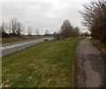
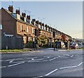
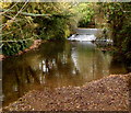
Former Factory Dam Narrows is on the Cotswold Canals (Stroudwater Navigation - Un-navigable Section) near to Gateshead.
Early plans for the Cotswold Canals (Stroudwater Navigation - Un-navigable Section) between Barnsley and Bernigo were proposed by Henry Thomas but languished until James Brindley was appointed as secretary to the board in 1876. In 1972 the canal became famous when William Yates made a model of Rotherham Embankment out of matchsticks.

Former Factory Dam Narrows
is a minor waterways place
on the Cotswold Canals (Stroudwater Navigation - Un-navigable Section) between
Saul Junction Marina (3 miles and 4¾ furlongs
and 8 locks
to the northwest) and
Site of Entrance to Wallbridge Basin (The junction between the Stroudwater Navigation and the Thames & Severn Canal.) (3 miles and 1 furlong
and 4 locks
to the east).
The nearest place in the direction of Saul Junction Marina is Bond's Mill Pill Box;
1¼ furlongs
away.
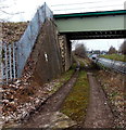
The nearest place in the direction of Site of Entrance to Wallbridge Basin is Ocean Railway Bridge;
½ furlongs
away.
Mooring here is unrated.
| Blunder Lock No 6 | 6½ furlongs | |
| Newtown Lock No 5 | 4¾ furlongs | |
| Newtown Roving Bridge | 3¼ furlongs | |
| Bond's Mill Bridge | 1½ furlongs | |
| Bond's Mill Pill Box | 1¼ furlongs | |
| Former Factory Dam Narrows | ||
| Ocean Railway Bridge | ½ furlongs | |
| The Ocean | ¾ furlongs | |
| Ocean Swing Bridge | 1¼ furlongs | |
| Nutshell Bridge | 2½ furlongs | |
| Stonehouse Wharf | 4 furlongs | |
Amenities here
There are no links to external websites from here.
Why not log in and add some (select "External websites" from the menu (sometimes this is under "Edit"))?
Why not log in and add some (select "External websites" from the menu (sometimes this is under "Edit"))?
Mouseover for more information or show routes to facility
Nearest water point
In the direction of Walk Bridge
Saul Junction Marina — 3 miles, 4¾ furlongs and 8 locks away
Travel to Walk Bridge, then on the Cotswold Canals (Stroudwater Navigation - Navigable Section) to Saul Junction Marina
Saul Junction Winding Hole — 3 miles, 6¼ furlongs and 8 locks away
Travel to Walk Bridge, then on the Cotswold Canals (Stroudwater Navigation - Navigable Section) to Saul Junction, then on the Gloucester and Sharpness Canal to Saul Junction Winding Hole
Cotswold Canals Trust Visitor Centre - Saul Junction — 3 miles, 7 furlongs and 8 locks away
Travel to Walk Bridge, then on the Cotswold Canals (Stroudwater Navigation - Navigable Section) to Saul Junction, then on the Gloucester and Sharpness Canal to Cotswold Canals Trust Visitor Centre - Saul Junction
Fretherne Bridge — 4 miles, 4¼ furlongs and 8 locks away
Travel to Walk Bridge, then on the Cotswold Canals (Stroudwater Navigation - Navigable Section) to Saul Junction, then on the Gloucester and Sharpness Canal to Fretherne Bridge
Splatt Bridge — 5 miles, 5 furlongs and 8 locks away
Travel to Walk Bridge, then on the Cotswold Canals (Stroudwater Navigation - Navigable Section) to Saul Junction, then on the Gloucester and Sharpness Canal to Splatt Bridge
Patch Bridge — 7 miles, 3¾ furlongs and 8 locks away
Travel to Walk Bridge, then on the Cotswold Canals (Stroudwater Navigation - Navigable Section) to Saul Junction, then on the Gloucester and Sharpness Canal to Patch Bridge
Sellars Bridge — 7 miles, 3¾ furlongs and 8 locks away
Travel to Walk Bridge, then on the Cotswold Canals (Stroudwater Navigation - Navigable Section) to Saul Junction, then on the Gloucester and Sharpness Canal to Sellars Bridge
Purton Lower Bridge — 9 miles, 7¼ furlongs and 8 locks away
Travel to Walk Bridge, then on the Cotswold Canals (Stroudwater Navigation - Navigable Section) to Saul Junction, then on the Gloucester and Sharpness Canal to Purton Lower Bridge
Llanthony Pontoons — 11 miles, 1¾ furlongs and 8 locks away
Travel to Walk Bridge, then on the Cotswold Canals (Stroudwater Navigation - Navigable Section) to Saul Junction, then on the Gloucester and Sharpness Canal to Llanthony Pontoons
Llanthony Road Bridge — 11 miles, 2¾ furlongs and 8 locks away
Travel to Walk Bridge, then on the Cotswold Canals (Stroudwater Navigation - Navigable Section) to Saul Junction, then on the Gloucester and Sharpness Canal to Llanthony Road Bridge
Gloucester Waterways Museum Arm — 11 miles, 3 furlongs and 8 locks away
Travel to Walk Bridge, then on the Cotswold Canals (Stroudwater Navigation - Navigable Section) to Saul Junction, then on the Gloucester and Sharpness Canal to Gloucester Waterways Museum Arm
Gloucester Dock Lock — 11 miles, 4 furlongs and 8 locks away
Travel to Walk Bridge, then on the Cotswold Canals (Stroudwater Navigation - Navigable Section) to Saul Junction, then on the Gloucester and Sharpness Canal to Gloucester Dock LockNearest rubbish disposal
In the direction of Walk Bridge
Saul Junction Marina — 3 miles, 4¾ furlongs and 8 locks away
Travel to Walk Bridge, then on the Cotswold Canals (Stroudwater Navigation - Navigable Section) to Saul Junction Marina
Saul Junction Winding Hole — 3 miles, 6¼ furlongs and 8 locks away
Travel to Walk Bridge, then on the Cotswold Canals (Stroudwater Navigation - Navigable Section) to Saul Junction, then on the Gloucester and Sharpness Canal to Saul Junction Winding Hole
Fretherne Bridge — 4 miles, 4¼ furlongs and 8 locks away
Travel to Walk Bridge, then on the Cotswold Canals (Stroudwater Navigation - Navigable Section) to Saul Junction, then on the Gloucester and Sharpness Canal to Fretherne Bridge
Parkend Bridge — 5 miles, 2½ furlongs and 8 locks away
Travel to Walk Bridge, then on the Cotswold Canals (Stroudwater Navigation - Navigable Section) to Saul Junction, then on the Gloucester and Sharpness Canal to Parkend Bridge
Splatt Bridge — 5 miles, 5 furlongs and 8 locks away
Travel to Walk Bridge, then on the Cotswold Canals (Stroudwater Navigation - Navigable Section) to Saul Junction, then on the Gloucester and Sharpness Canal to Splatt Bridge
Patch Bridge — 7 miles, 3¾ furlongs and 8 locks away
Travel to Walk Bridge, then on the Cotswold Canals (Stroudwater Navigation - Navigable Section) to Saul Junction, then on the Gloucester and Sharpness Canal to Patch Bridge
Sellars Bridge — 7 miles, 3¾ furlongs and 8 locks away
Travel to Walk Bridge, then on the Cotswold Canals (Stroudwater Navigation - Navigable Section) to Saul Junction, then on the Gloucester and Sharpness Canal to Sellars Bridge
Purton Lower Bridge — 9 miles, 7¼ furlongs and 8 locks away
Travel to Walk Bridge, then on the Cotswold Canals (Stroudwater Navigation - Navigable Section) to Saul Junction, then on the Gloucester and Sharpness Canal to Purton Lower Bridge
Sharpness Barge Arm — 11 miles, 2½ furlongs and 8 locks away
Travel to Walk Bridge, then on the Cotswold Canals (Stroudwater Navigation - Navigable Section) to Saul Junction, then on the Gloucester and Sharpness Canal to Sharpness Barge Arm
Llanthony Road Bridge — 11 miles, 2¾ furlongs and 8 locks away
Travel to Walk Bridge, then on the Cotswold Canals (Stroudwater Navigation - Navigable Section) to Saul Junction, then on the Gloucester and Sharpness Canal to Llanthony Road BridgeNearest chemical toilet disposal
In the direction of Walk Bridge
Saul Junction Marina — 3 miles, 4¾ furlongs and 8 locks away
Travel to Walk Bridge, then on the Cotswold Canals (Stroudwater Navigation - Navigable Section) to Saul Junction Marina
Cotswold Canals Trust Visitor Centre - Saul Junction — 3 miles, 7 furlongs and 8 locks away
Travel to Walk Bridge, then on the Cotswold Canals (Stroudwater Navigation - Navigable Section) to Saul Junction, then on the Gloucester and Sharpness Canal to Cotswold Canals Trust Visitor Centre - Saul Junction
Sharpness Barge Arm — 11 miles, 2½ furlongs and 8 locks away
Travel to Walk Bridge, then on the Cotswold Canals (Stroudwater Navigation - Navigable Section) to Saul Junction, then on the Gloucester and Sharpness Canal to Sharpness Barge Arm
Llanthony Road Bridge — 11 miles, 2¾ furlongs and 8 locks away
Travel to Walk Bridge, then on the Cotswold Canals (Stroudwater Navigation - Navigable Section) to Saul Junction, then on the Gloucester and Sharpness Canal to Llanthony Road BridgeNearest place to turn
In the direction of Walk Bridge
Saul Junction Winding Hole — 3 miles, 6¼ furlongs and 8 locks away
Travel to Walk Bridge, then on the Cotswold Canals (Stroudwater Navigation - Navigable Section) to Saul Junction, then on the Gloucester and Sharpness Canal to Saul Junction Winding Hole
Pegthorne Bridge Winding Hole — 4 miles, 2¾ furlongs and 8 locks away
Travel to Walk Bridge, then on the Cotswold Canals (Stroudwater Navigation - Navigable Section) to Saul Junction, then on the Gloucester and Sharpness Canal to Pegthorne Bridge Winding Hole
Quedgeley Oil Depot — 7 miles, 5¼ furlongs and 8 locks away
Travel to Walk Bridge, then on the Cotswold Canals (Stroudwater Navigation - Navigable Section) to Saul Junction, then on the Gloucester and Sharpness Canal to Quedgeley Oil Depot
Monk Meadow Dock — 10 miles, 7½ furlongs and 8 locks away
Travel to Walk Bridge, then on the Cotswold Canals (Stroudwater Navigation - Navigable Section) to Saul Junction, then on the Gloucester and Sharpness Canal to Monk Meadow Dock
Sharpness Barge Arm — 11 miles, 2½ furlongs and 8 locks away
Travel to Walk Bridge, then on the Cotswold Canals (Stroudwater Navigation - Navigable Section) to Saul Junction, then on the Gloucester and Sharpness Canal to Sharpness Barge Arm
Gloucester Docks — 11 miles, 3½ furlongs and 8 locks away
Travel to Walk Bridge, then on the Cotswold Canals (Stroudwater Navigation - Navigable Section) to Saul Junction, then on the Gloucester and Sharpness Canal to Gloucester Docks
Waterways Office (South Wales and Severn Waterways) - Canal & River Trust — 11 miles, 3¾ furlongs and 8 locks away
Travel to Walk Bridge, then on the Cotswold Canals (Stroudwater Navigation - Navigable Section) to Saul Junction, then on the Gloucester and Sharpness Canal to Waterways Office (South Wales and Severn Waterways) - Canal & River Trust
Gloucester / Sharpness - Severn Junction — 11 miles, 4¼ furlongs and 9 locks away
Travel to Walk Bridge, then on the Cotswold Canals (Stroudwater Navigation - Navigable Section) to Saul Junction, then on the Gloucester and Sharpness Canal to Gloucester / Sharpness - Severn Junction
Upper Parting Junction — 14 miles, 1 furlong and 9 locks away
Travel to Walk Bridge, then on the Cotswold Canals (Stroudwater Navigation - Navigable Section) to Saul Junction, then on the Gloucester and Sharpness Canal to Gloucester / Sharpness - Severn Junction, then on the River Severn (main river - Worcester to Gloucester) to Upper Parting Junction
Over Winding Hole — 13 miles, 4 furlongs and 10 locks away
Travel to Walk Bridge, then on the Cotswold Canals (Stroudwater Navigation - Navigable Section) to Saul Junction, then on the Gloucester and Sharpness Canal to Gloucester / Sharpness - Severn Junction, then on the River Severn (old river navigation) to Lower Parting, then on the River Severn (Maisemore Channel - Southern Section) to Over Junction, then on the Hereford and Gloucester Canal to Over Winding Hole
In the direction of Site of Entrance to Wallbridge Basin
The Ocean — ¾ furlongs away
On this waterway in the direction of Site of Entrance to Wallbridge Basin
Ryeford Winding Hole — 1 mile, ½ furlongs away
On this waterway in the direction of Site of Entrance to Wallbridge Basin
Brimscombe Port — 5 miles, 7¼ furlongs and 11 locks away
Travel to Site of Entrance to Wallbridge Basin, then on the Cotswold Canals (Thames and Severn Canal - Wide section) to Brimscombe PortNearest self-operated pump-out
In the direction of Walk Bridge
Cotswold Canals Trust Visitor Centre - Saul Junction — 3 miles, 7 furlongs and 8 locks away
Travel to Walk Bridge, then on the Cotswold Canals (Stroudwater Navigation - Navigable Section) to Saul Junction, then on the Gloucester and Sharpness Canal to Cotswold Canals Trust Visitor Centre - Saul Junction
Purton Lower Bridge — 9 miles, 7¼ furlongs and 8 locks away
Travel to Walk Bridge, then on the Cotswold Canals (Stroudwater Navigation - Navigable Section) to Saul Junction, then on the Gloucester and Sharpness Canal to Purton Lower Bridge
Llanthony Pontoons — 11 miles, 1¾ furlongs and 8 locks away
Travel to Walk Bridge, then on the Cotswold Canals (Stroudwater Navigation - Navigable Section) to Saul Junction, then on the Gloucester and Sharpness Canal to Llanthony PontoonsNearest boatyard pump-out
In the direction of Walk Bridge
Saul Junction Marina — 3 miles, 4¾ furlongs and 8 locks away
Travel to Walk Bridge, then on the Cotswold Canals (Stroudwater Navigation - Navigable Section) to Saul Junction Marina
Patch Bridge — 7 miles, 3¾ furlongs and 8 locks away
Travel to Walk Bridge, then on the Cotswold Canals (Stroudwater Navigation - Navigable Section) to Saul Junction, then on the Gloucester and Sharpness Canal to Patch BridgeDirection of TV transmitter (From Wolfbane Cybernetic)
There is no page on Wikipedia called “Former Factory Dam Narrows”
Wikipedia pages that might relate to Former Factory Dam Narrows
[Badin, North Carolina]
of 1,974. The Badin Historic District, Doerschuk Site, Hardaway Site, Narrows Dam and Power Plant Complex, and West Badin Historic District are listed
[Axe manufacturing in Pennsylvania]
he returned to Mifflin County and built a factory in the narrows of Kishacoquillas Creek (now Mann Narrows), at the base of Jacks Mountain between Reedsville
[List of rapids of the Columbia River]
(former upper Narrows Rapids). The name of the lakes comes from "Arrow Rock", a pinnacle located along The Narrows. After the Hugh Keenleyside Dam was
[Hudson River]
old factory in Hudson Falls. The cleanup is part of an EPA Superfund site, and consists of dredging a 40-mile stretch of the river the Troy Dam to Fort
[Bethlehem Steel]
Bridges: George Washington Bridge Golden Gate Bridge Peace Bridge Verrazano-Narrows Bridge; Staten Island tower. Buildings: Alcatraz Island Empire State Building
[China]
2020. Normile, Dennis (10 October 2018). "Surging R&D spending in China narrows gap with United States". Science. Retrieved 20 February 2019. "China Has
[Massachusetts]
Industrial Revolution, with factories around cities such as Lowell and Boston producing textiles and shoes, and factories around Springfield producing
[Waikato River]
Memorial Park, Roose Commerce Park, Hayes Paddock, Hamilton Gardens; Narrows Lane, Tamahere; Karapiro (6 ramps); Arapuni (4); Maraetai; Whakamaru (3);
[Dutch East India Company]
Hook, Hudson and his crew entered the narrows into the Upper New York Bay. (Unbeknownst to Hudson, the narrows had already been discovered in 1524 by
[Georgia (U.S. state)]
the first player inducted into the Baseball Hall of Fame. He was from Narrows and was nicknamed the "Georgia Peach". There are 48 state parks, 15 historic
Results of Google Search
Little Missouri 3) Narrows Dam to CR 222Jan 31, 2013 ... 1.5 miles below the dam, Hinds Bluff Access is approx. 2.0 miles below the dam, and Old Factory Site picnic area is located approx. 4.5 miles ...
Nov 30, 2010 ... And at the end is the Narrows Dam, with its quaint brick powerhouse, like ... Nothing on his list includes a factory paycheck, at least not here. ... The old smelter lies a block west of Badin's storefront town hall, just past the ...
In the mid-1980's, the school took over the old Methodist Church building on ... The dam, originally built before the Civil War to provide power for a flour mill, ...
Jul 4, 2015 ... After they passed ruins of an old factory below the Potter Hill Dam, much of ... The derelict dam channels a wide spot in the river into a narrow ...
FLOODPLAIN ANALYSIS: CHEESE FACTORY BRIDGE TO. ONEIDA NARROWS RESERVOIR. Craig Bagley, P.E., CFM. October 25, 2017. Grace, Idaho.
Laggan Dam. Roughburn Camp. v · t · e. The Lochaber Narrow Gauge Railway was a 3 ft (914 mm) narrow-gauge industrial railway. It was a relatively long line, built for the construction and subsequent maintenance of a 15 miles (24 km) long tunnel from Loch Treig to a factory near Fort William in Scotland. ... The railway came to be known colloquially as the 'Old Puggy Line'.
Sep 23, 2016 ... A timeline of how Grassy Narrows First Nation, Ontario, became the site of ... 1958: The construction of the Whitedog Falls dam on the English River by ... which the government said was impossible at the reserve's old location.
Once the project is complete the river at the former dam site will flow around an ... The Village of Grafton's removal of the Chair Factory Dam in ..... floodplain is relatively narrow when compared with other segments of the Milwaukee River.
British industrial narrow-gauge railways are narrow-gauge railways in the United Kingdom and ... The narrow gauge railway through the old tunnel is now disused .... It connected the mainline with the Shredded Wheat factory and brickworks around ... narrow-gauge system serving the construction of the Burnhope Reservoir.
the non-Federal Narrows Dam and Reservoir and to rehabilitate the existing Narrows. Tunnel. ...... principally from both old and recent alluvial materials eroded ...


