CanalPlanAC

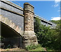
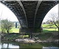
Northwood Lane Bridge

 
Elan Aqueduct Pipeline Bridge, Northwood Lane, Wyre Forest DY12 1AS, United Kingdom
 
Information about the place
Northwood Lane Bridge is a minor waterways place on the River Severn (upper river) between Bewdley Bridge (1 mile and 7¾ furlongs to the southeast) and Upper Arley Footbridge (1 mile and 6¾ furlongs to the northwest).
 
 
The nearest place in the direction of Upper Arley Footbridge is Severn Valley Railway Bridge (Arley); 1 mile and 1¾ furlongs away.

There may be access to the towpath here.

Mooring here is unrated.

There is a bridge here which takes a minor road over the canal.

Limit of Navigation5 miles
A456 Bridge2 miles, 6¼ furlongs
Bewdley Bridge1 mile, 7¾ furlongs
Northwood Lane Bridge
Severn Valley Railway Bridge (Arley)1 mile, 1¾ furlongs
Upper Arley Footbridge1 mile, 6¾ furlongs
Arley Quarry Landing3 miles, 2¾ furlongs
 
 
Amenities

Amenities nearby at Bewdley Bridge

 West Midlands Co-operative Society Ltd
 Bailiffs House
 Black Boy
 Cock & Magpie
 George Hotel
 George Hotel
 Little Pack Horse
 Mug House
 Mug House Inn
 Rising Sun
 SEE ADDRESS
 Wetherspoons
 Fish & Chips
 Barclays
 Cashpoint
 Cashpoint
 Cashpoint
 Riverside Caravan Park
 Texaco
 
Maps
If you are a user and are logged on, or if you are actively planning a route, a map will be displayed here.
Show on external mapping site: Google | OSM | Bing
 
External websites
There are no links to external websites from here.
Why not log in and add some (select "External websites" from the menu (sometimes this is under "Edit"))?
 
Nearest facilities

Mouseover for more information or show routes to facility

Nearest water point

In the direction of Limit of Navigation

Lincomb Lock7 miles, ¾ furlongs away
Travel to Limit of Navigation, then on the River Severn (main river - Stourport to Worcester) to Lincomb Lock
Upper Basin Waterpoint6 miles and 2 locks away
Travel to Limit of Navigation, then on the River Severn (main river - Stourport to Worcester) to Severn - Stourport Broad Locks Entrance, then on the Staffordshire and Worcestershire Canal (Stourport Basins: Broad Route) to Stourport Upper Basin, then on the Staffordshire and Worcestershire Canal (Stourport Basins: Narrow Route) to Upper Basin Waterpoint
Holt Lock (Holt Fleet)11 miles, 2½ furlongs and 1 lock away
Travel to Limit of Navigation, then on the River Severn (main river - Stourport to Worcester) to Holt Lock (Holt Fleet)
Caldwall Mill Bridge No 149 miles, 6¼ furlongs and 5 locks away
Travel to Limit of Navigation, then on the River Severn (main river - Stourport to Worcester) to Severn - Stourport Broad Locks Entrance, then on the Staffordshire and Worcestershire Canal (Stourport Basins: Broad Route) to Stourport Upper Basin, then on the Staffordshire and Worcestershire Canal (Stourport Basins: Narrow Route) to York Street Bridge, then on the Staffordshire and Worcestershire Canal (Main Line: Stourport to Stourton) to Caldwall Mill Bridge No 14
Worcester Trip Boat Moorings17 miles, 7¼ furlongs and 3 locks away
Travel to Limit of Navigation, then on the River Severn (main river - Stourport to Worcester) to Worcester Trip Boat Moorings
Diglis Locks18 miles, 7¾ furlongs and 3 locks away
Travel to Limit of Navigation, then on the River Severn (main river - Stourport to Worcester) to Diglis Junction, then on the River Severn (main river - Worcester to Gloucester) to Diglis Locks
Diglis Services18 miles, 7 furlongs and 5 locks away
Travel to Limit of Navigation, then on the River Severn (main river - Stourport to Worcester) to Diglis Junction, then on the Worcester and Birmingham Canal (Diglis Junction to Diglis Basin) to Diglis Basin, then on the Worcester and Birmingham Canal (Diglis Basin to King's Norton Junction) to Diglis Services
Lowesmoor Basin19 miles, 6¾ furlongs and 7 locks away
Travel to Limit of Navigation, then on the River Severn (main river - Stourport to Worcester) to Diglis Junction, then on the Worcester and Birmingham Canal (Diglis Junction to Diglis Basin) to Diglis Basin, then on the Worcester and Birmingham Canal (Diglis Basin to King's Norton Junction) to Lowesmoor Basin
Kinver Services16 miles, 5¼ furlongs and 11 locks away
Travel to Limit of Navigation, then on the River Severn (main river - Stourport to Worcester) to Severn - Stourport Broad Locks Entrance, then on the Staffordshire and Worcestershire Canal (Stourport Basins: Broad Route) to Stourport Upper Basin, then on the Staffordshire and Worcestershire Canal (Stourport Basins: Narrow Route) to York Street Bridge, then on the Staffordshire and Worcestershire Canal (Main Line: Stourport to Stourton) to Kinver Services
Netherwich Basin19 miles, 5¾ furlongs and 10 locks away
Travel to Limit of Navigation, then on the River Severn (main river - Stourport to Worcester) to Hawford Junction, then on the Droitwich Canals (Droitwich Barge Canal) to Netherwich Basin
Stewponey Water Point18 miles, 1 furlong and 13 locks away
Travel to Limit of Navigation, then on the River Severn (main river - Stourport to Worcester) to Severn - Stourport Broad Locks Entrance, then on the Staffordshire and Worcestershire Canal (Stourport Basins: Broad Route) to Stourport Upper Basin, then on the Staffordshire and Worcestershire Canal (Stourport Basins: Narrow Route) to York Street Bridge, then on the Staffordshire and Worcestershire Canal (Main Line: Stourport to Stourton) to Stewponey Water Point

Nearest rubbish disposal

In the direction of Limit of Navigation

Upper Basin Waterpoint6 miles and 2 locks away
Travel to Limit of Navigation, then on the River Severn (main river - Stourport to Worcester) to Severn - Stourport Broad Locks Entrance, then on the Staffordshire and Worcestershire Canal (Stourport Basins: Broad Route) to Stourport Upper Basin, then on the Staffordshire and Worcestershire Canal (Stourport Basins: Narrow Route) to Upper Basin Waterpoint
Sabrina Footbridge17 miles, 5½ furlongs and 3 locks away
Travel to Limit of Navigation, then on the River Severn (main river - Stourport to Worcester) to Sabrina Footbridge
Diglis Basin18 miles, 6½ furlongs and 5 locks away
Travel to Limit of Navigation, then on the River Severn (main river - Stourport to Worcester) to Diglis Junction, then on the Worcester and Birmingham Canal (Diglis Junction to Diglis Basin) to Diglis Basin
Lowesmoor Basin19 miles, 6¾ furlongs and 7 locks away
Travel to Limit of Navigation, then on the River Severn (main river - Stourport to Worcester) to Diglis Junction, then on the Worcester and Birmingham Canal (Diglis Junction to Diglis Basin) to Diglis Basin, then on the Worcester and Birmingham Canal (Diglis Basin to King's Norton Junction) to Lowesmoor Basin
Kinver Services16 miles, 5¼ furlongs and 11 locks away
Travel to Limit of Navigation, then on the River Severn (main river - Stourport to Worcester) to Severn - Stourport Broad Locks Entrance, then on the Staffordshire and Worcestershire Canal (Stourport Basins: Broad Route) to Stourport Upper Basin, then on the Staffordshire and Worcestershire Canal (Stourport Basins: Narrow Route) to York Street Bridge, then on the Staffordshire and Worcestershire Canal (Main Line: Stourport to Stourton) to Kinver Services
Netherwich Basin19 miles, 5¾ furlongs and 10 locks away
Travel to Limit of Navigation, then on the River Severn (main river - Stourport to Worcester) to Hawford Junction, then on the Droitwich Canals (Droitwich Barge Canal) to Netherwich Basin

Nearest chemical toilet disposal

In the direction of Limit of Navigation

Stourport Marina6 miles, 5¼ furlongs away
Travel to Limit of Navigation, then on the River Severn (main river - Stourport to Worcester) to Stourport Marina
Upper Basin Waterpoint6 miles and 2 locks away
Travel to Limit of Navigation, then on the River Severn (main river - Stourport to Worcester) to Severn - Stourport Broad Locks Entrance, then on the Staffordshire and Worcestershire Canal (Stourport Basins: Broad Route) to Stourport Upper Basin, then on the Staffordshire and Worcestershire Canal (Stourport Basins: Narrow Route) to Upper Basin Waterpoint
Caldwall Mill Bridge No 149 miles, 6¼ furlongs and 5 locks away
Travel to Limit of Navigation, then on the River Severn (main river - Stourport to Worcester) to Severn - Stourport Broad Locks Entrance, then on the Staffordshire and Worcestershire Canal (Stourport Basins: Broad Route) to Stourport Upper Basin, then on the Staffordshire and Worcestershire Canal (Stourport Basins: Narrow Route) to York Street Bridge, then on the Staffordshire and Worcestershire Canal (Main Line: Stourport to Stourton) to Caldwall Mill Bridge No 14
Diglis Services18 miles, 7 furlongs and 5 locks away
Travel to Limit of Navigation, then on the River Severn (main river - Stourport to Worcester) to Diglis Junction, then on the Worcester and Birmingham Canal (Diglis Junction to Diglis Basin) to Diglis Basin, then on the Worcester and Birmingham Canal (Diglis Basin to King's Norton Junction) to Diglis Services
Lowesmoor Basin19 miles, 6¾ furlongs and 7 locks away
Travel to Limit of Navigation, then on the River Severn (main river - Stourport to Worcester) to Diglis Junction, then on the Worcester and Birmingham Canal (Diglis Junction to Diglis Basin) to Diglis Basin, then on the Worcester and Birmingham Canal (Diglis Basin to King's Norton Junction) to Lowesmoor Basin
Kinver Services16 miles, 5¼ furlongs and 11 locks away
Travel to Limit of Navigation, then on the River Severn (main river - Stourport to Worcester) to Severn - Stourport Broad Locks Entrance, then on the Staffordshire and Worcestershire Canal (Stourport Basins: Broad Route) to Stourport Upper Basin, then on the Staffordshire and Worcestershire Canal (Stourport Basins: Narrow Route) to York Street Bridge, then on the Staffordshire and Worcestershire Canal (Main Line: Stourport to Stourton) to Kinver Services

Nearest place to turn

In the direction of Limit of Navigation

Severn - Stourport Narrow Locks Entrance5 miles, 6 furlongs away
Travel to Limit of Navigation, then on the River Severn (main river - Stourport to Worcester) to Severn - Stourport Narrow Locks Entrance
Stourport Lower Basin - between Broad Locks5 miles, 7 furlongs and 1 lock away
Travel to Limit of Navigation, then on the River Severn (main river - Stourport to Worcester) to Severn - Stourport Broad Locks Entrance, then on the Staffordshire and Worcestershire Canal (Stourport Basins: Broad Route) to Stourport Lower Basin - between Broad Locks
Stourport Lower Basin - between Narrow Locks5 miles, 7½ furlongs and 1 lock away
Travel to Limit of Navigation, then on the River Severn (main river - Stourport to Worcester) to Severn - Stourport Broad Locks Entrance, then on the Staffordshire and Worcestershire Canal (Stourport Basins: Broad Route) to Stourport Lower Basin - between Broad Locks, then on the Staffordshire and Worcestershire Canal (Stourport Basins: Broad Locks to Narrow Locks to Stourport Lower Basin - between Narrow Locks
Stourport Upper Basin5 miles, 7¾ furlongs and 2 locks away
Travel to Limit of Navigation, then on the River Severn (main river - Stourport to Worcester) to Severn - Stourport Broad Locks Entrance, then on the Staffordshire and Worcestershire Canal (Stourport Basins: Broad Route) to Stourport Upper Basin
Stourport Clock Basin6 miles, ¼ furlongs and 2 locks away
Travel to Limit of Navigation, then on the River Severn (main river - Stourport to Worcester) to Severn - Stourport Broad Locks Entrance, then on the Staffordshire and Worcestershire Canal (Stourport Basins: Broad Route) to Stourport Upper Basin, then on the Staffordshire and Worcestershire Canal (Stourport Basins: Narrow Route) to Stourport Clock Basin
Former Railway Interchange Basin6 miles, 6¼ furlongs and 3 locks away
Travel to Limit of Navigation, then on the River Severn (main river - Stourport to Worcester) to Severn - Stourport Broad Locks Entrance, then on the Staffordshire and Worcestershire Canal (Stourport Basins: Broad Route) to Stourport Upper Basin, then on the Staffordshire and Worcestershire Canal (Stourport Basins: Narrow Route) to York Street Bridge, then on the Staffordshire and Worcestershire Canal (Main Line: Stourport to Stourton) to Former Railway Interchange Basin
Pratt's Wharf8 miles, 1¾ furlongs and 3 locks away
Travel to Limit of Navigation, then on the River Severn (main river - Stourport to Worcester) to Severn - Stourport Broad Locks Entrance, then on the Staffordshire and Worcestershire Canal (Stourport Basins: Broad Route) to Stourport Upper Basin, then on the Staffordshire and Worcestershire Canal (Stourport Basins: Narrow Route) to York Street Bridge, then on the Staffordshire and Worcestershire Canal (Main Line: Stourport to Stourton) to Pratt's Wharf
Holt Lock Weir Entrance11 miles and 1 lock away
Travel to Limit of Navigation, then on the River Severn (main river - Stourport to Worcester) to Holt Lock Weir Entrance
Holt Lock Weir Exit11 miles, 3½ furlongs and 2 locks away
Travel to Limit of Navigation, then on the River Severn (main river - Stourport to Worcester) to Holt Lock Weir Exit
Academy Winding Hole10 miles, ½ furlongs and 5 locks away
Travel to Limit of Navigation, then on the River Severn (main river - Stourport to Worcester) to Severn - Stourport Broad Locks Entrance, then on the Staffordshire and Worcestershire Canal (Stourport Basins: Broad Route) to Stourport Upper Basin, then on the Staffordshire and Worcestershire Canal (Stourport Basins: Narrow Route) to York Street Bridge, then on the Staffordshire and Worcestershire Canal (Main Line: Stourport to Stourton) to Academy Winding Hole
Kidderminster10 miles, 3 furlongs and 6 locks away
Travel to Limit of Navigation, then on the River Severn (main river - Stourport to Worcester) to Severn - Stourport Broad Locks Entrance, then on the Staffordshire and Worcestershire Canal (Stourport Basins: Broad Route) to Stourport Upper Basin, then on the Staffordshire and Worcestershire Canal (Stourport Basins: Narrow Route) to York Street Bridge, then on the Staffordshire and Worcestershire Canal (Main Line: Stourport to Stourton) to Kidderminster
Bevere Lock Weir Entrance14 miles, 4¼ furlongs and 2 locks away
Travel to Limit of Navigation, then on the River Severn (main river - Stourport to Worcester) to Bevere Lock Weir Entrance
Broadwaters Aqueduct Winding Hole11 miles, 1¼ furlongs and 6 locks away
Travel to Limit of Navigation, then on the River Severn (main river - Stourport to Worcester) to Severn - Stourport Broad Locks Entrance, then on the Staffordshire and Worcestershire Canal (Stourport Basins: Broad Route) to Stourport Upper Basin, then on the Staffordshire and Worcestershire Canal (Stourport Basins: Narrow Route) to York Street Bridge, then on the Staffordshire and Worcestershire Canal (Main Line: Stourport to Stourton) to Broadwaters Aqueduct Winding Hole
Bevere Lock Weir Exit14 miles, 6¾ furlongs and 3 locks away
Travel to Limit of Navigation, then on the River Severn (main river - Stourport to Worcester) to Bevere Lock Weir Exit
Lea Lane Winding Hole12 miles, 5 furlongs and 8 locks away
Travel to Limit of Navigation, then on the River Severn (main river - Stourport to Worcester) to Severn - Stourport Broad Locks Entrance, then on the Staffordshire and Worcestershire Canal (Stourport Basins: Broad Route) to Stourport Upper Basin, then on the Staffordshire and Worcestershire Canal (Stourport Basins: Narrow Route) to York Street Bridge, then on the Staffordshire and Worcestershire Canal (Main Line: Stourport to Stourton) to Lea Lane Winding Hole
Diglis Junction18 miles, 5¼ furlongs and 3 locks away
Travel to Limit of Navigation, then on the River Severn (main river - Stourport to Worcester) to Diglis Junction
Debdale Lock Winding Hole13 miles, 2½ furlongs and 9 locks away
Travel to Limit of Navigation, then on the River Severn (main river - Stourport to Worcester) to Severn - Stourport Broad Locks Entrance, then on the Staffordshire and Worcestershire Canal (Stourport Basins: Broad Route) to Stourport Upper Basin, then on the Staffordshire and Worcestershire Canal (Stourport Basins: Narrow Route) to York Street Bridge, then on the Staffordshire and Worcestershire Canal (Main Line: Stourport to Stourton) to Debdale Lock Winding Hole
Cookley Forge Towpath Bridge13 miles, 3½ furlongs and 9 locks away
Travel to Limit of Navigation, then on the River Severn (main river - Stourport to Worcester) to Severn - Stourport Broad Locks Entrance, then on the Staffordshire and Worcestershire Canal (Stourport Basins: Broad Route) to Stourport Upper Basin, then on the Staffordshire and Worcestershire Canal (Stourport Basins: Narrow Route) to York Street Bridge, then on the Staffordshire and Worcestershire Canal (Main Line: Stourport to Stourton) to Cookley Forge Towpath Bridge
Diglis Locks Weir Exit19 miles, ½ furlongs and 4 locks away
Travel to Limit of Navigation, then on the River Severn (main river - Stourport to Worcester) to Diglis Junction, then on the River Severn (main river - Worcester to Gloucester) to Diglis Locks Weir Exit
Severn - Teme Junction19 miles, 6½ furlongs and 4 locks away
Travel to Limit of Navigation, then on the River Severn (main river - Stourport to Worcester) to Diglis Junction, then on the River Severn (main river - Worcester to Gloucester) to Severn - Teme Junction
Direction of TV transmitter (From Wolfbane Cybernetic)
 
 
Geograph
 
Wikipedia

There is no page on Wikipedia called “Northwood Lane Bridge”

Wikipedia pages that might relate to Northwood Lane Bridge
[Frankford, Philadelphia] Lane, Fishers Lane to the Southern line of Friends Hospital North to East side of Roosevelt Boulevard. Note: The historical records of the Northwood Civic [U.S. Route 4] used NE-6 (now US 3), and from Concord to Northwood, New Hampshire it used NE-9 (now NH-9). Between Northwood and Dover, New Hampshire, it used a road [Pinner] Since the 2010 general election, Pinner has been part of the Ruislip, Northwood and Pinner parliamentary constituency, currently served by David Simmonds [Kirkby railway station] involves the construction of a new station in the Northwood area of the town. This new facility, at Headbolt Lane - previously planned in the early 1970s but [U.S. Route 4 in New Hampshire] four-route concurrency into Northwood, where Route 107 splits off to the northwest. US-4, US-202, and Route 9 continue through Northwood, and US-202 and Route [Longueville Motor Bus Company] commenced operating an unauthorised service from Lane Cove to York Street in the Sydney CBD via the Five Bridges (Fig Tree, Gladesville, Iron Cove, Glebe Island [U.S. Route 202] ends short of Chichester, and NH 9 rejoins the two-lane concurrency along with US 4 and 202. At Northwood, US 202 and NH 9 leave US 4. NH 9 splits off a few [U.S. Route 50 in Maryland] nearby residential development, coming to a bridge over the Wicomico River. The road passes through the Northwood business park on an earthen viaduct, crossing [University Drive] interchange, the road runs under a pedestrian and bicycle bridge and then meets Alabama 53 / Jordan Lane. University Drive eventually connects to Memorial Parkway [Lane Cove] Sydney Harbour Bridge. In March, 1932 the Sydney Harbour Bridge with its associated railway and tramway tracks was opened and services from Lane Cove to the
 
Google

Results of Google Search

List of infrastructure - SVR Wiki
May 8, 2016 ... 1 Geographical List. 1.1 Kidderminster to Bewdley; 1.2 Bewdley to Arley; 1.3 Arley to Highley; 1.4 Highley to Hampton Loade; 1.5 Hampton Loade to Bridgnorth. 2 Alphabetical List of numbered Bridges, Viaducts and Tunnels; 3 Types of bridge and crossing; 4 Track, rails and sleepers; 5 Broad gauge rails ...
BridgePointe Inn & Suites $49 ($̶5̶4̶) - UPDATED 2018 Prices ...
Now $49 (Was $̶5̶4̶) on TripAdvisor: BridgePointe Inn & Suites, Northwood. See 226 traveler reviews, 96 candid photos, and great deals for BridgePointe Inn & Suites, ranked #2 of 3 hotels in Northwood and rated 3 of 5 at TripAdvisor.
SouthShore Bridge Club
SouthShore Bridge Club is the oldest Bridge Club on Long Island, founded 1952. Our address is: 9 Northwood Lane,. Patchogue,New York 11779. We are located in the Recreation Hall of the Northwood Apts. The northwood apts are located off Montauk Highway,just. east of the resturant,. Mason O'le ...
Northwood Christian Church | Welcome!
Social Media. Facebook · Twitter · Vimeo · QR · Return to Home. © Copyright 2012, Northwood Christian Church | 2425 Harvest Ln, Springfield, OR 97477 | P: 541.746.2790 | E: northwoodoffice@comcast.net · HOME · Preschool ...
Northwood, New South Wales - Wikipedia
Northwood is a suburb on the lower North Shore of Sydney, in the state of New South Wales, Australia 8 kilometres north-west of the Sydney central business district, in the local government area of the Municipality of Lane Cove. Northwood is on the northern side of the Lane Cove River between Woodford Bay and Gore  ...
Bridgepointe Inn & Suites Toledo, Northwood, OH - Booking.com
2600 Lauren Lane, Northwood, OH 43619, United States of America – Show map .... The Northwood Bridgepointe Inn & Suites is about 8 miles from The University of Toledo and Swan Creek Preserve Metropark. Toledo Zoo is a 15-minute drive away. This property also has one of the top-rated locations in Northwood!
LONG ISLAND MASTER CLUB SCHEDULE
LONG ISLAND MASTER CLUB SCHEDULE. Bridge Center of LI. 516-481-4311. 3678 W. Oceanside Road. Oceanside. Lin Fisher. Smithtown. 631-360-8456. 22 Lawrence Avenue. Smithtown. Sue Scholer, Carol Mathews ... 9 Northwood Lane , Patchogue. 631-654-5313. Pat Mahoney. Thurs. 11:00 am, Sun 12:30 pm.
Northwood Calendar – BRIDGES
Loula V. York Library; 1st United Methodist Church; Pahokee Elementary School; BRIDGES at West Palm Beach; BRIDGES at Pahokee; BRIDGES at Northwood; BRIDGES at Lake Worth West; BRIDGES at Lake Worth; BRIDGES at Lake Park; BRIDGES at Highland; BRIDGES at Boynton Beach; BRIDGES at Riviera Beach
Toledo Hotel | Hotels in Toledo, OH | Bridgepointe Inn Toledo ...
For Pleasure. The Toledo Bridgepointe Inn & Suites is a great place for a family getaway as we are closely located to many area attractions. We are also close to Toledo's new Hollywood Casino and downtown Toledo's nightlife. Bridgepointe Inn & Suites 2600 Lauren Lane, Northwood, OH 43619 Phone: 419-662-1200
Northwood – BRIDGES
Welcome to BRIDGES at Northwood! We are here to support you in raising your children healthy, safe and strong. We are working to increase the number of children born healthy and living in safe and nurturing environments – free from abuse and neglect. We are also working alongside you and your community to increase ...