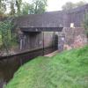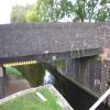
Wood Lane Road Bridge No 74
is a minor waterways place
on the Chesterfield Canal (Retford to the Trent) between
Cooper's Bridge No 80 (Misterton) (3 miles and ¼ furlongs
and 1 lock
to the northeast) and
Lady's Bridge No 72 (2 miles and 3¼ furlongs
and 1 lock
to the southwest).
The nearest place in the direction of Cooper's Bridge No 80 is Middle Bridge Road Bridge No 75;
1¾ furlongs
away.
The nearest place in the direction of Lady's Bridge No 72 is Gringley Top Lock No 61;
a few yards
away.
There may be access to the towpath here.
Mooring here is unrated.
There is a bridge here which takes a minor road over the canal.
| Smiths Bridge No 77 | 1 mile, 7 furlongs | |
| Wooden Beck Visitor Moorings | 1 mile, 1¾ furlongs | |
| Low Lock Bridge No 76 | 5½ furlongs | |
| Shaw Lock No 62 | 5½ furlongs | |
| Middle Bridge Road Bridge No 75 | 1¾ furlongs | |
| Wood Lane Road Bridge No 74 | ||
| Gringley Top Lock No 61 | a few yards | |
| Gainsborough Road Bridge No 73 (A631) | 1 mile, 5¼ furlongs | |
| Drakeholes Tunnel (northern entrance) | 1 mile, 5½ furlongs | |
| Drakeholes Tunnel (southern entrance) | 1 mile, 6¼ furlongs | |
| Drakeholes Visitor Moorings | 1 mile, 6¾ furlongs | |
Amenities nearby at Middle Bridge Road Bridge No 75
There are no links to external websites from here.
Why not log in and add some (select "External websites" from the menu (sometimes this is under "Edit"))?
Why not log in and add some (select "External websites" from the menu (sometimes this is under "Edit"))?
Mouseover for more information or show routes to facility
Nearest water point
In the direction of West Retford Lock No 58
Clayworth CRT Boaters Facilities — 4 miles, 7¼ furlongs and 1 lock away
On this waterway in the direction of West Retford Lock No 58
Hop Pole Bridge No 59 — 9 miles, 2 furlongs and 2 locks away
On this waterway in the direction of West Retford Lock No 58
Forest Middle Top Lock No 55 — 13 miles, 4 furlongs and 6 locks away
Travel to West Retford Lock No 58, then on the Chesterfield Canal (Norwood to Retford) to Forest Middle Top Lock No 55
Forest Middle Top Water Point — 13 miles, 4 furlongs and 7 locks away
Travel to West Retford Lock No 58, then on the Chesterfield Canal (Norwood to Retford) to Forest Middle Top Water Point
In the direction of Chesterfield Canal - River Trent Junction
West Stockwith Basin — 4 miles, 5½ furlongs and 3 locks away
On this waterway in the direction of Chesterfield Canal - River Trent Junction
Keadby Visitor Moorings — 17 miles, 5 furlongs and 5 locks away
Travel to Chesterfield Canal - River Trent Junction, then on the River Trent (tidal section - Cromwell to Keadby) to Keadby Junction, then on the Sheffield and South Yorkshire Navigation (Stainforth and Keadby Canal) to Keadby Visitor Moorings
Torksey Lock — 19 miles, 6½ furlongs and 4 locks away
Travel to Chesterfield Canal - River Trent Junction, then on the River Trent (tidal section - Cromwell to Keadby) to Torksey Junction, then on the Fossdyke Canal to Torksey LockNearest rubbish disposal
In the direction of West Retford Lock No 58
Clayworth CRT Boaters Facilities — 4 miles, 7¼ furlongs and 1 lock away
On this waterway in the direction of West Retford Lock No 58
Forest Middle Top Lock No 55 — 13 miles, 4 furlongs and 6 locks away
Travel to West Retford Lock No 58, then on the Chesterfield Canal (Norwood to Retford) to Forest Middle Top Lock No 55
In the direction of Chesterfield Canal - River Trent Junction
West Stockwith Basin — 4 miles, 5½ furlongs and 3 locks away
On this waterway in the direction of Chesterfield Canal - River Trent Junction
Keadby Visitor Moorings — 17 miles, 5 furlongs and 5 locks away
Travel to Chesterfield Canal - River Trent Junction, then on the River Trent (tidal section - Cromwell to Keadby) to Keadby Junction, then on the Sheffield and South Yorkshire Navigation (Stainforth and Keadby Canal) to Keadby Visitor Moorings
Torksey Lock — 19 miles, 6½ furlongs and 4 locks away
Travel to Chesterfield Canal - River Trent Junction, then on the River Trent (tidal section - Cromwell to Keadby) to Torksey Junction, then on the Fossdyke Canal to Torksey LockNearest chemical toilet disposal
In the direction of West Retford Lock No 58
Clayworth CRT Boaters Facilities — 4 miles, 7¼ furlongs and 1 lock away
On this waterway in the direction of West Retford Lock No 58
Forest Middle Top Lock No 55 — 13 miles, 4 furlongs and 6 locks away
Travel to West Retford Lock No 58, then on the Chesterfield Canal (Norwood to Retford) to Forest Middle Top Lock No 55
In the direction of Chesterfield Canal - River Trent Junction
West Stockwith Basin — 4 miles, 5½ furlongs and 3 locks away
On this waterway in the direction of Chesterfield Canal - River Trent Junction
Keadby Visitor Moorings — 17 miles, 5 furlongs and 5 locks away
Travel to Chesterfield Canal - River Trent Junction, then on the River Trent (tidal section - Cromwell to Keadby) to Keadby Junction, then on the Sheffield and South Yorkshire Navigation (Stainforth and Keadby Canal) to Keadby Visitor Moorings
Torksey Lock — 19 miles, 6½ furlongs and 4 locks away
Travel to Chesterfield Canal - River Trent Junction, then on the River Trent (tidal section - Cromwell to Keadby) to Torksey Junction, then on the Fossdyke Canal to Torksey LockNearest place to turn
In the direction of West Retford Lock No 58
Drakeholes Tunnel (southern entrance) — 1 mile, 6¼ furlongs and 1 lock away
On this waterway in the direction of West Retford Lock No 58
Drakeholes Visitor Moorings — 1 mile, 6¾ furlongs and 1 lock away
On this waterway in the direction of West Retford Lock No 58
Otter's Bridge Winding Hole — 4 miles, 1¾ furlongs and 1 lock away
On this waterway in the direction of West Retford Lock No 58
Clayworth Top Bridge Winding Hole — 4 miles, 6¾ furlongs and 1 lock away
On this waterway in the direction of West Retford Lock No 58
Main Street Winding Hole — 6 miles, 4½ furlongs and 1 lock away
On this waterway in the direction of West Retford Lock No 58
Grove Mill Bridge Winding Hole — 10 miles, ½ furlongs and 2 locks away
On this waterway in the direction of West Retford Lock No 58
Retford Winding Hole — 10 miles, 2¼ furlongs and 2 locks away
On this waterway in the direction of West Retford Lock No 58
Babworth Winding Hole — 11 miles, 6¼ furlongs and 4 locks away
Travel to West Retford Lock No 58, then on the Chesterfield Canal (Norwood to Retford) to Babworth Winding Hole
Forest Top Lock Winding Hole — 13 miles, 6¾ furlongs and 7 locks away
Travel to West Retford Lock No 58, then on the Chesterfield Canal (Norwood to Retford) to Forest Top Lock Winding Hole
Ranby Bridge Winding Hole — 16 miles, ½ furlongs and 8 locks away
Travel to West Retford Lock No 58, then on the Chesterfield Canal (Norwood to Retford) to Ranby Bridge Winding Hole
In the direction of Chesterfield Canal - River Trent Junction
Manor Farm Winding Hole — 2 miles, 1¼ furlongs and 1 lock away
On this waterway in the direction of Chesterfield Canal - River Trent Junction
West Stockwith Basin — 4 miles, 5½ furlongs and 3 locks away
On this waterway in the direction of Chesterfield Canal - River Trent JunctionNearest self-operated pump-out
In the direction of Chesterfield Canal - River Trent Junction
Torksey Lock — 19 miles, 6½ furlongs and 4 locks away
Travel to Chesterfield Canal - River Trent Junction, then on the River Trent (tidal section - Cromwell to Keadby) to Torksey Junction, then on the Fossdyke Canal to Torksey LockNo information
CanalPlan has no information on any of the following facilities within range:boatyard pump-out
Direction of TV transmitter (From Wolfbane Cybernetic)
There is no page on Wikipedia called “Wood Lane Road Bridge”
Wikipedia pages that might relate to Wood Lane Road Bridge
[Wood Lane]
with Wood Lane but the area was still rural in character with the buildings of Wood Lane Farm, Eynam Farm and Hoof's Farm to the east of the road and a
[Wood Lane tube station (Metropolitan line)]
(now the Hammersmith & City line), on the viaduct adjacent to the bridge over Wood Lane and close to a station of the same name but on the Central London
[Wood Lane tube station]
Wood Lane is a London Underground station in the White City area of west London, United Kingdom. It is on the Circle and Hammersmith & City lines, between
[River Don, Yorkshire]
Brightside Lane with Attercliffe Road. In the 17th century, Newhall Road Bridge was a packhouse bridge in a very rural setting. The road takes its name
[Bridge]
A bridge is a structure built to span a physical obstacle, such as a body of water, valley, or road, without closing the way underneath. It is constructed
[Wood Lane tube station (Central line)]
Wood Lane is a former station on the London Underground located in Shepherd's Bush, west London. It was latterly served by the Central line and from 1908
[Regency Bridge]
The Regency Bridge, locally known as the "Swinging Bridge," is a one-lane suspension bridge over the Colorado River in Texas. It is located at the intersection
[List of international men's cricket grounds in England and Wales]
Bramall Lane Bristol Chelmsford Derby Hove New Road Wantage Road Southampton Taunton Edgbaston Grace Road Headingley The Oval Lord's Nevill Ground North
[Steel Bridge]
upper deck carries road traffic (on the Pacific Highway West No. 1W, former Oregon Route 99W), and light rail (MAX), making the bridge one of the most multimodal
[Bosphorus Bridge]
second bridge after the above-mentioned bridge built by Emperor Darius I The Great across the Bosphorus in 513 BCE. The bridge highway is eight lanes wide


