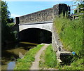
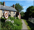
Langford Wharf
The Highwayman Hotel, 249 Banbury Road, Thrupp OX5 1BF, United Kingdom

Langford Wharf
is a minor waterways place
on the Oxford Canal (Southern Section - Main Line) between
Yarnton Lane Bridge No 228 (Kidlington half a mile north) (1 mile and 1¾ furlongs
and 1 lock
to the southeast) and
Sparrowgap Bridge No 223 (2½ furlongs
to the northwest).
The nearest place in the direction of Yarnton Lane Bridge No 228 is Henderson Bridge No 224A;
2¼ furlongs
away.
The nearest place in the direction of Sparrowgap Bridge No 223 is The Highwayman PH and Restaurant;
¼ furlongs
away.
Mooring here is unrated.
| Kidlington Railway Bridge | 6 furlongs | |
| Roundham Bridge No 226 | 5½ furlongs | |
| Roundham Lock No 42 | 5¼ furlongs | |
| Site of Bridge No 225 | 4 furlongs | |
| Henderson Bridge No 224A | 2¼ furlongs | |
| Langford Wharf | ||
| The Highwayman PH and Restaurant | ¼ furlongs | |
| Langford Lane Bridge No 224 | ½ furlongs | |
| Langford Lane Moorings | 1½ furlongs | |
| Sparrowgap Bridge No 223 | 2½ furlongs | |
| The Jolly Boatman PH | 2½ furlongs | |
- Oxford Canal Walk - Part One - Oxford to Thrupp - YouTube — associated with Oxford Canal
- A walk along the Oxford Canal (Southern Section) from Oxford to Thrupp Wide
Mouseover for more information or show routes to facility
Nearest water point
In the direction of Napton Junction
Langford Lane Bridge No 224 — ½ furlongs away
On this waterway in the direction of Napton Junction
Aubreys Lift Bridge No 221 — 5¾ furlongs away
On this waterway in the direction of Napton Junction
Thrupp Cruising Club — 6 furlongs away
On this waterway in the direction of Napton Junction
Heyford Wharf Bridge No 206 — 8 miles, 2¼ furlongs and 5 locks away
On this waterway in the direction of Napton Junction
Heyford Wharf — 8 miles, 2½ furlongs and 5 locks away
On this waterway in the direction of Napton Junction
Aynho Wharf — 14 miles, 2¾ furlongs and 8 locks away
On this waterway in the direction of Napton Junction
In the direction of End of Hythe Bridge Arm
Wolvercote Junction Water Point — 2 miles, 7½ furlongs and 2 locks away
On this waterway in the direction of End of Hythe Bridge Arm
Wolvercote Sanitary Station — 3 miles, 3¾ furlongs and 3 locks away
On this waterway in the direction of End of Hythe Bridge Arm
St Edwards Lift Bridge No 238 — 4 miles, 4½ furlongs and 4 locks away
On this waterway in the direction of End of Hythe Bridge Arm
Oxford Visitor Moorings — 6 miles, 1 furlong and 4 locks away
On this waterway in the direction of End of Hythe Bridge Arm
Eynsham Lock — 6 miles, 3 furlongs and 4 locks away
Travel to Wolvercote Junction, then on the Oxford Canal (Duke's Cut) to Duke's Cut Junction, then on the River Thames (above Oxford) to Eynsham Lock
Abingdon Lock — 15 miles and 8 locks away
Travel to Isis Lock Junction, then on the River Thames (Sheepwash Channel) to Sheepwash Channel Junction, then on the River Thames (above Oxford) to Osney Bridge, then on the River Thames (below Oxford) to Abingdon Lock
Shifford Lock — 16 miles, 3¾ furlongs and 7 locks away
Travel to Wolvercote Junction, then on the Oxford Canal (Duke's Cut) to Duke's Cut Junction, then on the River Thames (above Oxford) to Shifford Lock
Abingdon Bridge Marine — 15 miles, 3½ furlongs and 9 locks away
Travel to Isis Lock Junction, then on the River Thames (Sheepwash Channel) to Sheepwash Channel Junction, then on the River Thames (above Oxford) to Osney Bridge, then on the River Thames (below Oxford) to Abingdon Bridge MarineNearest rubbish disposal
In the direction of Napton Junction
Aubreys Lift Bridge No 221 — 5¾ furlongs away
On this waterway in the direction of Napton Junction
Thrupp Cruising Club — 6 furlongs away
On this waterway in the direction of Napton Junction
Heyford Wharf Bridge No 206 — 8 miles, 2¼ furlongs and 5 locks away
On this waterway in the direction of Napton Junction
Heyford Wharf — 8 miles, 2½ furlongs and 5 locks away
On this waterway in the direction of Napton Junction
Aynho Wharf — 14 miles, 2¾ furlongs and 8 locks away
On this waterway in the direction of Napton Junction
In the direction of End of Hythe Bridge Arm
Wolvercote Sanitary Station — 3 miles, 3¾ furlongs and 3 locks away
On this waterway in the direction of End of Hythe Bridge Arm
Eynsham Lock — 6 miles, 3 furlongs and 4 locks away
Travel to Wolvercote Junction, then on the Oxford Canal (Duke's Cut) to Duke's Cut Junction, then on the River Thames (above Oxford) to Eynsham Lock
Abingdon Lock — 15 miles and 8 locks away
Travel to Isis Lock Junction, then on the River Thames (Sheepwash Channel) to Sheepwash Channel Junction, then on the River Thames (above Oxford) to Osney Bridge, then on the River Thames (below Oxford) to Abingdon LockNearest chemical toilet disposal
In the direction of Napton Junction
Thrupp Cruising Club — 6 furlongs away
On this waterway in the direction of Napton Junction
In the direction of End of Hythe Bridge Arm
Wolvercote Sanitary Station — 3 miles, 3¾ furlongs and 3 locks away
On this waterway in the direction of End of Hythe Bridge Arm
Eynsham Lock — 6 miles, 3 furlongs and 4 locks away
Travel to Wolvercote Junction, then on the Oxford Canal (Duke's Cut) to Duke's Cut Junction, then on the River Thames (above Oxford) to Eynsham Lock
Abingdon Lock — 15 miles and 8 locks away
Travel to Isis Lock Junction, then on the River Thames (Sheepwash Channel) to Sheepwash Channel Junction, then on the River Thames (above Oxford) to Osney Bridge, then on the River Thames (below Oxford) to Abingdon LockNearest place to turn
In the direction of Napton Junction
Thrupp Wide — 6 furlongs away
On this waterway in the direction of Napton Junction
Shipton Weir Junction — 1 mile, 6½ furlongs and 1 lock away
On this waterway in the direction of Napton Junction
Enslow Winding Hole — 3 miles, 2½ furlongs and 2 locks away
On this waterway in the direction of Napton Junction
Kirtlington Winding Hole — 5 miles and 3 locks away
On this waterway in the direction of Napton Junction
The Cleeves Winding Hole — 7 miles, 6½ furlongs and 5 locks away
On this waterway in the direction of Napton Junction
Heyford Wharf — 8 miles, 2½ furlongs and 5 locks away
On this waterway in the direction of Napton Junction
Heyford Wharf Winding Hole — 8 miles, 2½ furlongs and 5 locks away
On this waterway in the direction of Napton Junction
In the direction of End of Hythe Bridge Arm
Wolvercote Junction — 3 miles, ¼ furlongs and 3 locks away
On this waterway in the direction of End of Hythe Bridge Arm
Bypass Reservoir Junction — 3 miles, 2¼ furlongs and 4 locks away
Travel to Wolvercote Junction, then on the Oxford Canal (Duke's Cut) to Bypass Reservoir Junction
Duke's Cut Junction — 3 miles, 6½ furlongs and 4 locks away
Travel to Wolvercote Junction, then on the Oxford Canal (Duke's Cut) to Duke's Cut Junction
Hythe Bridge Arm Winding Hole — 6 miles and 4 locks away
On this waterway in the direction of End of Hythe Bridge Arm
End of Hythe Bridge Arm — 6 miles, 1 furlong and 4 locks away
On this waterway in the direction of End of Hythe Bridge Arm
Thames - Wharf Stream Junction — 6 miles, 1¼ furlongs and 4 locks away
Travel to Wolvercote Junction, then on the Oxford Canal (Duke's Cut) to Duke's Cut Junction, then on the River Thames (above Oxford) to Thames - Wharf Stream Junction
Castle Mill Stream Junction — 6 miles, ½ furlongs and 5 locks away
Travel to Isis Lock Junction, then on the River Thames (Sheepwash Channel) to Castle Mill Stream Junction
Sheepwash Channel Junction — 6 miles, 1¼ furlongs and 5 locks away
Travel to Isis Lock Junction, then on the River Thames (Sheepwash Channel) to Sheepwash Channel Junction
Bossoms Boat Yard — 6 miles, 3¾ furlongs and 6 locks away
Travel to Wolvercote Junction, then on the Oxford Canal (Duke's Cut) to Duke's Cut Junction, then on the River Thames (above Oxford) to Bossoms Boat Yard
Osney Lock Weir Exit — 6 miles, 4¼ furlongs and 6 locks away
Travel to Isis Lock Junction, then on the River Thames (Sheepwash Channel) to Sheepwash Channel Junction, then on the River Thames (above Oxford) to Osney Bridge, then on the River Thames (below Oxford) to Osney Lock Weir Exit
Pinkhill Lock Weir Exit — 7 miles, 5½ furlongs and 5 locks away
Travel to Wolvercote Junction, then on the Oxford Canal (Duke's Cut) to Duke's Cut Junction, then on the River Thames (above Oxford) to Pinkhill Lock Weir Exit
Thames - Cherwell Junction — 7 miles, 6¼ furlongs and 6 locks away
Travel to Isis Lock Junction, then on the River Thames (Sheepwash Channel) to Sheepwash Channel Junction, then on the River Thames (above Oxford) to Osney Bridge, then on the River Thames (below Oxford) to Thames - Cherwell Junction
Iffley Lock Weir Entrance No 1 — 8 miles, 5½ furlongs and 6 locks away
Travel to Isis Lock Junction, then on the River Thames (Sheepwash Channel) to Sheepwash Channel Junction, then on the River Thames (above Oxford) to Osney Bridge, then on the River Thames (below Oxford) to Iffley Lock Weir Entrance No 1Nearest self-operated pump-out
In the direction of Napton Junction
Aubreys Lift Bridge No 221 — 5¾ furlongs away
On this waterway in the direction of Napton Junction
Thrupp Cruising Club — 6 furlongs away
On this waterway in the direction of Napton Junction
In the direction of End of Hythe Bridge Arm
Eynsham Lock — 6 miles, 3 furlongs and 4 locks away
Travel to Wolvercote Junction, then on the Oxford Canal (Duke's Cut) to Duke's Cut Junction, then on the River Thames (above Oxford) to Eynsham Lock
Abingdon Lock — 15 miles and 8 locks away
Travel to Isis Lock Junction, then on the River Thames (Sheepwash Channel) to Sheepwash Channel Junction, then on the River Thames (above Oxford) to Osney Bridge, then on the River Thames (below Oxford) to Abingdon LockNearest boatyard pump-out
In the direction of Napton Junction
Enslow Wharf — 3 miles, 1½ furlongs and 2 locks away
On this waterway in the direction of Napton Junction
Heyford Wharf — 8 miles, 2½ furlongs and 5 locks away
On this waterway in the direction of Napton Junction
Aynho Wharf — 14 miles, 2¾ furlongs and 8 locks away
On this waterway in the direction of Napton Junction
Twyford Wharf — 18 miles, 2 furlongs and 11 locks away
On this waterway in the direction of Napton Junction
In the direction of End of Hythe Bridge Arm
Oxford Cruisers Marina — 7 miles, 2¾ furlongs and 5 locks away
Travel to Wolvercote Junction, then on the Oxford Canal (Duke's Cut) to Duke's Cut Junction, then on the River Thames (above Oxford) to Oxford Cruisers Marina
Abingdon Bridge Marine — 15 miles, 3½ furlongs and 9 locks away
Travel to Isis Lock Junction, then on the River Thames (Sheepwash Channel) to Sheepwash Channel Junction, then on the River Thames (above Oxford) to Osney Bridge, then on the River Thames (below Oxford) to Abingdon Bridge MarineDirection of TV transmitter (From Wolfbane Cybernetic)
There is no page on Wikipedia called “Langford Wharf”
Wikipedia pages that might relate to Langford Wharf
[Limehouse Studios]
the South Quay Import Dock. This was located at the eastern end of Canary Wharf in Limehouse near the Isle of Dogs in London, which opened in 1983. The
[Langford Wellman Colley-Priest]
Langford Wellman Colley-Priest MM (September 1890 – 11/12 February 1928) was an Australian stretcher bearer during the First World War for the 8th Field
[List of 2021 albums]
comfort amid the carnage". The Irish Times. Retrieved January 22, 2021. Langford, Jackson (October 14, 2020). "Jarryd James announces new album 'P.M.'"
[Sydney Ferries]
service connection Barangaroo ferry wharf with Pirrama Park and Fish Market Wharf in Pyrmont, and Blackwattle Bay Wharf in Glebe using the ferry ME-MEL.
[Detective Pikachu (film)]
Smith. Newton beat out Natalia Dyer, Haley Lu Richardson, and Katherine Langford for the role. In December 2017, Ryan Reynolds was cast in the title role
[Webb Dock railway line]
Street. It turned south at Todd Road, before turning west, parallel to Wharf Road, and beneath the West Gate Bridge, to Webb Dock. After being opened
[River Ivel]
Bedfordshire. It flows through the parishes of Stotfold, Arlesey, Henlow, Langford, Biggleswade, Sandy and Blunham. It joins the Great Ouse at Tempsford.
[JPMorgan Chase]
investors. In November 2009, a week after Birmingham, Alabama Mayor Larry Langford was convicted for financial crimes related to bond swaps for Jefferson
[Victoria, British Columbia]
for Wharf, Humboldt streets". Times Colonist. Archived from the original on 2 June 2018. Retrieved 30 May 2018. "Victoria approves plans for Wharf and
[BP]
2005. Archived from the original on 10 May 2013. Retrieved 26 April 2013. Langford, Cameron (15 April 2013). "Texas Refinery Neighbors Sue BP for Billions"


![Sign for the Wise Alderman. This pub on the A423 (now the A4260) has since been renamed the Highwayman, according to a more recent photo [[1693733]]. It was a Halls pub - I don't know whether that brewer is still in business. by Stephen Craven – 30 July 1993](https://s3.geograph.org.uk/geophotos/02/80/95/2809583_8d33bb11_120x120.jpg)
![Banbury Road railway bridge at Station Approach junction. There is an OS benchmark [[3214233]] on the far end of the bridge parapet by Roger Templeman – 06 November 2012](https://s3.geograph.org.uk/geophotos/03/21/42/3214247_80a05ec4_120x120.jpg)
![Cemex Readymix Kidlington depot. There is an OS benchmark [[3214166]] on the right hand edge of the brick reception building by Roger Templeman – 06 November 2012](https://s3.geograph.org.uk/geophotos/03/21/42/3214207_3467fb46_120x120.jpg)


![Former Kidlington station. A class 47 with a Poole-Manchester train passes Kidlington station (already closed when this was taken in 1980, and has now disappeared altogether with a housing development and industrial buildings).For more recent views of the same location, see [[1322006]] and [[4043177]]; the latter shows that the station visible in this photo has now gone. by Stephen Craven – 04 April 1980](https://s3.geograph.org.uk/photos/21/50/215003_49b8426d_120x120.jpg)