CanalPlanAC

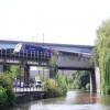
Cole Road Railway Bridge

 
Feeder Canal, Netham Road, Bristol BS5 9PJ, United Kingdom
 
Information about the place
Cole Road Railway Bridge is a minor waterways place on the River Avon - Bristol (Main River - Bath to Bristol) between Hanham Lock Weir Entrance (Channel leading to the Weir) (3 miles and 6¾ furlongs and 2 locks to the east) and City Ferry Landing Arm Junction (1 mile and 5¾ furlongs to the west).
 
 
The nearest place in the direction of Hanham Lock Weir Entrance is Marsh Lane Bridge (Bristol); 2 furlongs away.
 
The nearest place in the direction of City Ferry Landing Arm Junction is St. Philips Causeway Bridge; ¼ furlongs away.

Mooring here is impossible (it may be physically impossible, forbidden, or allowed only for specific short-term purposes).

There is a bridge here which takes a railway over the canal.


Amenities

Amenities here

 Lidl
 SEE ADDRESS
 Burger King
 KFC
 Cashpoint
 Lloyds Bank
 Shell
 Shell
 Marwood Group
 Travis Perkins

Amenities nearby at St. Philips Causeway Bridge

 Costcutter
 Shell Fuel Card

Amenities nearby at Marsh Lane Bridge (Bristol)

 Costcutter
 Sainsburys
 Chiquito
 McDonalds
 Pizza Hut
 Chinese Takeaway
 Krispy Kreme
 Boots
 Boots Chemist
 Mr Kandiah Narendradasan
 Sainsburys Fuel
 Machine Mart
 Speedy Hire
 The Range
 Lawrence Hill Station
 
Maps
If you are a user and are logged on, or if you are actively planning a route, a map will be displayed here.
Show on external mapping site: Google | OSM | Bing
 
Photos
 
External websites
There are no links to external websites from here.
Why not log in and add some (select "External websites" from the menu (sometimes this is under "Edit"))?
 
Nearest facilities

Mouseover for more information or show routes to facility

Nearest water point

In the direction of Cumberland Basin Entrance Lock No 2

Arnolfini Moorings1 mile, 6¼ furlongs away
Travel to City Ferry Landing Arm Junction, then on the River Avon - Bristol (City Ferry Landing Arm) to Arnolfini Moorings
Harbour Inlet2 miles, ½ furlongs away
On this waterway in the direction of Cumberland Basin Entrance Lock No 2

In the direction of Hanham Lock No 1

Hanham Lock No 13 miles, 5¾ furlongs and 1 lock away
On this waterway in the direction of Hanham Lock No 1
Wessex Water Services8 miles, 4¼ furlongs and 4 locks away
Travel to Hanham Lock No 1, then on the River Avon (Kennet and Avon Navigation) to Wessex Water Services
Bath Top Lock Visitor Moorings15 miles, 4¼ furlongs and 13 locks away
Travel to Hanham Lock No 1, then on the River Avon (Kennet and Avon Navigation) to River Avon Junction, then on the Kennet and Avon Canal (Main Line) to Bath Top Lock Visitor Moorings
Bathampton Bridge No 18317 miles, 3 furlongs and 13 locks away
Travel to Hanham Lock No 1, then on the River Avon (Kennet and Avon Navigation) to River Avon Junction, then on the Kennet and Avon Canal (Main Line) to Bathampton Bridge No 183

Nearest rubbish disposal

In the direction of Hanham Lock No 1

Hanham Lock No 13 miles, 5¾ furlongs and 1 lock away
On this waterway in the direction of Hanham Lock No 1
Abbey View Lock No 1115 miles, 3 furlongs and 10 locks away
Travel to Hanham Lock No 1, then on the River Avon (Kennet and Avon Navigation) to River Avon Junction, then on the Kennet and Avon Canal (Main Line) to Abbey View Lock No 11

Nearest chemical toilet disposal

In the direction of Hanham Lock No 1

Wessex Water Services8 miles, 4¼ furlongs and 4 locks away
Travel to Hanham Lock No 1, then on the River Avon (Kennet and Avon Navigation) to Wessex Water Services

Nearest place to turn

In the direction of Cumberland Basin Entrance Lock No 2

Bathhurst Parade Marina1 mile, 4½ furlongs away
On this waterway in the direction of Cumberland Basin Entrance Lock No 2
City Ferry Landing Arm Junction1 mile, 5¾ furlongs away
On this waterway in the direction of Cumberland Basin Entrance Lock No 2
Baltic Wharf2 miles, 3¾ furlongs away
On this waterway in the direction of Cumberland Basin Entrance Lock No 2
Ferry Landings Arm2 miles, 4 furlongs away
On this waterway in the direction of Cumberland Basin Entrance Lock No 2

In the direction of Hanham Lock No 1

Hanham Lock Weir Exit3 miles, 5½ furlongs and 1 lock away
On this waterway in the direction of Hanham Lock No 1
Hanham Lock Weir Entrance3 miles, 6¾ furlongs and 2 locks away
Travel to Hanham Lock No 1, then on the River Avon (Kennet and Avon Navigation) to Hanham Lock Weir Entrance
Keynsham Lock Weir Entrance5 miles, 6¾ furlongs and 3 locks away
Travel to Hanham Lock No 1, then on the River Avon (Kennet and Avon Navigation) to Keynsham Lock Weir Entrance
Horseshoe Walk Bridge Winding Hole15 miles, 2½ furlongs and 10 locks away
Travel to Hanham Lock No 1, then on the River Avon (Kennet and Avon Navigation) to River Avon Junction, then on the Kennet and Avon Canal (Main Line) to Horseshoe Walk Bridge Winding Hole
Pulteney Gardens Winding Hole15 miles, 3¼ furlongs and 11 locks away
Travel to Hanham Lock No 1, then on the River Avon (Kennet and Avon Navigation) to River Avon Junction, then on the Kennet and Avon Canal (Main Line) to Pulteney Gardens Winding Hole
Sydney Wharf Winding Hole15 miles, 5¾ furlongs and 13 locks away
Travel to Hanham Lock No 1, then on the River Avon (Kennet and Avon Navigation) to River Avon Junction, then on the Kennet and Avon Canal (Main Line) to Sydney Wharf Winding Hole
Bathampton Bridge Winding Hole17 miles, 3¾ furlongs and 13 locks away
Travel to Hanham Lock No 1, then on the River Avon (Kennet and Avon Navigation) to River Avon Junction, then on the Kennet and Avon Canal (Main Line) to Bathampton Bridge Winding Hole
Bathampton Winding Hole17 miles, 5¾ furlongs and 13 locks away
Travel to Hanham Lock No 1, then on the River Avon (Kennet and Avon Navigation) to River Avon Junction, then on the Kennet and Avon Canal (Main Line) to Bathampton Winding Hole
Claverton Winding Hole19 miles, ¾ furlongs and 13 locks away
Travel to Hanham Lock No 1, then on the River Avon (Kennet and Avon Navigation) to River Avon Junction, then on the Kennet and Avon Canal (Main Line) to Claverton Winding Hole

Nearest self-operated pump-out

In the direction of Cumberland Basin Entrance Lock No 2

Harbour Inlet2 miles, ½ furlongs away
On this waterway in the direction of Cumberland Basin Entrance Lock No 2

Nearest boatyard pump-out

In the direction of Cumberland Basin Entrance Lock No 2

Baltic Wharf2 miles, 3¾ furlongs away
On this waterway in the direction of Cumberland Basin Entrance Lock No 2
Direction of TV transmitter (From Wolfbane Cybernetic)
 
 
Geograph
 
Wikipedia

There is no page on Wikipedia called “Cole Road Railway Bridge”

Wikipedia pages that might relate to Cole Road Railway Bridge
[Cole Green Way] former Cole Green railway station. There are bridges at Station Road by Cole Green and Chapel Lane near Letty Green. A further bridge was filled in further [Royal Gorge Bridge] the Royal Gorge Bridge and Amusement Company of San Antonio, Texas. Piper hired George E. Cole as the Chief Engineer and the bridge was completed in [Bridge to nowhere] A bridge to nowhere is a bridge where one or both ends are broken, incomplete, or unconnected to any roads. If it is an overpass or an interchange, the [Royal Albert Bridge] Main Line railway in and out of Cornwall. It is adjacent to the Tamar Bridge which opened in 1962 to carry the A38 road. The Royal Albert Bridge was designed [Ayot Greenway] North Road. Walkers and cyclists then use a road bridge over the A1(M) and pick up the trail again just north of Ayot St. Peter at what was its railway station [Old Wye Bridge, Chepstow] Gloucester until 1988, when a new road bridge was opened downstream alongside Chepstow Railway Bridge. The road bridge now carries local traffic between [Lea Valley Walk] The path carries on under the Broxbourne to the Nazeing road bridge, close to Broxbourne railway station. Approximately 13.1 miles (21.1 km) The Crown public [Somerset and Dorset Joint Railway] been fully preserved. With road access gained over the former railway bridges, in the former goods yard and approach roads Sainsbury's have developed [River Cole, West Midlands] two decades the Four Arches Bridge continued to be used, but then Cole Valley Road was built up and thenceforward the bridge led nowhere, and it was allowed [Alban Way] Railway bridge Ayot Greenway Cole Green Way "The Cemetery, Hill End Hospital, St Albans, 20th Century". "St Albans Abbey tram-train announced". Railway Gazette
 
Google

Results of Google Search

Cole Creek Flood Reduction Project - Elm Point Rd to Runnymede ...
Cole Creek Flood Reduction Project. ... Project Location. Cole Creek from Norfolk Southern railway bridge (Elm Point Rd) to Runnymede Dr. bridge.
Cole Green Way - Wikipedia
The Cole Green Way is a rail trail which runs east-west from the eastern edge of Welwyn ... former Cole Green railway station. There are bridges at Station Road by Cole Green and Chapel Lane near Letty Green. A further bridge was filled in ...
Cole Creek Flood Reduction Project - Elm Point ROAD to ...
Cole Creek Flood Reduction Project - Elm Point ROAD to Runnymede DRIVE - 16STM8 ... Cole Creek from Norfolk Southern railway bridge (Elm Point Road) to  ...
Hobsons Bay Railways Heritage Precinct
Railway-road stone bridges, Cole (Shown in cover image) & Thompson Streets, Williamstown (both 1859 and altered 1916) (q.v.). - Railway bridge & stone ford ...
Riverfront Park boasts King Cole Way | The Spokesman-Review
Aug 14, 2008 ... The bridge had been dedicated as King Cole Bridge in 1994, and a sign ... legacy of Expo was the creation of a park where transcontinental rail ...
Route changes in Book 2
Nov 1, 2018 ... Soon passing under first a railway bridge, ignore Cole Road on the left and continue forward with the Feeder Road. Immediately passing under ...
Eastern Trail in Maine | TrailLink
Trail end points: Warrens Way & SR 35 (Kennebunk) to W. Cole Rd near SR 111 ... Nearly 22 miles of the route follows off-road rail-trail and greenway ..... Sign on Turnpike bridge,interstate 95,reads"Eastern Trail-East Coast Greenway".Trail in ...
Greenspace Action Plan for the Cole Green Way
Cole Green Way is Hertingfordbury Park Bridge, close to St. Joseph's in the Park ... The Cole Green Way passes over old railway bridges at three of its four road ...
Design & Construction | Cole County, MO
The Cole County Engineer and Staff are involved in the planning and design of road, bridge, and stormwater projects. The department inspects and oversees ...
MDOT - Mower Rd./ Cole Drain
The structure carries Mower Road over the Cole Drain in rural Spaulding Township. The Mower Road Bridge is comprised of three concrete through girder  ...