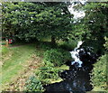
Eastington Wharf
Stroud GL10 3SQ, United Kingdom

Eastington Wharf
is a minor waterways place
on the Cotswold Canals (Stroudwater Navigation - Un-navigable Section) between
Saul Junction Marina (2 miles and 4½ furlongs
and 5 locks
to the northwest) and
Site of Entrance to Wallbridge Basin (The junction between the Stroudwater Navigation and the Thames & Severn Canal.) (4 miles and 1¼ furlongs
and 7 locks
to the east).
The nearest place in the direction of Saul Junction Marina is Former Dry Dock at Chipmans Platt;
¼ furlongs
away.
The nearest place in the direction of Site of Entrance to Wallbridge Basin is Pike Bridge (Restored to a fully navigable bridge in 2005.);
¼ furlongs
away.
Mooring here is unrated.
| Westfield Bridge | 1½ furlongs | |
| Westfield Lock No 9 | 1¼ furlongs | |
| Meadow Mill Overflow Weir | 1 furlong | |
| Dock Lock No 8 | ½ furlongs | |
| Former Dry Dock at Chipmans Platt | ¼ furlongs | |
| Eastington Wharf | ||
| Pike Bridge | ¼ furlongs | |
| Pike Lock No 7 | ½ furlongs | |
| Eastington Slipway | ¾ furlongs | |
| Blunder Lock No 6 | 1½ furlongs | |
| Newtown Lock No 5 | 3½ furlongs | |
There are no links to external websites from here.
Why not log in and add some (select "External websites" from the menu (sometimes this is under "Edit"))?
Why not log in and add some (select "External websites" from the menu (sometimes this is under "Edit"))?
Mouseover for more information or show routes to facility
Nearest water point
In the direction of Walk Bridge
Saul Junction Marina — 2 miles, 4½ furlongs and 5 locks away
Travel to Walk Bridge, then on the Cotswold Canals (Stroudwater Navigation - Navigable Section) to Saul Junction Marina
Saul Junction Winding Hole — 2 miles, 6 furlongs and 5 locks away
Travel to Walk Bridge, then on the Cotswold Canals (Stroudwater Navigation - Navigable Section) to Saul Junction, then on the Gloucester and Sharpness Canal to Saul Junction Winding Hole
Cotswold Canals Trust Visitor Centre - Saul Junction — 2 miles, 6¾ furlongs and 5 locks away
Travel to Walk Bridge, then on the Cotswold Canals (Stroudwater Navigation - Navigable Section) to Saul Junction, then on the Gloucester and Sharpness Canal to Cotswold Canals Trust Visitor Centre - Saul Junction
Fretherne Bridge — 3 miles, 4 furlongs and 5 locks away
Travel to Walk Bridge, then on the Cotswold Canals (Stroudwater Navigation - Navigable Section) to Saul Junction, then on the Gloucester and Sharpness Canal to Fretherne Bridge
Splatt Bridge — 4 miles, 4¾ furlongs and 5 locks away
Travel to Walk Bridge, then on the Cotswold Canals (Stroudwater Navigation - Navigable Section) to Saul Junction, then on the Gloucester and Sharpness Canal to Splatt Bridge
Patch Bridge — 6 miles, 3½ furlongs and 5 locks away
Travel to Walk Bridge, then on the Cotswold Canals (Stroudwater Navigation - Navigable Section) to Saul Junction, then on the Gloucester and Sharpness Canal to Patch Bridge
Sellars Bridge — 6 miles, 3¾ furlongs and 5 locks away
Travel to Walk Bridge, then on the Cotswold Canals (Stroudwater Navigation - Navigable Section) to Saul Junction, then on the Gloucester and Sharpness Canal to Sellars Bridge
Purton Lower Bridge — 8 miles, 7¼ furlongs and 5 locks away
Travel to Walk Bridge, then on the Cotswold Canals (Stroudwater Navigation - Navigable Section) to Saul Junction, then on the Gloucester and Sharpness Canal to Purton Lower Bridge
Llanthony Pontoons — 10 miles, 1¾ furlongs and 5 locks away
Travel to Walk Bridge, then on the Cotswold Canals (Stroudwater Navigation - Navigable Section) to Saul Junction, then on the Gloucester and Sharpness Canal to Llanthony Pontoons
Llanthony Road Bridge — 10 miles, 2½ furlongs and 5 locks away
Travel to Walk Bridge, then on the Cotswold Canals (Stroudwater Navigation - Navigable Section) to Saul Junction, then on the Gloucester and Sharpness Canal to Llanthony Road Bridge
Gloucester Waterways Museum Arm — 10 miles, 3 furlongs and 5 locks away
Travel to Walk Bridge, then on the Cotswold Canals (Stroudwater Navigation - Navigable Section) to Saul Junction, then on the Gloucester and Sharpness Canal to Gloucester Waterways Museum Arm
Gloucester Dock Lock — 10 miles, 3¾ furlongs and 5 locks away
Travel to Walk Bridge, then on the Cotswold Canals (Stroudwater Navigation - Navigable Section) to Saul Junction, then on the Gloucester and Sharpness Canal to Gloucester Dock LockNearest rubbish disposal
In the direction of Walk Bridge
Saul Junction Marina — 2 miles, 4½ furlongs and 5 locks away
Travel to Walk Bridge, then on the Cotswold Canals (Stroudwater Navigation - Navigable Section) to Saul Junction Marina
Saul Junction Winding Hole — 2 miles, 6 furlongs and 5 locks away
Travel to Walk Bridge, then on the Cotswold Canals (Stroudwater Navigation - Navigable Section) to Saul Junction, then on the Gloucester and Sharpness Canal to Saul Junction Winding Hole
Fretherne Bridge — 3 miles, 4 furlongs and 5 locks away
Travel to Walk Bridge, then on the Cotswold Canals (Stroudwater Navigation - Navigable Section) to Saul Junction, then on the Gloucester and Sharpness Canal to Fretherne Bridge
Parkend Bridge — 4 miles, 2¼ furlongs and 5 locks away
Travel to Walk Bridge, then on the Cotswold Canals (Stroudwater Navigation - Navigable Section) to Saul Junction, then on the Gloucester and Sharpness Canal to Parkend Bridge
Splatt Bridge — 4 miles, 4¾ furlongs and 5 locks away
Travel to Walk Bridge, then on the Cotswold Canals (Stroudwater Navigation - Navigable Section) to Saul Junction, then on the Gloucester and Sharpness Canal to Splatt Bridge
Patch Bridge — 6 miles, 3½ furlongs and 5 locks away
Travel to Walk Bridge, then on the Cotswold Canals (Stroudwater Navigation - Navigable Section) to Saul Junction, then on the Gloucester and Sharpness Canal to Patch Bridge
Sellars Bridge — 6 miles, 3¾ furlongs and 5 locks away
Travel to Walk Bridge, then on the Cotswold Canals (Stroudwater Navigation - Navigable Section) to Saul Junction, then on the Gloucester and Sharpness Canal to Sellars Bridge
Purton Lower Bridge — 8 miles, 7¼ furlongs and 5 locks away
Travel to Walk Bridge, then on the Cotswold Canals (Stroudwater Navigation - Navigable Section) to Saul Junction, then on the Gloucester and Sharpness Canal to Purton Lower Bridge
Sharpness Barge Arm — 10 miles, 2½ furlongs and 5 locks away
Travel to Walk Bridge, then on the Cotswold Canals (Stroudwater Navigation - Navigable Section) to Saul Junction, then on the Gloucester and Sharpness Canal to Sharpness Barge Arm
Llanthony Road Bridge — 10 miles, 2½ furlongs and 5 locks away
Travel to Walk Bridge, then on the Cotswold Canals (Stroudwater Navigation - Navigable Section) to Saul Junction, then on the Gloucester and Sharpness Canal to Llanthony Road BridgeNearest chemical toilet disposal
In the direction of Walk Bridge
Saul Junction Marina — 2 miles, 4½ furlongs and 5 locks away
Travel to Walk Bridge, then on the Cotswold Canals (Stroudwater Navigation - Navigable Section) to Saul Junction Marina
Cotswold Canals Trust Visitor Centre - Saul Junction — 2 miles, 6¾ furlongs and 5 locks away
Travel to Walk Bridge, then on the Cotswold Canals (Stroudwater Navigation - Navigable Section) to Saul Junction, then on the Gloucester and Sharpness Canal to Cotswold Canals Trust Visitor Centre - Saul Junction
Sharpness Barge Arm — 10 miles, 2½ furlongs and 5 locks away
Travel to Walk Bridge, then on the Cotswold Canals (Stroudwater Navigation - Navigable Section) to Saul Junction, then on the Gloucester and Sharpness Canal to Sharpness Barge Arm
Llanthony Road Bridge — 10 miles, 2½ furlongs and 5 locks away
Travel to Walk Bridge, then on the Cotswold Canals (Stroudwater Navigation - Navigable Section) to Saul Junction, then on the Gloucester and Sharpness Canal to Llanthony Road BridgeNearest place to turn
In the direction of Walk Bridge
Saul Junction Winding Hole — 2 miles, 6 furlongs and 5 locks away
Travel to Walk Bridge, then on the Cotswold Canals (Stroudwater Navigation - Navigable Section) to Saul Junction, then on the Gloucester and Sharpness Canal to Saul Junction Winding Hole
Pegthorne Bridge Winding Hole — 3 miles, 2½ furlongs and 5 locks away
Travel to Walk Bridge, then on the Cotswold Canals (Stroudwater Navigation - Navigable Section) to Saul Junction, then on the Gloucester and Sharpness Canal to Pegthorne Bridge Winding Hole
Quedgeley Oil Depot — 6 miles, 5 furlongs and 5 locks away
Travel to Walk Bridge, then on the Cotswold Canals (Stroudwater Navigation - Navigable Section) to Saul Junction, then on the Gloucester and Sharpness Canal to Quedgeley Oil Depot
Monk Meadow Dock — 9 miles, 7¼ furlongs and 5 locks away
Travel to Walk Bridge, then on the Cotswold Canals (Stroudwater Navigation - Navigable Section) to Saul Junction, then on the Gloucester and Sharpness Canal to Monk Meadow Dock
Sharpness Barge Arm — 10 miles, 2½ furlongs and 5 locks away
Travel to Walk Bridge, then on the Cotswold Canals (Stroudwater Navigation - Navigable Section) to Saul Junction, then on the Gloucester and Sharpness Canal to Sharpness Barge Arm
Gloucester Docks — 10 miles, 3¼ furlongs and 5 locks away
Travel to Walk Bridge, then on the Cotswold Canals (Stroudwater Navigation - Navigable Section) to Saul Junction, then on the Gloucester and Sharpness Canal to Gloucester Docks
Waterways Office (South Wales and Severn Waterways) - Canal & River Trust — 10 miles, 3½ furlongs and 5 locks away
Travel to Walk Bridge, then on the Cotswold Canals (Stroudwater Navigation - Navigable Section) to Saul Junction, then on the Gloucester and Sharpness Canal to Waterways Office (South Wales and Severn Waterways) - Canal & River Trust
Gloucester / Sharpness - Severn Junction — 10 miles, 4 furlongs and 6 locks away
Travel to Walk Bridge, then on the Cotswold Canals (Stroudwater Navigation - Navigable Section) to Saul Junction, then on the Gloucester and Sharpness Canal to Gloucester / Sharpness - Severn Junction
Upper Parting Junction — 13 miles, ¾ furlongs and 6 locks away
Travel to Walk Bridge, then on the Cotswold Canals (Stroudwater Navigation - Navigable Section) to Saul Junction, then on the Gloucester and Sharpness Canal to Gloucester / Sharpness - Severn Junction, then on the River Severn (main river - Worcester to Gloucester) to Upper Parting Junction
Over Winding Hole — 12 miles, 3¾ furlongs and 7 locks away
Travel to Walk Bridge, then on the Cotswold Canals (Stroudwater Navigation - Navigable Section) to Saul Junction, then on the Gloucester and Sharpness Canal to Gloucester / Sharpness - Severn Junction, then on the River Severn (old river navigation) to Lower Parting, then on the River Severn (Maisemore Channel - Southern Section) to Over Junction, then on the Hereford and Gloucester Canal to Over Winding Hole
In the direction of Site of Entrance to Wallbridge Basin
The Ocean — 1 mile, 1 furlong and 3 locks away
On this waterway in the direction of Site of Entrance to Wallbridge Basin
Ryeford Winding Hole — 2 miles, ¾ furlongs and 3 locks away
On this waterway in the direction of Site of Entrance to Wallbridge Basin
Brimscombe Port — 6 miles, 7¼ furlongs and 14 locks away
Travel to Site of Entrance to Wallbridge Basin, then on the Cotswold Canals (Thames and Severn Canal - Wide section) to Brimscombe PortNearest self-operated pump-out
In the direction of Walk Bridge
Cotswold Canals Trust Visitor Centre - Saul Junction — 2 miles, 6¾ furlongs and 5 locks away
Travel to Walk Bridge, then on the Cotswold Canals (Stroudwater Navigation - Navigable Section) to Saul Junction, then on the Gloucester and Sharpness Canal to Cotswold Canals Trust Visitor Centre - Saul Junction
Purton Lower Bridge — 8 miles, 7¼ furlongs and 5 locks away
Travel to Walk Bridge, then on the Cotswold Canals (Stroudwater Navigation - Navigable Section) to Saul Junction, then on the Gloucester and Sharpness Canal to Purton Lower Bridge
Llanthony Pontoons — 10 miles, 1¾ furlongs and 5 locks away
Travel to Walk Bridge, then on the Cotswold Canals (Stroudwater Navigation - Navigable Section) to Saul Junction, then on the Gloucester and Sharpness Canal to Llanthony PontoonsNearest boatyard pump-out
In the direction of Walk Bridge
Saul Junction Marina — 2 miles, 4½ furlongs and 5 locks away
Travel to Walk Bridge, then on the Cotswold Canals (Stroudwater Navigation - Navigable Section) to Saul Junction Marina
Patch Bridge — 6 miles, 3½ furlongs and 5 locks away
Travel to Walk Bridge, then on the Cotswold Canals (Stroudwater Navigation - Navigable Section) to Saul Junction, then on the Gloucester and Sharpness Canal to Patch BridgeDirection of TV transmitter (From Wolfbane Cybernetic)
There is no page on Wikipedia called “Eastington Wharf”
Wikipedia pages that might relate to Eastington Wharf
[Stroudwater Navigation]
granted them permission to start work on the section from Pike Bridge at Eastington to Ryeford, so that a trip-boat could be used on it. As attitudes softened
[List of electoral wards in England by constituency]
Cainscross, Cam East, Cam West, Central, Chalford, Coaley and Uley, Dursley, Eastington and Standish, Farmhill and Paganhill, Hardwicke, Nailsworth, Over Stroud
[List of poor law unions in England]
Aldwyn + detached portion, Coln St Dennis, Compton Abdale, Dowdeswell, Eastington, Eastleach Martin, Eastleach Turville, Farmington, Hampnett, Hazleton
Results of Google Search
Easington, Buckinghamshire - WikipediaEasington is a hamlet in the civil parish of Chilton, Buckinghamshire, about 3 miles (5 km) north ... Buckingham Park · Buckland · Buckland · Buckland Wharf · Calvert Green · Calvert · Charndon · Chearsley · Cheddington · Cheddington · Cooks Wharf.
Oct 27, 2016 ... Eastington is one of many communities within the Stroud District ...... main wharf and boat repair yard in the 19th century; Millend, the largest ...
These two pounds of the Eastington flight of locks are accessible to portable craft ... In between Dock House and the site of Pike Bridge was Eastington Wharf.
Nov 30, 2009 ... Eastington to Stonehouse. From the collection of Stanley Gardiner, Lionel Padin and Mike Mills (GPM). Photo:Whiting's coal barge at the wharf ...
Bristol Road Wharf, and start of infilling [more]. Site of Bristol Road ... Dock Lock, Chipmans Platt [more]. Pike Bridge, Eastington [more]. Pike Lock, Eastington ...
Feb 24, 2019 - Rent Condominiums in Eastington, United Kingdom from $20/ night. Find unique ... Places to stay in Eastington. Places to ...... Clevedon Pier View.
Bristol Road Wharf, and start of infilling [more]. Site of Bristol Road Bridge ... Dock Lock, Chipmans Platt [more]. Pike Bridge ... Newtown Lock, Eastington [more].
Apr 20, 2017 ... Desk Based Assessment at Eastington Park Farm (2007). 29676 ..... Stonehouse Wharf stood to the west of Downton Road and in the 1860s ...
Sep 17, 2018 ... For several centuries the Millend area of Eastington formed a detached .... Brimscombe quarry and brought to the Eastington stone wharf on the ...


