Forge Hill Lane Bridge
is a minor waterways place
on the Aire and Calder Navigation (Main Line - Goole to Castleford) between
Bank Dole Junction (Junction of the Aire and Calder Navigation (Selby Section) and the Aire and Calder Navigation (Main Line)) (1 mile
to the east) and
Castleford Junction (Junction of the Aire and Calder Navigation (Wakefield Section) and the Aire and Calder Navigation (Main Line)) (6 miles
and 3 locks
to the west).
The nearest place in the direction of Bank Dole Junction is Gaggs Bridge;
2½ furlongs
away.
The nearest place in the direction of Castleford Junction is Mill Bridge Wharf;
1½ furlongs
away.
There may be access to the towpath here.
Mooring here is unrated.
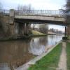
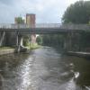
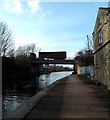
There is a bridge here which takes a minor road over the canal.
Bank Dole Junction | 1 mile | |
Shepherds Bridge | 7 furlongs | |
Cow Lane Bridge | 5¾ furlongs | |
Jackson's Bridge No 22 | 3¾ furlongs | |
Gaggs Bridge | 2½ furlongs | |
Forge Hill Lane Bridge | ||
Mill Bridge Wharf | 1½ furlongs | |
Ferrybridge Flood Lock No 11 | 4¼ furlongs | |
Ferrybridge Flood Lock Footbridge | 4¾ furlongs | |
Ferrybridge Weir Entrance | 5 furlongs | |
Ferrybridge Bypass Bridge | 5¼ furlongs |
There are no links to external websites from here.
Why not log in and add some (select "External websites" from the menu (sometimes this is under "Edit"))?
Mouseover for more information or show routes to facility
Nearest water point
In the direction of Castleford Junction
Ferrybridge Flood Lock No 11 — 4¼ furlongs away
On this waterway in the direction of Castleford Junction
Ferrybridge Flood Lock Footbridge — 4¾ furlongs and 1 lock away
On this waterway in the direction of Castleford Junction
Bulholme Lock No 10 — 5 miles, 2¼ furlongs and 1 lock away
On this waterway in the direction of Castleford Junction
Castleford Sanitary Station — 5 miles, 7 furlongs and 2 locks away
On this waterway in the direction of Castleford Junction
Woodnook Lock No 6 — 8 miles, 1¾ furlongs and 3 locks away
Travel to Castleford Junction, then on the Aire and Calder Navigation (Wakefield Section) to Woodnook Lock No 6
Fairies Hill Moorings — 8 miles, ¼ furlongs and 4 locks away
Travel to Castleford Junction, then on the Aire and Calder Navigation (Wakefield Section) to Fairies Hill Lock Junction, then on the Aire and Calder Navigation (Wakefield Section - Fairies Hill Mooring Arm) to Fairies Hill Moorings
Lemonroyd Lock No 7 — 9 miles, 3½ furlongs and 3 locks away
Travel to Castleford Junction, then on the Aire and Calder Navigation (Main Line - Castleford to Leeds) to Lemonroyd Lock No 7
Lemonroyd Marina — 9 miles, 4½ furlongs and 4 locks away
Travel to Castleford Junction, then on the Aire and Calder Navigation (Main Line - Castleford to Leeds) to Lemonroyd Marina
King's Road Lock No 3 — 9 miles, 3¼ furlongs and 4 locks away
Travel to Castleford Junction, then on the Aire and Calder Navigation (Wakefield Section) to King's Road Lock No 3
Woodlesford Lock No 5 — 10 miles, 6¼ furlongs and 4 locks away
Travel to Castleford Junction, then on the Aire and Calder Navigation (Main Line - Castleford to Leeds) to Woodlesford Lock No 5
Fishpond Lock No 4 — 11 miles, 5 furlongs and 5 locks away
Travel to Castleford Junction, then on the Aire and Calder Navigation (Main Line - Castleford to Leeds) to Fishpond Lock No 4
Stanley Ferry Water Point — 11 miles, ¼ furlongs and 6 locks away
Travel to Castleford Junction, then on the Aire and Calder Navigation (Wakefield Section) to Stanley Ferry Water Point
Ramsdens Bridge Sanitary Station — 11 miles, 1 furlong and 6 locks away
Travel to Castleford Junction, then on the Aire and Calder Navigation (Wakefield Section) to Ramsdens Bridge Sanitary Station
In the direction of Ouse - Aire and Calder Junction
Bank Dole Lock No 1 — 1 mile, 2 furlongs away
Travel to Bank Dole Junction, then on the Aire and Calder Navigation (Selby Section) to Bank Dole Lock No 1
Beal Bridge — 3 miles, 4½ furlongs and 1 lock away
Travel to Bank Dole Junction, then on the Aire and Calder Navigation (Selby Section) to Beal Bridge
Beal Lock No 2 — 3 miles, 5¾ furlongs and 1 lock away
Travel to Bank Dole Junction, then on the Aire and Calder Navigation (Selby Section) to Beal Lock No 2
Whitley Lock No 12 — 4 miles, 7½ furlongs away
On this waterway in the direction of Ouse - Aire and Calder Junction
Pollington Manor Swing Bridge — 8 miles, 5½ furlongs and 2 locks away
On this waterway in the direction of Ouse - Aire and Calder Junction
Pollington Visitor Mooring — 8 miles, 6 furlongs and 2 locks away
On this waterway in the direction of Ouse - Aire and Calder Junction
Selby Basin — 12 miles, 2½ furlongs and 3 locks away
Travel to Bank Dole Junction, then on the Aire and Calder Navigation (Selby Section) to Selby BasinNearest rubbish disposal
In the direction of Castleford Junction
Castleford Sanitary Station — 5 miles, 7 furlongs and 2 locks away
On this waterway in the direction of Castleford Junction
Lemonroyd Marina — 9 miles, 4½ furlongs and 4 locks away
Travel to Castleford Junction, then on the Aire and Calder Navigation (Main Line - Castleford to Leeds) to Lemonroyd Marina
Woodlesford Lock No 5 — 10 miles, 6¼ furlongs and 4 locks away
Travel to Castleford Junction, then on the Aire and Calder Navigation (Main Line - Castleford to Leeds) to Woodlesford Lock No 5
Ramsdens Bridge Visitor Moorings — 11 miles, ¾ furlongs and 6 locks away
Travel to Castleford Junction, then on the Aire and Calder Navigation (Wakefield Section) to Ramsdens Bridge Visitor Moorings
Leeds Sanitary Station — 15 miles, 2¾ furlongs and 7 locks away
Travel to Castleford Junction, then on the Aire and Calder Navigation (Main Line - Castleford to Leeds) to Leeds Sanitary Station
Leeds Basin — 16 miles, 2 furlongs and 9 locks away
Travel to Castleford Junction, then on the Aire and Calder Navigation (Main Line - Castleford to Leeds) to Leeds Bridge, then on the Leeds and Liverpool Canal (Main Line - Wigan to Leeds) to Leeds Basin
Horbury Basin Residential Moorings & Sanitary Station — 18 miles, 5½ furlongs and 11 locks away
Travel to Castleford Junction, then on the Aire and Calder Navigation (Wakefield Section) to Fall Ing Junction, then on the Calder and Hebble Navigation (Main Line) to Horbury Basin Residential Moorings & Sanitary Station
In the direction of Ouse - Aire and Calder Junction
Whitley Lock No 12 — 4 miles, 7½ furlongs away
On this waterway in the direction of Ouse - Aire and Calder Junction
Selby Basin — 12 miles, 2½ furlongs and 3 locks away
Travel to Bank Dole Junction, then on the Aire and Calder Navigation (Selby Section) to Selby Basin
Dutch Riverside — 17 miles and 2 locks away
On this waterway in the direction of Ouse - Aire and Calder Junction
Goole Marina — 17 miles, 1½ furlongs and 2 locks away
On this waterway in the direction of Ouse - Aire and Calder Junction
Barnby Dun Lift Bridge — 17 miles, 3 furlongs and 3 locks away
Travel to Sykehouse Junction, then on the Sheffield and South Yorkshire Navigation (New Junction Canal) to Bramwith Junction, then on the Sheffield and South Yorkshire Navigation (Main Line) to Barnby Dun Lift Bridge
Bramwith Swing Bridge — 16 miles, 7½ furlongs and 4 locks away
Travel to Sykehouse Junction, then on the Sheffield and South Yorkshire Navigation (New Junction Canal) to Bramwith Junction, then on the Sheffield and South Yorkshire Navigation (Bramwith to Stainforth) to Bramwith Swing BridgeNearest chemical toilet disposal
In the direction of Castleford Junction
Castleford Sanitary Station — 5 miles, 7 furlongs and 2 locks away
On this waterway in the direction of Castleford Junction
Fairies Hill Moorings — 8 miles, ¼ furlongs and 4 locks away
Travel to Castleford Junction, then on the Aire and Calder Navigation (Wakefield Section) to Fairies Hill Lock Junction, then on the Aire and Calder Navigation (Wakefield Section - Fairies Hill Mooring Arm) to Fairies Hill Moorings
Lemonroyd Marina — 9 miles, 4½ furlongs and 4 locks away
Travel to Castleford Junction, then on the Aire and Calder Navigation (Main Line - Castleford to Leeds) to Lemonroyd Marina
Ramsdens Bridge Sanitary Station — 11 miles, 1 furlong and 6 locks away
Travel to Castleford Junction, then on the Aire and Calder Navigation (Wakefield Section) to Ramsdens Bridge Sanitary Station
Leeds Sanitary Station — 15 miles, 2¾ furlongs and 7 locks away
Travel to Castleford Junction, then on the Aire and Calder Navigation (Main Line - Castleford to Leeds) to Leeds Sanitary Station
Horbury Basin Residential Moorings & Sanitary Station — 18 miles, 5½ furlongs and 11 locks away
Travel to Castleford Junction, then on the Aire and Calder Navigation (Wakefield Section) to Fall Ing Junction, then on the Calder and Hebble Navigation (Main Line) to Horbury Basin Residential Moorings & Sanitary Station
In the direction of Ouse - Aire and Calder Junction
Whitley Lock No 12 — 4 miles, 7½ furlongs away
On this waterway in the direction of Ouse - Aire and Calder Junction
Selby Basin — 12 miles, 2½ furlongs and 3 locks away
Travel to Bank Dole Junction, then on the Aire and Calder Navigation (Selby Section) to Selby Basin
Dutch Riverside — 17 miles and 2 locks away
On this waterway in the direction of Ouse - Aire and Calder Junction
Goole Marina — 17 miles, 1½ furlongs and 2 locks away
On this waterway in the direction of Ouse - Aire and Calder Junction
Barnby Dun Lift Bridge — 17 miles, 3 furlongs and 3 locks away
Travel to Sykehouse Junction, then on the Sheffield and South Yorkshire Navigation (New Junction Canal) to Bramwith Junction, then on the Sheffield and South Yorkshire Navigation (Main Line) to Barnby Dun Lift Bridge
Bramwith Swing Bridge — 16 miles, 7½ furlongs and 4 locks away
Travel to Sykehouse Junction, then on the Sheffield and South Yorkshire Navigation (New Junction Canal) to Bramwith Junction, then on the Sheffield and South Yorkshire Navigation (Bramwith to Stainforth) to Bramwith Swing BridgeNearest place to turn
In the direction of Castleford Junction
Bulholme Lock Weir Exit — 5 miles, 2 furlongs and 1 lock away
On this waterway in the direction of Castleford Junction
Lemonroyd Lock Weir Exit — 9 miles, 2½ furlongs and 3 locks away
Travel to Castleford Junction, then on the Aire and Calder Navigation (Main Line - Castleford to Leeds) to Lemonroyd Lock Weir Exit
Fairies Hill Lock Arm — 8 miles, 3¼ furlongs and 4 locks away
Travel to Castleford Junction, then on the Aire and Calder Navigation (Wakefield Section) to Fairies Hill Lock Arm
Fleet Lane Arm — 9 miles, 6½ furlongs and 4 locks away
Travel to Castleford Junction, then on the Aire and Calder Navigation (Main Line - Castleford to Leeds) to Fleet Lane Arm
Stanley Ferry Marina — 10 miles, 7½ furlongs and 6 locks away
Travel to Castleford Junction, then on the Aire and Calder Navigation (Wakefield Section) to Stanley Ferry Marina
Junction with River Aire (Old Channel) South — 14 miles, ¾ furlongs and 6 locks away
Travel to Castleford Junction, then on the Aire and Calder Navigation (Main Line - Castleford to Leeds) to Junction with River Aire (Old Channel) South
Junction with River Aire (Old Channel) North — 14 miles, 6 furlongs and 7 locks away
Travel to Castleford Junction, then on the Aire and Calder Navigation (Main Line - Castleford to Leeds) to Junction with River Aire (Old Channel) North
Knostrop Flood Lock Weir Entrance — 14 miles, 6¼ furlongs and 7 locks away
Travel to Castleford Junction, then on the Aire and Calder Navigation (Main Line - Castleford to Leeds) to Knostrop Flood Lock Weir Entrance
Wakefield Weir Entrance — 14 miles and 8 locks away
Travel to Castleford Junction, then on the Aire and Calder Navigation (Wakefield Section) to Fall Ing Junction, then on the Calder and Hebble Navigation (Main Line) to Wakefield Weir Entrance
Leeds Dock Side Arm — 15 miles, 5¼ furlongs and 8 locks away
Travel to Castleford Junction, then on the Aire and Calder Navigation (Main Line - Castleford to Leeds) to Leeds Dock Entrance, then on the Aire and Calder Navigation (Leeds Dock) to Leeds Dock Side Arm
River Aire Junction — 16 miles, 1½ furlongs and 8 locks away
Travel to Castleford Junction, then on the Aire and Calder Navigation (Main Line - Castleford to Leeds) to Leeds Bridge, then on the Leeds and Liverpool Canal (Main Line - Wigan to Leeds) to River Aire Junction
Leeds Basin — 16 miles, 2 furlongs and 9 locks away
Travel to Castleford Junction, then on the Aire and Calder Navigation (Main Line - Castleford to Leeds) to Leeds Bridge, then on the Leeds and Liverpool Canal (Main Line - Wigan to Leeds) to Leeds Basin
Broad Cut Weir Entrance — 16 miles, 4½ furlongs and 9 locks away
Travel to Castleford Junction, then on the Aire and Calder Navigation (Wakefield Section) to Fall Ing Junction, then on the Calder and Hebble Navigation (Main Line) to Broad Cut Weir Entrance
Waller Bridge Winding Hole — 16 miles, 6½ furlongs and 10 locks away
Travel to Castleford Junction, then on the Aire and Calder Navigation (Wakefield Section) to Fall Ing Junction, then on the Calder and Hebble Navigation (Main Line) to Waller Bridge Winding Hole
In the direction of Ouse - Aire and Calder Junction
Bank Dole Lock Junction — 1 mile, 2¼ furlongs and 1 lock away
Travel to Bank Dole Junction, then on the Aire and Calder Navigation (Selby Section) to Bank Dole Lock Junction
Beal Lock No 2 Weir Entrance — 3 miles, 4¾ furlongs and 1 lock away
Travel to Bank Dole Junction, then on the Aire and Calder Navigation (Selby Section) to Beal Lock No 2 Weir Entrance
Haddlesey Junction — 7 miles, 4 furlongs and 2 locks away
Travel to Bank Dole Junction, then on the Aire and Calder Navigation (Selby Section) to Haddlesey Junction
Selby Basin — 12 miles, 2½ furlongs and 3 locks away
Travel to Bank Dole Junction, then on the Aire and Calder Navigation (Selby Section) to Selby Basin
Viking Marina — 17 miles, ¾ furlongs and 2 locks away
On this waterway in the direction of Ouse - Aire and Calder Junction
Huddle Grounds Winding Hole — 18 miles, 6¾ furlongs and 4 locks away
Travel to Sykehouse Junction, then on the Sheffield and South Yorkshire Navigation (New Junction Canal) to Bramwith Junction, then on the Sheffield and South Yorkshire Navigation (Bramwith to Stainforth) to Stainforth Junction, then on the Sheffield and South Yorkshire Navigation (Stainforth and Keadby Canal) to Huddle Grounds Winding HoleNearest self-operated pump-out
In the direction of Castleford Junction
Castleford Sanitary Station — 5 miles, 7 furlongs and 2 locks away
On this waterway in the direction of Castleford Junction
Ramsdens Bridge Sanitary Station — 11 miles, 1 furlong and 6 locks away
Travel to Castleford Junction, then on the Aire and Calder Navigation (Wakefield Section) to Ramsdens Bridge Sanitary Station
Leeds Sanitary Station — 15 miles, 2¾ furlongs and 7 locks away
Travel to Castleford Junction, then on the Aire and Calder Navigation (Main Line - Castleford to Leeds) to Leeds Sanitary Station
In the direction of Ouse - Aire and Calder Junction
Long Sandall Lock No 13 — 19 miles, 4¼ furlongs and 3 locks away
Travel to Sykehouse Junction, then on the Sheffield and South Yorkshire Navigation (New Junction Canal) to Bramwith Junction, then on the Sheffield and South Yorkshire Navigation (Main Line) to Long Sandall Lock No 13Nearest boatyard pump-out
In the direction of Castleford Junction
Lemonroyd Marina — 9 miles, 4½ furlongs and 4 locks away
Travel to Castleford Junction, then on the Aire and Calder Navigation (Main Line - Castleford to Leeds) to Lemonroyd Marina
In the direction of Ouse - Aire and Calder Junction
Goole Marina — 17 miles, 1½ furlongs and 2 locks away
On this waterway in the direction of Ouse - Aire and Calder JunctionDirection of TV transmitter (From Wolfbane Cybernetic)
There is no page on Wikipedia called “Forge Hill Lane Bridge”
Wikipedia pages that might relate to Forge Hill Lane Bridge
[Little Aston]
main areas: Little Aston Park, Claverdon Park, Rosemary Hill Road, Little Aston Lane, Forge Lane, Walsall Road, Aldridge Road, Little Aston Hall and Lady
[Pennsylvania Turnpike]
Forge interchange the turnpike is designated as I-276 and becomes a six-lane road serving as a suburban commuter highway. The road comes to a bridge over
[Leeds and Liverpool Canal]
Granary Wharf, Leeds city centre Armley Pool Kirkstall Bramley Apperley Bridge Shipley Saltaire Bingley Keighley Silsden Skipton Gargrave Barnoldswick
[Moodna Creek]
the 9W bridge, and washing out an area at the Forge Hill Road bridge. This caused the closing of part of Butternut Drive, and all of Forge Hill Rd, except
[Schuylkill Expressway]
a nine-lane freeway carrying four westbound lanes and five eastbound lanes that is designated as part of I-76, passing through the Valley Forge Interchange
[Park Hill, Sheffield]
designing the Park Hill Flats. Inspired by Le Corbusier's Unité d'Habitation and the Smithsons' unbuilt schemes, most notably for Golden Lane in London, the
[Interstate 64 in Virginia]
Rise Bridge and associated lanes of I-64 from the I-464/I-64 interchange. Both directions would have a primary entrance/exit near the Bowers Hill interchange
[List of places in County Durham]
High Forge, High Friarside, High Grange, High Haswell, High Hesledon, High Shincliffe, High Stoop, High Throston, High Urpeth, High Westwood, Hill End
[List of places in Herefordshire]
Mountain (SO265515) Brimfield (SO525678) Bringewood Forge (SO458745) Bringsty Common (SO705559) Brinkley Hill (SO589315) Brinsop (SO445448) Brinsop Common (SO438445)
[List of schools in Sheffield]
English county of South Yorkshire. Abbey Lane Primary School, Sheffield Abbeydale Primary School, Sheffield Acres Hill Primary School, Sheffield All Saints