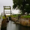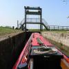
Lower Kyme Lock
North Kyme, North Kesteven, Lincolnshire, England, United Kingdom
Address is taken from a point 4058 yards away.

Lower Kyme Lock
is a minor waterways place
on the River Witham (Sleaford Navigation(Kyme Eau)-navigable section) between
Chapel Hill Junction (Junction with Sleaford Navigation (Kyme Eau)-navigable section ) (1 mile and ¾ furlongs
to the northeast) and
South Kyme (2 miles and 4¼ furlongs
to the southwest).
The nearest place in the direction of Chapel Hill Junction is Kyme Eau Flood Lock;
7½ furlongs
away.
The nearest place in the direction of South Kyme is Winding Hole below Clay Bank Road Bridge;
1 mile and 6¾ furlongs
away.
Mooring here is unrated.
This is a lock, the rise of which is not known.
| Chapel Hill Junction | 1 mile, ¾ furlongs | |
| North Forty Foot Bank Bridge | 7¾ furlongs | |
| Kyme Eau Flood Lock | 7½ furlongs | |
| Lower Kyme Lock | ||
| Winding Hole below Clay Bank Road Bridge | 1 mile, 6¾ furlongs | |
| Clay Bank Road Bridge | 2 miles, 3½ furlongs | |
| South Kyme | 2 miles, 4¼ furlongs | |
| High Street Footbridge | 2 miles, 4¾ furlongs | |
| Low Road Bridge | 2 miles, 5½ furlongs | |
There are no links to external websites from here.
Why not log in and add some (select "External websites" from the menu (sometimes this is under "Edit"))?
Mouseover for more information or show routes to facility
Nearest water point
In the direction of Chapel Hill Junction
Langrick Bridge General Store and Marina — 6 miles, 4½ furlongs and 1 lock away
Travel to Chapel Hill Junction, then on the River Witham (Lincoln to Boston) to Langrick Bridge General Store and Marina
Boston Lock Visitor Moorings — 10 miles, 5½ furlongs and 1 lock away
Travel to Chapel Hill Junction, then on the River Witham (Lincoln to Boston) to Boston Lock Visitor Moorings
Bardney Lock No 2 — 14 miles, 7¾ furlongs and 1 lock away
Travel to Chapel Hill Junction, then on the River Witham (Lincoln to Boston) to Bardney Lock No 2Nearest rubbish disposal
In the direction of Chapel Hill Junction
Boston Lock Visitor Moorings — 10 miles, 5½ furlongs and 1 lock away
Travel to Chapel Hill Junction, then on the River Witham (Lincoln to Boston) to Boston Lock Visitor Moorings
Boston Grand Sluice Lock No 3 — 11 miles and 1 lock away
Travel to Chapel Hill Junction, then on the River Witham (Lincoln to Boston) to Boston Grand Sluice Lock No 3
Bardney Lock No 2 — 14 miles, 7¾ furlongs and 1 lock away
Travel to Chapel Hill Junction, then on the River Witham (Lincoln to Boston) to Bardney Lock No 2Nearest chemical toilet disposal
In the direction of Chapel Hill Junction
Boston Grand Sluice Lock No 3 — 11 miles and 1 lock away
Travel to Chapel Hill Junction, then on the River Witham (Lincoln to Boston) to Boston Grand Sluice Lock No 3
Bardney Lock No 2 — 14 miles, 7¾ furlongs and 1 lock away
Travel to Chapel Hill Junction, then on the River Witham (Lincoln to Boston) to Bardney Lock No 2Nearest place to turn
In the direction of Chapel Hill Junction
Chapel Hill Junction — 1 mile, ¾ furlongs and 1 lock away
On this waterway in the direction of Chapel Hill Junction
Orchard Caravan and Camping Park Moorings — 1 mile, 3¼ furlongs and 1 lock away
Travel to Chapel Hill Junction, then on the River Witham (Lincoln to Boston) to Orchard Caravan and Camping Park Moorings
Dogdyke Visitor Moorings — 2 miles, ¼ furlongs and 1 lock away
Travel to Chapel Hill Junction, then on the River Witham (Lincoln to Boston) to Dogdyke Visitor Moorings
Belle Isle Marina — 2 miles, ¾ furlongs and 1 lock away
Travel to Chapel Hill Junction, then on the River Witham (Lincoln to Boston) to Belle Isle Marina
Tattershall Bridge Visitor Moorings — 3 miles and 1 lock away
Travel to Chapel Hill Junction, then on the River Witham (Lincoln to Boston) to Tattershall Bridge Visitor Moorings
Horncastle Canal Junction — 3 miles, 4¾ furlongs and 1 lock away
Travel to Chapel Hill Junction, then on the River Witham (Lincoln to Boston) to Horncastle Canal Junction
Langrick Bridge General Store and Marina — 6 miles, 4½ furlongs and 1 lock away
Travel to Chapel Hill Junction, then on the River Witham (Lincoln to Boston) to Langrick Bridge General Store and Marina
Kirkstead Bridge Visitor Moorings — 7 miles, 3½ furlongs and 1 lock away
Travel to Chapel Hill Junction, then on the River Witham (Lincoln to Boston) to Kirkstead Bridge Visitor Moorings
Anton's Gowt Junction — 8 miles, 4¾ furlongs and 1 lock away
Travel to Chapel Hill Junction, then on the River Witham (Lincoln to Boston) to Anton's Gowt Junction
Stixwould — 9 miles, 4½ furlongs and 1 lock away
Travel to Chapel Hill Junction, then on the River Witham (Lincoln to Boston) to Stixwould
Boston Lock Visitor Moorings — 10 miles, 5½ furlongs and 1 lock away
Travel to Chapel Hill Junction, then on the River Witham (Lincoln to Boston) to Boston Lock Visitor Moorings
Boston Motor Yatch Club — 10 miles, 6¾ furlongs and 1 lock away
Travel to Chapel Hill Junction, then on the River Witham (Lincoln to Boston) to Boston Motor Yatch Club
Boston Gateway Marina — 10 miles, 7¼ furlongs and 1 lock away
Travel to Chapel Hill Junction, then on the River Witham (Lincoln to Boston) to Boston Gateway Marina
Southrey Visitor Moorings — 11 miles, 1¼ furlongs and 1 lock away
Travel to Chapel Hill Junction, then on the River Witham (Lincoln to Boston) to Southrey Visitor Moorings
Dunstan Fen Visitor Moorings — 11 miles, 1¾ furlongs and 1 lock away
Travel to Chapel Hill Junction, then on the River Witham (Lincoln to Boston) to Dunstan Fen Visitor Moorings
River Witham - Nocton Delph Junction — 11 miles, 7¼ furlongs and 1 lock away
Travel to Chapel Hill Junction, then on the River Witham (Lincoln to Boston) to River Witham - Nocton Delph Junction
Bardney Village Visitor Moorings — 14 miles, 2½ furlongs and 1 lock away
Travel to Chapel Hill Junction, then on the River Witham (Lincoln to Boston) to Bardney Village Visitor Moorings
Bettinson's Bridge Winding Hole — 14 miles, 4½ furlongs and 2 locks away
Travel to Chapel Hill Junction, then on the River Witham (Lincoln to Boston) to Anton's Gowt Junction, then on the Witham Navigable Drains (Frith Bank Drain) to Newham Drain - Frith Bank Drain Junction, then on the Witham Navigable Drains (Newham Drain) to Newham Drain - Howbridge Drain - West Fen Drain Junction, then on the Witham Navigable Drains (Howbridge Drain) to Bettinson's Bridge Winding Hole
In the direction of Cobblers Lock
Winding Hole below Clay Bank Road Bridge — 1 mile, 6¾ furlongs and 1 lock away
On this waterway in the direction of Cobblers Lock
Cobblers Lock Winding Hole — 5 miles, 7¼ furlongs and 1 lock away
On this waterway in the direction of Cobblers LockNo information
CanalPlan has no information on any of the following facilities within range:self-operated pump-out
boatyard pump-out
Direction of TV transmitter (From Wolfbane Cybernetic)
There is no page on Wikipedia called “Lower Kyme Lock”
Wikipedia pages that might relate to Lower Kyme Lock
[Sleaford Navigation]
navigation was restored to the first 8 miles (13 km) with the re-opening of Lower Kyme lock in 1986. The Sleaford Navigation Trust has been working towards restoring
[Anne Askew]
Anne Askew (née Ayscough, Ascue; married name Anne Kyme; 1521 – 16 July 1546) was an English writer, poet, and Protestant martyr who was condemned as a
[River Witham]
by the Kyme Eau, which connects to the Sleaford Navigation on which navigation will eventually be restored to Sleaford. At Antons Gowt, a lock drops down
[Troy]
from the 1334 BC date of Duris of Samos to the 1135 BC date of Ephoros of Kyme in Aeolis. Blegen preferred the 1184 BC date of Eratosthenes, which was most
[Coin]
was Pheidon of Argos, or Demodike of Kyme (who was wife of Midas the Phrygian and daughter of King Agammemnon of Kyme), or Erichthonios and Lycos of Athens
[South Forty-Foot Drain]
Ewerby, Great Hale, Heckington, Holland Fen, Howell, Little Hale and South Kyme. Much of the area to the south and west of Boston, some 91 square miles (240 km2)
[Sleaford]
Holdingham, Howell, Kelby, Kirkby Green, Kirkby la Thrope, North Kyme, South Kyme, Leadenham, Leasingham, Martin, Newton, Osbournby, Quarrington, North
[Witham First District IDB]
smaller area of 5,176 acres (2,095 ha) between Billinghay Skirth and Kyme Eau, the lower part of the River Slea. It became part of the First District in 1953
[List of electoral wards in England by constituency]
Green, Haselbury, Jubilee, Lower Edmonton, Ponders End, Upper Edmonton. Enfield North: Chase, Enfield Highway, Enfield Lock, Highlands, Southbury, Town
[List of poor law unions in England]
Leadenham, Leasingham, Little Hale, Martin, New Sleaford, Newton, North Kyme, North Rauceby, Old Sleaford + detached portion, Osbournby, Quarrington,
Results of Google Search
Sleaford Navigation - WikipediaThe Sleaford Navigation was a 12.5 mile (20.1 km) canalisation of the River Slea in ... remained navigable until the 1940s. Lower Kyme lock was then replaced by a sluice, which prevented navigation until a lock was reinstated in 1986.
Lower Kyme Lock. B1395 Clay Bank bridge, South Kyme. Old course of River Slea. Head of navigation. Cobblers Lock. Haverholme Lock ...
May 3, 2016 ... tags: canoeing, locks, mills, navigation, river Slea, weirs ... 2 miles – Corn mill lock (remains) and footbridge. ... 11 miles – Lower Kyme Lock.
Lower Kyme Lock, Kyme Eau-Sleaford Canal. Related Articles of Kyme Eau - Sleaford Canal. Oxford to Boston. Related Books of Kyme Eau - Sleaford Canal.
Jul 8, 2010 ... ... on the River Steeping near Skegness, Bottom Lock on the Kyme Eau near Chapel Hill, and the River Glen at Surfleet Seas End, near Surfleet ...
Kyme Eau - Sleaford Canal click to see more details of the waterway - including the table ... Ewerby Waithe Common, Lower Kyme Lock, 4.88, 1, 5hr 20min, 1.10 Â ...
Apr 18, 2015 ... Bottom Lock used to be known as Kyme Lower Lock though it is quite some distance from South Kyme (or anywhere else for that matter).
May 29, 2019 ... The lock lets you down about 4 feet off the river onto the 'Witham ... was going fine so we carried on for a mile and a half to Lower Kyme Lock.


![That's Far Enough. This looked a wise point to turn the boat around and head back the way we came.Bottom Lock on the Sleaford Navigation, in the duckweed season.There's nobody much to help you if you get stuck out on this lonely waterway.See also [[601964]] for more boats in the weed. by Des Blenkinsopp – 22 August 2005](https://s0.geograph.org.uk/geophotos/03/79/27/3792704_8db090b6_120x120.jpg)