CanalPlanAC

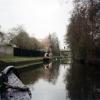
Clay Lane Bridge

 
Clay Lane, Guildford GU4 7ND, United Kingdom
 
Information about the place
Clay Lane Bridge is a minor waterways place on the River Wey Wey Navigation between Byfleet (8 miles and 4¾ furlongs and 7 locks to the northeast) and Dapdune Wharf (2 miles and 5¼ furlongs and 1 lock to the southwest).
 
 
The nearest place in the direction of Byfleet is Bower's Lock No 6; 1 furlong away.
 
The nearest place in the direction of Dapdune Wharf is Bower's Bridge; ½ furlongs away.

There is access (suitable for wheels) to the towpath here.

Mooring here is good (a nice place to moor), mooring pins are needed.

There is a bridge here which takes a minor road over the canal.

Send Church Bridge1 mile, 5¼ furlongs
Triggs Lock Weir Entrance7 furlongs
Broadoak Bridge6¾ furlongs
Bower's Lock Weir Exit1 furlong
Bower's Lock No 61 furlong
Clay Lane Bridge
Bower's Bridge½ furlongs
Bower's Lock Weir Entrance1¼ furlongs
Stoke Lock Weir Exit1 mile, ½ furlongs
Stoke Lock No 51 mile, ¾ furlongs
Stoke Lock Slipway1 mile, 1 furlong
 
 
Amenities

Amenities here

 Sainsbury's
 Sainsburys
 Starbucks
 Cashpoint
 Sainsburys Fuel

Amenities nearby at Bower's Bridge

 Aldi
 Fish & Chips
 Cashpoint
 BP
 Cycleworks Uk - Guilford
 
Maps
If you are a user and are logged on, or if you are actively planning a route, a map will be displayed here.
Show on external mapping site: Google | OSM | Bing
 
Photos
 
External websites
 River Wey and Godalming Navigations and Dapdune Wharf — associated with River Wey
This is the web site for the National Trust who manage the River Wey
 
Nearest facilities

Mouseover for more information or show routes to facility

Nearest water point

In the direction of Thames - Wey Junction

Cartbridge Wharf3 miles, 1½ furlongs and 3 locks away
On this waterway in the direction of Thames - Wey Junction
Pyrford Lock No 126 miles, 7¼ furlongs and 6 locks away
On this waterway in the direction of Thames - Wey Junction
Thames Lock No 1611 miles, 4½ furlongs and 10 locks away
On this waterway in the direction of Thames - Wey Junction
Chertsey Lock13 miles, 7¼ furlongs and 12 locks away
Travel to Thames - Wey Junction, then on the River Thames (below Oxford) to Chertsey Lock
Arthur's Bridge13 miles, 4¼ furlongs and 13 locks away
Travel to Woodham Junction, then on the Basingstoke Canal to Arthur's Bridge
Molesey Lock17 miles, 2½ furlongs and 12 locks away
Travel to Thames - Wey Junction, then on the River Thames (below Oxford) to West End of Desborough Cut, then on the River Thames (Desborough Cut) to Thames Meadow, then on the River Thames (below Oxford) to Molesey Lock

In the direction of Millmead Lock No 4

Stoke Lock No 51 mile, ¾ furlongs away
On this waterway in the direction of Millmead Lock No 4
Guildford Waterside Centre1 mile, 5½ furlongs and 1 lock away
On this waterway in the direction of Millmead Lock No 4
Dapdune Wharf2 miles, 5¼ furlongs and 1 lock away
On this waterway in the direction of Millmead Lock No 4
Godalming Wharf7 miles, 4¼ furlongs and 5 locks away
Travel to Millmead Lock No 4, then on the River Wey Godalming Navigation to Godalming Wharf

Nearest rubbish disposal

In the direction of Thames - Wey Junction

Pyrford Lock No 126 miles, 7¼ furlongs and 6 locks away
On this waterway in the direction of Thames - Wey Junction
Shepperton Lock11 miles, 7½ furlongs and 11 locks away
Travel to Thames - Wey Junction, then on the River Thames (below Oxford) to Shepperton Lock
Arthur's Bridge13 miles, 4¼ furlongs and 13 locks away
Travel to Woodham Junction, then on the Basingstoke Canal to Arthur's Bridge
Penton Hook Lock15 miles, 6½ furlongs and 13 locks away
Travel to Thames - Wey Junction, then on the River Thames (below Oxford) to Penton Hook Lock
Molesey Lock17 miles, 2½ furlongs and 12 locks away
Travel to Thames - Wey Junction, then on the River Thames (below Oxford) to West End of Desborough Cut, then on the River Thames (Desborough Cut) to Thames Meadow, then on the River Thames (below Oxford) to Molesey Lock
Bell Weir Lock18 miles, 5 furlongs and 14 locks away
Travel to Thames - Wey Junction, then on the River Thames (below Oxford) to Bell Weir Lock

In the direction of Millmead Lock No 4

Guildford Waterside Centre1 mile, 5½ furlongs and 1 lock away
On this waterway in the direction of Millmead Lock No 4
Dapdune Wharf2 miles, 5¼ furlongs and 1 lock away
On this waterway in the direction of Millmead Lock No 4
Godalming Wharf7 miles, 4¼ furlongs and 5 locks away
Travel to Millmead Lock No 4, then on the River Wey Godalming Navigation to Godalming Wharf

Nearest chemical toilet disposal

In the direction of Thames - Wey Junction

Pyrford Lock No 126 miles, 7¼ furlongs and 6 locks away
On this waterway in the direction of Thames - Wey Junction
Shepperton Lock11 miles, 7½ furlongs and 11 locks away
Travel to Thames - Wey Junction, then on the River Thames (below Oxford) to Shepperton Lock
Arthur's Bridge13 miles, 4¼ furlongs and 13 locks away
Travel to Woodham Junction, then on the Basingstoke Canal to Arthur's Bridge
Molesey Lock17 miles, 2½ furlongs and 12 locks away
Travel to Thames - Wey Junction, then on the River Thames (below Oxford) to West End of Desborough Cut, then on the River Thames (Desborough Cut) to Thames Meadow, then on the River Thames (below Oxford) to Molesey Lock

In the direction of Millmead Lock No 4

Guildford Waterside Centre1 mile, 5½ furlongs and 1 lock away
On this waterway in the direction of Millmead Lock No 4
Godalming Wharf7 miles, 4¼ furlongs and 5 locks away
Travel to Millmead Lock No 4, then on the River Wey Godalming Navigation to Godalming Wharf

Nearest place to turn

In the direction of Thames - Wey Junction

Triggs Lock Weir Exit2 miles, 2¾ furlongs and 2 locks away
On this waterway in the direction of Thames - Wey Junction
Worsfold Winding Hole2 miles, 6 furlongs and 2 locks away
On this waterway in the direction of Thames - Wey Junction
Worsfold Flood Gates Weir Entrance2 miles, 7 furlongs and 2 locks away
On this waterway in the direction of Thames - Wey Junction
Papercourt Lock Weir Exit4 miles, 5¾ furlongs and 4 locks away
On this waterway in the direction of Thames - Wey Junction
Newark Lock Weir Entrance5 miles, ¾ furlongs and 4 locks away
On this waterway in the direction of Thames - Wey Junction
Newark Lock Weir Exit No 15 miles, 3 furlongs and 5 locks away
On this waterway in the direction of Thames - Wey Junction
Newark Lock Weir Exit No 25 miles, 3¾ furlongs and 5 locks away
On this waterway in the direction of Thames - Wey Junction
Woodham Junction8 miles, 6¾ furlongs and 7 locks away
On this waterway in the direction of Thames - Wey Junction
Coxes Railway Bridge Winding Hole10 miles, 2¾ furlongs and 9 locks away
On this waterway in the direction of Thames - Wey Junction

In the direction of Millmead Lock No 4

Stoke Lock Weir Entrance1 mile, 4½ furlongs and 1 lock away
On this waterway in the direction of Millmead Lock No 4
Guildford Waterside Centre1 mile, 5½ furlongs and 1 lock away
On this waterway in the direction of Millmead Lock No 4
Dapdune Wharf2 miles, 5¼ furlongs and 1 lock away
On this waterway in the direction of Millmead Lock No 4
Millmead Basin3 miles, 3¾ furlongs and 1 lock away
On this waterway in the direction of Millmead Lock No 4
Millmead Lock Weir Exit3 miles, 4 furlongs and 1 lock away
On this waterway in the direction of Millmead Lock No 4
St. Catherine's Lock Weir Exit4 miles, 3¾ furlongs and 2 locks away
Travel to Millmead Lock No 4, then on the River Wey Godalming Navigation to St. Catherine's Lock Weir Exit
Guns Mouth Junction5 miles, 3¾ furlongs and 3 locks away
Travel to Millmead Lock No 4, then on the River Wey Godalming Navigation to Guns Mouth Junction
Unstead Lock Weir Exit5 miles, 5¼ furlongs and 3 locks away
Travel to Millmead Lock No 4, then on the River Wey Godalming Navigation to Unstead Lock Weir Exit
Catteshall Lock Weir Exit6 miles, 7½ furlongs and 4 locks away
Travel to Millmead Lock No 4, then on the River Wey Godalming Navigation to Catteshall Lock Weir Exit
Catteshall Lock Weir Entrance7 miles, 2¼ furlongs and 5 locks away
Travel to Millmead Lock No 4, then on the River Wey Godalming Navigation to Catteshall Lock Weir Entrance
Godalming Wharf7 miles, 4¼ furlongs and 5 locks away
Travel to Millmead Lock No 4, then on the River Wey Godalming Navigation to Godalming Wharf

Nearest self-operated pump-out

In the direction of Thames - Wey Junction

Molesey Lock17 miles, 2½ furlongs and 12 locks away
Travel to Thames - Wey Junction, then on the River Thames (below Oxford) to West End of Desborough Cut, then on the River Thames (Desborough Cut) to Thames Meadow, then on the River Thames (below Oxford) to Molesey Lock

No information

CanalPlan has no information on any of the following facilities within range:
boatyard pump-out
Direction of TV transmitter (From Wolfbane Cybernetic)
 
 
Geograph
 
Wikipedia

There is no page on Wikipedia called “Clay Lane Bridge”

Wikipedia pages that might relate to Clay Lane Bridge
[Clay Wade Bailey Bridge] the middle lane changes according to the time of day. The bridge was named after a prominent political reporter for The Kentucky Post, Clay Wade Bailey; [Clays Ferry Bridge] The Clay's Ferry Bridge is a combination of three former bridges combined into one bridge. It carries Interstate 75 along with US 25 and US 421 across [Skjeggestad Bridge] bridge partially collapsed. No one was injured and both bridges were closed after collapse. The collapse was caused by a landslide in the quick clay surrounding [Chouteau Bridge] Chouteau Bridge a four-lane girder bridge on Route 269 across the Missouri River between Jackson County, Missouri, and Clay County, Missouri. The bridge is [Shands Bridge] The Shands Bridge is a two-lane automobile bridge carrying SR 16 over the St. Johns River south of Jacksonville, Florida. The first structure at the site [Bridge] The Tsing Ma Bridge and Kap Shui Mun Bridge in Hong Kong have six lanes on their upper decks, and on their lower decks there are two lanes and a pair of [West Gate Bridge] during the bridge's construction, and carries up to 200,000 vehicles per day. The West Gate Bridge is a 10-lane dual-carriageway freeway bridge, carrying [Huey P. Long Bridge (Jefferson Parish)] River at mile 106.1 with three lanes of US 90 on each side of the central tracks. Opened in December 1935, the bridge was named for the late Governor [Liberty Bend Bridge] River Bend. The original Liberty Bend Bridge was located about two miles to the north, which then crossed over into Clay County, Missouri. The main span length [Howrah Bridge] considerable. A good place for the bridge was at Pulta Ghat "about a dozen miles north of Calcutta" where a "bed of stiff clay existed at no great depth under
 
Google

Results of Google Search

A haunted bridge - We Are South Devon
It involves going through Kingsteignton along the newly improved B3193 Clay Pits Way and then turning left into Clay Lane to eventually join the A38, also ...
File:Clay Lane bridge - geograph.org.uk - 936948.jpg - Wikimedia ...
Aug 14, 2008 ... File:Clay Lane bridge - geograph.org.uk - 936948.jpg. No higher resolution available. Clay_Lane_bridge_-_geograph.org.uk_-_936948.jpg ...
Detailed Result: CLAY LANE BRIDGE - Pastscape
An accommodation bridge in the Gothic-Tudor style with a four-centred arch and gently humpbacked profile, erected over a cutting in 1839-40.
Clay Wade Bailey Bridge - Wikipedia
The Clay Wade Bailey Bridge is a cantilever bridge carrying U.S. Route 42 and U.S. Route 127 ... It is a 3-lane bridge; Two lanes are dedicated to travel each way and the middle lane is a reversible lane, meaning the direction of travel of the ...
NEW: Claylane – Haverfordwest, THE most haunted road in Wales ...
Sep 23, 2018 ... Statement 1: At 10 pm I and a friend who saw it as well were driving down clay lane from merlins bridge side. Not far along the road, we saw a ...
B3344 (Clay Lane) bridge over A38 © David Smith :: Geograph ...
Sep 9, 2011 ... The A38 is passing through an area of ball clay pits; in the distance is a factory that uses the clay to make tiles.
Lower the Speed Limit of Clay Lane in Merlins Bridge - Home ...
Lower the Speed Limit of Clay Lane in Merlins Bridge. 159 likes. There is going to be a bad accident down there if changes are not made. Putting this out...
Clay Lane Bridge, A38 © N Chadwick :: Geograph Britain and Ireland
Jul 13, 2012 ... SX8476 :: Clay Lane Bridge, A38, near to Chudleigh Knighton, Devon, Great Britain by N Chadwick.
23.04.2019 – NAVIGATION RESTRICTION & TOWPATH ...
Apr 27, 2018 ... The works include replacing the accommodation bridge connecting ... The towpath above the lock to old Clay Lane Bridge and upper lock ...