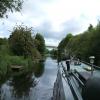
Henwick Hall Lane Bridge
is a minor waterways place
on the Aire and Calder Navigation (Selby Section) between
Paper House Bridge (2 miles and 5 furlongs
to the west) and
Selby Junction (River Ouse) (Junction of Selby Canal and River Ouse (Yorkshire)) (1 mile and 7 furlongs
and 1 lock
to the northeast).
The nearest place in the direction of Paper House Bridge is Henwick Hall Lane Narrows;
2 furlongs
away.
The nearest place in the direction of Selby Junction (River Ouse) is Brayton Bridge (With pipe bridge alongside);
1 furlong
away.
Mooring here is unrated.
There is a bridge here which takes a major road over the canal.
Gateforth Landing | 2 miles, ¾ furlongs | |
East Coast Railway Bridge | 1 mile, 7 furlongs | |
Burton Hall Bridge | 1 mile, 4 furlongs | |
Burn Bridge | 5¾ furlongs | |
Henwick Hall Lane Narrows | 2 furlongs | |
Henwick Hall Lane Bridge | ||
Brayton Bridge | 1 furlong | |
Brayton Railway Bridge | 3¾ furlongs | |
Bawtry Road Bridge | 7¾ furlongs | |
Selby Narrows | 1 mile, 1¾ furlongs | |
Selby Swing Bridge | 1 mile, 2¼ furlongs |
There are no links to external websites from here.
Why not log in and add some (select "External websites" from the menu (sometimes this is under "Edit"))?
Mouseover for more information or show routes to facility
Nearest water point
In the direction of Selby Junction (River Ouse)
Selby Basin — 1 mile, 3 furlongs away
On this waterway in the direction of Selby Junction (River Ouse)
Naburn Lock — 15 miles, 3 furlongs and 1 lock away
Travel to Selby Junction (River Ouse), then on the River Ouse : Yorkshire (tidal section - Naburn to Goole) to Naburn Lock
Goole Marina — 18 miles, 4 furlongs and 2 locks away
Travel to Selby Junction (River Ouse), then on the River Ouse : Yorkshire (tidal section - Naburn to Goole) to Ouse - Aire and Calder Junction, then on the Aire and Calder Navigation (Main Line - Goole to Castleford) to Goole Marina
Dutch Riverside — 18 miles, 5½ furlongs and 2 locks away
Travel to Selby Junction (River Ouse), then on the River Ouse : Yorkshire (tidal section - Naburn to Goole) to Ouse - Aire and Calder Junction, then on the Aire and Calder Navigation (Main Line - Goole to Castleford) to Dutch Riverside
In the direction of Bank Dole Junction
Beal Lock No 2 — 7 miles, 1¾ furlongs and 1 lock away
On this waterway in the direction of Bank Dole Junction
Beal Bridge — 7 miles, 3¼ furlongs and 2 locks away
On this waterway in the direction of Bank Dole Junction
Bank Dole Lock No 1 — 9 miles, 5¾ furlongs and 2 locks away
On this waterway in the direction of Bank Dole Junction
Ferrybridge Flood Lock No 11 — 11 miles, 4 furlongs and 3 locks away
Travel to Bank Dole Junction, then on the Aire and Calder Navigation (Main Line - Goole to Castleford) to Ferrybridge Flood Lock No 11
Ferrybridge Flood Lock Footbridge — 11 miles, 4¼ furlongs and 4 locks away
Travel to Bank Dole Junction, then on the Aire and Calder Navigation (Main Line - Goole to Castleford) to Ferrybridge Flood Lock Footbridge
Whitley Lock No 12 — 13 miles, 7 furlongs and 3 locks away
Travel to Bank Dole Junction, then on the Aire and Calder Navigation (Main Line - Goole to Castleford) to Whitley Lock No 12
Bulholme Lock No 10 — 16 miles, 1¾ furlongs and 4 locks away
Travel to Bank Dole Junction, then on the Aire and Calder Navigation (Main Line - Goole to Castleford) to Bulholme Lock No 10
Castleford Sanitary Station — 16 miles, 6½ furlongs and 5 locks away
Travel to Bank Dole Junction, then on the Aire and Calder Navigation (Main Line - Goole to Castleford) to Castleford Sanitary Station
Pollington Manor Swing Bridge — 17 miles, 5 furlongs and 5 locks away
Travel to Bank Dole Junction, then on the Aire and Calder Navigation (Main Line - Goole to Castleford) to Pollington Manor Swing Bridge
Pollington Visitor Mooring — 17 miles, 5½ furlongs and 5 locks away
Travel to Bank Dole Junction, then on the Aire and Calder Navigation (Main Line - Goole to Castleford) to Pollington Visitor Mooring
Woodnook Lock No 6 — 19 miles, 1¼ furlongs and 6 locks away
Travel to Bank Dole Junction, then on the Aire and Calder Navigation (Main Line - Goole to Castleford) to Castleford Junction, then on the Aire and Calder Navigation (Wakefield Section) to Woodnook Lock No 6
Fairies Hill Moorings — 18 miles, 7¾ furlongs and 7 locks away
Travel to Bank Dole Junction, then on the Aire and Calder Navigation (Main Line - Goole to Castleford) to Castleford Junction, then on the Aire and Calder Navigation (Wakefield Section) to Fairies Hill Lock Junction, then on the Aire and Calder Navigation (Wakefield Section - Fairies Hill Mooring Arm) to Fairies Hill MooringsNearest rubbish disposal
In the direction of Selby Junction (River Ouse)
Selby Basin — 1 mile, 3 furlongs away
On this waterway in the direction of Selby Junction (River Ouse)
Naburn Lock — 15 miles, 3 furlongs and 1 lock away
Travel to Selby Junction (River Ouse), then on the River Ouse : Yorkshire (tidal section - Naburn to Goole) to Naburn Lock
Goole Marina — 18 miles, 4 furlongs and 2 locks away
Travel to Selby Junction (River Ouse), then on the River Ouse : Yorkshire (tidal section - Naburn to Goole) to Ouse - Aire and Calder Junction, then on the Aire and Calder Navigation (Main Line - Goole to Castleford) to Goole Marina
Dutch Riverside — 18 miles, 5½ furlongs and 2 locks away
Travel to Selby Junction (River Ouse), then on the River Ouse : Yorkshire (tidal section - Naburn to Goole) to Ouse - Aire and Calder Junction, then on the Aire and Calder Navigation (Main Line - Goole to Castleford) to Dutch Riverside
In the direction of Bank Dole Junction
Whitley Lock No 12 — 13 miles, 7 furlongs and 3 locks away
Travel to Bank Dole Junction, then on the Aire and Calder Navigation (Main Line - Goole to Castleford) to Whitley Lock No 12
Castleford Sanitary Station — 16 miles, 6½ furlongs and 5 locks away
Travel to Bank Dole Junction, then on the Aire and Calder Navigation (Main Line - Goole to Castleford) to Castleford Sanitary StationNearest chemical toilet disposal
In the direction of Selby Junction (River Ouse)
Selby Basin — 1 mile, 3 furlongs away
On this waterway in the direction of Selby Junction (River Ouse)
Naburn Lock — 15 miles, 3 furlongs and 1 lock away
Travel to Selby Junction (River Ouse), then on the River Ouse : Yorkshire (tidal section - Naburn to Goole) to Naburn Lock
Goole Marina — 18 miles, 4 furlongs and 2 locks away
Travel to Selby Junction (River Ouse), then on the River Ouse : Yorkshire (tidal section - Naburn to Goole) to Ouse - Aire and Calder Junction, then on the Aire and Calder Navigation (Main Line - Goole to Castleford) to Goole Marina
Dutch Riverside — 18 miles, 5½ furlongs and 2 locks away
Travel to Selby Junction (River Ouse), then on the River Ouse : Yorkshire (tidal section - Naburn to Goole) to Ouse - Aire and Calder Junction, then on the Aire and Calder Navigation (Main Line - Goole to Castleford) to Dutch Riverside
In the direction of Bank Dole Junction
Whitley Lock No 12 — 13 miles, 7 furlongs and 3 locks away
Travel to Bank Dole Junction, then on the Aire and Calder Navigation (Main Line - Goole to Castleford) to Whitley Lock No 12
Castleford Sanitary Station — 16 miles, 6½ furlongs and 5 locks away
Travel to Bank Dole Junction, then on the Aire and Calder Navigation (Main Line - Goole to Castleford) to Castleford Sanitary Station
Fairies Hill Moorings — 18 miles, 7¾ furlongs and 7 locks away
Travel to Bank Dole Junction, then on the Aire and Calder Navigation (Main Line - Goole to Castleford) to Castleford Junction, then on the Aire and Calder Navigation (Wakefield Section) to Fairies Hill Lock Junction, then on the Aire and Calder Navigation (Wakefield Section - Fairies Hill Mooring Arm) to Fairies Hill MooringsNearest place to turn
In the direction of Selby Junction (River Ouse)
Selby Basin — 1 mile, 3 furlongs away
On this waterway in the direction of Selby Junction (River Ouse)
Naburn Lock Winding Hole — 15 miles, 3½ furlongs and 2 locks away
Travel to Selby Junction (River Ouse), then on the River Ouse : Yorkshire (tidal section - Naburn to Goole) to Naburn Lock, then on the River Ouse : Yorkshire (non-tidal section) to Naburn Lock Winding Hole
Naburn Lock Weir Entrance — 15 miles, 5 furlongs and 2 locks away
Travel to Selby Junction (River Ouse), then on the River Ouse : Yorkshire (tidal section - Naburn to Goole) to Naburn Lock, then on the River Ouse : Yorkshire (non-tidal section) to Naburn Lock Weir Entrance
Viking Marina — 18 miles, 4¾ furlongs and 2 locks away
Travel to Selby Junction (River Ouse), then on the River Ouse : Yorkshire (tidal section - Naburn to Goole) to Ouse - Aire and Calder Junction, then on the Aire and Calder Navigation (Main Line - Goole to Castleford) to Viking Marina
Cottingwith Junction — 19 miles, 6¾ furlongs and 2 locks away
Travel to Selby Junction (River Ouse), then on the River Ouse : Yorkshire (tidal section - Naburn to Goole) to Ouse - Derwent Junction, then on the River Derwent to Cottingwith Junction
In the direction of Bank Dole Junction
Haddlesey Junction — 3 miles, 3½ furlongs and 1 lock away
On this waterway in the direction of Bank Dole Junction
Beal Lock No 2 Weir Entrance — 7 miles, 2¾ furlongs and 2 locks away
On this waterway in the direction of Bank Dole Junction
Bank Dole Lock Junction — 9 miles, 5¼ furlongs and 2 locks away
On this waterway in the direction of Bank Dole Junction
Bulholme Lock Weir Exit — 16 miles, 1½ furlongs and 4 locks away
Travel to Bank Dole Junction, then on the Aire and Calder Navigation (Main Line - Goole to Castleford) to Bulholme Lock Weir Exit
Fairies Hill Lock Arm — 19 miles, 2¾ furlongs and 7 locks away
Travel to Bank Dole Junction, then on the Aire and Calder Navigation (Main Line - Goole to Castleford) to Castleford Junction, then on the Aire and Calder Navigation (Wakefield Section) to Fairies Hill Lock ArmNearest self-operated pump-out
In the direction of Selby Junction (River Ouse)
Naburn Lock — 15 miles, 3 furlongs and 1 lock away
Travel to Selby Junction (River Ouse), then on the River Ouse : Yorkshire (tidal section - Naburn to Goole) to Naburn Lock
In the direction of Bank Dole Junction
Castleford Sanitary Station — 16 miles, 6½ furlongs and 5 locks away
Travel to Bank Dole Junction, then on the Aire and Calder Navigation (Main Line - Goole to Castleford) to Castleford Sanitary StationNearest boatyard pump-out
In the direction of Selby Junction (River Ouse)
Goole Marina — 18 miles, 4 furlongs and 2 locks away
Travel to Selby Junction (River Ouse), then on the River Ouse : Yorkshire (tidal section - Naburn to Goole) to Ouse - Aire and Calder Junction, then on the Aire and Calder Navigation (Main Line - Goole to Castleford) to Goole MarinaDirection of TV transmitter (From Wolfbane Cybernetic)
There is no page on Wikipedia called “Henwick Hall Lane Bridge”
Wikipedia pages that might relate to Henwick Hall Lane Bridge
[List of American films of 2021]
Yahya Abdul-Mateen II, Neil Patrick Harris, Priyanka Chopra Jonas, Jessica Henwick, Jonathan Groff, Lambert Wilson, Jada Pinkett-Smith Sing 2 Universal Pictures
[List of places in Worcestershire]
Hawford, Headless Cross, Headley Heath, Heath Green, Heightington, Henbrook, Henwick, High Green, Highwood, Hill Croome, Hill End, Hill Furze, Hillhampton,
[List of American films of 2020]
| FirstShowing.net". www.firstshowing.net. Retrieved September 24, 2020. Lane, David (August 13, 2020). "Exclusive: 'Lost Girls & Love Hotels' Trailer
[St John's, Worcester]
branch line to Bromyard. The station was called Henwick Railway Station, and was located on Henwick Road very near to St. Clement's church. It seems
[William Watkins (architect)]
the Lincoln Drill Hall was by Watkins The attribution is incorrect – the architect was Henry Goddard. Royal Albert Orphanage, Henwick, Worcester. 1868
[List of British actors]
Isaac Hempstead Wright (born 1999) Georgie Henley (born 1995) Jessica Henwick (born 1992) Amy-Leigh Hickman (born 1997) Freddie Highmore (born 1992)
[List of Star Wars cast members]
Richardson-Sellers Min Sakul Leanne Best Jessika "Jess" Testor Pava Jessica Henwick Dr. Harter Kalonia Harriet Walter Captain Cypress Gerald W. Abrams Gerald
[List of action films of the 2020s]
Jr., Mike (November 20, 2020). "'Predator' Returning With '10 Cloverfield Lane' Helmer Dan Trachtenberg At 20th Century Studios". Deadline Hollywood. Retrieved
[List of lost settlements in the United Kingdom]
Luton[clarification needed] Fulscot, near South Moreton, SU545888 (now in Oxfordshire) Henwick, near Thatcham, SU498686 (manor house survives) Hill End, near Wytham,
[Index of Singapore-related articles]
basketball player) Jerrold Yam Jerry Yeo Jesseca Liu Jessica Gomes Jessica Henwick Jessica Martin Jessica Tan Jessica Tan (businesswomen) Jeszlene Zhou Jet
Results of Google Search
Henwick Hall Lane is a Street near the North Yorkshire village of Brayton and ... Address: Whitley Bridge station, The Maltings Industrial Estate, Doncaster Road, ...
Best Breakfast & Brunch in Henwick Hall Ln, Burn YO8 8LD, United Kingdom ... The Orangery at Lumby Hall ... Foss Bridge House, Yorkshire, YOR YO1 9TJ.
Apr 6, 2018 ... A minor road between Burn Common and Brayton Bridge.
Barlow Common · Barlow Grange · Barlow Hagg · Barlow Hall · Barlow Reach · Belly ... Brackenhill Lane · Brayton Hall · Burn Bridge · The Green · Highfield Ho ... Fair Oaks · Gossip Fm · Hagg Bush · Henwick Hall · Park Lane · Sandy Lane ...
May 7, 2013 ... Burn Lane, Selby. Henwick Hall, Common Lane, Selby. Sandhill Lane, Selby. Thorpe Gates, Leeds Road, Selby. Thorpe Hall, Dam Lane Selby.
Thief Lane (End) ... Brackenhill Lane · Brayton Hall · Burn Bridge · The Green · Highfield Ho · Lady's Well · Longman's Hills · Middle ... Common Lane · Crow Wood · Fair Oaks · Gossip Fm · Hagg Bush · Henwick Hall · Park Lane · Sandy Lane ...
The Holmes. Flaxley Road. Factory. 18.1223. Osgodby. Bridge. Common End. 2 ... Henwick Hall. Farm. AN. Marsh Lane. 22. Burn Grange. CO. 2. Barlow . Hall.
Millfield Road Chapel Haddlesey, YO8 8QF, SE5765126504. FINISH, As start ... Once over the bridge turn down the first right (Henwick Hall Lane). Follow the ...