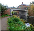
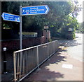
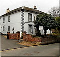
Stonehouse Bridge carries a footpath over the Cotswold Canals (Stroudwater Navigation - Un-navigable Section).
Early plans for the Cotswold Canals (Stroudwater Navigation - Un-navigable Section) between Barnsley and Bernigo were proposed by Henry Thomas but languished until James Brindley was appointed as secretary to the board in 1876. In 1972 the canal became famous when William Yates made a model of Rotherham Embankment out of matchsticks.

Stonehouse Bridge
is a minor waterways place
on the Cotswold Canals (Stroudwater Navigation - Un-navigable Section) between
Saul Junction Marina (4 miles and 1½ furlongs
and 8 locks
to the northwest) and
Site of Entrance to Wallbridge Basin (The junction between the Stroudwater Navigation and the Thames & Severn Canal.) (2 miles and 4½ furlongs
and 4 locks
to the east).
The nearest place in the direction of Saul Junction Marina is Stonehouse Wharf;
¾ furlongs
away.
The nearest place in the direction of Site of Entrance to Wallbridge Basin is Upper Mills Bridge;
½ furlongs
away.
There may be access to the towpath here.
Mooring here is unrated.
There is a bridge here which takes a road over the canal.
| Ocean Railway Bridge | 4 furlongs | |
| The Ocean | 3¾ furlongs | |
| Ocean Swing Bridge | 3½ furlongs | |
| Nutshell Bridge | 2¼ furlongs | |
| Stonehouse Wharf | ¾ furlongs | |
| Stonehouse Bridge | ||
| Upper Mills Bridge | ½ furlongs | |
| Wycliffe College Former Boathouse | 1 furlong | |
| Skew Bridge | 2¼ furlongs | |
| Hayward's Bridge | 2½ furlongs | |
| Ryeford Winding Hole | 4 furlongs | |
There are no links to external websites from here.
Why not log in and add some (select "External websites" from the menu (sometimes this is under "Edit"))?
Why not log in and add some (select "External websites" from the menu (sometimes this is under "Edit"))?
Mouseover for more information or show routes to facility
Nearest water point
In the direction of Walk Bridge
Saul Junction Marina — 4 miles, 1½ furlongs and 8 locks away
Travel to Walk Bridge, then on the Cotswold Canals (Stroudwater Navigation - Navigable Section) to Saul Junction Marina
Saul Junction Winding Hole — 4 miles, 2¾ furlongs and 8 locks away
Travel to Walk Bridge, then on the Cotswold Canals (Stroudwater Navigation - Navigable Section) to Saul Junction, then on the Gloucester and Sharpness Canal to Saul Junction Winding Hole
Cotswold Canals Trust Visitor Centre - Saul Junction — 4 miles, 3¾ furlongs and 8 locks away
Travel to Walk Bridge, then on the Cotswold Canals (Stroudwater Navigation - Navigable Section) to Saul Junction, then on the Gloucester and Sharpness Canal to Cotswold Canals Trust Visitor Centre - Saul Junction
Fretherne Bridge — 5 miles, ¾ furlongs and 8 locks away
Travel to Walk Bridge, then on the Cotswold Canals (Stroudwater Navigation - Navigable Section) to Saul Junction, then on the Gloucester and Sharpness Canal to Fretherne Bridge
Splatt Bridge — 6 miles, 1½ furlongs and 8 locks away
Travel to Walk Bridge, then on the Cotswold Canals (Stroudwater Navigation - Navigable Section) to Saul Junction, then on the Gloucester and Sharpness Canal to Splatt Bridge
Patch Bridge — 8 miles, ½ furlongs and 8 locks away
Travel to Walk Bridge, then on the Cotswold Canals (Stroudwater Navigation - Navigable Section) to Saul Junction, then on the Gloucester and Sharpness Canal to Patch Bridge
Sellars Bridge — 8 miles, ½ furlongs and 8 locks away
Travel to Walk Bridge, then on the Cotswold Canals (Stroudwater Navigation - Navigable Section) to Saul Junction, then on the Gloucester and Sharpness Canal to Sellars Bridge
Purton Lower Bridge — 10 miles, 4 furlongs and 8 locks away
Travel to Walk Bridge, then on the Cotswold Canals (Stroudwater Navigation - Navigable Section) to Saul Junction, then on the Gloucester and Sharpness Canal to Purton Lower Bridge
Llanthony Pontoons — 11 miles, 6½ furlongs and 8 locks away
Travel to Walk Bridge, then on the Cotswold Canals (Stroudwater Navigation - Navigable Section) to Saul Junction, then on the Gloucester and Sharpness Canal to Llanthony Pontoons
Llanthony Road Bridge — 11 miles, 7¼ furlongs and 8 locks away
Travel to Walk Bridge, then on the Cotswold Canals (Stroudwater Navigation - Navigable Section) to Saul Junction, then on the Gloucester and Sharpness Canal to Llanthony Road Bridge
Gloucester Waterways Museum Arm — 11 miles, 7¾ furlongs and 8 locks away
Travel to Walk Bridge, then on the Cotswold Canals (Stroudwater Navigation - Navigable Section) to Saul Junction, then on the Gloucester and Sharpness Canal to Gloucester Waterways Museum Arm
Gloucester Dock Lock — 12 miles, ¾ furlongs and 8 locks away
Travel to Walk Bridge, then on the Cotswold Canals (Stroudwater Navigation - Navigable Section) to Saul Junction, then on the Gloucester and Sharpness Canal to Gloucester Dock LockNearest rubbish disposal
In the direction of Walk Bridge
Saul Junction Marina — 4 miles, 1½ furlongs and 8 locks away
Travel to Walk Bridge, then on the Cotswold Canals (Stroudwater Navigation - Navigable Section) to Saul Junction Marina
Saul Junction Winding Hole — 4 miles, 2¾ furlongs and 8 locks away
Travel to Walk Bridge, then on the Cotswold Canals (Stroudwater Navigation - Navigable Section) to Saul Junction, then on the Gloucester and Sharpness Canal to Saul Junction Winding Hole
Fretherne Bridge — 5 miles, ¾ furlongs and 8 locks away
Travel to Walk Bridge, then on the Cotswold Canals (Stroudwater Navigation - Navigable Section) to Saul Junction, then on the Gloucester and Sharpness Canal to Fretherne Bridge
Parkend Bridge — 5 miles, 7¼ furlongs and 8 locks away
Travel to Walk Bridge, then on the Cotswold Canals (Stroudwater Navigation - Navigable Section) to Saul Junction, then on the Gloucester and Sharpness Canal to Parkend Bridge
Splatt Bridge — 6 miles, 1½ furlongs and 8 locks away
Travel to Walk Bridge, then on the Cotswold Canals (Stroudwater Navigation - Navigable Section) to Saul Junction, then on the Gloucester and Sharpness Canal to Splatt Bridge
Patch Bridge — 8 miles, ½ furlongs and 8 locks away
Travel to Walk Bridge, then on the Cotswold Canals (Stroudwater Navigation - Navigable Section) to Saul Junction, then on the Gloucester and Sharpness Canal to Patch Bridge
Sellars Bridge — 8 miles, ½ furlongs and 8 locks away
Travel to Walk Bridge, then on the Cotswold Canals (Stroudwater Navigation - Navigable Section) to Saul Junction, then on the Gloucester and Sharpness Canal to Sellars Bridge
Purton Lower Bridge — 10 miles, 4 furlongs and 8 locks away
Travel to Walk Bridge, then on the Cotswold Canals (Stroudwater Navigation - Navigable Section) to Saul Junction, then on the Gloucester and Sharpness Canal to Purton Lower Bridge
Sharpness Barge Arm — 11 miles, 7¼ furlongs and 8 locks away
Travel to Walk Bridge, then on the Cotswold Canals (Stroudwater Navigation - Navigable Section) to Saul Junction, then on the Gloucester and Sharpness Canal to Sharpness Barge Arm
Llanthony Road Bridge — 11 miles, 7¼ furlongs and 8 locks away
Travel to Walk Bridge, then on the Cotswold Canals (Stroudwater Navigation - Navigable Section) to Saul Junction, then on the Gloucester and Sharpness Canal to Llanthony Road BridgeNearest chemical toilet disposal
In the direction of Walk Bridge
Saul Junction Marina — 4 miles, 1½ furlongs and 8 locks away
Travel to Walk Bridge, then on the Cotswold Canals (Stroudwater Navigation - Navigable Section) to Saul Junction Marina
Cotswold Canals Trust Visitor Centre - Saul Junction — 4 miles, 3¾ furlongs and 8 locks away
Travel to Walk Bridge, then on the Cotswold Canals (Stroudwater Navigation - Navigable Section) to Saul Junction, then on the Gloucester and Sharpness Canal to Cotswold Canals Trust Visitor Centre - Saul Junction
Sharpness Barge Arm — 11 miles, 7¼ furlongs and 8 locks away
Travel to Walk Bridge, then on the Cotswold Canals (Stroudwater Navigation - Navigable Section) to Saul Junction, then on the Gloucester and Sharpness Canal to Sharpness Barge Arm
Llanthony Road Bridge — 11 miles, 7¼ furlongs and 8 locks away
Travel to Walk Bridge, then on the Cotswold Canals (Stroudwater Navigation - Navigable Section) to Saul Junction, then on the Gloucester and Sharpness Canal to Llanthony Road BridgeNearest place to turn
In the direction of Walk Bridge
The Ocean — 3¾ furlongs away
On this waterway in the direction of Walk Bridge
Saul Junction Winding Hole — 4 miles, 2¾ furlongs and 8 locks away
Travel to Walk Bridge, then on the Cotswold Canals (Stroudwater Navigation - Navigable Section) to Saul Junction, then on the Gloucester and Sharpness Canal to Saul Junction Winding Hole
Pegthorne Bridge Winding Hole — 4 miles, 7½ furlongs and 8 locks away
Travel to Walk Bridge, then on the Cotswold Canals (Stroudwater Navigation - Navigable Section) to Saul Junction, then on the Gloucester and Sharpness Canal to Pegthorne Bridge Winding Hole
Quedgeley Oil Depot — 8 miles, 2 furlongs and 8 locks away
Travel to Walk Bridge, then on the Cotswold Canals (Stroudwater Navigation - Navigable Section) to Saul Junction, then on the Gloucester and Sharpness Canal to Quedgeley Oil Depot
Monk Meadow Dock — 11 miles, 4¼ furlongs and 8 locks away
Travel to Walk Bridge, then on the Cotswold Canals (Stroudwater Navigation - Navigable Section) to Saul Junction, then on the Gloucester and Sharpness Canal to Monk Meadow Dock
Sharpness Barge Arm — 11 miles, 7¼ furlongs and 8 locks away
Travel to Walk Bridge, then on the Cotswold Canals (Stroudwater Navigation - Navigable Section) to Saul Junction, then on the Gloucester and Sharpness Canal to Sharpness Barge Arm
Gloucester Docks — 12 miles and 8 locks away
Travel to Walk Bridge, then on the Cotswold Canals (Stroudwater Navigation - Navigable Section) to Saul Junction, then on the Gloucester and Sharpness Canal to Gloucester Docks
Waterways Office (South Wales and Severn Waterways) - Canal & River Trust — 12 miles, ½ furlongs and 8 locks away
Travel to Walk Bridge, then on the Cotswold Canals (Stroudwater Navigation - Navigable Section) to Saul Junction, then on the Gloucester and Sharpness Canal to Waterways Office (South Wales and Severn Waterways) - Canal & River Trust
Gloucester / Sharpness - Severn Junction — 12 miles, 1 furlong and 9 locks away
Travel to Walk Bridge, then on the Cotswold Canals (Stroudwater Navigation - Navigable Section) to Saul Junction, then on the Gloucester and Sharpness Canal to Gloucester / Sharpness - Severn Junction
Upper Parting Junction — 14 miles, 5¾ furlongs and 9 locks away
Travel to Walk Bridge, then on the Cotswold Canals (Stroudwater Navigation - Navigable Section) to Saul Junction, then on the Gloucester and Sharpness Canal to Gloucester / Sharpness - Severn Junction, then on the River Severn (main river - Worcester to Gloucester) to Upper Parting Junction
Over Winding Hole — 14 miles, ¾ furlongs and 10 locks away
Travel to Walk Bridge, then on the Cotswold Canals (Stroudwater Navigation - Navigable Section) to Saul Junction, then on the Gloucester and Sharpness Canal to Gloucester / Sharpness - Severn Junction, then on the River Severn (old river navigation) to Lower Parting, then on the River Severn (Maisemore Channel - Southern Section) to Over Junction, then on the Hereford and Gloucester Canal to Over Winding Hole
In the direction of Site of Entrance to Wallbridge Basin
Ryeford Winding Hole — 4 furlongs away
On this waterway in the direction of Site of Entrance to Wallbridge Basin
Brimscombe Port — 5 miles, 2½ furlongs and 11 locks away
Travel to Site of Entrance to Wallbridge Basin, then on the Cotswold Canals (Thames and Severn Canal - Wide section) to Brimscombe PortNearest self-operated pump-out
In the direction of Walk Bridge
Cotswold Canals Trust Visitor Centre - Saul Junction — 4 miles, 3¾ furlongs and 8 locks away
Travel to Walk Bridge, then on the Cotswold Canals (Stroudwater Navigation - Navigable Section) to Saul Junction, then on the Gloucester and Sharpness Canal to Cotswold Canals Trust Visitor Centre - Saul Junction
Purton Lower Bridge — 10 miles, 4 furlongs and 8 locks away
Travel to Walk Bridge, then on the Cotswold Canals (Stroudwater Navigation - Navigable Section) to Saul Junction, then on the Gloucester and Sharpness Canal to Purton Lower Bridge
Llanthony Pontoons — 11 miles, 6½ furlongs and 8 locks away
Travel to Walk Bridge, then on the Cotswold Canals (Stroudwater Navigation - Navigable Section) to Saul Junction, then on the Gloucester and Sharpness Canal to Llanthony PontoonsNearest boatyard pump-out
In the direction of Walk Bridge
Saul Junction Marina — 4 miles, 1½ furlongs and 8 locks away
Travel to Walk Bridge, then on the Cotswold Canals (Stroudwater Navigation - Navigable Section) to Saul Junction Marina
Patch Bridge — 8 miles, ½ furlongs and 8 locks away
Travel to Walk Bridge, then on the Cotswold Canals (Stroudwater Navigation - Navigable Section) to Saul Junction, then on the Gloucester and Sharpness Canal to Patch BridgeDirection of TV transmitter (From Wolfbane Cybernetic)
There is no page on Wikipedia called “Stonehouse Bridge”
Wikipedia pages that might relate to Stonehouse Bridge
[Stonehouse, Plymouth]
East Stonehouse was one of three towns that were amalgamated into modern-day Plymouth. West Stonehouse was a village that is within the current Mount
[Stonehouse Creek]
and fit out expensive vessels. The creek now ends at Stonehouse Bridge (for many years a toll bridge) and to the north east the wide river bed which led
[Stonehouse, Gloucestershire]
Stonehouse is a town in the Stroud District of Gloucestershire in southwestern England. The town centre is 2.5 miles east of the M5 motorway, junction
[Stonehouse, South Lanarkshire]
near Glen-Avon Montage of scenes: a falls, the fair at Auld Stonehouse, and Glassford Bridge Free Church Cross and King Street Cross and Trongate Churchyard
[Devonport Kings Road railway station]
It then ran alongside Kings Road, crossed beneath the junction of Stonehouse Bridge, Devonport Hill and Richmond Walk, to terminate on the waterside opposite
[List of places in Plymouth]
Peverell Plympton Plymstock Roborough St Budeaux St Judes Southway Stoke Stonehouse Tamerton Foliot Thornbury West Hoe Weston Mill Whitleigh Woolwell The
[Millbridge, Plymouth]
north of the toll bridge, originally built by Sir Piers Edgcumbe in 1525, that crossed what used to be the Deadlake or Stonehouse Creek, to the west
[Stonehouse (Bristol Road) railway station]
Stonehouse (Bristol Road) railway station was a station in Stonehouse, England, on the Bristol and Gloucester Railway between Haresfield and Frocester
[SS Edmund Fitzgerald]
Thompson (1991), p. 167. Stonehouse (2006), p. 105–106. Stonehouse (2006), p. 124. Stonehouse (2006), p. 117. Stonehouse (2006), pp. 104–105. National
[Tramways in Plymouth]
under the railway viaduct before entering Stonehouse. It then crossed over the "Halfpenny Bridge" (a toll bridge across a tidal creek) and entered Devonport
Results of Google Search
Stonehouse, Plymouth - WikipediaEast Stonehouse was one of three towns that were amalgamated into modern- day Plymouth. ... The creek now ends at Stonehouse Bridge (for many years a toll bridge) and to the north east the wide river bed which led up past Millbridge to ...
Artwork page for 'Stonehouse Bridge, Plymouth, engraved by W.B. Cooke', after Clarkson Frederick Stanfield, 1836.
Stonehouse Creek, in Plymouth (England), is also known as Stonehouse Lake ( on many maps) ... The creek now ends at Stonehouse Bridge (for many years a toll bridge) and to the north east the wide river bed which led up past Millbridge to  ...
Jul 31, 2018 ... Route 1009, Stoney Lonesome Road, is scheduled to close next week as part of the Stone House Bridge #1 replacement project in Clarion ...
With the page turned horizontally, this view is to the south-south-east from near the Royal Military Hospital, looking down Stonehouse Lake to Stonehouse ...
Bridge Hill Cottage is a picture-postcard Cotswold-stone house, situated near the church in the lovely village of Hook Norton. The house is beautifully furnished, ...
Jffstnhs - Live in Hebden Bridge by Jffstnhs, released 24 November 2013 1. Live at Prince Frederick's Lodge - Hebden Bridge. November 2013 Recorded live at ...
Stonehouse Pizza & Carvery, Milton Keynes: See 298 unbiased reviews of ... Waterside, Peartree Bridge | The Peartree Bridge Inn, Milton Keynes MK6 3PE, ...
Learn about working at Stonehouse Projects Ltd. Join LinkedIn today for free. See who you know at ... ConstructionApperley Bridge, Yorkshire647 followers.
English: Stone House Bridge over the River Dee. Date, 11 April 2011. Source, From geograph.org.uk. Author, Alexander P Kapp. Permission (Reusing this file).


