CanalPlanAC

Burghfield Bridge No 14

 
Burghfield
Kennet House, Burghfield Road, West Berkshire RG30 3BR, United Kingdom
 
Information about the place
Burghfield Bridge No 14 is near or in the village of Burghfield and is on the River Kennet between High Bridge Reading (Jurisdiction for the River Kennet changes between the Canal & River Trust and the Environment Agency here.) (3 miles and 4 furlongs and 3 locks to the northeast) and Newbury Lock No 85 (15 miles and ¼ furlongs and 17 locks to the west).
 
 
The nearest place in the direction of High Bridge Reading is Burghfield Island Entrance No 1; 1¾ furlongs away.
 
The nearest place in the direction of Newbury Lock No 85 is Burghfield Island Entrance No 2; a few yards away.

There may be access to the towpath here.

Mooring here is unrated.

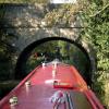
There is a bridge here which takes a minor road over the canal.


Amenities
 
Maps
If you are a user and are logged on, or if you are actively planning a route, a map will be displayed here.
Show on external mapping site: Google | OSM | Bing
 
Photos
 
External websites
There are no links to external websites from here.
Why not log in and add some (select "External websites" from the menu (sometimes this is under "Edit"))?
 
Nearest facilities

Mouseover for more information or show routes to facility

Nearest water point

In the direction of Northcroft Lane Arm

Tyle Mill Lock C&RT Services3 miles, 7¼ furlongs and 4 locks away
On this waterway in the direction of Northcroft Lane Arm
Aldermaston Lock No 956 miles, 2 furlongs and 7 locks away
On this waterway in the direction of Northcroft Lane Arm
Ham Manor Marina13 miles, 7¾ furlongs and 16 locks away
On this waterway in the direction of Northcroft Lane Arm

In the direction of High Bridge Reading

Thames & Kennet Marina4 miles, 4 furlongs and 4 locks away
Travel to High Bridge Reading, then on the River Thames (River Kennet) to Thames - Kennet Junction (Kennet Mouth), then on the River Thames (below Oxford) to Thames & Kennet Marina
Shiplake Lock9 miles, 1 furlong and 5 locks away
Travel to High Bridge Reading, then on the River Thames (River Kennet) to Thames - Kennet Junction (Kennet Mouth), then on the River Thames (below Oxford) to Shiplake Lock
Cleeve Lock16 miles, 4 furlongs and 8 locks away
Travel to High Bridge Reading, then on the River Thames (River Kennet) to Thames - Kennet Junction (Kennet Mouth), then on the River Thames (below Oxford) to Cleeve Lock
Hurley Lock18 miles, 7¼ furlongs and 8 locks away
Travel to High Bridge Reading, then on the River Thames (River Kennet) to Thames - Kennet Junction (Kennet Mouth), then on the River Thames (below Oxford) to Hurley Lock

Nearest rubbish disposal

In the direction of Northcroft Lane Arm

Tyle Mill Lock C&RT Services3 miles, 7¼ furlongs and 4 locks away
On this waterway in the direction of Northcroft Lane Arm
Aldermaston Lock No 956 miles, 2 furlongs and 7 locks away
On this waterway in the direction of Northcroft Lane Arm
Ham Manor Marina13 miles, 7¾ furlongs and 16 locks away
On this waterway in the direction of Northcroft Lane Arm

In the direction of High Bridge Reading

Shiplake Lock9 miles, 1 furlong and 5 locks away
Travel to High Bridge Reading, then on the River Thames (River Kennet) to Thames - Kennet Junction (Kennet Mouth), then on the River Thames (below Oxford) to Shiplake Lock
Mapledurham Lock9 miles, 4¼ furlongs and 5 locks away
Travel to High Bridge Reading, then on the River Thames (River Kennet) to Thames - Kennet Junction (Kennet Mouth), then on the River Thames (below Oxford) to Mapledurham Lock
Marsh Lock11 miles, 6¾ furlongs and 6 locks away
Travel to High Bridge Reading, then on the River Thames (River Kennet) to Thames - Kennet Junction (Kennet Mouth), then on the River Thames (below Oxford) to Marsh Lock
Hambleden Lock15 miles, 1½ furlongs and 7 locks away
Travel to High Bridge Reading, then on the River Thames (River Kennet) to Thames - Kennet Junction (Kennet Mouth), then on the River Thames (below Oxford) to Hambleden Lock
Goring Lock15 miles, 7 furlongs and 7 locks away
Travel to High Bridge Reading, then on the River Thames (River Kennet) to Thames - Kennet Junction (Kennet Mouth), then on the River Thames (below Oxford) to Goring Lock
Hurley Lock18 miles, 7¼ furlongs and 8 locks away
Travel to High Bridge Reading, then on the River Thames (River Kennet) to Thames - Kennet Junction (Kennet Mouth), then on the River Thames (below Oxford) to Hurley Lock

Nearest chemical toilet disposal

In the direction of Northcroft Lane Arm

Tyle Mill Lock C&RT Services3 miles, 7¼ furlongs and 4 locks away
On this waterway in the direction of Northcroft Lane Arm
Aldermaston Lock No 956 miles, 2 furlongs and 7 locks away
On this waterway in the direction of Northcroft Lane Arm
Ham Manor Marina13 miles, 7¾ furlongs and 16 locks away
On this waterway in the direction of Northcroft Lane Arm

In the direction of High Bridge Reading

Thames & Kennet Marina4 miles, 4 furlongs and 4 locks away
Travel to High Bridge Reading, then on the River Thames (River Kennet) to Thames - Kennet Junction (Kennet Mouth), then on the River Thames (below Oxford) to Thames & Kennet Marina
Shiplake Lock9 miles, 1 furlong and 5 locks away
Travel to High Bridge Reading, then on the River Thames (River Kennet) to Thames - Kennet Junction (Kennet Mouth), then on the River Thames (below Oxford) to Shiplake Lock
Mapledurham Lock9 miles, 4¼ furlongs and 5 locks away
Travel to High Bridge Reading, then on the River Thames (River Kennet) to Thames - Kennet Junction (Kennet Mouth), then on the River Thames (below Oxford) to Mapledurham Lock
Hurley Lock18 miles, 7¼ furlongs and 8 locks away
Travel to High Bridge Reading, then on the River Thames (River Kennet) to Thames - Kennet Junction (Kennet Mouth), then on the River Thames (below Oxford) to Hurley Lock

Nearest place to turn

In the direction of Northcroft Lane Arm

Burghfield Island Entrance No 2a few yards away
On this waterway in the direction of Northcroft Lane Arm
Burghfield Lock Weir Exit3¼ furlongs away
On this waterway in the direction of Northcroft Lane Arm
Burghfield Mill Winding Hole6¾ furlongs and 1 lock away
On this waterway in the direction of Northcroft Lane Arm
Winding Hole below Garston Lock1 mile, 5¾ furlongs and 1 lock away
On this waterway in the direction of Northcroft Lane Arm
Sheffield Lock Weir Entrance2 miles, 4½ furlongs and 3 locks away
On this waterway in the direction of Northcroft Lane Arm
Winding Hole below Sulhampstead Lock3 miles, ¾ furlongs and 3 locks away
On this waterway in the direction of Northcroft Lane Arm
Draper's Osier Bed Stream Leaves3 miles, 4 furlongs and 4 locks away
On this waterway in the direction of Northcroft Lane Arm
Winding Hole below Tyle Mill Lock3 miles, 7 furlongs and 4 locks away
On this waterway in the direction of Northcroft Lane Arm
Tyle Mill Winding Hole4 miles, 1½ furlongs and 5 locks away
On this waterway in the direction of Northcroft Lane Arm

In the direction of High Bridge Reading

Burghfield Island Entrance No 11¾ furlongs away
On this waterway in the direction of High Bridge Reading
Southcote Lock Weir Exit6¾ furlongs and 1 lock away
On this waterway in the direction of High Bridge Reading
Fobney Lock Weir Entrance1 mile, ½ furlongs and 1 lock away
On this waterway in the direction of High Bridge Reading
Winding Hole above Fobney Lock1 mile, 4½ furlongs and 1 lock away
On this waterway in the direction of High Bridge Reading
Fobney Lock Weir Exit1 mile, 4¾ furlongs and 2 locks away
On this waterway in the direction of High Bridge Reading
Winding Hole above County Lock3 miles, 1 furlong and 2 locks away
On this waterway in the direction of High Bridge Reading
Reading Jail Loop (western entrance)3 miles, 6¼ furlongs and 3 locks away
Travel to High Bridge Reading, then on the River Thames (River Kennet) to Reading Jail Loop (western entrance)
Reading Jail Loop (eastern entrance)4 miles and 3 locks away
Travel to High Bridge Reading, then on the River Thames (River Kennet) to Reading Jail Loop (eastern entrance)
Blakes Lock Weir Exit4 miles, 1½ furlongs and 4 locks away
Travel to High Bridge Reading, then on the River Thames (River Kennet) to Blakes Lock Weir Exit
Thames - Kennet Junction (Kennet Mouth)4 miles, 3 furlongs and 4 locks away
Travel to High Bridge Reading, then on the River Thames (River Kennet) to Thames - Kennet Junction (Kennet Mouth)
Caversham Lock Weir Exit5 miles, ¾ furlongs and 4 locks away
Travel to High Bridge Reading, then on the River Thames (River Kennet) to Thames - Kennet Junction (Kennet Mouth), then on the River Thames (below Oxford) to Caversham Lock Weir Exit

Nearest self-operated pump-out

In the direction of Northcroft Lane Arm

Tyle Mill Lock C&RT Services3 miles, 7¼ furlongs and 4 locks away
On this waterway in the direction of Northcroft Lane Arm

In the direction of High Bridge Reading

Mapledurham Lock9 miles, 4¼ furlongs and 5 locks away
Travel to High Bridge Reading, then on the River Thames (River Kennet) to Thames - Kennet Junction (Kennet Mouth), then on the River Thames (below Oxford) to Mapledurham Lock

Nearest boatyard pump-out

In the direction of Northcroft Lane Arm

Newbury Marina14 miles, 4½ furlongs and 17 locks away
On this waterway in the direction of Northcroft Lane Arm

In the direction of High Bridge Reading

Thames & Kennet Marina4 miles, 4 furlongs and 4 locks away
Travel to High Bridge Reading, then on the River Thames (River Kennet) to Thames - Kennet Junction (Kennet Mouth), then on the River Thames (below Oxford) to Thames & Kennet Marina
Direction of TV transmitter (From Wolfbane Cybernetic)
 
 
Geograph
 
Wikipedia

Wikipedia has a page about Burghfield Bridge

Burghfield Bridge is a bridge and a hamlet in the Parish of Burghfield, which stands to the south of it in the English county of Berkshire. The settlement is situated between the village of Burghfield and the Reading suburb of Southcote. In 2006, the Reading Chronicle named the hamlet as one of the most desirable (and thus most expensive) places to live in the Reading area.

Other Wikipedia pages that might relate to Burghfield Bridge
[Burghfield] Burghfield /ˈbɜːr.fiːld/ is a village and large civil parish in West Berkshire, England, with a boundary with Reading. Burghfield can trace its history [List of places in Berkshire] Bloomfield Hatch Brightwalton Green Brimpton Common Burghfield Bridge Burghfield Common Burghfield Hill Burnt Hill Calcot Chapel Row Colthrop Crockham [Pingewood] civil parish of Burghfield, to the south of Reading, in the English county of Berkshire. It lies to the Southwest of Burghfield Bridge The name Pingewood [Burghfield Brook] Burghfield Brook is a small stream in southern England. It rises in Wokefield Common between the Berkshire villages of Mortimer and Burghfield Common. [List of bridges in the United Kingdom] Bridges in the United Kingdom is a link page for any road bridges or footbridges in the United Kingdom. Railway bridges are listed under: List of railway [Foudry Brook] left bank, with Foudry Bridge to the south and Gravelly Bridge to the north. Just before it reaches the M4 motorway Burghfield Brook joins on its left [Southcote, Berkshire] located between Southcote Lock and Burghfield Bridge. The canal is accessible from footpaths near Burghfield Bridge, Southcote Mill and Fobney Lock, and [Siege of Basing House] peacefully sleeping, reached the River Kennet at Burghfield Bridge, and having forded the river (the bridge being destroyed) on the following morning crossed [River Kennet] lock cuts, and a series of locks including County, Fobney, Southcote, Burghfield, Garston, Sheffield, Sulhamstead and Tyle Mill overcome a rise of 130
 
Google

Results of Google Search

4 :: Kennet Navigation from Reading to Newbury :: Geograph Britain ...
Burghfield Island Boat Club: Burghfield Bridge No.14 ... 2010 SU6870 : Graffiti on Burghfield Bridge by Rose and Trev Clough ...
File:Burghfield Bridge No. 14.jpg - Wikimedia Commons
Nov 26, 2016 ... Original file (1,024 × 768 pixels, file size: 539 KB, MIME type: image/jpeg). Structured data. Captions. English. Add a one-line explanation of ...
14 :: Kennet Navigation from Reading to Newbury :: Geograph ...
Hints for navigating through Woolhampton lock and swing bridge when going downstream: 1. Operate ... Woolhampton Lock No.94 and Bridge: Navigation hints:.
5 :: Kennet Navigation from Reading to Newbury :: Geograph Britain ...
... by Christine Johnstone, 2013 SU6670 : Danger near Burghfield Mill by Christine Johnstone ... 2004 From Hissey's Bridge No 17. SU6670 : River Kennet by ...
Burghfield PC
Feb 26, 2015 ... App. No: Location and Proposal. 1. 14/03289/COMIND. Proposed Green Park Railway ... Small Mead Bridge, Kirtons Farm Road, Pingewood.
19 :: Kennet Navigation from Reading to Newbury :: Geograph ...
Greenham Lock No.86: Victoria Park Bridge: Park Road Bridge: Stone Building ... Bridge carries towpath over the entrance to one of the marinas on the eastern ...
Kennet & Avon Canal - Bridge List
No.4 Inner Distribution Road Bridge. No.5 Berkley Avenue ... No.14 Burghfield Bridge. No.15 Swan's ... No.21 Sulhamstead Cut Swing Bridge. No.23 Tyle Mill ...
16 :: Kennet Navigation from Reading to Newbury :: Geograph ...
Colthrop: Colthrop Bridge No.39: Gravel workings: ... SU5466 : Gravel workings at Colthrop by Simon Mortimer. Viewed from the towpath, this is a new area of ...