
Oakport Lough (eastern entrance)
Oakport ED, Cuilmore, County Roscommon, Ireland
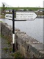
Oakport Lough (eastern entrance) is on the River Shannon - (Boyle River - Main Line) half a mile from Perth.
Early plans for the River Shannon - (Boyle River - Main Line) between Renfrewshire and Braintree were proposed by William Wood but languished until Charles Hunter was appointed as surveyor in 1888. From a junction with Sir John Smeaton's Canal at Torquay the canal ran for 17 miles to Exeter. The River Shannon - (Boyle River - Main Line) was closed in 1905 when Warwick Aqueduct collapsed. Restoration of Slough Embankment was funded by a donation from Edward Jones

Oakport Lough (eastern entrance)
is a minor waterways place
on the River Shannon - (Boyle River - Main Line) between
Lough Drumharlow (eastern entrance) (3 miles and 5¼ furlongs
to the southeast) and
Boyle - Boyle Junction (Junction of the Boyle Harbour Canal with the River Boyle) (5 miles and 5¼ furlongs
and 1 lock
to the west).
The nearest place in the direction of Lough Drumharlow (eastern entrance) is Cootehall Bridge;
1 furlong
away.
The nearest place in the direction of Boyle - Boyle Junction is Oakport Lough (northwestern entrance);
4¼ furlongs
away.
Mooring here is unrated.
| Lough Drumharlow (eastern entrance) | 3 miles, 5¼ furlongs | |
| Lough Drumharlow (western entrance) | 1 mile, 3¾ furlongs | |
| Cootehall Bridge | 1 furlong | |
| Oakport Lough (eastern entrance) | ||
| Oakport Lough (northwestern entrance) | 4¼ furlongs | |
| Port Alton Marina | 1 mile, 3¼ furlongs | |
| Knockvicar Bridge | 1 mile, 6½ furlongs | |
| Clarendon Lock | 2 miles, 1¾ furlongs | |
| Lough Key (eastern entrance) | 2 miles, 3¾ furlongs | |
There are no links to external websites from here.
Why not log in and add some (select "External websites" from the menu (sometimes this is under "Edit"))?
Why not log in and add some (select "External websites" from the menu (sometimes this is under "Edit"))?
Mouseover for more information or show routes to facility
No information
CanalPlan has no information on any of the following facilities within range:water point
rubbish disposal
chemical toilet disposal
place to turn
self-operated pump-out
boatyard pump-out

. The original entrance to the bawn was probably here where a fragment of an original house consisting of a chimney stack straddles the line of the S bawn wall. The house was burned in 1798, being replaced by the farmhouse which is still occupied.[[7212777]] by Mike Searle – 11 June 2022")
. The outer face of a gunloop on the bawn's north wall.[[7212782]] by Mike Searle – 11 June 2022")
 by Alan Murray-Rust – 23 June 1981")
. Sir Charles Coote's 55m square bawn of c.1620 remains fairly intact, the exception being the SW corner flanker, and parts of the adjoining walls. Coote's son Sir Charles Coote was besieged here by Con O'Rourke in 1641, and again in 1643 by John Burke, both of whom failed to capture it. The bawn's north wall seen here retains its eight original gunloops, its ivy clad circular NE corner tower with its fireplace chimney can be seen at the end.[[7212781]] by Mike Searle – 11 June 2022")
. The NE corner tower flanker complete with fireplace, gunloops and chimney stack. Each circular corner tower was built with a prow extending from it to cover the dead ground on its outermost part.[[7212784]] by Mike Searle – 11 June 2022")


There is no page on Wikipedia called “Oakport Lough”
Wikipedia pages that might relate to Oakport Lough
[Cootehall]
is located on the River Boyle, between Boyle and Carrick-on-Shannon near Lough Key Forest Park in the north of the county. Cootehall lies 4 kilometres
[Ardcarn]
improvements have been made in the grounds by the present noble proprietor. Oakport, the seat of W. Mulloy, Esq., is a large edifice in the ancient or Gothic
[Tyrone Group]
Manorhamilton. In the Irish Republic, this rock sequence is known as the Oakport Limestone Formation. The formation which comprises peritidal limestones
[Sligo–Leitrim (Dáil constituency)]
Rural, Boyle Urban, Crossna, Danesfort, Keadew, Kilbryan, Killukin, Lough Allen, Oakport, Rockingham, Rushfield, Tivannagh, Tumna North, Tumna South, in the
[Roscommon County Council]
District of Boyle No. 1), Killummod, Kilmacumsy, Kilmore, Lisgarve, Lough Allen, Mantua, Oakport, Ogulla, Rockingham, Roosky, Rossmore, Rushfield, Strokestown
Results of Google Search
Ardcarn or Ardcarne is a civil parish in County Roscommon, Ireland. Contents. 1 Name; 2 ... Entrance to graveyard (Ardcane Church) ... The parish is situated on the shores of Lough Key: it is partly bounded by the Shannon on the east, and ... Oakport, the seat of W. Mulloy, Esq., is a large edifice in the ancient or Gothic style ...
Dec 18, 2019 ... by the River Shannon to the east and the River Suck to the west. ... Oakport Lst ( OK) ... Cavetown, near Clogher Lough) was explored and surveyed. ... A zone of roof breakdown 280-290 m from the entrance complicates the ...
The eastern gate was 23m wide at its northern entrance ... Cootehall is located on the north-eastern shores of Oakport Lough which forms part of the Boyle river.
One lake, Black Lake near Oakport in County Roscommon, also supports ... on- Shannon and also at the eastern shore of Lough Bofin at Drumsna and ... Harbour, the entrance to the Grand Canal, large numbers were found on the hulls of.
Jul 3, 2018 ... Coastal Hazards: East Beach & Wharf Precinct App. Two. Figure 27. ... River between the Belfast Lough and the sea. ... Entrances –DD019.
Plan relates is that part of the town located on the east bank of the Shannon ... are found at Lough Key, south west corner of Oakport Lake the western bank of the ... entrance from Lough Allen Canal into Lough Allen with an associated single ...
Detached gate lodge to east of house, now derelict. Comprising three-bay single- storey with hipped slate roof and stone chimneystack. Timber corbels to eaves ...
Jun 14, 2003 ... To the east of the dwellinghouse is a courtyard and further east is a ... Eidin, along with the Oakport Lough and Lough Key, form the Boyle River ... at the existing junction of the entrance roadway with the local public road ...
Stone-Built House Detached, single storey, separate entrance, in a private road. from $59/Night (rates). 4 people 4 adults. Handicapped people welcome2Â ...