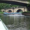
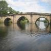
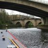
Old Great North Road Bridge
is a minor waterways place
on the Aire and Calder Navigation (Main Line - Goole to Castleford) between
Bank Dole Junction (Junction of the Aire and Calder Navigation (Selby Section) and the Aire and Calder Navigation (Main Line)) (1 mile and 6 furlongs
and 1 lock
to the east) and
Castleford Junction (Junction of the Aire and Calder Navigation (Wakefield Section) and the Aire and Calder Navigation (Main Line)) (5 miles and 2 furlongs
and 2 locks
to the west).
The nearest place in the direction of Bank Dole Junction is Ferrybridge Bypass Bridge;
½ furlongs
away.
The nearest place in the direction of Castleford Junction is Ferrybridge Railway Bridge;
4¼ furlongs
away.
There may be access to the towpath here.
Mooring here is unrated.
There is a bridge here which takes pedestrian traffic over the canal.
Mill Bridge Wharf | 4½ furlongs | |
Ferrybridge Flood Lock No 11 | 1½ furlongs | |
Ferrybridge Flood Lock Footbridge | 1¼ furlongs | |
Ferrybridge Weir Entrance | ¾ furlongs | |
Ferrybridge Bypass Bridge | ½ furlongs | |
Old Great North Road Bridge | ||
Ferrybridge Railway Bridge | 4¼ furlongs | |
Power Station Pipe Bridge | 7½ furlongs | |
Ferrybridge Wharf | 1 mile, ½ furlongs | |
A1(M) Motorway Bridge | 1 mile, 4½ furlongs | |
Fairburn Railway Bridge | 1 mile, 7¼ furlongs |
There are no links to external websites from here.
Why not log in and add some (select "External websites" from the menu (sometimes this is under "Edit"))?
Mouseover for more information or show routes to facility
Nearest water point
In the direction of Castleford Junction
Bulholme Lock No 10 — 4 miles, 4½ furlongs away
On this waterway in the direction of Castleford Junction
Castleford Sanitary Station — 5 miles, 1¼ furlongs and 1 lock away
On this waterway in the direction of Castleford Junction
Woodnook Lock No 6 — 7 miles, 3¾ furlongs and 2 locks away
Travel to Castleford Junction, then on the Aire and Calder Navigation (Wakefield Section) to Woodnook Lock No 6
Fairies Hill Moorings — 7 miles, 2½ furlongs and 3 locks away
Travel to Castleford Junction, then on the Aire and Calder Navigation (Wakefield Section) to Fairies Hill Lock Junction, then on the Aire and Calder Navigation (Wakefield Section - Fairies Hill Mooring Arm) to Fairies Hill Moorings
Lemonroyd Lock No 7 — 8 miles, 5¾ furlongs and 2 locks away
Travel to Castleford Junction, then on the Aire and Calder Navigation (Main Line - Castleford to Leeds) to Lemonroyd Lock No 7
Lemonroyd Marina — 8 miles, 6¾ furlongs and 3 locks away
Travel to Castleford Junction, then on the Aire and Calder Navigation (Main Line - Castleford to Leeds) to Lemonroyd Marina
King's Road Lock No 3 — 8 miles, 5¼ furlongs and 3 locks away
Travel to Castleford Junction, then on the Aire and Calder Navigation (Wakefield Section) to King's Road Lock No 3
Woodlesford Lock No 5 — 10 miles, ½ furlongs and 3 locks away
Travel to Castleford Junction, then on the Aire and Calder Navigation (Main Line - Castleford to Leeds) to Woodlesford Lock No 5
Fishpond Lock No 4 — 10 miles, 7¼ furlongs and 4 locks away
Travel to Castleford Junction, then on the Aire and Calder Navigation (Main Line - Castleford to Leeds) to Fishpond Lock No 4
Stanley Ferry Water Point — 10 miles, 2½ furlongs and 5 locks away
Travel to Castleford Junction, then on the Aire and Calder Navigation (Wakefield Section) to Stanley Ferry Water Point
Ramsdens Bridge Sanitary Station — 10 miles, 3¼ furlongs and 5 locks away
Travel to Castleford Junction, then on the Aire and Calder Navigation (Wakefield Section) to Ramsdens Bridge Sanitary Station
In the direction of Ouse - Aire and Calder Junction
Ferrybridge Flood Lock Footbridge — 1¼ furlongs away
On this waterway in the direction of Ouse - Aire and Calder Junction
Ferrybridge Flood Lock No 11 — 1½ furlongs away
On this waterway in the direction of Ouse - Aire and Calder Junction
Bank Dole Lock No 1 — 1 mile, 7¾ furlongs and 1 lock away
Travel to Bank Dole Junction, then on the Aire and Calder Navigation (Selby Section) to Bank Dole Lock No 1
Beal Bridge — 4 miles, 2¼ furlongs and 2 locks away
Travel to Bank Dole Junction, then on the Aire and Calder Navigation (Selby Section) to Beal Bridge
Beal Lock No 2 — 4 miles, 3½ furlongs and 2 locks away
Travel to Bank Dole Junction, then on the Aire and Calder Navigation (Selby Section) to Beal Lock No 2
Whitley Lock No 12 — 5 miles, 5¼ furlongs and 1 lock away
On this waterway in the direction of Ouse - Aire and Calder Junction
Pollington Manor Swing Bridge — 9 miles, 3½ furlongs and 3 locks away
On this waterway in the direction of Ouse - Aire and Calder Junction
Pollington Visitor Mooring — 9 miles, 3¾ furlongs and 3 locks away
On this waterway in the direction of Ouse - Aire and Calder Junction
Selby Basin — 13 miles, ¼ furlongs and 4 locks away
Travel to Bank Dole Junction, then on the Aire and Calder Navigation (Selby Section) to Selby BasinNearest rubbish disposal
In the direction of Castleford Junction
Castleford Sanitary Station — 5 miles, 1¼ furlongs and 1 lock away
On this waterway in the direction of Castleford Junction
Lemonroyd Marina — 8 miles, 6¾ furlongs and 3 locks away
Travel to Castleford Junction, then on the Aire and Calder Navigation (Main Line - Castleford to Leeds) to Lemonroyd Marina
Woodlesford Lock No 5 — 10 miles, ½ furlongs and 3 locks away
Travel to Castleford Junction, then on the Aire and Calder Navigation (Main Line - Castleford to Leeds) to Woodlesford Lock No 5
Ramsdens Bridge Visitor Moorings — 10 miles, 2¾ furlongs and 5 locks away
Travel to Castleford Junction, then on the Aire and Calder Navigation (Wakefield Section) to Ramsdens Bridge Visitor Moorings
Leeds Sanitary Station — 14 miles, 5 furlongs and 6 locks away
Travel to Castleford Junction, then on the Aire and Calder Navigation (Main Line - Castleford to Leeds) to Leeds Sanitary Station
Leeds Basin — 15 miles, 4¼ furlongs and 8 locks away
Travel to Castleford Junction, then on the Aire and Calder Navigation (Main Line - Castleford to Leeds) to Leeds Bridge, then on the Leeds and Liverpool Canal (Main Line - Wigan to Leeds) to Leeds Basin
Horbury Basin Residential Moorings & Sanitary Station — 17 miles, 7½ furlongs and 10 locks away
Travel to Castleford Junction, then on the Aire and Calder Navigation (Wakefield Section) to Fall Ing Junction, then on the Calder and Hebble Navigation (Main Line) to Horbury Basin Residential Moorings & Sanitary Station
In the direction of Ouse - Aire and Calder Junction
Whitley Lock No 12 — 5 miles, 5¼ furlongs and 1 lock away
On this waterway in the direction of Ouse - Aire and Calder Junction
Selby Basin — 13 miles, ¼ furlongs and 4 locks away
Travel to Bank Dole Junction, then on the Aire and Calder Navigation (Selby Section) to Selby Basin
Dutch Riverside — 17 miles, 5¾ furlongs and 3 locks away
On this waterway in the direction of Ouse - Aire and Calder Junction
Goole Marina — 17 miles, 7¼ furlongs and 3 locks away
On this waterway in the direction of Ouse - Aire and Calder Junction
Barnby Dun Lift Bridge — 18 miles, ¾ furlongs and 4 locks away
Travel to Sykehouse Junction, then on the Sheffield and South Yorkshire Navigation (New Junction Canal) to Bramwith Junction, then on the Sheffield and South Yorkshire Navigation (Main Line) to Barnby Dun Lift Bridge
Bramwith Swing Bridge — 17 miles, 5¼ furlongs and 5 locks away
Travel to Sykehouse Junction, then on the Sheffield and South Yorkshire Navigation (New Junction Canal) to Bramwith Junction, then on the Sheffield and South Yorkshire Navigation (Bramwith to Stainforth) to Bramwith Swing BridgeNearest chemical toilet disposal
In the direction of Castleford Junction
Castleford Sanitary Station — 5 miles, 1¼ furlongs and 1 lock away
On this waterway in the direction of Castleford Junction
Fairies Hill Moorings — 7 miles, 2½ furlongs and 3 locks away
Travel to Castleford Junction, then on the Aire and Calder Navigation (Wakefield Section) to Fairies Hill Lock Junction, then on the Aire and Calder Navigation (Wakefield Section - Fairies Hill Mooring Arm) to Fairies Hill Moorings
Lemonroyd Marina — 8 miles, 6¾ furlongs and 3 locks away
Travel to Castleford Junction, then on the Aire and Calder Navigation (Main Line - Castleford to Leeds) to Lemonroyd Marina
Ramsdens Bridge Sanitary Station — 10 miles, 3¼ furlongs and 5 locks away
Travel to Castleford Junction, then on the Aire and Calder Navigation (Wakefield Section) to Ramsdens Bridge Sanitary Station
Leeds Sanitary Station — 14 miles, 5 furlongs and 6 locks away
Travel to Castleford Junction, then on the Aire and Calder Navigation (Main Line - Castleford to Leeds) to Leeds Sanitary Station
Horbury Basin Residential Moorings & Sanitary Station — 17 miles, 7½ furlongs and 10 locks away
Travel to Castleford Junction, then on the Aire and Calder Navigation (Wakefield Section) to Fall Ing Junction, then on the Calder and Hebble Navigation (Main Line) to Horbury Basin Residential Moorings & Sanitary Station
In the direction of Ouse - Aire and Calder Junction
Whitley Lock No 12 — 5 miles, 5¼ furlongs and 1 lock away
On this waterway in the direction of Ouse - Aire and Calder Junction
Selby Basin — 13 miles, ¼ furlongs and 4 locks away
Travel to Bank Dole Junction, then on the Aire and Calder Navigation (Selby Section) to Selby Basin
Dutch Riverside — 17 miles, 5¾ furlongs and 3 locks away
On this waterway in the direction of Ouse - Aire and Calder Junction
Goole Marina — 17 miles, 7¼ furlongs and 3 locks away
On this waterway in the direction of Ouse - Aire and Calder Junction
Barnby Dun Lift Bridge — 18 miles, ¾ furlongs and 4 locks away
Travel to Sykehouse Junction, then on the Sheffield and South Yorkshire Navigation (New Junction Canal) to Bramwith Junction, then on the Sheffield and South Yorkshire Navigation (Main Line) to Barnby Dun Lift Bridge
Bramwith Swing Bridge — 17 miles, 5¼ furlongs and 5 locks away
Travel to Sykehouse Junction, then on the Sheffield and South Yorkshire Navigation (New Junction Canal) to Bramwith Junction, then on the Sheffield and South Yorkshire Navigation (Bramwith to Stainforth) to Bramwith Swing BridgeNearest place to turn
In the direction of Castleford Junction
Bulholme Lock Weir Exit — 4 miles, 4 furlongs away
On this waterway in the direction of Castleford Junction
Lemonroyd Lock Weir Exit — 8 miles, 4¾ furlongs and 2 locks away
Travel to Castleford Junction, then on the Aire and Calder Navigation (Main Line - Castleford to Leeds) to Lemonroyd Lock Weir Exit
Fairies Hill Lock Arm — 7 miles, 5½ furlongs and 3 locks away
Travel to Castleford Junction, then on the Aire and Calder Navigation (Wakefield Section) to Fairies Hill Lock Arm
Fleet Lane Arm — 9 miles, ¾ furlongs and 3 locks away
Travel to Castleford Junction, then on the Aire and Calder Navigation (Main Line - Castleford to Leeds) to Fleet Lane Arm
Stanley Ferry Marina — 10 miles, 1¾ furlongs and 5 locks away
Travel to Castleford Junction, then on the Aire and Calder Navigation (Wakefield Section) to Stanley Ferry Marina
Junction with River Aire (Old Channel) South — 13 miles, 3 furlongs and 5 locks away
Travel to Castleford Junction, then on the Aire and Calder Navigation (Main Line - Castleford to Leeds) to Junction with River Aire (Old Channel) South
Junction with River Aire (Old Channel) North — 14 miles, ¼ furlongs and 6 locks away
Travel to Castleford Junction, then on the Aire and Calder Navigation (Main Line - Castleford to Leeds) to Junction with River Aire (Old Channel) North
Knostrop Flood Lock Weir Entrance — 14 miles, ¼ furlongs and 6 locks away
Travel to Castleford Junction, then on the Aire and Calder Navigation (Main Line - Castleford to Leeds) to Knostrop Flood Lock Weir Entrance
Wakefield Weir Entrance — 13 miles, 2 furlongs and 7 locks away
Travel to Castleford Junction, then on the Aire and Calder Navigation (Wakefield Section) to Fall Ing Junction, then on the Calder and Hebble Navigation (Main Line) to Wakefield Weir Entrance
Leeds Dock Side Arm — 14 miles, 7½ furlongs and 7 locks away
Travel to Castleford Junction, then on the Aire and Calder Navigation (Main Line - Castleford to Leeds) to Leeds Dock Entrance, then on the Aire and Calder Navigation (Leeds Dock) to Leeds Dock Side Arm
River Aire Junction — 15 miles, 3¾ furlongs and 7 locks away
Travel to Castleford Junction, then on the Aire and Calder Navigation (Main Line - Castleford to Leeds) to Leeds Bridge, then on the Leeds and Liverpool Canal (Main Line - Wigan to Leeds) to River Aire Junction
Leeds Basin — 15 miles, 4¼ furlongs and 8 locks away
Travel to Castleford Junction, then on the Aire and Calder Navigation (Main Line - Castleford to Leeds) to Leeds Bridge, then on the Leeds and Liverpool Canal (Main Line - Wigan to Leeds) to Leeds Basin
Broad Cut Weir Entrance — 15 miles, 6½ furlongs and 8 locks away
Travel to Castleford Junction, then on the Aire and Calder Navigation (Wakefield Section) to Fall Ing Junction, then on the Calder and Hebble Navigation (Main Line) to Broad Cut Weir Entrance
Waller Bridge Winding Hole — 16 miles, ¾ furlongs and 9 locks away
Travel to Castleford Junction, then on the Aire and Calder Navigation (Wakefield Section) to Fall Ing Junction, then on the Calder and Hebble Navigation (Main Line) to Waller Bridge Winding Hole
In the direction of Ouse - Aire and Calder Junction
Bank Dole Lock Junction — 2 miles and 2 locks away
Travel to Bank Dole Junction, then on the Aire and Calder Navigation (Selby Section) to Bank Dole Lock Junction
Beal Lock No 2 Weir Entrance — 4 miles, 2½ furlongs and 2 locks away
Travel to Bank Dole Junction, then on the Aire and Calder Navigation (Selby Section) to Beal Lock No 2 Weir Entrance
Haddlesey Junction — 8 miles, 2 furlongs and 3 locks away
Travel to Bank Dole Junction, then on the Aire and Calder Navigation (Selby Section) to Haddlesey Junction
Selby Basin — 13 miles, ¼ furlongs and 4 locks away
Travel to Bank Dole Junction, then on the Aire and Calder Navigation (Selby Section) to Selby Basin
Viking Marina — 17 miles, 6½ furlongs and 3 locks away
On this waterway in the direction of Ouse - Aire and Calder Junction
Huddle Grounds Winding Hole — 19 miles, 4½ furlongs and 5 locks away
Travel to Sykehouse Junction, then on the Sheffield and South Yorkshire Navigation (New Junction Canal) to Bramwith Junction, then on the Sheffield and South Yorkshire Navigation (Bramwith to Stainforth) to Stainforth Junction, then on the Sheffield and South Yorkshire Navigation (Stainforth and Keadby Canal) to Huddle Grounds Winding HoleNearest self-operated pump-out
In the direction of Castleford Junction
Castleford Sanitary Station — 5 miles, 1¼ furlongs and 1 lock away
On this waterway in the direction of Castleford Junction
Ramsdens Bridge Sanitary Station — 10 miles, 3¼ furlongs and 5 locks away
Travel to Castleford Junction, then on the Aire and Calder Navigation (Wakefield Section) to Ramsdens Bridge Sanitary Station
Leeds Sanitary Station — 14 miles, 5 furlongs and 6 locks away
Travel to Castleford Junction, then on the Aire and Calder Navigation (Main Line - Castleford to Leeds) to Leeds Sanitary StationNearest boatyard pump-out
In the direction of Castleford Junction
Lemonroyd Marina — 8 miles, 6¾ furlongs and 3 locks away
Travel to Castleford Junction, then on the Aire and Calder Navigation (Main Line - Castleford to Leeds) to Lemonroyd Marina
In the direction of Ouse - Aire and Calder Junction
Goole Marina — 17 miles, 7¼ furlongs and 3 locks away
On this waterway in the direction of Ouse - Aire and Calder JunctionDirection of TV transmitter (From Wolfbane Cybernetic)
There is no page on Wikipedia called “Old Great North Road Bridge”
Wikipedia pages that might relate to Old Great North Road Bridge
[Great North Road (Great Britain)]
The Great North Road was the main highway between England and Scotland. It became a coaching route used by mail coaches travelling between London, York
[A roads in Zone 1 of the Great Britain numbering scheme]
List of A roads in zone 1 in Great Britain beginning north of the River Thames, east of the A1 (roads beginning with 1). "Old Stoke Bridge, Ipswich". www
[London Inner Ring Road]
the roads defining the boundary are Pentonville Road, City Road, Old Street, Great Eastern Street, Commercial Street, Mansell Street, Tower Bridge, Tower
[Forth Road Bridge]
Forth Road Bridge is a suspension bridge in east central Scotland. The bridge opened in 1964 and at the time was the longest suspension bridge in the
[Great River Road]
Louisiana. It formerly extended north into Canada, serving the provinces of Ontario and Manitoba. The term "Great River Road" refers both to a series of roadways
[Great North Road, Zambia]
being part of the Great North Road; but this is only since the opening of the Chirundu Bridge in 1939 - before that, the Great North Road ran through Bulawayo
[Great Wagon Road]
The Great Wagon Road was an improved trail through the Great Appalachian Valley from Pennsylvania to North Carolina, and from there to Georgia in colonial
[Great North Road (New South Wales)]
The Great North Road is a historic road that was built to link early Sydney, in the Colony of New South Wales, now Australia, with the fertile Hunter
[Chain of Rocks Bridge]
of Rocks Bridge carries vehicular traffic to the north. The old route to the bridge is now called Chain of Rocks Road and ends near Roman Road. Parking
[London Bridge]
the bridge offered uninterrupted, mass movement of foot, horse, and wheeled traffic across the Thames, linking four major arterial road systems north of