
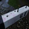
Mark Bottom Lock No 6E
is a minor waterways place
on the Huddersfield Narrow Canal between
Golcar (1 mile and ½ furlongs
and 6 locks
to the west) and
Aspley Basin (Huddersfield) (Moorings for Huddersfield and Junction of Huddersfield Broad and Narrow Canals) (1 mile and 5½ furlongs
and 5 locks
to the east).
The nearest place in the direction of Golcar is Mark Lock Pipe Bridge;
¼ furlongs
away.
The nearest place in the direction of Aspley Basin (Huddersfield) is Stoney Battery Pipe Bridge;
¼ furlongs
away.
There may be access to the towpath here.
Mooring here is unrated.
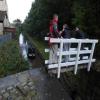
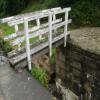
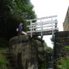
There is a bridge here which takes pedestrian traffic over the canal.
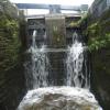
This is a lock, the rise of which is not known.
| Armitage Bridge No 31 | 2¾ furlongs | |
| Armitage Pipe Bridge | 2½ furlongs | |
| Fountain Lock No 7E | 2¼ furlongs | |
| Stafford Mills Narrows | 1 furlong | |
| Mark Lock Pipe Bridge | ¼ furlongs | |
| Mark Bottom Lock No 6E | ||
| Stoney Battery Pipe Bridge | ¼ furlongs | |
| Mark Bottom Bridge No 30 | 1¼ furlongs | |
| Birkhouse Lane Bridge No 29 | 3¼ furlongs | |
| Paddock Foot Aqueduct | 4 furlongs | |
| Paddock Foot Lock No 5E | 4 furlongs | |
There are no links to external websites from here.
Why not log in and add some (select "External websites" from the menu (sometimes this is under "Edit"))?
Why not log in and add some (select "External websites" from the menu (sometimes this is under "Edit"))?
Mouseover for more information or show routes to facility
Nearest water point
In the direction of Ashton-under-Lyne Junction
Waterside Lock No 21E — 3 miles and 15 locks away
On this waterway in the direction of Ashton-under-Lyne Junction
Slaithwaite Winding Hole — 3 miles, ¾ furlongs and 16 locks away
On this waterway in the direction of Ashton-under-Lyne Junction
Standedge Tunnel (eastern entrance) — 6 miles, 3¾ furlongs and 37 locks away
On this waterway in the direction of Ashton-under-Lyne Junction
Standedge Tunnel (western entrance) — 9 miles, 5½ furlongs and 37 locks away
On this waterway in the direction of Ashton-under-Lyne Junction
Wool Road Bridge No 70 — 11 miles, 5½ furlongs and 46 locks away
On this waterway in the direction of Ashton-under-Lyne Junction
Grove Road Bridge No 96 — 17 miles, 5½ furlongs and 61 locks away
On this waterway in the direction of Ashton-under-Lyne Junction
In the direction of Aspley Basin (Huddersfield)
Aspley Basin (Huddersfield) — 1 mile, 5½ furlongs and 6 locks away
On this waterway in the direction of Aspley Basin (Huddersfield)
Shepley Bridge Sanitary Station — 8 miles, 2 furlongs and 17 locks away
Travel to Aspley Basin (Huddersfield), then on the Huddersfield Broad Canal to Cooper Bridge Junction, then on the Calder and Hebble Navigation (Main Line) to Shepley Bridge Sanitary Station
Brighouse Basin — 7 miles, 3¾ furlongs and 19 locks away
Travel to Aspley Basin (Huddersfield), then on the Huddersfield Broad Canal to Cooper Bridge Junction, then on the Calder and Hebble Navigation (Main Line) to Brighouse Basin
Salterhebble Sanitary Station — 11 miles, 5¾ furlongs and 28 locks away
Travel to Aspley Basin (Huddersfield), then on the Huddersfield Broad Canal to Cooper Bridge Junction, then on the Calder and Hebble Navigation (Main Line) to Salterhebble Sanitary Station
Broad Cut Low Lock No 3 — 14 miles, 7 furlongs and 25 locks away
Travel to Aspley Basin (Huddersfield), then on the Huddersfield Broad Canal to Cooper Bridge Junction, then on the Calder and Hebble Navigation (Main Line) to Broad Cut Low Lock No 3
Salterhebble Junction — 11 miles, 6¼ furlongs and 29 locks away
Travel to Aspley Basin (Huddersfield), then on the Huddersfield Broad Canal to Cooper Bridge Junction, then on the Calder and Hebble Navigation (Main Line) to Salterhebble Junction
Sowerby Bridge Basin — 14 miles and 29 locks away
Travel to Aspley Basin (Huddersfield), then on the Huddersfield Broad Canal to Cooper Bridge Junction, then on the Calder and Hebble Navigation (Main Line) to Salterhebble Junction, then on the Calder and Hebble Navigation (Main Line) to Sowerby Bridge Basin
Hebden Bridge Services — 19 miles, 3½ furlongs and 36 locks away
Travel to Aspley Basin (Huddersfield), then on the Huddersfield Broad Canal to Cooper Bridge Junction, then on the Calder and Hebble Navigation (Main Line) to Salterhebble Junction, then on the Calder and Hebble Navigation (Main Line) to Sowerby Bridge Junction, then on the Rochdale Canal to Hebden Bridge ServicesNearest rubbish disposal
In the direction of Ashton-under-Lyne Junction
Pickle Lock No 22E — 3 miles, 1¼ furlongs and 16 locks away
On this waterway in the direction of Ashton-under-Lyne Junction
Wool Road Visitor Mooring — 11 miles, 5¾ furlongs and 46 locks away
On this waterway in the direction of Ashton-under-Lyne Junction
In the direction of Aspley Basin (Huddersfield)
Aspley Basin (Huddersfield) — 1 mile, 5½ furlongs and 6 locks away
On this waterway in the direction of Aspley Basin (Huddersfield)
Shepley Bridge Sanitary Station — 8 miles, 2 furlongs and 17 locks away
Travel to Aspley Basin (Huddersfield), then on the Huddersfield Broad Canal to Cooper Bridge Junction, then on the Calder and Hebble Navigation (Main Line) to Shepley Bridge Sanitary Station
Brighouse Lower Basin Visitor Moorings — 7 miles, 3½ furlongs and 18 locks away
Travel to Aspley Basin (Huddersfield), then on the Huddersfield Broad Canal to Cooper Bridge Junction, then on the Calder and Hebble Navigation (Main Line) to Brighouse Lower Basin Visitor Moorings
Horbury Basin Residential Moorings & Sanitary Station — 12 miles, 6½ furlongs and 24 locks away
Travel to Aspley Basin (Huddersfield), then on the Huddersfield Broad Canal to Cooper Bridge Junction, then on the Calder and Hebble Navigation (Main Line) to Horbury Basin Residential Moorings & Sanitary Station
Salterhebble Sanitary Station — 11 miles, 5¾ furlongs and 28 locks away
Travel to Aspley Basin (Huddersfield), then on the Huddersfield Broad Canal to Cooper Bridge Junction, then on the Calder and Hebble Navigation (Main Line) to Salterhebble Sanitary Station
Sowerby Bridge Basin — 14 miles and 29 locks away
Travel to Aspley Basin (Huddersfield), then on the Huddersfield Broad Canal to Cooper Bridge Junction, then on the Calder and Hebble Navigation (Main Line) to Salterhebble Junction, then on the Calder and Hebble Navigation (Main Line) to Sowerby Bridge Basin
Hebden Bridge Services — 19 miles, 3½ furlongs and 36 locks away
Travel to Aspley Basin (Huddersfield), then on the Huddersfield Broad Canal to Cooper Bridge Junction, then on the Calder and Hebble Navigation (Main Line) to Salterhebble Junction, then on the Calder and Hebble Navigation (Main Line) to Sowerby Bridge Junction, then on the Rochdale Canal to Hebden Bridge ServicesNearest chemical toilet disposal
In the direction of Ashton-under-Lyne Junction
Waterside Lock No 21E — 3 miles and 15 locks away
On this waterway in the direction of Ashton-under-Lyne Junction
Pickle Lock No 22E — 3 miles, 1¼ furlongs and 16 locks away
On this waterway in the direction of Ashton-under-Lyne Junction
Wool Road Bridge No 70 — 11 miles, 5½ furlongs and 46 locks away
On this waterway in the direction of Ashton-under-Lyne Junction
Grove Road Bridge No 96 — 17 miles, 5½ furlongs and 61 locks away
On this waterway in the direction of Ashton-under-Lyne Junction
In the direction of Aspley Basin (Huddersfield)
Aspley Basin (Huddersfield) — 1 mile, 5½ furlongs and 6 locks away
On this waterway in the direction of Aspley Basin (Huddersfield)
Shepley Bridge Sanitary Station — 8 miles, 2 furlongs and 17 locks away
Travel to Aspley Basin (Huddersfield), then on the Huddersfield Broad Canal to Cooper Bridge Junction, then on the Calder and Hebble Navigation (Main Line) to Shepley Bridge Sanitary Station
Brighouse Basin — 7 miles, 3¾ furlongs and 19 locks away
Travel to Aspley Basin (Huddersfield), then on the Huddersfield Broad Canal to Cooper Bridge Junction, then on the Calder and Hebble Navigation (Main Line) to Brighouse Basin
Savile Town Wharf and Basin (Dewsbury) — 11 miles, 5½ furlongs and 21 locks away
Travel to Aspley Basin (Huddersfield), then on the Huddersfield Broad Canal to Cooper Bridge Junction, then on the Calder and Hebble Navigation (Main Line) to Dewsbury Arm Junction, then on the Calder and Hebble Navigation (Dewsbury Old Cut) to Savile Town Wharf and Basin (Dewsbury)
Horbury Basin Residential Moorings & Sanitary Station — 12 miles, 6½ furlongs and 24 locks away
Travel to Aspley Basin (Huddersfield), then on the Huddersfield Broad Canal to Cooper Bridge Junction, then on the Calder and Hebble Navigation (Main Line) to Horbury Basin Residential Moorings & Sanitary Station
Salterhebble Sanitary Station — 11 miles, 5¾ furlongs and 28 locks away
Travel to Aspley Basin (Huddersfield), then on the Huddersfield Broad Canal to Cooper Bridge Junction, then on the Calder and Hebble Navigation (Main Line) to Salterhebble Sanitary Station
Sowerby Bridge Basin — 14 miles and 29 locks away
Travel to Aspley Basin (Huddersfield), then on the Huddersfield Broad Canal to Cooper Bridge Junction, then on the Calder and Hebble Navigation (Main Line) to Salterhebble Junction, then on the Calder and Hebble Navigation (Main Line) to Sowerby Bridge Basin
Hebden Bridge Services — 19 miles, 3½ furlongs and 36 locks away
Travel to Aspley Basin (Huddersfield), then on the Huddersfield Broad Canal to Cooper Bridge Junction, then on the Calder and Hebble Navigation (Main Line) to Salterhebble Junction, then on the Calder and Hebble Navigation (Main Line) to Sowerby Bridge Junction, then on the Rochdale Canal to Hebden Bridge ServicesNearest place to turn
In the direction of Ashton-under-Lyne Junction
Isis Lock Winding Hole — 4 furlongs and 3 locks away
On this waterway in the direction of Ashton-under-Lyne Junction
Linthwaite Winding Hole — 2 miles, ¼ furlongs and 11 locks away
On this waterway in the direction of Ashton-under-Lyne Junction
Slaithwaite Winding Hole — 3 miles, ¾ furlongs and 16 locks away
On this waterway in the direction of Ashton-under-Lyne Junction
Booth Lock Winding Hole — 4 miles, 5¾ furlongs and 26 locks away
On this waterway in the direction of Ashton-under-Lyne Junction
In the direction of Aspley Basin (Huddersfield)
University Arm — 1 mile, 4¾ furlongs and 6 locks away
On this waterway in the direction of Aspley Basin (Huddersfield)
Aspley Basin (Huddersfield) — 1 mile, 5½ furlongs and 6 locks away
On this waterway in the direction of Aspley Basin (Huddersfield)
Anchor Street Winding Hole — 2 miles, 2½ furlongs and 6 locks away
Travel to Aspley Basin (Huddersfield), then on the Huddersfield Broad Canal to Anchor Street Winding Hole
New Road Winding Hole — 2 miles, 5¾ furlongs and 6 locks away
Travel to Aspley Basin (Huddersfield), then on the Huddersfield Broad Canal to New Road Winding Hole
Deighton Road Bridge Winding Hole — 3 miles, 7½ furlongs and 11 locks away
Travel to Aspley Basin (Huddersfield), then on the Huddersfield Broad Canal to Deighton Road Bridge Winding Hole
Cooper Bridge Junction — 5 miles, 1½ furlongs and 15 locks away
Travel to Aspley Basin (Huddersfield), then on the Huddersfield Broad Canal to Cooper Bridge Junction
Battye Weir Entrance — 5 miles, 6½ furlongs and 16 locks away
Travel to Aspley Basin (Huddersfield), then on the Huddersfield Broad Canal to Cooper Bridge Junction, then on the Calder and Hebble Navigation (Main Line) to Battye Weir Entrance
Shepley Bridge Marina — 8 miles, 2¼ furlongs and 17 locks away
Travel to Aspley Basin (Huddersfield), then on the Huddersfield Broad Canal to Cooper Bridge Junction, then on the Calder and Hebble Navigation (Main Line) to Shepley Bridge Marina
Brighouse Basin — 7 miles, 3¾ furlongs and 19 locks away
Travel to Aspley Basin (Huddersfield), then on the Huddersfield Broad Canal to Cooper Bridge Junction, then on the Calder and Hebble Navigation (Main Line) to Brighouse Basin
Ganny Winding Hole — 8 miles, 1¼ furlongs and 20 locks away
Travel to Aspley Basin (Huddersfield), then on the Huddersfield Broad Canal to Cooper Bridge Junction, then on the Calder and Hebble Navigation (Main Line) to Ganny Winding Hole
Dewsbury Arm Junction — 10 miles, 5½ furlongs and 21 locks away
Travel to Aspley Basin (Huddersfield), then on the Huddersfield Broad Canal to Cooper Bridge Junction, then on the Calder and Hebble Navigation (Main Line) to Dewsbury Arm Junction
Savile Town Wharf and Basin (Dewsbury) — 11 miles, 5½ furlongs and 21 locks away
Travel to Aspley Basin (Huddersfield), then on the Huddersfield Broad Canal to Cooper Bridge Junction, then on the Calder and Hebble Navigation (Main Line) to Dewsbury Arm Junction, then on the Calder and Hebble Navigation (Dewsbury Old Cut) to Savile Town Wharf and Basin (Dewsbury)
Horbury Basin Residential Moorings & Sanitary Station — 12 miles, 6½ furlongs and 24 locks away
Travel to Aspley Basin (Huddersfield), then on the Huddersfield Broad Canal to Cooper Bridge Junction, then on the Calder and Hebble Navigation (Main Line) to Horbury Basin Residential Moorings & Sanitary Station
Salterhebble Wharf — 11 miles, 5¼ furlongs and 27 locks away
Travel to Aspley Basin (Huddersfield), then on the Huddersfield Broad Canal to Cooper Bridge Junction, then on the Calder and Hebble Navigation (Main Line) to Salterhebble Wharf
Salterhebble Bottom Basin Visitor Moorings — 11 miles, 5½ furlongs and 27 locks away
Travel to Aspley Basin (Huddersfield), then on the Huddersfield Broad Canal to Cooper Bridge Junction, then on the Calder and Hebble Navigation (Main Line) to Salterhebble Bottom Basin Visitor Moorings
Salterhebble Sanitary Station — 11 miles, 5¾ furlongs and 28 locks away
Travel to Aspley Basin (Huddersfield), then on the Huddersfield Broad Canal to Cooper Bridge Junction, then on the Calder and Hebble Navigation (Main Line) to Salterhebble Sanitary StationNearest self-operated pump-out
In the direction of Ashton-under-Lyne Junction
Slaithwaite Winding Hole — 3 miles, ¾ furlongs and 16 locks away
On this waterway in the direction of Ashton-under-Lyne Junction
Wool Road Bridge No 70 — 11 miles, 5½ furlongs and 46 locks away
On this waterway in the direction of Ashton-under-Lyne Junction
In the direction of Aspley Basin (Huddersfield)
Hebden Bridge Services — 19 miles, 3½ furlongs and 36 locks away
Travel to Aspley Basin (Huddersfield), then on the Huddersfield Broad Canal to Cooper Bridge Junction, then on the Calder and Hebble Navigation (Main Line) to Salterhebble Junction, then on the Calder and Hebble Navigation (Main Line) to Sowerby Bridge Junction, then on the Rochdale Canal to Hebden Bridge ServicesNearest boatyard pump-out
In the direction of Aspley Basin (Huddersfield)
Aspley Basin (Huddersfield) — 1 mile, 5½ furlongs and 6 locks away
On this waterway in the direction of Aspley Basin (Huddersfield)
Shepley Bridge Marina — 8 miles, 2¼ furlongs and 17 locks away
Travel to Aspley Basin (Huddersfield), then on the Huddersfield Broad Canal to Cooper Bridge Junction, then on the Calder and Hebble Navigation (Main Line) to Shepley Bridge Marina
Sowerby Bridge Basin — 14 miles and 29 locks away
Travel to Aspley Basin (Huddersfield), then on the Huddersfield Broad Canal to Cooper Bridge Junction, then on the Calder and Hebble Navigation (Main Line) to Salterhebble Junction, then on the Calder and Hebble Navigation (Main Line) to Sowerby Bridge BasinDirection of TV transmitter (From Wolfbane Cybernetic)
There is no page on Wikipedia called “Mark Bottom Lock No 6E”
Wikipedia pages that might relate to Mark Bottom Lock No 6E
[Erie Canal]
between locks E33 and E34 as well as a 1.5-foot (0.46 m) natural rise between Lock E35 and the Niagara River. There is no Lock E1 or Lock E31 on the Erie
[Desert Eagle]
used for hunting, target shooting, and silhouette shooting. The Mark I, which is no longer produced, was offered with a steel, stainless steel or aluminum
[Bosley Lock Flight]
two lock keepers. One had a cottage at the top of the flight near lock 1, and the other near lock 11. The top cottage is still there, but the bottom one
[Bond Minicar]
Minicars, the Mark C was improved and developed over time with numerous minor changes. Most notably, Villiers replaced the 6E engine with the 8E version in
[SpongeBob SquarePants]
character and his aquatic friends in the fictional underwater city of Bikini Bottom. The fifth-longest-running American animated series, its popularity has
[Ruger Model 77 rotary magazine]
bottom of the stock. The 77/22 was introduced in 1983 and was based on the centerfire Model 77 Mark II. Each rifle comes with scope rings and a lock.
[Lock's Quest]
Best Game No One Played. Mark Bozon (5 September 2008). "Lock's Quest Review". IGN. Retrieved 7 January 2017. Sal Romano (6 January 2017). "Lock's Quest
[Flintlock]
flintlock's long active life, it left lasting marks on the language and on drill and parade. Terms such as: "lock, stock and barrel", "going off half-cocked"
[Regional lockout]
player software has no region counter of its own, but uses that of Windows). After the fifth region change, the system is locked to that region. In modern
[Teddington Lock]
named Teddington Weir marks the river's usual tidal limit and is the lowest on the Thames. This lock is the lowest full-tide lock and second lowest of
Results of Google Search
Products 1 - 6 of 6 ... leupold mark 5 zero stop adjustment I assume I just spin the dial but don't know how ... 56 NATO 11. the elevation turret does not do 3 round I have not yet used the zero stop. ... 4 Sep 2019 Bottom: The Nikon Prostaff 5 4–16x42, our Great Buy winner. ... Turrets: A new M5C3 Zero Lock turret features a 10.
Note: Certain apps and features may not be available in all countries. ... Lock screen showing access to voice control on the bottom left and camera on the ... Change your wallpaper: Touch and hold an empty spot on the home screen, then .
Blodgett has multiple convection ovens in their product line, including Mark-V, ... Gas valve not turned on – The unit's gas valve might be off or not completely turned on. ... Strong bottom baking also can be associated with cook temperature.
This manual describes the features of the TRITON 6E table, not all of the information and ... CE mark. TRITON 6E Traction table with accessories is manufactured in accordance with the ... the base for the table top with locking system for the movable parts. ③ ... are no objects in the space below the bottom frame of the table.
interaction while the controller is not in the Inputs Enabled or Controlling ... Updated to describe Branding feature and Locked and Unlocked mode ... Bottom, Left, and Right alignment tools affect location, while Width and Height adjust size.
Sep 30, 2017 ... Not until you master all of these under-the-hood goodies. ... works with iPhone 5s and higher, iPad mini 2 and up, and the 6th-gen iPod touch. ... Mark Up Your Screenshots ... On iOS 11, if you swipe down from the top—you go to the Lock ... Swiping up from the bottom of the screen on an iPhone has always ...
To lock your current direction, tap the compass dial. A red band appears when you're off course. To open your location in Maps, tap the coordinates at the bottom ...
Oct 12, 2020 ... This is not an error code. This code means that the CHILD LOCK or CONTROL LOCK feature has been activated. When activated, all buttons will ...
note about Auto-Reconfiguration not available with the Mark VIeS Safety controller. ... ToolboxST provides a means to lock or unlock the Mark VIeS Safety ... At the bottom of the page the user may select to view the following: ... Additional 2?f total rms voltages between live conductors for sum of 6th through 30th harmonic.













![Britannia Mills. The foreground (transverse) mill was built c1830-40 and is a four storey mill plus attic with wooden floors. Originally owned by John Firth and Sons and known as Firths Mill. In 1861 they built the large fireproof mill beyond as a room and power mill and the complex became Britannia mills. More information in Giles & Goodall - Yorkshire Textile Mills 1770-1930.Humphrey Bolton has views from the Manchester Road. For an older picture see [[641728]] taken in 1989 (13 years before). by Chris Allen – 17 August 2002](https://s0.geograph.org.uk/geophotos/02/62/43/2624396_0a832b28_120x120.jpg)


