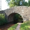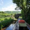
Panteague Bridge No 129
Cyffredyn Lane, Llangynidr NP8 1NL, United Kingdom

Panteague Bridge No 129
is a minor waterways place
on the Monmouthshire and Brecon Canal between
Upper Yard Bridge No 115 (4 miles and ½ furlongs
to the east) and
Talybont Drawbridge No 144 (4 miles and 3½ furlongs
and 5 locks
to the west).
The nearest place in the direction of Upper Yard Bridge No 115 is Nant Cleisfer Aqueduct No 6;
¾ furlongs
away.
The nearest place in the direction of Talybont Drawbridge No 144 is Coed-Yr-Ynys Field Bridge No 130;
2 furlongs
away.
There may be access to the towpath here.
Mooring here is unrated.
There is a bridge here which takes a minor road over the canal.
| Dyfnant Aqueduct | 1 mile, ¼ furlongs | |
| Aberhowy Bridge No 126 | 5½ furlongs | |
| Old House Bridge No 127 | 3½ furlongs | |
| Panteague Drawbridge Bridge No 128 | 1¾ furlongs | |
| Nant Cleisfer Aqueduct No 6 | ¾ furlongs | |
| Panteague Bridge No 129 | ||
| Coed-Yr-Ynys Field Bridge No 130 | 2 furlongs | |
| Llangynidr Bridge No 131 | 5¼ furlongs | |
| Lower Lock Bridge No 132 | 7¾ furlongs | |
| Lower Lock No 64 | 7¾ furlongs | |
| Cwm Crawnon Road Pipe Bridge | 1 mile, ½ furlongs | |
There are no links to external websites from here.
Why not log in and add some (select "External websites" from the menu (sometimes this is under "Edit"))?
Why not log in and add some (select "External websites" from the menu (sometimes this is under "Edit"))?
Mouseover for more information or show routes to facility
Nearest water point
In the direction of Five Locks Road
Govilon Wharf — 9 miles, 2¼ furlongs away
On this waterway in the direction of Five Locks Road
Govilon Visitor Moorings — 9 miles, 3¼ furlongs away
On this waterway in the direction of Five Locks Road
In the direction of Theatre Basin
Brynich Aqueduct No 2 (southern end) — 9 miles, ¼ furlongs and 5 locks away
On this waterway in the direction of Theatre BasinNearest place to turn
In the direction of Five Locks Road
Beacon Park Boats — 4 miles, 2 furlongs away
On this waterway in the direction of Five Locks Road
Pen-Pedair Heol Winding Hole — 5 miles, 1¾ furlongs away
On this waterway in the direction of Five Locks Road
Malford Grove Winding Hole — 6 miles, 7¾ furlongs away
On this waterway in the direction of Five Locks Road
Govilon Winding Hole — 9 miles, 2½ furlongs away
On this waterway in the direction of Five Locks Road
Llanfoist Wharf — 10 miles, 3¾ furlongs away
On this waterway in the direction of Five Locks Road
Llanover Winding Hole — 14 miles, 3½ furlongs away
On this waterway in the direction of Five Locks Road
Jenkin Rosser's Winding Hole — 15 miles, 3 furlongs away
On this waterway in the direction of Five Locks Road
Goytre Arm — 15 miles, 5½ furlongs away
On this waterway in the direction of Five Locks Road
Croes-y-Pant Winding Hole — 16 miles, 6¼ furlongs away
On this waterway in the direction of Five Locks Road
Cwmoody Winding Hole — 19 miles, 3½ furlongs away
On this waterway in the direction of Five Locks Road
In the direction of Theatre Basin
Pencelli Winding Hole — 6 miles, 5 furlongs and 5 locks away
On this waterway in the direction of Theatre Basin
Storehouse Bridge Winding Hole — 7 miles, 6¼ furlongs and 5 locks away
On this waterway in the direction of Theatre Basin
Brynich Turn Bridge Winding Hole — 8 miles, 7½ furlongs and 5 locks away
On this waterway in the direction of Theatre Basin
Dadfords Bridge Winding Hole — 11 miles, 2¼ furlongs and 6 locks away
On this waterway in the direction of Theatre Basin
Theatre Basin — 11 miles, 2¾ furlongs and 6 locks away
On this waterway in the direction of Theatre BasinNo information
CanalPlan has no information on any of the following facilities within range:rubbish disposal
chemical toilet disposal
self-operated pump-out
boatyard pump-out
Direction of TV transmitter (From Wolfbane Cybernetic)
There is no page on Wikipedia called “Panteague Bridge”
Results of Google Search
Road bridge leading to Dyffryn Crawnon on S side of B4558 in Cwm Crawnon. II Cyffredyn ... Approximately 1.1km NNE of Llangynidr church, on N side and set back from Cyffredyn Lane. ... II Panteague Upper Bridge (Canal Bridge No 129)
Approximately 1.1km NNE of Llangynidr church on S side of Cyffredyn Lane. ... II Panteague Upper Bridge (Canal Bridge No 129) ... On S side of minor road between Penmyarth and Bwlch, approximately 1.2km E of Llangynidr Bridge.
Approximately 1km NNW of Bwlch church on S side of minor road between Bwlch and ... II Panteague Upper Bridge (Canal Bridge No 129) ... Approximately 250m NNW of Llangynidr church and reached by private drive E of Cyffredyn Lane.
Jun 20, 2012 ... BSBI Welsh Bulletin No. ... hotel is 10 minutes drive from the main A483 trunk road and we can ... a bridge over the A55 is no less implausible ... BRECON, v.c. 42; Mr M. Porter, Aberhoywy Farm, Cyffredyn Lane, ... θ129/6.1.
... Highways, Transport and Recycling, 9IK242, Lgbi C2175 Tafolwern Fawr Bridge De ... 129, Council Dwellings, Housing and Commissioning, Bungalow 1 Bedroom ... Highways, Transport and Recycling, 9IB951, 2008 C206 Cyffredyn Lane ... Transport and Recycling, 79000972L, Ystradgynlais Plot 8 Station Road No 82.
Jul 19, 2008 ... Editors: R. D. Pryce & G. Hutchinson. No. 82, JUL 2008. Photocopy of un pressed ... BRECON, v.c. 42; Mr M. Porter, Aberhoywy Farm, Cyffredyn Lane, Llangynidr, ... Tregate Bridge, 80478.172, P.lohns & 8.1.Tyler ... +129/3.1.
Editor: R. D. Pryce. No. 62, SUMMER 1997. fLORI Of TilE BRITISH ISLES. l' otoolOgctan X ... valleys near Devil's Bridge in August 1995, and at the Teifi Pools in August 1996 (all have. been written ... BRECON, VC 42; M.Porter, Aberhoywy Farm, Cyffredyn Lane, L1angynidr, near Crickhowell, Powys NP8. lLR ... 135/28/129.


![Stone stile by Panteague Upper Bridge. Looking right from [[[7165388]]]. The stile gives access to the junction beside the bridge of Cyffredyn Lane with the entrance road to Aberyail. by Derek Harper – 22 June 2021](https://s2.geograph.org.uk/geophotos/07/16/54/7165402_21eca8e2_120x120.jpg)


![Monmouthshire and Brecon Canal by Panteague Upper Bridge. Looking north along the canal from beside the bridge [[[6879802]]]. by Derek Harper – 22 June 2021](https://s0.geograph.org.uk/geophotos/07/16/53/7165388_44c350e6_120x120.jpg)


![Monmouthshire & Brecon Canal south of Bridge 129. Canal viewed from the bridge [[5502784]] carrying Cyffredin Lane. by M J Roscoe – 12 August 2017](https://s3.geograph.org.uk/geophotos/05/50/27/5502743_d5812923_120x120.jpg)

![Panteague Upper Bridge. A reverse view of [[[7165338]]]. The bridge is also shown in [[[6879802]]] and described at https://cadwpublic-api.azurewebsites.net/reports/listedbuilding/FullReport?lang=&id=20369 . by Derek Harper – 22 June 2021](https://s1.geograph.org.uk/geophotos/07/16/54/7165457_64e44978_120x120.jpg)

![Nant Cleisfer. A different angle on the stream from [[[7165470]]], though more rocks than water can be seen in this view from further southwest along the canal towpath. by Derek Harper – 22 June 2021](https://s0.geograph.org.uk/geophotos/07/16/54/7165496_e914e166_120x120.jpg)
![Farmland by Nant Cleisfer. The gap in the trees is on the right of [[[7165496]]], and seen here from the southern part of a loop in the course of the Monmouthshire and Brecon Canal. The wooded slopes beyond the Usk are on the west side of Myarth. by Derek Harper – 22 June 2021](https://s2.geograph.org.uk/geophotos/07/16/55/7165538_4f448019_120x120.jpg)
![Farmland by Nant Cleisfer. The gap in the trees seen in [[[7165538]]] from a point a little further west; this view gives a different backdrop. by Derek Harper – 22 June 2021](https://s3.geograph.org.uk/geophotos/07/16/55/7165543_e6912c77_120x120.jpg)

![Cwm Cleisfer. Looking back to the right from where [[6879802]] was taken. by Derek Harper – 22 June 2021](https://s3.geograph.org.uk/geophotos/07/16/53/7165327_7136459c_120x120.jpg)
![Trees by Nant Cleisfer. Looking more to the right than [[[7165546]]], showing two gaps in the trees by the stream, and more of the western slopes of Myarth. by Derek Harper – 22 June 2021](https://s3.geograph.org.uk/geophotos/07/16/56/7165607_97c31499_120x120.jpg)
![Fields and trees by Nant Cleisfer. Looking right from [[[7165543]]], with the wooded Myarth rising across the Usk valley. by Derek Harper – 22 June 2021](https://s2.geograph.org.uk/geophotos/07/16/55/7165546_163d00c8_120x120.jpg)


![Near Nant Cleisfer Aqueduct. On the towpath of the Monmouthshire and Brecon Canal, looking left from [[[7165543]]], and following Llangynidr footpath 47/1 and the Usk Valley Walk. by Derek Harper – 22 June 2021](https://s0.geograph.org.uk/geophotos/07/16/55/7165552_7a24c366_120x120.jpg)


![Footbridge, Monmouthshire and Brecon Canal. The bridge shown in [[[7165567]]] seen from a little further away and in sunshine. by Derek Harper – 22 June 2021](https://s3.geograph.org.uk/geophotos/07/16/56/7165603_5cb46fd4_120x120.jpg)
