CanalPlanAC

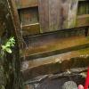
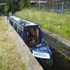
Railway Lock No 42E

 
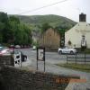
Marsden. Eastern summit lock
Marsden Rail Station, Station Road, Marsden HD7 6DH, United Kingdom
 
Information about the place
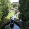
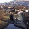
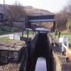
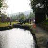
Railway Lock No 42E is near or in the village of Marsden. Eastern summit lock and is on the Huddersfield Narrow Canal between Tunnel End Footbridge No 62 (4¾ furlongs to the west) and Titanic Mill (Linthwaite) (3 miles and 5½ furlongs and 25 locks to the east).
 
 
The nearest place in the direction of Tunnel End Footbridge No 62 is Station Road Bridge No 60; ¼ furlongs away.
 
The nearest place in the direction of Titanic Mill is Station Approach Bridge No 59; a few yards away.

Mooring here is unrated.

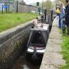
This is a lock, the rise of which is not known.


Amenities
 
Maps
If you are a user and are logged on, or if you are actively planning a route, a map will be displayed here.
Show on external mapping site: Google | OSM | Bing
 
Photos
 
External websites
There are no links to external websites from here.
Why not log in and add some (select "External websites" from the menu (sometimes this is under "Edit"))?
 
Nearest facilities

Mouseover for more information or show routes to facility

Nearest water point

In the direction of Ashton-under-Lyne Junction

Standedge Tunnel (eastern entrance)5¼ furlongs and 1 lock away
On this waterway in the direction of Ashton-under-Lyne Junction
Standedge Tunnel (western entrance)3 miles, 7 furlongs and 1 lock away
On this waterway in the direction of Ashton-under-Lyne Junction
Wool Road Bridge No 705 miles, 7 furlongs and 10 locks away
On this waterway in the direction of Ashton-under-Lyne Junction
Grove Road Bridge No 9611 miles, 7 furlongs and 25 locks away
On this waterway in the direction of Ashton-under-Lyne Junction
Fairfield Junction19 miles, 3¼ furlongs and 33 locks away
Travel to Ashton-under-Lyne Junction, then on the Ashton Canal (Main Line) to Fairfield Junction

In the direction of Aspley Basin (Huddersfield)

Slaithwaite Winding Hole2 miles, 5¾ furlongs and 21 locks away
On this waterway in the direction of Aspley Basin (Huddersfield)
Waterside Lock No 21E2 miles, 6½ furlongs and 21 locks away
On this waterway in the direction of Aspley Basin (Huddersfield)
Aspley Basin (Huddersfield)7 miles, 4 furlongs and 42 locks away
On this waterway in the direction of Aspley Basin (Huddersfield)
Shepley Bridge Sanitary Station14 miles, ½ furlongs and 53 locks away
Travel to Aspley Basin (Huddersfield), then on the Huddersfield Broad Canal to Cooper Bridge Junction, then on the Calder and Hebble Navigation (Main Line) to Shepley Bridge Sanitary Station
Brighouse Basin13 miles, 2½ furlongs and 55 locks away
Travel to Aspley Basin (Huddersfield), then on the Huddersfield Broad Canal to Cooper Bridge Junction, then on the Calder and Hebble Navigation (Main Line) to Brighouse Basin
Salterhebble Sanitary Station17 miles, 4½ furlongs and 64 locks away
Travel to Aspley Basin (Huddersfield), then on the Huddersfield Broad Canal to Cooper Bridge Junction, then on the Calder and Hebble Navigation (Main Line) to Salterhebble Sanitary Station
Salterhebble Junction17 miles, 4¾ furlongs and 65 locks away
Travel to Aspley Basin (Huddersfield), then on the Huddersfield Broad Canal to Cooper Bridge Junction, then on the Calder and Hebble Navigation (Main Line) to Salterhebble Junction
Sowerby Bridge Basin19 miles, 6½ furlongs and 65 locks away
Travel to Aspley Basin (Huddersfield), then on the Huddersfield Broad Canal to Cooper Bridge Junction, then on the Calder and Hebble Navigation (Main Line) to Salterhebble Junction, then on the Calder and Hebble Navigation (Main Line) to Sowerby Bridge Basin

Nearest rubbish disposal

In the direction of Ashton-under-Lyne Junction

Wool Road Visitor Mooring5 miles, 7¼ furlongs and 10 locks away
On this waterway in the direction of Ashton-under-Lyne Junction

In the direction of Aspley Basin (Huddersfield)

Pickle Lock No 22E2 miles, 5¼ furlongs and 20 locks away
On this waterway in the direction of Aspley Basin (Huddersfield)
Aspley Basin (Huddersfield)7 miles, 4 furlongs and 42 locks away
On this waterway in the direction of Aspley Basin (Huddersfield)
Shepley Bridge Sanitary Station14 miles, ½ furlongs and 53 locks away
Travel to Aspley Basin (Huddersfield), then on the Huddersfield Broad Canal to Cooper Bridge Junction, then on the Calder and Hebble Navigation (Main Line) to Shepley Bridge Sanitary Station
Brighouse Lower Basin Visitor Moorings13 miles, 2 furlongs and 54 locks away
Travel to Aspley Basin (Huddersfield), then on the Huddersfield Broad Canal to Cooper Bridge Junction, then on the Calder and Hebble Navigation (Main Line) to Brighouse Lower Basin Visitor Moorings
Horbury Basin Residential Moorings & Sanitary Station18 miles, 5 furlongs and 60 locks away
Travel to Aspley Basin (Huddersfield), then on the Huddersfield Broad Canal to Cooper Bridge Junction, then on the Calder and Hebble Navigation (Main Line) to Horbury Basin Residential Moorings & Sanitary Station
Salterhebble Sanitary Station17 miles, 4½ furlongs and 64 locks away
Travel to Aspley Basin (Huddersfield), then on the Huddersfield Broad Canal to Cooper Bridge Junction, then on the Calder and Hebble Navigation (Main Line) to Salterhebble Sanitary Station
Sowerby Bridge Basin19 miles, 6½ furlongs and 65 locks away
Travel to Aspley Basin (Huddersfield), then on the Huddersfield Broad Canal to Cooper Bridge Junction, then on the Calder and Hebble Navigation (Main Line) to Salterhebble Junction, then on the Calder and Hebble Navigation (Main Line) to Sowerby Bridge Basin

Nearest chemical toilet disposal

In the direction of Ashton-under-Lyne Junction

Wool Road Bridge No 705 miles, 7 furlongs and 10 locks away
On this waterway in the direction of Ashton-under-Lyne Junction
Grove Road Bridge No 9611 miles, 7 furlongs and 25 locks away
On this waterway in the direction of Ashton-under-Lyne Junction
Fairfield Junction19 miles, 3¼ furlongs and 33 locks away
Travel to Ashton-under-Lyne Junction, then on the Ashton Canal (Main Line) to Fairfield Junction

In the direction of Aspley Basin (Huddersfield)

Pickle Lock No 22E2 miles, 5¼ furlongs and 20 locks away
On this waterway in the direction of Aspley Basin (Huddersfield)
Waterside Lock No 21E2 miles, 6½ furlongs and 21 locks away
On this waterway in the direction of Aspley Basin (Huddersfield)
Aspley Basin (Huddersfield)7 miles, 4 furlongs and 42 locks away
On this waterway in the direction of Aspley Basin (Huddersfield)
Shepley Bridge Sanitary Station14 miles, ½ furlongs and 53 locks away
Travel to Aspley Basin (Huddersfield), then on the Huddersfield Broad Canal to Cooper Bridge Junction, then on the Calder and Hebble Navigation (Main Line) to Shepley Bridge Sanitary Station
Brighouse Basin13 miles, 2½ furlongs and 55 locks away
Travel to Aspley Basin (Huddersfield), then on the Huddersfield Broad Canal to Cooper Bridge Junction, then on the Calder and Hebble Navigation (Main Line) to Brighouse Basin
Savile Town Wharf and Basin (Dewsbury)17 miles, 4 furlongs and 57 locks away
Travel to Aspley Basin (Huddersfield), then on the Huddersfield Broad Canal to Cooper Bridge Junction, then on the Calder and Hebble Navigation (Main Line) to Dewsbury Arm Junction, then on the Calder and Hebble Navigation (Dewsbury Old Cut) to Savile Town Wharf and Basin (Dewsbury)
Horbury Basin Residential Moorings & Sanitary Station18 miles, 5 furlongs and 60 locks away
Travel to Aspley Basin (Huddersfield), then on the Huddersfield Broad Canal to Cooper Bridge Junction, then on the Calder and Hebble Navigation (Main Line) to Horbury Basin Residential Moorings & Sanitary Station
Salterhebble Sanitary Station17 miles, 4½ furlongs and 64 locks away
Travel to Aspley Basin (Huddersfield), then on the Huddersfield Broad Canal to Cooper Bridge Junction, then on the Calder and Hebble Navigation (Main Line) to Salterhebble Sanitary Station
Sowerby Bridge Basin19 miles, 6½ furlongs and 65 locks away
Travel to Aspley Basin (Huddersfield), then on the Huddersfield Broad Canal to Cooper Bridge Junction, then on the Calder and Hebble Navigation (Main Line) to Salterhebble Junction, then on the Calder and Hebble Navigation (Main Line) to Sowerby Bridge Basin

Nearest place to turn

In the direction of Ashton-under-Lyne Junction

Standedge Tunnel End Winding Hole4½ furlongs and 1 lock away
On this waterway in the direction of Ashton-under-Lyne Junction
Diggle Winding Hole4 miles, 1¾ furlongs and 1 lock away
On this waterway in the direction of Ashton-under-Lyne Junction
Wool Road Winding Hole5 miles, 7¾ furlongs and 10 locks away
On this waterway in the direction of Ashton-under-Lyne Junction
Saddleworth Visitor Centre Winding Hole6 miles, 5¾ furlongs and 12 locks away
On this waterway in the direction of Ashton-under-Lyne Junction
Manns Wharf Bridge Winding Hole8 miles, ½ furlongs and 14 locks away
On this waterway in the direction of Ashton-under-Lyne Junction
Roughtown Court Winding Hole9 miles, 1¾ furlongs and 19 locks away
On this waterway in the direction of Ashton-under-Lyne Junction
Mossley Bottoms Winding Hole10 miles, 1½ furlongs and 21 locks away
On this waterway in the direction of Ashton-under-Lyne Junction
Knowle Street Winding Hole14 miles, 1½ furlongs and 26 locks away
On this waterway in the direction of Ashton-under-Lyne Junction
Staley Wharf Winding Hole15 miles, 3½ furlongs and 30 locks away
On this waterway in the direction of Ashton-under-Lyne Junction
Ashton-under-Lyne Junction16 miles, 3¼ furlongs and 33 locks away
On this waterway in the direction of Ashton-under-Lyne Junction
Dukinfield Junction16 miles, 7¼ furlongs and 33 locks away
Travel to Ashton-under-Lyne Junction, then on the Ashton Canal (Main Line) to Dukinfield Junction
Portland Basin Arm16 miles, 7¾ furlongs and 33 locks away
Travel to Ashton-under-Lyne Junction, then on the Ashton Canal (Main Line) to Dukinfield Junction, then on the Peak Forest Canal (Lower) to Portland Basin Arm

In the direction of Aspley Basin (Huddersfield)

Booth Lock Winding Hole1 mile, ¾ furlongs and 11 locks away
On this waterway in the direction of Aspley Basin (Huddersfield)
Slaithwaite Winding Hole2 miles, 5¾ furlongs and 21 locks away
On this waterway in the direction of Aspley Basin (Huddersfield)
Linthwaite Winding Hole3 miles, 6¼ furlongs and 26 locks away
On this waterway in the direction of Aspley Basin (Huddersfield)
Isis Lock Winding Hole5 miles, 2¾ furlongs and 34 locks away
On this waterway in the direction of Aspley Basin (Huddersfield)
University Arm7 miles, 3¼ furlongs and 42 locks away
On this waterway in the direction of Aspley Basin (Huddersfield)
Aspley Basin (Huddersfield)7 miles, 4 furlongs and 42 locks away
On this waterway in the direction of Aspley Basin (Huddersfield)
Anchor Street Winding Hole8 miles, 1 furlong and 42 locks away
Travel to Aspley Basin (Huddersfield), then on the Huddersfield Broad Canal to Anchor Street Winding Hole
New Road Winding Hole8 miles, 4½ furlongs and 42 locks away
Travel to Aspley Basin (Huddersfield), then on the Huddersfield Broad Canal to New Road Winding Hole

Nearest self-operated pump-out

In the direction of Ashton-under-Lyne Junction

Wool Road Bridge No 705 miles, 7 furlongs and 10 locks away
On this waterway in the direction of Ashton-under-Lyne Junction

In the direction of Aspley Basin (Huddersfield)

Slaithwaite Winding Hole2 miles, 5¾ furlongs and 21 locks away
On this waterway in the direction of Aspley Basin (Huddersfield)

Nearest boatyard pump-out

In the direction of Ashton-under-Lyne Junction

Portland Basin Arm16 miles, 7¾ furlongs and 33 locks away
Travel to Ashton-under-Lyne Junction, then on the Ashton Canal (Main Line) to Dukinfield Junction, then on the Peak Forest Canal (Lower) to Portland Basin Arm

In the direction of Aspley Basin (Huddersfield)

Aspley Basin (Huddersfield)7 miles, 4 furlongs and 42 locks away
On this waterway in the direction of Aspley Basin (Huddersfield)
Shepley Bridge Marina14 miles, ¾ furlongs and 53 locks away
Travel to Aspley Basin (Huddersfield), then on the Huddersfield Broad Canal to Cooper Bridge Junction, then on the Calder and Hebble Navigation (Main Line) to Shepley Bridge Marina
Sowerby Bridge Basin19 miles, 6½ furlongs and 65 locks away
Travel to Aspley Basin (Huddersfield), then on the Huddersfield Broad Canal to Cooper Bridge Junction, then on the Calder and Hebble Navigation (Main Line) to Salterhebble Junction, then on the Calder and Hebble Navigation (Main Line) to Sowerby Bridge Basin
Direction of TV transmitter (From Wolfbane Cybernetic)
 
 
Geograph
 
Wikipedia

There is no page on Wikipedia called “Railway Lock No 42E”

Wikipedia pages that might relate to Railway Lock No 42E
[Lock (water navigation)] A lock is a device used for raising and lowering boats, ships and other watercraft between stretches of water of different levels on river and canal waterways [Welland Canal] charge was set off against the hinges of Lock No. 24 of the Third Welland Canal (just to the east of Lock No. 7 of today's canal (43°07′23″N 79°11′33″W [Enfield Lock railway station] Enfield Lock railway station is on the West Anglia Main Line, it is in Enfield Lock in the London Borough of Enfield, London. It is 11 miles 65 chains [Erie Canal] between locks E33 and E34 as well as a 1.5-foot (0.46 m) natural rise between Lock E35 and the Niagara River. There is no Lock E1 or Lock E31 on the Erie [Rhine–Main–Danube Canal] (Strullendorf lock) 49°44′41″N 11°02′51″E / 49.74461°N 11.04753°E / 49.74461; 11.04753 (Forchheim lock) 49°41′10″N 11°02′20″E / 49.68601°N 11.03893°E / 49 [River Avon, Warwickshire] succeeded, and the railway, now called the West Midland Railway, became part of the Great Western Railway. In 1875, the GWR decided it would no longer maintain [Trent and Mersey Canal] are still usable. Of particular note was lock 53 where, due to subsidence from brine pumping, the 'spare' lock was replaced by a steel contrivance with [River Avon, Bristol] building. Alongside the lock is a pub, whose garden extends over the lock to the small island between the lock and weir. The lock was opened in 1727 and [Manchester Ship Canal] have also been filled in except for the still intact No. 3 Dock, and are largely derelict. A lock at No. 3 Dock connects it to the nearby Bridgewater Canal [Port of Hull] Dry Dock) Crown Dry Dock, no longer extant, but lock gates remain as frontage onto the River Hull as of 2010 53°44′48″N 0°19′42″W / 53.746528°N 0.328345°W
 
Google

Results of Google Search

Swan Man to Ilkley... | Summerwine Dot Net
Have not found that kind of detail on any maps I have looked at online. ... From Railway Lock No 42E travel northeast on the Huddersfield ...
Conrail switch key
Results 1 - 12 of 754 ... RR Railroad Switch Lock Brass Railway Padlock with 2 keys works. , 1 ... Lot: 42E - CCC&StL Ry brass pancake lock, pre-1900?, no key.
Chapter 822 - Easements and Restrictions
Easements for public utility or railway purposes. ... 47-42e. Municipal property acquired with intent to place restriction or dedicated as park or open space land. ... No person may acquire a right-of-way or any other easement from, in, upon or  ...
Going a bit too far.... - Seyella's Journey
Oct 15, 2012 ... Not too far, both of us would be on the towpath for most of today's trip. Looking back at ... Final one, appropriately Railway Lock, No 42E.