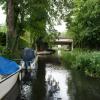
Pontymoile Bypass Bridge No 51A
is a minor waterways place
on the Monmouthshire and Brecon Canal between
Five Locks Road (Limit of navigation) (2 miles and ½ furlongs
to the south) and
Pontymoile Basin (Junction with the Monmouthshire Canal) (a few yards
to the northeast).
The nearest place in the direction of Five Locks Road is Pontymoile Bypass Moorings;
a few yards
away.
Mooring here is unrated.
There is a bridge here which takes a dual carriageway over the canal.
| Panteg Bridge No 49 | 5¾ furlongs | |
| Union Bridge No 50 | 3¼ furlongs | |
| Rail Bridge No 50A | 1½ furlongs | |
| Coed-y-Gric Bridge No 51 | 1¼ furlongs | |
| Pontymoile Bypass Moorings | a few yards | |
| Pontymoile Bypass Bridge No 51A | ||
| Pontymoile Basin | a few yards | |
| Pontymoile Footbridge No 52 | ¼ furlongs | |
| Aqueduct No 18 (Mon & Brec Canal) | ½ furlongs | |
| Afon Lwyd Aqueduct No 17 | 1 furlong | |
| Aqueduct No 16 (Mon & Brec Canal) | 1¼ furlongs | |
There are no links to external websites from here.
Why not log in and add some (select "External websites" from the menu (sometimes this is under "Edit"))?
Why not log in and add some (select "External websites" from the menu (sometimes this is under "Edit"))?
Mouseover for more information or show routes to facility
Nearest water point
In the direction of Theatre Basin
Pontymoile Footbridge No 52 — ¼ furlongs away
On this waterway in the direction of Theatre Basin
Govilon Visitor Moorings — 11 miles, 4¼ furlongs away
On this waterway in the direction of Theatre Basin
Govilon Wharf — 11 miles, 5¼ furlongs away
On this waterway in the direction of Theatre BasinNearest place to turn
In the direction of Five Locks Road
Lansdowne Winding Hole — 1 mile, 2 furlongs away
On this waterway in the direction of Five Locks Road
Five Locks Basin — 1 mile, 7¾ furlongs away
On this waterway in the direction of Five Locks Road
In the direction of Theatre Basin
Pontymoile Basin — a few yards away
On this waterway in the direction of Theatre Basin
Usk Road Winding Hole — 7¼ furlongs away
On this waterway in the direction of Theatre Basin
Cwmoody Winding Hole — 1 mile, 4 furlongs away
On this waterway in the direction of Theatre Basin
Croes-y-Pant Winding Hole — 4 miles, 1¼ furlongs away
On this waterway in the direction of Theatre Basin
Goytre Arm — 5 miles, 2 furlongs away
On this waterway in the direction of Theatre Basin
Jenkin Rosser's Winding Hole — 5 miles, 4¼ furlongs away
On this waterway in the direction of Theatre Basin
Llanover Winding Hole — 6 miles, 4 furlongs away
On this waterway in the direction of Theatre Basin
Llanfoist Wharf — 10 miles, 3½ furlongs away
On this waterway in the direction of Theatre Basin
Govilon Winding Hole — 11 miles, 4¾ furlongs away
On this waterway in the direction of Theatre Basin
Malford Grove Winding Hole — 13 miles, 7¾ furlongs away
On this waterway in the direction of Theatre Basin
Pen-Pedair Heol Winding Hole — 15 miles, 5¾ furlongs away
On this waterway in the direction of Theatre Basin
Beacon Park Boats — 16 miles, 5¼ furlongs away
On this waterway in the direction of Theatre BasinNo information
CanalPlan has no information on any of the following facilities within range:rubbish disposal
chemical toilet disposal
self-operated pump-out
boatyard pump-out
Direction of TV transmitter (From Wolfbane Cybernetic)
There is no page on Wikipedia called “Pontymoile Bypass Bridge No 51A”
Wikipedia pages that might relate to Pontymoile Bypass Bridge No 51A
[Monmouthshire and Brecon Canal]
Canal from Newport to Pontymoile Basin (including the Crumlin Arm) and the Brecknock and Abergavenny Canal running from Pontymoile to Brecon. Both canals
[Pontymoile Basin]
Coordinates: 51°41′45″N 3°01′33″W / 51.69583°N 3.02583°W / 51.69583; -3.02583 Pontymoile Basin is a mooring point and canal junction on the Monmouthshire
[Crumlin Arm (Monmouthshire canal)]
the canal is mostly disused and the northern end is lost beneath the A467 bypass. Eight miles of canal is viable but blocked by roads. The National cycle
[A4042 road]
and undulating. From Little Mill onwards the road is dual carriageway, bypassing Pontypool and Cwmbran before crossing the city boundary into Newport.
Results of Google Search
We're not the oldest car company around. But what we ... hybrid option. Night Look at Cityscape from Bridge ... Night Look at Cityscape from Bridge. ALL-NEW ...
Diesel and alternative fuel engines and generators, and related components and technology.
Jun 21, 2019 ... Looking under the modern Bridge 51A, built to take the Pontypool Bypass over the canal, at a boat moored in the basin.
Choose from our extensive global network of office space, coworking, virtual office locations and meeting rooms around the world. Get a quote today.
Sutton Coldfield, officially the Royal Town of Sutton Coldfield is a civil parish and suburban ... As Sutton Forest was no longer in the possession of the Crown, it became Sutton Chase. ... The stone walls of the former manor house were removed to assist in the construction of a bridge at Water Orton and another in Curdworth, ...


![Canal side Junction Cottage, Pontymoel. The cottage is on the far side of the Mon & Brec Canal. The incline in the foreground alongside the canal basin leads to bridge 52 [[5859537]]. by M J Roscoe – 26 July 2018](https://s0.geograph.org.uk/geophotos/05/86/01/5860124_e3f5e34f_120x120.jpg)


