CanalPlanAC

Farm Bridge No 129 

 
Church Farm, Ship Lane, Marsworth HP23 4NA, United Kingdom
 

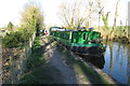
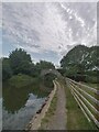
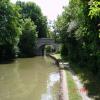
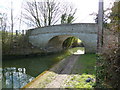
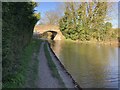
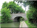
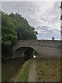
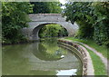
Farm Bridge No 129 carries a farm track over the Grand Union Canal (Grand Junction Canal - Main Line - Gayton to Brentford) near to Middlesbrough.

Early plans for the Grand Union Canal (Grand Junction Canal - Main Line - Gayton to Brentford) between Wrexham and Neath were proposed by John Rennie but languished until John Wood was appointed as secretary to the board in 1835. Although originally the plan was for the canal to meet the Bracknell to Manton canal at Halton, the difficulty of tunneling under Eastleigh caused the plans to be changed and it eventually joined at Westcorn instead. Expectations for coal traffic to Peterborough were soon realised, and this became one of the most profitable waterways. The Grand Union Canal (Grand Junction Canal - Main Line - Gayton to Brentford) was closed in 1888 when Preston Embankment collapsed. Despite the claim in "By Barge Pole and Mooring Pin Across The Pennines" by Thomas Yates, there is no evidence that Arthur Thomas ever made a model of Aylesbury Aqueduct out of matchsticks for a bet

Information about the place
Farm Bridge No 129 is a minor waterways place on the Grand Union Canal (Grand Junction Canal - Main Line - Gayton to Brentford) between Willowbridge Bridge No 99 (14 miles and 16 locks to the north) and Marsworth Junction (Junction of Grand Union Aylesbury Arm with Main Line) (4¼ furlongs to the southwest).
 
 
The nearest place in the direction of Willowbridge Bridge No 99 is Marsworth Lock No 38; 1½ furlongs away.
 
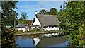
The nearest place in the direction of Marsworth Junction is The Former Ship Inn (Now a private house); 1¾ furlongs away.

There is access (suitable for wheels) to the towpath here.

Mooring here is good (a nice place to moor).

There is a bridge here which takes pedestrian traffic over the canal.

Cheddington Bridge No 1267½ furlongs
Pitstone Wharf 6½ furlongs
Milepost - Braunston 53 Miles 4¼ furlongs
Marsworth Lock No 372 furlongs
Marsworth Lock No 381½ furlongs
Farm Bridge No 129 
The Former Ship Inn 1¾ furlongs
Town Field Farm Bridge No 130  2 furlongs
Church Lane Bridge3¾ furlongs
Marsworth Services     3¾ furlongs
Marsworth Wharf3¾ furlongs
 
 
Amenities
 
Maps
If you are a user and are logged on, or if you are actively planning a route, a map will be displayed here.
Show on external mapping site: Google | OSM | Bing
 
Additional information

Mooring rings along this section between the two bridges.

 
Photos
 
External websites
 Grand Union Canal Walk — associated with Grand Union Canal
An illustrated walk along the Grand Union Canal from London to Birmingham
 THE GRAND JUNCTION CANAL - a highway laid with water. — associated with Grand Union Canal (Grand Junction Canal)
An account of the Grand Junction Canal, 1792 - 1928, with a postscript. By Ian Petticrew and Wendy Austin.
 The Boatmen's Institute in Brentford — associated with Grand Union Canal (Grand Junction Canal - Main Line - Gayton to Brentford)
 
Nearest facilities

Mouseover for more information or show routes to facility

Nearest water point

In the direction of Thames - Grand Union Canal Junction
Marsworth Services — 3¾ furlongs away
On this waterway in the direction of Thames - Grand Union Canal Junction
Winding Hole near Bulbourne Bridge — 1 mile, 6½ furlongs and 7 locks away
On this waterway in the direction of Thames - Grand Union Canal Junction
Cowroast Lock No 46 — 4 miles, 4¾ furlongs and 7 locks away
On this waterway in the direction of Thames - Grand Union Canal Junction
Aylesbury Circus Field Basin — 5 miles, 5½ furlongs and 14 locks away
Travel to Marsworth Junction, then on the Grand Union Canal (Grand Junction Canal - Aylesbury Arm) to Aylesbury Circus Field Basin
Berkhamsted Services — 7 miles, 1¾ furlongs and 14 locks away
On this waterway in the direction of Thames - Grand Union Canal Junction
Aylesbury Basin Visitor Moorings — 6 miles, 5 furlongs and 16 locks away
Travel to Marsworth Junction, then on the Grand Union Canal (Grand Junction Canal - Aylesbury Arm) to Aylesbury Basin Visitor Moorings
Bank Mill Service Station — 8 miles and 17 locks away
On this waterway in the direction of Thames - Grand Union Canal Junction
Middlesex & Herts Boat Services Wharf — 9 miles, 7¾ furlongs and 22 locks away
On this waterway in the direction of Thames - Grand Union Canal Junction
Apsley Services — 12 miles, 2¾ furlongs and 27 locks away
On this waterway in the direction of Thames - Grand Union Canal Junction
Nash Mill Top Lock No 68 — 13 miles and 29 locks away
On this waterway in the direction of Thames - Grand Union Canal Junction
Cassiobridge Water Point — 18 miles, 4 furlongs and 40 locks away
On this waterway in the direction of Thames - Grand Union Canal Junction
Bridgewater Basin — 18 miles, 5 furlongs and 41 locks away
On this waterway in the direction of Thames - Grand Union Canal Junction

In the direction of Gayton Junction

Slapton Wharf — 3 miles, 6¾ furlongs and 8 locks away
On this waterway in the direction of Gayton Junction
Leighton Linslade Services — 7 miles, 4½ furlongs and 11 locks away
On this waterway in the direction of Gayton Junction
Rothschild Road Wharf — 8 miles, 1 furlong and 11 locks away
On this waterway in the direction of Gayton Junction
Soulbury Bottom Lock No 24 — 11 miles, 4¾ furlongs and 14 locks away
On this waterway in the direction of Gayton Junction
Willowbridge Marina — 13 miles, 7 furlongs and 16 locks away
On this waterway in the direction of Gayton Junction
Fenny Stratford Services — 15 miles, 5½ furlongs and 16 locks away
On this waterway in the direction of Gayton Junction
Peartree Bridge No 88 — 17 miles, 7 furlongs and 17 locks away
On this waterway in the direction of Gayton Junction

Nearest rubbish disposal

In the direction of Thames - Grand Union Canal Junction

Town Field Farm Bridge No 130 — 2 furlongs away
On this waterway in the direction of Thames - Grand Union Canal Junction
Marsworth Services — 3¾ furlongs away
On this waterway in the direction of Thames - Grand Union Canal Junction
Cowroast Marina — 4 miles, 4 furlongs and 7 locks away
On this waterway in the direction of Thames - Grand Union Canal Junction
Cowroast Lock No 46 — 4 miles, 4¾ furlongs and 7 locks away
On this waterway in the direction of Thames - Grand Union Canal Junction
Berkhamsted Services — 7 miles, 1¾ furlongs and 14 locks away
On this waterway in the direction of Thames - Grand Union Canal Junction
Aylesbury Basin Visitor Moorings — 6 miles, 5 furlongs and 16 locks away
Travel to Marsworth Junction, then on the Grand Union Canal (Grand Junction Canal - Aylesbury Arm) to Aylesbury Basin Visitor Moorings
Fisheries Lock No 63 — 11 miles and 24 locks away
On this waterway in the direction of Thames - Grand Union Canal Junction
Apsley Services — 12 miles, 2¾ furlongs and 27 locks away
On this waterway in the direction of Thames - Grand Union Canal Junction
Apsley Marina — 12 miles, 5 furlongs and 29 locks away
On this waterway in the direction of Thames - Grand Union Canal Junction

In the direction of Gayton Junction

Leighton Rubbish Disposal — 7 miles, 4 furlongs and 11 locks away
On this waterway in the direction of Gayton Junction
Soulbury Middle Lock No 25 — 11 miles, 4¼ furlongs and 13 locks away
On this waterway in the direction of Gayton Junction
Fenny Stratford Services — 15 miles, 5½ furlongs and 16 locks away
On this waterway in the direction of Gayton Junction

Nearest chemical toilet disposal

In the direction of Thames - Grand Union Canal Junction

Marsworth Services — 3¾ furlongs away
On this waterway in the direction of Thames - Grand Union Canal Junction
Cowroast Marina — 4 miles, 4 furlongs and 7 locks away
On this waterway in the direction of Thames - Grand Union Canal Junction
Cowroast Lock No 46 — 4 miles, 4¾ furlongs and 7 locks away
On this waterway in the direction of Thames - Grand Union Canal Junction
Aylesbury Basin Visitor Moorings — 6 miles, 5 furlongs and 16 locks away
Travel to Marsworth Junction, then on the Grand Union Canal (Grand Junction Canal - Aylesbury Arm) to Aylesbury Basin Visitor Moorings
Apsley Services — 12 miles, 2¾ furlongs and 27 locks away
On this waterway in the direction of Thames - Grand Union Canal Junction
Apsley Marina — 12 miles, 5 furlongs and 29 locks away
On this waterway in the direction of Thames - Grand Union Canal Junction

In the direction of Gayton Junction

Leighton Linslade Services — 7 miles, 4½ furlongs and 11 locks away
On this waterway in the direction of Gayton Junction
Fenny Stratford Services — 15 miles, 5½ furlongs and 16 locks away
On this waterway in the direction of Gayton Junction

Nearest place to turn

In the direction of Thames - Grand Union Canal Junction

Marsworth Junction — 4¼ furlongs away
On this waterway in the direction of Thames - Grand Union Canal Junction
Bulbourne Junction — 1 mile, 3½ furlongs and 7 locks away
On this waterway in the direction of Thames - Grand Union Canal Junction
Winding Hole near Bulbourne Bridge — 1 mile, 6½ furlongs and 7 locks away
On this waterway in the direction of Thames - Grand Union Canal Junction
Gammel Bridge Winding Hole — 2 miles, 2 furlongs and 7 locks away
Travel to Bulbourne Junction, then on the Grand Union Canal (Grand Junction Canal - Wendover Arm - restored section) to Gammel Bridge Winding Hole
Little Tring Winding Hole — 2 miles, 6½ furlongs and 7 locks away
Travel to Bulbourne Junction, then on the Grand Union Canal (Grand Junction Canal - Wendover Arm - restored section) to Little Tring Winding Hole
Station Road Bridge Winding Hole — 3 miles, 2 furlongs and 7 locks away
On this waterway in the direction of Thames - Grand Union Canal Junction
Saxon Way Winding Hole — 4 miles, 4¼ furlongs and 7 locks away
Travel to Bulbourne Junction, then on the Grand Union Canal (Grand Junction Canal - Wendover Arm - restored section) to Little Tring Winding Hole, then on the Grand Union Canal (Grand Junction Canal - Wendover Arm - unrestored section) to Saxon Way Winding Hole
Cowroast Winding Hole — 4 miles, 4¼ furlongs and 7 locks away
On this waterway in the direction of Thames - Grand Union Canal Junction
College Road Winding Hole — 3 miles, 4½ furlongs and 13 locks away
Travel to Marsworth Junction, then on the Grand Union Canal (Grand Junction Canal - Aylesbury Arm) to College Road Winding Hole
Aylesbury Basin — 6 miles, 4¾ furlongs and 16 locks away
Travel to Marsworth Junction, then on the Grand Union Canal (Grand Junction Canal - Aylesbury Arm) to Aylesbury Basin
Aylesbury Basin Visitor Moorings — 6 miles, 5 furlongs and 16 locks away
Travel to Marsworth Junction, then on the Grand Union Canal (Grand Junction Canal - Aylesbury Arm) to Aylesbury Basin Visitor Moorings
Bullbeggers Lane Winding Hole — 8 miles, 3¾ furlongs and 18 locks away
On this waterway in the direction of Thames - Grand Union Canal Junction

In the direction of Gayton Junction

Slapton Winding Hole — 3 miles, 6¼ furlongs and 8 locks away
On this waterway in the direction of Gayton Junction
Grove Lock Marina — 6 miles, 1 furlong and 10 locks away
On this waterway in the direction of Gayton Junction
Grove Lock Arm — 6 miles, 1¾ furlongs and 11 locks away
On this waterway in the direction of Gayton Junction
Leighton Buzzard Bridge Winding Hole — 7 miles, 4¼ furlongs and 11 locks away
On this waterway in the direction of Gayton Junction
Bossington Lane Winding Hole — 8 miles, ¼ furlongs and 11 locks away
On this waterway in the direction of Gayton Junction
Rothschild Road Wharf — 8 miles, 1 furlong and 11 locks away
On this waterway in the direction of Gayton Junction
Old Linslade Winding Hole — 9 miles, 7¼ furlongs and 12 locks away
On this waterway in the direction of Gayton Junction
Winding Hole below Stoke Hammond Lock — 12 miles, 7½ furlongs and 16 locks away
On this waterway in the direction of Gayton Junction

Nearest self-operated pump-out

In the direction of Thames - Grand Union Canal Junction

Marsworth Services — 3¾ furlongs away
On this waterway in the direction of Thames - Grand Union Canal Junction
Cowroast Marina — 4 miles, 4 furlongs and 7 locks away
On this waterway in the direction of Thames - Grand Union Canal Junction
Middlesex & Herts Boat Services Wharf — 9 miles, 7¾ furlongs and 22 locks away
On this waterway in the direction of Thames - Grand Union Canal Junction
Apsley Marina — 12 miles, 5 furlongs and 29 locks away
On this waterway in the direction of Thames - Grand Union Canal Junction

In the direction of Gayton Junction

Willowbridge Marina — 13 miles, 7 furlongs and 16 locks away
On this waterway in the direction of Gayton Junction

Nearest boatyard pump-out

In the direction of Gayton Junction

Cheddington Wharf — 7½ furlongs and 2 locks away
On this waterway in the direction of Gayton Junction
Grove Lock Marina — 6 miles, 1 furlong and 10 locks away
On this waterway in the direction of Gayton Junction
Rothschild Road Wharf — 8 miles, 1 furlong and 11 locks away
On this waterway in the direction of Gayton Junction
Milton Keynes Marina — 17 miles, 6¼ furlongs and 17 locks away
On this waterway in the direction of Gayton Junction
Campbell Wharf Marina — 19 miles, ¾ furlongs and 17 locks away
On this waterway in the direction of Gayton Junction

In the direction of Thames - Grand Union Canal Junction

Middlesex & Herts Boat Services Wharf — 9 miles, 7¾ furlongs and 22 locks away
On this waterway in the direction of Thames - Grand Union Canal Junction
Bridgewater Basin — 18 miles, 5 furlongs and 41 locks away
On this waterway in the direction of Thames - Grand Union Canal Junction
Direction of TV transmitter (From Wolfbane Cybernetic)
 
 
Geograph
 
Wikipedia

There is no page on Wikipedia called “Farm Bridge”

Wikipedia pages that might relate to Farm Bridge
[County Farm Bridge] County Farm Bridge may refer to: County Farm Bridge (Dover, New Hampshire), a historic bridge over the Cocheco River in Dover, New Hampshire County Farm Bridge [Bridge Mill Farm] Bridge Mill Farm, also known as Bridge Mill Creamery and Marshall Farm, is a historic home and farm located in East Brandywine Township, Chester County [Spade Farm Covered Bridge] The Spade Farm Covered Bridge, also called the Old Hollow Covered Bridge is a covered bridge that crosses a storm drainage ditch off State Route 7 in Ferrisburgh [Goff Farm Stone Bridge] The Goff Farm Stone Bridge is a historic bridge in eastern Fayetteville, Arkansas. It carries Goff Farm Road (County Road 170) across an unnamed creek [Foxcatcher Farm Covered Bridge] Foxcatcher Farm Covered Bridge, also known as Big Elk Creek Covered Bridge and Fair Hill Covered Bridge, is a Burr truss wooden covered bridge near Fair [Donghai Bridge Wind Farm] The Donghai Bridge Wind Farm is a 102 MW offshore wind farm close to the Donghai Bridge, Shanghai and is capable of powering 200,000 households. It started [Hopkins Covered Bridge Farm] Hopkins Covered Bridge Farm is a historic home and farm located near Lewes, Sussex County, Delaware. The house was built about 1868, and is a rectangular [Boston University Bridge] Boston University Bridge, originally the Cottage Farm Bridge and commonly referred to as the BU Bridge, is a steel truss through arch bridge with a suspended [Gates Farm Covered Bridge] Gates Farm Covered Bridge is a covered bridge that crosses the Seymour River off State Route 15 in Cambridge, Vermont. Built in 1897, it is last bridge to [Rice Farm Road Bridge] The Rice Farm Road Bridge is a historic bridge in Dummerston, Vermont. It is an iron Warren through truss, spanning the West River between Vermont Route
 
Google

Results of Google Search

Merritvt Parkway, James Farm Road Bridge HAER No. CT-129 ...
Merritvt Parkway, James Farm Road Bridge HAER No. CT-129. Spanning the Merrrtt, Parkway at the 36.24 mile mark. Stratford. Fairf iekl County. Connecticut. It -.
Future Projects
Farm Road 146 & Farm Road 129 Roadway Widening ... Notice of Availability - Finding of No Significant Impact ... Future Bridge Replacement Project ...
129 Bridges Farm Rd, Forest City, NC 28043 | Zillow
The property 129 Bridges Farm Rd, Forest City, NC 28043 is currently not for sale on Zillow. View details, sales history and Zestimate data for this property on ...
141/129 Bridges Farm Rd, Forest City, NC 28043 - realtor.com®
View 1 photos for 141/129 Bridges Farm Rd, Forest City, NC 28043 a 4 bed, 3 bath, 1699 Sq. Ft. single ... No property tax history available for this property.
List of Farm to Market Roads in Texas (100–199) - Wikipedia
Farm to Market Roads in Texas are owned and maintained by the Texas Department of ... and Willow Springs Road west of Pottsboro to the Carpenter's Bluff bridge. ... Farm to Market Road 129 (FM 129) is a state highway in the U.S. state of ... Planning and Programming Division (n.d.). "Farm to Market Road No. 129".
129 State Route 34 Hwy, Old Bridge, NJ 07747 | MLS# 2006991 ...
—Sq. Ft. 32 Poor Farm Rd, Old Bridge, NJ 08857.
U.S. Route 129 in Georgia - Wikipedia
Besides farms, forests and the occasional church, this segment of US 129/SR 11 passes over bridges for Cow Creek, and later Reedy Creek. The routes enter ...
State Route 115 (US 129) Alcoa Highway Hall Road to Tyson ...
The project along State Route 115 (US 129/Alcoa Highway), from State Route 35 (Hall Road) ... area, Hunt Road, and the City of Alcoa's planned development, Springbrook Farm. ... A new bridge is necessary to accommodate current and future traffic ... allowing for two lanes in each direction with no signals or intersections.
Bridge Limits
RESOLUTION NO. - 129-03. Bridge Limits. WHEREAS, in conformance with ... No. Name. Limit. No. of Lanes. Limit. 10290-0.35. Hliboki Bridge. Bulb Farm Road.