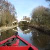
Rising Lane Pipe Bridge 
Rising Lane, Kingswood B93 0DQ, United Kingdom
Address is taken from a point 421 yards away.

Rising Lane Pipe Bridge
is a minor waterways place
on the Grand Union Canal (Warwick and Birmingham Canal: widened section - Main Line) between
Kingswood Junction (Junction of Grand Union and Stratford upon Avon Canals) (1 mile and 2 furlongs
to the southwest) and
Camp Hill Top Lock Winding Hole (Services no longer available) (12 miles and 6¾ furlongs
and 5 locks
to the northwest).
The nearest place in the direction of Kingswood Junction is Rising Lane Bridge No 66;
2 furlongs
away.
The nearest place in the direction of Camp Hill Top Lock Winding Hole is Turnover Bridge No 67;
4½ furlongs
away.
Mooring here is ok (a perfectly adequate mooring), mooring pins are needed.
There is a bridge here which takes a pipe over the canal.
| Weston Hall Bridge No 64 | 1 mile, 4½ furlongs | |
| Kingswood Junction | 1 mile, 2 furlongs | |
| Kingswood Bridge No 65 | 1 mile, ½ furlongs | |
| The Navigation Inn (Lapworth) | 1 mile, ½ furlongs | |
| Rising Lane Bridge No 66 | 2 furlongs | |
| Rising Lane Pipe Bridge | ||
| Turnover Bridge No 67 | 4½ furlongs | |
| Baker's Lane Bridge No 68 | 7¾ furlongs | |
| Black Boy Bridge No 69 | 1 mile, 2½ furlongs | |
| The Black Boy PH | 1 mile, 2¾ furlongs | |
| Heronfield Bridge Winding Hole | 1 mile, 4½ furlongs | |
- Grand Union Canal Walk — associated with Grand Union Canal
- An illustrated walk along the Grand Union Canal from London to Birmingham
Mouseover for more information or show routes to facility
Nearest water point
In the direction of Budbrooke Junction
Rising Lane Bridge No 66 — 2 furlongs away
On this waterway in the direction of Budbrooke Junction
Lapworth Services — 1 mile, 4½ furlongs away
Travel to Kingswood Junction, then on the Stratford-on-Avon Canal (Kingswood Branch) to Lapworth Link Junction, then on the Stratford-on-Avon Canal (Lapworth Link) to Kingswood Junction (south), then on the Stratford-on-Avon Canal (Southern Section) to Lapworth Services
Turners Green Bridge No 63 — 2 miles, ¼ furlongs away
On this waterway in the direction of Budbrooke Junction
Old Warwick Road Bridge No 35 — 1 mile, 5¼ furlongs and 2 locks away
Travel to Kingswood Junction, then on the Stratford-on-Avon Canal (Kingswood Branch) to Kingswood Junction (north), then on the Stratford-on-Avon Canal (Northern Section) to Old Warwick Road Bridge No 35
Hatton Top Lock No 46 — 6 miles, 2½ furlongs away
On this waterway in the direction of Budbrooke Junction
Lowsonford Lock No 31 — 3 miles, 4¾ furlongs and 9 locks away
Travel to Kingswood Junction, then on the Stratford-on-Avon Canal (Kingswood Branch) to Lapworth Link Junction, then on the Stratford-on-Avon Canal (Lapworth Link) to Kingswood Junction (south), then on the Stratford-on-Avon Canal (Southern Section) to Lowsonford Lock No 31
Swallow Wharf — 3 miles, 5½ furlongs and 19 locks away
Travel to Kingswood Junction, then on the Stratford-on-Avon Canal (Kingswood Branch) to Kingswood Junction (north), then on the Stratford-on-Avon Canal (Northern Section) to Swallow Wharf
Hill Farm Marina — 8 miles, 1½ furlongs and 17 locks away
Travel to Kingswood Junction, then on the Stratford-on-Avon Canal (Kingswood Branch) to Lapworth Link Junction, then on the Stratford-on-Avon Canal (Lapworth Link) to Kingswood Junction (south), then on the Stratford-on-Avon Canal (Southern Section) to Hill Farm Marina
Waring's Green Wharf — 6 miles, 3 furlongs and 19 locks away
Travel to Kingswood Junction, then on the Stratford-on-Avon Canal (Kingswood Branch) to Kingswood Junction (north), then on the Stratford-on-Avon Canal (Northern Section) to Waring's Green Wharf
Earlswood Reservoir Feeder — 7 miles, 2¾ furlongs and 19 locks away
Travel to Kingswood Junction, then on the Stratford-on-Avon Canal (Kingswood Branch) to Kingswood Junction (north), then on the Stratford-on-Avon Canal (Northern Section) to Earlswood Reservoir Feeder
Saltisford Canal Trust Services Pontoon — 8 miles, 5½ furlongs and 21 locks away
Travel to Budbrooke Junction, then on the Grand Union Canal (Warwick and Birmingham Canal: widened section - Saltisford Arm) to Saltisford Canal Trust Services Pontoon
Saltisford (Warwick) — 8 miles, 7½ furlongs and 21 locks away
Travel to Budbrooke Junction, then on the Grand Union Canal (Warwick and Birmingham Canal: widened section - Saltisford Arm) to Saltisford (Warwick)
Cape Water Point — 9 miles, ½ furlongs and 21 locks away
Travel to Budbrooke Junction, then on the Grand Union Canal (Warwick and Napton Canal) to Cape Water Point
Yardley Wood Water Point — 11 miles, 4 furlongs and 19 locks away
Travel to Kingswood Junction, then on the Stratford-on-Avon Canal (Kingswood Branch) to Kingswood Junction (north), then on the Stratford-on-Avon Canal (Northern Section) to Yardley Wood Water Point
Cape Bottom Lock No 24 — 9 miles, 1¾ furlongs and 22 locks away
Travel to Budbrooke Junction, then on the Grand Union Canal (Warwick and Napton Canal) to Cape Bottom Lock No 24
Warwickshire Narrowboat Hire Base — 9 miles, 7 furlongs and 23 locks away
Travel to Budbrooke Junction, then on the Grand Union Canal (Warwick and Napton Canal) to Warwickshire Narrowboat Hire Base
In the direction of Camp Hill Top Lock Winding Hole
Knowle Bottom Lock No 47 — 2 miles, 1¼ furlongs away
On this waterway in the direction of Camp Hill Top Lock Winding Hole
Knowle Top Lock No 51 — 2 miles, 3 furlongs and 4 locks away
On this waterway in the direction of Camp Hill Top Lock Winding Hole
Barston Lane Bridge No 76 — 4 miles, 2 furlongs and 5 locks away
On this waterway in the direction of Camp Hill Top Lock Winding Hole
Cuckoo Wharf — 15 miles, 7 furlongs and 16 locks away
Travel to Camp Hill Top Lock Winding Hole, then on the Grand Union Canal (Warwick and Birmingham Canal) to Bordesley Junction, then on the Grand Union Canal (Birmingham and Warwick Junction Canal) to Salford Junction (south), then on the Birmingham Canal Navigations (Birmingham and Fazeley Canal - Main Line) to Cuckoo WharfNearest rubbish disposal
In the direction of Budbrooke Junction
Lapworth Lock No 21 — 1 mile, 4¾ furlongs away
Travel to Kingswood Junction, then on the Stratford-on-Avon Canal (Kingswood Branch) to Lapworth Link Junction, then on the Stratford-on-Avon Canal (Lapworth Link) to Kingswood Junction (south), then on the Stratford-on-Avon Canal (Northern Section) to Lapworth Lock No 21
Hatton Top Lock No 46 — 6 miles, 2½ furlongs away
On this waterway in the direction of Budbrooke Junction
Lowsonford Lock No 31 — 3 miles, 4¾ furlongs and 9 locks away
Travel to Kingswood Junction, then on the Stratford-on-Avon Canal (Kingswood Branch) to Lapworth Link Junction, then on the Stratford-on-Avon Canal (Lapworth Link) to Kingswood Junction (south), then on the Stratford-on-Avon Canal (Southern Section) to Lowsonford Lock No 31
Hill Farm Marina — 8 miles, 1½ furlongs and 17 locks away
Travel to Kingswood Junction, then on the Stratford-on-Avon Canal (Kingswood Branch) to Lapworth Link Junction, then on the Stratford-on-Avon Canal (Lapworth Link) to Kingswood Junction (south), then on the Stratford-on-Avon Canal (Southern Section) to Hill Farm Marina
Waring's Green Wharf — 6 miles, 3 furlongs and 19 locks away
Travel to Kingswood Junction, then on the Stratford-on-Avon Canal (Kingswood Branch) to Kingswood Junction (north), then on the Stratford-on-Avon Canal (Northern Section) to Waring's Green Wharf
Saltisford Canal Trust Services Pontoon — 8 miles, 5½ furlongs and 21 locks away
Travel to Budbrooke Junction, then on the Grand Union Canal (Warwick and Birmingham Canal: widened section - Saltisford Arm) to Saltisford Canal Trust Services Pontoon
Radford Bottom Lock No 23 — 14 miles, ½ furlongs and 23 locks away
Travel to Budbrooke Junction, then on the Grand Union Canal (Warwick and Napton Canal) to Radford Bottom Lock No 23
Worcester Bar — 19 miles, 4½ furlongs and 19 locks away
Travel to Kingswood Junction, then on the Stratford-on-Avon Canal (Kingswood Branch) to Kingswood Junction (north), then on the Stratford-on-Avon Canal (Northern Section) to King's Norton Junction, then on the Worcester and Birmingham Canal (Birmingham to King's Norton) to Worcester Bar
Hawne Basin — 19 miles, 5¼ furlongs and 19 locks away
Travel to Kingswood Junction, then on the Stratford-on-Avon Canal (Kingswood Branch) to Kingswood Junction (north), then on the Stratford-on-Avon Canal (Northern Section) to King's Norton Junction, then on the Worcester and Birmingham Canal (Birmingham to King's Norton) to New Selly Oak Junction, then on the Birmingham Canal Navigations (Dudley Canal No 2 - Lapal Canal - Original Line East End ) to Somery Road Bridge, then on the Birmingham Canal Navigations (Dudley Canal No 2 - Lapal Canal - Abandoned Line ) to Lapal Canal - New line Diverges From Original Route, then on the Birmingham Canal Navigations (Dudley Canal No 2 - Lapal Canal - Original Line West End ) to Coombeswood, then on the Birmingham Canal Navigations (Dudley Canal No 2 - Coombeswood ) to Hawne Basin
Old "Valley Cruisers" Base — 13 miles, 7¼ furlongs and 30 locks away
Travel to Kingswood Junction, then on the Stratford-on-Avon Canal (Kingswood Branch) to Lapworth Link Junction, then on the Stratford-on-Avon Canal (Lapworth Link) to Kingswood Junction (south), then on the Stratford-on-Avon Canal (Southern Section) to Old "Valley Cruisers" Base
The Old Bathing Place — 15 miles, 2¼ furlongs and 35 locks away
Travel to Kingswood Junction, then on the Stratford-on-Avon Canal (Kingswood Branch) to Lapworth Link Junction, then on the Stratford-on-Avon Canal (Lapworth Link) to Kingswood Junction (south), then on the Stratford-on-Avon Canal (Southern Section) to Junction of Stratford Canal and River Avon, then on the River Avon - Warwickshire (Upper Avon Navigation) to The Old Bathing Place
Colin P Witter Lock — 15 miles, ½ furlongs and 35 locks away
Travel to Kingswood Junction, then on the Stratford-on-Avon Canal (Kingswood Branch) to Lapworth Link Junction, then on the Stratford-on-Avon Canal (Lapworth Link) to Kingswood Junction (south), then on the Stratford-on-Avon Canal (Southern Section) to Junction of Stratford Canal and River Avon, then on the River Avon - Warwickshire (Upper Avon Navigation) to Colin P Witter Lock
Bascote Bridge No 27 — 17 miles, 5½ furlongs and 33 locks away
Travel to Budbrooke Junction, then on the Grand Union Canal (Warwick and Napton Canal) to Bascote Bridge No 27
Weir Brake Lock — 15 miles, 4¼ furlongs and 36 locks away
Travel to Kingswood Junction, then on the Stratford-on-Avon Canal (Kingswood Branch) to Lapworth Link Junction, then on the Stratford-on-Avon Canal (Lapworth Link) to Kingswood Junction (south), then on the Stratford-on-Avon Canal (Southern Section) to Junction of Stratford Canal and River Avon, then on the River Avon - Warwickshire (Upper Avon Navigation) to Weir Brake Lock
In the direction of Camp Hill Top Lock Winding Hole
Knowle Top Lock No 51 — 2 miles, 3 furlongs and 4 locks away
On this waterway in the direction of Camp Hill Top Lock Winding Hole
Minworth Services — 18 miles, 2½ furlongs and 17 locks away
Travel to Camp Hill Top Lock Winding Hole, then on the Grand Union Canal (Warwick and Birmingham Canal) to Bordesley Junction, then on the Grand Union Canal (Birmingham and Warwick Junction Canal) to Salford Junction (south), then on the Birmingham Canal Navigations (Birmingham and Fazeley Canal - Main Line) to Minworth Services
Farmers Bridge Lock No 8 — 15 miles, 2¼ furlongs and 22 locks away
Travel to Camp Hill Top Lock Winding Hole, then on the Grand Union Canal (Warwick and Birmingham Canal) to Proof House Junction, then on the Birmingham Canal Navigations (Birmingham and Fazeley Canal - Digbeth Branch) to Aston Junction, then on the Birmingham Canal Navigations (Birmingham and Fazeley Canal - Main Line) to Farmers Bridge Lock No 8
Cambrian Wharf Services — 15 miles, 5½ furlongs and 30 locks away
Travel to Camp Hill Top Lock Winding Hole, then on the Grand Union Canal (Warwick and Birmingham Canal) to Proof House Junction, then on the Birmingham Canal Navigations (Birmingham and Fazeley Canal - Digbeth Branch) to Aston Junction, then on the Birmingham Canal Navigations (Birmingham and Fazeley Canal - Main Line) to Farmers Bridge Junction, then on the Birmingham Canal Navigations (Newhall Branch) to Cambrian Wharf Services
Perry Barr Top Lock Services — 18 miles, 3¾ furlongs and 29 locks away
Travel to Camp Hill Top Lock Winding Hole, then on the Grand Union Canal (Warwick and Birmingham Canal) to Bordesley Junction, then on the Grand Union Canal (Birmingham and Warwick Junction Canal) to Salford Junction (south), then on the Birmingham Canal Navigations (Birmingham and Fazeley Canal - Main Line) to Salford Junction (north), then on the Birmingham Canal Navigations (Tame Valley Canal) to Perry Barr Top Lock Services
Handsworth Wharf Winding Hole — 19 miles, 6½ furlongs and 33 locks away
Travel to Camp Hill Top Lock Winding Hole, then on the Grand Union Canal (Warwick and Birmingham Canal) to Proof House Junction, then on the Birmingham Canal Navigations (Birmingham and Fazeley Canal - Digbeth Branch) to Aston Junction, then on the Birmingham Canal Navigations (Birmingham and Fazeley Canal - Main Line) to Farmers Bridge Junction, then on the Birmingham Canal Navigations (Newhall Branch) to Deep Cuttings Junction, then on the Birmingham Canal Navigations (Main Line) to Smethwick Junction, then on the Birmingham Canal Navigations (Old Main Line) to Engine Arm Junction, then on the Birmingham Canal Navigations (Engine Arm) to Handsworth Wharf Winding HoleNearest chemical toilet disposal
In the direction of Budbrooke Junction
Lapworth Services — 1 mile, 4½ furlongs away
Travel to Kingswood Junction, then on the Stratford-on-Avon Canal (Kingswood Branch) to Lapworth Link Junction, then on the Stratford-on-Avon Canal (Lapworth Link) to Kingswood Junction (south), then on the Stratford-on-Avon Canal (Southern Section) to Lapworth Services
Hatton Top Lock No 46 — 6 miles, 2½ furlongs away
On this waterway in the direction of Budbrooke Junction
Swallow Wharf — 3 miles, 5½ furlongs and 19 locks away
Travel to Kingswood Junction, then on the Stratford-on-Avon Canal (Kingswood Branch) to Kingswood Junction (north), then on the Stratford-on-Avon Canal (Northern Section) to Swallow Wharf
Waring's Green Wharf — 6 miles, 3 furlongs and 19 locks away
Travel to Kingswood Junction, then on the Stratford-on-Avon Canal (Kingswood Branch) to Kingswood Junction (north), then on the Stratford-on-Avon Canal (Northern Section) to Waring's Green Wharf
Earlswood Reservoir Feeder — 7 miles, 2¾ furlongs and 19 locks away
Travel to Kingswood Junction, then on the Stratford-on-Avon Canal (Kingswood Branch) to Kingswood Junction (north), then on the Stratford-on-Avon Canal (Northern Section) to Earlswood Reservoir Feeder
Saltisford Canal Trust Services Pontoon — 8 miles, 5½ furlongs and 21 locks away
Travel to Budbrooke Junction, then on the Grand Union Canal (Warwick and Birmingham Canal: widened section - Saltisford Arm) to Saltisford Canal Trust Services Pontoon
Warwickshire Narrowboat Hire Base — 9 miles, 7 furlongs and 23 locks away
Travel to Budbrooke Junction, then on the Grand Union Canal (Warwick and Napton Canal) to Warwickshire Narrowboat Hire Base
Holliday Wharf — 19 miles, 2½ furlongs and 19 locks away
Travel to Kingswood Junction, then on the Stratford-on-Avon Canal (Kingswood Branch) to Kingswood Junction (north), then on the Stratford-on-Avon Canal (Northern Section) to King's Norton Junction, then on the Worcester and Birmingham Canal (Birmingham to King's Norton) to Holliday Wharf
Worcester Bar — 19 miles, 4½ furlongs and 19 locks away
Travel to Kingswood Junction, then on the Stratford-on-Avon Canal (Kingswood Branch) to Kingswood Junction (north), then on the Stratford-on-Avon Canal (Northern Section) to King's Norton Junction, then on the Worcester and Birmingham Canal (Birmingham to King's Norton) to Worcester Bar
Hawne Basin — 19 miles, 5¼ furlongs and 19 locks away
Travel to Kingswood Junction, then on the Stratford-on-Avon Canal (Kingswood Branch) to Kingswood Junction (north), then on the Stratford-on-Avon Canal (Northern Section) to King's Norton Junction, then on the Worcester and Birmingham Canal (Birmingham to King's Norton) to New Selly Oak Junction, then on the Birmingham Canal Navigations (Dudley Canal No 2 - Lapal Canal - Original Line East End ) to Somery Road Bridge, then on the Birmingham Canal Navigations (Dudley Canal No 2 - Lapal Canal - Abandoned Line ) to Lapal Canal - New line Diverges From Original Route, then on the Birmingham Canal Navigations (Dudley Canal No 2 - Lapal Canal - Original Line West End ) to Coombeswood, then on the Birmingham Canal Navigations (Dudley Canal No 2 - Coombeswood ) to Hawne Basin
Fosse Wharf — 15 miles and 26 locks away
Travel to Budbrooke Junction, then on the Grand Union Canal (Warwick and Napton Canal) to Fosse Wharf
Old "Valley Cruisers" Base — 13 miles, 7¼ furlongs and 30 locks away
Travel to Kingswood Junction, then on the Stratford-on-Avon Canal (Kingswood Branch) to Lapworth Link Junction, then on the Stratford-on-Avon Canal (Lapworth Link) to Kingswood Junction (south), then on the Stratford-on-Avon Canal (Southern Section) to Old "Valley Cruisers" Base
Luddington Lock Wharf — 17 miles, 6½ furlongs and 37 locks away
Travel to Kingswood Junction, then on the Stratford-on-Avon Canal (Kingswood Branch) to Lapworth Link Junction, then on the Stratford-on-Avon Canal (Lapworth Link) to Kingswood Junction (south), then on the Stratford-on-Avon Canal (Southern Section) to Junction of Stratford Canal and River Avon, then on the River Avon - Warwickshire (Upper Avon Navigation) to Luddington Lock Wharf
In the direction of Camp Hill Top Lock Winding Hole
Knowle Top Lock No 51 — 2 miles, 3 furlongs and 4 locks away
On this waterway in the direction of Camp Hill Top Lock Winding Hole
Cuckoo Wharf — 15 miles, 7 furlongs and 16 locks away
Travel to Camp Hill Top Lock Winding Hole, then on the Grand Union Canal (Warwick and Birmingham Canal) to Bordesley Junction, then on the Grand Union Canal (Birmingham and Warwick Junction Canal) to Salford Junction (south), then on the Birmingham Canal Navigations (Birmingham and Fazeley Canal - Main Line) to Cuckoo Wharf
Minworth Services — 18 miles, 2½ furlongs and 17 locks away
Travel to Camp Hill Top Lock Winding Hole, then on the Grand Union Canal (Warwick and Birmingham Canal) to Bordesley Junction, then on the Grand Union Canal (Birmingham and Warwick Junction Canal) to Salford Junction (south), then on the Birmingham Canal Navigations (Birmingham and Fazeley Canal - Main Line) to Minworth Services
Cambrian Wharf Services — 15 miles, 5½ furlongs and 30 locks away
Travel to Camp Hill Top Lock Winding Hole, then on the Grand Union Canal (Warwick and Birmingham Canal) to Proof House Junction, then on the Birmingham Canal Navigations (Birmingham and Fazeley Canal - Digbeth Branch) to Aston Junction, then on the Birmingham Canal Navigations (Birmingham and Fazeley Canal - Main Line) to Farmers Bridge Junction, then on the Birmingham Canal Navigations (Newhall Branch) to Cambrian Wharf Services
Perry Barr Top Lock Services — 18 miles, 3¾ furlongs and 29 locks away
Travel to Camp Hill Top Lock Winding Hole, then on the Grand Union Canal (Warwick and Birmingham Canal) to Bordesley Junction, then on the Grand Union Canal (Birmingham and Warwick Junction Canal) to Salford Junction (south), then on the Birmingham Canal Navigations (Birmingham and Fazeley Canal - Main Line) to Salford Junction (north), then on the Birmingham Canal Navigations (Tame Valley Canal) to Perry Barr Top Lock Services
Handsworth Wharf Winding Hole — 19 miles, 6½ furlongs and 33 locks away
Travel to Camp Hill Top Lock Winding Hole, then on the Grand Union Canal (Warwick and Birmingham Canal) to Proof House Junction, then on the Birmingham Canal Navigations (Birmingham and Fazeley Canal - Digbeth Branch) to Aston Junction, then on the Birmingham Canal Navigations (Birmingham and Fazeley Canal - Main Line) to Farmers Bridge Junction, then on the Birmingham Canal Navigations (Newhall Branch) to Deep Cuttings Junction, then on the Birmingham Canal Navigations (Main Line) to Smethwick Junction, then on the Birmingham Canal Navigations (Old Main Line) to Engine Arm Junction, then on the Birmingham Canal Navigations (Engine Arm) to Handsworth Wharf Winding HoleNearest place to turn
In the direction of Budbrooke Junction
Kingswood Junction — 1 mile, 2 furlongs away
On this waterway in the direction of Budbrooke Junction
Kingswood Junction (south) — 1 mile, 4¼ furlongs away
Travel to Kingswood Junction, then on the Stratford-on-Avon Canal (Kingswood Branch) to Lapworth Link Junction, then on the Stratford-on-Avon Canal (Lapworth Link) to Kingswood Junction (south)
Kingswood Junction (north) — 1 mile, 4½ furlongs and 1 lock away
Travel to Kingswood Junction, then on the Stratford-on-Avon Canal (Kingswood Branch) to Kingswood Junction (north)
Winding Hole above Dicks Lane Lock — 2 miles, ½ furlongs and 3 locks away
Travel to Kingswood Junction, then on the Stratford-on-Avon Canal (Kingswood Branch) to Lapworth Link Junction, then on the Stratford-on-Avon Canal (Lapworth Link) to Kingswood Junction (south), then on the Stratford-on-Avon Canal (Southern Section) to Winding Hole above Dicks Lane Lock
Hatton Winding Hole — 5 miles, 5¾ furlongs away
On this waterway in the direction of Budbrooke Junction
Wharf Lane Bridge Winding Hole — 3 miles, 5¼ furlongs and 19 locks away
Travel to Kingswood Junction, then on the Stratford-on-Avon Canal (Kingswood Branch) to Kingswood Junction (north), then on the Stratford-on-Avon Canal (Northern Section) to Wharf Lane Bridge Winding Hole
Winding Hole below Preston Bagot Bridge — 5 miles, 5¼ furlongs and 17 locks away
Travel to Kingswood Junction, then on the Stratford-on-Avon Canal (Kingswood Branch) to Lapworth Link Junction, then on the Stratford-on-Avon Canal (Lapworth Link) to Kingswood Junction (south), then on the Stratford-on-Avon Canal (Southern Section) to Winding Hole below Preston Bagot Bridge
Hockley Heath Wharf — 4 miles, 2 furlongs and 19 locks away
Travel to Kingswood Junction, then on the Stratford-on-Avon Canal (Kingswood Branch) to Kingswood Junction (north), then on the Stratford-on-Avon Canal (Northern Section) to Hockley Heath Wharf
Rotherham's Oak Winding Hole — 5 miles, 3¼ furlongs and 19 locks away
Travel to Kingswood Junction, then on the Stratford-on-Avon Canal (Kingswood Branch) to Kingswood Junction (north), then on the Stratford-on-Avon Canal (Northern Section) to Rotherham's Oak Winding Hole
Winding Hole above Footbridge No 53 — 7 miles, 3¾ furlongs and 17 locks away
Travel to Kingswood Junction, then on the Stratford-on-Avon Canal (Kingswood Branch) to Lapworth Link Junction, then on the Stratford-on-Avon Canal (Lapworth Link) to Kingswood Junction (south), then on the Stratford-on-Avon Canal (Southern Section) to Winding Hole above Footbridge No 53
In the direction of Camp Hill Top Lock Winding Hole
Heronfield Bridge Winding Hole — 1 mile, 4½ furlongs away
On this waterway in the direction of Camp Hill Top Lock Winding Hole
Winding Hole below Knowle Bottom Lock — 2 miles, 1 furlong away
On this waterway in the direction of Camp Hill Top Lock Winding Hole
Winding Hole near Kixley Bridge — 2 miles, 5¾ furlongs and 5 locks away
On this waterway in the direction of Camp Hill Top Lock Winding Hole
Henwood Mill Winding Hole — 4 miles, 5½ furlongs and 5 locks away
On this waterway in the direction of Camp Hill Top Lock Winding Hole
Redfern Winding Hole — 10 miles, 7½ furlongs and 5 locks away
On this waterway in the direction of Camp Hill Top Lock Winding Hole
Camp Hill Top Lock Winding Hole — 12 miles, 6¾ furlongs and 5 locks away
On this waterway in the direction of Camp Hill Top Lock Winding Hole
Camp Hill Locks Winding Hole — 12 miles, 7 furlongs and 8 locks away
Travel to Camp Hill Top Lock Winding Hole, then on the Grand Union Canal (Warwick and Birmingham Canal) to Camp Hill Locks Winding Hole
Bordesley Junction — 12 miles, 7½ furlongs and 11 locks away
Travel to Camp Hill Top Lock Winding Hole, then on the Grand Union Canal (Warwick and Birmingham Canal) to Bordesley Junction
Proof House Winding Hole — 13 miles, 3¼ furlongs and 11 locks away
Travel to Camp Hill Top Lock Winding Hole, then on the Grand Union Canal (Warwick and Birmingham Canal) to Proof House Winding Hole
Proof House Junction — 13 miles, 3¼ furlongs and 11 locks away
Travel to Camp Hill Top Lock Winding Hole, then on the Grand Union Canal (Warwick and Birmingham Canal) to Proof House JunctionNearest self-operated pump-out
In the direction of Budbrooke Junction
Lapworth Services — 1 mile, 4½ furlongs away
Travel to Kingswood Junction, then on the Stratford-on-Avon Canal (Kingswood Branch) to Lapworth Link Junction, then on the Stratford-on-Avon Canal (Lapworth Link) to Kingswood Junction (south), then on the Stratford-on-Avon Canal (Southern Section) to Lapworth Services
Hill Farm Marina — 8 miles, 1½ furlongs and 17 locks away
Travel to Kingswood Junction, then on the Stratford-on-Avon Canal (Kingswood Branch) to Lapworth Link Junction, then on the Stratford-on-Avon Canal (Lapworth Link) to Kingswood Junction (south), then on the Stratford-on-Avon Canal (Southern Section) to Hill Farm Marina
Shakespeare Marina — 15 miles, 2¾ furlongs and 36 locks away
Travel to Kingswood Junction, then on the Stratford-on-Avon Canal (Kingswood Branch) to Lapworth Link Junction, then on the Stratford-on-Avon Canal (Lapworth Link) to Kingswood Junction (south), then on the Stratford-on-Avon Canal (Southern Section) to Junction of Stratford Canal and River Avon, then on the River Avon - Warwickshire (Upper Avon Navigation) to Shakespeare Marina
In the direction of Camp Hill Top Lock Winding Hole
Handsworth Wharf Winding Hole — 19 miles, 6½ furlongs and 33 locks away
Travel to Camp Hill Top Lock Winding Hole, then on the Grand Union Canal (Warwick and Birmingham Canal) to Proof House Junction, then on the Birmingham Canal Navigations (Birmingham and Fazeley Canal - Digbeth Branch) to Aston Junction, then on the Birmingham Canal Navigations (Birmingham and Fazeley Canal - Main Line) to Farmers Bridge Junction, then on the Birmingham Canal Navigations (Newhall Branch) to Deep Cuttings Junction, then on the Birmingham Canal Navigations (Main Line) to Smethwick Junction, then on the Birmingham Canal Navigations (Old Main Line) to Engine Arm Junction, then on the Birmingham Canal Navigations (Engine Arm) to Handsworth Wharf Winding HoleNearest boatyard pump-out
In the direction of Budbrooke Junction
Swallow Wharf — 3 miles, 5½ furlongs and 19 locks away
Travel to Kingswood Junction, then on the Stratford-on-Avon Canal (Kingswood Branch) to Kingswood Junction (north), then on the Stratford-on-Avon Canal (Northern Section) to Swallow Wharf
Hill Farm Marina — 8 miles, 1½ furlongs and 17 locks away
Travel to Kingswood Junction, then on the Stratford-on-Avon Canal (Kingswood Branch) to Lapworth Link Junction, then on the Stratford-on-Avon Canal (Lapworth Link) to Kingswood Junction (south), then on the Stratford-on-Avon Canal (Southern Section) to Hill Farm Marina
Waring's Green Wharf — 6 miles, 3 furlongs and 19 locks away
Travel to Kingswood Junction, then on the Stratford-on-Avon Canal (Kingswood Branch) to Kingswood Junction (north), then on the Stratford-on-Avon Canal (Northern Section) to Waring's Green Wharf
Earlswood Reservoir Feeder — 7 miles, 2¾ furlongs and 19 locks away
Travel to Kingswood Junction, then on the Stratford-on-Avon Canal (Kingswood Branch) to Kingswood Junction (north), then on the Stratford-on-Avon Canal (Northern Section) to Earlswood Reservoir Feeder
Saltisford Canal Trust Services Pontoon — 8 miles, 5½ furlongs and 21 locks away
Travel to Budbrooke Junction, then on the Grand Union Canal (Warwick and Birmingham Canal: widened section - Saltisford Arm) to Saltisford Canal Trust Services Pontoon
Warwickshire Narrowboat Hire Base — 9 miles, 7 furlongs and 23 locks away
Travel to Budbrooke Junction, then on the Grand Union Canal (Warwick and Napton Canal) to Warwickshire Narrowboat Hire Base
Delta Marine Services — 10 miles, ¾ furlongs and 23 locks away
Travel to Budbrooke Junction, then on the Grand Union Canal (Warwick and Napton Canal) to Delta Marine Services
Hawne Basin — 19 miles, 5¼ furlongs and 19 locks away
Travel to Kingswood Junction, then on the Stratford-on-Avon Canal (Kingswood Branch) to Kingswood Junction (north), then on the Stratford-on-Avon Canal (Northern Section) to King's Norton Junction, then on the Worcester and Birmingham Canal (Birmingham to King's Norton) to New Selly Oak Junction, then on the Birmingham Canal Navigations (Dudley Canal No 2 - Lapal Canal - Original Line East End ) to Somery Road Bridge, then on the Birmingham Canal Navigations (Dudley Canal No 2 - Lapal Canal - Abandoned Line ) to Lapal Canal - New line Diverges From Original Route, then on the Birmingham Canal Navigations (Dudley Canal No 2 - Lapal Canal - Original Line West End ) to Coombeswood, then on the Birmingham Canal Navigations (Dudley Canal No 2 - Coombeswood ) to Hawne Basin
Stockton Top Marina — 19 miles, 6 furlongs and 43 locks away
Travel to Budbrooke Junction, then on the Grand Union Canal (Warwick and Napton Canal) to Stockton Top Marina
In the direction of Camp Hill Top Lock Winding Hole
Barston Lane Bridge No 76 — 4 miles, 2 furlongs and 5 locks away
On this waterway in the direction of Camp Hill Top Lock Winding Hole
Sherborne Wharf Services — 16 miles, 1 furlong and 30 locks away
Travel to Camp Hill Top Lock Winding Hole, then on the Grand Union Canal (Warwick and Birmingham Canal) to Proof House Junction, then on the Birmingham Canal Navigations (Birmingham and Fazeley Canal - Digbeth Branch) to Aston Junction, then on the Birmingham Canal Navigations (Birmingham and Fazeley Canal - Main Line) to Farmers Bridge Junction, then on the Birmingham Canal Navigations (Newhall Branch) to Deep Cuttings Junction, then on the Birmingham Canal Navigations (Main Line) to Sherborne Wharf ServicesDirection of TV transmitter (From Wolfbane Cybernetic)
There is no page on Wikipedia called “Rising Lane Pipe Bridge”
Wikipedia pages that might relate to Rising Lane Pipe Bridge
[Smaalenene Bridge]
buildingprosess was started in 2007. The bridge has a tower close 90 meters high and is founded on a 24 meter high column rising from the bottom of River Glomma
[Old Woods, Shropshire]
There is also a letter box in the hamlet. There was once a small brick and pipe works, with its own clay pit, in the hamlet, as well as associated railway
[River Don, Yorkshire]
Abyssinia Bridge crossed the river at the same place as the current Amberley Street footbridge. There are three bridges (two road and one pipe) in that
[Commodore Barry Bridge]
The Commodore Barry Bridge (also known as the Commodore John Barry Bridge or John Barry Bridge) is a cantilever bridge that spans the Delaware River from
[River Fleet]
century the river was called River of Wells. The small lane at the south-west end of New Bridge Street is called Watergate because it was the river entrance
[Bollard]
Public Website". www.cpni.gov.uk. Retrieved 5 April 2019. "Bollards stainless pipe fabrication". stainlessandalloy.com. Retrieved 26 October 2013. "Bollard
[List of bridge failures]
River bridge fails, severing Trans-Canada Highway". CBC News. CBC. Retrieved 10 January 2016. "Ontario's Nipigon River Bridge opens to 1 lane after piece
[River Don Navigation]
businesses. Downstream of this bridge are 3 pipe bridges. Called “Rotherham Rawmarsh Road Bridge 39” by British Waterways, this bridge carries the A633 Rotherham
[Blenheim Palace]
Retrieved 29 July 2018. "The National Pipe Organ Register – Blenheim Palace: the Long Library". "The National Pipe Organ Register – Blenheim Palace: the
[Isambard Kingdom Brunel]
bridges in question are a clever arrangement allowing the routes of the Grand Junction Canal, Great Western and Brentford Railway, and Windmill Lane to
Results of Google Search
Oct. 7-10: Rte 199 Single-Lane Closures for Pipe Repair Work ...Oct 7, 2019 ... VDOT Hampton Roads maintains the interstates, HRBT, MMMBT, James River Bridge, Coleman Bridge, High Rise Bridge, Berkley Bridge, the ...
Aug 30, 2000 ... drainage, gutter flow calculations, inlet spacing, pipe sizing, and ... an 0.005 ft/ft increase in the cross slope for each additional lane beyond ... The minimum desirable longitudinal slope for bridge deck drainage is 0.5 percent.
The Richmond–San Rafael Bridge is the northernmost of the east–west crossings of the San ... In November 1929, vertical clearance had been increased to 160 feet (49 m) to ... The pipe transferred 8,000,000 gallons of water a day from the East Bay ... After the Bay Bridge was reopened, the third lane was again closed.
including bridges, low water crossings and culverts be ... DRIVEWAY OR LANE. BRIDGE ... Vented fords use pipes under the crossing to allow low flows to pass ...
In North America, a standpipe is a type of rigid water piping which is built into multi-story buildings in a vertical position or bridges in a horizontal position, to which fire hoses can be connected, allowing manual application of water to the fire. Within the context of a building or bridge, a standpipe serves the same ... often located between each pair of floors in stairwells in high rise buildings.
Lane's aluminum drainage products provide added protection with a tough oxide film and an alloy that is ... Corrugations, Round, Pipe-Arch (Span x Rise).
Travel advisories, including road closures and lane closures on major roads, will be listed on the calendar below. ... S Military Hwy lane closure at Sunray Bridge ...
Unlike corrugated steel pipe, corrugated steel structural plate (SSP) is shipped to ... limitations associated with large conventional pipe, combined with increased ... types of structures of similar size, such as structural steel or concrete bridges.
Sep 19, 2017 ... The I-64 Southside Widening & High Rise Bridge Project is located on Interstate 64 ... accommodate one High Occupancy Toll (HOT) lane and two general purpose ... way traffic; installation of storm drain pipes and stormwater ...
Oct 18, 2019 ... Short Term. I-84-EB -Lackawanna-Exit 3 -I84/380 split to Exit 8 Mt. Cobb-Bridge Deck ... To pave, crews need temperatures of at least 40 degrees and rising. ... SR 2035-Suscon Road-Bear Creek Township-Single lane-Pipe ...


![Pylons near Rising Bridge. Looking along a pylon line from Baddesley Clinton footpath W196 as it crosses the field shown in [[[5552453]]]. by Derek Harper – 29 June 2017](https://s3.geograph.org.uk/geophotos/05/55/24/5552463_13911985_120x120.jpg)


![Tare near Rising Bridge. This looks very much like hairy tare (Vicia hirsuta) in the grass field shown in [[[5552463]]]. by Derek Harper – 29 June 2017](https://s0.geograph.org.uk/geophotos/05/55/24/5552476_594759d2_120x120.jpg)
![North along the Grand Union Canal, Rising Lane, near Baddesley Clinton, Warwickshire. There don't appear to be any moorings for canal boats this side of Rising Bridge. There could be some out of view round the bend. There are definitely moorings south of the bridge [[4227025]] by Brian Robert Marshall – 30 October 2014](https://s1.geograph.org.uk/geophotos/04/22/78/4227825_feecfcb9_120x120.jpg)

![Grand Union Canal from Rising Bridge. Looking northwards from the bridge shown in [[[5552421]]]. by Derek Harper – 29 June 2017](https://s3.geograph.org.uk/geophotos/05/55/24/5552439_6279431f_120x120.jpg)


![Rising Bridge (Bridge no. 66), Grand Union Canal, near Kingswood, Warwickshire. Looking south at the bridge which carries Rising Lane across the canal.[[3794293]]. by P L Chadwick – 24 August 2013](https://s0.geograph.org.uk/geophotos/03/79/43/3794304_f5d538dd_120x120.jpg)
![Rising Bridge (Bridge no. 66), Grand Union Canal, near Kingswood, Warwickshire. The bridge takes Rising Lane across the canal.[[3794304]]. by P L Chadwick – 24 August 2013](https://s1.geograph.org.uk/geophotos/03/79/42/3794293_4caed430_120x120.jpg)


![Grand Union Canal at Rising Bridge. Three modes of travel as the narrowboat shown in [[[5552368]]] approaches the bridge past walkers while a car crosses the bridge along Rising Lane. by Derek Harper – 29 June 2017](https://s1.geograph.org.uk/geophotos/05/55/24/5552421_7dcdd9df_120x120.jpg)