Aldershot Railway Bridge
Gold Valley Springlakes, Basingstoke Canal Towpath, Rushmoor GU11 2PT, United Kingdom
Address is taken from a point 349 yards away.

Aldershot Railway Bridge
is a minor waterways place
on the Basingstoke Canal between
Woodham Junction (Junction of Basingstoke Canal with River Wey) (16 miles and 1¾ furlongs
and 28 locks
to the east) and
Odiham Castle Stop (End of Navigation) (14 miles and 3 furlongs
and 1 lock
to the west).
The nearest place in the direction of Woodham Junction is Ash Aqueduct (New aqueduct (92yds) created to allow the A331 to pass below the canal. A set of narrows are constructed either side of the aqueduct. Access to Spring Lakes from here);
3 furlongs
away.
The nearest place in the direction of Odiham Castle Stop is Government Road Bridge (with accompanying pipe bridge);
1 furlong
away.
Mooring here is unrated.
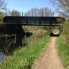
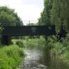
There is a bridge here which takes a railway over the canal.
Heath Vale Bridge | 1 mile, 4¾ furlongs | |
Ash Wharf Bridge Winding Hole | 7 furlongs | |
Ash Wharf Bridge | 6¾ furlongs | |
Ash Vale Railway Bridge | 6 furlongs | |
Ash Aqueduct | 3 furlongs | |
Aldershot Railway Bridge | ||
Government Road Bridge | 1 furlong | |
Ash Lock No 29 | 1¼ furlongs | |
Ash Lock Canal Depot | 1½ furlongs | |
Mons Barracks Footbridge | 5¾ furlongs | |
Queen's Avenue Iron Bridge | 1 mile, 2 furlongs |
There are no links to external websites from here.
Why not log in and add some (select "External websites" from the menu (sometimes this is under "Edit"))?
Mouseover for more information or show routes to facility
Nearest water point
In the direction of Odiham Castle Stop
Ash Lock Canal Depot — 1½ furlongs and 1 lock away
On this waterway in the direction of Odiham Castle Stop
The Fox and Hounds (Crookham) — 5 miles, 7¾ furlongs and 1 lock away
On this waterway in the direction of Odiham Castle Stop
Barley Mow Bridge — 10 miles, ¾ furlongs and 1 lock away
On this waterway in the direction of Odiham Castle Stop
In the direction of Woodham Junction
Mytchett Bridge — 3 miles, 1 furlong away
On this waterway in the direction of Woodham Junction
Canal Centre Swing Bridge — 3 miles, 2 furlongs away
On this waterway in the direction of Woodham Junction
Arthur's Bridge — 11 miles, 4¼ furlongs and 22 locks away
On this waterway in the direction of Woodham Junction
Pyrford Lock No 12 — 18 miles, 1¼ furlongs and 28 locks away
Travel to Woodham Junction, then on the River Wey Wey Navigation to Pyrford Lock No 12
Thames Lock No 16 — 18 miles, 7½ furlongs and 31 locks away
Travel to Woodham Junction, then on the River Wey Wey Navigation to Thames Lock No 16Nearest rubbish disposal
In the direction of Odiham Castle Stop
Ash Lock Canal Depot — 1½ furlongs and 1 lock away
On this waterway in the direction of Odiham Castle Stop
In the direction of Woodham Junction
Mytchett Bridge — 3 miles, 1 furlong away
On this waterway in the direction of Woodham Junction
Canal Centre Swing Bridge — 3 miles, 2 furlongs away
On this waterway in the direction of Woodham Junction
Arthur's Bridge — 11 miles, 4¼ furlongs and 22 locks away
On this waterway in the direction of Woodham Junction
Pyrford Lock No 12 — 18 miles, 1¼ furlongs and 28 locks away
Travel to Woodham Junction, then on the River Wey Wey Navigation to Pyrford Lock No 12
Shepperton Lock — 19 miles, 2½ furlongs and 32 locks away
Travel to Woodham Junction, then on the River Wey Wey Navigation to Thames - Wey Junction, then on the River Thames (below Oxford) to Shepperton LockNearest chemical toilet disposal
In the direction of Woodham Junction
Canal Centre Swing Bridge — 3 miles, 2 furlongs away
On this waterway in the direction of Woodham Junction
Arthur's Bridge — 11 miles, 4¼ furlongs and 22 locks away
On this waterway in the direction of Woodham Junction
Pyrford Lock No 12 — 18 miles, 1¼ furlongs and 28 locks away
Travel to Woodham Junction, then on the River Wey Wey Navigation to Pyrford Lock No 12
Shepperton Lock — 19 miles, 2½ furlongs and 32 locks away
Travel to Woodham Junction, then on the River Wey Wey Navigation to Thames - Wey Junction, then on the River Thames (below Oxford) to Shepperton LockNearest place to turn
In the direction of Odiham Castle Stop
Ash Lock Canal Depot — 1½ furlongs and 1 lock away
On this waterway in the direction of Odiham Castle Stop
Wharf Bridge (Aldershot) Winding Hole — 1 mile, 5 furlongs and 1 lock away
On this waterway in the direction of Odiham Castle Stop
Eelmoor Bridge Winding Hole — 3 miles, ¼ furlongs and 1 lock away
On this waterway in the direction of Odiham Castle Stop
Pondtail Bridge Winding Hole — 4 miles, 3¼ furlongs and 1 lock away
On this waterway in the direction of Odiham Castle Stop
Crondall Bridge Winding Hole — 7 miles, 3 furlongs and 1 lock away
On this waterway in the direction of Odiham Castle Stop
Blacksmiths Bridge Winding Hole — 9 miles and 1 lock away
On this waterway in the direction of Odiham Castle Stop
Colt Hill Bridge Winding Hole — 12 miles, 5¾ furlongs and 1 lock away
On this waterway in the direction of Odiham Castle Stop
Whitewater Winding Hole — 14 miles, 3 furlongs and 1 lock away
On this waterway in the direction of Odiham Castle Stop
In the direction of Woodham Junction
Ash Wharf Bridge Winding Hole — 7 furlongs away
On this waterway in the direction of Woodham Junction
Great Bottom Flash — 1 mile, 7½ furlongs away
On this waterway in the direction of Woodham Junction
Winter's Close Winding Hole — 2 miles, 2½ furlongs away
On this waterway in the direction of Woodham Junction
Anglers' Flash — 2 miles, 3¾ furlongs away
On this waterway in the direction of Woodham Junction
Potter's Wharf — 3 miles, ¼ furlongs away
On this waterway in the direction of Woodham Junction
Lock No 26 Winding Hole — 5 miles, 7 furlongs and 3 locks away
On this waterway in the direction of Woodham Junction
Frimley Lock Winding Hole — 6 miles, 6¼ furlongs and 9 locks away
On this waterway in the direction of Woodham Junction
Frimley Bottom Lock Winding Hole — 7 miles, 5 furlongs and 13 locks away
On this waterway in the direction of Woodham Junction
Connaught Crescent Winding Hole — 7 miles, 7½ furlongs and 14 locks away
On this waterway in the direction of Woodham Junction
Hermitage Bridge Winding Hole — 9 miles, 2¾ furlongs and 17 locks away
On this waterway in the direction of Woodham Junction
Blackhorse Road Winding Hole — 9 miles, 4 furlongs and 17 locks away
On this waterway in the direction of Woodham Junction
Arthurs Bridge Winding Hole — 11 miles, 4½ furlongs and 22 locks away
On this waterway in the direction of Woodham JunctionNearest self-operated pump-out
In the direction of Woodham Junction
Mytchett Bridge — 3 miles, 1 furlong away
On this waterway in the direction of Woodham Junction
Canal Centre Swing Bridge — 3 miles, 2 furlongs away
On this waterway in the direction of Woodham JunctionNo information
CanalPlan has no information on any of the following facilities within range:boatyard pump-out
Direction of TV transmitter (From Wolfbane Cybernetic)
There is no page on Wikipedia called “Aldershot Railway Bridge”
Wikipedia pages that might relate to Aldershot Railway Bridge
[Aldershot narrow-gauge suspension railway]
The Aldershot narrow-gauge suspension railway was built in 1872 as an innovative experimental railway at Aldershot Camp, Hampshire, England. It had a gauge
[Aldershot railway station]
Aldershot railway station is located near the town centre of Aldershot in Hampshire, England. It is 35 miles (56 km) down the line from London Waterloo
[Aldershot GO Station]
Aldershot GO Station is a railway station and bus station used by Via Rail and GO Transit, located at Highway 403 and Waterdown Road in the Aldershot
[Guildford railway station]
interchange station for two other railway lines: the North Downs Line northwards towards Reading, which has a connection to Aldershot; the same line eastwards
[Basingstoke Canal]
North Warnborough, Odiham, Dogmersfield, Fleet, Farnborough Airfield, Aldershot, Mytchett, Brookwood, Knaphill and Woking. Its eastern end is at Byfleet
[Badshot Lea]
Valley or Aldershot Urban Area, the thirtieth largest conurbation in the UK. Badshot Lea's boundaries are four bridges—three western railway bridges and Pea
[Tongham railway station]
camps at Aldershot. Its significance was drastically reduced, both as a station and as part of a through route, with the opening of Aldershot railway station
[River Blackwater (River Loddon)]
and bricks. The river curves east-south-east, passing under the railway line to Aldershot station, between two lakes, under Badshot Lea Road and past some
[London Waterloo station]
to the South Eastern Railway (SER) line from London Bridge to Charing Cross opened in July 1865. It was diverted from London Bridge to Cannon Street on
[Stamford Bridge (stadium)]
stadium. In its early days, Stamford Bridge stadium was served by a small railway station, Chelsea and Fulham railway station, which was later closed after
Results of Google Search
Aldershot railway station - WikipediaAldershot railway station is located near the town centre of Aldershot in Hampshire, England. It is on the Alton Line, part of the National Rail network, with train services and station facilities provided by South Western Railway. Aldershot railway station has the three-letter code AHT. This code is used, for example, to locate ...
Jul 4, 2016 ... Network Rail has unveiled its new railway bridge over Aldershot High Street, alongside representatives from the Aldershot Garrison, Aldershot F.C. and Rushmoor Borough Council who were representing Sir Gerald Howarth, MP.
The Basingstoke Canal is a British canal, completed in 1794, built to connect Basingstoke with the River Thames at Weybridge via the Wey Navigation. From Basingstoke, the canal passes through or near Greywell, North Warnborough, Odiham, Dogmersfield, Fleet, Farnborough Airfield, Aldershot, Mytchett, Brookwood, ...
BY RAIL: The nearest train station is Aldershot. The station is less than a 10- minute walk from the ground. It is served by mainline trains on the London Waterloo to Alton line, including stops at Clapham Junction and Woking. The journey from London Waterloo to Aldershot takes just under an hour.
The maximum speed attained with a passengers only train was thirty miles an hour (48 km/h), and the carriages ran as smoothly as those of a standard-gauge railway. There was no perceptible oscillation of the structure, and the vibration was no more than it was usual with contemporary iron and timber railway bridges .
Follow signs towards Aldershot on the A331 and take the exit signposted A323 Aldershot and Woking. At the roundabout, take the third exit towards Aldershot, go straight on through the two sets of traffic lights and across two mini- roundabouts towards the town. The EBB Stadium is on your right, just past the railway bridge.
From Aldershot/Farnborough Follow A323 through Aldershot, variously named Wellington Avenue, High Street and Ash Road. After passing drive-in burger bar, Aldershot FC, and passing under the railway bridge, continue following A323 for about 2/3 mile to traffic lights with Sainsbury's on near right and Vauxhall car ...
Discover Aldershot Rail Station. Getting to and from, buying and collecting tickets, staffing, facilities, accessibility & mobility access.
Home · South West · Hampshire · Rushmoor. Aldershot. Places in Aldershot. Montgomery Lines · North Town · Thorn Hill. Stops in Aldershot. +−. Leaflet | © OpenMapTiles | © OpenStreetMap contributors · Aldershot Rail Station (Entrance ) · Bridge Road (N-bound) · Bridge Road (S-bound) · Buller Barracks (E-bound) · Buller ...
Information on Aldershot's train station: address, business hours, available products and services, etc.