CanalPlanAC

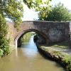
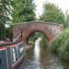
Wolvercote Green Field Bridge No 236

 
Wolvercote Common, Godstow Road, Oxford OX2 8PF, United Kingdom
Address is taken from a point 370 yards away.
 
Information about the place
Wolvercote Green Field Bridge No 236 is a minor waterways place on the Oxford Canal (Southern Section - Main Line) between Isis Lock Junction (2 miles and 1¼ furlongs to the southeast) and Wolvercote Junction (Junction of Duke's Cut with Oxford Canal) (6¾ furlongs and 1 lock to the northwest).
 
It is part of City of Oxford.
 
The nearest place in the direction of Isis Lock Junction is Wolvercote Railway Bridge No 236A; 2¾ furlongs away.
 
The nearest place in the direction of Wolvercote Junction is Wolvercote Footbridge; 1½ furlongs away.

There is access (via steps) to the towpath here.

Mooring here is tolerable (it's just about possible if really necessary), mooring pins are needed. Mooring is limited to 14 days. The towpath edge is appalling, so ended up requiring a gang plank to get ashore.

There is a bridge here which takes a track over the canal.


Amenities

Amenities here

 Plough

Amenities nearby at Wolvercote Footbridge

 Plough

Amenities in City of Oxford

 Somerfield - Oxford - Summertown - Store# 1701
 Tesco
 Court Candy Shop
 Globe News
 Oxford Swindon & Gloucester Co-operative Society Ltd
 Oxford Swindon & Gloucester Co-operative Society Ltd
 Oxford Swindon & Gloucester Co-operative Society Ltd
 Oxford Swindon & Gloucester Co-operative Society Ltd
 Oxford Swindon & Gloucester Co-operative Society Ltd
 St Clemence Newsagents
 Tims Newsagent
 Caffe Nero
 Caffe Nero
 Starbucks
 Starbucks
 Nandos
 Oxford, Saffron
 Oxford, Spice Lounge
 Pizza Hut
 Strada
 Xi'an
 Beefeater
 Chequers
 City Arms
 Cowley Retreat
 Dewdrop
 Eagle & Child
 Fir Tree
 Jacobs Inn
 James Street Tavern
 Kings Arms
 Port Mahon
 Royal Oak
 Rusty Bicycle
 SEE ADDRESS
 SEE ADDRESS
 SEE ADDRESS
 SEE ADDRESS
 SEE ADDRESS
 St Aldates Tavern
 Turf Tavern
 Turf Tavern
 White Hart
 White Horse
 Alcocks
 D Torjussen & Sons
 Dunelm Mill
 Hedges
 John Lindsey & Son
 Oxford, City Council Covered Market
 Stewarts
 W Alder
 Fish & Chips
 ShakeAway
 Boots Chemist
 Boots Chemist
 Boots Chemist
 Barclays
 Cashpoint
 Cashpoint
 Cashpoint
 Cashpoint
 Cashpoint
 Cashpoint
 Cashpoint
 Cashpoint
 Cashpoint
 HSBC
 Lloyds Bank
 Lloyds Bank
 NatWest
 NatWest
 NatWest
 Santander
 Goldenfuels
 Oxford, Goldenfuels Ltd
 Beeline Bike - Oxford
 Bike Zone - Oxford
 Jewson
 Summerton Cycles - Oxford
 Travis Perkins

Amenities at other places in City of Oxford

 Sainsbury's at End of Hythe Bridge Arm
 Sainsbury's at Grandpont Bridge
 Sainsburys at End of Hythe Bridge Arm
 Sainsburys at Grandpont Bridge
 Castle News at End of Hythe Bridge Arm
 Globe News Market at End of Hythe Bridge Arm
 Lung Wah Chong at End of Hythe Bridge Arm
 Oxford Swindon & Gloucester Co-Operative Society Ltd at Osney Lock
 Oxford Swindon & Gloucester Co-operative Society Ltd at Jericho Footbridge
 St Giles News at Oxford Visitor Moorings
 Wendy News at End of Hythe Bridge Arm
 Costa Coffee at End of Hythe Bridge Arm
 Starbucks at End of Hythe Bridge Arm
 Ask and Zizzi at End of Hythe Bridge Arm
 Bella Italia at End of Hythe Bridge Arm
 Loch Fyne at Jericho Footbridge
 McDonalds at End of Hythe Bridge Arm
 Pizza Hut at End of Hythe Bridge Arm
 Pizza Hut at End of Hythe Bridge Arm
 Brewery Gate at End of Hythe Bridge Arm
 Four Candles at End of Hythe Bridge Arm
 Jericho at Jericho Footbridge
 Jude the Obscure at Jericho Footbridge
 Lighthouse at End of Hythe Bridge Arm
 Old Bookbinders at Combe Road Wharf
 Old Tom at Grandpont Bridge
 Oxford Retreat at End of Hythe Bridge Arm
 Prince of Wales at Iffley Lock Weir Entrance No 1
 Que Pasa Oxford at End of Hythe Bridge Arm
 Rickety Press at Jericho Footbridge
 SEE ADDRESS at End of Hythe Bridge Arm
 Slug and Lettuce at End of Hythe Bridge Arm
 Wetherspoons at End of Hythe Bridge Arm
 Wetherspoons at End of Hythe Bridge Arm
 White House at Osney Bridge
 Wig & Pen at End of Hythe Bridge Arm
 Oxford, Clarendon Centre at End of Hythe Bridge Arm
 W H Smith at End of Hythe Bridge Arm
 W H Smith at Osney Bridge
 Chinese Takeaway at Wolvercote Lock No 45
 Dominos Pizza at End of Hythe Bridge Arm
 Fish & Chips at End of Hythe Bridge Arm
 Krispy Kreme at End of Hythe Bridge Arm
 Oxford, La Baguette at End of Hythe Bridge Arm
 Superdrug at End of Hythe Bridge Arm
 Barclays at Isis Sanitary Station
 Cashpoint at End of Hythe Bridge Arm
 Cashpoint at Isis Sanitary Station
 Cashpoint at Osney Bridge
 Cashpoint at End of Hythe Bridge Arm
 Cashpoint at End of Hythe Bridge Arm
 Cashpoint at End of Hythe Bridge Arm
 Cashpoint at End of Hythe Bridge Arm
 Cashpoint at End of Hythe Bridge Arm
 Cashpoint at Osney Bridge
 Cashpoint at End of Hythe Bridge Arm
 Nationwide at End of Hythe Bridge Arm
 Santander at End of Hythe Bridge Arm
 College Cruisers at Combe Road Wharf
 Esso at Osney Marina
 Oxford Calor Centre at Osney - East Street Moorings
 Halfords at Osney Bridge
 Halfords at Osney Bridge
 Sbr Sports - Oxford at End of Hythe Bridge Arm
 Walton St Cycles - Oxford at Walton Well Road Bridge No 242
 Warlands - Oxford at Osney Bridge
 Oxford Station at Osney Bridge
 
Maps
If you are a user and are logged on, or if you are actively planning a route, a map will be displayed here.
Show on external mapping site: Google | OSM | Bing
 
Additional information

The Plough Inn is accessible by crossing the bridge and then is about 150m away to the east. As of July 2022 it had good food and cask beer. Had a pleasant evening in here.

 
Photos
 
External websites
 Oxford Canal Walk - Part One - Oxford to Thrupp - YouTube — associated with Oxford Canal
A walk along the Oxford Canal (Southern Section) from Oxford to Thrupp Wide
 
Nearest facilities

Mouseover for more information or show routes to facility

Nearest water point

In the direction of Napton Junction

Wolvercote Sanitary Station3¼ furlongs and 1 lock away
On this waterway in the direction of Napton Junction
Wolvercote Junction Water Point7½ furlongs and 2 locks away
On this waterway in the direction of Napton Junction
Eynsham Lock4 miles, 1½ furlongs and 2 locks away
Travel to Wolvercote Junction, then on the Oxford Canal (Duke's Cut) to Duke's Cut Junction, then on the River Thames (above Oxford) to Eynsham Lock
Langford Lane Bridge No 2243 miles, 7½ furlongs and 4 locks away
On this waterway in the direction of Napton Junction
Aubreys Lift Bridge No 2214 miles, 4¾ furlongs and 4 locks away
On this waterway in the direction of Napton Junction
Thrupp Cruising Club4 miles, 5 furlongs and 4 locks away
On this waterway in the direction of Napton Junction
Shifford Lock14 miles, 2¼ furlongs and 5 locks away
Travel to Wolvercote Junction, then on the Oxford Canal (Duke's Cut) to Duke's Cut Junction, then on the River Thames (above Oxford) to Shifford Lock
Heyford Wharf Bridge No 20612 miles, 1¼ furlongs and 9 locks away
On this waterway in the direction of Napton Junction
Heyford Wharf12 miles, 1½ furlongs and 9 locks away
On this waterway in the direction of Napton Junction
Aynho Wharf18 miles, 1¾ furlongs and 12 locks away
On this waterway in the direction of Napton Junction

In the direction of End of Hythe Bridge Arm

St Edwards Lift Bridge No 2385½ furlongs away
On this waterway in the direction of End of Hythe Bridge Arm
Oxford Visitor Moorings2 miles, 2 furlongs away
On this waterway in the direction of End of Hythe Bridge Arm
Abingdon Lock11 miles, 1 furlong and 4 locks away
Travel to Isis Lock Junction, then on the River Thames (Sheepwash Channel) to Sheepwash Channel Junction, then on the River Thames (above Oxford) to Osney Bridge, then on the River Thames (below Oxford) to Abingdon Lock
Abingdon Bridge Marine11 miles, 4¾ furlongs and 5 locks away
Travel to Isis Lock Junction, then on the River Thames (Sheepwash Channel) to Sheepwash Channel Junction, then on the River Thames (above Oxford) to Osney Bridge, then on the River Thames (below Oxford) to Abingdon Bridge Marine

Nearest rubbish disposal

In the direction of Napton Junction

Wolvercote Sanitary Station3¼ furlongs and 1 lock away
On this waterway in the direction of Napton Junction
Eynsham Lock4 miles, 1½ furlongs and 2 locks away
Travel to Wolvercote Junction, then on the Oxford Canal (Duke's Cut) to Duke's Cut Junction, then on the River Thames (above Oxford) to Eynsham Lock
Aubreys Lift Bridge No 2214 miles, 4¾ furlongs and 4 locks away
On this waterway in the direction of Napton Junction
Thrupp Cruising Club4 miles, 5 furlongs and 4 locks away
On this waterway in the direction of Napton Junction
Heyford Wharf Bridge No 20612 miles, 1¼ furlongs and 9 locks away
On this waterway in the direction of Napton Junction
Heyford Wharf12 miles, 1½ furlongs and 9 locks away
On this waterway in the direction of Napton Junction
Rushey Lock18 miles, 3¼ furlongs and 6 locks away
Travel to Wolvercote Junction, then on the Oxford Canal (Duke's Cut) to Duke's Cut Junction, then on the River Thames (above Oxford) to Rushey Lock
Aynho Wharf18 miles, 1¾ furlongs and 12 locks away
On this waterway in the direction of Napton Junction

In the direction of End of Hythe Bridge Arm

Abingdon Lock11 miles, 1 furlong and 4 locks away
Travel to Isis Lock Junction, then on the River Thames (Sheepwash Channel) to Sheepwash Channel Junction, then on the River Thames (above Oxford) to Osney Bridge, then on the River Thames (below Oxford) to Abingdon Lock
Day's Lock19 miles, 3 furlongs and 7 locks away
Travel to Isis Lock Junction, then on the River Thames (Sheepwash Channel) to Sheepwash Channel Junction, then on the River Thames (above Oxford) to Osney Bridge, then on the River Thames (below Oxford) to Day's Lock

Nearest chemical toilet disposal

In the direction of Napton Junction

Wolvercote Sanitary Station3¼ furlongs and 1 lock away
On this waterway in the direction of Napton Junction
Eynsham Lock4 miles, 1½ furlongs and 2 locks away
Travel to Wolvercote Junction, then on the Oxford Canal (Duke's Cut) to Duke's Cut Junction, then on the River Thames (above Oxford) to Eynsham Lock
Thrupp Cruising Club4 miles, 5 furlongs and 4 locks away
On this waterway in the direction of Napton Junction
Rushey Lock18 miles, 3¼ furlongs and 6 locks away
Travel to Wolvercote Junction, then on the Oxford Canal (Duke's Cut) to Duke's Cut Junction, then on the River Thames (above Oxford) to Rushey Lock

In the direction of End of Hythe Bridge Arm

Abingdon Lock11 miles, 1 furlong and 4 locks away
Travel to Isis Lock Junction, then on the River Thames (Sheepwash Channel) to Sheepwash Channel Junction, then on the River Thames (above Oxford) to Osney Bridge, then on the River Thames (below Oxford) to Abingdon Lock
Day's Lock19 miles, 3 furlongs and 7 locks away
Travel to Isis Lock Junction, then on the River Thames (Sheepwash Channel) to Sheepwash Channel Junction, then on the River Thames (above Oxford) to Osney Bridge, then on the River Thames (below Oxford) to Day's Lock

Nearest place to turn

In the direction of Napton Junction

Wolvercote Junction6¾ furlongs and 1 lock away
On this waterway in the direction of Napton Junction
Bypass Reservoir Junction1 mile, ¾ furlongs and 2 locks away
Travel to Wolvercote Junction, then on the Oxford Canal (Duke's Cut) to Bypass Reservoir Junction
Duke's Cut Junction1 mile, 5¼ furlongs and 2 locks away
Travel to Wolvercote Junction, then on the Oxford Canal (Duke's Cut) to Duke's Cut Junction
Thames - Wharf Stream Junction3 miles, 7¾ furlongs and 2 locks away
Travel to Wolvercote Junction, then on the Oxford Canal (Duke's Cut) to Duke's Cut Junction, then on the River Thames (above Oxford) to Thames - Wharf Stream Junction
Pinkhill Lock Weir Exit5 miles, 4 furlongs and 3 locks away
Travel to Wolvercote Junction, then on the Oxford Canal (Duke's Cut) to Duke's Cut Junction, then on the River Thames (above Oxford) to Pinkhill Lock Weir Exit
Thrupp Wide4 miles, 5 furlongs and 4 locks away
On this waterway in the direction of Napton Junction
Shipton Weir Junction5 miles, 5½ furlongs and 5 locks away
On this waterway in the direction of Napton Junction
Enslow Winding Hole7 miles, 1½ furlongs and 6 locks away
On this waterway in the direction of Napton Junction
Kirtlington Winding Hole8 miles, 7 furlongs and 7 locks away
On this waterway in the direction of Napton Junction

In the direction of End of Hythe Bridge Arm

Hythe Bridge Arm Winding Hole2 miles, 1 furlong away
On this waterway in the direction of End of Hythe Bridge Arm
End of Hythe Bridge Arm2 miles, 2 furlongs away
On this waterway in the direction of End of Hythe Bridge Arm
Castle Mill Stream Junction2 miles, 1½ furlongs and 1 lock away
Travel to Isis Lock Junction, then on the River Thames (Sheepwash Channel) to Castle Mill Stream Junction
Sheepwash Channel Junction2 miles, 2¼ furlongs and 1 lock away
Travel to Isis Lock Junction, then on the River Thames (Sheepwash Channel) to Sheepwash Channel Junction
Bossoms Boat Yard3 miles, ¼ furlongs and 1 lock away
Travel to Isis Lock Junction, then on the River Thames (Sheepwash Channel) to Sheepwash Channel Junction, then on the River Thames (above Oxford) to Bossoms Boat Yard
Osney Lock Weir Exit2 miles, 5¼ furlongs and 2 locks away
Travel to Isis Lock Junction, then on the River Thames (Sheepwash Channel) to Sheepwash Channel Junction, then on the River Thames (above Oxford) to Osney Bridge, then on the River Thames (below Oxford) to Osney Lock Weir Exit
Thames - Cherwell Junction3 miles, 7¼ furlongs and 2 locks away
Travel to Isis Lock Junction, then on the River Thames (Sheepwash Channel) to Sheepwash Channel Junction, then on the River Thames (above Oxford) to Osney Bridge, then on the River Thames (below Oxford) to Thames - Cherwell Junction
Iffley Lock Weir Entrance No 14 miles, 6½ furlongs and 2 locks away
Travel to Isis Lock Junction, then on the River Thames (Sheepwash Channel) to Sheepwash Channel Junction, then on the River Thames (above Oxford) to Osney Bridge, then on the River Thames (below Oxford) to Iffley Lock Weir Entrance No 1
Iffley Lock Weir Exit No 14 miles, 7½ furlongs and 3 locks away
Travel to Isis Lock Junction, then on the River Thames (Sheepwash Channel) to Sheepwash Channel Junction, then on the River Thames (above Oxford) to Osney Bridge, then on the River Thames (below Oxford) to Iffley Lock Weir Exit No 1
Sandford Lock Weir Exit (Thames)6 miles, 5¼ furlongs and 4 locks away
Travel to Isis Lock Junction, then on the River Thames (Sheepwash Channel) to Sheepwash Channel Junction, then on the River Thames (above Oxford) to Osney Bridge, then on the River Thames (below Oxford) to Sandford Lock Weir Exit (Thames)
Abingdon Lock Weir Exit No 111 miles, 1½ furlongs and 5 locks away
Travel to Isis Lock Junction, then on the River Thames (Sheepwash Channel) to Sheepwash Channel Junction, then on the River Thames (above Oxford) to Osney Bridge, then on the River Thames (below Oxford) to Abingdon Lock Weir Exit No 1

Nearest self-operated pump-out

In the direction of Napton Junction

Eynsham Lock4 miles, 1½ furlongs and 2 locks away
Travel to Wolvercote Junction, then on the Oxford Canal (Duke's Cut) to Duke's Cut Junction, then on the River Thames (above Oxford) to Eynsham Lock
Aubreys Lift Bridge No 2214 miles, 4¾ furlongs and 4 locks away
On this waterway in the direction of Napton Junction
Thrupp Cruising Club4 miles, 5 furlongs and 4 locks away
On this waterway in the direction of Napton Junction
Rushey Lock18 miles, 3¼ furlongs and 6 locks away
Travel to Wolvercote Junction, then on the Oxford Canal (Duke's Cut) to Duke's Cut Junction, then on the River Thames (above Oxford) to Rushey Lock

In the direction of End of Hythe Bridge Arm

Abingdon Lock11 miles, 1 furlong and 4 locks away
Travel to Isis Lock Junction, then on the River Thames (Sheepwash Channel) to Sheepwash Channel Junction, then on the River Thames (above Oxford) to Osney Bridge, then on the River Thames (below Oxford) to Abingdon Lock

Nearest boatyard pump-out

In the direction of Napton Junction

Oxford Cruisers Marina5 miles, 1½ furlongs and 3 locks away
Travel to Wolvercote Junction, then on the Oxford Canal (Duke's Cut) to Duke's Cut Junction, then on the River Thames (above Oxford) to Oxford Cruisers Marina
Enslow Wharf7 miles, ½ furlongs and 6 locks away
On this waterway in the direction of Napton Junction
Heyford Wharf12 miles, 1½ furlongs and 9 locks away
On this waterway in the direction of Napton Junction
Aynho Wharf18 miles, 1¾ furlongs and 12 locks away
On this waterway in the direction of Napton Junction

In the direction of End of Hythe Bridge Arm

Abingdon Bridge Marine11 miles, 4¾ furlongs and 5 locks away
Travel to Isis Lock Junction, then on the River Thames (Sheepwash Channel) to Sheepwash Channel Junction, then on the River Thames (above Oxford) to Osney Bridge, then on the River Thames (below Oxford) to Abingdon Bridge Marine
Direction of TV transmitter (From Wolfbane Cybernetic)
 
 
Geograph
 
Wikipedia

There is no page on Wikipedia called “Wolvercote Green Field Bridge”

Wikipedia pages that might relate to Wolvercote Green Field Bridge
[Port Meadow with Wolvercote Common and Green] Port Meadow with Wolvercote Common and Green is a 167.1-hectare (413-acre) biological Site of Special Scientific Interest in Oxford in Oxfordshire. It [Port Meadow, Oxford] ever since. The meadow runs from Jericho to Wolvercote (where north of the Shiplake Ditch it becomes Wolvercote Common) along the east (left) bank of the [River Thames] existing bridges both in London and along the length of the river. These included Putney Bridge, Westminster Bridge, Datchet Bridge, Windsor Bridge and Sonning [Oxford Canal] through a bridge under Hythe Bridge Street to a turning basin and goods wharf south of Hythe Bridge Street. It then continued via a bridge under Worcester [Varsity Line] from Oxford to Islip: Summertown Halt, soon to be renamed Port Meadow; Wolvercote; Oxford Road, and between Islip and Bicester: Oddington, Charlton and [Oxford] include the suburbs of Headington, Cowley and Iffley to the east, and Wolvercote to the north. Also during the 1920s, the economy and society of Oxford [Thamesmead] and killed by a gang in Tavy Bridge. In October 2014, 25 year-old Olamide "Trigger" Fasina was stabbed to death on Wolvercote Road. In September 2019, Willow [Timeline of Oxford] at Wolvercote Cemetery). 1890 – December: Dullest month on record in Oxford, 5 hours of sunshine. 1891 Winter: River freezes solid at Folly Bridge. Jane [Wallingford, Oxfordshire] Oxford Canal reached Oxford from Warwickshire, and the Duke's Cut at Wolvercote gave it a connection to the Thames. This allowed coal from the Midlands [Siege of Oxford] newly erected bridge at Marston, the King's forces 'drowned' the meadow, fired houses in the suburbs and placed a garrison at Wolvercote. Whilst viewing
 
Google

Results of Google Search

Wolvercote - Wikipedia
Wolvercote is a village that is part of the City of Oxford, England. It is about 3 miles (5 km) ... The bridge bears a plaque in memory of two airmen of the Royal Flying Corps ... Inn and the White Hart are by the central small green in Lower Wolvercote. ... trademark of the Wikimedia Foundation, Inc., a non-profit organization.
As part of that project, John Temple, Oxfordshire Branch Member ...
12 Godstow Road Bridge (233. Wolvercote ... no. P&R First Turn. 11 Footbridge ( 236). Wolvercote Green. First Tum. M48H (for 100m ... Playing Field (North end).
Table 1 Rejected Sites Ref no Site name Ward REJECT ST 1 (SAC ...
Refinement of uses assuming satisfactory evidence of suitability and deliverability. 470. Land North of Godstow Bridge. Wolvercote. REJECTED - Greenfield.
Wolvercote: Introduction | British History Online
The section from Godstow bridge to Wytham was a private road, used in the 18th century ... appears to have been only an access road for fields west of the Woodstock Road in 1765; ... 9) No. 5 Wolvercote Green, another St. John's farmhouse, dates from the later 17th century. ... Map, 1" solid and drift, sheet 236 ( 1938 edn.).
Canoeing the Oxford Circuit with Iris Murdoch | Ripe-tomato.org
Jul 7, 2015 ... 2.75 miles – Wolvercote Green Field bridge. ... No. 48 is about 500 yards after Aristotle bridge as the canal kinks very slightly left, marked by two ...